
Search for another town




Free U.S. delivery 7 to 10 days after you order
Orange, Virginia Map Art
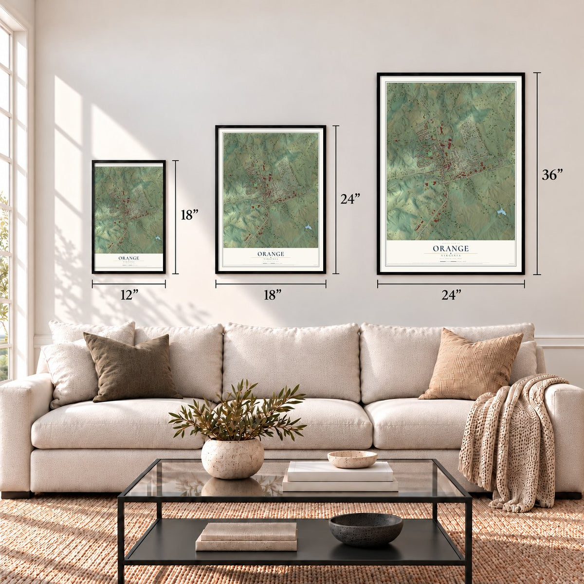
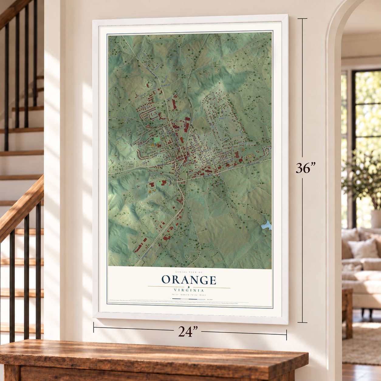
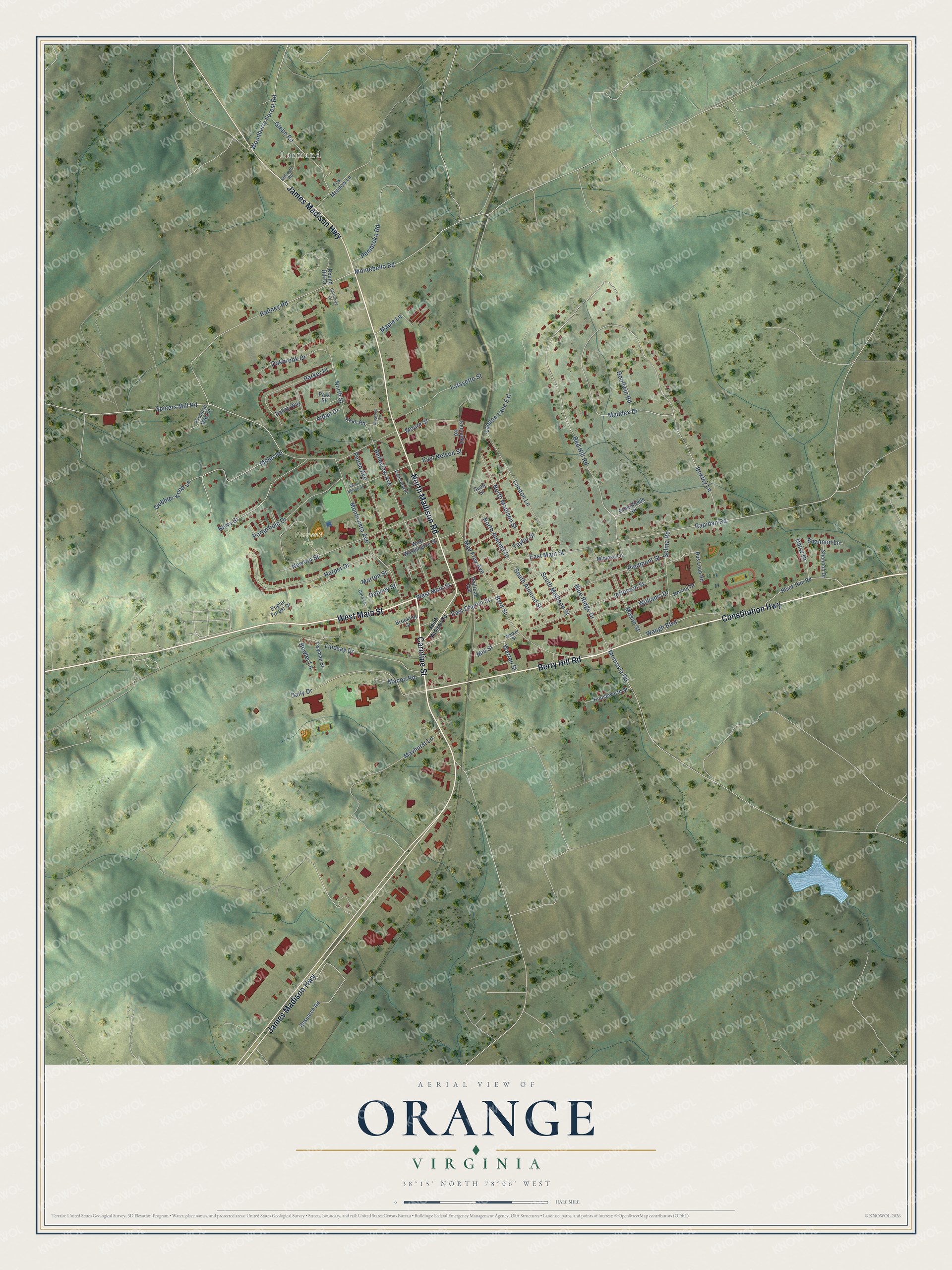
A new map of Orange, Virginia, made in 2026 and printed to order on thick archival matte paper.
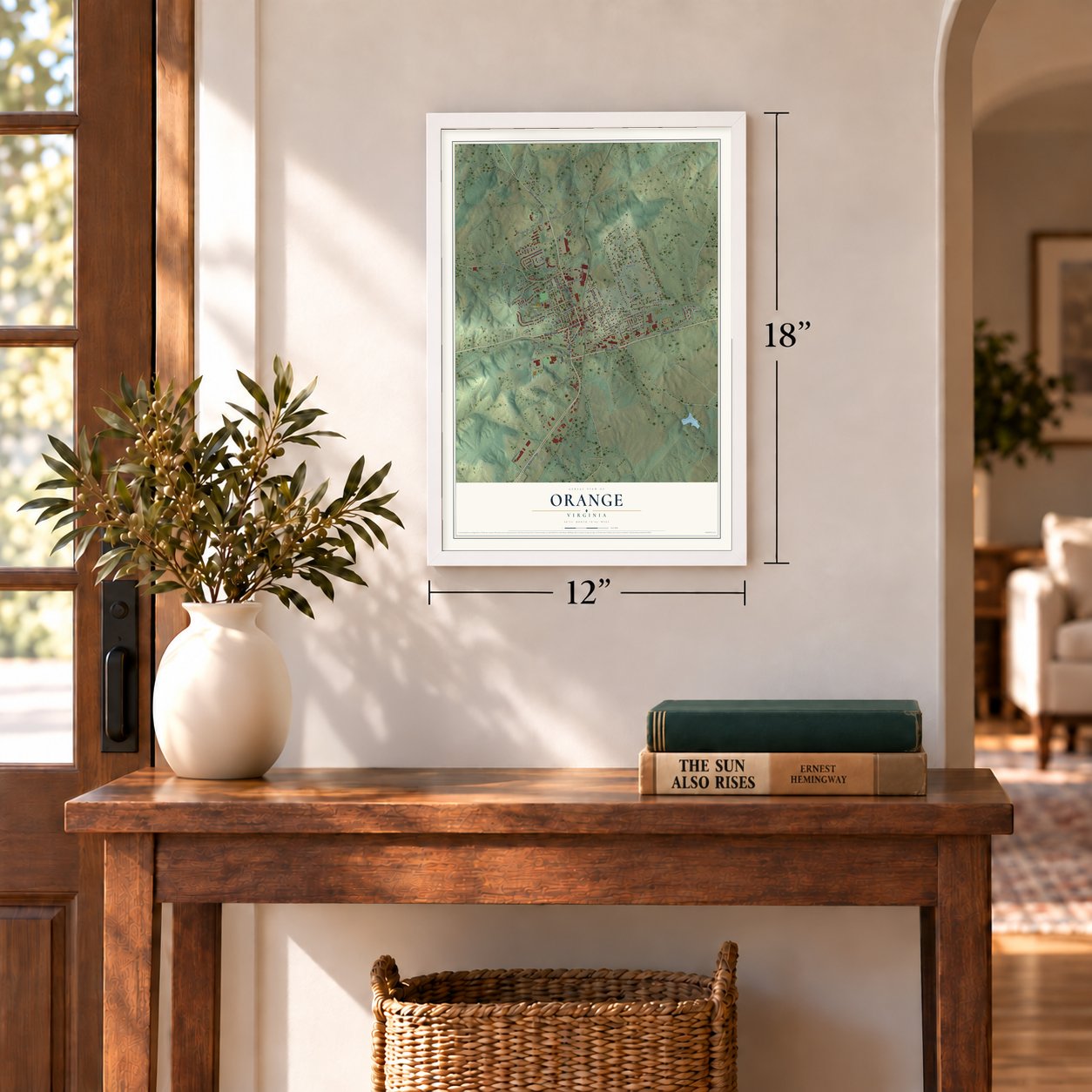
12" x 18" Archival Matte Print
A Map of Home. A Work of Art.
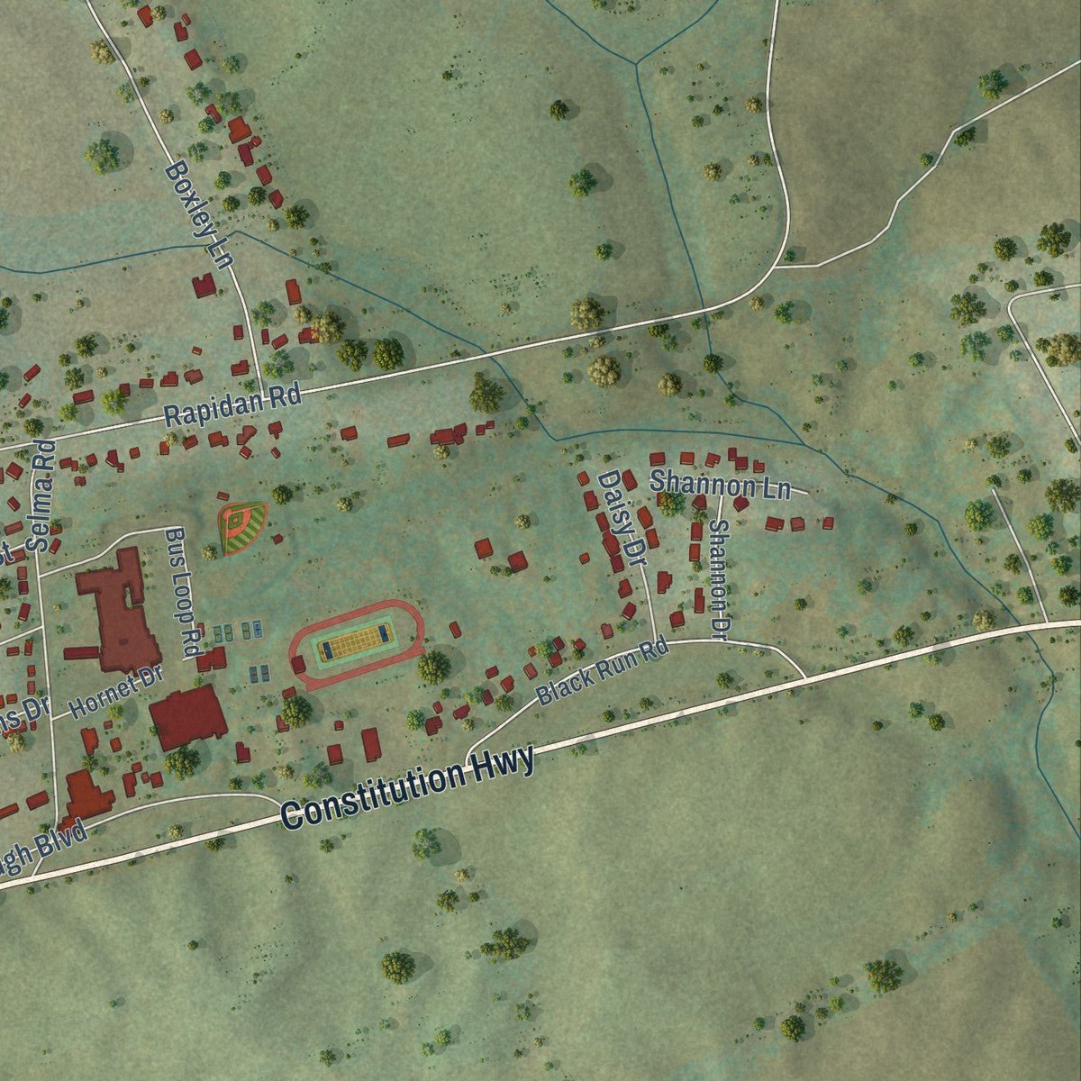
Explore Orange, Virginia from a whole new perspective. Created using aerial imagery and detailed geographic data, this map captures Orange building by building, with labeled streets, familiar landmarks, and shaded topographical relief that highlights the natural contours of the landscape.
Combining modern data with the timeless character of a vintage atlas, this map is just as interesting up close as it is beautiful on the wall. Whether you grew up in Orange, spent memorable years there, or call it home today, this unique map is a great way to celebrate a place that means something to you. Zoom in on the preview to look for your street, and then order a print to put your memories on the wall.
Three ways to hang it
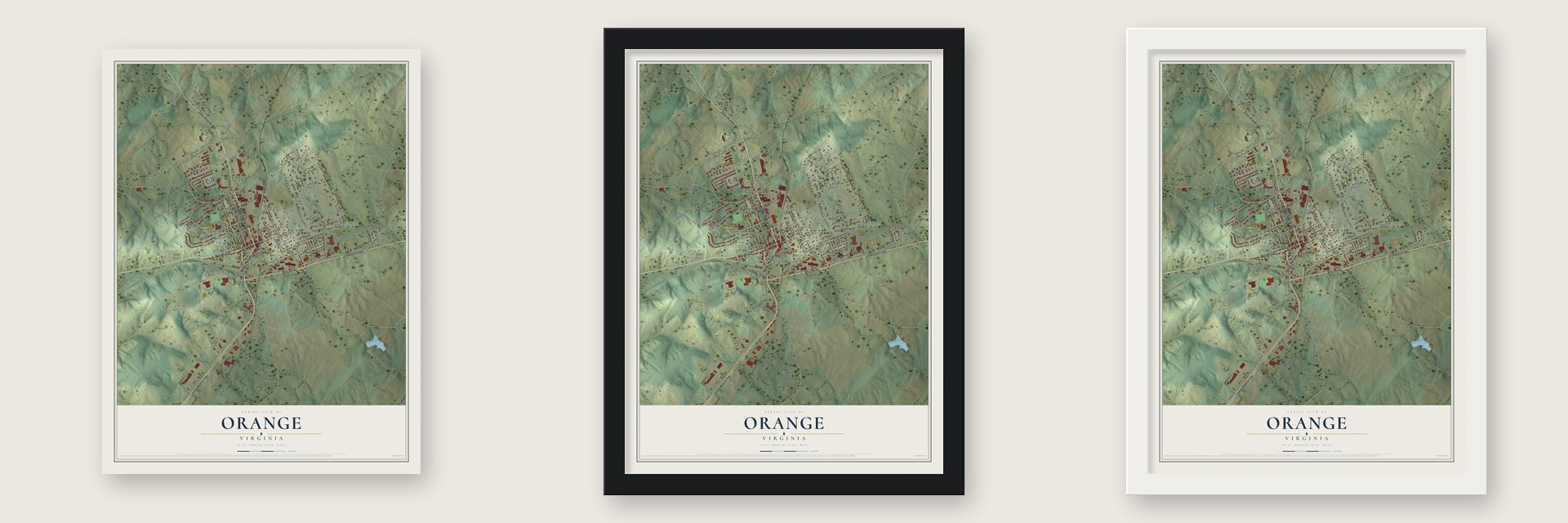
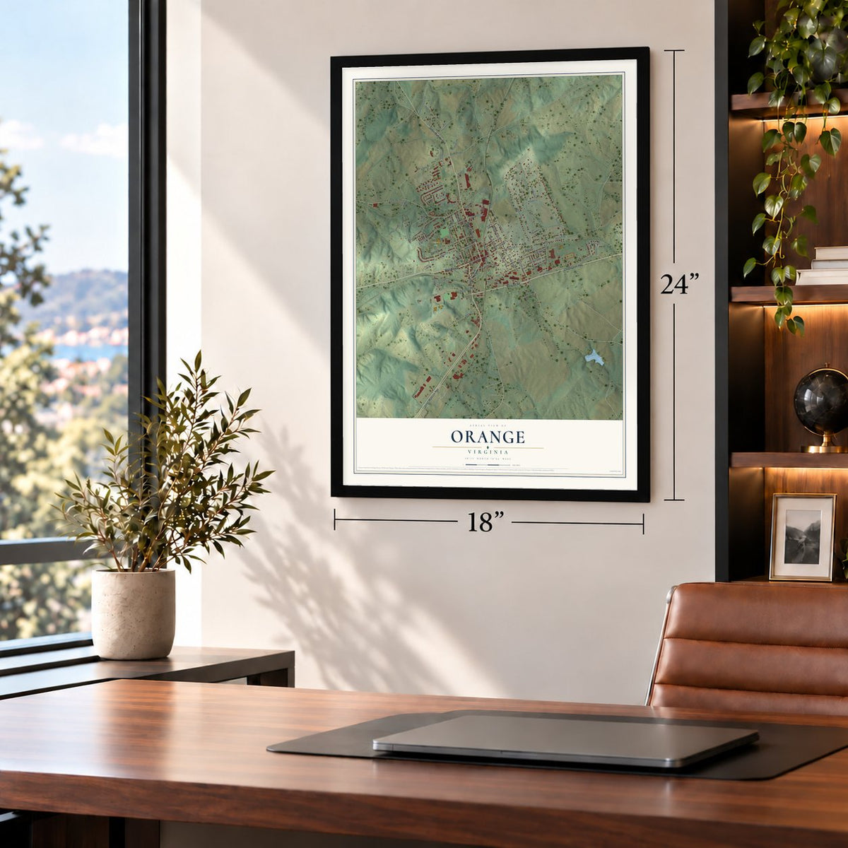
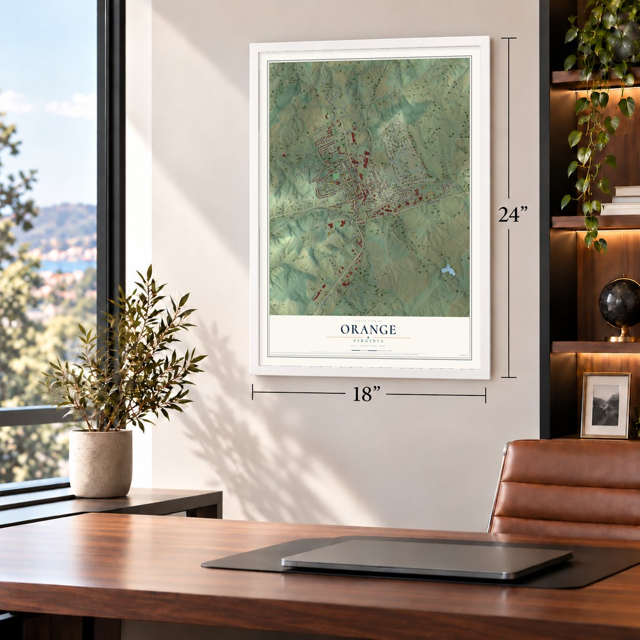
Unframed archival matte, a black wood frame or a white wood frame.
Up close
Geography Worth Displaying
This map was created using accurate cartographic data and authoritative geographic sources, including the U.S. Geological Survey and the Census Bureau. The map brings together terrain, waterways, roads, and building detail. The majority of the streets are labeled, houses are accurately depicted, and the topography is derived from government sources. Combining local data with carefully composed color and shading leads to this beautifully detailed Orange artwork for your wall.
Rather than simply showing street outlines, we’ve included as many of the street names as we could reasonably fit on the map while keeping their names legible. Zoom in on the high resolution preview to see exactly what’s on the map. We truly set out to create a statement piece for anyone who loves Orange. So whether it’s for you, or a gift for someone you love, we hope this map of Orange brings back fond memories.
Read the story behind this map of Orange, Virginia from 2026.

About Orange, Virginia
Orange is a town of 4,880 people and the county seat of Orange County, 4 miles east of James Madison's Montpelier. When Culpeper County was carved out of Orange County in 1749, the county court moved here and met in the home of Timothy Crosthwait. In 1752 Crosthwait deeded two acres to the county, and a courthouse went up on the lot, with a few houses, stores and a tavern around it.
In 1799 Paul Verdier bought William Bell's farm along Main Street and split it into lots, setting the pattern the town would grow on. His house, Montpeliso, still stands. The legislature allowed the town to incorporate in 1834 and again in 1855, but the 1855 act needed the voters' consent, which came only after the Civil War. A petition to elect town trustees was filed in 1872, the first council met on June 28, 1872, and in 1890 Orange Court House officially became Orange.
“Of the several county schools for black students, Orange Graded was the only one built using the Julius Rosenwald Fund, which was established in 1917 by the president of Sears, Roebuck and Company to construct schools for African Americans across the rural South.”
- A courthouse moved for the railroadIn 1847 the Orange and Alexandria Railroad picked a route from Alexandria to Gordonsville that ran through town. The county court gave it a right-of-way across the courthouse grounds, so the courthouse had to move. The fourth courthouse, finished in 1859 in the Italian Villa style, still stands at Madison Road and Main Street, and it joined the National Register in 1979.
- Lee's wartime headquartersFrom March 1862 to May 1864 the Rapidan River, just north of town, served as the Confederacy's northern line, so troops camped, patrolled and skirmished all around Orange. Robert E. Lee kept his headquarters here and worshipped at St. Thomas Episcopal Church, built in 1833, which became a hospital for Confederate wounded after Chancellorsville and the Wilderness. As Federal troops came through, a clerk of court carried county records dating to 1734 away to safety.
- From fire to car dealersA fire in 1909 destroyed most of the east side of town, and the railroad's importance faded early in the 20th century. Orange sat where two major roads met, though, and after the Orange Automobile Club formed in 1910 it became the region's center for selling and servicing cars. That trade helped carry the town through the Great Depression.
- Parachutes for the AlliesAmerican Silk Mills opened in Orange in 1929, turning raw silk into finished cloth. During World War II the mill earned a presidential citation for the parachutes it made for Allied troops.
Find your street
Names on the Orange map
Every name below is printed on this map. Look for your street, your school, the park where you played, or the pond down the road.
Places and landmarks2
- Larmand
- Veteran's Park
Streets and roads93
- North Madison Road
- Constitution Highway
- Caroline Street
- West Main Street
- James Madison Highway
- Berry Hill Road
- Radney Road
- Spicers Mill Road
- North Almond Street
- May Fray Avenue
- Boxley Lane
- Red Hill Road
- East Main Street
- Belleview Avenue
- Peliso Avenue
- Newton Street
- Jefferson Street
- Harper Drive
- Byrd Street
- Daily Drive
- Miller Road
- Landon Lane
- Piedmont Street
- Lindsay Drive
- Blue Ridge Drive
- Montevista Avenue
- Mayhurst Lane
- Glebe Road
- Berry Street
- Landon Lane Extension
Show all 93 streets
- North Madison Street
- Parker Place
- Porterfield Drive
- Montebello Road
- Waugh Boulevard
- Selma Road
- Lafayette Street
- Rapidan Road
- Mill Street
- Williams Drive
- Aidan Drive
- North Street
- Oakbrook Drive
- Gobbler Knob Lane
- South Almond Street
- Maddex Drive
- Mason Street
- Woodberry Forest Road
- South Madison Street
- East Nelson Street
- Monrovia Road
- Moore Street
- East Church Street
- Bowler Lane
- Macon Road
- Pembroke Road
- Maple Lane
- Taylor Street
- Warren Street
- Goodwin Road
- Daisy Drive
- Shannon Lane
- Dabney Street
- Morton Street
- Kean Road
- Mimosa Lane
- Research Road
- Black Run Road
- Round Hill Drive
- Twyman Street
- Bus Loop Road
- Park Street
- Poplar Forest Drive
- West Washington Street
- Scott Street
- Houseworth Street
- Shannon Drive
- Greenfields Drive
- Promise Way Lane
- Kentucky Road
- Fox Meadow Lane
- Railroad Avenue
- Daliah Way
- Hornet Drive
- Brooking Street
- Walker Street
- Kirkwall Road
- Dora Lane
- Cathedral Place
- South Madison Road
- West Nelson Street
- Dogwood Lane
- University Lane
Names are listed as they appear on the printed map. Zoom into the product photos to find them.
The art of mapping a place
How This Map Was Made
Real places. Remarkable detail. Discover the layers that turn geographic data into a map of home.

The view from above
Aerial imagery reveals the character of the land: woodland, open fields, and the patterns of a place.

The shape of the land
Elevation data brings hills, valleys, and subtle changes in the landscape into view.

The details of home
Roads, waterways, and building footprints come together to make the map feel unmistakably local.

Geography becomes art
Considered color, shading, and typography bring the layers together in a map made for your wall.


Process illustrated with Mendon, Massachusetts. Aerial imagery: USDA NAIP. Terrain: USGS 3D Elevation Program. Map details and finished artwork: KNOWOL.
The Details
About This Print
Choose an archival matte print, or a black or white Ayous wood frame. The archival matte print is unframed.
Select your size and finish above to see the matching product image and price.
Materials & Craftsmanship
A contemporary map with the character of a classic atlas, printed on archival matte paper. Optional frames are made from Ayous wood.
Your printed map does not include the watermark shown in the full-map preview.
Shipping & Delivery
Free shipping within the United States. Every print is made to order in the USA.
Buying a gift? Add a note in your cart and we'll include it. We never put prices in the package.
Prints ship within 2 to 3 business days. Allow 7 to 10 days total from ordering for delivery. Timing may vary during holidays or periods of high order volume.
Read our shipping policy.
Returns and damaged prints
Each print is made to order. Change-of-mind refunds are not available after production.
If your print arrives damaged, misprinted or incorrect, contact support@knowol.com within 30 days of receiving it. Include your order number, photos and a description of the issue.
Read our full refund and replacement policy. For questions about your order, email support@knowol.com.
Find your town
Looking for another city?
Find a map of home in our Virginia collection, or any town in the country.
Nearby
Maps of towns near Orange
Know someone from one of these towns? Their map makes a great gift.
 Unionville
, Virginia
From $39.99See the map
 Gordonsville
, Virginia
From $39.99See the map
 Rhoadesville
, Virginia
From $39.99See the map
More maps nearby: Barboursville, Blue Ridge Shores, Madison, Brightwood and Ruckersville.