
Search for another town




Free U.S. delivery 7 to 10 days after you order
Orangeburg, South Carolina Map Art
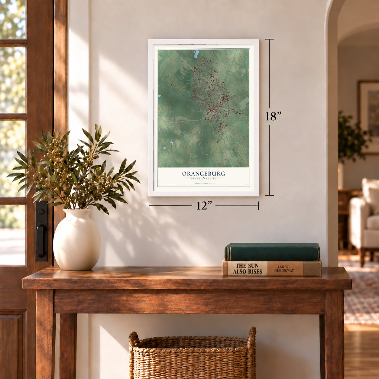
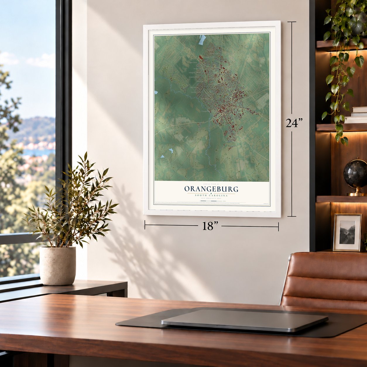
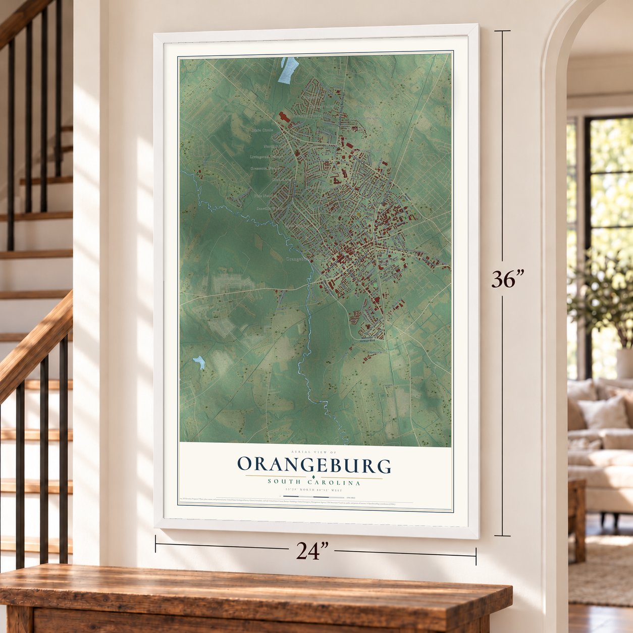
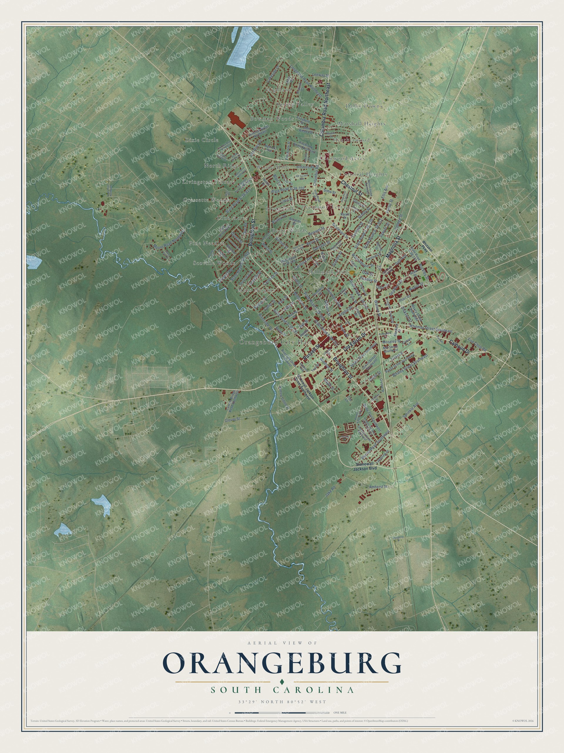
A new map of Orangeburg, South Carolina, made in 2026 and printed to order on thick archival matte paper.
12" x 18" Archival Matte Print
A Map of Home. A Work of Art.
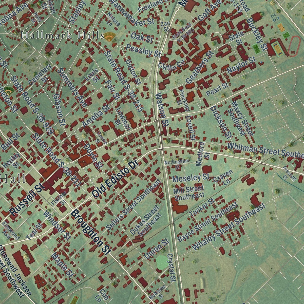
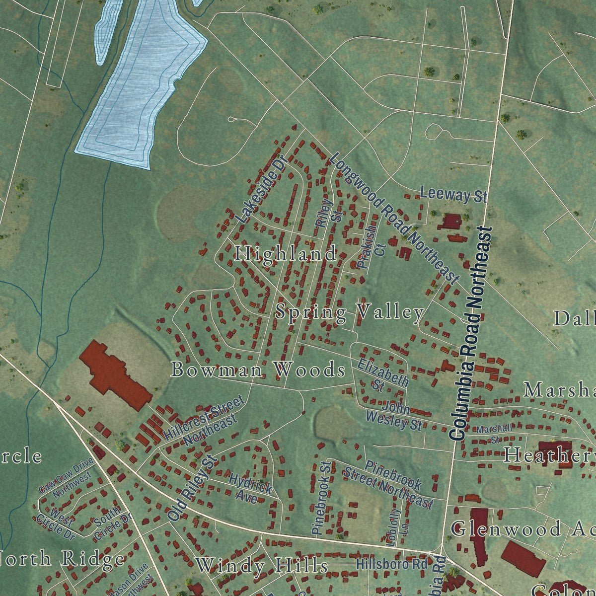
Explore Orangeburg, South Carolina from a whole new perspective. Created using aerial imagery and detailed geographic data, this map captures Orangeburg building by building, with labeled streets, familiar landmarks, and shaded topographical relief that highlights the natural contours of the landscape.
Combining modern data with the timeless character of a vintage atlas, this map is just as interesting up close as it is beautiful on the wall. Whether you grew up in Orangeburg, spent memorable years there, or call it home today, this unique map is a great way to celebrate a place that means something to you. Zoom in on the preview to look for your street, and then order a print to put your memories on the wall.
Three ways to hang it
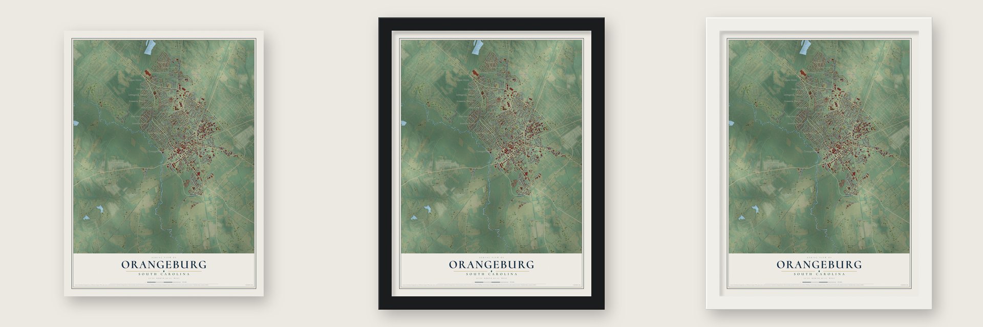
Unframed archival matte, a black wood frame or a white wood frame.
Up close
Geography Worth Displaying
This map was created using accurate cartographic data and authoritative geographic sources, including the U.S. Geological Survey and the Census Bureau. The map brings together terrain, waterways, roads, and building detail. The majority of the streets are labeled, houses are accurately depicted, and the topography is derived from government sources. Combining local data with carefully composed color and shading leads to this beautifully detailed Orangeburg artwork for your wall.
Rather than simply showing street outlines, we’ve included as many of the street names as we could reasonably fit on the map while keeping their names legible. Zoom in on the high resolution preview to see exactly what’s on the map. We truly set out to create a statement piece for anyone who loves Orangeburg. So whether it’s for you, or a gift for someone you love, we hope this map of Orangeburg brings back fond memories.
Read the story behind this map of Orangeburg, South Carolina from 2026.

About Orangeburg, South Carolina
Orangeburg is a city of 13,240 people on the North Fork of the Edisto River. It is the seat of Orangeburg County. George Sterling opened a fur trading post here in 1704. In 1730 the colonial assembly laid out a township to attract settlers. It honored King George II's son-in-law, William IV, Prince of Orange.
In 1735, 200 Swiss, German and Dutch settlers made homes near the river. They came for the rich soil and the plentiful game. The river carried their crops and lumber down to Charleston, and the colony of small farmers did well. After the Revolution, Eli Whitney's cotton gin made upland cotton pay. The county filled with large plantations worked by enslaved African Americans, who soon made up most of its people.
“The first Lutheran congregation in the state was established at Orangeburg; it converted to the Anglican faith in 1750 under the leadership of the Reverend John Giessendanner.”
- A church from before 1763The congregation built its church in the middle of the village before 1763. Fighting in the Revolutionary War destroyed it, so the members built a new one. During the Civil War, General William Tecumseh Sherman's Union troops marched through Orangeburg. They used the new church as a smallpox hospital.
- Two colleges after freedomAfter the Civil War, freed Black residents set out to get an education, and two colleges grew up in the city. Claflin, the state's oldest historically Black university, opened in 1869. Its Tingley Memorial Hall joined the National Register in 1983. South Carolina State followed in 1896. Under segregation, it was the state's land grant college for Black students.
- A center of the movementIn 1960 police arrested more than 400 Claflin and South Carolina State students at sit-ins and marches. In August 1963 the Orangeburg Freedom Movement, led by Harlowe Caldwell of the NAACP, gave the mayor 10 integration demands. Talks failed, and protests led to more than 1,300 arrests.
- The Orangeburg MassacreOn February 8, 1968, police fired on students who were protesting a segregated bowling alley. Samuel Hammond, Henry Smith and Delano Middleton died, and 27 were wounded. The shooting is called the Orangeburg Massacre.
- Roses since 1951Edisto Memorial Gardens began in the 1920s as azaleas on 5 acres. A playground came in 1922, and a greenhouse and nursery in 1947. The first rose garden went in in 1951 to make the blooming season longer. Today more than 50 beds hold some 4,000 plants of at least 75 kinds, on over 150 acres. The city has held its Festival of Roses since 1972.
Find your street
Names on the Orangeburg map
Every name below is printed on this map. Look for your street, your school, the park where you played, or the pond down the road.
Places and landmarks22
- Orangeburg City Hall
- Berry Woods
- Bowman Woods
- Club Acres
- Colonial Heights
- Dalby Downs
- Dixie Circle
- Glenwood Acres
- Gressette Woods
- Hallmark Hills
- Heatherwood
- Highland
Show all 22 places
- Hyde Park
- Livingston Terrace
- Marshall Heights
- Moss Heights
- North Ridge
- Pecanway Terrace
- Pine Needles
- Scoville Woods
- Spring Valley
- Windy Hills
Streets and roads168
- Broughton Street
- Magnolia Street
- Old Edisto Drive
- Calhoun Drive
- Chestnut Street
- Russell Street
- Columbia Road Northeast
- Old Riley Street
- Middleton Street
- State Road S-38-211
- Glover Street
- State Road S-38-224
- Boulevard Street
- State Road S-38-811
- Ellis Avenue
- Columbia Road
- Lakeside Drive
- Carolina Avenue
- State Road S-38-181
- Windsor Street
- Dantzler Street
- State Road S-38-215
- Whitman Street Southeast
- Amelia Street
- State Road S-38-702
- Summers Avenue
- Berry Street
- Park Street
- Murray Road Southwest
- State Road S-38-905
Show all 168 streets
- Whaley Street Southeast
- Jake Road
- Riverside Drive
- Buckley Street
- Sunset Street
- Moss Street
- Green Street
- State Road S-38-929
- Gue Road
- Longwood Road Northeast
- Moore Road Northwest
- Maple Street
- Geathers Street
- Union Street
- Sprinkle Avenue
- State Road S-38-912
- Goff Avenue
- Carolina Street
- Bennett Street
- College Street
- Amherst Street
- Naylor Street
- Pinehill Road
- Raysor Street
- Doyle Street
- Gibson Street
- Bull Street
- Stanley Street
- Fairfield Street
- Sawyer Street
- Scoville Street
- Sims Street
- Fair Street
- Schley Street
- Azalea Drive
- Moseley Street
- Wannamaker Street
- Peasley Street
- Leeway Street
- Five Chop Road
- Limit Street
- Culler Street
- Dunes Street
- Public Street
- Dickson Street
- Watson Street
- Blair Lane
- Oak Street
- Stonewall Jackson Boulevard
- Andrew Dibble Street
- Dukes Street Southeast
- Hillsboro Road
- State Road S-38-225
- Hillcrest Street Northeast
- State Road S-38-153
- Henley Street
- Riverside Drive Southwest
- Club Acres Boulevard
- Riley Street
- Wells Drive
- Wilson Street
- Adden Street
- Brewton Street
- Sellers Street Southeast
- Wolfe Trail Southwest
- Waring Street
- Bayne Street Southeast
- Spring Street
- Hydrick Avenue
- Cannon Bridge Road Southwest
- Pinebrook Street Northeast
- Cemetery Street
- Maxcy Street Southeast
- John Wesley Street
- Medford Street
- Lakeview Drive
- Perryclear Street
- Freeland Street
- Dutton Street
- Crystal Street
- State Street
- Pinebrook Street
- Teal Street
- Biltmore Street
- Gloria Street
- Mill Street Southeast
- Prakish Court
- Claflin Circle
- Lowman Street
- Tucker Street
- Louis Street
- Shuler Street
- Craven Lane
- Elizabeth Street
- Lovell Street
- Pearl Street
- Stuart Street
- Cob Lane
- Stonewall Jackson Street Southwest
- Whitaker Parkway
- State Road S-38-25
- State Road S-38-113
- Livingston Terrace Northwest
- Cherokee Street Southwest
- Nelson Street Northeast
- Robert East Lee Street
- Way Drive
- Pinehurst Drive
- Fischer Street
- West Circle Drive
- Pinckney Street
- South Circle Drive
- Elmwood Avenue
- Loblolly Lane
- Nature Lane
- Zan Street
- State Road S-38-890
- Rutledge Avenue
- State Road S-38-800
- State Road S-38-94
- Old Orchard Way
- Marshall Street
- Crossing Circle
- Putter Path Road
- Douglas Macarthur Street Southwest
- Nansbrook Drive
- Mason Drive Northwest
- Cherrywoods Street
- Prosperity Drive
- Nottingham Street
- Green Valley Street
- Caw Caw Drive Northwest
- McAlpine Street
- Centre Street
- Mobile Street
- Holly Street
- Pruitt Drive Northwest
- Prescott Street
Names are listed as they appear on the printed map. Zoom into the product photos to find them.
The art of mapping a place
How This Map Was Made
Real places. Remarkable detail. Discover the layers that turn geographic data into a map of home.

The view from above
Aerial imagery reveals the character of the land: woodland, open fields, and the patterns of a place.

The shape of the land
Elevation data brings hills, valleys, and subtle changes in the landscape into view.

The details of home
Roads, waterways, and building footprints come together to make the map feel unmistakably local.

Geography becomes art
Considered color, shading, and typography bring the layers together in a map made for your wall.


Process illustrated with Mendon, Massachusetts. Aerial imagery: USDA NAIP. Terrain: USGS 3D Elevation Program. Map details and finished artwork: KNOWOL.
The Details
About This Print
Choose an archival matte print, or a black or white Ayous wood frame. The archival matte print is unframed.
Select your size and finish above to see the matching product image and price.
Materials & Craftsmanship
A contemporary map with the character of a classic atlas, printed on archival matte paper. Optional frames are made from Ayous wood.
Your printed map does not include the watermark shown in the full-map preview.
Shipping & Delivery
Free shipping within the United States. Every print is made to order in the USA.
Buying a gift? Add a note in your cart and we'll include it. We never put prices in the package.
Prints ship within 2 to 3 business days. Allow 7 to 10 days total from ordering for delivery. Timing may vary during holidays or periods of high order volume.
Read our shipping policy.
Returns and damaged prints
Each print is made to order. Change-of-mind refunds are not available after production.
If your print arrives damaged, misprinted or incorrect, contact support@knowol.com within 30 days of receiving it. Include your order number, photos and a description of the issue.
Read our full refund and replacement policy. For questions about your order, email support@knowol.com.
Find your town
Looking for another city?
Find a map of home in our South Carolina collection, or any town in the country.
Nearby
Maps of towns near Orangeburg
Know someone from one of these towns? Their map makes a great gift.
 Edisto
, South Carolina
From $39.99See the map
 Wilkinson Heights
, South Carolina
From $39.99See the map
 Brookdale
, South Carolina
From $39.99See the map
More maps nearby: Cordova, Rowesville, Cameron, Cope and St. Matthews.