
Search for another town





Free U.S. delivery 7 to 10 days after you order
Owensboro, Kentucky Map Art
Building by building, with labeled streets and shaded relief.
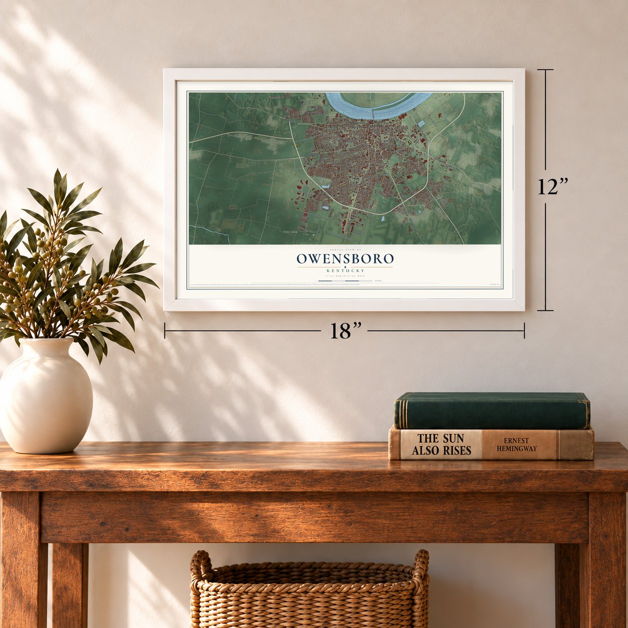
12" x 18" Archival Matte Print
A Map of Home. A Work of Art.
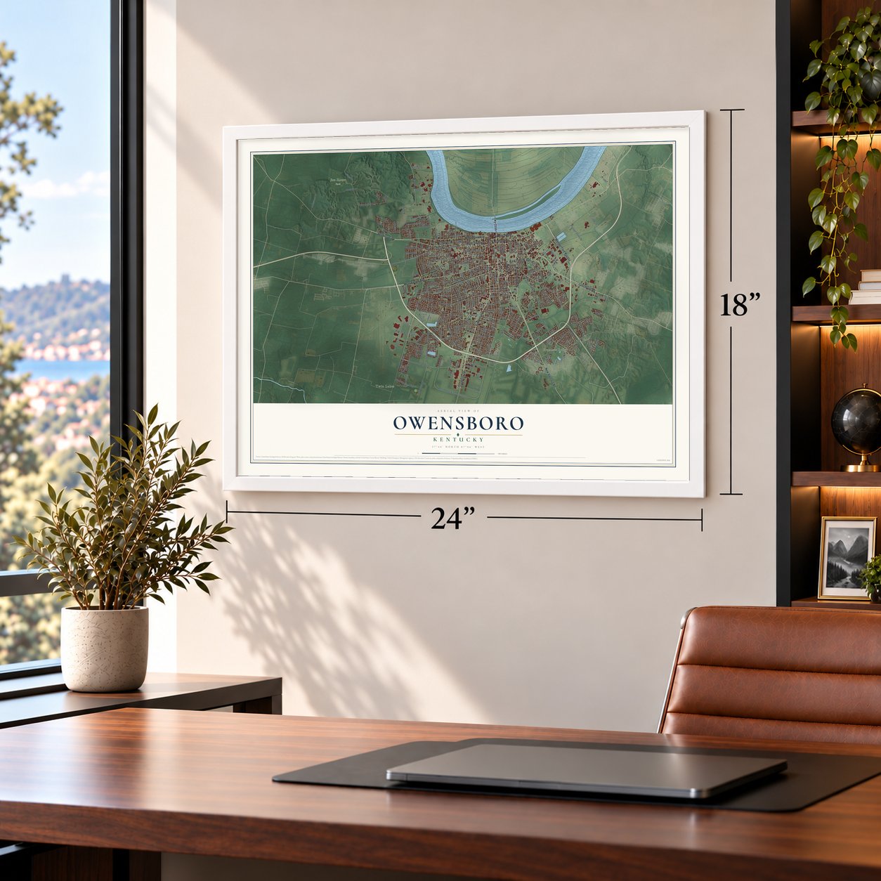
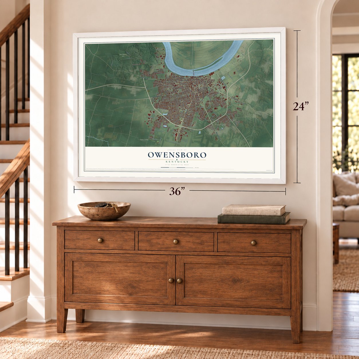
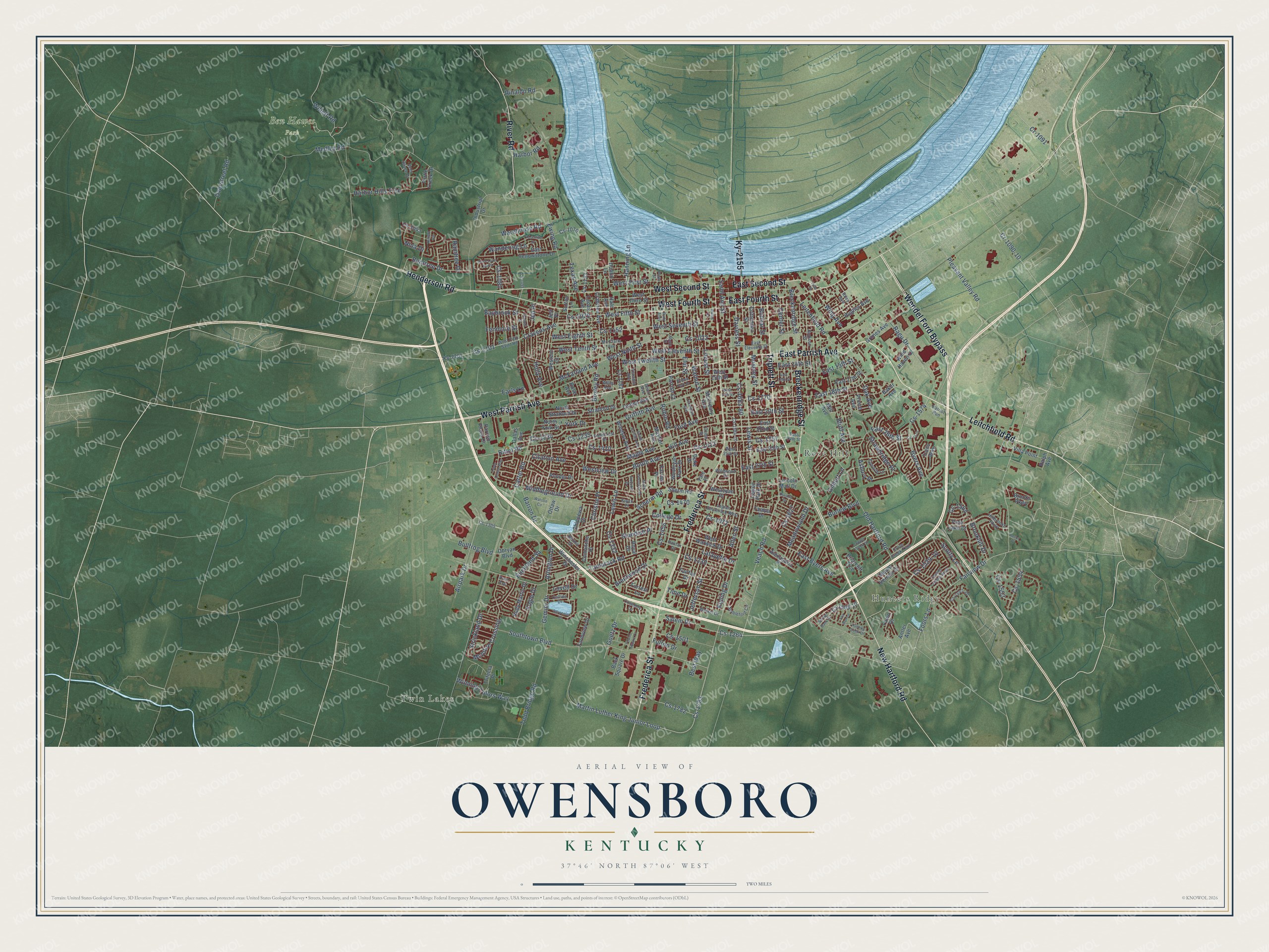
Explore Owensboro, Kentucky from a whole new perspective. Created using aerial imagery and detailed geographic data, this map captures Owensboro building by building, with labeled streets, familiar landmarks, and shaded topographical relief that highlights the natural contours of the landscape.
Combining modern data with the timeless character of a vintage atlas, this map is just as interesting up close as it is beautiful on the wall. Whether you grew up in Owensboro, spent memorable years there, or call it home today, this unique map is a great way to celebrate a place that means something to you. Zoom in on the preview to look for your street, and then order a print to put your memories on the wall.
Three ways to hang it
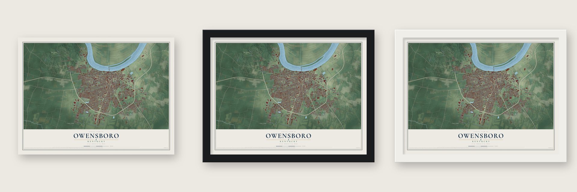
Unframed archival matte, a black wood frame or a white wood frame.
Up close
Geography Worth Displaying
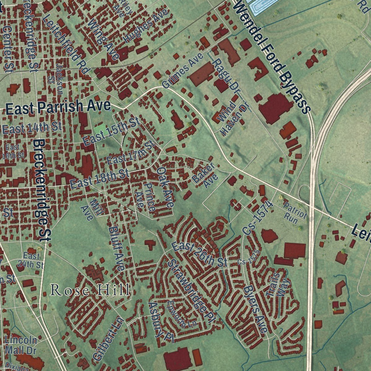
This map was created using accurate cartographic data and authoritative geographic sources, including the U.S. Geological Survey and the Census Bureau. The map brings together terrain, waterways, roads, and building detail. The majority of the streets are labeled, houses are accurately depicted, and the topography is derived from government sources. Combining local data with carefully composed color and shading leads to this beautifully detailed Owensboro artwork for your wall.
Rather than simply showing street outlines, we’ve included as many of the street names as we could reasonably fit on the map while keeping their names legible. Zoom in on the high resolution preview to see exactly what’s on the map. We truly set out to create a statement piece for anyone who loves Owensboro. So whether it’s for you, or a gift for someone you love, we hope this map of Owensboro brings back fond memories.
Read the story behind this map of Owensboro, Kentucky from 2026.

Find your street
Names on the Owensboro map
Every name below is printed on this map. Look for your street, your school, the park where you played, or the pond down the road.
Places and landmarks4
- Twin Lakes
- Hunters Ridge
- Ben Hawes Park
- Rose Hill
Streets and roads280
- Wendel Ford Bypass
- Triplett Street
- Leitchfield Road
- Breckenridge Street
- East Parrish Avenue
- West Parrish Avenue
- New Hartford Road
- Frederica Street
- West Second Street
- West Fourth Street
- Henderson Road
- East Fourth Street
- River Road
- East Second Street
- Ky-2155
- Allen Street
- Southtown Boulevard
- Veach Road
- Fairview Drive
- Booth Avenue
- Cs-1412
- Cs-1770
- Foors Lane
- Martin Luther King Junior Loop
- Westview Drive
- East 18th Street
- Carter Road
- West First Street
- Cs-1101
- Citation Avenue
Show all 280 streets
- Cs-1072
- Medley Road
- Old Hartford Road
- Tamarack Road
- Daviess Street
- Cs-1330
- Griffith Avenue
- West Fifth Street
- Cs-1574
- West Ninth Street
- Cs-1234
- Ford Avenue
- Scherm Road
- Cs-1410
- Cs-1020
- Cs-1683-80
- Cs-1332
- Lewis Lane
- West Seventh Street
- Center Street
- Lewis Street
- Saint Ann Street
- Buckland Square
- Cs-1022
- Bittel Road
- Cs-1235
- Locust Street
- West Eleventh Street
- Cs-1783
- East Byers Avenue
- East 20th Street
- Walnut Street
- Hill Avenue
- West Twelfth Street
- Cs-1152
- Christie Place
- McIntire Crossing
- West Eighth Street
- Byers Avenue
- Maple Avenue
- Bluff Avenue
- Ewing Road
- Elm Street
- East 26th Street
- Airpark Drive
- Wing Avenue
- Jefferson Street
- Cs-1264
- Salem Drive
- Middleground Drive
- Ragu Drive
- Cs-1529-10
- McFarland Avenue
- West Tenth Street
- East 15th Street
- Burlew Boulevard
- Pleasant Valley Road
- East 14th Street
- Winning Colors Way
- College Drive
- Standish Place
- Cs-1757
- Robin Road
- Brentwood Drive
- Bolivar Street
- Barron Drive
- Benttree Drive
- Wandering Lane
- Harbor Hills Trce
- Strickland Drive
- Moseley Street
- Strawbridge Place
- Todd Bridge Road
- Cravens Avenue
- Willett Road
- Gemini Drive
- Raintree Drive
- Hanning Lane
- Holly Avenue
- Meadowland Drive
- Lafayette Drive
- Bosley Road
- Goetz Drive
- Fulton Drive
- Overstreet Road
- Warehouse Road
- Earls Lane
- East 27th Street
- Cs-1565
- Asbury Place
- Scotty Lane
- Baybrook Street
- Kipling Drive
- Cs-1081
- Cr-1091
- Lovell Drive
- Cs-1782
- Brookhill Drive
- Rinaldo Road
- Cs-1554
- Arlington Drive
- Cs-1553
- Cr-1090-10
- Nina Drive
- Harbor Road
- Fogle Drive
- Bullfrog Boulevard
- York Drive
- Cs-1470
- Cs-1501
- Texas Avenue
- Cs-1458
- Fenmore Street
- Jed Place
- Oak Avenue
- Cs-1627
- Gilbert Lane
- Best Way
- Time Drive
- West Third Street
- Ky-2701
- Windsor Avenue
- East 22nd Street
- Mayfair Avenue
- Crabtree Avenue
- East 17th Street
- Cs-1508-10
- Pine Lake Court
- East 25th Street
- West 15th Street
- Crittenden Street
- Sherm Road
- Grimes Avenue
- Trails Way
- Wesleyan Park Drive
- West Warwick Drive
- Villa Point
- Industrial Drive
- Prince Avenue
- North Stratford Drive
- Royal Drive
- Alexandria Place
- Obryan Boulevard
- Hale Avenue
- East Yellowstone Drive
- Hughes Avenue
- Farmview Drive
- Turtle Creek Drive
- Rudy Martin Drive
- Winchester Drive
- Cs-1182
- Legion Park Drive
- Trifecta Place
- Antler Avenue
- North York Street
- Wesleyan Place
- Stratford Drive
- Dublin Lane
- Comanche Place
- Farrier Place
- Western Court
- Sutton Lane
- Chippewa Drive
- Fairfax Drive
- Brooks Parkway
- Parrish Plaza Drive
- Linden Avenue
- Mount Vernon Drive
- Cs-1133
- Fawn Drive
- Back Square Drive
- McCreary Avenue
- Briarcliff Trce
- Wind Haven Drive
- Parrish Court
- Cs-1070
- Ponder Place
- Forrest Lane
- Lucas Avenue
- Lincoln Mall Drive
- Dallas Avenue
- Duke Drive
- Cs-1043
- Mill Avenue
- Tampa Drive
- Baker Avenue
- Ralph Avenue
- Ottaw Drive
- Jeff Place
- Yale Place
- Rose Avenue
- Cs-1684-10
- Cs-1547-20
- Hillbrooke Parkway
- West 25th Street
- Cedar Street
- West Fifth Saint Road
- Jackson Street
- East 24th Street
- Stableford Circle
- Plum Street
- East Eleventh Street
- Epworth Lane
- Fieldcrest Drive
- Legion Boulevard West
- Cross Creek Trail
- Venable Avenue
- Sioux Place
- Deer Haven Drive
- Cs-1305
- Weikel Drive
- Dean Avenue
- Dickey Drive
- Wildwood Drive
- Collins Drive
- Mc Clarty Avenue
- Coventry Lane
- Halifax Drive
- Patriot Run
- Riley Avenue
- Willis Avenue
- Hunt Avenue
- South Griffith Avenue
- Maple Street
- Spring Bank Drive
- Carpenter Drive
- East 16th Street
- Walnut Park Drive
- Copper Creek Drive
- Yosemite Drive
- Reliant Circle
- Hunting Creek Drive
- South Cherokee Drive
- Dixiana Drive
- Yewells Landing South
- Lexington Avenue
- Triple Crown Way
- Dove Loop North
- Cs-1575
- Dornell Street
- Rudy Alley
- Towne Square Court
- Watson Circle
- Fox Run Lane
- Iroquois Drive
- Cs-1099
- West 17th Street
- Ewing Court
- Pecks Place
- Tyler Street
Names are listed as they appear on the printed map. Zoom into the product photos to find them.
About Owensboro, Kentucky
Owensboro is a city of 60,183 people and the seat of Daviess County, set in a bend of the Ohio River. People lived here 12,000 years ago, and the last Shawnee had been driven out by the close of the 18th century. In 1797 the frontiersman William Smothers, also spelled Smeathers, became the first settler of European descent, and the riverfront park still carries his name.
The settlement was first called Yellow Banks, for the color of the soil along the river. It was formally set up in 1817 as Owensborough, named for Col. Abraham Owen, and in 1893 the spelling was cut down to Owensboro. Distillers made bourbon in and around the city, and the Green River Distilling Company, started in 1885, is still at work.
“Buffalo herds opened first road in wilderness to present site of Owensboro. Bill Smothers, the pioneer settler of Yellow Banks, followed trail from Rough Creek, near present day Hartford, to Ohio River.”
- Lights for baseball's first night gameThe Kentucky Electrical Lamp Company began making light bulbs here in 1899. Its bulbs lit the first night game in Major League Baseball, played by the Reds and the Phillies at Crosley Field in Cincinnati on May 24, 1935. General Electric took over the business in 1945, and in 1961 its Owensboro engineers introduced the Compactron, a family of vacuum tubes.
- From carriages to cars to furnitureFrederick A. Ames arrived from Washington, Pennsylvania, in 1887 and opened a shop to repair horse-drawn carriages. He began building Ames automobiles in 1910 and hired Vincent Bendix in 1912. A Texas dealer called the Ames the "best $1500" car, but the company quit making its own model in 1915 and built bodies for the Ford Model T instead. In 1922 it turned to furniture as the Ames Corporation, and it sold out to Whitehall Furniture in 1970.
- Barbecue and bluegrassOwensboro calls itself the Barbecue Capital of the World and holds its International Bar-B-Q Festival every second weekend in May. ROMP, the River of Music Party, is a bluegrass festival that now draws 25,000 visitors a year, and the Bluegrass Music Hall of Fame and Museum keeps the story of the music here.
- A synagogue from 1877The congregation of Temple Adath Israel organized in 1858 and built its temple in 1877. It is among the oldest synagogues in the nation, and it is listed on the National Register.
Keep exploring Kentucky
Owensboro is one of 659 Kentucky towns we've mapped. Every dot on the map is a print of its own.
The search covers every state, Kentucky first.
Near Owensboro
Order 2 or more town maps and save 10%. Shown in the size and finish you picked above, so they hang as a set.
- Sorgho 12" x 18" / Archival Matte Print $39.99
- Thruston 12" x 18" / Archival Matte Print $39.99
- Philpot 12" x 18" / Archival Matte Print $39.99
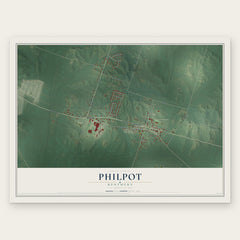
More maps nearby: Masonville, Moseleyville, Stanley, Maceo and Yelvington.
The art of mapping a place
How This Map Was Made
Real places. Remarkable detail. Discover the layers that turn geographic data into a map of home.

The view from above
Aerial imagery reveals the character of the land: woodland, open fields, and the patterns of a place.

The shape of the land
Elevation data brings hills, valleys, and subtle changes in the landscape into view.

The details of home
Roads, waterways, and building footprints come together to make the map feel unmistakably local.

Geography becomes art
Considered color, shading, and typography bring the layers together in a map made for your wall.


Process illustrated with Mendon, Massachusetts. Aerial imagery: USDA NAIP. Terrain: USGS 3D Elevation Program. Map details and finished artwork: KNOWOL.
The Details
About This Print
Choose an archival matte print, or a black or white Ayous wood frame. The archival matte print is unframed.
Select your size and finish above to see the matching product image and price.
Materials & Craftsmanship
A contemporary map with the character of a classic atlas, printed on archival matte paper. Optional frames are made from Ayous wood.
Your printed map does not include the watermark shown in the full-map preview.
Shipping & Delivery
Free shipping within the United States. Every print is made to order in the USA.
Buying a gift? Add a note in your cart and we'll include it. We never put prices in the package.
Prints ship within 2 to 3 business days. Allow 7 to 10 days total from ordering for delivery. Timing may vary during holidays or periods of high order volume.
Read our shipping policy.
Returns and damaged prints
Each print is made to order. Change-of-mind refunds are not available after production.
If your print arrives damaged, misprinted or incorrect, contact support@knowol.com within 30 days of receiving it. Include your order number, photos and a description of the issue.
Read our full refund and replacement policy. For questions about your order, email support@knowol.com.