
Search for another town


Free U.S. delivery 7 to 10 days after you order
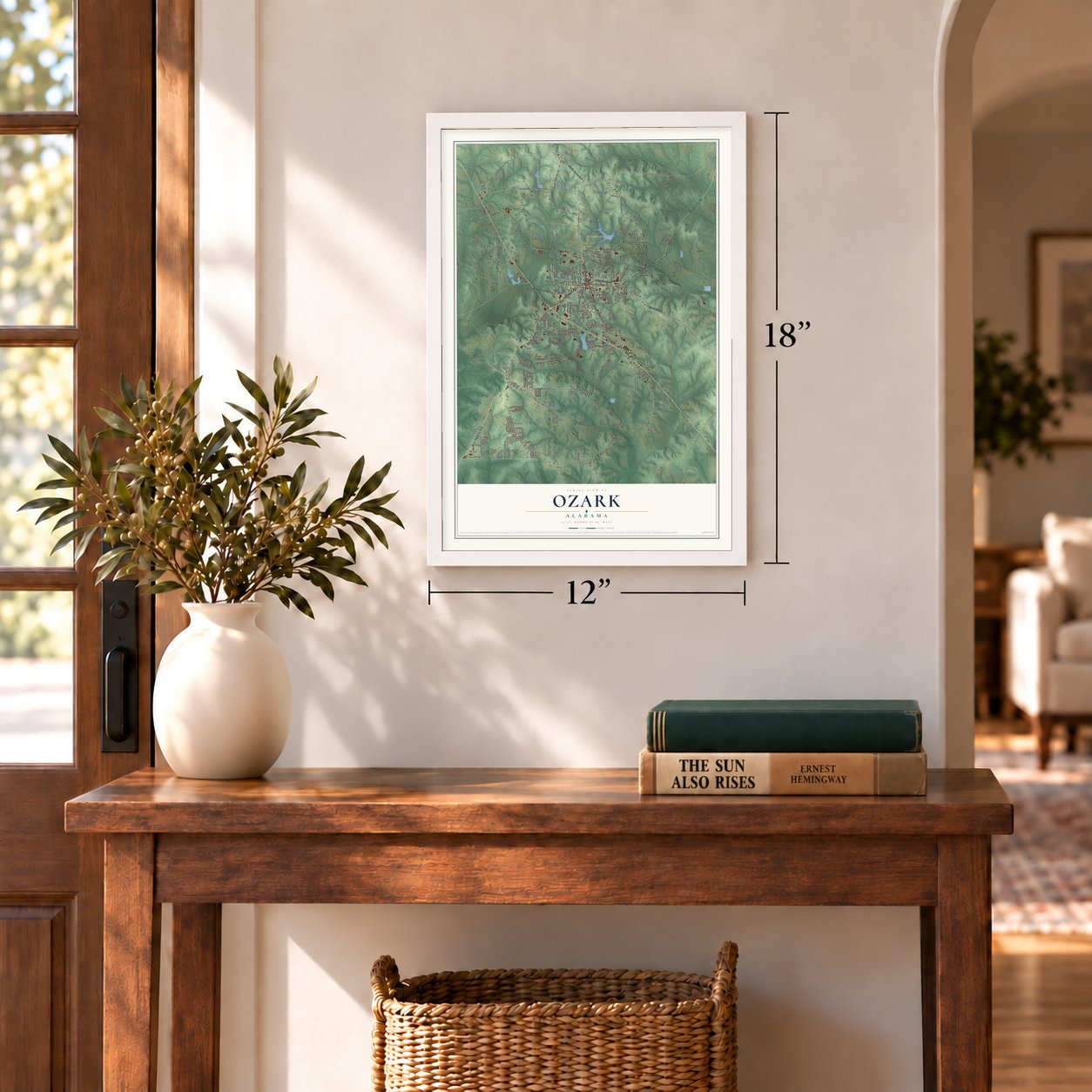
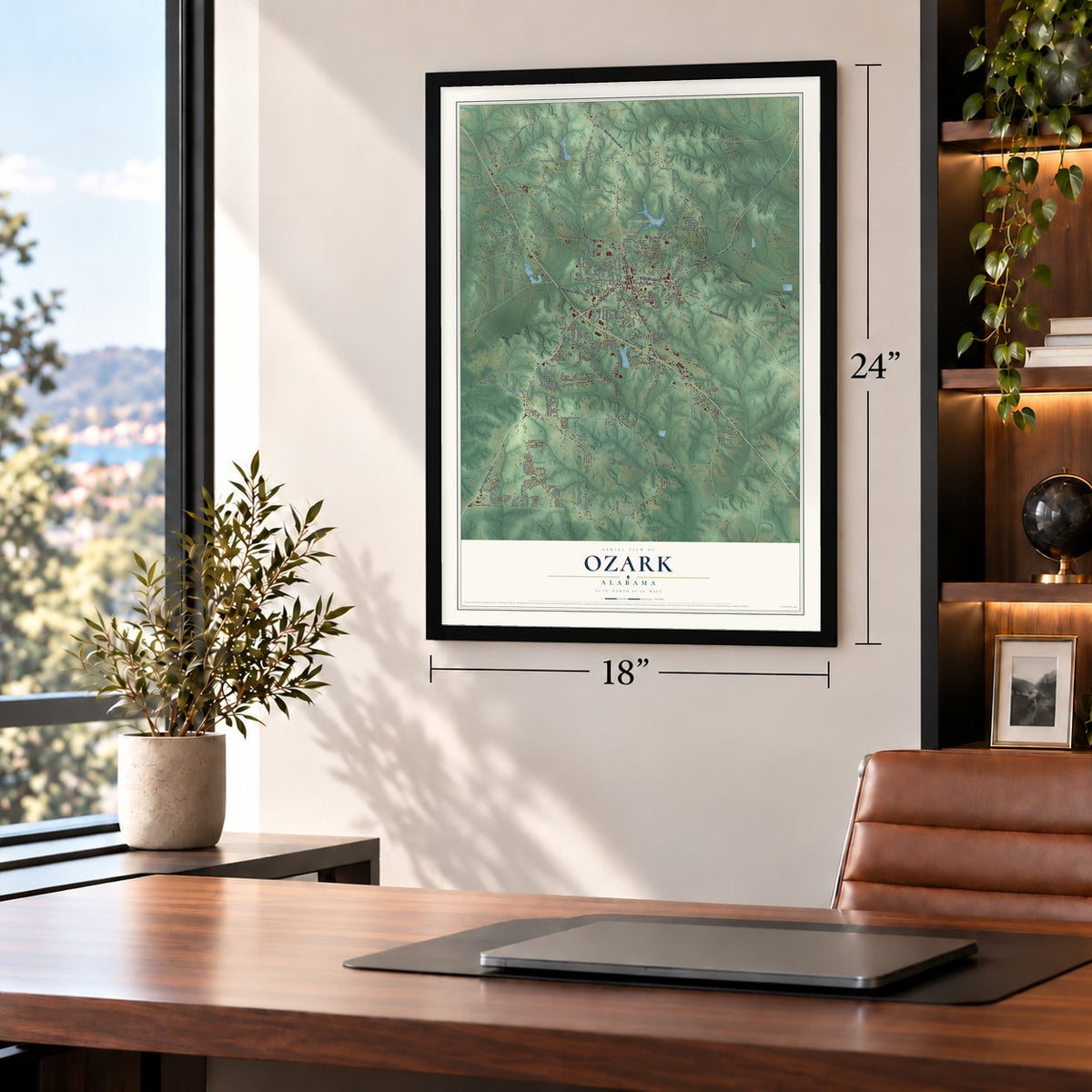
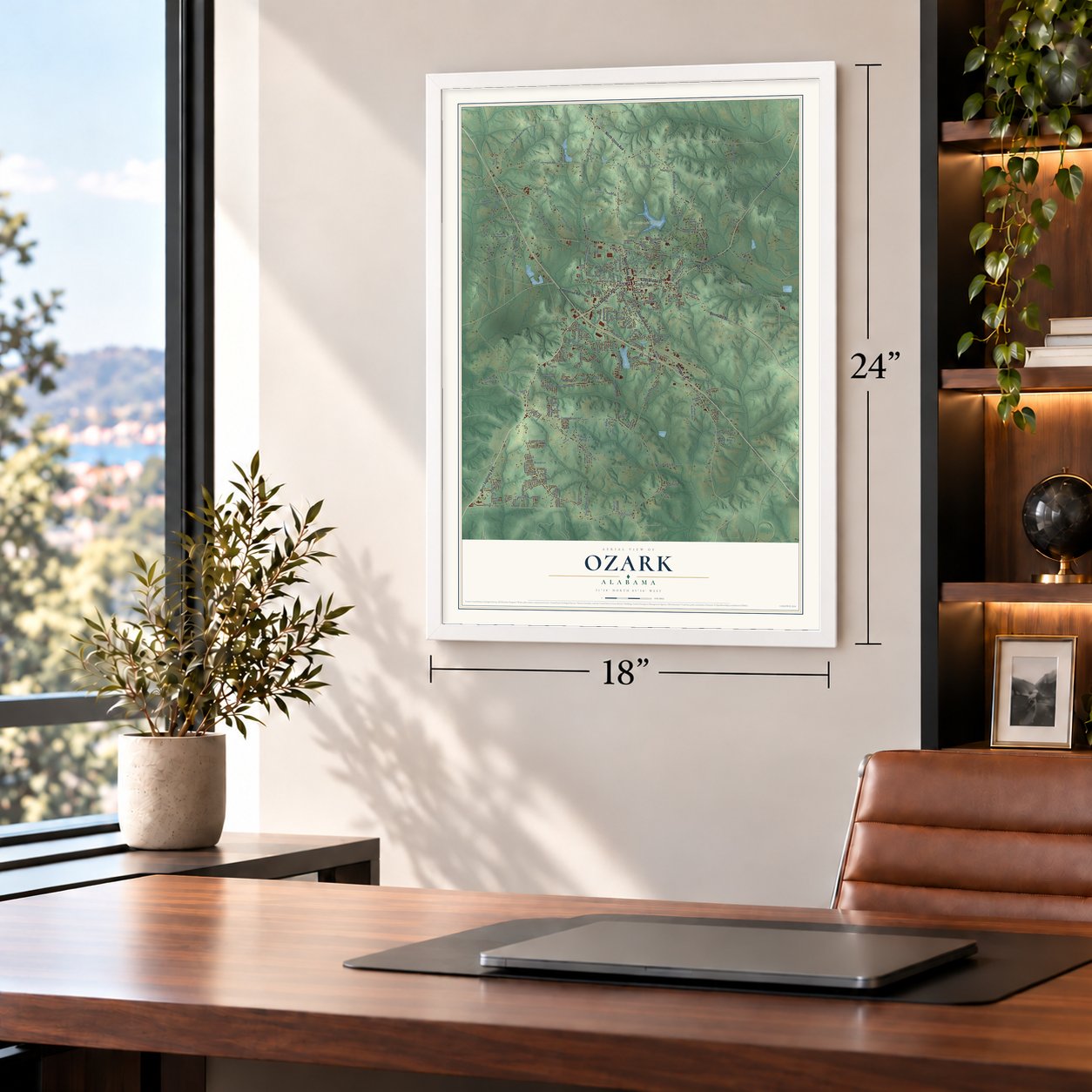
Ozark, Alabama Map Art
A new map of Ozark, Alabama, made in 2026 and printed to order on thick archival matte paper.
12" x 18" Archival Matte Print
A Map of Home. A Work of Art.
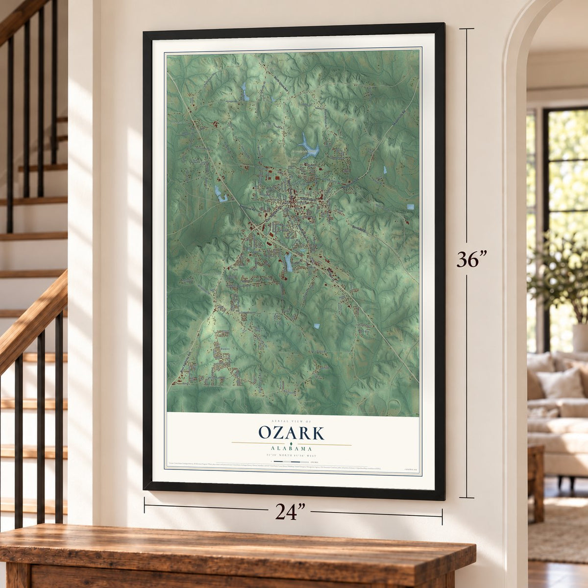
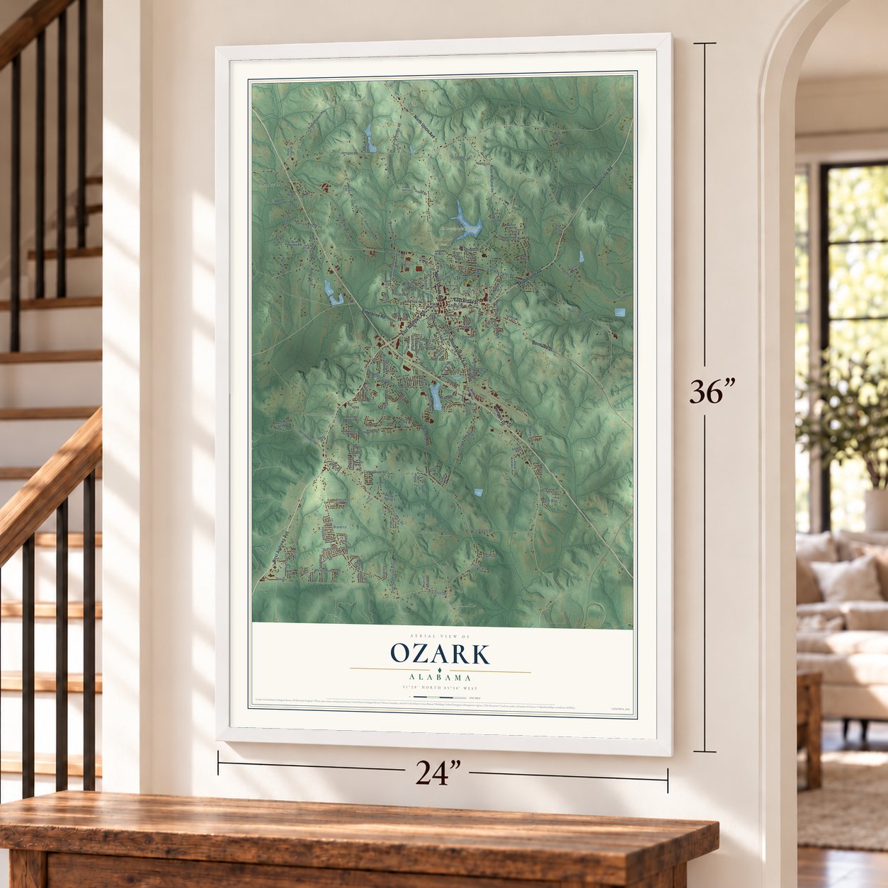
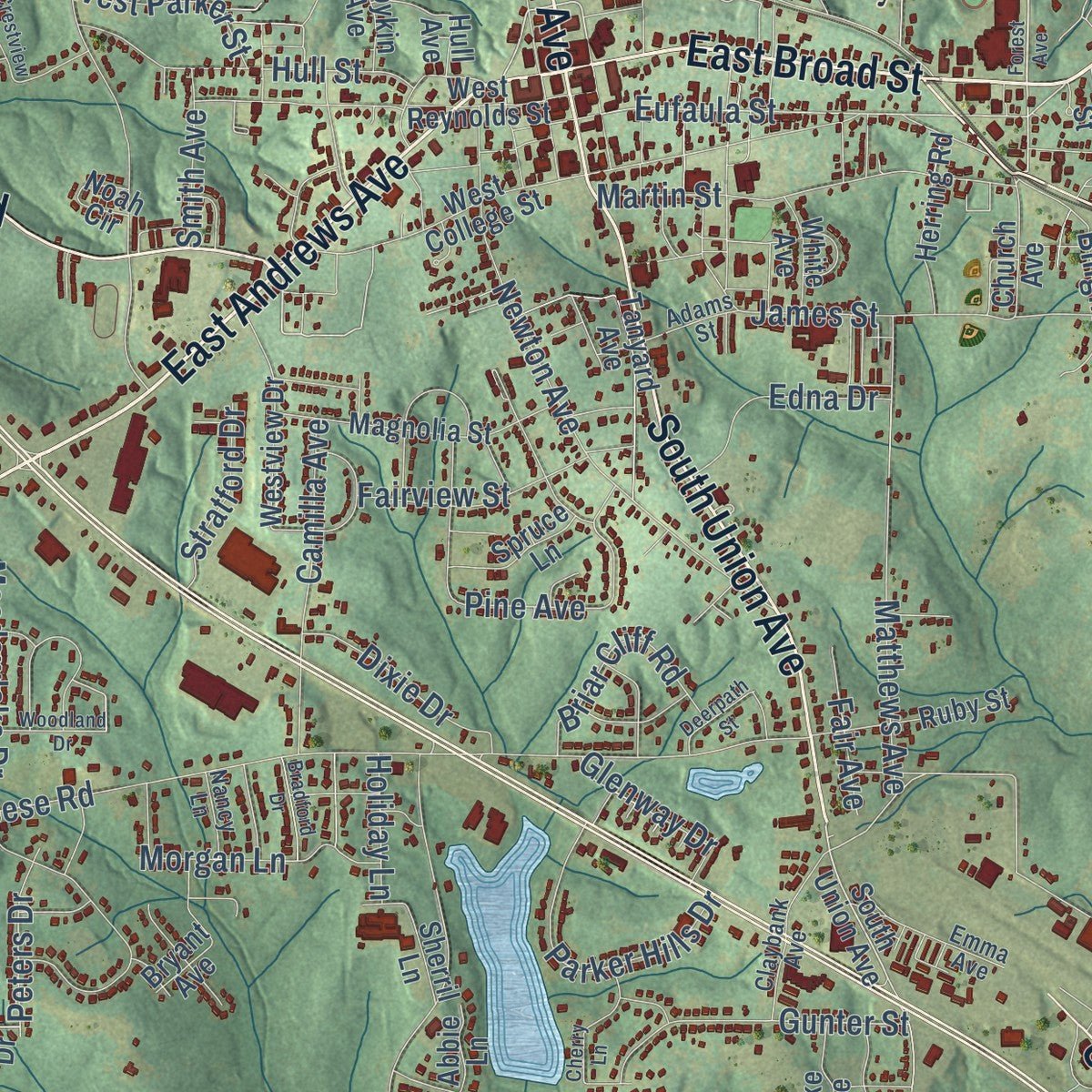
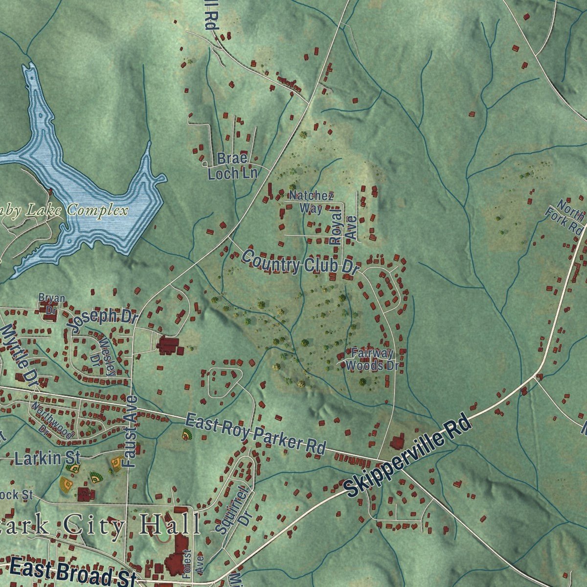
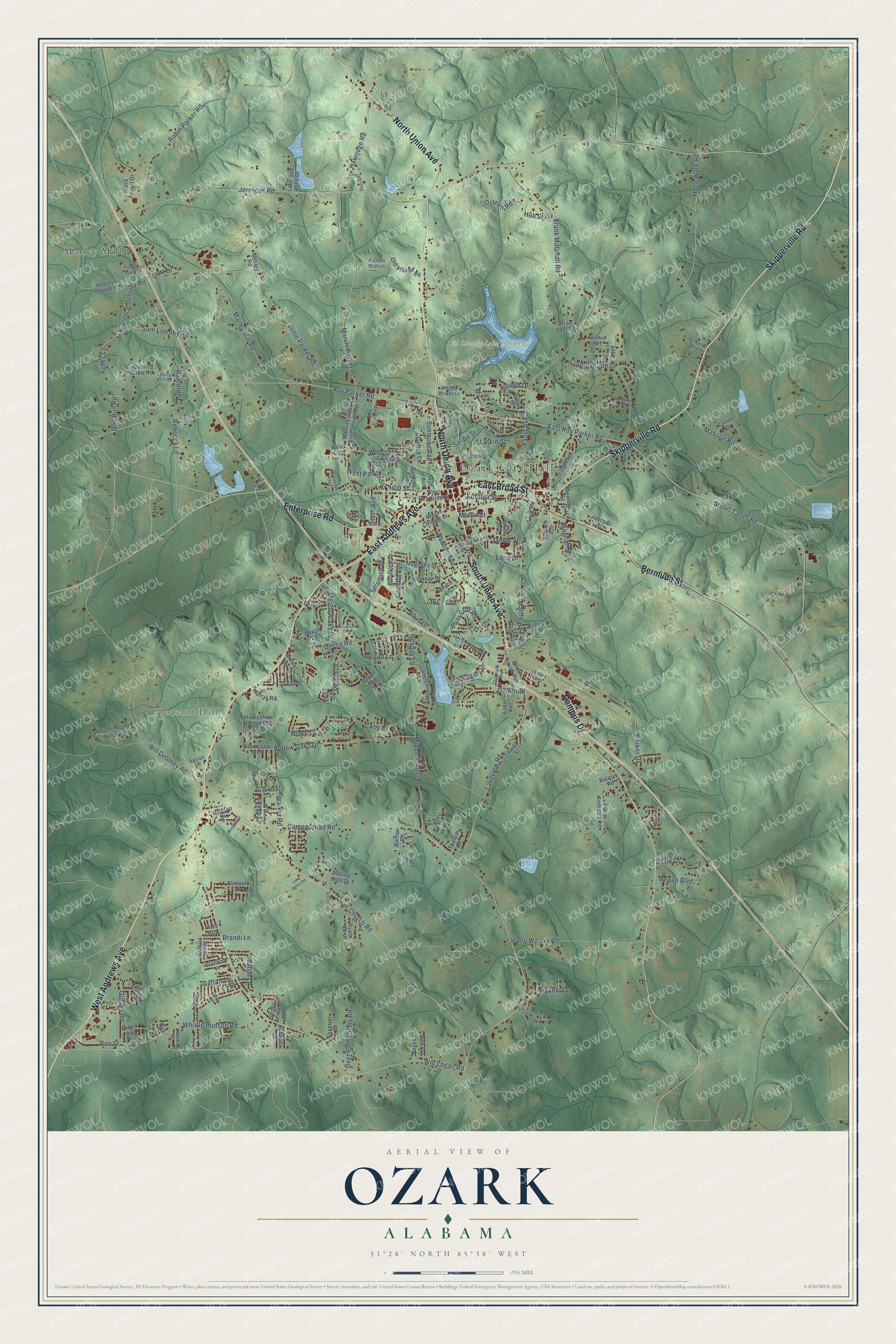
Explore Ozark, Alabama from a whole new perspective. Created using aerial imagery and detailed geographic data, this map captures Ozark building by building, with labeled streets, familiar landmarks, and shaded topographical relief that highlights the natural contours of the landscape.
Combining modern data with the timeless character of a vintage atlas, this map is just as interesting up close as it is beautiful on the wall. Whether you grew up in Ozark, spent memorable years there, or call it home today, this unique map is a great way to celebrate a place that means something to you. Zoom in on the preview to look for your street, and then order a print to put your memories on the wall.
Three ways to hang it
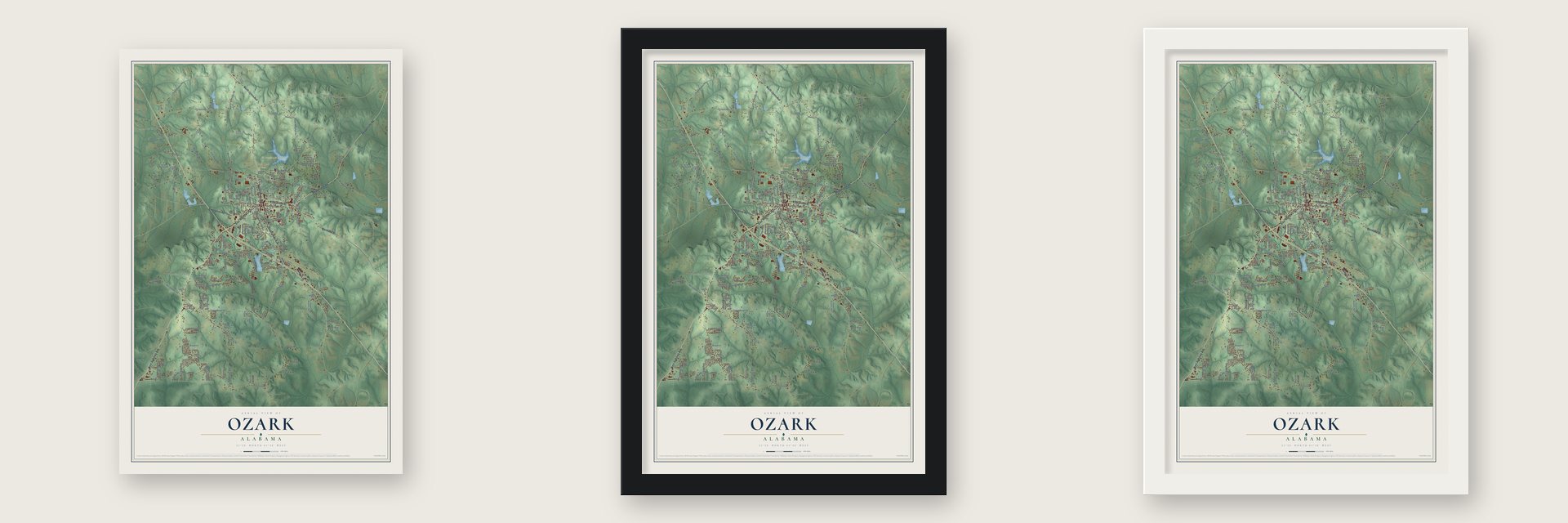
Unframed archival matte, a black wood frame or a white wood frame.
Up close
Geography Worth Displaying
This map was created using accurate cartographic data and authoritative geographic sources, including the U.S. Geological Survey and the Census Bureau. The map brings together terrain, waterways, roads, and building detail. The majority of the streets are labeled, houses are accurately depicted, and the topography is derived from government sources. Combining local data with carefully composed color and shading leads to this beautifully detailed Ozark artwork for your wall.
Rather than simply showing street outlines, we’ve included as many of the street names as we could reasonably fit on the map while keeping their names legible. Zoom in on the high resolution preview to see exactly what’s on the map. We truly set out to create a statement piece for anyone who loves Ozark. So whether it’s for you, or a gift for someone you love, we hope this map of Ozark brings back fond memories.

About Ozark, Alabama
Ozark is a city of 14,368 people and the seat of Dale County, in the Wiregrass of southeast Alabama. In 1822 John Merrick Sr., who had fought in the Revolutionary War, built a cabin on ground that is now downtown, so the settlement was first called Merricks. In 1843 it became Woodshop, after a woodworking business that mattered to the town, and in the mid-1850s it took the name Ozark. Local lore says a traveler thought the land looked like Arkansas's Ozark Mountains.
Daleville had been the county seat since 1824, and Newton held it from 1843. When the Newton courthouse burned in 1869, county officials called an election to pick a new seat. Ozark won, and on October 27, 1870, it became an incorporated town. That same year The Southern Star began printing, and the weekly still comes out today. Rail lines followed, to Eufaula in 1888 and to Troy in 1889.
- Claybank Log Church, 1856Rev. Dempsey Dowling moved to the area in 1826, and his family founded the Claybank Church in 1829-30. The log building standing today is the second on the site, put up in 1856, and it counts among the oldest log structures in the region. It joined the National Register in 1976.
- A depot that sent soldiers offOzark's first wooden depot, a block from the public square, burned in 1910. A brick one opened with the morning train on September 5, 1911. Company G of the 4th Alabama Infantry left from it for the Mexican border on June 26, 1916, draftees bound for Camp Rucker arrived there in 1942, and a National Guard tank company left for Fort Knox on September 16, 1950. Passenger trains stopped in the 1960s; the depot came down in January 2018.
- From cotton to Army AviationThe Ozark Oil Mill, later the Mutual Cotton Oil Company, began pressing cottonseed oil in 1914. By then the boll weevil was ruining the area's cotton, so farmers turned to livestock, peanuts and other crops. Farming led the economy until Camp Rucker was established. As Fort Rucker, home of Army Aviation, it remains the main force behind Ozark's economy.
- The Holman HouseThe J. D. Holman House was built in 1912-13 and is a well-known example of Neoclassical architecture. It joined the National Register in 1982, and today it is used as an event center.
Find your street
Names on the Ozark map
Every name below is printed on this map. Look for your street, your school, the park where you played, or the pond down the road.
Places and landmarks6
- Ozark City Hall
- Dill
- Pleasant Hill
- Ed Lisenby Lake Complex
- Sam Dale Park
- Marley Mill
Streets and roads193
- West Andrews Avenue
- North Union Avenue
- Skipperville Road
- East Andrews Avenue
- East Broad Street
- South Union Avenue
- Bermuda Street
- Enterprise Road
- Campus Drive
- Roy Parker Road
- East Roy Parker Road
- Stuart Tarter Road
- Eufaula Street
- Mabson Road
- Agnes Lane
- Clarence Deloney Road
- Parker Drive
- James Street
- Blake Drive
- Campground Road
- Will Logan Road
- Faust Avenue
- Jernigan Road
- Marley Mill Road
- Deese Road
- Dean Church Road
- Marvin Parker Road
- Mixon School Road
- Jodie Parker Road
- Frank Marshall Road
Show all 193 streets
- Whittle Hudson Road
- Meadowlake Drive
- Willow Oaks Drive
- Country Club Drive
- Newton Avenue
- Mose Ware Road
- Sam Lisenby Road
- Robin Parker Road
- Lakeview Road
- Harry Walker Road
- Myrtle Drive
- Bill Deloney Road
- Hawridge Road
- Matthews Avenue
- Hull Street
- Camilla Avenue
- Bingham Avenue
- Martin Street
- Pine Avenue
- Deer Path Farms Road
- Osteen Road
- Walker Road
- Grimes Road
- Parker Hills Drive
- Gunter Street
- Joseph Drive
- Willa Street
- Larkin Street
- Coby Drive
- Sharon Lane
- Rebecca Lane
- Morgan Lane
- Edna Drive
- Fairview Street
- Ben Street
- Dixie Drive
- Briar Cliff Road
- Hampton Place
- Oakhill Drive
- West Parker Street
- Simmons Avenue
- Megan Boulevard
- Stratford Drive
- Garland Avenue
- Smith Avenue
- Peters Drive
- Fair Avenue
- Saliba Street
- Doe Run Road
- Glenway Drive
- Troy Street
- Holiday Lane
- Brandi Lane
- Hub Street
- Goff Drive
- Susie Drive
- Alcuri Drive
- Debra Lane
- Squirrel Drive
- Kennesaw Boulevard
- Church Avenue
- Martin Luther King Junior Avenue
- West Reynolds Street
- Porter Andrews Road
- Westview Drive
- Rolling Hills Drive
- Horseshoe Bend Drive
- West College Street
- Magnolia Street
- Hopeful Church Road
- Black Forest Drive
- Boykin Avenue
- Walter Hand Junior Drive
- Tanyard Avenue
- Ruby Street
- Hudson Circle
- Herring Road
- Old Village Road
- Sunny Acres Drive
- Willa Circle
- Alec Circle
- Bryant Avenue
- Foxbrier Drive
- Mixon Lane
- Quail Hollow Road
- Reyes Street
- Brae Loch Lane
- Willow Ridge Lane
- Lakeland Hills Drive
- Don Circle
- Miranda Street
- Sherril Lane
- Brown Drive
- Ryan Drive
- Spruce Lane
- Juniper Drive
- Susan Lane
- Murray Road
- Bartow Road
- Mosley Road
- Redd Street
- Carver Drive
- Bonnie Drive
- Stanford Place
- White Avenue
- Johanna Drive
- Julian Street
- Cypress Lane
- Hull Avenue
- Blossom Drive
- Noah Circle
- Royal Avenue
- Lake Avenue
- Tharpe Drive
- Johnson Street
- Fuqua Avenue
- Balcom Road
- South Street
- Abbie Lane
- Gill Drive
- Fox Lane
- Peacock Street
- Emma Avenue
- Shadow Woods Lane
- Claybank Avenue
- Harris Road
- Springdale Lane
- Van Heusen Drive
- Plum Street
- Pierces Station
- Mark Avenue
- Holly Hill Road
- Wesley Drive
- Fairway Woods Drive
- Green Village Road
- Natchez Way
- Keirns Court
- Adams Street
- Don Avenue
- Hank Nix Drive
- Nancy Lane
- Keisha Court
- North Fork Road
- Ned Avenue
- Neal Avenue
- Forest Avenue
- Bryan Drive
- Northwood Drive
- Cherry Lane
- George Faulk Drive
- Jernigan Loop
- Periwinkle Lane
- Woodland Drive
- Ashley Drive
- Bradford Drive
- Wooded Lane
- Deerpath Street
- Crestview Terrace
- Denise Lane
- Gibson Lane
- Lake Helen Road
- Sandy Drive
- Casey Drive
Names are listed as they appear on the printed map. Zoom into the product photos to find them.
The art of mapping a place
How This Map Was Made
Real places. Remarkable detail. Discover the layers that turn geographic data into a map of home.

The view from above
Aerial imagery reveals the character of the land: woodland, open fields, and the patterns of a place.

The shape of the land
Elevation data brings hills, valleys, and subtle changes in the landscape into view.

The details of home
Roads, waterways, and building footprints come together to make the map feel unmistakably local.

Geography becomes art
Considered color, shading, and typography bring the layers together in a map made for your wall.


Process illustrated with Mendon, Massachusetts. Aerial imagery: USDA NAIP. Terrain: USGS 3D Elevation Program. Map details and finished artwork: KNOWOL.
The Details
About This Print
Choose an archival matte print, or a black or white Ayous wood frame. The archival matte print is unframed.
Select your size and finish above to see the matching product image and price.
Materials & Craftsmanship
A contemporary map with the character of a classic atlas, printed on archival matte paper. Optional frames are made from Ayous wood.
Your printed map does not include the watermark shown in the full-map preview.
Shipping & Delivery
Free shipping within the United States. Every print is made to order in the USA.
Buying a gift? Add a note in your cart and we'll include it. We never put prices in the package.
Prints ship within 2 to 3 business days. Allow 7 to 10 days total from ordering for delivery. Timing may vary during holidays or periods of high order volume.
Read our shipping policy.
Returns and damaged prints
Each print is made to order. Change-of-mind refunds are not available after production.
If your print arrives damaged, misprinted or incorrect, contact support@knowol.com within 30 days of receiving it. Include your order number, photos and a description of the issue.
Read our full refund and replacement policy. For questions about your order, email support@knowol.com.
Find your town
Looking for another city?
Find a map of home in our Alabama collection, or any town in the country.
Nearby
Maps of towns near Ozark
Know someone from one of these towns? Their map makes a great gift.
 Newton
, Alabama
From $39.99See the map
 Fort Rucker
, Alabama
From $39.99See the map
 Ariton
, Alabama
From $39.99See the map
More maps nearby: Pinckard, Daleville, Level Plains, Midland City and Napier Field.