
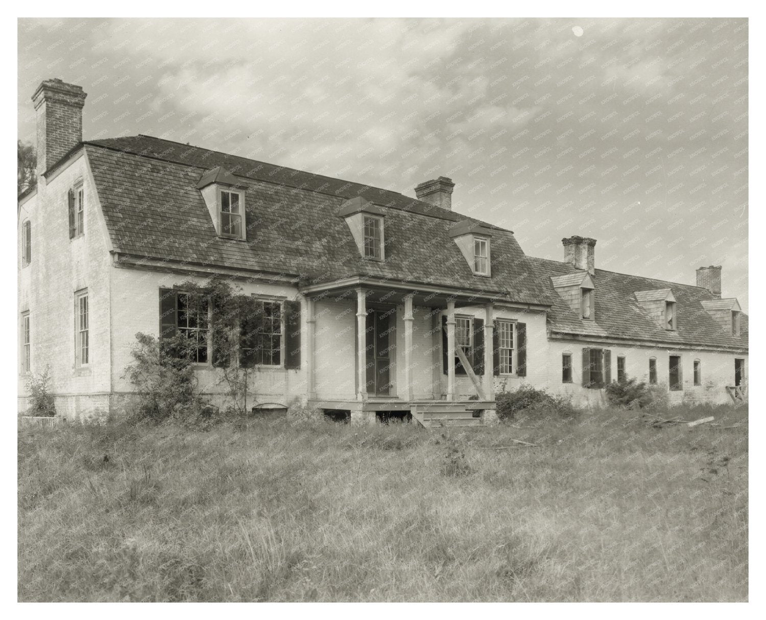
Paca House, Queen Anne County, MD, 1747 History Image
This vintage photograph showcases the Paca House, located in Queen Anne County, Maryland. Constructed in 1747, the house is notable for its impressive length of 120 feet. It was built by William Paca, a significant historical figure who served as Governor of Maryland and was a signer of the Declaration of Independence. The architectural design features distinctive dormers and gambrel roofs, typical of colonial-era homes.
The Paca House stands on a hill overlooking the Wye River, illustrating the grandeur and historical significance of 18th-century colonial architecture. This image is part of the Carnegie Survey of the Architecture of the South, which aimed to document and preserve the architectural heritage of the region.
Captured by Frances Benjamin Johnston, a prominent photographer of the early 20th century, this photograph is an essential piece of Marylands history, providing insights into the states colonial past and architectural evolution.
Paca House, Queen Anne County, MD, 1747 History Image