
Search for another town




Free U.S. delivery 7 to 10 days after you order
Palm Coast, Florida Map Art
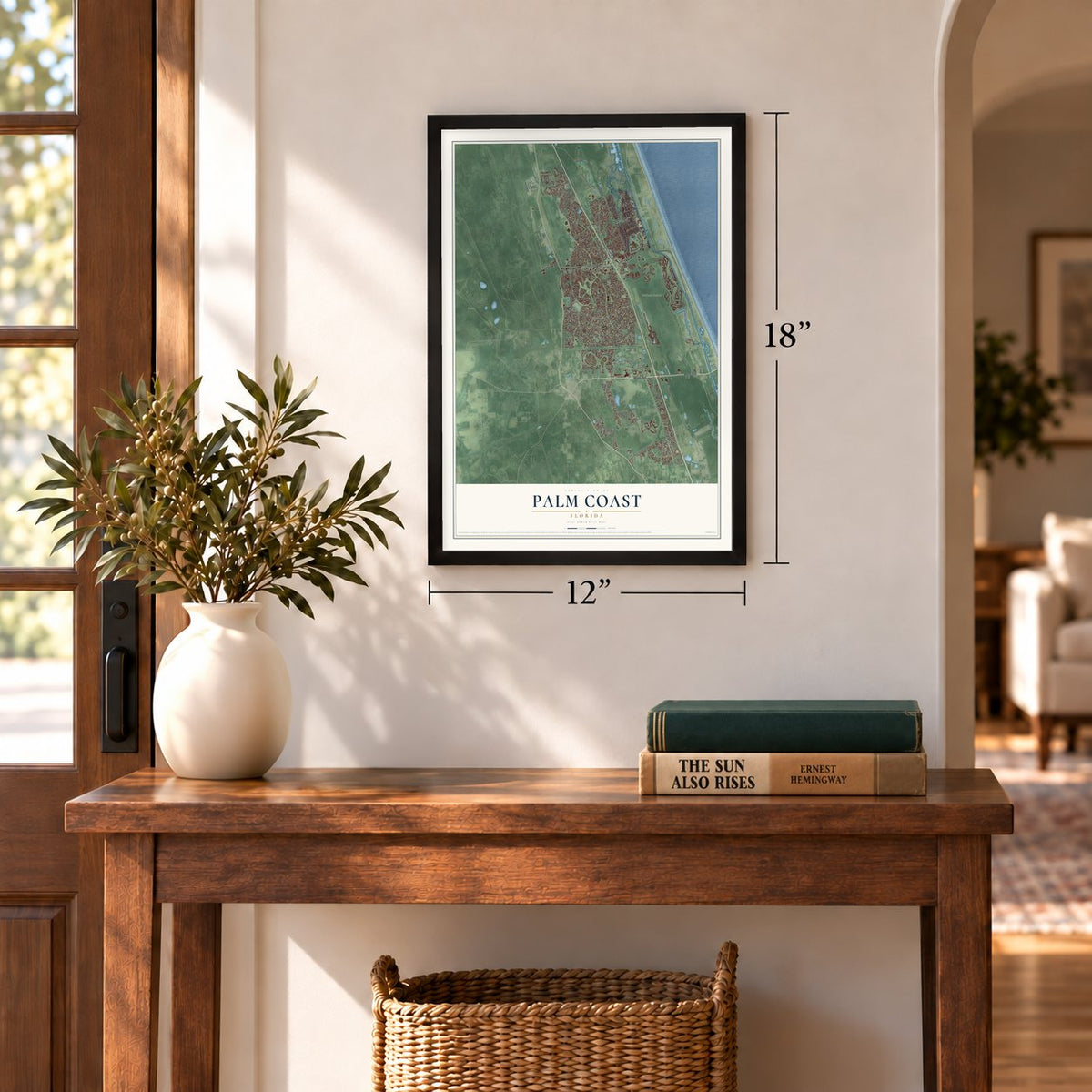
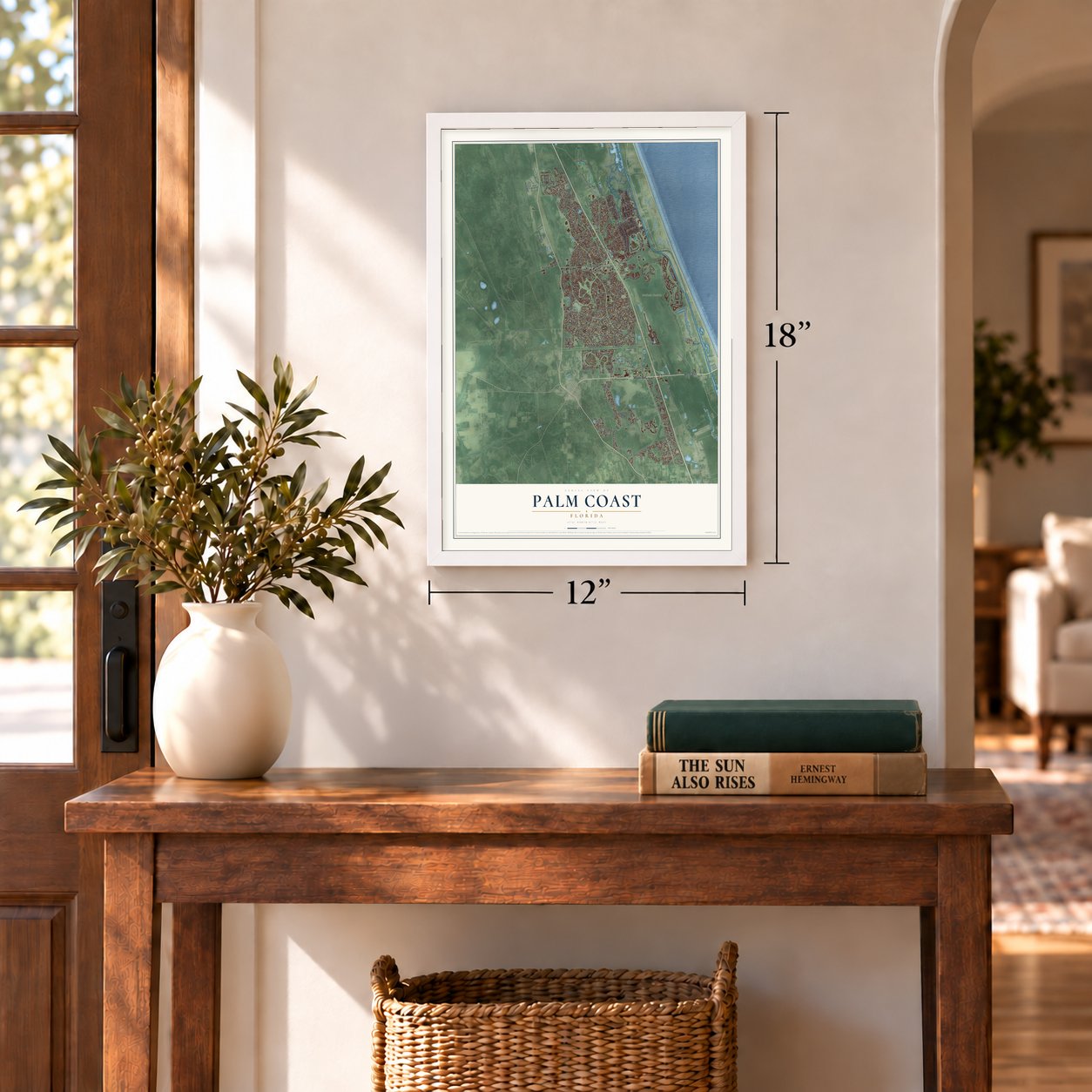
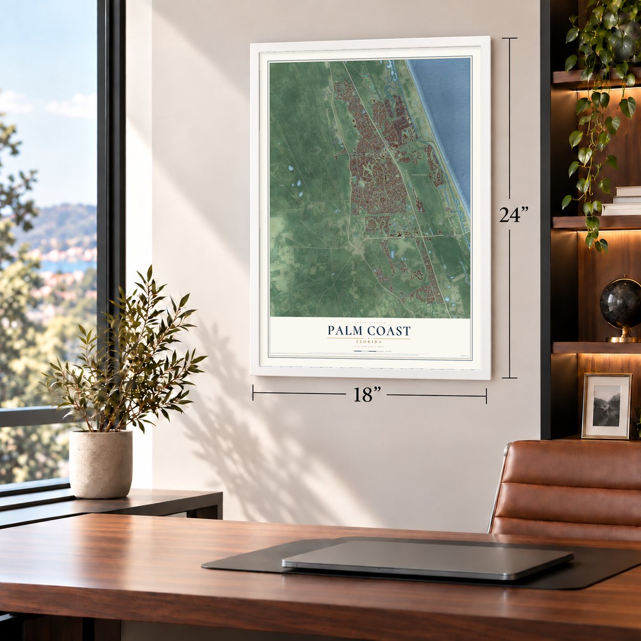
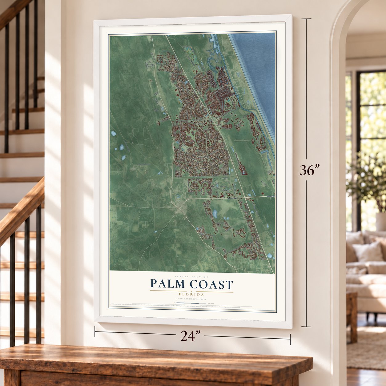
A new map of Palm Coast, Florida, made in 2026 and printed to order on thick archival matte paper.
12" x 18" Archival Matte Print
A Map of Home. A Work of Art.
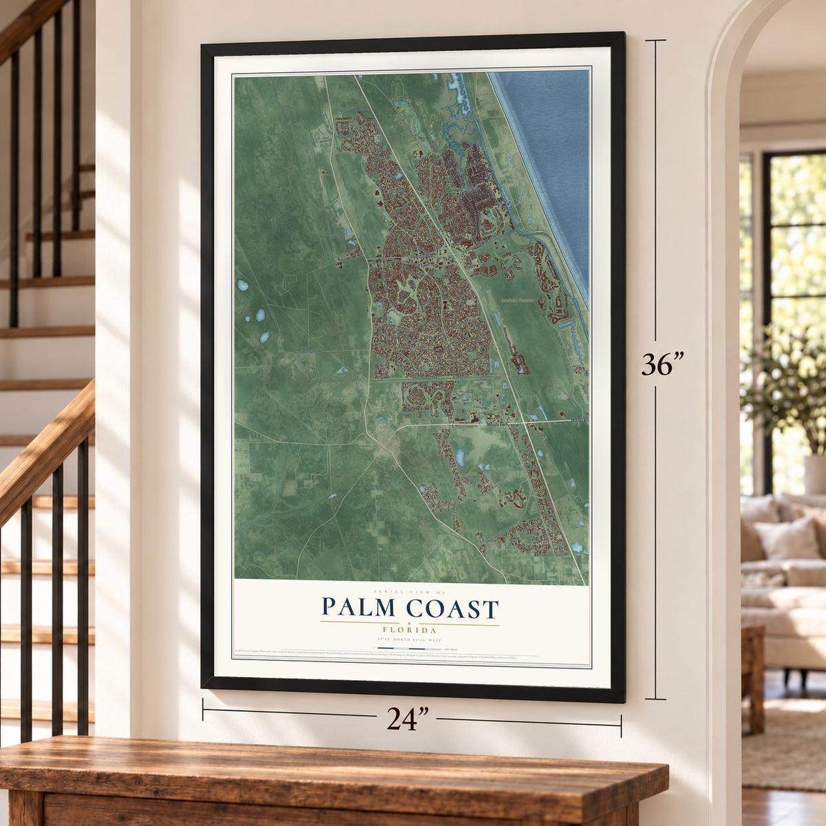
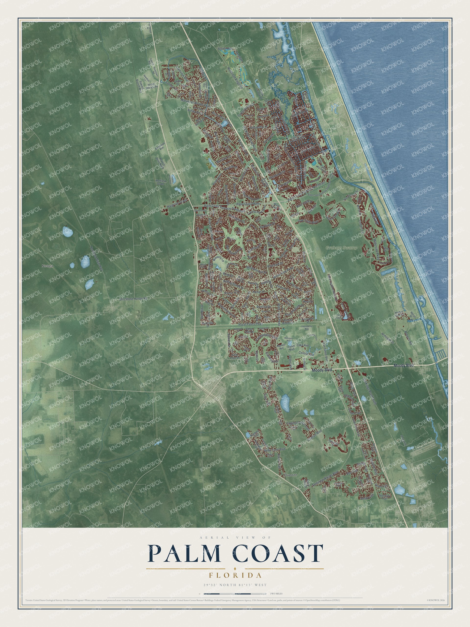
Explore Palm Coast, Florida from a whole new perspective. Created using aerial imagery and detailed geographic data, this map captures Palm Coast building by building, with labeled streets, familiar landmarks, and shaded topographical relief that highlights the natural contours of the landscape.
Combining modern data with the timeless character of a vintage atlas, this map is just as interesting up close as it is beautiful on the wall. Whether you grew up in Palm Coast, spent memorable years there, or call it home today, this unique map is a great way to celebrate a place that means something to you. Zoom in on the preview to look for your street, and then order a print to put your memories on the wall.
Three ways to hang it
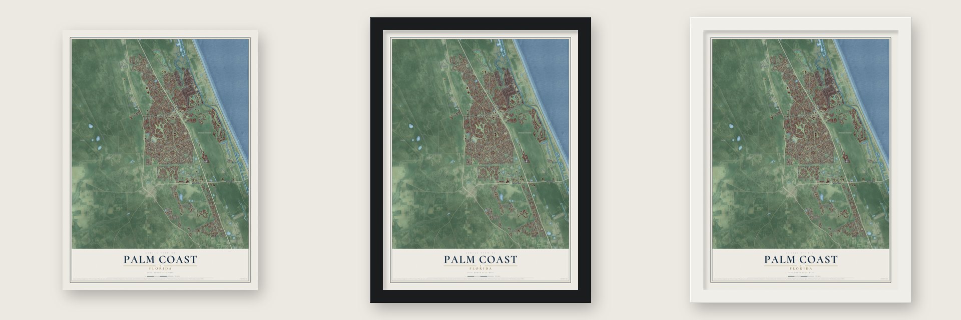
Unframed archival matte, a black wood frame or a white wood frame.
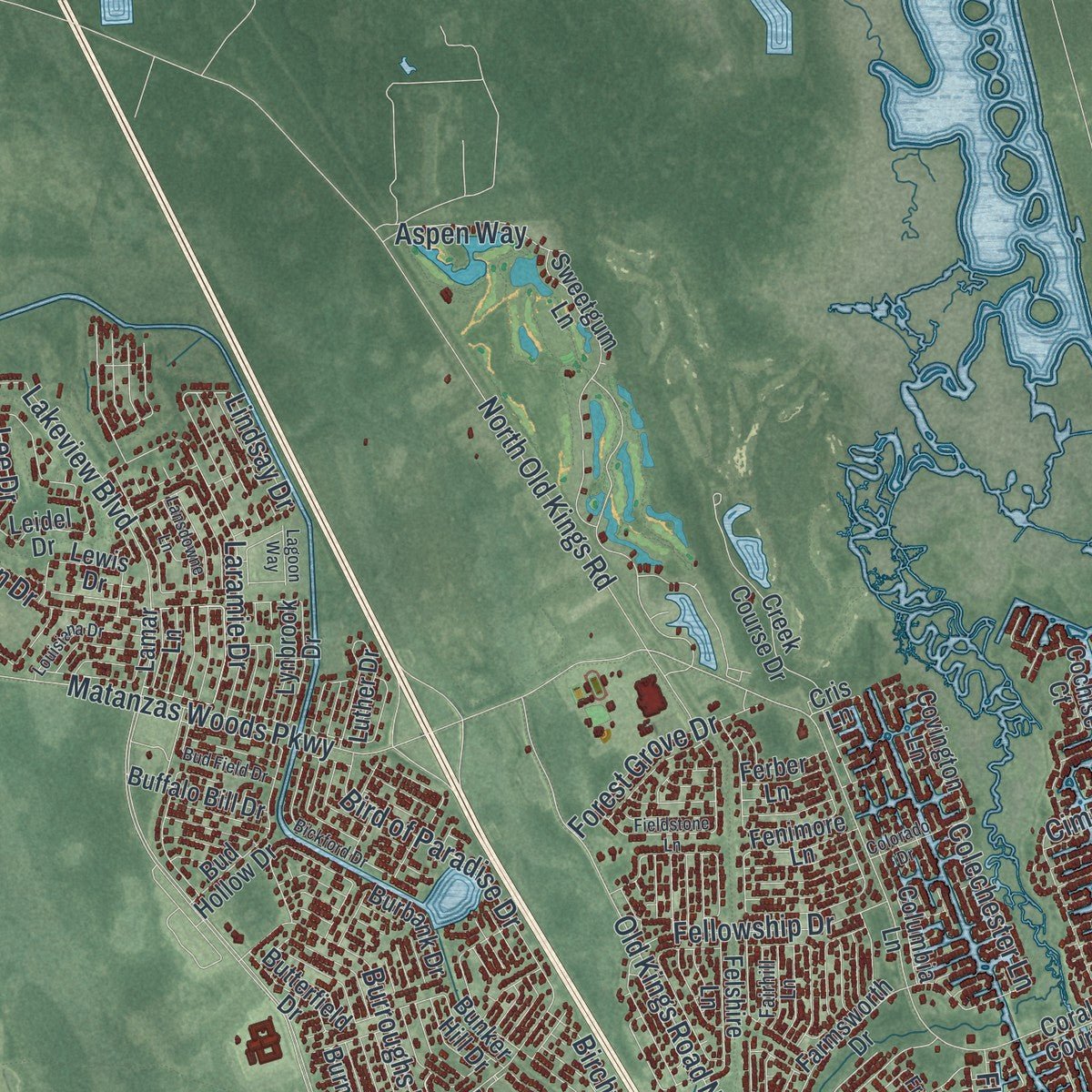
Up close
Geography Worth Displaying
This map was created using accurate cartographic data and authoritative geographic sources, including the U.S. Geological Survey (USGS) and FEMA. The map brings together terrain, waterways, roads, and building detail. The majority of the streets are labeled, houses are accurately depicted, and the topography is derived from government sources. Combining local data with carefully composed color and shading leads to this beautifully detailed Palm Coast artwork for your wall.
Rather than simply showing street outlines, we’ve included as many of the street names as we could reasonably fit on the map while keeping their names legible. Zoom in on the high resolution preview to see exactly what’s on the map. We truly set out to create a statement piece for anyone who loves Palm Coast. So whether it’s for you, or a gift for someone you love, we hope this map of Palm Coast brings back fond memories.
Explore the full map of Palm Coast, Florida and read about the local places it shows.

About Palm Coast, Florida
Palm Coast is a city of 89,258 people in Flagler County, on the Intracoastal Waterway between St. Augustine and Daytona Beach. In the late 1950s this ground was mostly swamp and pine woods, with a handful of farms and beach houses and a turpentine still, and visitors paid to hunt and fish here. In 1969 ITT Community Development Corporation, which owned 68,000 acres, drew up plans to divide about 42,000 of them into 48,000 home sites. Each lot had paved streets and central water and sewer service, and the company dug 46 miles of freshwater canals, plus 23 more miles of saltwater canals, to recharge the water table.
On October 29, 1970, ITT opened its welcome center, a date the city still celebrates as Founder's Day. Starting in 1975, the Palm Coast Service District, set up by the county commission, used property taxes to pay for fire protection, hydrants and street lights. In September 1999 residents chose by two to one to incorporate. The city became official on December 31, 1999, and Jim Canfield served as its first mayor. On October 1, 2000, the district handed all of its services over to the new city.
- Wildfires in 1985 and 1998The Palm Coast Fire of 1985 destroyed 131 homes. It was Florida's first serious blaze where woods met houses, and researchers learned that dense brush near homes mattered most. Fire struck the same subdivision again in 1998. The entire county was evacuated, 45,000 people fled, and crews from 44 states joined the biggest air attack ever launched against a U.S. fire. That effort held the loss to 71 homes.
- A toll bridge since 1988The Hammock Dunes Bridge opened in 1988 to help develop the Hammock, the busy barrier island across the Intracoastal Waterway. The privately run toll bridge rises 65 feet and gives the mainland quick access to the beach. It also serves as an evacuation route, because the county's only other way over the waterway is the Flagler Beach Bridge on State Road 100.
- European Village, 2006The European Village opened on February 21, 2006, in Palm Harbor, close to the Hammock Dunes Bridge. It was built in an old world style, with almost 100 condos above 36,000 square feet of shops around an open-air plaza. Bands play its Center Stage on weekends, and a farmers market sets up there on Sundays.
- Almost tripled since 2000Palm Coast counted 32,832 people in 2000 and 89,258 in 2020. In May 2023 the Daytona Beach News-Journal wrote that the city had passed Deltona to become the largest in its metropolitan area.
Find your street
Names on the Palm Coast map
Every name below is printed on this map. Look for your street, your school, the park where you played, or the pond down the road.
Places and landmarks3
- Neoga
- Graham Swamp
- Dupont
Streets and roads290
- Moody Boulevard
- Palm Coast Parkway Northeast
- Palm Coast Parkway
- Palm Coast Parkway Southwest
- Lagare Street
- Sesame Boulevard
- Waterside Parkway
- Easthampton Boulevard
- Belle Terre Parkway
- Old Kings Road South
- Colbert Lane
- North Old Dixie Highway
- Seminole Woods Boulevard
- Palm Harbor Parkway
- Hargrove Grade
- Royal Palms Parkway
- Pine Lakes Parkway
- Old Kings Road North
- Belle Terre Boulevard
- White View Parkway
- Rymfire Drive
- Matanzas Woods Parkway
- Otis Stone Hunter Road
- Bird of Paradise Drive
- Pine Grove Drive
- Birchwood Drive
- Citation Boulevard
- Eric Drive
- Wellington Drive
- North Old Kings Road
Show all 290 streets
- Clubhouse Drive
- London Drive
- Central Avenue
- Florida Park Drive North
- Pritchard Drive
- Parkview Drive
- New Leatherwood Drive
- Point Pleasant Drive
- Red Mill Drive
- Wynnfield Drive
- Rae Drive
- Bayside Drive
- Westhampton Drive
- Rolling Sands Drive
- Laramie Drive
- Beechwood Lane
- Lakeview Boulevard
- Sea Trail
- Ullian Trail
- Cimmaron Drive
- Lindsay Drive
- Edward Drive
- Burroughs Drive
- Whippoorwill Drive
- Frontier Drive
- Colechester Lane
- Laguna Forest Trail
- Smith Trail
- Lee Drive
- Belleaire Drive
- Bridgehaven Drive
- Rickenbacker Drive
- Bren Mar Lane
- Karas Trail
- Seattle Trail
- Farragut Drive
- Eastwood Drive
- Fellowship Drive
- Ulaturn Trail
- Oak Trails Boulevard
- Fleetwood Drive
- Roberts Road
- Forest Grove Drive
- Blare Drive
- Rose Drive
- Zaun Trail
- Radcliffe Drive
- Pittman Drive
- Armoyan Drive
- Waverly Lane
- Zeus Path
- Aspen Way
- Rollins Lane
- Lake Avenue
- Price Lane
- Riviera Drive
- Barrister Lane
- Botany Lane
- Egan Drive
- Palm Harbor Drive
- Marlin Drive
- Underwood Trail
- Boulder Rock Drive
- Town Center Boulevard
- Ryan Drive
- Cypress Point Parkway
- Wellfield Grade
- Willow Oak Way
- Beachway Drive
- Fenimore Lane
- Secretary Trail
- Arena Lake Drive
- Wood Haven Drive
- Evans Drive
- Bud Hollow Drive
- Cochise Court
- Point of Woods Drive
- Roxboro Drive
- Bulldog Drive
- Renshaw Drive
- Coral Reef Court North
- Port Royal Drive
- Westgrill Drive
- Selma Trail
- Raemoor Drive
- Sawmill Branch Boulevard
- Farmsworth Drive
- Lynbrook Drive
- Burbank Drive
- Randolph Drive
- Ulysses Trail
- Hulett Woods Road
- Kashmir Trail
- Pin Oak Drive
- Pine Circle Drive
- Presidential Lane
- Luther Drive
- Ethan Allen Drive
- Reidsville Drive
- Royal Oak Drive
- Ponce Deleon Drive
- Foster Lane
- Covington Lane
- Kankakee Trail
- Reverie Drive North
- Sentinel Trail
- Porcupine Drive
- Woodbury Drive
- Prattwood Lane
- Sea Front Trail
- Brownstone Lane
- Pilgrim Drive
- Blare Castle Drive
- Ryder Drive
- Raleigh Drive
- Raintree Place
- Butterfield Drive
- Edith Pope Drive
- Club Field Drive
- Leidel Drive
- Forest Hill Drive
- Zinnia Trail
- Haven Boulevard
- Baltimore Lane
- Wood Cedar Drive
- Burnell Drive
- Lewis Drive
- Leaver Drive
- Felshire Lane
- Patric Drive
- Landing Boulevard
- Courtney Place
- Bunker Hill Drive
- Sweetgum Lane
- Riviere Lane
- Buffalo Bill Drive
- Sabal Bend
- Harbor View Drive
- Egret Drive
- Columbia Lane
- Bruning Lane
- Creek Course Drive
- Utah Place
- Shady Oaks Drive
- Water Tower Road
- Red Barn Drive
- Utica Path
- Somerset Avenue
- Market Avenue
- Village Circle
- Palm Lane
- Spoonbill Drive
- Welling Lane
- Utility Drive
- Heron Drive
- Perrotti Lane
- Paul Lane
- Pierce Lane
- Rylin Lane
- Ferber Lane
- Lamar Lane
- Cole Place
- Ryker Lane
- Fawn Lane
- Cris Lane
- Palm Coast Parkway Southeast
- Woodside Drive
- Wheatfield Drive
- Waters Drive
- White Hall Drive
- Williams Drive
- Brittany Lane
- Cooper Lane
- Zephyr Lily Trail
- Pickering Drive
- Esperanto Drive
- Putter Drive
- Oakleaf Way
- Foxhall Lane
- Waterfront Park Road
- Lloyd Trail
- Sea Breeze Trail
- Rivertown Road
- Egret Trail
- Westlee Lane
- Walker Drive
- Regency Drive
- Rocking Horse Drive
- Post View Drive
- Eastlake Drive
- Bassett Lane
- Pine Tree Drive
- Pebble Beach Drive
- Rymer Lane
- Thornberry Way
- Riverbend Drive
- Sawdust Lane
- Edge Lane
- Longview Way
- Westbury Lane
- Secretariat Lane
- Jasmine Drive
- Faith Lane
- Francis Lane
- Becker Lane
- Fairhill Lane
- Roxland Lane
- Slumber Path
- Wood Acre Lane
- Priory Lane
- Edmond Place
- Pepper Lane
- Zoeller Court
- Palm Leaf Lane
- Zonal Court
- Long Place
- Front Street
- Ryberry Drive
- Bickford Drive
- Reverie Drive South
- Greenwood Drive
- Fieldstone Lane
- Burning Bush Drive
- Kalamazoo Trail
- Wasserman Drive
- Bannbury Lane
- Kathleen Trail
- Boston Lane
- Hawthorn Avenue
- Canopy Walk Lane
- Richmond Drive
- Ebb Tide Drive
- Pine Brook Drive
- Seven Wonders Trail
- North Park Circle
- Fischer Lane
- Commerce Boulevard
- Slowdrift Turn
- Louisiana Drive
- East Diamond Drive
- Llewellyn Trail
- Westcedar Lane
- Bud Field Drive
- Lansdowne Lane
- Colorado Drive
- Banton Lane
- Felter Lane
- Hidden Lakes Drive
- Mahogany Way
- Phoenix Lane
- Potters Lane
- Round Mill Lane
- Edith Lane
- Ryall Lane
- Wellham Lane
- Rockne Lane
- Lagoon Way
- Farver Lane
- Ellison Lane
- Fern Court
Names are listed as they appear on the printed map. Zoom into the product photos to find them.
The art of mapping a place
How This Map Was Made
Real places. Remarkable detail. Discover the layers that turn geographic data into a map of home.

The view from above
Aerial imagery reveals the character of the land: woodland, open fields, and the patterns of a place.

The shape of the land
Elevation data brings hills, valleys, and subtle changes in the landscape into view.

The details of home
Roads, waterways, and building footprints come together to make the map feel unmistakably local.

Geography becomes art
Considered color, shading, and typography bring the layers together in a map made for your wall.


Process illustrated with Mendon, Massachusetts. Aerial imagery: USDA NAIP. Terrain: USGS 3D Elevation Program. Map details and finished artwork: KNOWOL.
The Details
About This Print
Choose an archival matte print, or a black or white Ayous wood frame. The archival matte print is unframed.
Select your size and finish above to see the matching product image and price.
Materials & Craftsmanship
A contemporary map with the character of a classic atlas, printed on archival matte paper. Optional frames are made from Ayous wood.
Your printed map does not include the watermark shown in the full-map preview.
Shipping & Delivery
Free shipping within the United States. Every print is made to order in the USA.
Buying a gift? Add a note in your cart and we'll include it. We never put prices in the package.
Prints ship within 2 to 3 business days. Allow 7 to 10 days total from ordering for delivery. Timing may vary during holidays or periods of high order volume.
Read our shipping policy.
Returns and damaged prints
Each print is made to order. Change-of-mind refunds are not available after production.
If your print arrives damaged, misprinted or incorrect, contact support@knowol.com within 30 days of receiving it. Include your order number, photos and a description of the issue.
Read our full refund and replacement policy. For questions about your order, email support@knowol.com.
Find your town
Looking for another city?
Find a map of home in our Florida collection, or any town in the country.
Nearby
Maps of towns near Palm Coast
Know someone from one of these towns? Their map makes a great gift.
 Espanola
, Florida
From $39.99See the map
 Beverly Beach
, Florida
From $39.99See the map
 Flagler Beach
, Florida
From $39.99See the map
More maps nearby: Marineland, Bunnell, Crescent Beach, Flagler Estates and Ormond-by-the-Sea.