
Search for another town





Free U.S. delivery 7 to 10 days after you order
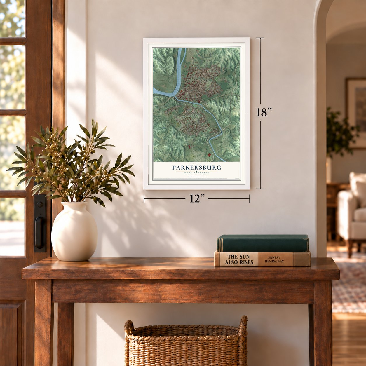
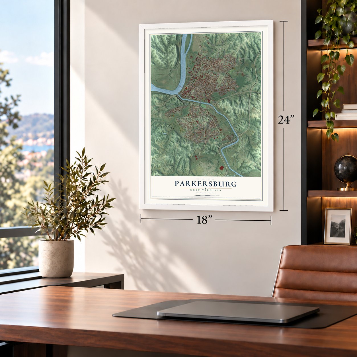
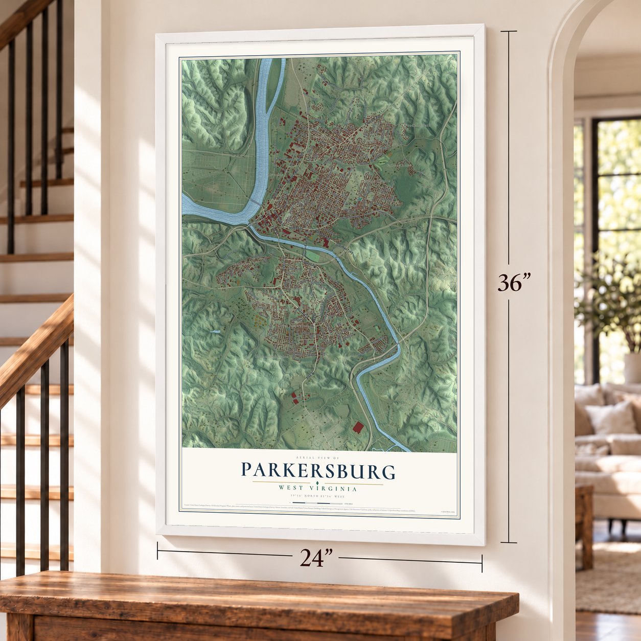
Parkersburg, West Virginia Map Art
Building by building, with labeled streets and shaded relief.
12" x 18" Archival Matte Print
A Map of Home. A Work of Art.
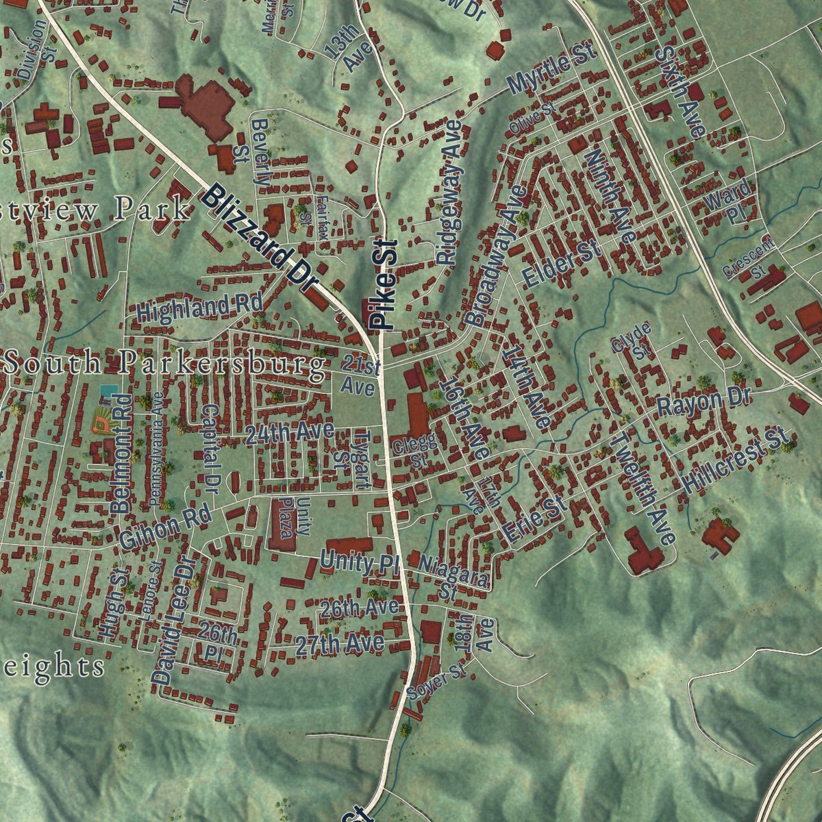
Explore Parkersburg, West Virginia from a whole new perspective. Created using aerial imagery and detailed geographic data, this map captures Parkersburg building by building, with labeled streets, familiar landmarks, and shaded topographical relief that highlights the natural contours of the landscape.
Combining modern data with the timeless character of a vintage atlas, this map is just as interesting up close as it is beautiful on the wall. Whether you grew up in Parkersburg, spent memorable years there, or call it home today, this unique map is a great way to celebrate a place that means something to you. Zoom in on the preview to look for your street, and then order a print to put your memories on the wall.
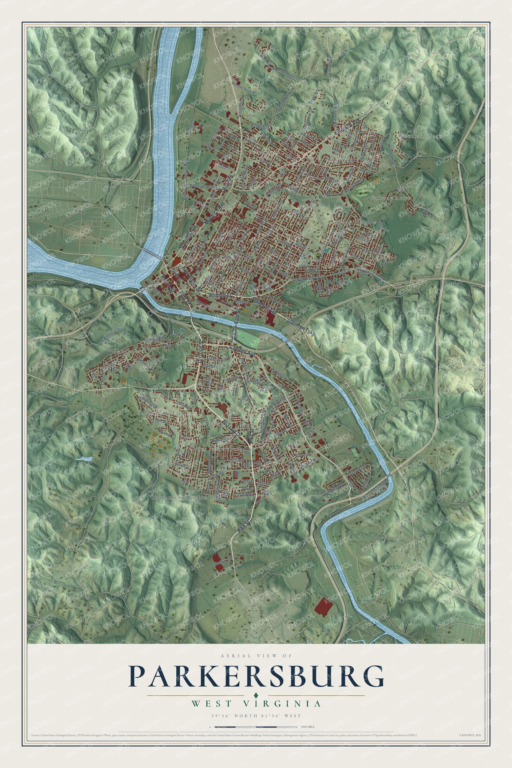
Three ways to hang it
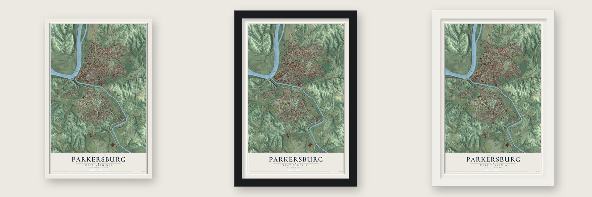
Unframed archival matte, a black wood frame or a white wood frame.
Up close
Geography Worth Displaying
This map was created using accurate cartographic data and authoritative geographic sources, including the U.S. Geological Survey and the Census Bureau. The map brings together terrain, waterways, roads, and building detail. The majority of the streets are labeled, houses are accurately depicted, and the topography is derived from government sources. Combining local data with carefully composed color and shading leads to this beautifully detailed Parkersburg artwork for your wall.
Rather than simply showing street outlines, we’ve included as many of the street names as we could reasonably fit on the map while keeping their names legible. Zoom in on the high resolution preview to see exactly what’s on the map. We truly set out to create a statement piece for anyone who loves Parkersburg. So whether it’s for you, or a gift for someone you love, we hope this map of Parkersburg brings back fond memories.
Read the story behind this map of Parkersburg, West Virginia from 2026.

Find your street
Names on the Parkersburg map
Every name below is printed on this map. Look for your street, your school, the park where you played, or the pond down the road.
Places and landmarks12
- Woodland Park
- Beechwood
- Crestview Park
- Fairview Heights
- Fairway Acres
- Lauckport
- Newport
- North Parkersburg
- Riverside
- South Hills Estates
- South Parkersburg
- Southmoor Heights
Streets and roads221
- Pike Street
- Blizzard Drive
- Division Street
- Garfield Avenue
- Seventh Street
- East Eighth Street
- Fourth Street
- Ohio Avenue
- Murdoch Avenue
- Emerson Avenue
- Camden Avenue
- Fifth Street
- Staunton Turnpike
- East Street
- Staunton Avenue
- Old US Highway 50
- Keever Avenue
- Keever Street
- 24th Avenue
- Old Rosemar Road
- Ann Street
- Parkview Drive
- Fourth Avenue
- Lubeck Avenue
- Gihon Road
- 16th Avenue
- Linden Street
- Twelfth Street
- Edgelawn Street
- Woodland Drive
Show all 221 streets
- Powell Street
- Liberty Street
- Seventh Avenue
- Avery Street
- Broadway Avenue
- 19th Street
- Plum Street
- 16th Street
- Sixth Avenue
- 23rd Street
- 17th Street
- 36th Street
- Market Street
- 13th Street
- 29th Street
- 26th Street
- 25th Street
- Eleventh Avenue
- Ninth Avenue
- 32nd Street
- 27th Street
- Neal Street
- 31st Street
- 20th Street
- Meadowcrest Drive
- Fairview Avenue
- Latrobe Street
- 24th Street
- 33rd Street
- Twelfth Avenue
- 30th Street
- Tenth Avenue
- Lynn Street
- 14th Avenue
- 15th Avenue
- 15th Street
- Dudley Avenue
- Broad Street
- 18th Street
- 35th Street
- Rosemar Road
- Cypress Street
- Sixth Street
- Rayon Drive
- Memorial Bridge
- Elm Street
- Oak Street
- Fort Boreman Drive
- Belmont Road
- Nash Street
- Sayre Avenue
- 21st Street
- Myrtle Street
- Packard Street
- 27th Avenue
- Covert Street
- 28th Street
- College Parkway
- Summers Street
- Stella Street
- Clement Avenue
- 19th Avenue
- Hillcrest Street
- George Street
- 37th Street
- Quincy Street
- City Park Drive
- Depot Street
- 39th Street
- Elder Street
- David Lee Drive
- Swann Street
- Ridgeway Avenue
- Erie Street
- 40th Street
- Mary Street
- Foley Drive
- Newberry Drive
- Foley Avenue
- Roseland Avenue
- Highland Road
- Cadillac Drive
- Grandview Street
- Andrew Street
- Unity Place
- Second Street
- Poplar Street
- Maple Street
- Murray Drive
- Lincoln Street
- Walton Drive
- Park Street
- Reed Street
- Steven Street
- Hamilton Street
- Northwestern Pike
- Beverly Street
- Pickering Street
- Eighth Avenue
- Willowbrook Drive
- Lakeview Drive
- 14th Street
- Juliana Street
- Masonic Home Road
- 42nd Street
- Hugh Street
- Capital Drive
- Park Avenue
- Central Avenue
- Morningside Avenue
- Charles Street
- Oakhurst Avenue
- 26th Avenue
- Saint Marys Avenue
- Birch Street
- Bartlett Street
- Jackson Avenue
- Niagara Street
- Wyndemere Way
- Tygart Street
- Hawthorne Street
- Tenth Street
- 18th Avenue
- 21st Avenue
- Lincoln Avenue
- Tefft Street
- 13th Avenue
- Walnut Street
- 38th Street
- City View Drive
- 34th Street
- Virgil Street
- Eastlawn Avenue
- First Street
- Ramsey Street
- Gateman Drive
- Ellis Avenue
- Wigal Street
- Victoria Avenue
- 26th Place
- Ward Place
- Burk Street
- Villa Drive
- Lee Street
- West Virginia Avenue
- 17th Avenue
- Pearcy Avenue
- Bird Street
- Thomas Street
- Jefferson Street
- 45th Street
- Beaver Street
- Jeanette Street
- New York Avenue
- Unity Plaza
- Soyer Street
- Elmwood Avenue
- Clyde Street
- Golf Drive
- Cora Drive
- South Campus View Drive
- Beech Street
- Mission Drive
- Vair Avenue
- Fox Hill Drive
- Point Drive
- Frances Street
- Prunty Street
- Custer Street
- Clegg Street
- East Street Bridge
- East Seventh Street
- Park Shopping Center
- Lenore Street
- Olive Street
- Williams Street
- Fairfax Street
- Crescent Street
- 22nd Street
- Pennsylvania Avenue
- Camden Street
- Willoughby Drive
- Race Street
- 46th Street
- Parker Avenue
- Laurel Street
- Butler Street
- Brookside Circle
- Cameron Avenue
- Merrick Street
- Miner Street
Names are listed as they appear on the printed map. Zoom into the product photos to find them.
About Parkersburg, West Virginia
Parkersburg is a city of 29,738 people and the seat of Wood County, where the Little Kanawha River meets the Ohio. Settlers who came after the Revolutionary War called the place Newport, but part of the town was laid out on land Virginia had given Alexander Parker for his service in that war. Parker and the Newport planners argued over who held the title until 1809, when the dispute was decided for his heirs. The next year the town became Parkersburg. The Virginia General Assembly chartered it in 1820, and it became a city in 1860.
Two turnpikes, the Staunton-Parkersburg and the Northwestern, ended here. In 1857 the Baltimore and Ohio Railroad ran a branch line south from Wheeling. Westbound travelers still needed a steamboat trip of 14 miles north to Marietta, where they could catch the Marietta and Cincinnati Railroad. Between 1868 and 1870 the B&O built a bridge across the river to Belpre, Ohio, on its main line from Baltimore to St. Louis. Jacob Linville designed it. The bridge pulled traffic and trade away from Marietta, and it is now called the Parkersburg Bridge.
- Oil refining from 1866During the Civil War, Union forces used Parkersburg as a transportation and medical center. After the war it became a major refining center for the oilfields at Volcano and Burning Springs. Johnson Newlon Camden, later a U.S. Senator, founded the Camden Consolidated Oil Company in 1866. It led the business here until he sold it to Rockefeller's Standard Oil in 1875, and Camden stayed on as a director and vice president of Standard.
- The debt office since 1954The U.S. Treasury moved its Bureau of the Public Debt to Parkersburg in 1954. The city sat halfway between Chicago and Washington, D.C., and was thought to be out of harm's way in a national emergency. In October 2012 the bureau merged with the Financial Management Service to become the Bureau of the Fiscal Service.
- 192 state championshipsBy 2008 the city's high school teams had won 192 state championships. That year Parkersburg and its three high schools finished second in ESPN's TitleTown USA contest. The schools field the Big Reds of Parkersburg High, the Patriots of Parkersburg South and the Crusaders of Parkersburg Catholic.
Keep exploring West Virginia
Parkersburg is one of 514 West Virginia towns we've mapped. Every dot on the map is a print of its own.
The search covers every state, West Virginia first.
Near Parkersburg
Order 2 or more town maps and save 10%. Shown in the size and finish you picked above, so they hang as a set.
- North Hills 12" x 18" / Archival Matte Print $39.99
- Lubeck 12" x 18" / Archival Matte Print $39.99
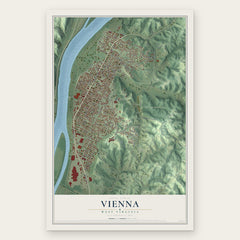
- Vienna 12" x 18" / Archival Matte Print $39.99
More maps nearby: Blennerhassett, Mineral Wells, Mineralwells, Kanawha and Washington.
The art of mapping a place
How This Map Was Made
Real places. Remarkable detail. Discover the layers that turn geographic data into a map of home.

The view from above
Aerial imagery reveals the character of the land: woodland, open fields, and the patterns of a place.

The shape of the land
Elevation data brings hills, valleys, and subtle changes in the landscape into view.

The details of home
Roads, waterways, and building footprints come together to make the map feel unmistakably local.

Geography becomes art
Considered color, shading, and typography bring the layers together in a map made for your wall.


Process illustrated with Mendon, Massachusetts. Aerial imagery: USDA NAIP. Terrain: USGS 3D Elevation Program. Map details and finished artwork: KNOWOL.
The Details
About This Print
Choose an archival matte print, or a black or white Ayous wood frame. The archival matte print is unframed.
Select your size and finish above to see the matching product image and price.
Materials & Craftsmanship
A contemporary map with the character of a classic atlas, printed on archival matte paper. Optional frames are made from Ayous wood.
Your printed map does not include the watermark shown in the full-map preview.
Shipping & Delivery
Free shipping within the United States. Every print is made to order in the USA.
Buying a gift? Add a note in your cart and we'll include it. We never put prices in the package.
Prints ship within 2 to 3 business days. Allow 7 to 10 days total from ordering for delivery. Timing may vary during holidays or periods of high order volume.
Read our shipping policy.
Returns and damaged prints
Each print is made to order. Change-of-mind refunds are not available after production.
If your print arrives damaged, misprinted or incorrect, contact support@knowol.com within 30 days of receiving it. Include your order number, photos and a description of the issue.
Read our full refund and replacement policy. For questions about your order, email support@knowol.com.