
Search for another town




Free U.S. delivery 7 to 10 days after you order
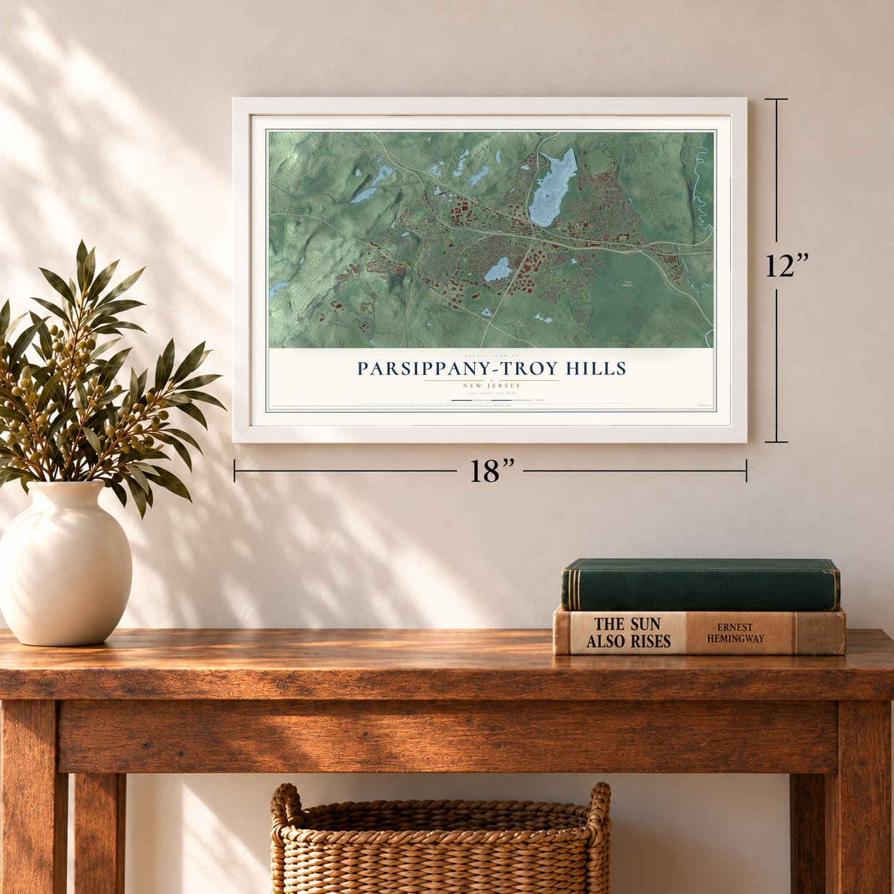
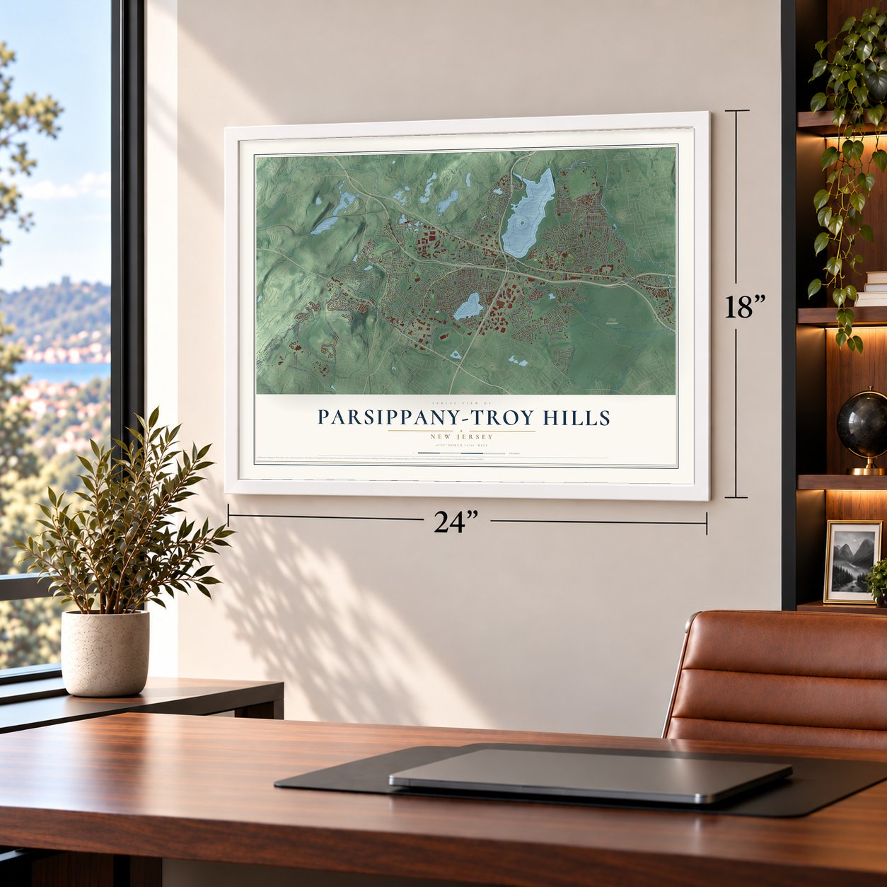
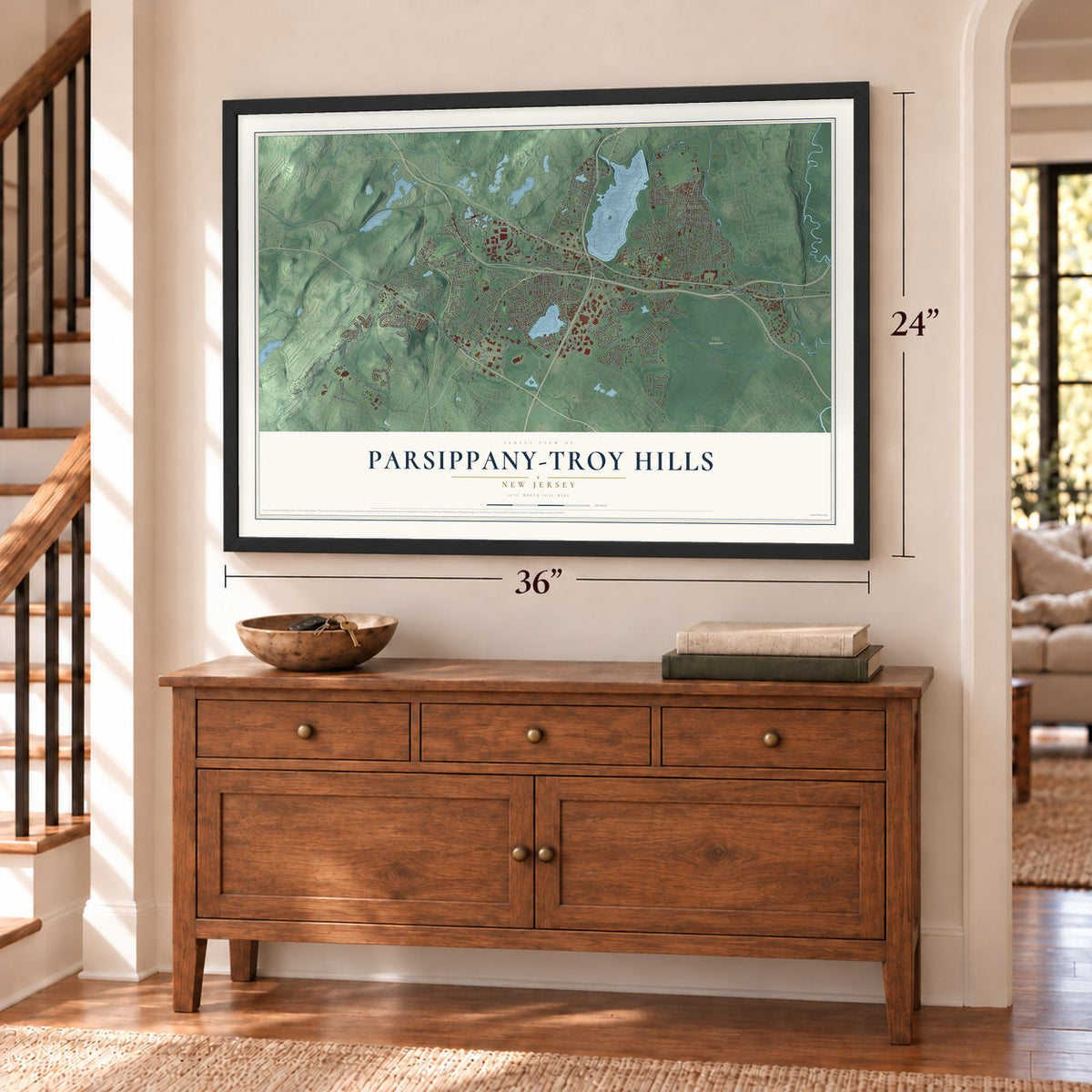
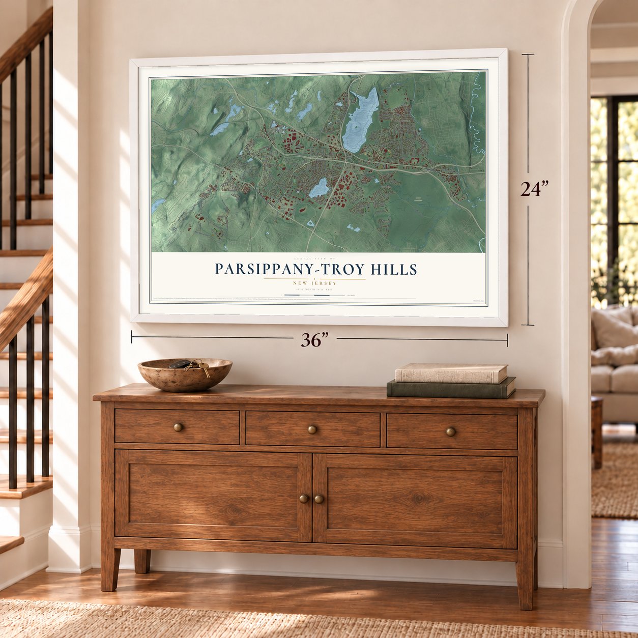
Parsippany-Troy Hills, New Jersey Map Art
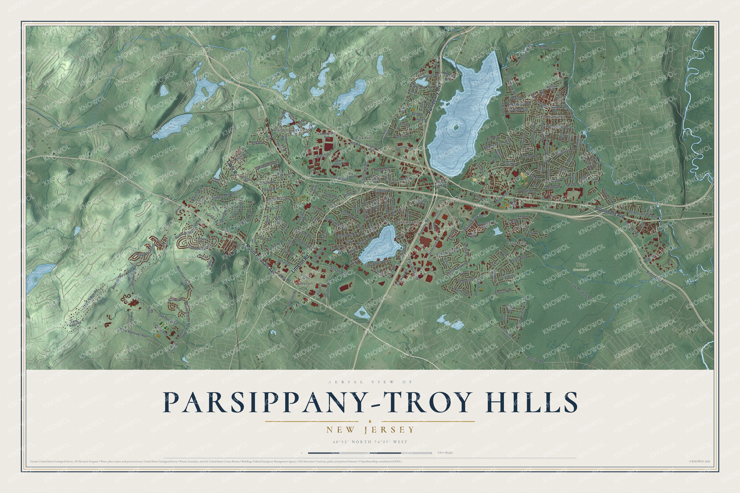
A new map of Parsippany-Troy Hills, New Jersey, made in 2026 and printed to order on thick archival matte paper.
12" x 18" Archival Matte Print
A Map of Home. A Work of Art.
Bring a piece of Parsippany-Troy Hills home. Whether it’s where you grew up, your current home, or simply a moment in your life, this Parsippany-Troy Hills, New Jersey map print brings those memories to your wall. Antique-inspired styling and modern geographic detail combine to create artwork that’s beautiful from across the room, with plenty to study and explore when you get up close.
Three ways to hang it
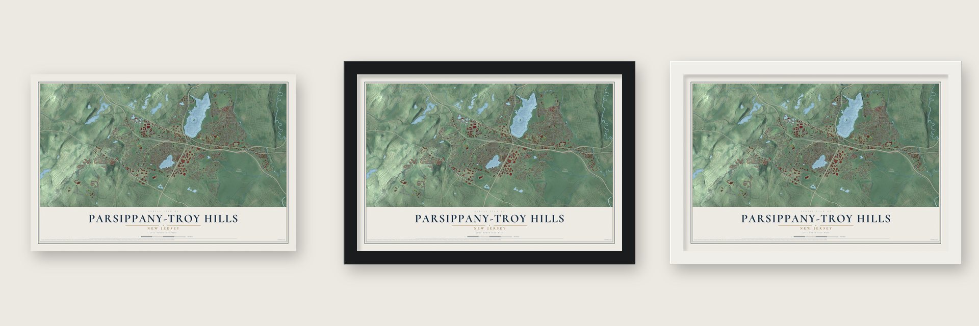
Unframed archival matte, a black wood frame or a white wood frame.
Up close
Real geography. Art worth displaying.
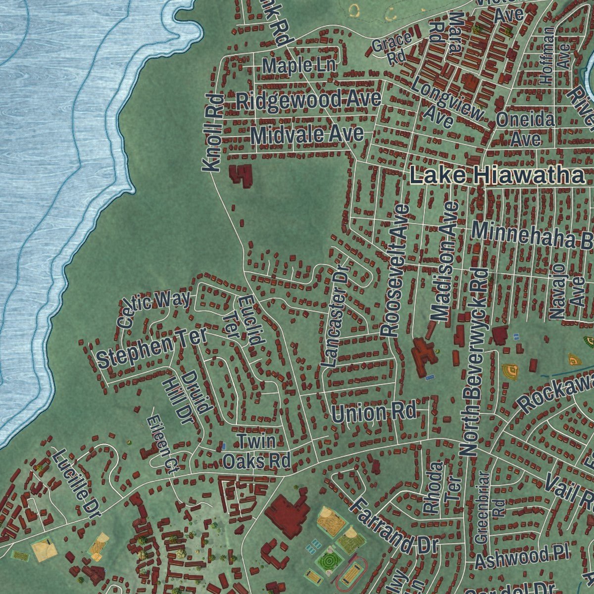
This map was created using accurate cartographic data and authoritative geographic sources, including the U.S. Geological Survey (USGS) and FEMA. The map brings together terrain, waterways, roads, and building detail. The majority of the streets are labeled, houses are accurately depicted, and the topography is derived from government sources. Combining local data with carefully composed color and shading leads to this beautifully detailed Parsippany-Troy Hills artwork for your wall.
Rather than simply showing street outlines, we’ve included as many of the street names as we could reasonably fit on the map while keeping their names legible. Zoom in on the high resolution preview to see exactly what’s on the map. We truly set out to create a statement piece for anyone who loves Parsippany-Troy Hills. So whether it’s for you, or a gift for someone you love, we hope this map of Parsippany-Troy Hills brings back fond memories.
Explore the full map of Parsippany-Troy Hills, New Jersey and read about the local places it shows.

About Parsippany-Troy Hills, New Jersey
Parsippany-Troy Hills is documented as a township in Morris County, and the 2020 census recorded 56,162 residents there. Its civic record reaches to March 12, 1928, when it was incorporated or formally organized, a date that remains part of the community's established local identity.
- 56,162 peopleThe United States census recorded this population in 2020.
- Morris CountyParsippany-Troy Hills is identified as a township in this New Jersey county.
- Organized in 1928The community was incorporated or formally organized on March 12, 1928.
Find your street
Names on the Parsippany-Troy Hills map
Every name below is printed on this map. Look for your street, your school, the park where you played, or the pond down the road.
Places and landmarks8
- Mountain Way Park
- Troy Meadows
- Fox Hill
- Lake Hiawatha
- Littleton
- Parsippany
- Rainbow Lakes
- Troy Hills
Streets and roads223
- Littleton Road
- Parsippany Boulevard
- Tabor Road
- Mount Pleasant Avenue
- Bloomfield Avenue
- Smith Road
- Sylvan Way
- Intervale Road
- Mazda Brook Road
- Powder Mill Road
- Cherry Hill Road
- Harrison Road
- Lake Shore Drive
- Vail Road
- South Beverwyck Road
- Knoll Road
- West Hanover Avenue
- Old Dover Road
- North Beverwyck Road
- Edwards Road
- Troy Road
- Troy Meadow Road
- Old Bloomfield Avenue
- Park Road
- Parsippany Road
- Mountain Way
- Allentown Road
- Dryden Way
- Brooklawn Drive
- Jefferson Road
Show all 223 streets
- Pomeroy Road
- Knoll Lane
- Interpace Parkway
- Moraine Road
- Greenbank Drive
- Greenbank Road
- Reynolds Avenue
- High Ridge Road
- Continental Road
- Halsey Road
- Roosevelt Avenue
- East Halsey Road
- Seasons Glen Drive
- Walsh Drive
- Manor Lane
- Fox Hill Road
- New Road
- River Drive
- Kingston Road
- Minnehaha Boulevard
- Baldwin Road
- Westminster Drive
- Ridgewood Avenue
- Waterloo Drive
- Entin Road
- Perrine Road
- Forest Drive
- Ridgedale Avenue
- Central Avenue
- Meadow Bluff Road
- Gatehall Drive
- Fairview Place
- Farrand Drive
- South Powder Mill Road
- Camden Road
- Koch Avenue
- Whitewood Drive
- Stephen Terrace
- Beachwood Road
- Rita Drive
- Union Hill Road
- Lake Drive
- Skyview Terrace
- Rockaway Place
- Marmora Road
- Johnson Road
- Fox Run
- Deauville Drive
- Midvale Avenue
- Parkside Drive
- Sedgefield Drive
- Dodie Drive
- Ball Avenue
- Carlton Drive
- Union Road
- Dartford Road
- Leamoor Drive
- Odell Road
- Madison Avenue
- Alan Drive
- Homer Street
- Friar Road
- Alba Place
- Preston Road
- Manito Avenue
- Nantes Road
- Califon Road
- Hill Road
- Century Drive
- Ser del Drive
- Beverly Street
- Ute Avenue
- Bell Road
- Tarn Drive
- Emily Place
- Arthur Drive
- Hilton Court
- Long Ridge Road
- Marcella Road
- Lanidex Plaza
- Atlantic Drive
- Longview Avenue
- Patriots Road
- Southwood Drive
- Raymound Boulevard
- Edgefield Drive
- Lord Stirling Drive
- Winding Way
- Glencove Road
- Winfield Drive
- Flintlock Road
- Navajo Avenue
- Druid Hill Drive
- Maple Lane
- South Tarn Drive
- Eastmans Road
- Webro Road
- Sagamore Road
- Dolly Drive
- Ironwood Drive
- Lenard Way
- Phillip Drive
- Leah Way
- Morris Avenue
- Mara Road
- Wingate Road
- Celtic Way
- Lancaster Drive
- Lackawanna Avenue
- Rockaway Boulevard
- Collins Road
- Gates Court
- Foxcroft Road
- Ferndale Drive
- Ashwood Place
- Oneida Avenue
- Warren Drive
- Upper Pond Road
- Spartan Avenue
- Fanny Road
- Long Road
- Barbara Street
- Twin Oaks Road
- Victoria Avenue
- Mitchell Road
- Tracy Lane
- Pitt Road
- Lucille Drive
- Trojan Avenue
- Ivy Lane
- Queen Street
- Grange Road
- Lowery Street
- Euclid Terrace
- Parrott Drive
- De Hart Drive
- Rhoda Terrace
- Cobb Road
- Tara Drive
- Ray Street
- Waterview Boulevard
- Campus Drive
- Pondview Road
- Everett Road
- Jacksonville Drive
- Woodcrest Road
- Cold Hill Road
- Hoffman Avenue
- Granada Drive
- Grace Road
- Glacier Drive
- Exeter Street
- Gov Chris Christie Drive
- Wood Hollow Road
- Alpine Road
- Seminole Avenue
- Greenbriar Road
- Rutgers Lane
- Bee Meadow Parkway
- Hilsinger Road
- Fernview Road
- Prospect Road
- Gloucester Road
- Eileen Court
- Elray Road
- Lynne Drive
- Ledgerock Court
- Hillside Terrace
- Warwick Road
- Littleton Road East
- Arnold Drive
- McD Boundary
- Delbrook Road
- Maple Avenue
- Main Drive
- Rainbow Trail
- Centerton Drive
- Normandy Drive
- Crown Point Road
- Averell Drive
- Emerson Road
- Yacenda Drive
- Wildwood Trail
- New Fox Hill Road
- Drumlin Drive
- Fairfield Road
- Prince Road
- Springhill Drive
- Overlook Terrace
- Dorothy Road
- Cairns Road
- Aldine Road
- Linda Street
Names are listed as they appear on the printed map. Zoom into the product photos to find them.
The art of mapping a place
How This Map Was Made
Real places. Remarkable detail. Discover the layers that turn geographic data into a map of home.

The view from above
Aerial imagery reveals the character of the land: woodland, open fields, and the patterns of a place.

The shape of the land
Elevation data brings hills, valleys, and subtle changes in the landscape into view.

The details of home
Roads, waterways, and building footprints come together to make the map feel unmistakably local.

Geography becomes art
Considered color, shading, and typography bring the layers together in a map made for your wall.


Process illustrated with Mendon, Massachusetts. Aerial imagery: USDA NAIP. Terrain: USGS 3D Elevation Program. Map details and finished artwork: KNOWOL.
The Details
About This Print
Choose an archival matte print, or a black or white Ayous wood frame. The archival matte print is unframed.
Select your size and finish above to see the matching product image and price.
Materials & Craftsmanship
A contemporary map with the character of a classic atlas, printed on archival matte paper. Optional frames are made from Ayous wood.
Your printed map does not include the watermark shown in the full-map preview.
Shipping & Delivery
Free shipping within the United States. Every print is made to order in the USA.
Buying a gift? Add a note in your cart and we'll include it. We never put prices in the package.
Prints ship within 2 to 3 business days. Allow 7 to 10 days total from ordering for delivery. Timing may vary during holidays or periods of high order volume.
Read our shipping policy.
Returns and damaged prints
Each print is made to order. Change-of-mind refunds are not available after production.
If your print arrives damaged, misprinted or incorrect, contact support@knowol.com within 30 days of receiving it. Include your order number, photos and a description of the issue.
Read our full refund and replacement policy. For questions about your order, email support@knowol.com.
Find your town
Looking for another city?
Find a map of home in our New Jersey collection.
Nearby
Maps of towns near Parsippany-Troy Hills
Know someone from one of these towns? Their map makes a great gift.


