
Search for another town




Free U.S. delivery 7 to 10 days after you order
Paupack, Pennsylvania Map Art
Building by building, with labeled streets and shaded relief.
12" x 18" Archival Matte Print
A Map of Home. A Work of Art.
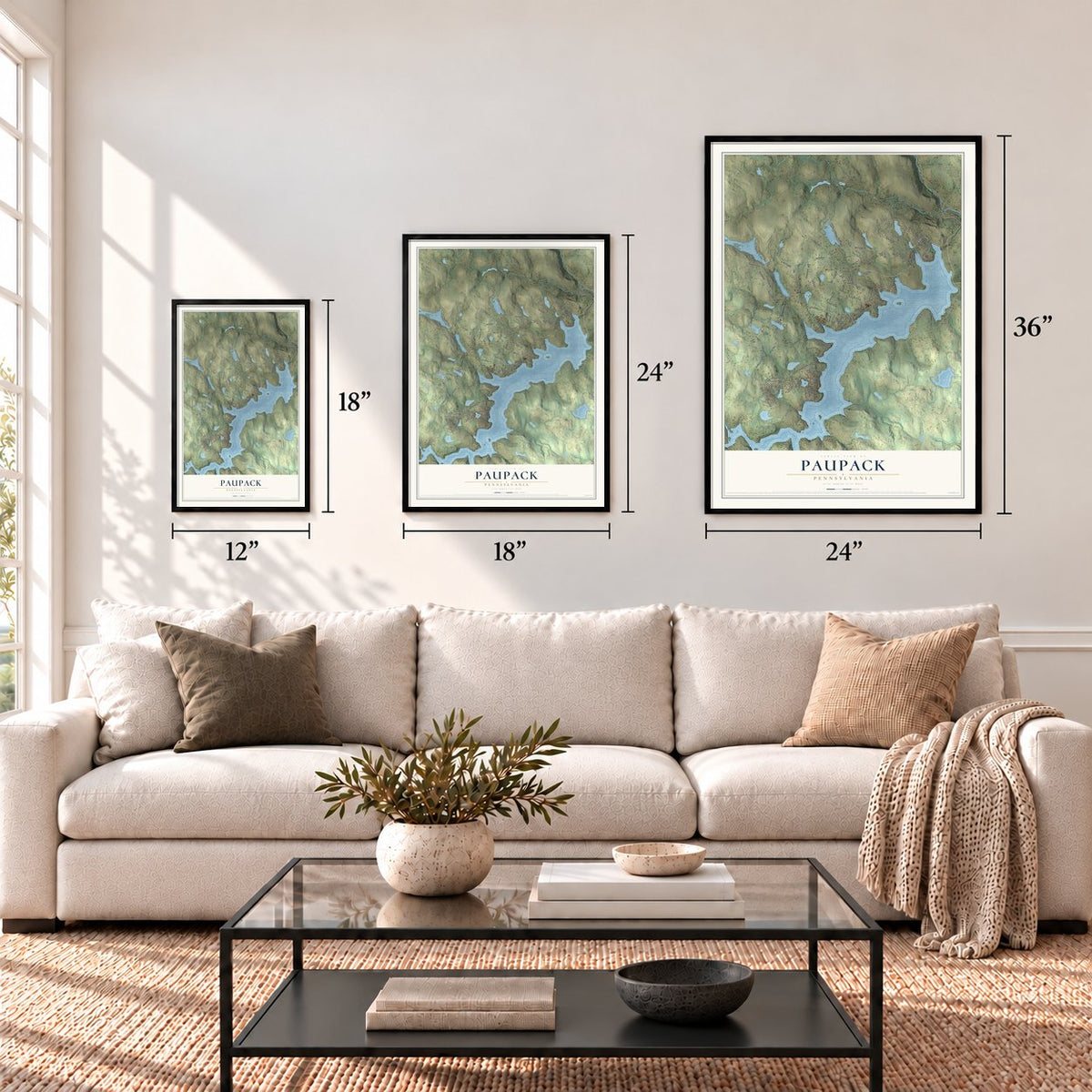
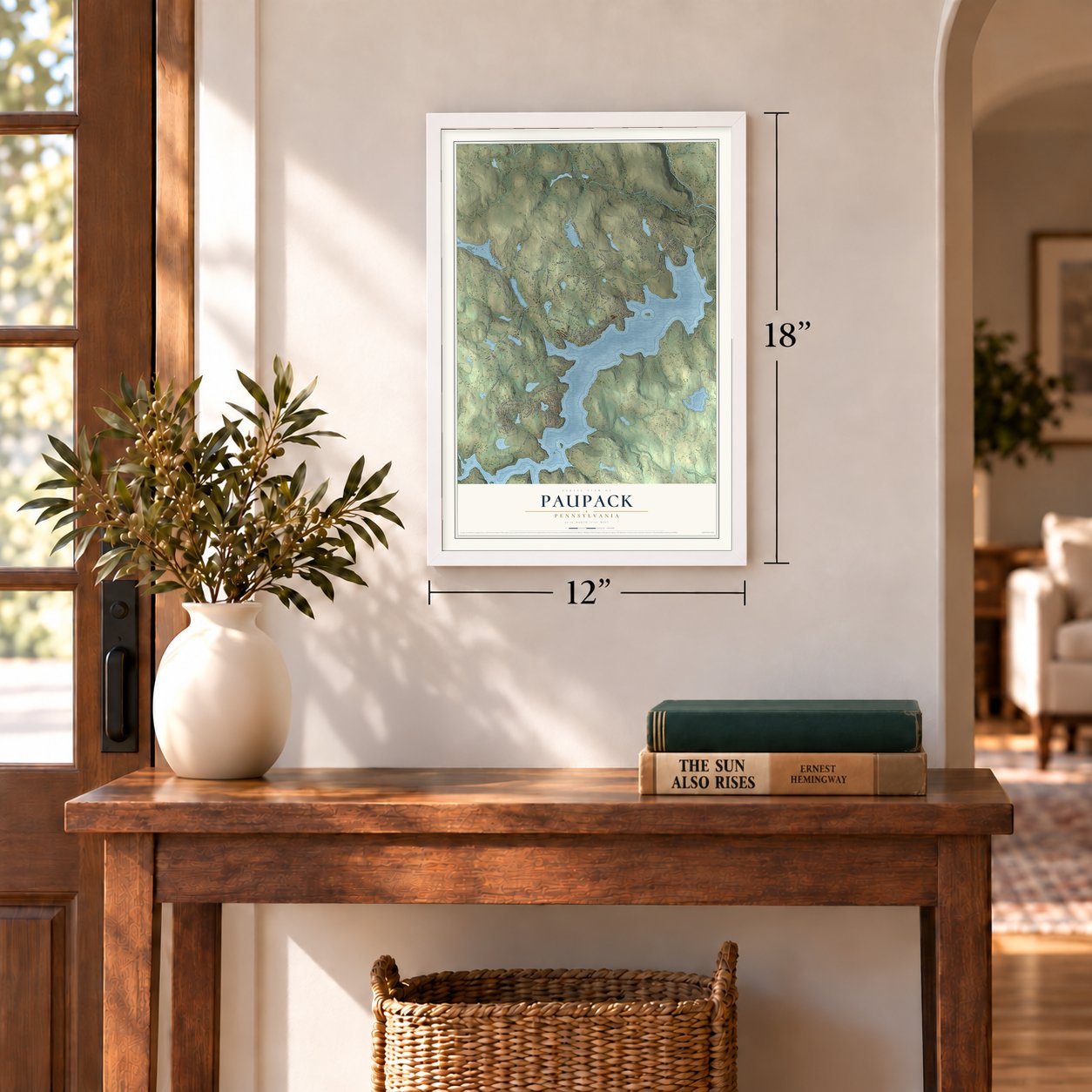
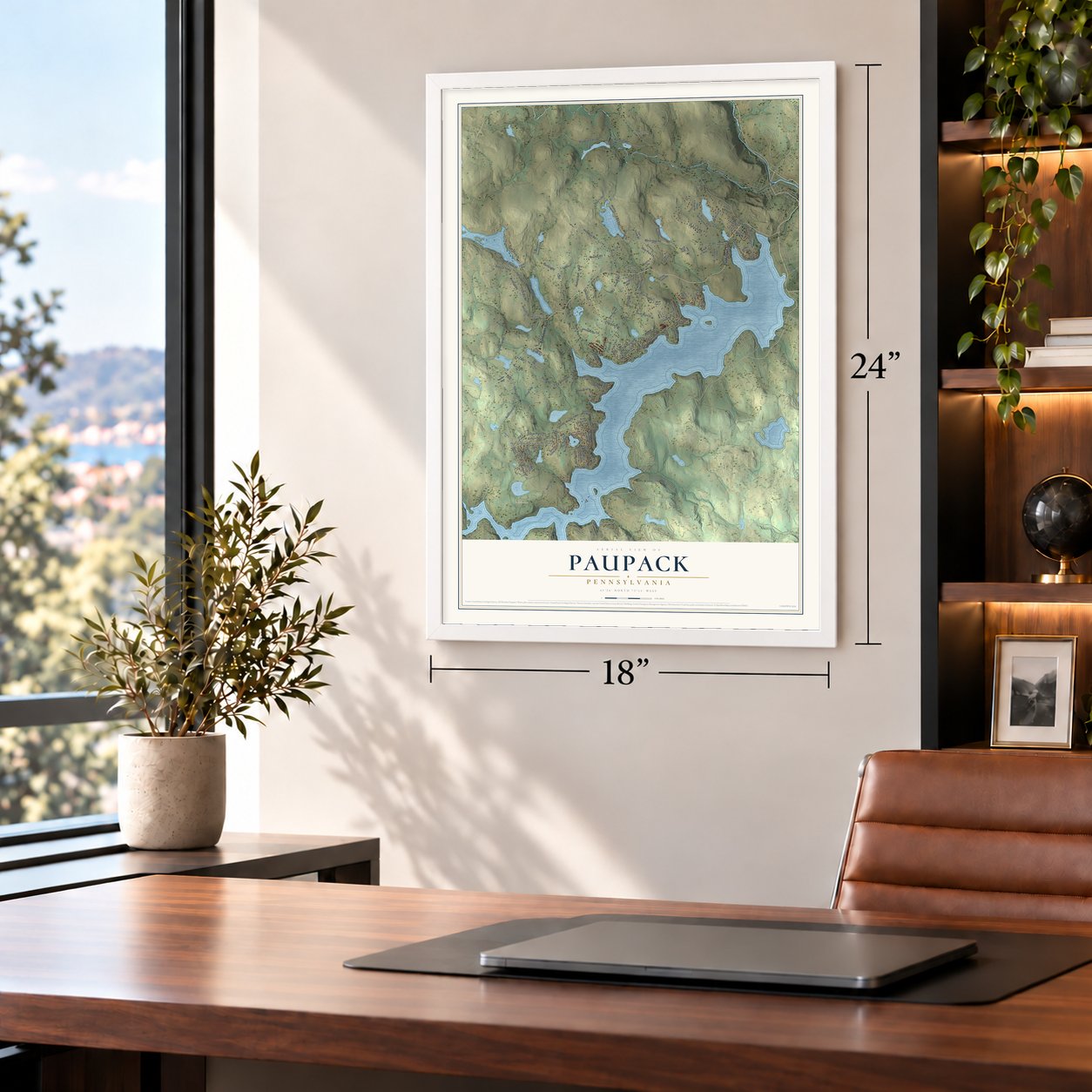
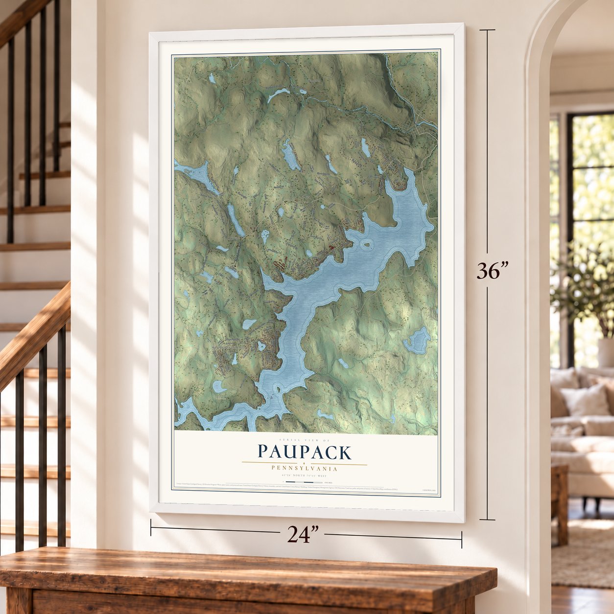
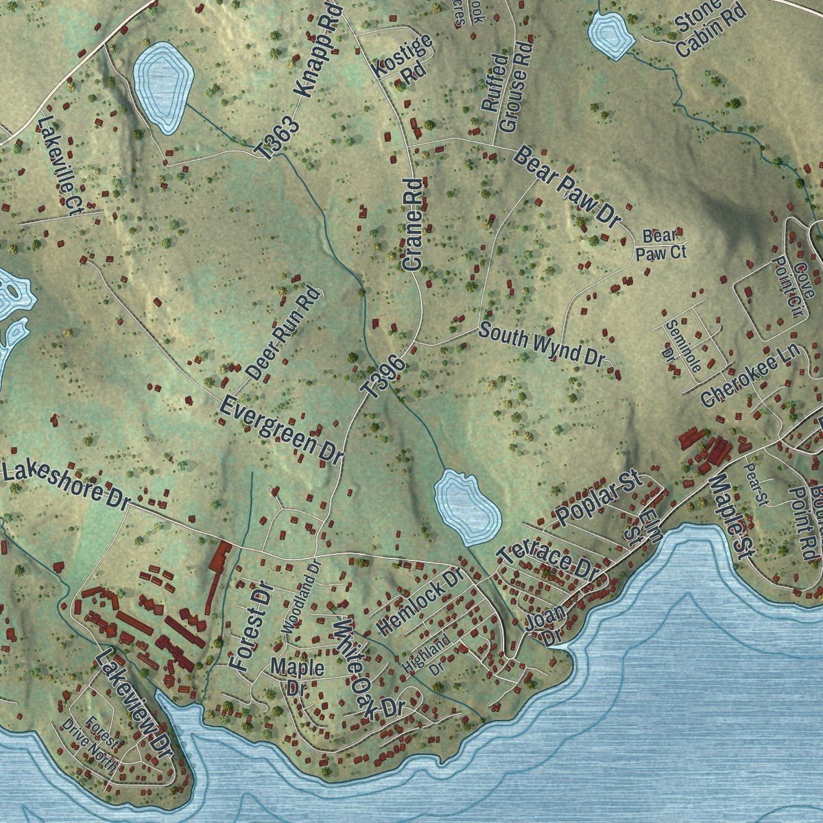
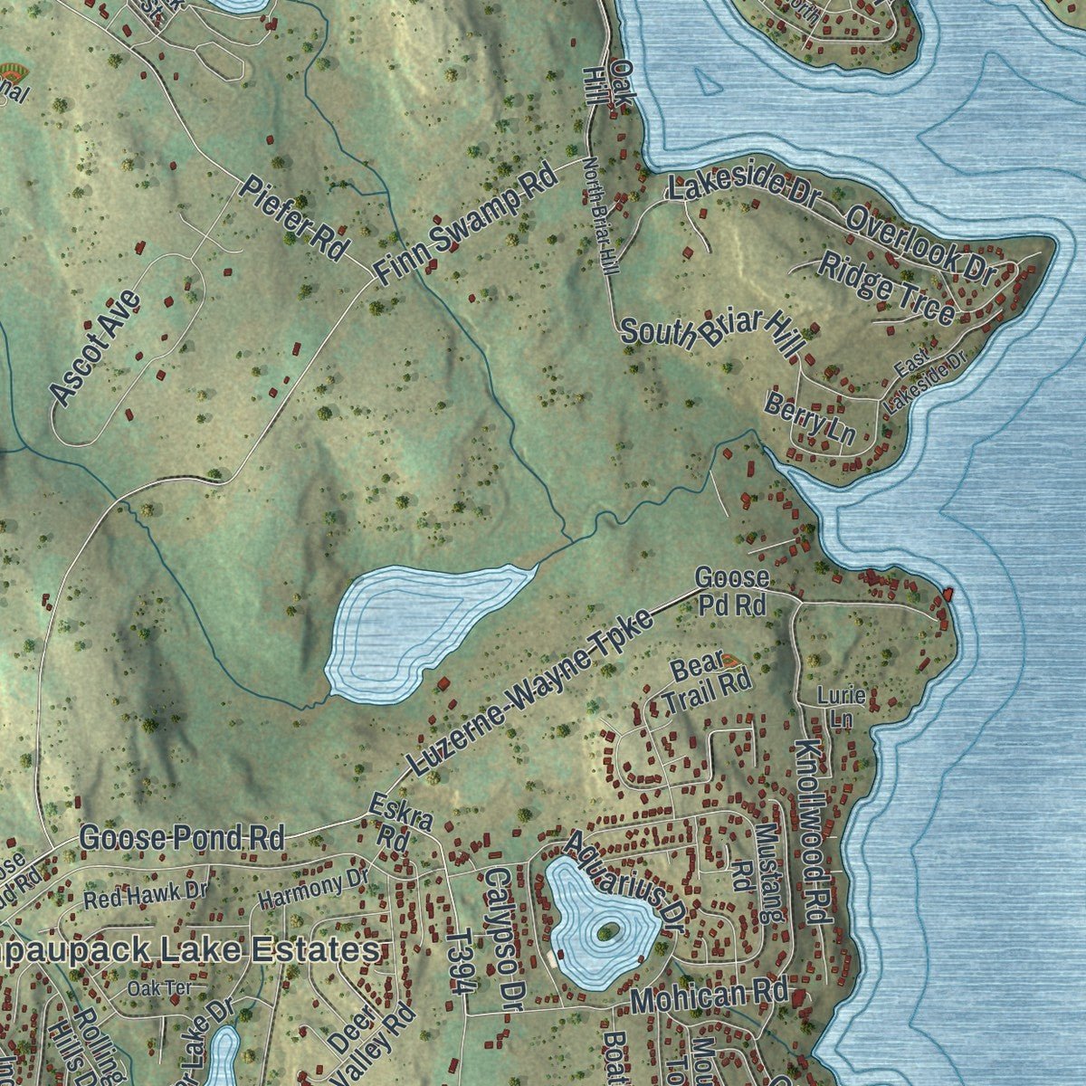
Explore Paupack, Pennsylvania from a whole new perspective. Created using aerial imagery and detailed geographic data, this map captures Paupack building by building, with labeled streets, familiar landmarks, and shaded topographical relief that highlights the natural contours of the landscape.
Combining modern data with the timeless character of a vintage atlas, this map is just as interesting up close as it is beautiful on the wall. Whether you grew up in Paupack, spent memorable years there, or call it home today, this unique map is a great way to celebrate a place that means something to you. Zoom in on the preview to look for your street, and then order a print to put your memories on the wall.

Three ways to hang it
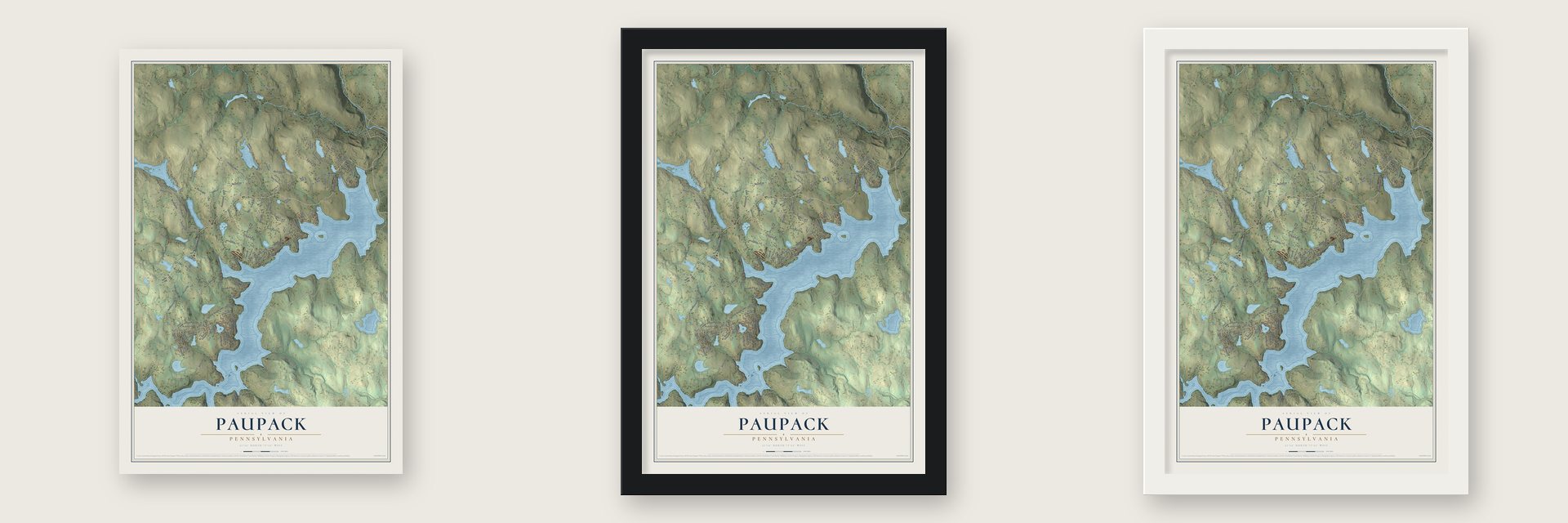
Unframed archival matte, a black wood frame or a white wood frame.
Up close
Geography Worth Displaying
This map was created using accurate cartographic data and authoritative geographic sources, including the U.S. Geological Survey and the Census Bureau. The map brings together terrain, waterways, roads, and building detail. The majority of the streets are labeled, houses are accurately depicted, and the topography is derived from government sources. Combining local data with carefully composed color and shading leads to this beautifully detailed Paupack artwork for your wall.
Rather than simply showing street outlines, we’ve included as many of the street names as we could reasonably fit on the map while keeping their names legible. Zoom in on the high resolution preview to see exactly what’s on the map. We truly set out to create a statement piece for anyone who loves Paupack. So whether it’s for you, or a gift for someone you love, we hope this map of Paupack brings back fond memories.
Read the story behind this map of Paupack, Pennsylvania from 2026.

Find your street
Names on the Paupack map
Every name below is printed on this map. Look for your street, your school, the park where you played, or the pond down the road.
Places and landmarks5
- Wangaum
- Wallenpaupack Lake Estates
- Lakeville
- Uswick
- Lacawac Sanctuary
Streets and roads138
- Purdytown Turnpike
- West Shore Drive
- Balanovich Road
- Goose Pond Road
- Forest Drive
- Acacia Drive
- Rock Road
- Owego Turnpike
- Finn Swamp Road
- Lake Shore Drive
- Hoadleys Road
- Boneridge Road
- Lakeland Drive
- Luzerne-Wayne Turnpike
- Dewberry Drive
- Wangum Road
- Daniels Road
- Evergreen Drive
- Crane Road
- East Shore Drive
- Avoy Road
- Maines Road
- Everly Road
- Lakeview Drive
- Pp&l Line
- Lake Road
- Lakeshore Drive
- Knapp Road
- Bear Paw Drive
- Piefer Road
Show all 138 streets
- Ascot Avenue
- Lakeside Drive
- Wangum Falls Road
- Deer Park Lane
- Aquarius Drive
- Sunrise Trail
- Windsor Road
- Pennell Road
- Paupack Point Road
- Knollwood Road
- South Briar Hill
- Sheridan Road
- Ferris Road
- Woodlyn Drive
- Tiffany Road
- Mohican Road
- Eisenhauer Road
- Glen Road
- White Oak Drive
- Boat House Road
- Ridge Trce
- Terrace Drive
- Poplar Street
- Overlook Drive
- Maple Street
- East Road
- Calypso Drive
- Daniel Road
- Lakeview Hunting Club
- Florence Trail
- Berry Hill Road
- Beaver Lake Drive
- North Lake Loop
- Indian Drive
- South Wynd Drive
- Whitney Lake Road
- Mustang Road
- Boulder Point Road
- Goose Pd Road
- Eskra Road
- Tennis Club Circle
- Forever Green Road
- Rolling Hills Drive
- Deer Valley Road
- Cherokee Lane
- Bear Trail Road
- Ruffed Grouse Road
- Deer Run Road
- Boathouse Road
- Kostige Road
- Four Pines Lane
- Wintergreen Court
- Elm Street
- Mountain Top Drive
- Stone Cabin Road
- Lakeville Court
- Beverly Drive
- Twin Ponds Road
- Aspin Ridge Road
- Stone Crop Road
- Hemlock Drive
- Berry Lane
- Acacia Road
- Maple Drive
- Witko Way
- Ski Road
- Yogi Boulevard
- Sixth Street
- Pr Drive
- Joan Drive
- Fawn Hill Court
- Oak Hill
- Bluff Road
- Goose Bud Road
- Cove Point Circle
- Red Hawk Drive
- South Shore Drive
- Harmony Drive
- Airport Lane
- Recreational Road
- Birch Lane
- Marks Way
- Hidden Valley Court
- Bear Paw Court
- Hill Road
- Lurie Lane
- Third Road
- Oak Street
- Hamlin Highway
- Bone Ridge Road
- Kuhn Lane
- Oak Mountain Drive
- Woodland Drive
- North Briar Hill
- Lake Drive
- Forest Drive North
- Lakeview Terrace
- Clubhouse Court
- East Lakeside Drive
- Highland Drive
- Old Gravity RR
- Pear Street
- Oak Terrace
- Cove Heights Lane
- Seminole Drive
- Weller Court
- Sheps Court
- Brook Acres
Names are listed as they appear on the printed map. Zoom into the product photos to find them.
About Paupack, Pennsylvania
Paupack is a township of 3,676 people in Wayne County, on the northern shore of Lake Wallenpaupack. Pioneers reached this ground almost as early as they reached the county's oldest townships, but for decades it was part of Palmyra Township. In 1850 residents of Palmyra's southwestern corner asked for a township of their own so that voting would be easier, and the Court of Quarter Sessions granted it at its September Term.
Early settlers found the soil stonier and poorer than in neighboring townships, so Paupack grew slowly. Its hamlets stood on busy turnpikes and once seemed sure to become important towns. Then Hawley and Honesdale drew business away, and the county history found the township living on lumber, which was running out fast, and on hard farming.
- Carter's post on the old roadBefore the French and Indian War, a settler named Carter lived at the nearby Wallenpaupack settlement. He and his family were killed and his house was burned, but the spot stayed a stopping place for travelers between Connecticut and Wyoming. Later, some emigrants bound for Wyoming gave up on the Susquehanna valley and stayed here instead. They built a log fort that sheltered both settlers and people passing through.
- Signal fires on Cobb's MountainThe road to Wyoming was a trail through the Paupack woods, marked by blazes cut into the trees. Emigrants sent a party one day's travel ahead to the top of Cobb's Mountain. At dusk it lit a fire the people in the fort could see, a sign the trail was safe and the party would wait for them. Indians had recently burned the oak woods, so the ground was open enough to spot a deer far away.
- Silas Purdy's clearing, 1783Silas Purdy and his wife Hannah came from Kingston, N.Y., by way of Cushutunk and the Wallenpaupack settlement in 1783. They were the first settlers on the west side of the Wallenpaupack, alone in thick forest. Purdy carried his seed corn in on his back, broke the ground with a plow borrowed from a Wilsonville settler, and fed his family on game until the first crops came in. His oldest son, Jacob, became the township's first blacksmith.
- The Shades of DeathPart of western Paupack lay in a dark swamp called "The Shades of Death," and wet bottomland ran along the lake. Streams flowing from Goose, Long and Purdy's Ponds offered good mill sites. The Wallenpaupack, which makes up about one-third of the township line, was deep and slow enough for small steamboats between Wilsonville and Ledgedale.
Keep exploring Pennsylvania
Paupack is one of 3,725 Pennsylvania towns we've mapped. Every dot on the map is a print of its own.
The search covers every state, Pennsylvania first.
Near Paupack
Order 2 or more town maps and save 10%. Shown in the size and finish you picked above, so they hang as a set.
- Wallenpaupack Lake Estates 12" x 18" / Archival Matte Print $39.99
- Palmyra 12" x 18" / Archival Matte Print $39.99
- The Hideout 12" x 18" / Archival Matte Print $39.99
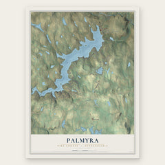
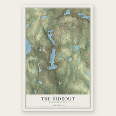
More maps nearby: Hawley, The Escape, Indian Rocks, Cherry Ridge and Palmyra.
The art of mapping a place
How This Map Was Made
Real places. Remarkable detail. Discover the layers that turn geographic data into a map of home.

The view from above
Aerial imagery reveals the character of the land: woodland, open fields, and the patterns of a place.

The shape of the land
Elevation data brings hills, valleys, and subtle changes in the landscape into view.

The details of home
Roads, waterways, and building footprints come together to make the map feel unmistakably local.

Geography becomes art
Considered color, shading, and typography bring the layers together in a map made for your wall.


Process illustrated with Mendon, Massachusetts. Aerial imagery: USDA NAIP. Terrain: USGS 3D Elevation Program. Map details and finished artwork: KNOWOL.
The Details
About This Print
Choose an archival matte print, or a black or white Ayous wood frame. The archival matte print is unframed.
Select your size and finish above to see the matching product image and price.
Materials & Craftsmanship
A contemporary map with the character of a classic atlas, printed on archival matte paper. Optional frames are made from Ayous wood.
Your printed map does not include the watermark shown in the full-map preview.
Shipping & Delivery
Free shipping within the United States. Every print is made to order in the USA.
Buying a gift? Add a note in your cart and we'll include it. We never put prices in the package.
Prints ship within 2 to 3 business days. Allow 7 to 10 days total from ordering for delivery. Timing may vary during holidays or periods of high order volume.
Read our shipping policy.
Returns and damaged prints
Each print is made to order. Change-of-mind refunds are not available after production.
If your print arrives damaged, misprinted or incorrect, contact support@knowol.com within 30 days of receiving it. Include your order number, photos and a description of the issue.
Read our full refund and replacement policy. For questions about your order, email support@knowol.com.