
Search for another town





Free U.S. delivery 7 to 10 days after you order
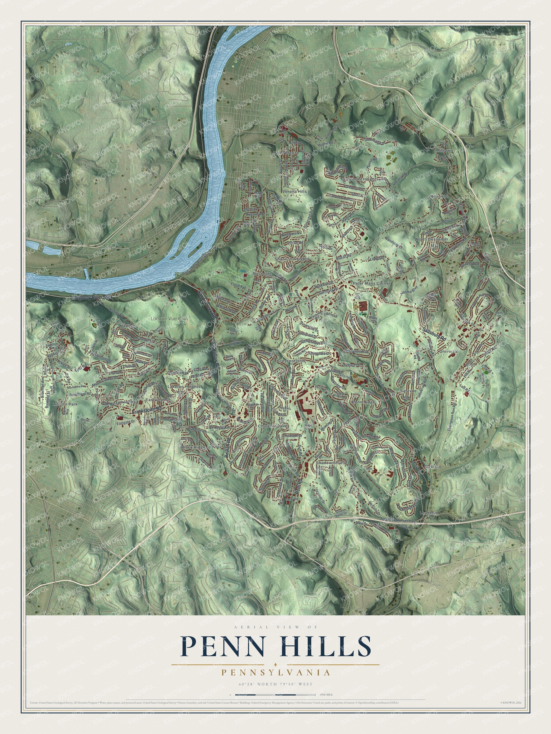
Penn Hills, Pennsylvania Map Art
Building by building, with labeled streets and shaded relief.
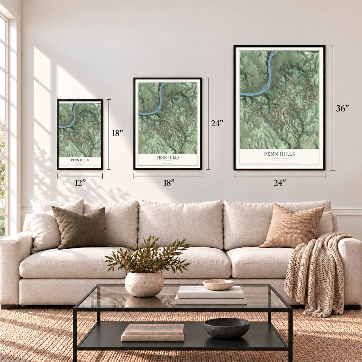
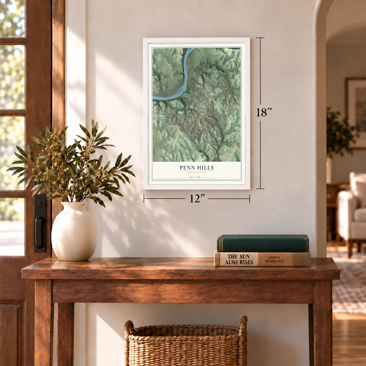
12" x 18" Archival Matte Print
A Map of Home. A Work of Art.
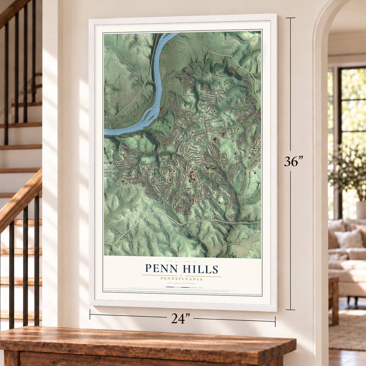
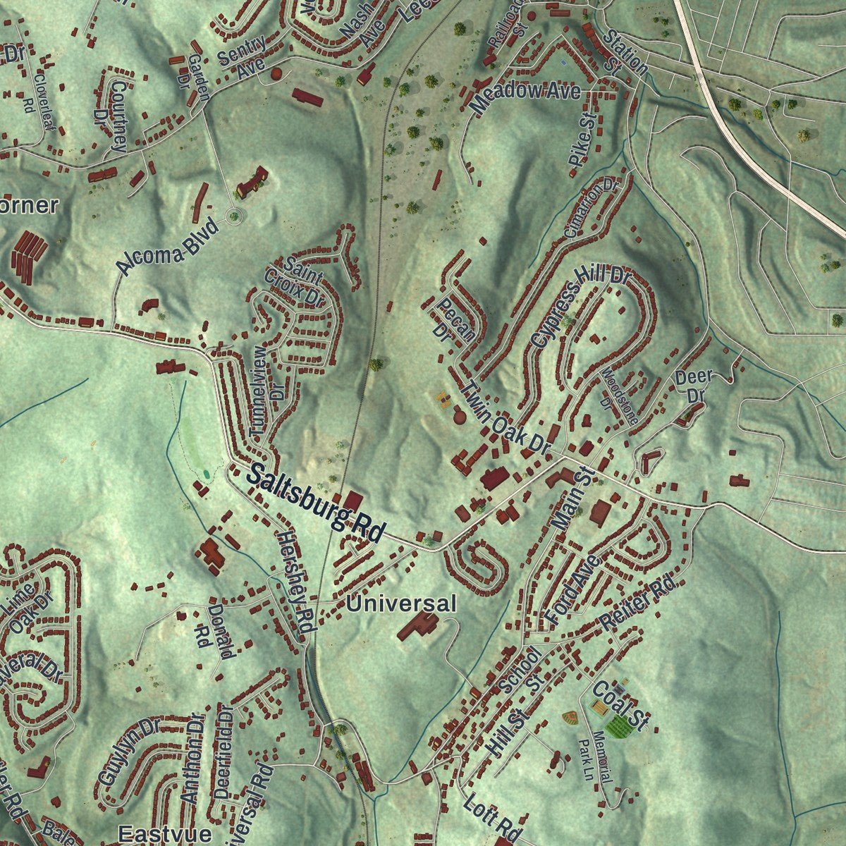
Explore Penn Hills municipality, Pennsylvania from a whole new perspective. Created using aerial imagery and detailed geographic data, this map captures Penn Hills municipality building by building, with labeled streets, familiar landmarks, and shaded topographical relief that highlights the natural contours of the landscape.
Combining modern data with the timeless character of a vintage atlas, this map is just as interesting up close as it is beautiful on the wall. Whether you grew up in Penn Hills municipality, spent memorable years there, or call it home today, this unique map is a great way to celebrate a place that means something to you. Zoom in on the preview to look for your street, and then order a print to put your memories on the wall.
Three ways to hang it
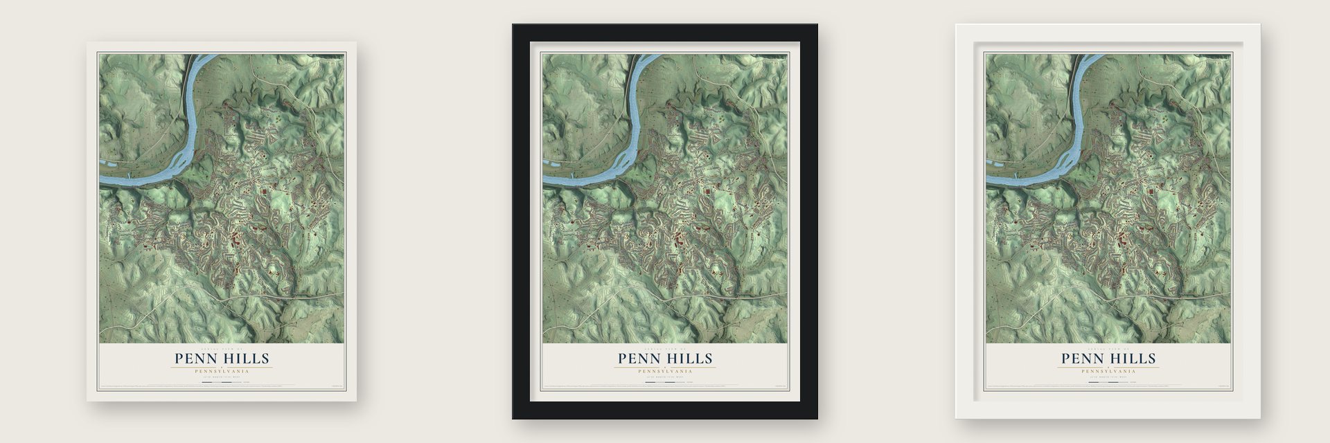
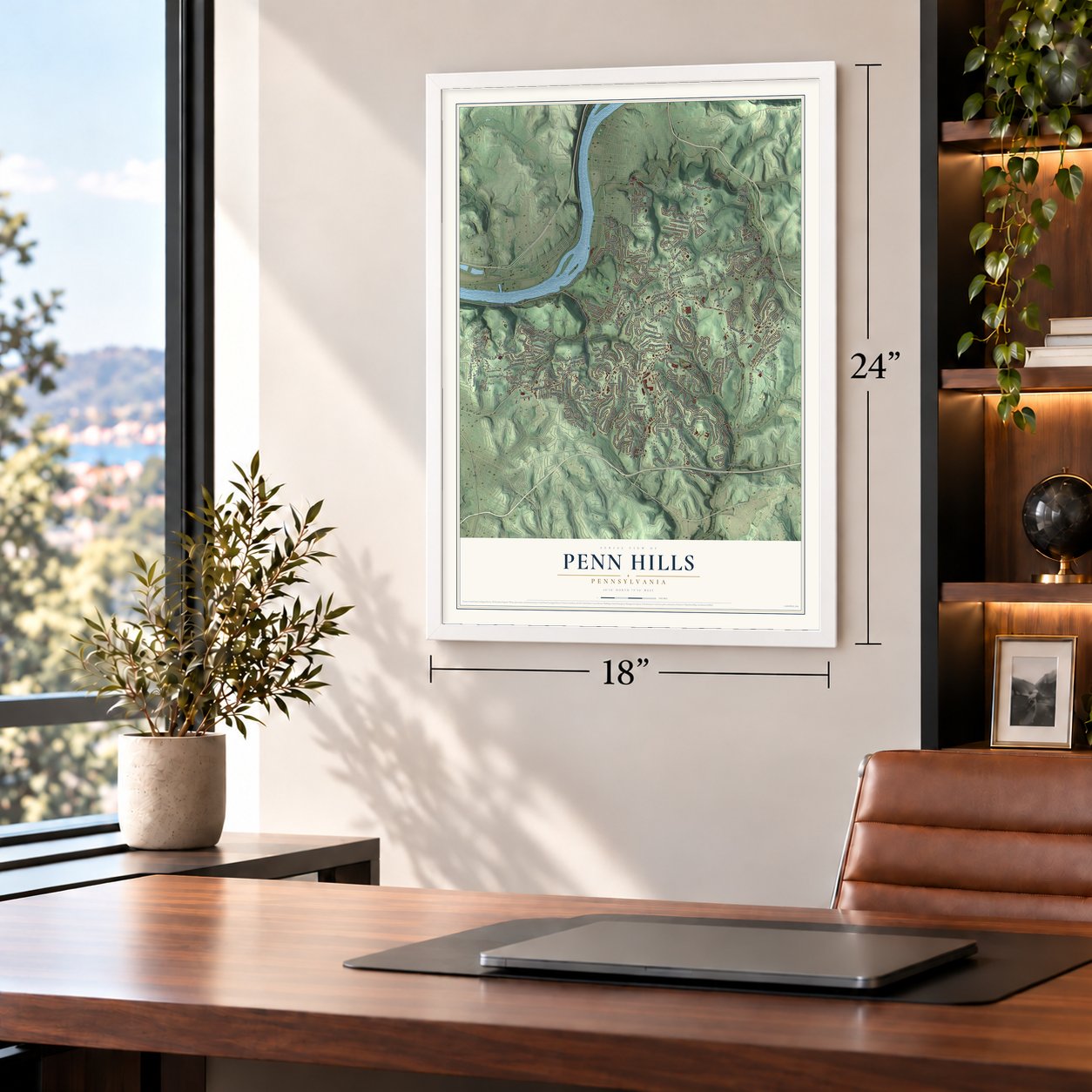
Unframed archival matte, a black wood frame or a white wood frame.
Up close
Geography Worth Displaying
This map was created using accurate cartographic data and authoritative geographic sources, including the U.S. Geological Survey and the Census Bureau. The map brings together terrain, waterways, roads, and building detail. The majority of the streets are labeled, houses are accurately depicted, and the topography is derived from government sources. Combining local data with carefully composed color and shading leads to this beautifully detailed Penn Hills artwork for your wall.
Rather than simply showing street outlines, we’ve included as many of the street names as we could reasonably fit on the map while keeping their names legible. Zoom in on the high resolution preview to see exactly what’s on the map. We truly set out to create a statement piece for anyone who loves Penn Hills. So whether it’s for you, or a gift for someone you love, we hope this map of Penn Hills brings back fond memories.
Read the story behind this map of Penn Hills municipality, Pennsylvania from 2026.

Find your street
Names on the Penn Hills map
Every name below is printed on this map. Look for your street, your school, the park where you played, or the pond down the road.
Places and landmarks24
- Black Ridge
- Churchill Valley
- Crescent Hills
- Eastvue
- Eastwood
- Gascola
- Laketon Heights
- Leak Run
- Lincoln Park
- Milltown
- Nadine
- Newfield
Show all 24 places
- North Bessemer
- Penn Ridge
- Peter Mans Corner
- Point Breeze
- Rodi
- Rosedale
- Shadow Shuttle
- Shannon Heights
- Universal
- Valemont Heights
- Verona Hills
- Longue Vue Club
Streets and roads305
- Frankstown Road
- Coal Hollow Road
- Sandy Creek Road
- Beulah Road
- Saltsburg Road
- Rodi Road
- Allegheny River Boulevard
- Hulton Road
- Universal Road
- Jefferson Road
- Hamil Road
- Main Street
- Elk Road
- Lott Road
- Verona Road
- Lincoln Road
- Leechburg Road
- Stotler Road
- Shannon Road
- Hunter Road
- Indiana Road
- Long Road
- Mount Carmel Road
- Thompson Run Road
- Lougeay Road
- Old William Penn Highway
- Frey Road
- Duff Road
- Poketa Road
- Laketon Road
Show all 305 streets
- Idlewood Road
- Springwood Drive
- Knickerbocker Drive
- Cypress Hill Drive
- Macbeth Drive
- Althea Road
- Milltown Road
- Third Street
- Aber Road
- Mark Drive
- Tyler Road
- Loretta Drive
- Laurie Drive
- Springdale Drive
- Azalea Drive
- Nadine Road
- Shenandoah Drive
- Glenfield Drive
- Orchard Drive
- McKenzie Drive
- Veronica Drive
- Heberton Drive
- Highland Road
- Fielding Drive
- Hershey Road
- Chaske Street
- Outlook Drive
- Hochberg Road
- Meadow Avenue
- Twin Oak Drive
- Sycamore Drive
- Elias Drive
- Spring Grove Road
- Fourth Street
- Parkridge Drive
- Maple Avenue
- Thon Drive
- Guylyn Drive
- Orlando Place
- Greenridge Drive
- Bryant Drive
- Gramac Drive
- Reiter Road
- Hazel Road
- Lowell Drive
- Old Coal Hollow Road
- Fitzsimmons Street
- Golden Gate Drive
- Garlow Drive
- Brushton Avenue
- Clematis Boulevard
- Newport Drive
- White Oak Drive
- Wilson Drive
- Floral Avenue
- Sixth Street
- Quincy Drive
- Suncrest Drive
- McCully Drive
- Janice Drive
- Colorado Street
- Pennview Drive
- Orin Street
- Lindberg Avenue
- Alcoma Boulevard
- Fifth Street
- Lynnwood Drive
- Idaho Avenue
- Evergreen Drive
- Anthon Drive
- Pheasant Drive
- Marshall Drive
- Pennoak Drive
- Valemont Drive
- Glendale Road
- Evaline Street
- Merry Drive
- Ford Avenue
- Sara Lane
- Riverview Drive
- Stephens Lane
- Harvard Drive
- Hill Street
- Woodside Lane
- Grandview Avenue
- Penn Vista Drive
- Morrow Drive
- Howard Street
- Hamill Road
- Curtis Street
- Front Street
- Beechford Road
- Dollman Road
- Princeton Drive
- Clay Drive
- Dalecrest Road
- Webster Drive
- Elliott Street
- Selvin Drive
- Canaveral Drive
- Hoover Road
- Eastgate Drive
- Coal Street
- Rodilin Drive
- Bower Avenue
- Seton Road
- Pearl Road
- Runnette Street
- Verona Street
- Royal Drive
- Keefer Drive
- Eighth Street
- Banfield Street
- Richmore Drive
- Lee Drive
- Jade Drive
- Clair Avenue
- Nike Drive
- Foltz Drive
- Schley Street
- Key Drive
- Pride Road
- Valley Street
- Orlan Place
- Ann Street
- McGregor Drive
- Lime Hollow Road
- Jefferson Heights Road
- Grove Road
- Collins Drive
- Nash Avenue
- Dorothy Drive
- Earlwood Road
- Everglade Drive
- Crescent Hills Road
- Joan Drive
- McCully Road
- Yosemite Drive
- Rockcliff Road
- Crab Hollow Road
- Pennwood Drive
- Tunnelview Drive
- Saint Croix Drive
- Rose Avenue
- Bramble Street
- Eastwood Road
- Hauck Drive
- Seventh Street
- Pershing Street
- Darrell Drive
- Bon Air Road
- Vetter Drive
- Woodlawn Avenue
- Poplar Ridge Drive
- Penny Drive
- School Street
- Newfield Drive
- Green Valley Drive
- Billy Drive
- Elm Drive
- Churchill Avenue
- Joyce Lane
- Harvest Drive
- Lime Oak Drive
- Poe Drive
- Sherwood Drive
- Deerfield Drive
- Courtney Drive
- Crestview Road
- Crescent Pines Drive
- Whittier Drive
- Indian Creek Road
- Barckhoff Street
- National Drive
- Erhardt Drive
- Ritzland Road
- Funston Avenue
- Mount Avenue
- Maple Lo Drive
- Elizabeth Drive
- Palm Avenue
- Jane Street
- Caryl Road
- Dixie Drive
- Pike Street
- Almar Drive
- Lisa Drive
- Sisto Street
- Ange Drive
- Liberto Road
- Sentry Avenue
- Mill Street
- Xavier Drive
- Torrance Street
- Verona Boulevard
- McCurdy Drive
- Purity Road
- Barger Street
- Donald Road
- Julian Drive
- Station Street
- Ozan Way
- Bale Drive
- Ninth Street
- Manilla Street
- Gail Drive
- Iris Drive
- Topaz Drive
- Kim Lane
- Aster Street
- Betty Jane Court
- Deer Drive
- Pecan Drive
- Plum Street
- Ung Drive
- Blackadore Avenue
- Fifth Street Extended
- Railroad Street
- Oakwood Road
- Highpoint Drive
- Marose Drive
- Duffield Avenue
- Datura Drive
- Hibiscus Drive
- Glenhurst Drive
- Gaywood Drive
- Calmar Drive
- Oak Avenue
- Greenview Drive
- Ridgecrest Drive
- Petermans Lane
- Vantine Street
- Cimarron Drive
- Horizon View Drive
- Gilmore Avenue
- Vista View Drive
- Garden Drive
- Flamingo Avenue
- Marathon Drive
- Holly Drive
- Country Club Drive
- Arbor Lane
- Russell Drive
- Arthur Drive
- Hansel Street
- Eola Street
- Memorial Park Lane
- Macfarlane Drive
- Burton Drive
- Pelone Drive
- Briarwood Drive
- Cloverleaf Road
- Southern Avenue
- College Street
- Auburn Street
- Hillary Drive
- Colgan Terrace
- Wildwood Avenue
- Davidson Drive
- Lois Drive
- Chadwick Street
- Oakview Drive
- Marymont Drive
- Woodstone Drive
- Crestmont Avenue
- Morris Street
- Lewis Drive
- Falkirk Drive
- Return Road
- Dodge Road
- Norvell Drive
- Turner Lane
- Elrono Drive
- Adam Street
- Ridge Street
Names are listed as they appear on the printed map. Zoom into the product photos to find them.
About Penn Hills municipality, Pennsylvania
Penn Hills was carved from the northern part of Wilkins Township in 1850. It was first called Adams, then renamed McNair Township that August. In 1851 the state legislature changed the name to Penn Township. It became Penn Hills Township in 1958 and a home rule municipality in 1976.
Keep exploring Pennsylvania
Penn Hills is one of 3,721 Pennsylvania towns we've mapped. Every dot on the map is a print of its own.
The search covers every state, Pennsylvania first.
Near Penn Hills
Order 2 or more town maps and save 10%. Shown in the size and finish you picked above, so they hang as a set.
- Blawnox 12" x 18" / Archival Matte Print $39.99
- Verona 12" x 18" / Archival Matte Print $39.99
- O'Hara 12" x 18" / Archival Matte Print $39.99


More maps nearby: Churchill, Oakmont, East Hills, Wilkinsburg and Homewood North.
The art of mapping a place
How This Map Was Made
Real places. Remarkable detail. Discover the layers that turn geographic data into a map of home.

The view from above
Aerial imagery reveals the character of the land: woodland, open fields, and the patterns of a place.

The shape of the land
Elevation data brings hills, valleys, and subtle changes in the landscape into view.

The details of home
Roads, waterways, and building footprints come together to make the map feel unmistakably local.

Geography becomes art
Considered color, shading, and typography bring the layers together in a map made for your wall.


Process illustrated with Mendon, Massachusetts. Aerial imagery: USDA NAIP. Terrain: USGS 3D Elevation Program. Map details and finished artwork: KNOWOL.
The Details
About This Print
Choose an archival matte print, or a black or white Ayous wood frame. The archival matte print is unframed.
Select your size and finish above to see the matching product image and price.
Materials & Craftsmanship
A contemporary map with the character of a classic atlas, printed on archival matte paper. Optional frames are made from Ayous wood.
Your printed map does not include the watermark shown in the full-map preview.
Shipping & Delivery
Free shipping within the United States. Every print is made to order in the USA.
Buying a gift? Add a note in your cart and we'll include it. We never put prices in the package.
Prints ship within 2 to 3 business days. Allow 7 to 10 days total from ordering for delivery. Timing may vary during holidays or periods of high order volume.
Read our shipping policy.
Returns and damaged prints
Each print is made to order. Change-of-mind refunds are not available after production.
If your print arrives damaged, misprinted or incorrect, contact support@knowol.com within 30 days of receiving it. Include your order number, photos and a description of the issue.
Read our full refund and replacement policy. For questions about your order, email support@knowol.com.