
Search for another town





Free U.S. delivery 7 to 10 days after you order
Philadelphia, Pennsylvania Map Art
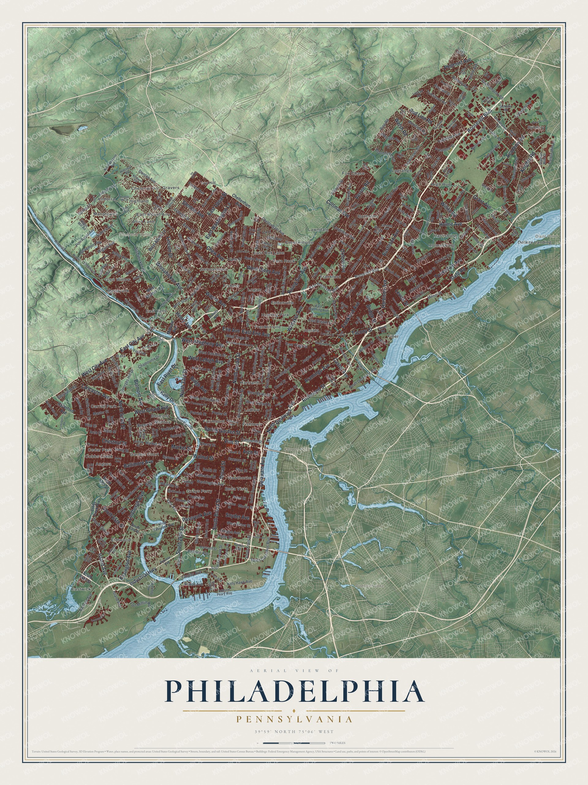
A new map of Philadelphia, Pennsylvania, made in 2026 and printed to order on thick archival matte paper.
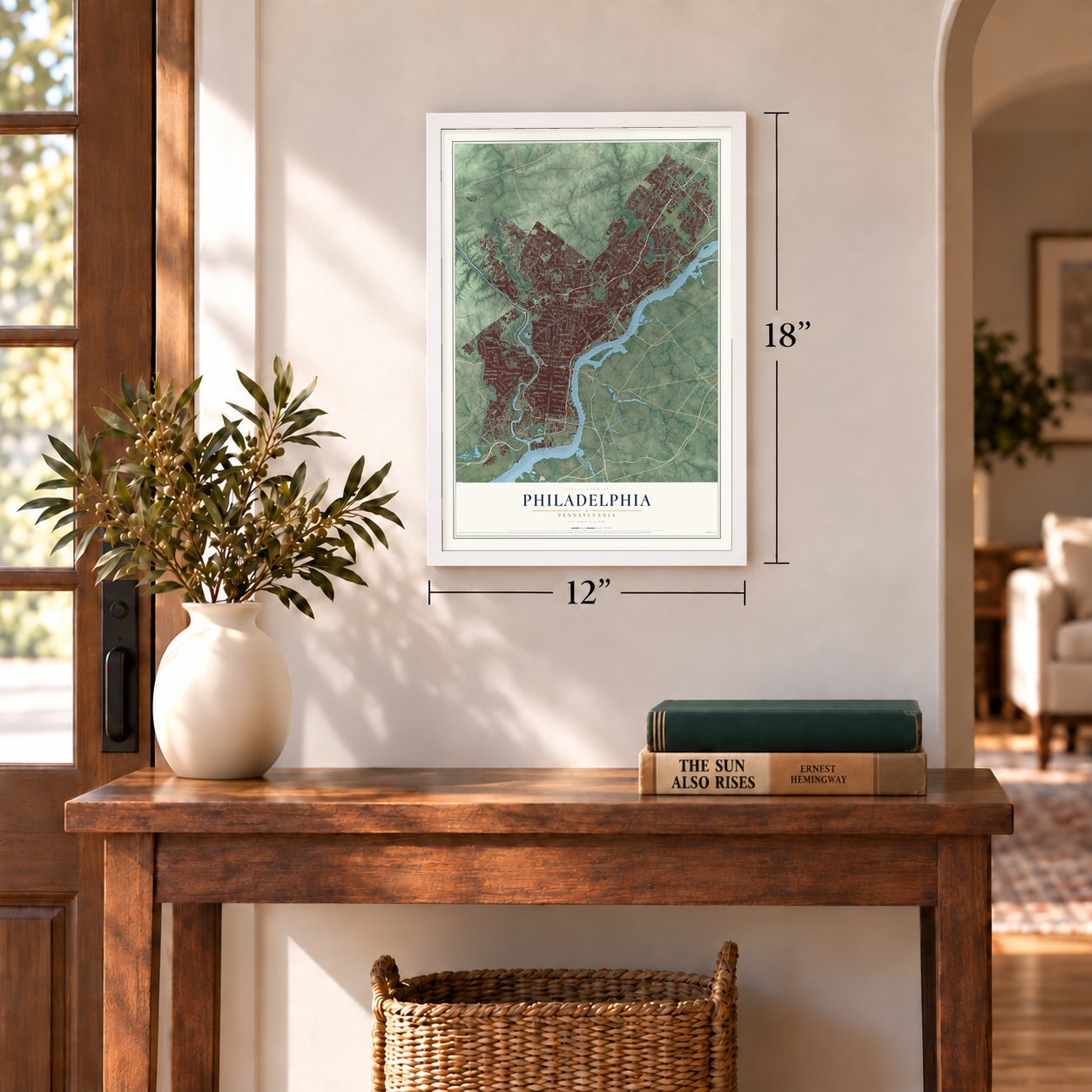
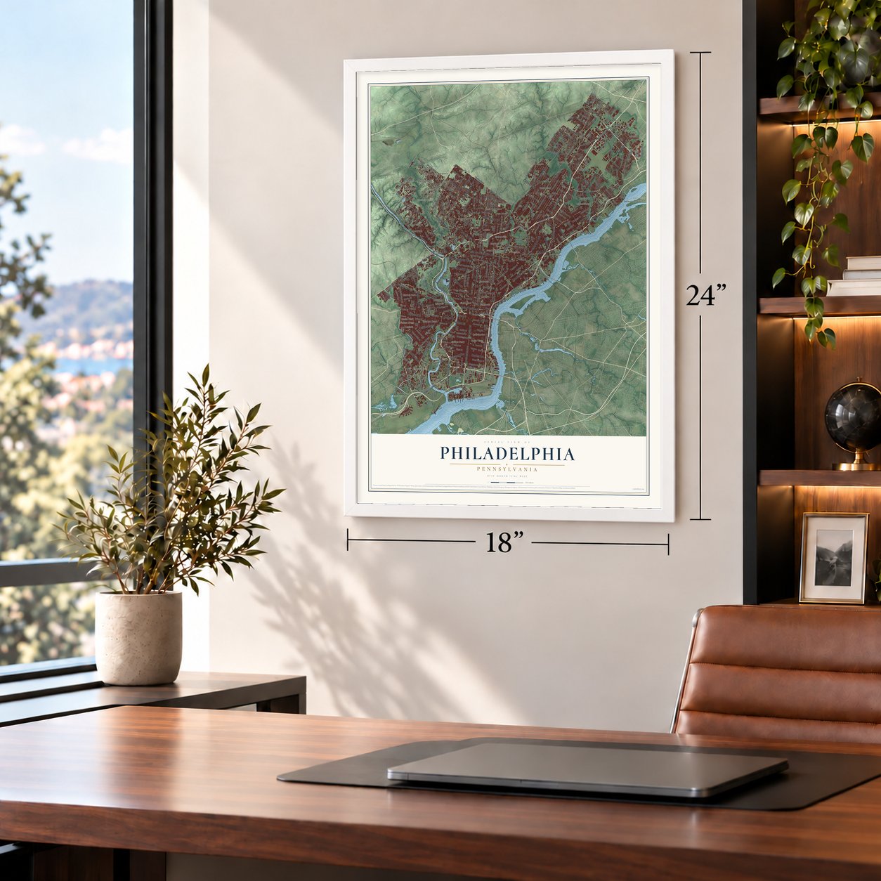
12" x 18" Archival Matte Print
A Map of Home. A Work of Art.
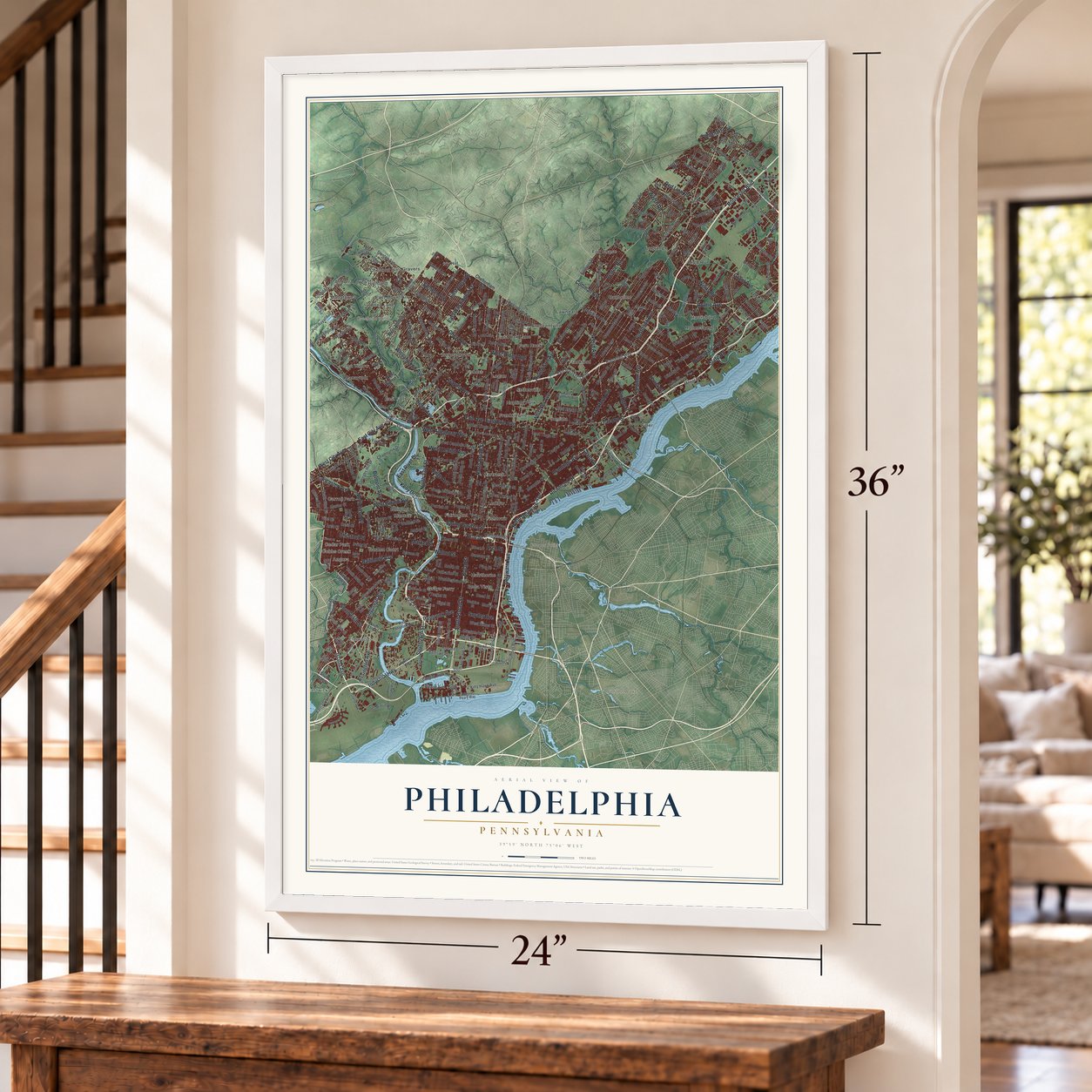
Explore Philadelphia, Pennsylvania from a whole new perspective. Created using aerial imagery and detailed geographic data, this map captures Philadelphia building by building, with labeled streets, familiar landmarks, and shaded topographical relief that highlights the natural contours of the landscape.
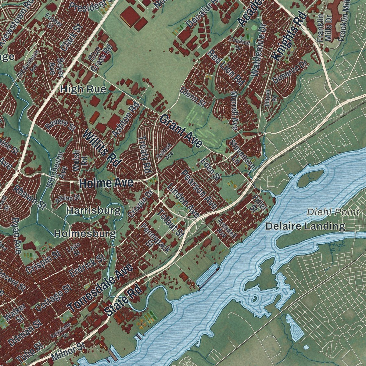
Combining modern data with the timeless character of a vintage atlas, this map is just as interesting up close as it is beautiful on the wall. Whether you grew up in Philadelphia, spent memorable years there, or call it home today, this unique map is a great way to celebrate a place that means something to you. Zoom in on the preview to look for your street, and then order a print to put your memories on the wall.
Three ways to hang it
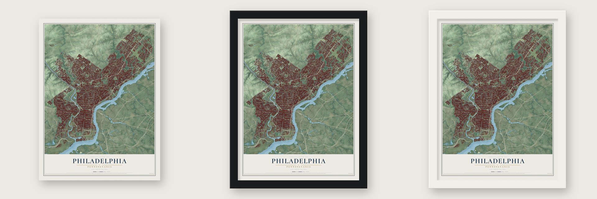
Unframed archival matte, a black wood frame or a white wood frame.
Up close
Geography Worth Displaying
This map was created using accurate cartographic data and authoritative geographic sources, including the U.S. Geological Survey and the Census Bureau. The map brings together terrain, waterways, roads, and building detail. The majority of the streets are labeled, houses are accurately depicted, and the topography is derived from government sources. Combining local data with carefully composed color and shading leads to this beautifully detailed Philadelphia artwork for your wall.
Rather than simply showing street outlines, we’ve included as many of the street names as we could reasonably fit on the map while keeping their names legible. Zoom in on the high resolution preview to see exactly what’s on the map. We truly set out to create a statement piece for anyone who loves Philadelphia. So whether it’s for you, or a gift for someone you love, we hope this map of Philadelphia brings back fond memories.
Read the story behind this map of Philadelphia, Pennsylvania from 2026.

About Philadelphia, Pennsylvania
Philadelphia is a city of 1,603,797 people in Philadelphia County, on the Delaware River. Charles II of England gave William Penn a charter for Pennsylvania in 1681 as partial payment of a debt, but Penn, a Quaker, still bought the land from the Lenape so the colony could live in peace. He signed a treaty of friendship with the Lenape chief Tammany under an elm at Shackamaxon, now part of Fishtown, and in 1682 he founded the city and gave it a Greek name meaning brotherly love.
Penn drew a wide grid so houses would have room for gardens and orchards, but settlers packed the riverfront and cut up and resold their lots. The town grew into a trading center, and by the 1750s it was bigger than Boston and the busiest port in British America. Delegates met at Carpenters' Hall for the First Continental Congress in 1774, and on July 4, 1776, the Second Continental Congress adopted the Declaration of Independence in the Pennsylvania State House, later named Independence Hall. The British held the city from September 1777 to June 1778, and Philadelphia served as the national capital on and off until 1800, when Washington, D.C. was ready.
“the most potent and consequential words in American history”
- The Liberty Bell hidden in 1777After Washington lost at Brandywine on September 11, 1777, the city expected a British attack. Bells could be recast into weapons, so the State Bell, now called the Liberty Bell, was carted out under heavy guard along with bells from Christ Church and St. Peter's Church. It spent nine months under the floorboards of Zion German Reformed Church in what is now Allentown, until the British left Philadelphia in June 1778.
- Computers on Ridge AvenueIn 1946 John W. Mauchly and J. Presper Eckert built ENIAC, the first all-purpose digital computer, at the University of Pennsylvania. Their next machine, BINAC, was tested successfully at 3747 Ridge Ave. on April 7, 1949, and a customer took delivery of their UNIVAC I on March 30, 1951. A state marker on Ridge Avenue credits the two machines with starting the commercial computer age.
- One priest in 1733The Rev. Joseph Greaton, a Jesuit, laid the earliest foundation of Catholicism in Pennsylvania in 1729. When his church was built in 1733, he was its first pastor, and no other Catholic priest served Philadelphia. Jesuits from the parish went on to found missions at Conewago, in Adams County, and at Goshenhoppen, in Berks County, as well as New Jersey's and Delaware's first Catholic churches.
- A city of firstsBenjamin Franklin helped start some of the earliest public services in the country, among them a fire company, a library and a hospital. Philadelphia's list of national firsts includes a library in 1731, a hospital in 1751, a medical school in 1765, a stock exchange in 1790, a zoo in 1874 and a business school in 1881.
Find your street
Names on the Philadelphia map
Every name below is printed on this map. Look for your street, your school, the park where you played, or the pond down the road.
Places and landmarks54
- Camp Hill
- Cooper Point
- Cresheim Valley
- Diehl Point
- Audubon Lake
- Allen Lane
- Andorra
- Angora
- Bala
- Bella Vista
- Belmont
- Burholme
Show all 54 places
- Byberry
- Carroll Park
- Cedar Park
- Chestnut Hill
- Cobbs Creek
- Crescentville
- Delaire Landing
- East Falls
- East Mount Airy
- East Oak Lane
- Eastwick
- Elmwood
- Fairmount
- Feltonville
- Fern Rock
- Fishers
- Fishtown
- Fitler
- Fox Chase
- Frankford
- Franklinville
- Garden Court
- Germantown
- Glen Willow
- Gravers
- Grays Ferry
- Harrisburg
- Hartranft
- Hawthorne
- High Rue
- Highland
- Holmesburg
- Hunting Park
- Ivy Hill
- Juniata
- Lagrange
- Lawndale
- Logan
- Ludlow
- Manatawna
- Manayunk
- Mantua
Streets and roads413
- Roosevelt Boulevard
- Chestnut Street
- Aramingo Avenue
- Industrial Highway
- West Girard Avenue
- Lancaster Avenue
- Island Avenue
- Harbison Avenue
- West City Avenue
- Market Street
- Baltimore Avenue
- North 52nd Street
- South 65th Street
- East City Avenue
- North 33rd Street
- Red Lion Road
- Arch Street
- Philmont Avenue
- Frankford Avenue
- Ridge Avenue
- North Broad Street
- Bustleton Avenue
- South Broad Street
- Broad Street
- Castor Avenue
- Delaware Avenue
- Torresdale Avenue
- Henry Avenue
- Walnut Street
- Spring Garden Street
Show all 413 streets
- Academy Road
- Kelly Drive
- East River Drive
- Cottman Avenue
- Oxford Avenue
- Verree Road
- Grant Avenue
- State Road
- Holme Avenue
- Richmond Street
- North Delaware Avenue
- Wissahickon Avenue
- Rising Sun Avenue
- West Allegheny Avenue
- West Lehigh Avenue
- Welsh Road
- East Erie Avenue
- Knights Road
- Passyunk Avenue
- Snyder Avenue
- Belmont Avenue
- East Washington Lane
- Tacony Street
- Lindbergh Boulevard
- East Upsal Street
- Chew Avenue
- Wayne Avenue
- West Olney Avenue
- Vine Street
- Whitaker Avenue
- Levick Street
- Bridge Street
- Willits Road
- Stenton Avenue
- Lincoln Drive
- South 26th Street
- Essington Avenue
- Erie Avenue
- East Roosevelt Boulevard
- North Front Street
- South 56th Street
- South Second Street
- Race Street
- South Front Street
- North 53rd Street
- North Second Street
- Poplar Street
- Bartram Avenue
- Tasker Street
- Germantown Avenue
- North Fifth Street
- North 16th Street
- North 15th Street
- North Seventh Street
- North Eleventh Street
- North 13th Street
- North 17th Street
- North 20th Street
- Tulip Street
- North Ninth Street
- North 18th Street
- Ditman Street
- Spruce Street
- Wissahickon Drive
- North 21st Street
- Rhawn Street
- Pine Street
- Sansom Street
- West Jefferson Street
- Morris Street
- North Mascher Street
- South Eleventh Street
- Large Street
- Brown Street
- Summerdale Avenue
- Unruh Avenue
- Bingham Street
- Loretto Avenue
- Longshore Avenue
- North 22nd Street
- West Oxford Street
- Catharine Street
- Cottage Street
- Tyson Avenue
- Horrocks Street
- Knorr Street
- Washington Avenue
- Frontenac Street
- Algon Avenue
- Byberry Road
- Oregon Avenue
- Woodland Avenue
- Parrish Street
- Reed Street
- South 20th Street
- Wharton Street
- Fort Mifflin Road
- Ardleigh Street
- Greene Street
- Cheltenham Avenue
- Almond Street
- Moore Street
- Tabor Avenue
- Erdrick Street
- West Berks Street
- Pine Road
- South 70th Street
- East Tioga Street
- Callowhill Street
- Solly Avenue
- South Street
- Kensington Avenue
- Wallace Street
- Crispin Street
- Southampton Road
- West Ritner Street
- Pattison Avenue
- Kitty Hawk Avenue
- West Cambria Street
- Hasbrook Avenue
- Jasper Street
- West School House Lane
- Amber Street
- West Tioga Street
- Loney Street
- North 63rd Street
- Forrest Avenue
- Penn Street
- Memphis Street
- 66th Avenue
- Tomlinson Road
- Boyer Street
- Fillmore Street
- Pechin Street
- Cresson Street
- Krewstown Road
- Milnor Street
- Fox Street
- Port Royal Avenue
- Cherry Street
- Comly Road
- Coral Street
- Kelvin Avenue
- Adams Avenue
- Sherwood Road
- Ashton Road
- Clark Street
- Umbria Street
- Rennard Street
- Townsend Road
- Linden Avenue
- Norcom Road
- Tolbut Street
- Ryan Avenue
- Comly Street
- Sigel Street
- Irving Street
- Master Street
- Haldeman Avenue
- Waldemire Drive
- Shawmont Avenue
- Vare Avenue
- President Street
- Ford Road
- Chamounix Drive
- Bloomfield Avenue
- Bigler Street
- South Columbus Boulevard
- Morton Street
- Valley Avenue
- Rockwell Avenue
- Alburger Avenue
- East Bristol Street
- Baring Street
- Spring Lane
- Pearson Avenue
- Morefield Road
- Langley Avenue
- Decatur Road
- Summit Avenue
- Andrews Avenue
- Georges Hill Drive
- Nedro Avenue
- Paoli Avenue
- Wigard Avenue
- River Road
- Rowan Avenue
- Atwood Road
- Treaty Road
- South 84th Street
- South 59th Street
- Haverford Avenue
- West Walnut Lane
- Midvale Avenue
- West Allens Lane
- Lockart Road
- Chester Avenue
- South 73rd Street
- North Sixth Street
- Woodhaven Road
- Old York Road
- Ludlow Street
- West River Drive
- South 13th Street
- Bleigh Avenue
- Walker Street
- South 17th Street
- Dickinson Street
- West York Street
- South 61st Street
- Saint Vincent Street
- South Third Street
- North Hope Street
- Revere Street
- East Ontario Street
- Woodbine Avenue
- Orthodox Street
- Winchester Avenue
- Wolf Street
- Federal Street
- Pratt Street
- Buist Avenue
- South 53rd Street
- North 56th Street
- Jeanes Street
- Strahle Street
- Dungan Road
- Green Street
- South Darien Street
- Packer Avenue
- South 49th Street
- Filbert Street
- East Vernon Road
- Grays Avenue
- West Queen Lane
- Blue Grass Road
- Pennypack Street
- North 50th Street
- Stevens Road
- East Wyoming Avenue
- North 41st Street
- Morrell Avenue
- Chelten Avenue
- Northwestern Avenue
- Lardner Street
- Musgrave Street
- Watkins Street
- Windrim Avenue
- Hartranft Street
- Green Lane
- Admiral Peary Way
- Brill Street
- Rosehill Street
- Franklin Mills Circle
- Fitler Street
- Franklin Mills Drive
- North 46th Street
- Jamison Avenue
- McNulty Road
- 67th Avenue
- Bells Mill Road
- Rex Avenue
- Wagner Avenue
- Crefeld Street
- Glenn Street
- Bryn Mawr Avenue
- Dimarco Drive
- Wheatsheaf Lane
- East Penn Street
- Hog Island Road
- Conlyn Street
- Arrott Street
- Hagys Mill Road
- Eden Street
- Lewis Street
- North 76th Street
- East Street
- Hornig Road
- Gates Street
- Stevenson Lane
- Hillcrest Road
- Sheaff Lane
- Falls Road
- Crispin Drive
- Beyer Avenue
- Plum Street
- Worth Road
- Black Road
- Nixon Street
- Birch Road
- Nice Street
- Ina Drive
- Cobbs Creek Parkway
- South 63rd Street
- West Passyunk Avenue
- Kingsessing Avenue
- Claridge Street
- North Third Street
- North Twelfth Street
- North Lawrence Street
- West Thompson Street
- Fairmount Avenue
- Locust Street
- Magee Avenue
- North Camac Street
- South 24th Street
- McKean Street
- West Westmoreland Street
- North Philip Street
- East Haines Street
- Cedar Avenue
- Leon Street
- East Luzerne Street
- Northeast Avenue
- Pennway Street
- Main Street
- Hendrix Street
- West Rittenhouse Street
- Arendell Avenue
- Cresheim Valley Drive
- Ivy Hill Road
- Rouse Boulevard
- Church Lane
- Glendale Avenue
- Bergen Street
- Parker Avenue
- Fulmer Street
- Alicia Street
- Paul Street
- Trevose Road
- County Line Road
- Oak Lane
- Holstein Avenue
- Winston Road
- Nanton Drive
- Thomas Mill Drive
- East Sedgley Avenue
- Albion Street
- Caroline Road
- Blair Street
- 71st Avenue
- Carter Road
- Norwood Avenue
- Susan Road
- Bryan Street
- Penny Lane
- Delray Street
- Trina Drive
- Park Avenue
- Penrose Avenue
- Roberts Avenue
- Departures Road
- Christian Street
- Ogontz Avenue
- Belgrade Street
- Limekiln Pike
- East Sanger Street
- Keystone Street
- Emlen Street
- Lowber Avenue
- Fairfield Street
- Conshohocken Avenue
- Rorer Street
- Devereaux Street
- Domino Lane
- Chalfont Drive
- Dunks Ferry Road
- East Ann Street
- East Wister Street
- Guilford Street
- East Oregon Avenue
- Stokley Street
- Lykens Lane
- South 76th Street
- Outlook Avenue
- Ellicott Road
- Bennett Road
- Geiger Road
- Delmar Street
- West Clapier Street
- Old Bustleton Avenue
- Gypsy Lane
- Cardington Road
Names are listed as they appear on the printed map. Zoom into the product photos to find them.
The art of mapping a place
How This Map Was Made
Real places. Remarkable detail. Discover the layers that turn geographic data into a map of home.

The view from above
Aerial imagery reveals the character of the land: woodland, open fields, and the patterns of a place.

The shape of the land
Elevation data brings hills, valleys, and subtle changes in the landscape into view.

The details of home
Roads, waterways, and building footprints come together to make the map feel unmistakably local.

Geography becomes art
Considered color, shading, and typography bring the layers together in a map made for your wall.


Process illustrated with Mendon, Massachusetts. Aerial imagery: USDA NAIP. Terrain: USGS 3D Elevation Program. Map details and finished artwork: KNOWOL.
The Details
About This Print
Choose an archival matte print, or a black or white Ayous wood frame. The archival matte print is unframed.
Select your size and finish above to see the matching product image and price.
Materials & Craftsmanship
A contemporary map with the character of a classic atlas, printed on archival matte paper. Optional frames are made from Ayous wood.
Your printed map does not include the watermark shown in the full-map preview.
Shipping & Delivery
Free shipping within the United States. Every print is made to order in the USA.
Buying a gift? Add a note in your cart and we'll include it. We never put prices in the package.
Prints ship within 2 to 3 business days. Allow 7 to 10 days total from ordering for delivery. Timing may vary during holidays or periods of high order volume.
Read our shipping policy.
Returns and damaged prints
Each print is made to order. Change-of-mind refunds are not available after production.
If your print arrives damaged, misprinted or incorrect, contact support@knowol.com within 30 days of receiving it. Include your order number, photos and a description of the issue.
Read our full refund and replacement policy. For questions about your order, email support@knowol.com.
Find your town
Looking for another city?
Find a map of home in our Pennsylvania collection, or any town in the country.
Nearby
Maps of towns near Philadelphia
Know someone from one of these towns? Their map makes a great gift.
 Oak Lane
, Pennsylvania
From $39.99See the map
 Melrose Park
, Pennsylvania
From $39.99See the map
 Cheltenham Village
, Pennsylvania
From $39.99See the map
More maps nearby: Elkins Park, Cheltenham, Bala Cynwyd, McKinley and Rockledge.