
Search for another town



Free U.S. delivery 7 to 10 days after you order
Poulsbo, Washington Map Art
A new map of Poulsbo, Washington, made in 2026 and printed to order on thick archival matte paper.
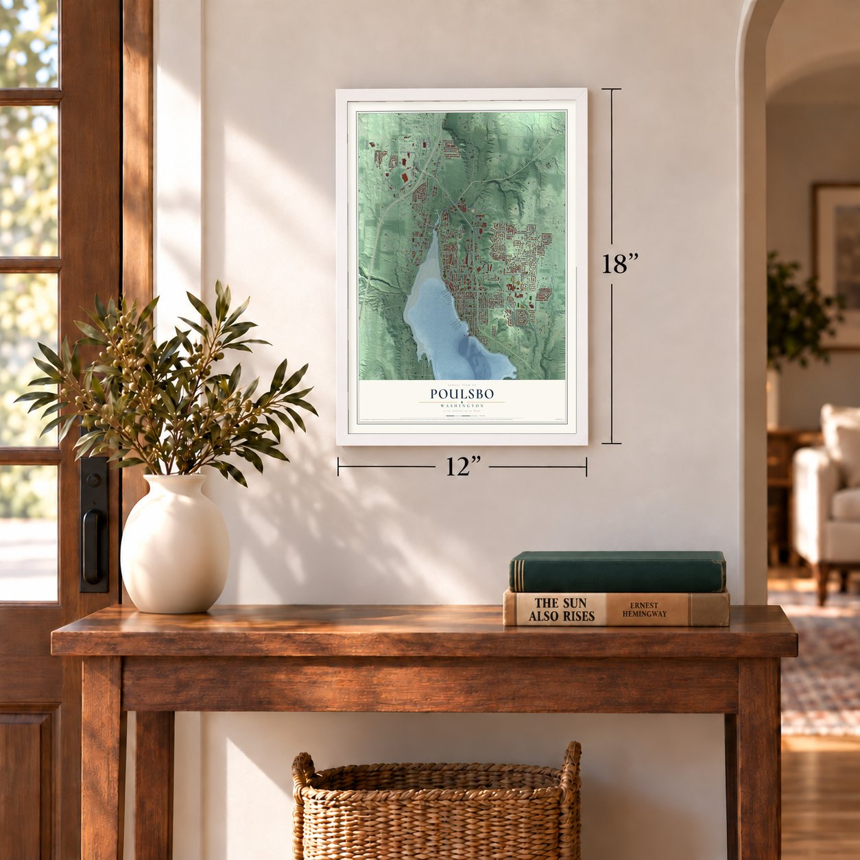
12" x 18" Archival Matte Print
A Map of Home. A Work of Art.
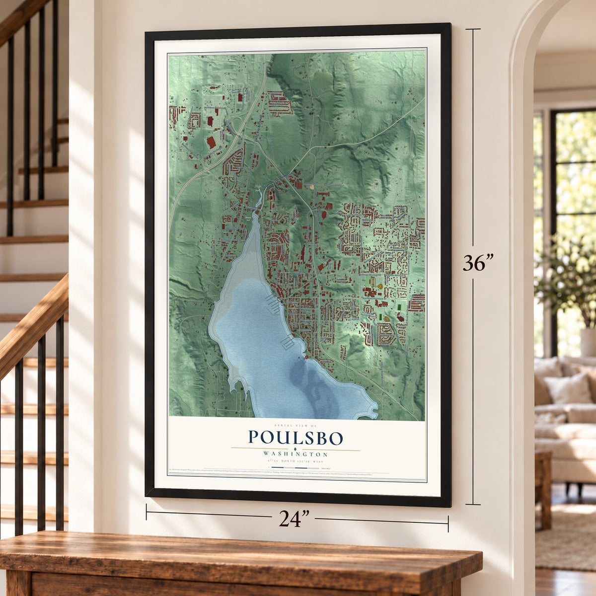
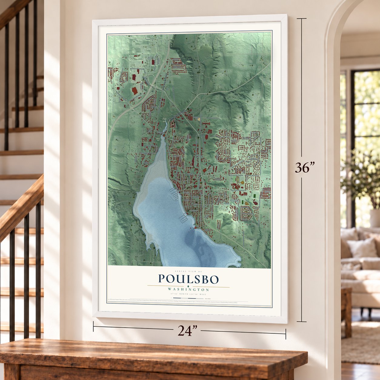
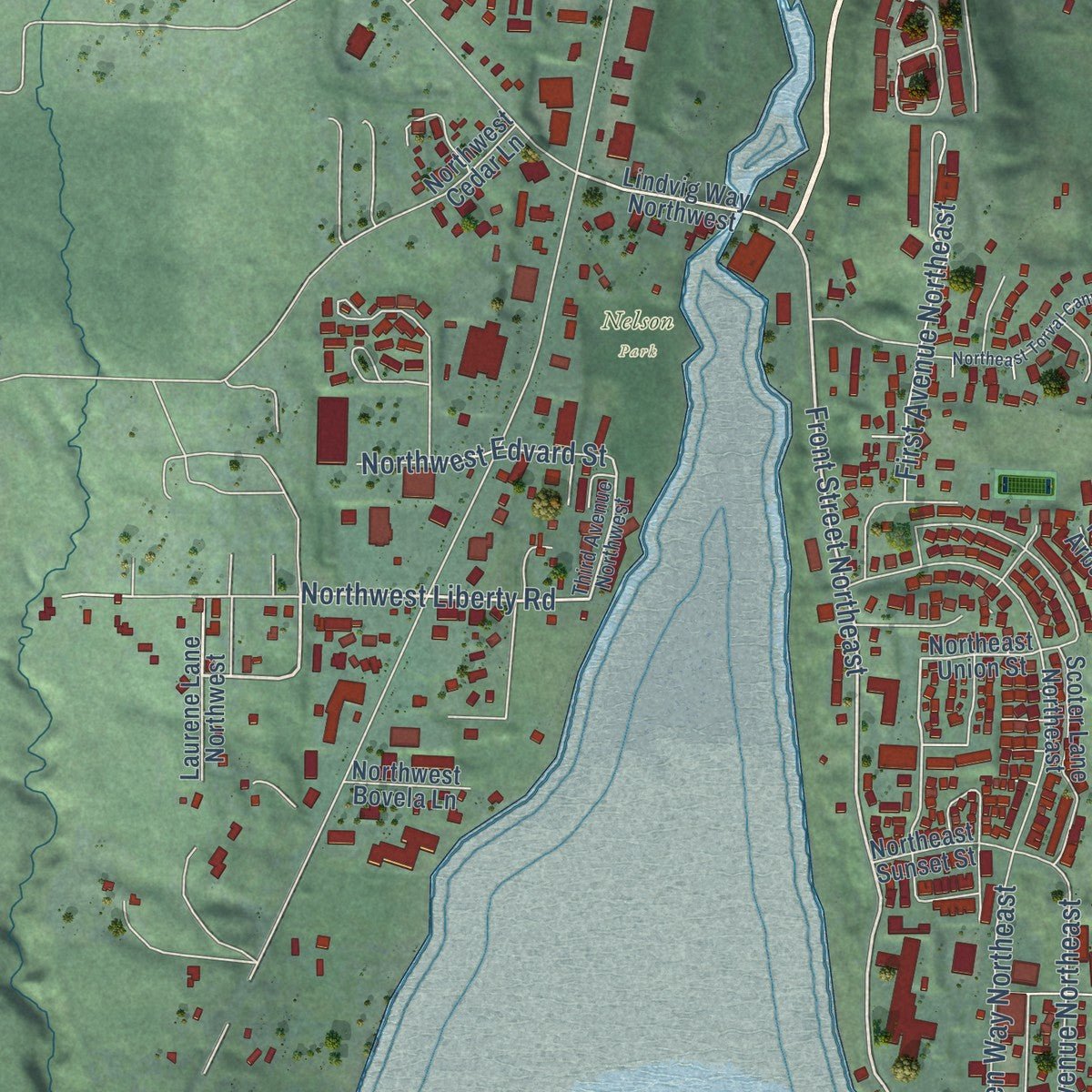
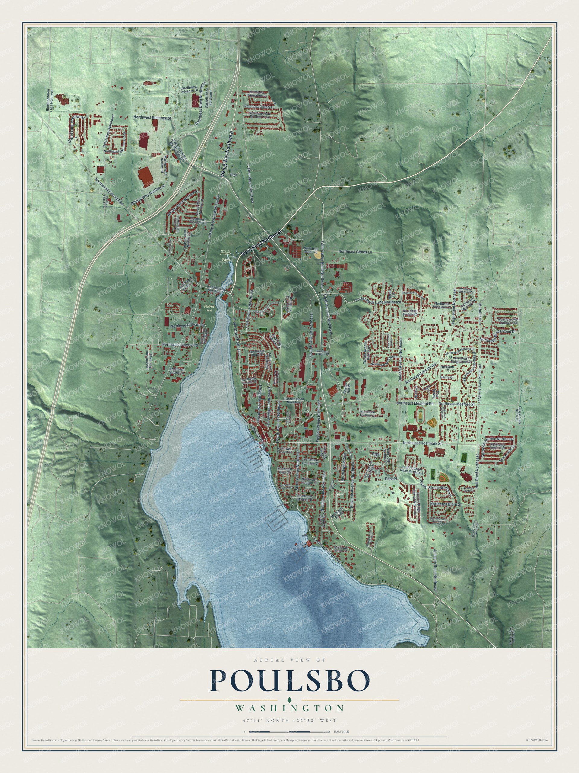
Explore Poulsbo, Washington from a whole new perspective. Created using aerial imagery and detailed geographic data, this map captures Poulsbo building by building, with labeled streets, familiar landmarks, and shaded topographical relief that highlights the natural contours of the landscape.
Combining modern data with the timeless character of a vintage atlas, this map is just as interesting up close as it is beautiful on the wall. Whether you grew up in Poulsbo, spent memorable years there, or call it home today, this unique map is a great way to celebrate a place that means something to you. Zoom in on the preview to look for your street, and then order a print to put your memories on the wall.
Three ways to hang it
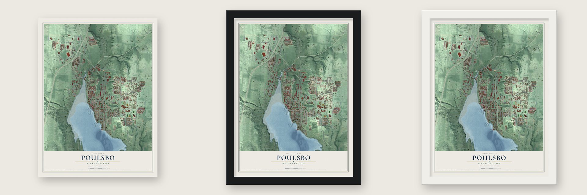
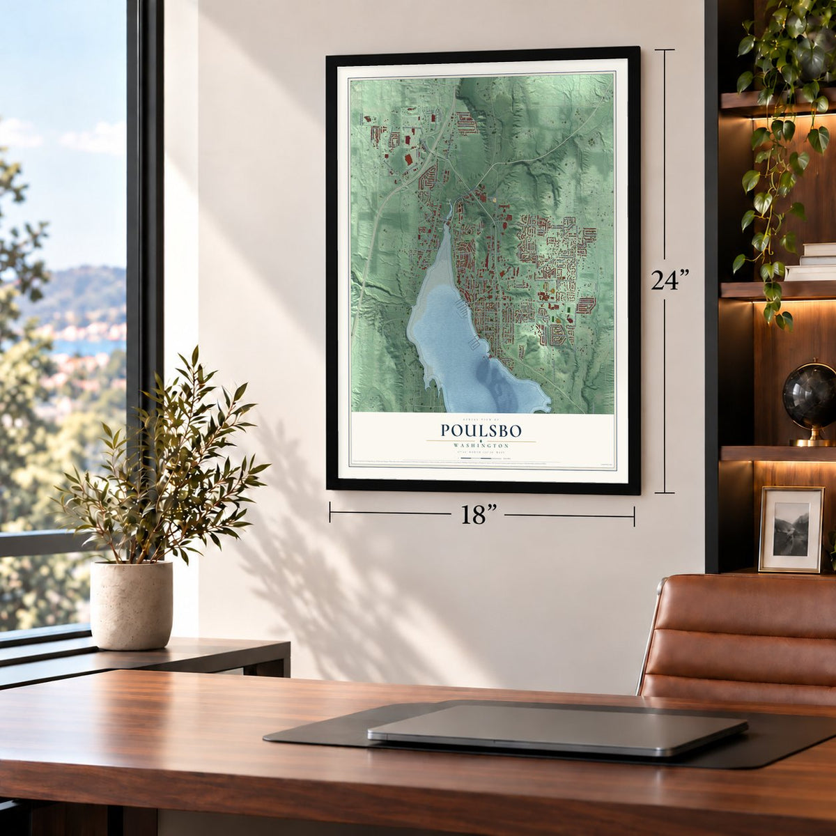
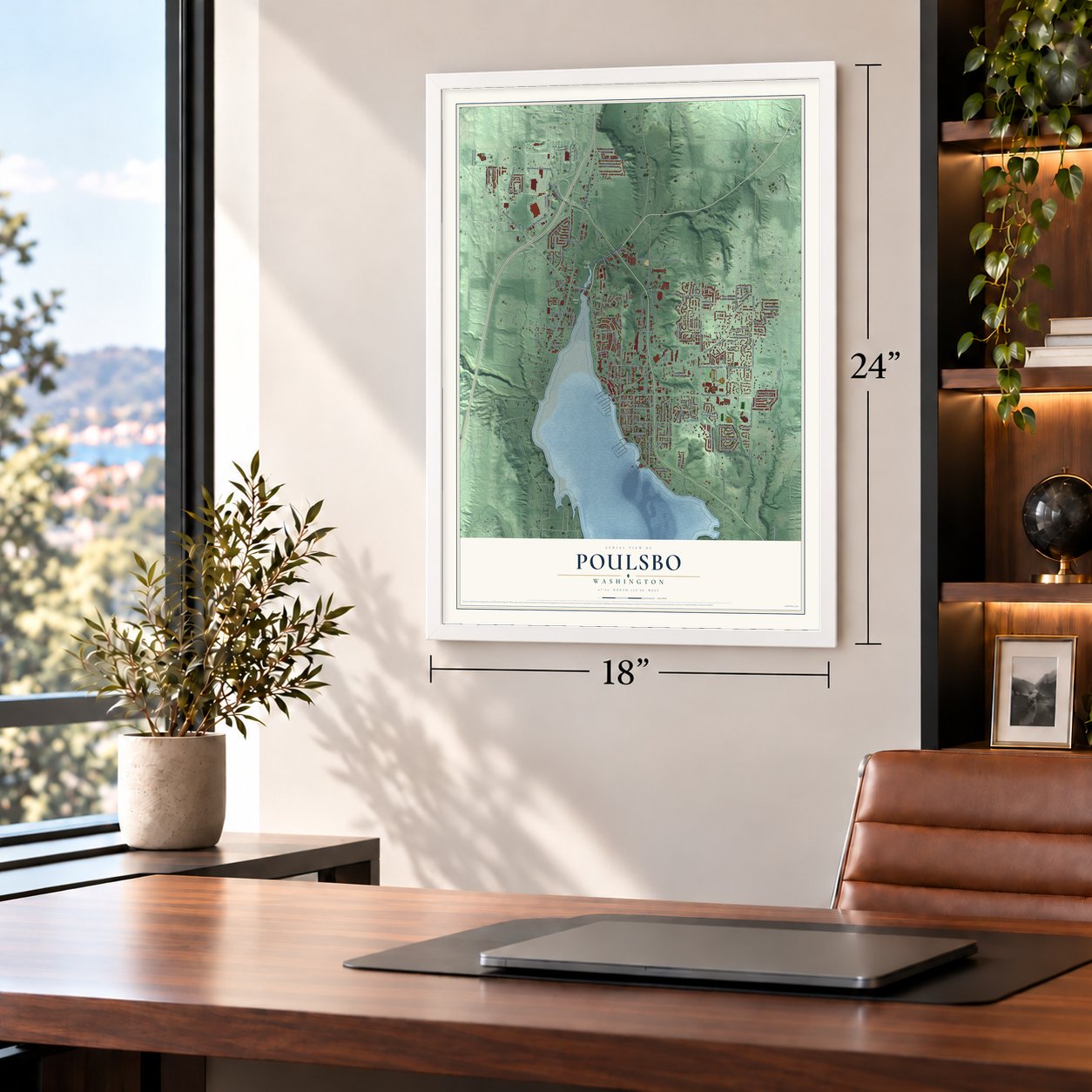
Unframed archival matte, a black wood frame or a white wood frame.
Up close
Geography Worth Displaying
This map was created using accurate cartographic data and authoritative geographic sources, including the U.S. Geological Survey and the Census Bureau. The map brings together terrain, waterways, roads, and building detail. The majority of the streets are labeled, houses are accurately depicted, and the topography is derived from government sources. Combining local data with carefully composed color and shading leads to this beautifully detailed Poulsbo artwork for your wall.
Rather than simply showing street outlines, we’ve included as many of the street names as we could reasonably fit on the map while keeping their names legible. Zoom in on the high resolution preview to see exactly what’s on the map. We truly set out to create a statement piece for anyone who loves Poulsbo. So whether it’s for you, or a gift for someone you love, we hope this map of Poulsbo brings back fond memories.
Read the story behind this map of Poulsbo, Washington from 2026.

About Poulsbo, Washington
Poulsbo is a city of 11,975 people in Kitsap County, and it sits where Liberty Bay ends to the north. The Suquamish called this ground Tcutcu Lats, or "maple grove," and gave it up in the Treaty of Point Elliott in 1855 while keeping their rights to fish and gather here. Loggers came soon after, and in 1860 Henry Eley set up a camp where downtown now stands. Henry Prescott started trapping dogfish for their oil in 1866, and he caught so many that the water was first known as Dog Fish Bay.
Ole Stubb and his family came from Norway, by way of South Dakota, in 1875. In September 1883 Jorgen Eliason and Peter Olson rowed over from Seattle, and Stubb helped them file homestead claims on the land where downtown is today. Olson sold out, but Eliason stayed and is counted as the founder. In December 1886 Iver B. Moe asked for a post office named for his Norwegian hometown, Paulsbo. The Postal Service misspelled it, so on December 8, 1886, Moe became postmaster of Poulsbo, and the town was incorporated on December 18, 1907.
“saw immediately that this was an ideal place with a promise of a great future. A place that would serve as a magnet to the Norwegians”
- First wagons over Snoqualmie PassThe Moe family left Minneapolis in spring 1882, paying their way west by cutting cord wood for a gold mine and working for the Northern Pacific Railroad. At Lake Kacheelus they rafted their wagons across, then cut through the forest, piling brush into ramps over the biggest fallen trees. Two weeks later they reached Issaquah, the first party to cross the pass with wagons, and they settled on Dog Fish Bay a month after Eliason.
- Steamers tied to log raftsSteamer service began in 1885, when the Augusta started calling three times a week. The town had no wharf until 1894, so boats tied up to log rafts in the bay, a rowboat carried people and goods ashore, and animals swam. Martin Bjermeland rafted in lumber for the first frame house in 1887, then went on to build the church, the school, the wharf, the Grand View Hotel and the codfish plant.
- A sixteen-year-old teacherThe school Bjermeland built opened in 1891, but an earlier one-room school stood on Moe's land. Its first teacher, Nellie Kiddy, was only 16, and after six weeks with six unruly boys and one girl she quit. Her replacement, 30-year-old Maggie Murphy, put up with no nonsense, and Iver Moe's son Chris, one of those boys, remembered her strict discipline for years.
- The downtown fire of 1914After a dry summer of brush fires, flames swept the business district on September 15, 1914, destroying eight buildings, about a third of the business section. No one ever learned the cause. Owners kept trading out of the buildings that survived, and the new downtown went up in cement instead of wood.
- A king's visit in 1975Many families still spoke Norwegian at home until World War II, when the military built about 300 housing units for workers at the Puget Sound Naval Shipyard in Bremerton. The population nearly tripled in three years, and English took over. Norway's King Olav V visited Poulsbo on October 22, 1975, for the 150th anniversary of Norwegian immigration, and his son Harald followed 20 years later.
Find your street
Names on the Poulsbo map
Every name below is printed on this map. Look for your street, your school, the park where you played, or the pond down the road.
Places and landmarks3
- Lincoln
- Fish Park
- Nelson Park
Streets and roads123
- Bond Road Northeast
- Viking Way Northwest
- Tenth Avenue Northeast
- Little Valley Road Northeast
- Northwest Liberty Road
- Front Street Northeast
- Northeast Hostmark Street
- Fourth Avenue Northeast
- Pugh Road Northeast
- Anderson Parkway
- First Avenue Northeast
- Fjord Drive Northeast
- Vetter Road Northeast
- Viking Avenue Northwest
- Northeast Lincoln Road
- Noll Road Northeast
- Caldart Avenue Northeast
- Prdr
- Northwest Finn Hill Road
- Seventh Avenue Northeast
- Jensen Way Northeast
- Northeast Mesford Road
- Ninth Avenue Northeast
- Olhava Way Northwest
- Eleventh Avenue Northeast
- Forest Rock Lane Northeast
- Claret Loop Northwest
- Northeast Kevos Pond Drive
- Northeast Mesford Street
- Eighth Avenue Northeast
Show all 123 streets
- Nordby Drive Northwest
- Dauntless Drive Northwest
- Third Avenue Northeast
- Sixth Avenue Northeast
- Northeast Genes Lane
- Gustaf Street Northeast
- Johnson Road Northeast
- Colwood Avenue Northeast
- North Eighth Avenue
- Northeast Bjorn Street
- Northwest Reliance Street
- Northwest Edvard Street
- Marantha Lane
- Vicki Road
- Park Place
- Lindvig Way Northwest
- Tosha Street
- 23rd Avenue Northeast
- Northeast Union Street
- Twelfth Avenue Northeast
- Northeast Max William Loop
- Olympic College Way Northwest
- South Ninth Avenue
- Urdahl Road Northwest
- Market Place Northwest
- Iverson Road Northeast
- Northeast Harrison Street
- Northwest Monterey Loop
- Northeast Bernt Road
- Sunnymede Street
- Northeast Noll Valley Loop
- 15th Loop Northeast
- Viking Crst Northeast
- Langaunet Lane Northeast
- Rhododendron Lane Northwest
- Northeast Watland Street
- 13th Avenue Northeast
- Sunrise Ridge Avenue Northeast
- Terasse Drive Northwest
- Northeast Redford Street
- Northeast Ridgewood Street
- Hoved Road
- Brevik Place Northwest
- Northeast Ohenry Court
- Scoter Lane Northeast
- Northeast Inspiration Street
- Northeast Ryen Street
- Northwest Stendahl Court
- Parnell Place Northwest
- Northwest Advance Drive
- Powder Hill Place
- Northeast Gilmax Lane
- Northeast Haugen Street
- Laurene Lane Northwest
- Curt Rudolph Road Northeast
- Northeast Matson Street
- Northeast Spartan Court
- Northeast Sol Vei
- Northeast Holm Court
- Northeast Poseidon Court
- Northeast Eliason Street
- Northeast Hogue Road
- Northeast Sunset Street
- Northwest Cedar Lane
- South Sixth Avenue
- Northwest Bovela Lane
- Northeast Arbutus Court
- Bartre Court
- Norrland Court
- Wendy Way
- Rygg Court
- Third Avenue Northwest
- Northwest Rasmussen Court
- Northeast Ridgewood Drive
- Swanson Way
- Storhoff Road Northeast
- Tallagson Lane Northeast
- Willet Lane Northeast
- Northeast Winesap Court
- Stenbom Lane Northeast
- Northeast Liberty Road
- North Ninth Avenue
- Miss Ellis Loop Northeast
- Mosjon Circle Northeast
- Northeast Torval Canyon Road
- Northeast Sommerseth Street
- Baywatch Court Northeast
- Northeast Outlook Way
- Kaster Road Northwest
- Karl Court Northeast
- Staffordshire Lane
- Fifth Avenue Northeast
- Northeast Thistle Court
Names are listed as they appear on the printed map. Zoom into the product photos to find them.
The art of mapping a place
How This Map Was Made
Real places. Remarkable detail. Discover the layers that turn geographic data into a map of home.

The view from above
Aerial imagery reveals the character of the land: woodland, open fields, and the patterns of a place.

The shape of the land
Elevation data brings hills, valleys, and subtle changes in the landscape into view.

The details of home
Roads, waterways, and building footprints come together to make the map feel unmistakably local.

Geography becomes art
Considered color, shading, and typography bring the layers together in a map made for your wall.


Process illustrated with Mendon, Massachusetts. Aerial imagery: USDA NAIP. Terrain: USGS 3D Elevation Program. Map details and finished artwork: KNOWOL.
The Details
About This Print
Choose an archival matte print, or a black or white Ayous wood frame. The archival matte print is unframed.
Select your size and finish above to see the matching product image and price.
Materials & Craftsmanship
A contemporary map with the character of a classic atlas, printed on archival matte paper. Optional frames are made from Ayous wood.
Your printed map does not include the watermark shown in the full-map preview.
Shipping & Delivery
Free shipping within the United States. Every print is made to order in the USA.
Buying a gift? Add a note in your cart and we'll include it. We never put prices in the package.
Prints ship within 2 to 3 business days. Allow 7 to 10 days total from ordering for delivery. Timing may vary during holidays or periods of high order volume.
Read our shipping policy.
Returns and damaged prints
Each print is made to order. Change-of-mind refunds are not available after production.
If your print arrives damaged, misprinted or incorrect, contact support@knowol.com within 30 days of receiving it. Include your order number, photos and a description of the issue.
Read our full refund and replacement policy. For questions about your order, email support@knowol.com.
Find your town
Looking for another city?
Find a map of home in our Washington collection, or any town in the country.
Nearby
Maps of towns near Poulsbo
Know someone from one of these towns? Their map makes a great gift.
 Suquamish
, Washington
From $39.99See the map
 Keyport
, Washington
From $39.99See the map
 Bangor Base
, Washington
From $39.99See the map
More maps nearby: Lofall, Silverdale, Indianola, Kingston and Port Gamble Tribal Community.