


Search for another town





Free U.S. delivery 7 to 10 days after you order
Princeton, Kentucky Map Art
Building by building, with labeled streets and shaded relief.
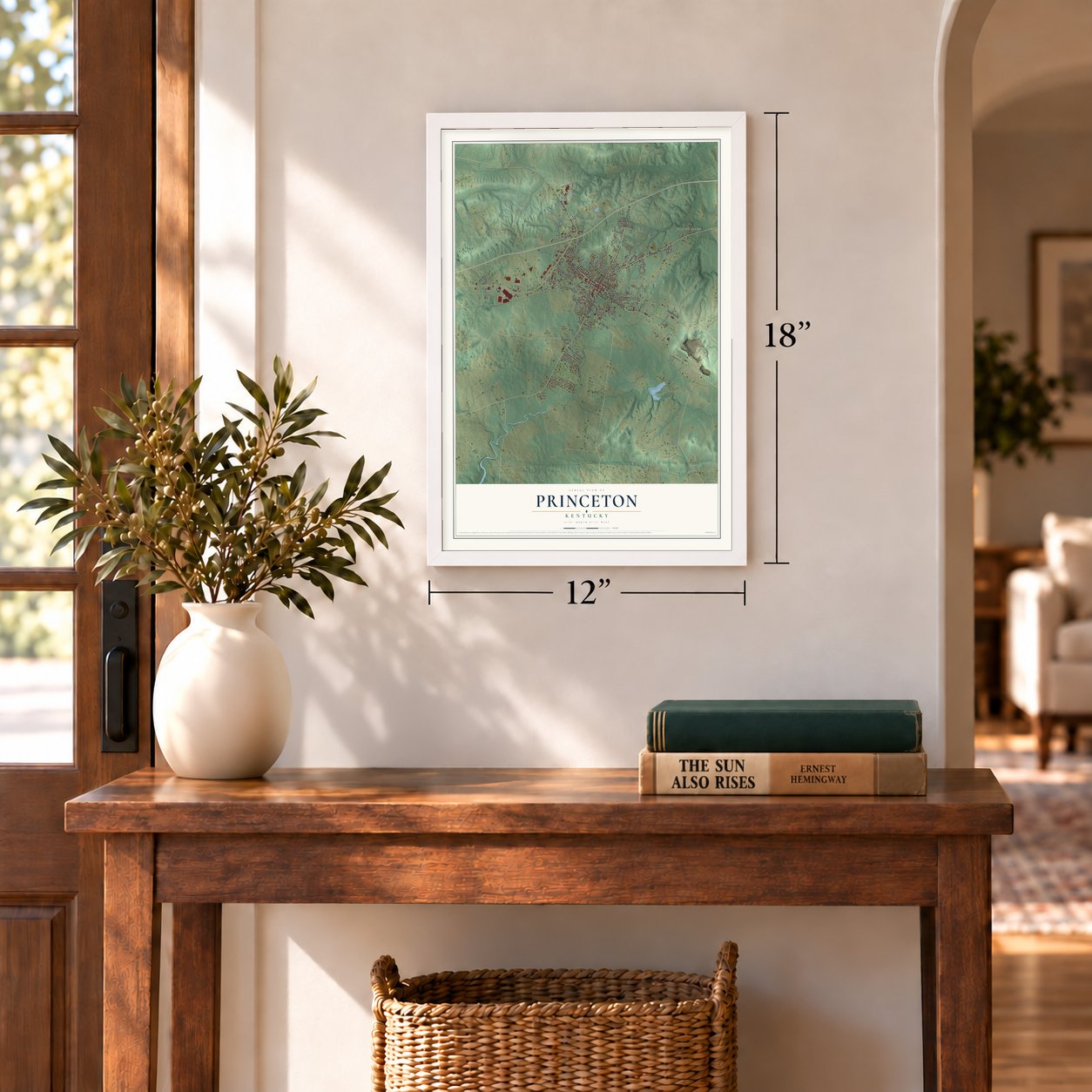
12" x 18" Archival Matte Print
A Map of Home. A Work of Art.
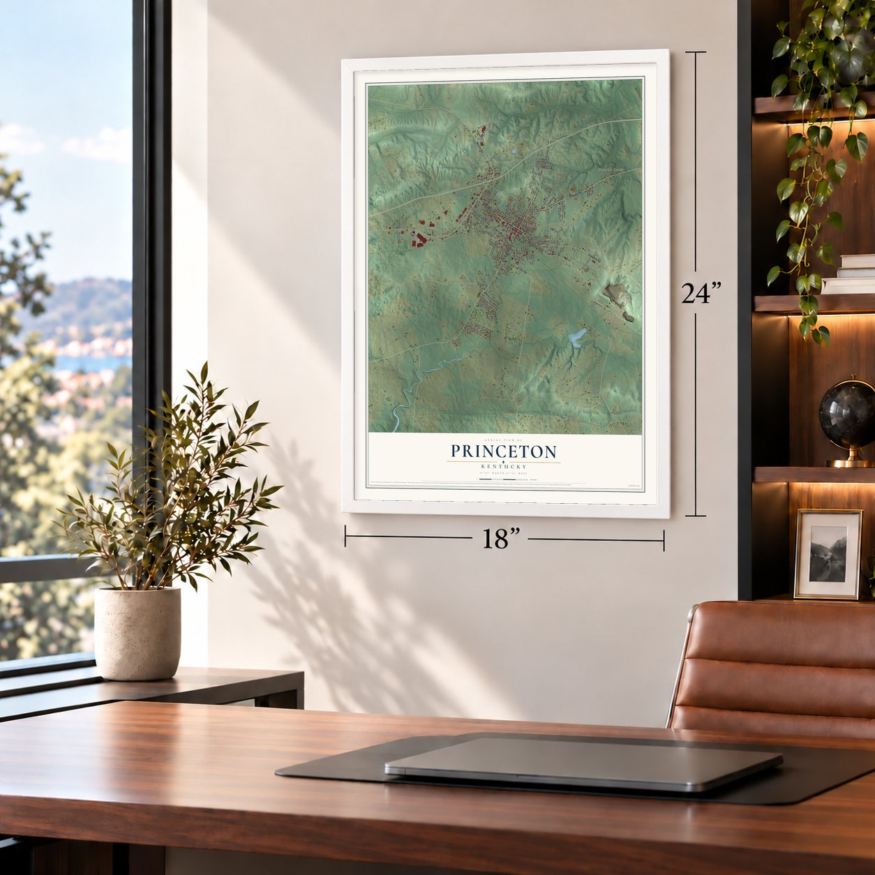
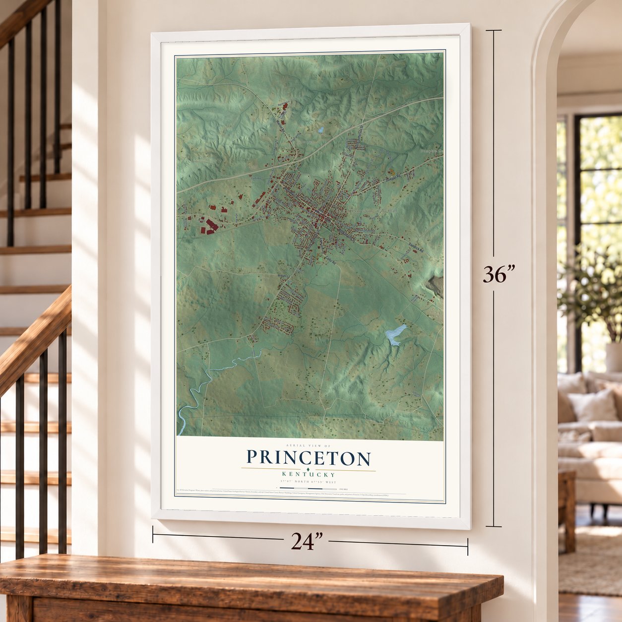
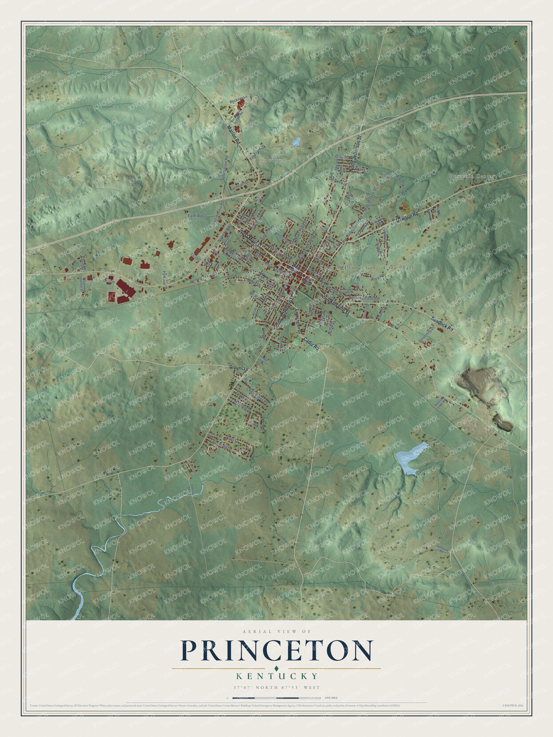
Explore Princeton, Kentucky from a whole new perspective. Created using aerial imagery and detailed geographic data, this map captures Princeton building by building, with labeled streets, familiar landmarks, and shaded topographical relief that highlights the natural contours of the landscape.
Combining modern data with the timeless character of a vintage atlas, this map is just as interesting up close as it is beautiful on the wall. Whether you grew up in Princeton, spent memorable years there, or call it home today, this unique map is a great way to celebrate a place that means something to you. Zoom in on the preview to look for your street, and then order a print to put your memories on the wall.
Three ways to hang it
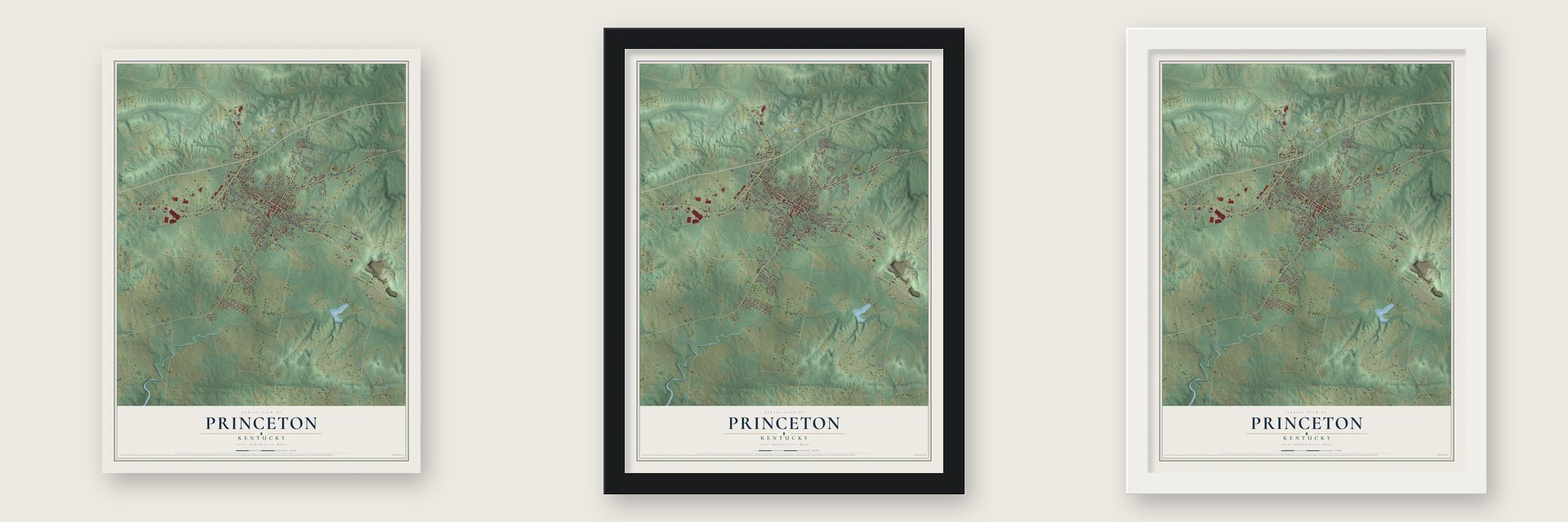
Unframed archival matte, a black wood frame or a white wood frame.
Up close
Geography Worth Displaying
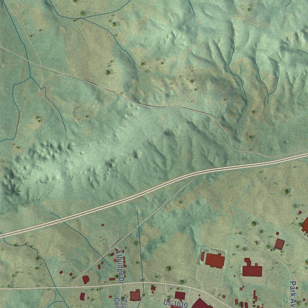
This map was created using accurate cartographic data and authoritative geographic sources, including the U.S. Geological Survey and the Census Bureau. The map brings together terrain, waterways, roads, and building detail. The majority of the streets are labeled, houses are accurately depicted, and the topography is derived from government sources. Combining local data with carefully composed color and shading leads to this beautifully detailed Princeton artwork for your wall.
Rather than simply showing street outlines, we’ve included as many of the street names as we could reasonably fit on the map while keeping their names legible. Zoom in on the high resolution preview to see exactly what’s on the map. We truly set out to create a statement piece for anyone who loves Princeton. So whether it’s for you, or a gift for someone you love, we hope this map of Princeton brings back fond memories.
Read the story behind this map of Princeton, Kentucky from 2026.

Find your street
Names on the Princeton map
Every name below is printed on this map. Look for your street, your school, the park where you played, or the pond down the road.
Places and landmarks3
- City of Princeton - City Hall
- Pumpkin Center
- Crowtown
Streets and roads105
- Cadiz Road
- North Jefferson Street
- West Main Street
- Dawson Road
- Hopkinsville Street
- South Jefferson Street
- Marion Road
- Sandlick Road
- West Washington Street
- East Market Street
- West Green Street
- Dogwood Lane
- Holly Lane
- Old Madisonville Road
- White Street
- Varmint Trace Road
- North Plum Street
- Linton Way
- Skyline Drive
- Madisonville Street
- Jeff Watson Road
- Maple Street
- Cadiz Street
- Old Fredonia Road
- Baker Hill Road
- South Seminary Street
- North Highland Avenue
- West Locust Street
- Muirfield Drive
- Troon Drive
Show all 105 streets
- Baldwin Avenue
- North Seminary Street
- Beckner Lane
- Cedar Creek Road
- Vivian Drive
- University Drive
- Faith Avenue
- Park Avenue
- Centennial Drive
- Northfield Drive
- Cherry Street
- Bell Street
- Alley 16
- Center Street
- Lakeview Drive
- Robin Road
- Hillview Drive
- Cecile Drive
- Ppool Drive
- Dowell Drive
- Manor Drive
- McLin Street
- Baker Street
- West Market Street
- East Legion Drive
- Grooms Lane
- Vocational School Road
- Turnbury Drive
- Cs-1010
- Noble Avenue
- East Locust Street
- Traylor Street
- Eagon Street
- Airport Road
- Training Center Drive
- Kentucky Avenue
- Cardinal Lane
- Jones Road
- Railroad Lake Road
- Masonic Drive
- Ethridge Drive
- Grace Street
- Oak Drive
- Violet Loop
- Fontaine Road
- Ratliff Street
- Jacob Drive
- Vine Street
- Alley 3
- Willow Lane
- Cs-1007
- Murray Drive
- Nancy Drive
- Jill Drive
- Oak Street
- Cox Street
- East Main Street
- Madisonville Road
- South Darby Street
- Apache Drive
- Dollar Street
- Fortner Drive
- Cantrell Drive
- Meadowbrook Drive
- East Green Street
- West Young Street
- Stevens Avenue
- Harvey Lane
- Hayes Avenue
- Country Club Lane
- Depot Street
- Magnolia Drive
- Saint Paul School Drive
- Parkway Drive
- Wood Street
Names are listed as they appear on the printed map. Zoom into the product photos to find them.
About Princeton, Kentucky
Princeton is a city of 6,270 people and the seat of Caldwell County. The settlement where Eddy Creek begins took the name Eddy Grove at first, for the large whirling spring that fed the creek. William Prince of Virginia received 1,700 acres here for his Revolutionary War service. In 1799 he settled on the land and built Shandy Hall, a brick house that doubled as a tavern. In 1817 his heirs and landowner Thomas Frazier offered 40 acres for a town if the new county moved its courthouse there from Eddyville. The court agreed that July and named the place Princetown, later shortened to Princeton.
Work on Princeton College started in 1860, but the Civil War halted it. In 1861 Confederate troops camped on the campus and turned one building into a hospital. After they pulled back early in 1862, Union soldiers held the town for the rest of the war. In December 1864, Kentucky cavalry under Confederate Gen. Hylan B. Lyon rode in and burned the courthouse, which the Union had been using as a garrison. Railroads later made Princeton a junction of the Illinois Central and the Louisville and Nashville lines.
- The Cherokee at Big SpringDuring the Cherokee removal, the plan was to send the Cherokee west by steamboat. A hard drought in the summer of 1838 left the rivers too low, so thousands of people traveled overland with horses, wagons and livestock, and water meant survival. Eleven of the 13 Ross detachments passed through Princeton toward the Ohio River and stopped at Big Spring, the cave spring downtown where the town's founder had built his home. The city owns Big Spring Park today.
- The Night Riders' raid, 1906Dark leaf tobacco made Caldwell and Christian counties a major growing area, but James B. Duke's hold on the tobacco market pushed many farmers into debt. A vigilante band called the Night Riders fought back by destroying crops, burning warehouses and threatening anyone who dealt with Duke's company. On December 1, 1906, they rode into Princeton and burned what were the largest tobacco factories anywhere. The downtown Black Patch Festival, held each September, takes its name from that tobacco.
- Adsmore on Jefferson StreetAdsmore, on North Jefferson Street, is a living history museum showing the Smith-Garrett family's life near the close of the Golden Age. Tours follow John Parker Smith, Nancy Bond Kevil Smith and their five children through a house dressed for the seasons, from Christmas and Easter to weddings and the Black Patch War. The name is thought to come from additions built onto it over 150 years. It joined the National Register in 1973.
- A farm the county boughtCaldwell County's citizens raised money by public subscription to buy 400 acres for the University of Kentucky. The farm was dedicated on September 7, 1925, to "scientific agriculture and a better Kentucky," with a staff of one. Its first job was rebuilding worn-out cropland and stopping erosion on steep ground. It later added livestock herds and research on pastures, grain, tobacco, fruit and vegetables, and a botanical garden is part of the center today.
- Country ham since 1917H.C. Newsom opened Newsom's on January 1, 1917, and his granddaughter Nancy Newsom Mahaffey, known as "the Ham Lady," runs it today. Her aged country ham was on the menu at the Kentucky Ball for the 2008 Presidential Inauguration. In May 2009 it was the only American ham invited to Spain's 5th World Congress of Dry Cured Hams, held in Aracena. A two-year-old Newsom's ham went on lasting display in the Jamon Museum there.
Keep exploring Kentucky
Princeton is one of 659 Kentucky towns we've mapped. Every dot on the map is a print of its own.
The search covers every state, Kentucky first.
Near Princeton
Order 2 or more town maps and save 10%. Shown in the size and finish you picked above, so they hang as a set.
- Eddyville 12" x 18" / Archival Matte Print $39.99
- Dawson Springs 12" x 18" / Archival Matte Print $39.99
- Fredonia 12" x 18" / Archival Matte Print $39.99


More maps nearby: Kuttawa, Cerulean, Crayne, Cadiz and Marion.
The art of mapping a place
How This Map Was Made
Real places. Remarkable detail. Discover the layers that turn geographic data into a map of home.

The view from above
Aerial imagery reveals the character of the land: woodland, open fields, and the patterns of a place.

The shape of the land
Elevation data brings hills, valleys, and subtle changes in the landscape into view.

The details of home
Roads, waterways, and building footprints come together to make the map feel unmistakably local.

Geography becomes art
Considered color, shading, and typography bring the layers together in a map made for your wall.


Process illustrated with Mendon, Massachusetts. Aerial imagery: USDA NAIP. Terrain: USGS 3D Elevation Program. Map details and finished artwork: KNOWOL.
The Details
About This Print
Choose an archival matte print, or a black or white Ayous wood frame. The archival matte print is unframed.
Select your size and finish above to see the matching product image and price.
Materials & Craftsmanship
A contemporary map with the character of a classic atlas, printed on archival matte paper. Optional frames are made from Ayous wood.
Your printed map does not include the watermark shown in the full-map preview.
Shipping & Delivery
Free shipping within the United States. Every print is made to order in the USA.
Buying a gift? Add a note in your cart and we'll include it. We never put prices in the package.
Prints ship within 2 to 3 business days. Allow 7 to 10 days total from ordering for delivery. Timing may vary during holidays or periods of high order volume.
Read our shipping policy.
Returns and damaged prints
Each print is made to order. Change-of-mind refunds are not available after production.
If your print arrives damaged, misprinted or incorrect, contact support@knowol.com within 30 days of receiving it. Include your order number, photos and a description of the issue.
Read our full refund and replacement policy. For questions about your order, email support@knowol.com.