Search for another town





Free U.S. delivery 7 to 10 days after you order
Princeton, New Jersey Map Art
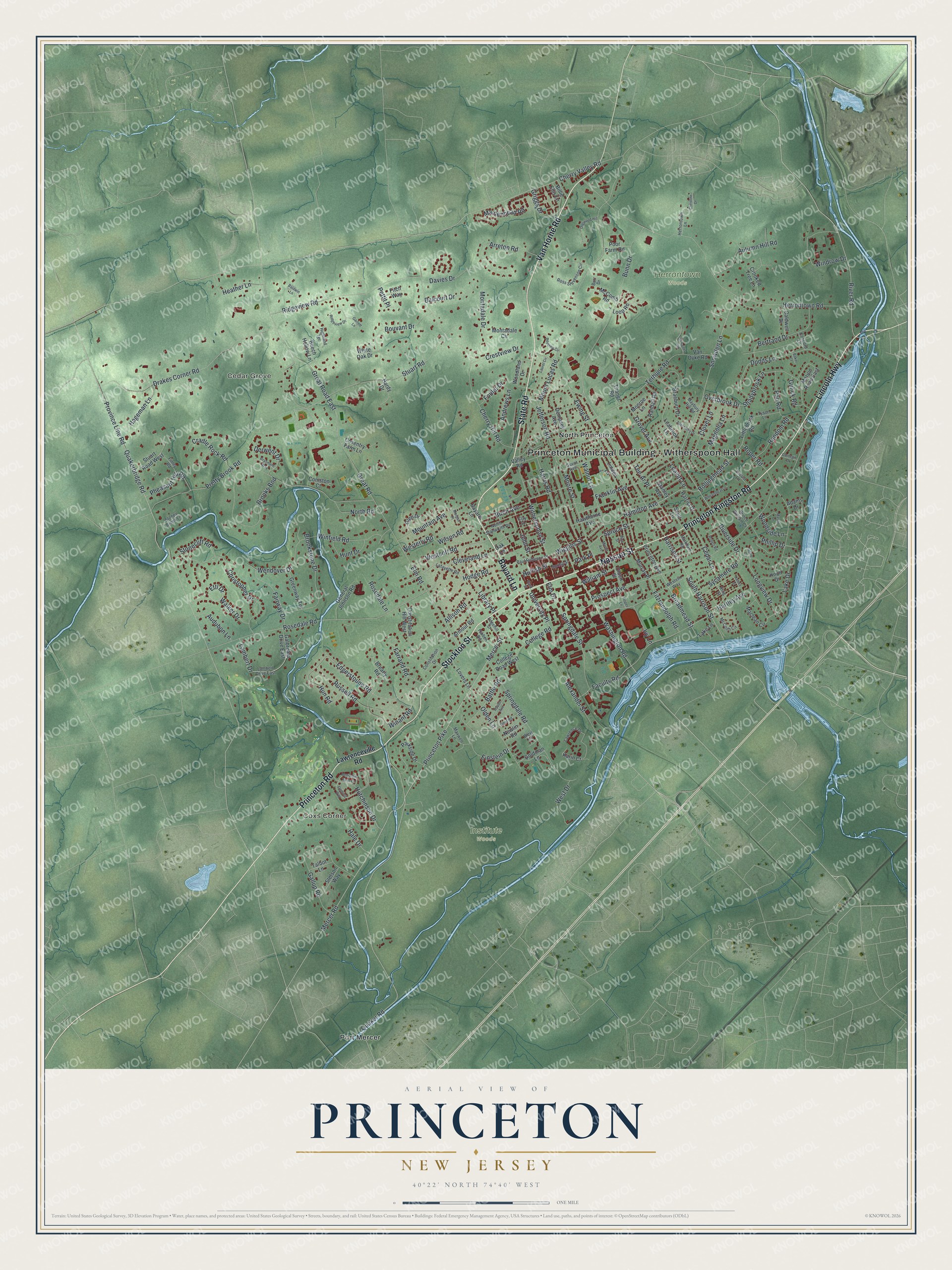
A new map of Princeton, New Jersey, made in 2026 and printed to order on thick archival matte paper.
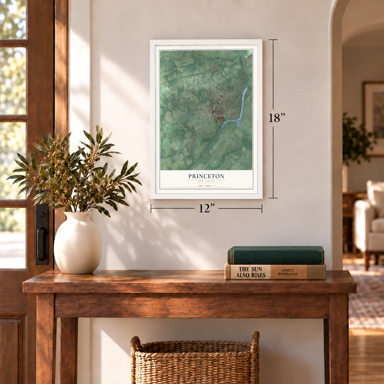
12" x 18" Archival Matte Print
A Map of Home. A Work of Art.
Bring a piece of Princeton home. Whether it’s where you grew up, your current home, or simply a moment in your life, this Princeton, New Jersey map print brings those memories to your wall. Antique-inspired styling and modern geographic detail combine to create artwork that’s beautiful from across the room, with plenty to study and explore when you get up close.
Three ways to hang it
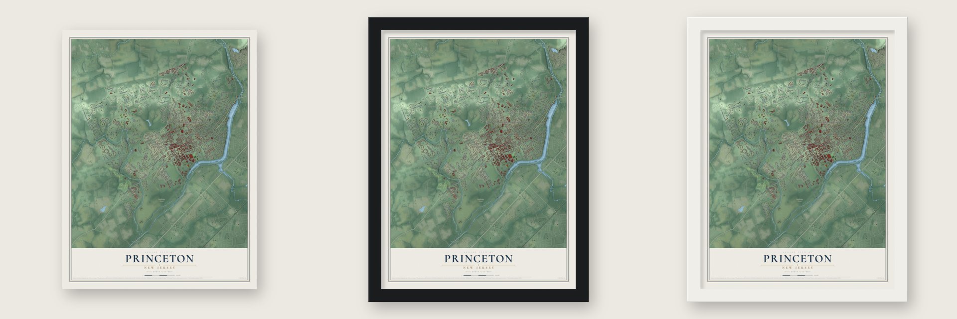
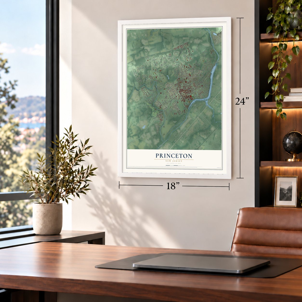
Unframed archival matte, a black wood frame or a white wood frame.
Up close
Real geography. Art worth displaying.
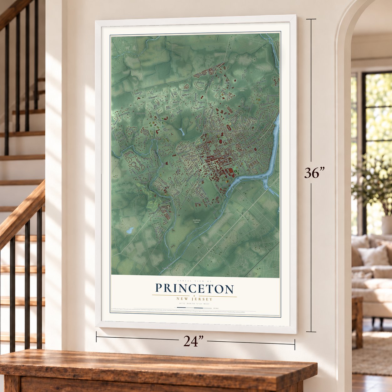
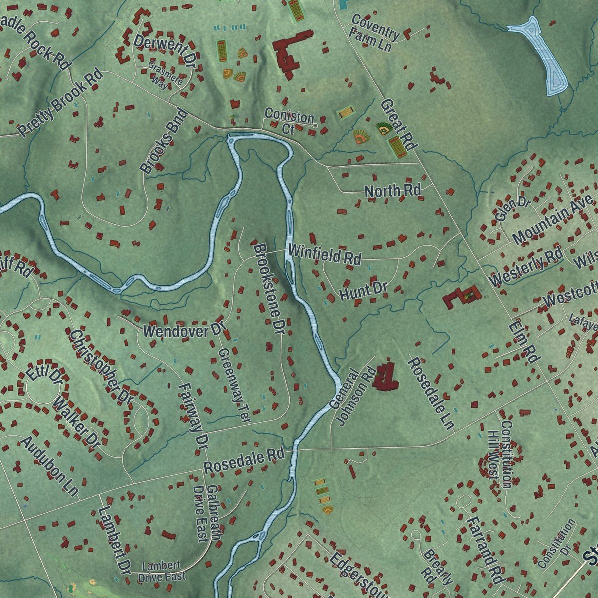
This map was created using accurate cartographic data and authoritative geographic sources, including the U.S. Geological Survey (USGS) and FEMA. The map brings together terrain, waterways, roads, and building detail. The majority of the streets are labeled, houses are accurately depicted, and the topography is derived from government sources. Combining local data with carefully composed color and shading leads to this beautifully detailed Princeton artwork for your wall.
Rather than simply showing street outlines, we’ve included as many of the street names as we could reasonably fit on the map while keeping their names legible. Zoom in on the high resolution preview to see exactly what’s on the map. We truly set out to create a statement piece for anyone who loves Princeton. So whether it’s for you, or a gift for someone you love, we hope this map of Princeton brings back fond memories.
Explore the full map of Princeton, New Jersey and read about the local places it shows.

About Princeton, New Jersey
Princeton is documented as a township in Mercer County, and the 2020 census recorded 30,681 residents there. The documented places associated with the community include Rogers, John, House, connecting its present-day identity with a site entered in the historical record.
- 30,681 peopleThe United States census recorded this population in 2020.
- Mercer CountyPrinceton is identified as a township in this New Jersey county.
- Historic placeRogers, John, House appears in the source packet among local National Register properties.
- Historic placeDrumthwacket appears in the source packet among local National Register properties.
Find your street
Names on the Princeton map
Every name below is printed on this map. Look for your street, your school, the park where you played, or the pond down the road.
Places and landmarks7
- Princeton Municipal Building - Witherspoon Hall
- Coxs Corner
- Cedar Grove
- Herrontown Woods
- Institute Woods
- North Princeton
- Port Mercer
Streets and roads241
- State Road
- Van Horne Road
- Lincoln Highway
- Nassau Street
- Stockton Street
- Bayard Lane
- Princeton Road
- Princeton Kingston Road
- Quaker Road
- Hamilton Avenue
- River Road
- Rollingmead Street
- Wiggins Street
- Snowden Lane
- South Harrison Street
- Broadmead Street
- Lambert Drive
- Lake Drive
- Princeton Pike
- Cleveland Lane
- Derwent Drive
- Harrison Street
- Cherry Valley Road
- Province Line Road
- Great Road
- Herrontown Road
- Mount Lucas Road
- Prospect Avenue
- Mercer Road
- Terhune Road
Show all 241 streets
- Pretty Brook Road
- Cherry Hill Road
- Rosedale Road
- Quakerbridge Road
- Mercer Street
- Stuart Road
- Drakes Corner Road
- Riverside Drive
- Ewing Street
- Bunn Drive
- Alexander Street
- Ridgeview Road
- Springdale Road
- Franklin Avenue
- Jefferson Road
- Bouvant Drive
- Gallup Road
- Dodds Lane
- Washington Road
- Christopher Drive
- Witherspoon Street
- Walnut Lane
- Brooks Bnd
- Faculty Road
- Walker Drive
- Elm Road
- Hartley Avenue
- Shadybrook Lane
- Moore Street
- Edgerstoune Road
- Winant Road
- Brookstone Drive
- Russell Road
- Arreton Road
- Great Road East
- John Street
- Mountain Avenue
- Library Place
- Bertrand Drive
- Windrow Drive
- Olden Lane
- Wendover Drive
- Clover Lane
- Hun Road
- Westcott Road
- Hodge Road
- Springdale Street
- Hutchinson Drive
- Winfield Road
- Grover Avenue
- Autumn Hill Road
- Ivy Lane
- Farrand Road
- Stonecliff Road
- Fairway Drive
- Einstein Drive
- Longview Drive
- University Place
- Poe Road
- Montadale Drive
- Fitzrandolph Road
- Ettl Drive
- Heather Lane
- Pheasant Hill Road
- Maidenhead Road
- Cedar Lane
- Davies Drive
- Cradle Rock Road
- Sycamore Road
- College Road
- Spruce Street
- Wilson Road
- Balcourt Drive
- Phillip Drive
- Battle Road
- Harris Road
- Andrews Lane
- Hageman Lane
- West Drive
- Birch Avenue
- Magnolia Lane
- Hunt Drive
- Random Road
- Griggs Drive
- North Road
- Westerly Road
- Crestview Drive
- Audubon Lane
- Overbrook Drive
- Gulick Road
- Woodside Lane
- Rosedale Lane
- Foulet Drive
- Roper Road
- William Street
- Elm Drive
- Leavitt Lane
- Hale Drive
- Pettit Place
- Hulfish Street
- Allison Road
- Tee-Ar Place
- Park Place
- Lawrenceville Road
- Littlebrook Road
- Princeton Avenue
- Valley Road
- Linden Lane
- Parkside Drive
- Leabrook Lane
- Constitution Hill West
- Hawthorne Avenue
- Randall Road
- Dempsey Avenue
- Braeburn Drive
- Galbreath Drive East
- General Johnson Road
- Stuart Road West
- Greenway Terrace
- Adams Drive
- Maclean Circle
- Coventry Farm Lane
- Glen Drive
- Crooked Tree Lane
- Lovers Lane
- Brearly Road
- Stetson Way
- Harriet Drive
- Murray Place
- Caldwell Drive
- Coniston Court
- Montadale Circle
- Olden Street
- Loop Road
- Knoll Drive
- Van Dyke Road
- Hardy Drive
- Marion Road East
- Newlin Road
- College Road West
- Armour Road
- Poor Farm Road
- Karin Court
- Goldman Lane
- Monroe Lane
- Woodland Drive
- Beech Hollow Lane
- Talbot Lane
- Billie Ellis Lane
- McComb Road
- White Oak Drive
- Scott Lane
- Fitch Way
- Thanet Road
- Lake Lane
- Stanley Avenue
- Oak Lane
- Paul Robeson Place
- Lambert Drive East
- Ross Stevenson Circle
- Western Way
- Lawrence Drive
- Guyot Avenue
- Lafayette Road
- McCosh Circle
- Herrontown Lane
- Highland Terrace
- Maxwell Lane
- Hibben Road
- Locust Lane
- North Stanworth Drive
- Finley Road
- Constitution Drive
- Tyson Lane
- Stoney Brook Lane
- Edgehill Street
- Prince William Court
- Markham Road
- Spring Street
- Maybury Hill Road
- Concord Lane
- Clay Street
- Burr Drive
- King Street
- Weyl Lane
- Grasmere Way
- Ridgeview Drive
- Dogwood Hill
- Abernathy Drive
- Baldwin Lane
- Fleming Way
- Mason Drive
- Robert Road
- All Saints Road
- Haslet Avenue
- Redding Circle
- Ober Road
- Benjamin Rush Lane
- Wheatsheaf Lane
- Christine Drive
- Pine Street
- Moran Avenue
- Roper Lane
- Garrett Lane
- Carnegie Drive
- Laurel Circle
- Bank Street
- Morgan Place
- Halsey Street
- Howe Circle
- Baker Court
Names are listed as they appear on the printed map. Zoom into the product photos to find them.
The art of mapping a place
How This Map Was Made
Real places. Remarkable detail. Discover the layers that turn geographic data into a map of home.

The view from above
Aerial imagery reveals the character of the land: woodland, open fields, and the patterns of a place.

The shape of the land
Elevation data brings hills, valleys, and subtle changes in the landscape into view.

The details of home
Roads, waterways, and building footprints come together to make the map feel unmistakably local.

Geography becomes art
Considered color, shading, and typography bring the layers together in a map made for your wall.


Process illustrated with Mendon, Massachusetts. Aerial imagery: USDA NAIP. Terrain: USGS 3D Elevation Program. Map details and finished artwork: KNOWOL.
The Details
About This Print
Choose an archival matte print, or a black or white Ayous wood frame. The archival matte print is unframed.
Select your size and finish above to see the matching product image and price.
Materials & Craftsmanship
A contemporary map with the character of a classic atlas, printed on archival matte paper. Optional frames are made from Ayous wood.
Your printed map does not include the watermark shown in the full-map preview.
Shipping & Delivery
Free shipping within the United States. Every print is made to order in the USA.
Buying a gift? Add a note in your cart and we'll include it. We never put prices in the package.
Prints ship within 2 to 3 business days. Allow 7 to 10 days total from ordering for delivery. Timing may vary during holidays or periods of high order volume.
Read our shipping policy.
Returns and damaged prints
Each print is made to order. Change-of-mind refunds are not available after production.
If your print arrives damaged, misprinted or incorrect, contact support@knowol.com within 30 days of receiving it. Include your order number, photos and a description of the issue.
Read our full refund and replacement policy. For questions about your order, email support@knowol.com.
Find your town
Looking for another city?
Find a map of home in our New Jersey collection.
Nearby
Maps of towns near Princeton
Know someone from one of these towns? Their map makes a great gift.