
Search for another town





Free U.S. delivery 7 to 10 days after you order
Quincy, Florida Map Art
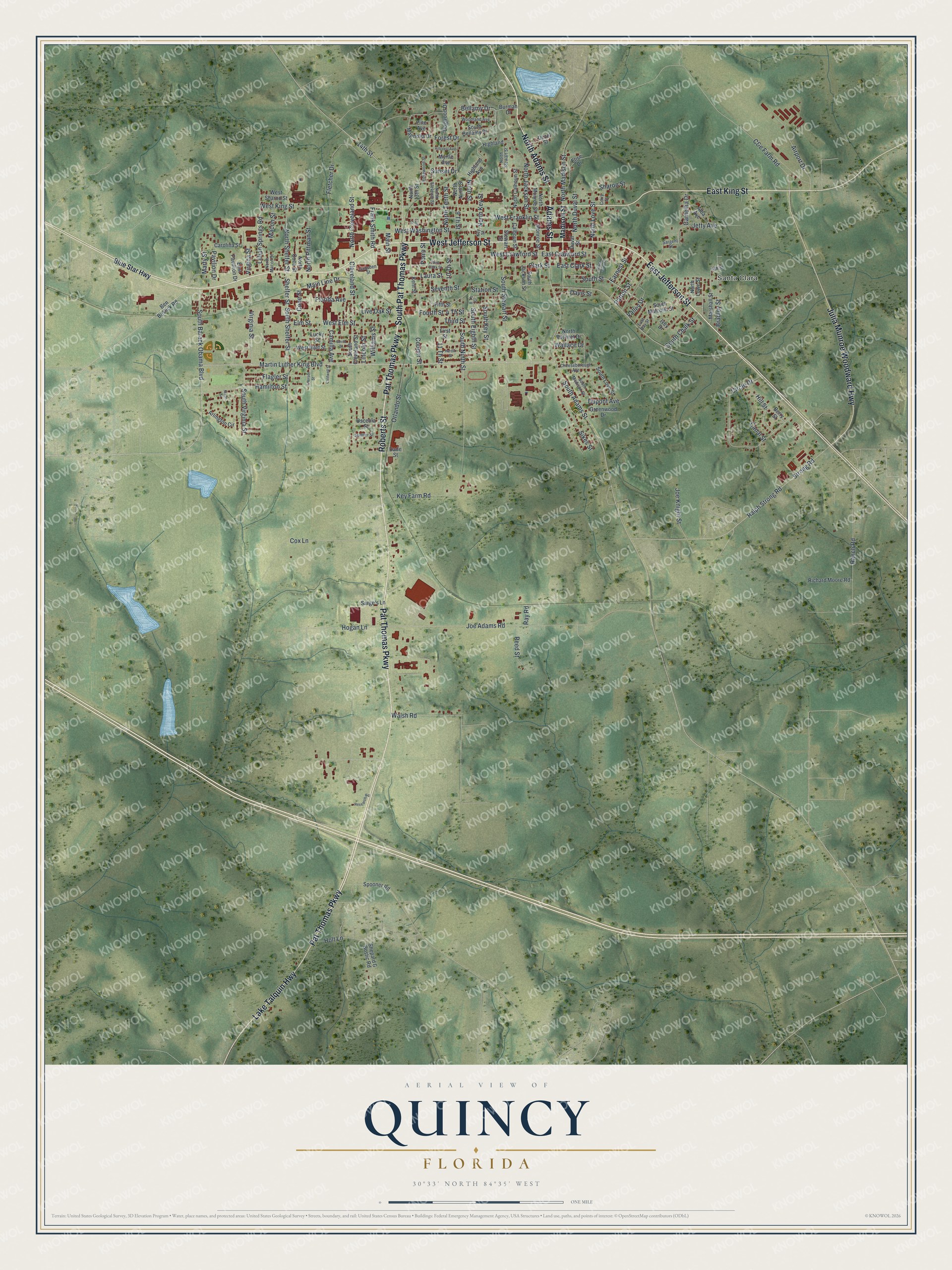
A new map of Quincy, Florida, made in 2026 and printed to order on thick archival matte paper.
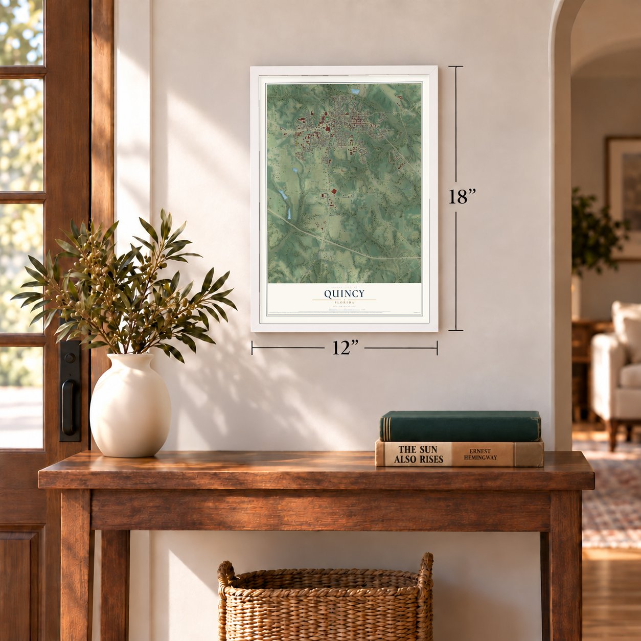
12" x 18" Archival Matte Print
A Map of Home. A Work of Art.
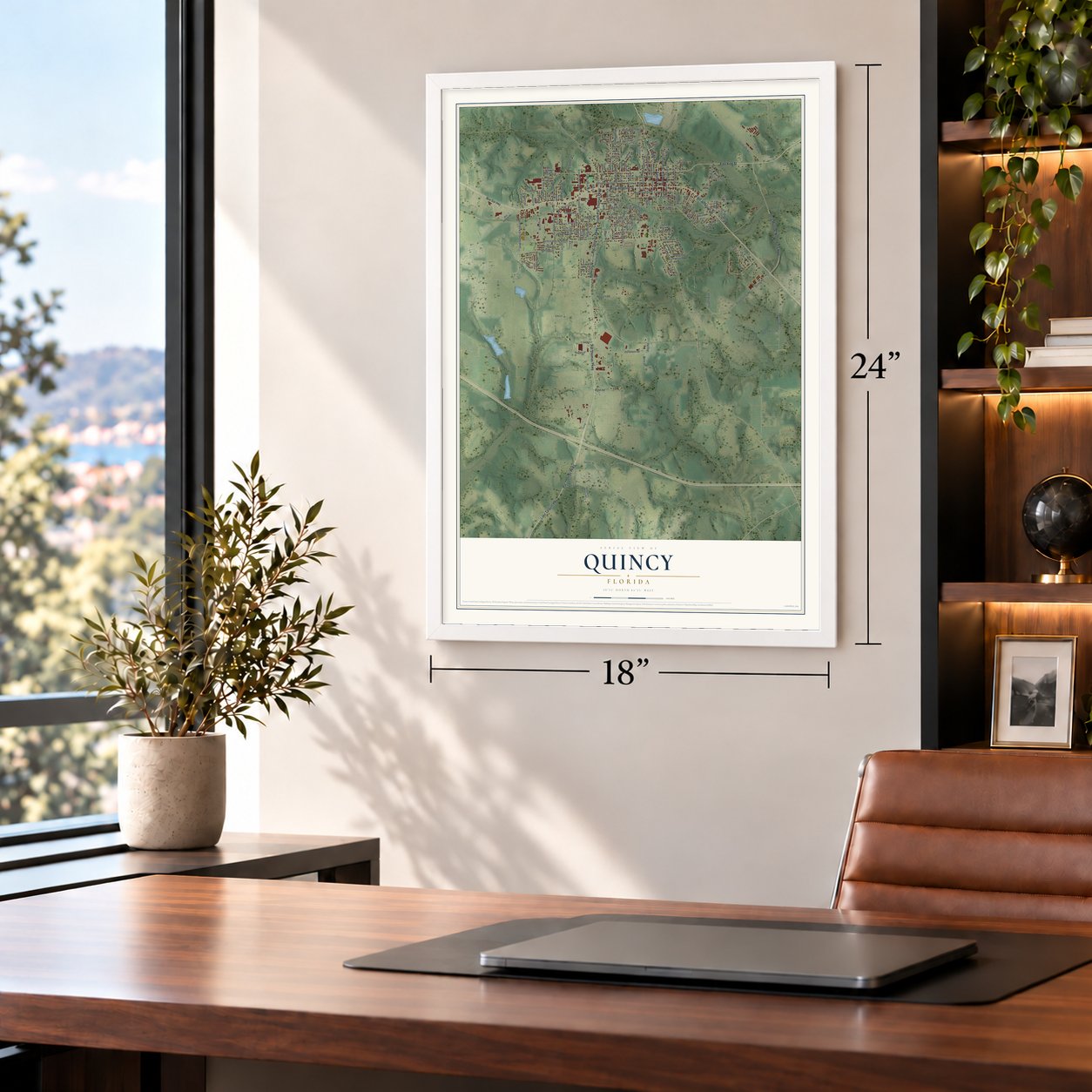
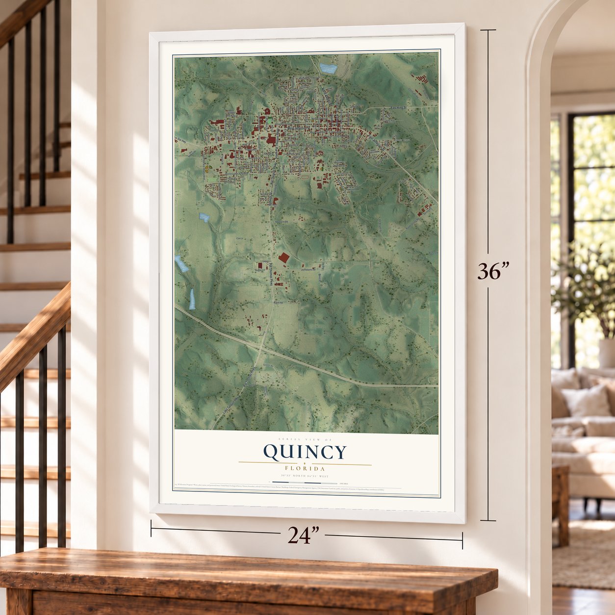
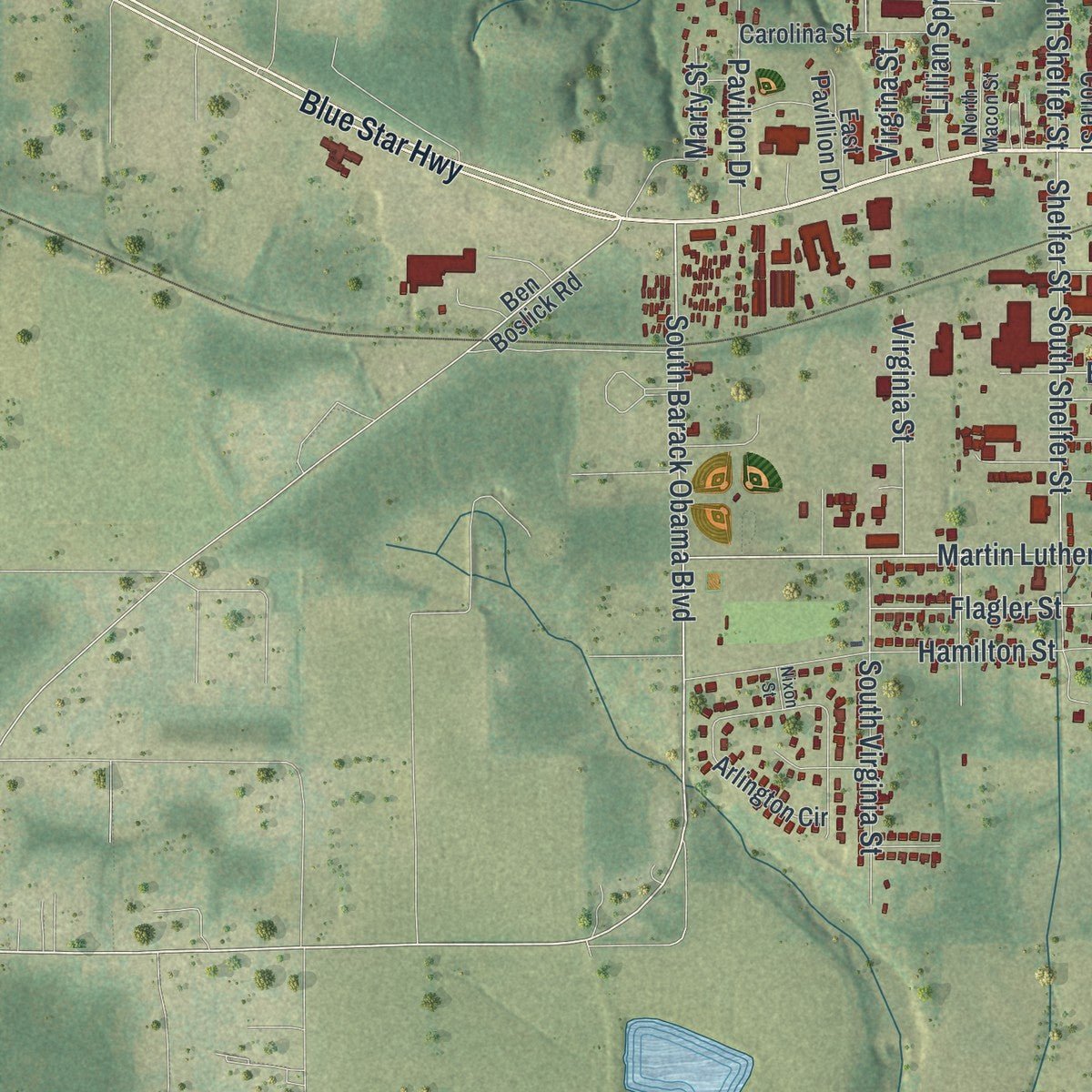
Explore Quincy, Florida from a whole new perspective. Created using aerial imagery and detailed geographic data, this map captures Quincy building by building, with labeled streets, familiar landmarks, and shaded topographical relief that highlights the natural contours of the landscape.
Combining modern data with the timeless character of a vintage atlas, this map is just as interesting up close as it is beautiful on the wall. Whether you grew up in Quincy, spent memorable years there, or call it home today, this unique map is a great way to celebrate a place that means something to you. Zoom in on the preview to look for your street, and then order a print to put your memories on the wall.
Three ways to hang it
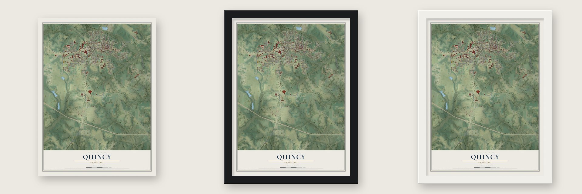
Unframed archival matte, a black wood frame or a white wood frame.
Up close
Geography Worth Displaying
This map was created using accurate cartographic data and authoritative geographic sources, including the U.S. Geological Survey (USGS) and FEMA. The map brings together terrain, waterways, roads, and building detail. The majority of the streets are labeled, houses are accurately depicted, and the topography is derived from government sources. Combining local data with carefully composed color and shading leads to this beautifully detailed Quincy artwork for your wall.
Rather than simply showing street outlines, we’ve included as many of the street names as we could reasonably fit on the map while keeping their names legible. Zoom in on the high resolution preview to see exactly what’s on the map. We truly set out to create a statement piece for anyone who loves Quincy. So whether it’s for you, or a gift for someone you love, we hope this map of Quincy brings back fond memories.
Explore the full map of Quincy, Florida and read about the local places it shows.
About Quincy, Florida
Quincy is a city of 7,970 people and the county seat of Gadsden County, 25 miles northwest of Tallahassee. It was established in 1828 and named for John Quincy Adams. By 1840 it had a male academy and a female academy, and Joshua Knowles printed the Quincy Sentinel here from 1839 until 1841, when the paper moved to Tallahassee and became the Florida Sentinel.
In 1829 John Smith came to the county by covered wagon with his family and four related families. The community already had a John Smith, so neighbors called him John "Virginia" Smith. He planted Cuban seed beside his own chewing and pipe tobacco, and over several years the two crossed. Seed saved from the mixed plants gave a thin, pale leaf called "Florida Wrapper." After the Civil War, growers learned that light, silky leaves sold best, so they shaded their fields, first with wood slats, then cheesecloth, and from 1950 with treated yellow cloth. Cigar wrapper tobacco ruled county life until demand dropped around 1970, and the last crop came in 1977.
- Coca-Cola shares at $40Mark Welch "Mr. Pat" Munroe, a Quincy banker, held stock in three banks that put 500,000 new shares of Coca-Cola on the market. He and others pressed widows and farmers to buy at $40 a share. As the stock split again and again, as many as 67 investors and county residents grew rich, and people said the town was full of millionaires.
- Quincy in the Civil WarOn June 27, 1860, the Constitutional Union Party, one of Florida's leading voices against secession, held its state convention in Quincy. Once the state left the Union anyway, former mayor William Tennent Stockton raised a cavalry company, the Gadsden Dragoons. Major Pleasant W. White of Quincy took overall command of the five districts that gathered beef, salt and other supplies from Florida for the Confederacy.
- The Dixie family's fightIn the 1920s A. I. Dixie and other Black residents of Quincy kept trying to organize, vote and protest harsh labor conditions, and white attackers answered with violence. Dixie was flogged more than once. He kept going, and in 1964 he opened his home to student activists sent by the Congress of Racial Equality. That year his daughter Linda led a sit-in, while Jewell Dixie ran for Gadsden County Sheriff as the first African American candidate for the office.
- The Leaf Theater, 1949The Leaf Theater opened in 1949 with Roy Rogers as host, and its name honored the shade tobacco that paid the town's bills. It shut down in 1980. In 1983 it was bought and donated to the Quincy Music Theatre, which restored it with help from relatives of the families who had first bought Coca-Cola stock.
- 145 buildings, listed in 1978The Quincy Historic District joined the National Register on November 9, 1978, with 145 historic buildings between Sharon, Clark, Stewart and Corry Streets. Inside it, the Gadsden Arts Center now fills the old Bell and Bates hardware store, built in 1912. In 1996 Quincy was named an All American City.
Find your street
Names on the Quincy map
Every name below is printed on this map. Look for your street, your school, the park where you played, or the pond down the road.
Places and landmarks1
- Santa Clara
Streets and roads177
- Pat Thomas Parkway
- West Jefferson Street
- North Adams Street
- Adams Street
- East Jefferson Street
- South Pat Thomas Parkway
- Lake Talquin Highway
- East King Street
- Roberts Street
- Julia Munroe Woodward Highway
- West Crawford Street
- South Barack Obama Boulevard
- Martin Luther King Boulevard
- Forest Drive
- 14th Street
- Circle Drive
- West Elm Street
- 9 Th Street
- North Madison Street
- 11 Th Street
- North Key Street
- Cone Street
- South Shelfer Street
- Lincoln Street
- Elm Street
- South Adams Street
- 10 Th Street
- Main Line Drive
- Camellia Drive
- South Key Street
Show all 177 streets
- South Eighth Street
- North Love Street
- West King Street
- East Crawford Street
- West Washington Street
- Key Farm Road
- Walsh Road
- West Franklin Street
- Fletcher Drive
- South Stewart Street
- Joe Adams Road
- South Virginia Street
- Fourth Street
- Ralph Strong Road
- Strong Road
- Bellamy Drive
- South Street
- Hamilton Street
- Cleveland Street
- Live Oak Street
- South Ninth Street
- Florida Avenue
- Shelfer Street
- Orlando Street
- North Shelfer Street
- Cooper Street
- Dupont Avenue
- Airport Drive
- Lillian Springs Road
- Bradley Street
- Virginia Street
- North Jackson Street
- C&e Farm Road
- 4 Th Street
- North Cleveland Street
- Flagler Street
- Station Street
- North Pittman Street
- Third Street
- Ranch Road
- Williams Street
- Sikes Street
- Canal Street
- Camilla Avenue
- Hill Street
- Laura Street
- North Duval Street
- Seventh Street
- Holt Lane
- Patton Street
- Joe Knight Street
- Pavilion Drive
- Reed Street
- North Tenth Street
- Hogan Lane
- South Chalk Street
- Virgina Street
- Frank Smith Road
- Main Street
- Macon Street
- Jetty Avenue
- East Clark Street
- Sunset Drive
- Valley Drive
- Davis Street
- Ninth Street
- Earnest Street
- Clark Street
- Wallace Drive
- Sharon Street
- Marty Street
- Porro Street
- Cox Lane
- Ray Road
- Madison Street
- Blue Star Highway
- Highland Avenue
- Ben Boslick Road
- Magnolia Drive
- Highland
- North Ninth Street
- Elise Drive
- West Sharon Street
- North Lowe Street
- South Cleveland Street
- Arlington Circle
- South Love Street
- North Calhoun Street
- North Monroe Street
- South Bellamy Drive
- Marshall Street
- Dogwood Drive
- South Jackson Street
- Monroe Street
- Carolina Street
- Richard Moore Road
- Kent Street
- Fifth Street
- Lucky Street
- South Malcolm Street
- Greenwood Drive
- West Inlet Street
- Calhoun Street
- Shepard & Bostic Road
- Alba Avenue
- North Betlinet Drive
- North Cone Street
- Dade Street
- Osceola Street
- East Pavillion Drive
- Spooner Road
- Sarge's Lane
- North 13th Street
- Duval Street
- Berry Street
- Stewart Street
- Dezel Street
- Myrtle Avenue
- Ivey Drive
- Burmah Drive
- Pine Avenue
- First Street
- North Eleventh Street
- Sargent Street
- 8 Th Street
- South Madison Street
- North Stewart Street
- Cheeseborough Avenue
- Woodland Avenue
- Key Street
- Sumter Street
- Rosewood Street
- Gadsden Street
- North Macon Street
- Corry Street
- East Bay Street
- Yah Street
- Frierson Street
- West Clark Street
- Hardin Street
- Smith Street
- Caldwell Street
- Research Road
- Hillcrest Avenue
- South Corry Street
- 13th Street
- Nixon Street
Names are listed as they appear on the printed map. Zoom into the product photos to find them.
The art of mapping a place
How This Map Was Made
Real places. Remarkable detail. Discover the layers that turn geographic data into a map of home.

The view from above
Aerial imagery reveals the character of the land: woodland, open fields, and the patterns of a place.

The shape of the land
Elevation data brings hills, valleys, and subtle changes in the landscape into view.

The details of home
Roads, waterways, and building footprints come together to make the map feel unmistakably local.

Geography becomes art
Considered color, shading, and typography bring the layers together in a map made for your wall.


Process illustrated with Mendon, Massachusetts. Aerial imagery: USDA NAIP. Terrain: USGS 3D Elevation Program. Map details and finished artwork: KNOWOL.
The Details
About This Print
Choose an archival matte print, or a black or white Ayous wood frame. The archival matte print is unframed.
Select your size and finish above to see the matching product image and price.
Materials & Craftsmanship
A contemporary map with the character of a classic atlas, printed on archival matte paper. Optional frames are made from Ayous wood.
Your printed map does not include the watermark shown in the full-map preview.
Shipping & Delivery
Free shipping within the United States. Every print is made to order in the USA.
Buying a gift? Add a note in your cart and we'll include it. We never put prices in the package.
Prints ship within 2 to 3 business days. Allow 7 to 10 days total from ordering for delivery. Timing may vary during holidays or periods of high order volume.
Read our shipping policy.
Returns and damaged prints
Each print is made to order. Change-of-mind refunds are not available after production.
If your print arrives damaged, misprinted or incorrect, contact support@knowol.com within 30 days of receiving it. Include your order number, photos and a description of the issue.
Read our full refund and replacement policy. For questions about your order, email support@knowol.com.
Find your town
Looking for another city?
Find a map of home in our Florida collection, or any town in the country.
Nearby
Maps of towns near Quincy
Know someone from one of these towns? Their map makes a great gift.
 Gretna
, Florida
From $39.99See the map
 Greensboro
, Florida
From $39.99See the map
 Midway
, Florida
From $39.99See the map
More maps nearby: Fort Braden, Havana, Chattahoochee, Hosford and Tallahassee.