
Search for another town




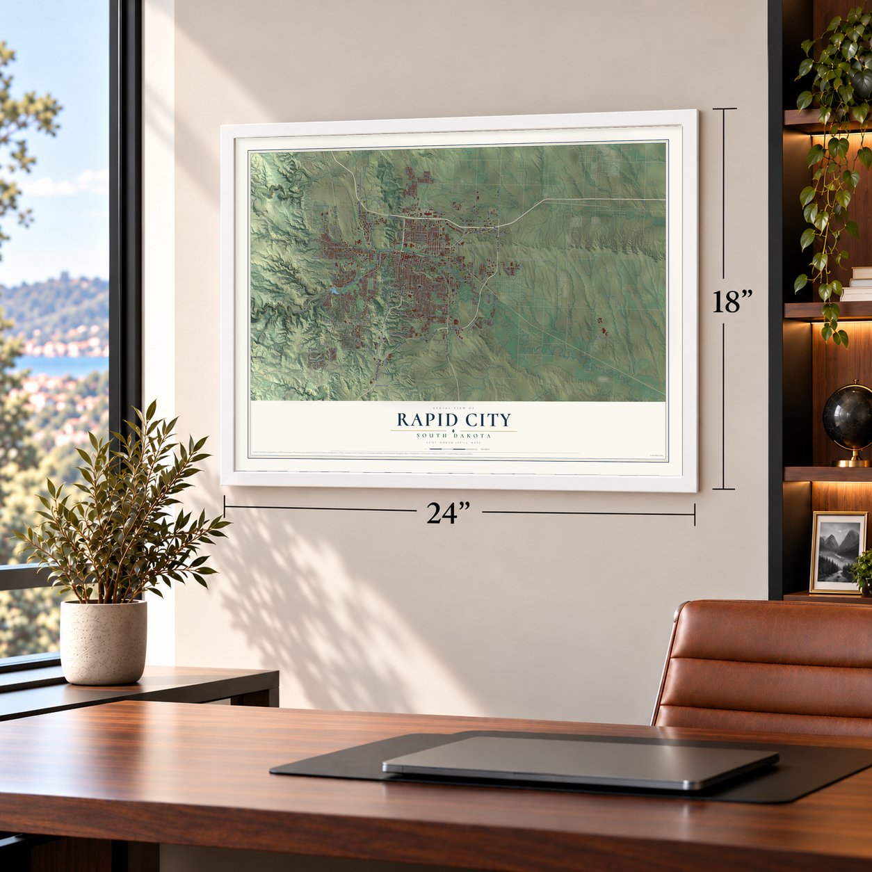
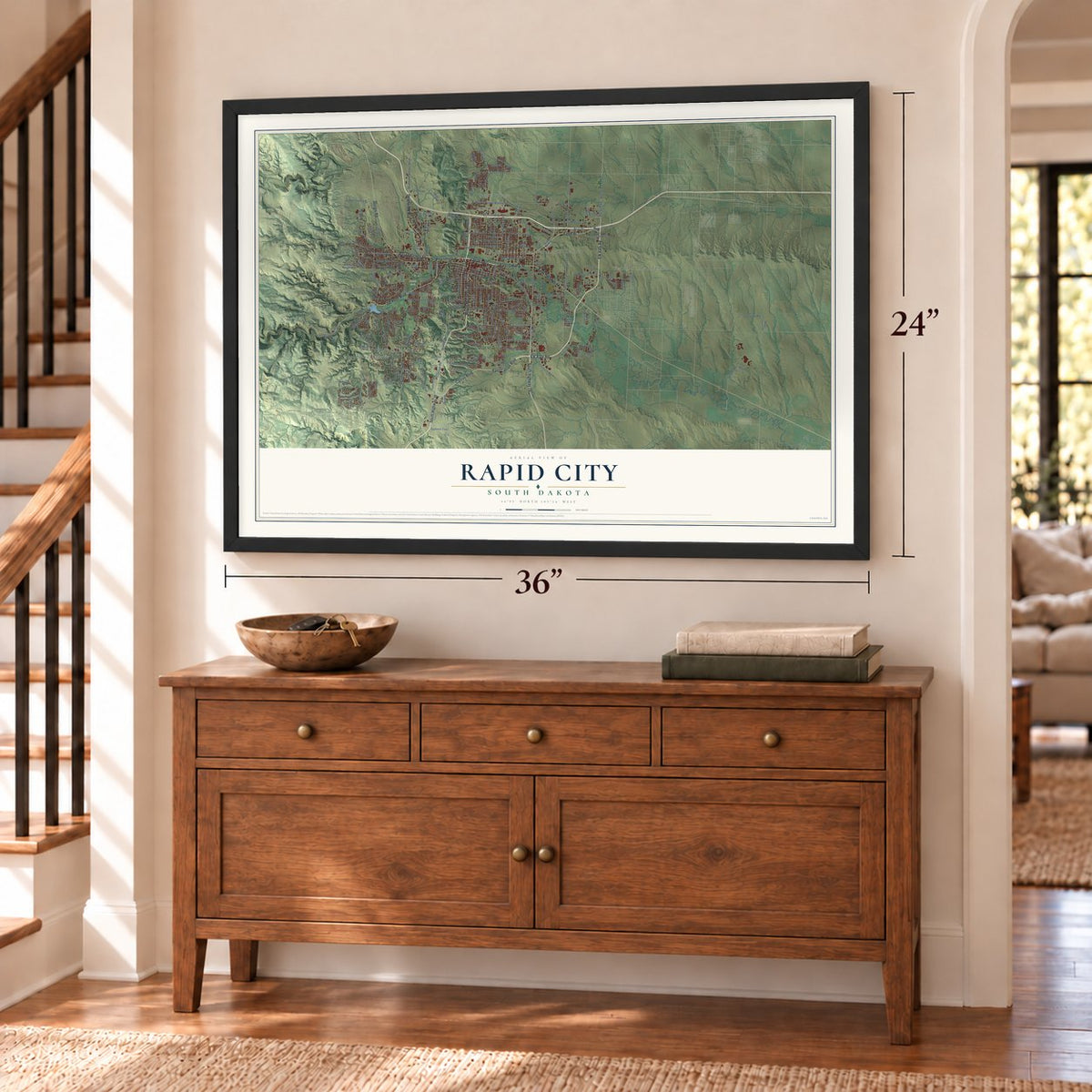
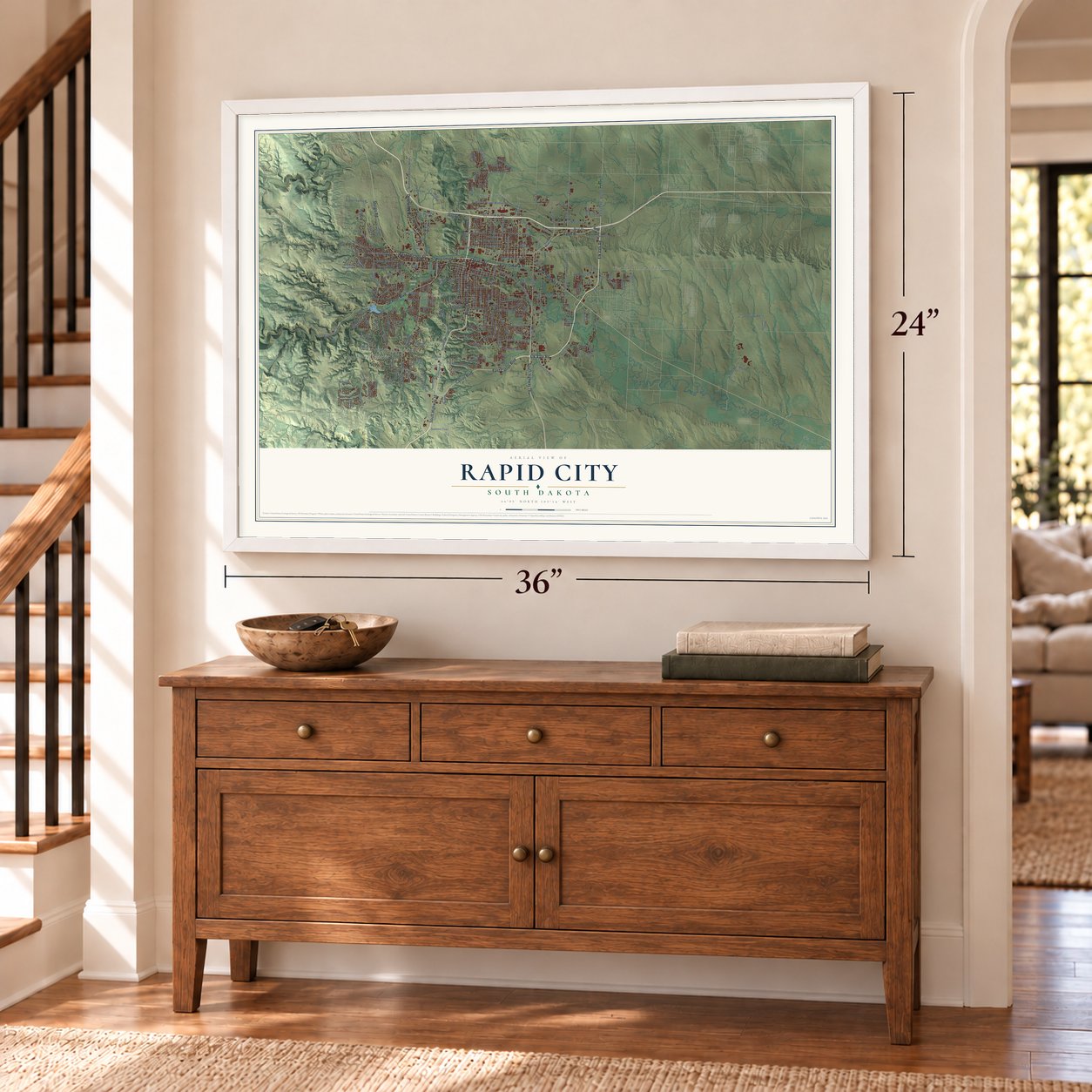

Free U.S. delivery 7 to 10 days after you order
Rapid City, South Dakota Map Art
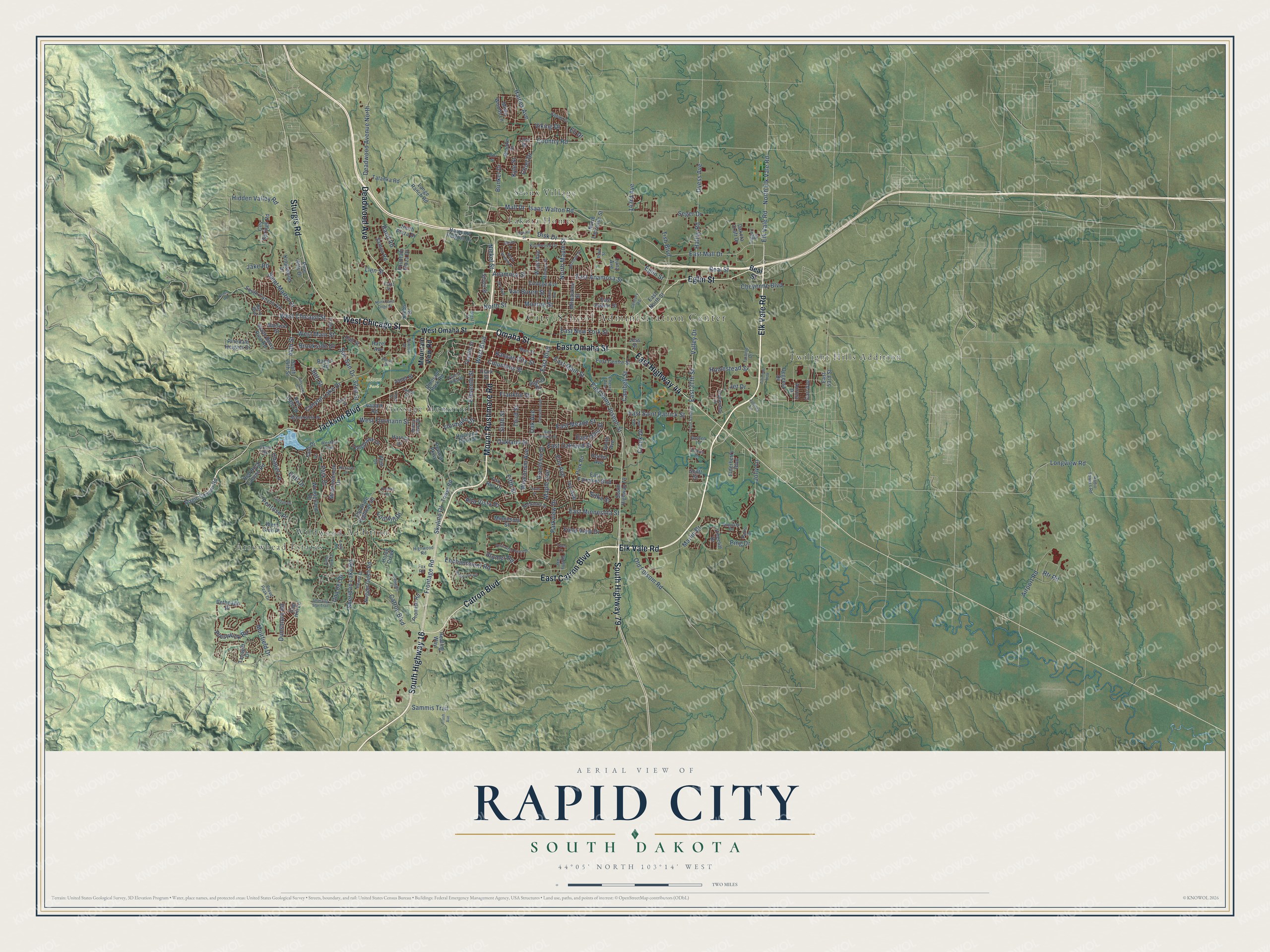
A new map of Rapid City, South Dakota, made in 2026 and printed to order on thick archival matte paper.
12" x 18" Archival Matte Print
A Map of Home. A Work of Art.
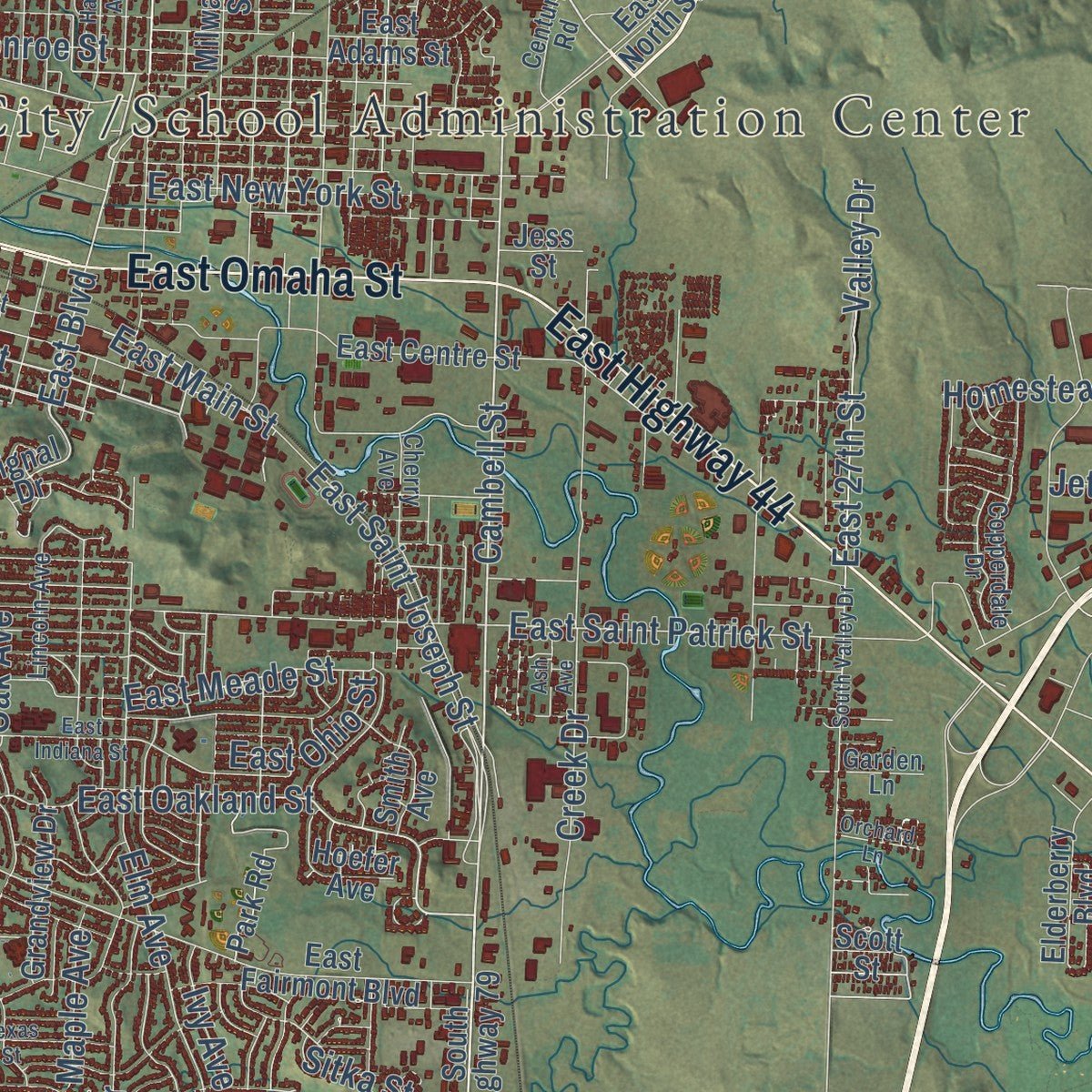
Explore Rapid City, South Dakota from a whole new perspective. Created using aerial imagery and detailed geographic data, this map captures Rapid City building by building, with labeled streets, familiar landmarks, and shaded topographical relief that highlights the natural contours of the landscape.
Combining modern data with the timeless character of a vintage atlas, this map is just as interesting up close as it is beautiful on the wall. Whether you grew up in Rapid City, spent memorable years there, or call it home today, this unique map is a great way to celebrate a place that means something to you. Zoom in on the preview to look for your street, and then order a print to put your memories on the wall.
Three ways to hang it
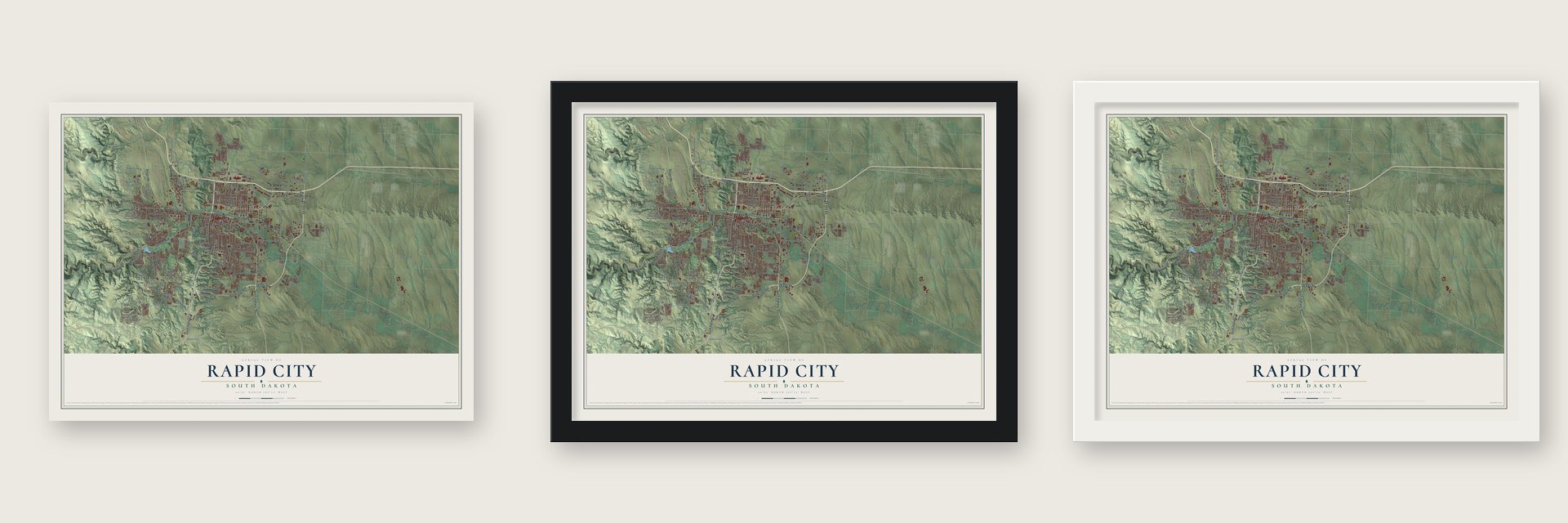
Unframed archival matte, a black wood frame or a white wood frame.
Up close
Geography Worth Displaying
This map was created using accurate cartographic data and authoritative geographic sources, including the U.S. Geological Survey and the Census Bureau. The map brings together terrain, waterways, roads, and building detail. The majority of the streets are labeled, houses are accurately depicted, and the topography is derived from government sources. Combining local data with carefully composed color and shading leads to this beautifully detailed Rapid City artwork for your wall.
Rather than simply showing street outlines, we’ve included as many of the street names as we could reasonably fit on the map while keeping their names legible. Zoom in on the high resolution preview to see exactly what’s on the map. We truly set out to create a statement piece for anyone who loves Rapid City. So whether it’s for you, or a gift for someone you love, we hope this map of Rapid City brings back fond memories.
Read the story behind this map of Rapid City, South Dakota from 2026.
About Rapid City, South Dakota
Rapid City is a city of 74,703 people and the county seat of Pennington County, on the eastern edge of the Black Hills. After Custer's Black Hills Expedition made a gold strike public in 1874, miners and settlers poured into the region. Two men, John Richard Brennan and Samuel Scott, led a small band of failed miners in February 1876 to lay out a new town. It was first called Hay Camp, and it later took its name from Rapid Creek.
The founders marked off a square mile, saved six blocks in the middle for business, and sent committees to bring in merchants who would sell supplies to miners. Railroads reached the town from the south and east in the late 1880s. By 1900 Rapid City had come through a boom and a bust and was growing into a trade center for the region.
- The flood of 1972Heavy rain fell on the eastern Black Hills on June 9, 1972, and flash floods raced down Rapid Creek; that night Canyon Lake Dam, on the city's west side, failed. The Red Cross counted 238 dead and 3,057 injured, and 1,335 homes and 5,000 cars were wrecked. Using donations and federal aid, the city cleared the creek banks and made the floodplain into parks, as its 1949 plan had hoped. Homes and businesses are still banned there.
- Coolidge's summer officeBetter roads and the automobile brought many more tourists after World War I, and in the summer of 1927 they included President Calvin Coolidge and the First Lady. Coolidge worked from a summer office in Rapid City, and it was there that he announced he would not run again in 1928.
- Dinosaur Park in 1936Dinosaur Park opened in 1936 and was finished in 1938. It was built partly to catch travelers headed for Mount Rushmore, where Gutzon Borglum had begun carving in 1927. The park is credited with starting Rapid City's growth into a major tourist town, and it joined the National Register in 1990.
- The air base doubles the townBuilt in the 1940s as a training ground for Army Air Corps crews, the Rapid City Army Air Base was later renamed Ellsworth Air Force Base. Between 1940 and 1948 the city grew from almost 14,000 people to nearly 27,000, close to double. Military families took every place to live in town, and mobile home parks spread.
- An invitation to Al CaponeIn 1930 the Rapid City Chamber of Commerce wrote to Al Capone and invited him to live in the Black Hills. The governor of South Dakota opposed the idea, and Capone turned the offer down.
Find your street
Names on the Rapid City map
Every name below is printed on this map. Look for your street, your school, the park where you played, or the pond down the road.
Places and landmarks7
- Sioux Park
- Arrowhead Estates
- Gossage Memorial
- Lakota Homes
- Sioux Village
- Twilight Hills Addition
- Wildwood Addition
Streets and roads249
- South Highway 16
- Catron Boulevard
- East Catron Boulevard
- South Highway 79
- Eglin Street
- Elk Vale Road
- Jackson Boulevard
- West Chicago Street
- Deadwood Avenue
- East Highway 44
- Omaha Street
- Mount Rushmore Road
- Sturgis Road
- East Omaha Street
- Cambell Street
- East Mall Drive
- East Anamosa Street
- North Elk Vale Road
- Mall Drive
- Kansas City Street
- Anamosa Street
- East Oakland Street
- North Maple Street
- Disk Drive
- East Boulevard
- West Boulevard
- Isaac Walton Road
- Oakland Street
- Skyline Drive
- 44th Street
Show all 249 streets
- Sheridan Lake Road
- Fifth Street
- West Main Street
- Haines Avenue
- Seger Drive
- Maple Avenue
- East Saint Patrick Street
- Canyon Lake Drive
- Elm Avenue
- Saint Martin Drive
- East Minnesota Street
- Creek Drive
- Country Road
- Frontage Road
- Homestead Street
- Longview Road
- Jolly Lane
- Park Drive
- Enchantment Road
- East Saint Joseph Street
- Dyess Avenue
- Cliff Drive
- Halley Road
- Third Street
- East 27th Street
- Parkview Drive
- Wisconsin Avenue
- Flormann Street
- Sixth Street
- Deadwood Avenue North
- Airport Road
- Muirfield Drive
- Alta Vista Drive
- Marlin Drive
- 38th Street
- Columbus Street
- Eleventh Street
- North Street
- Ivy Avenue
- Prestwick Road
- Van Buren Street
- Valley Drive
- Cheyenne Boulevard
- Old Folsom Road
- Hidden Valley Road
- East Meade Street
- Franklin Street
- Oak Avenue
- Nickel Street
- East New York Street
- Sammis Trail
- West Flormann Street
- Chapel Lane
- Brookside Drive
- Rand Road
- 32nd Street
- Field View Drive
- Stumer Road
- Bunker Drive
- Foothill Drive
- Soo San Drive
- East Main Street
- Monroe Street
- Dunsmore Road
- 143rd Avenue
- East Ohio Street
- Chief Drive
- Viking Drive
- Beal Street
- Penrose Place
- Una del Drive
- Kyle Street
- Sitka Street
- Lien Street
- Tish Boulevard
- Jake Road
- Eli Drive
- Ping Drive
- Jet Drive
- Rtr Road
- West Omaha Street
- Mountain View Road
- South Berry Pine Road
- Signal Drive
- Hazel Avenue
- Tower Road
- South 44th Street
- Carl Avenue
- East North Street
- Old State Highway 40
- North Lacrosse Street
- City Springs Road
- Dinosaur Park Road
- Harmony Heights Lane
- East Fairmont Boulevard
- South Canyon Road
- Wonderland Drive
- East Centre Street
- Milwaukee Street
- Kingswood Drive
- Hall Street
- Pinedale Heights Drive
- Hoefer Avenue
- Meadowbrook Drive
- Wood Avenue
- Lange Ranch Road
- North Plaza Drive
- East Adams Street
- Twelfth Street
- Pevans Parkway
- Tanager Drive
- East 53rd Street
- Clark Street
- Promise Road
- Tomahawk Drive
- Fox Run Drive
- Samco Road
- Magic Canyon Road
- Red Rock Canyon Road
- Nugget Gulch Road
- Grandview Drive
- Fountain Plaza Drive
- Smith Avenue
- Range Road
- Degeest Drive
- Pine Hills Drive
- Highland Park Drive
- Cog Hill Lane
- College Avenue
- Tatanka Road
- Harney Drive
- Elderberry Boulevard
- Misty Woods Lane
- Brooke Street
- Bethpage Drive
- Minnesota Street
- Horse Creek
- Park Road
- Baldwin Street
- Lion Drive
- Luna Avenue
- Dakota Craft Drive
- Silver Street
- West Glen Place
- Red Dale Drive
- Aurora Drive
- Vinecliff Drive
- Janet Street
- Healing Way
- Lanark Road
- Falls Drive
- Flint Drive
- Jess Street
- Krebs Drive
- Scott Street
- Main Street
- Fox Road
- Pine Street
- Radio Towers Road
- Herman Street
- Cherry Avenue
- Century Road
- Turbine Drive
- Cobalt Drive
- Bendt Drive
- Knollwood Drive
- Minnekahta Drive
- West Street
- Nebraska Street
- Joy Avenue
- Copperdale Drive
- Buena Vista Drive
- Padre Drive
- Berry Boulevard
- Highwood Road
- Midway Street
- Guest Road
- Lincoln Avenue
- Pine Tree Drive
- Plant Street
- Augusta Drive
- Cloud Peak Drive
- Taggart Road
- Forest Hills Drive
- Shelby Avenue
- Western Avenue
- Garden Lane
- Dakota Drive
- Lance Street
- Jubilee Lane
- Easy Street
- Ploof Drive
- Howard Street
- Orchard Lane
- Hillsview Drive
- Galaxy Drive
- Enchanted Pines Drive
- North Seventh Street
- Canyon Drive
- East Indiana Street
- Texas Street
- North Saint Onge Street
- Shooting Star Trail
- Ridgeview Road
- Halley Avenue
- South Valley Drive
- Villaggio Lane
- Dover Street
- Nicklaus Drive
- Topaz Lane
- Platt Street
- Timmons Boulevard
- Ash Avenue
- Trash Avenue
- Holiday Lane
- Iris Drive
- Nemo Road
- Alma Street
- Tepee Street
Names are listed as they appear on the printed map. Zoom into the product photos to find them.
The art of mapping a place
How This Map Was Made
Real places. Remarkable detail. Discover the layers that turn geographic data into a map of home.

The view from above
Aerial imagery reveals the character of the land: woodland, open fields, and the patterns of a place.

The shape of the land
Elevation data brings hills, valleys, and subtle changes in the landscape into view.

The details of home
Roads, waterways, and building footprints come together to make the map feel unmistakably local.

Geography becomes art
Considered color, shading, and typography bring the layers together in a map made for your wall.


Process illustrated with Mendon, Massachusetts. Aerial imagery: USDA NAIP. Terrain: USGS 3D Elevation Program. Map details and finished artwork: KNOWOL.
The Details
About This Print
Choose an archival matte print, or a black or white Ayous wood frame. The archival matte print is unframed.
Select your size and finish above to see the matching product image and price.
Materials & Craftsmanship
A contemporary map with the character of a classic atlas, printed on archival matte paper. Optional frames are made from Ayous wood.
Your printed map does not include the watermark shown in the full-map preview.
Shipping & Delivery
Free shipping within the United States. Every print is made to order in the USA.
Buying a gift? Add a note in your cart and we'll include it. We never put prices in the package.
Prints ship within 2 to 3 business days. Allow 7 to 10 days total from ordering for delivery. Timing may vary during holidays or periods of high order volume.
Read our shipping policy.
Returns and damaged prints
Each print is made to order. Change-of-mind refunds are not available after production.
If your print arrives damaged, misprinted or incorrect, contact support@knowol.com within 30 days of receiving it. Include your order number, photos and a description of the issue.
Read our full refund and replacement policy. For questions about your order, email support@knowol.com.
Find your town
Looking for another city?
Find a map of home in our South Dakota collection, or any town in the country.
Nearby
Maps of towns near Rapid City
Know someone from one of these towns? Their map makes a great gift.
 Rapid Valley
, South Dakota
From $39.99See the map
 Green Valley
, South Dakota
From $39.99See the map
 Colonial Pine Hills
, South Dakota
From $39.99See the map
More maps nearby: Ashland Heights, Box Elder, Blackhawk, Summerset and Johnson Siding.