
Search for another town



Free U.S. delivery 7 to 10 days after you order
Ridgecrest, California Map Art
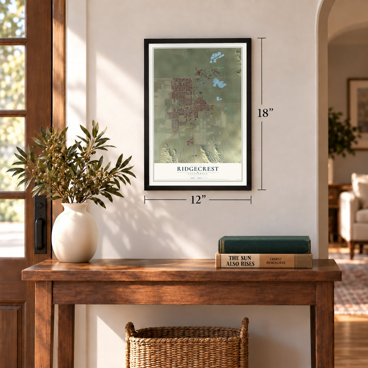
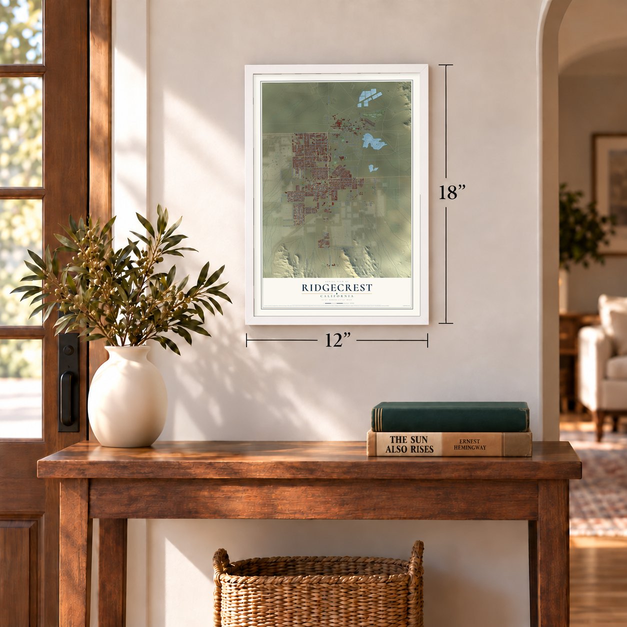
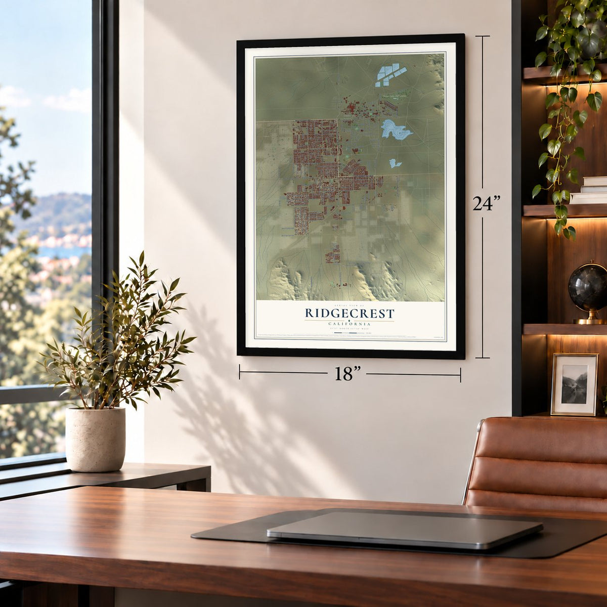
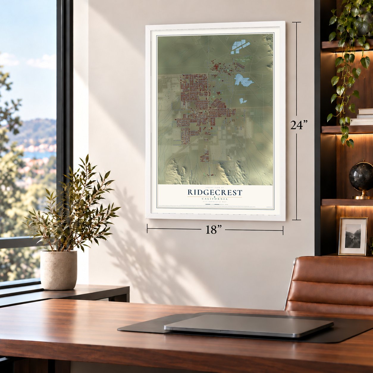
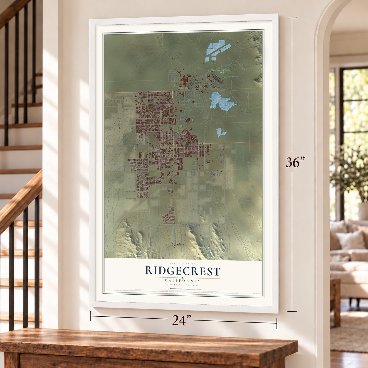
A new map of Ridgecrest, California, made in 2026 and printed to order on thick archival matte paper.
12" x 18" Archival Matte Print
A Map of Home. A Work of Art.
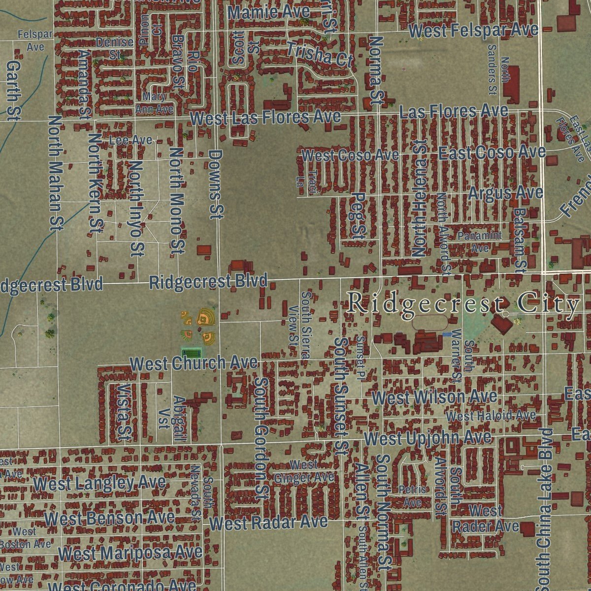
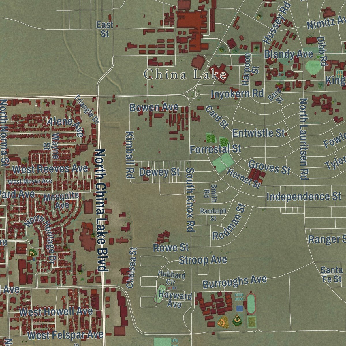
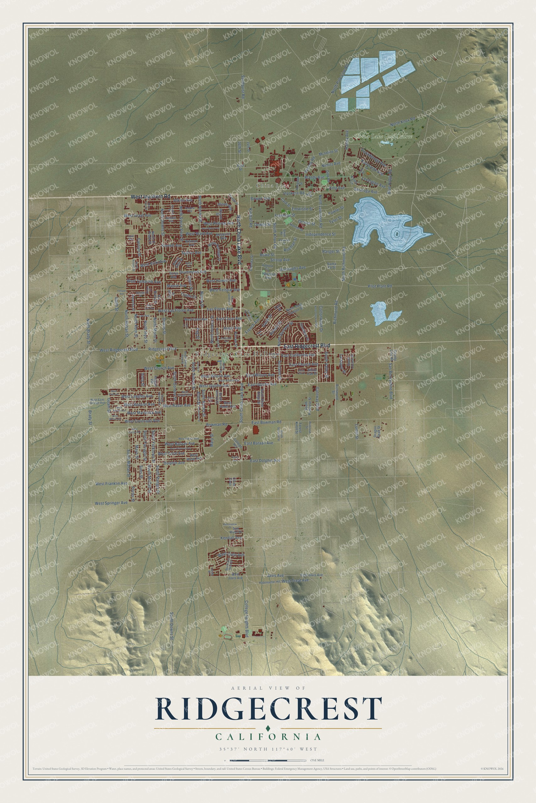
Explore Ridgecrest, California from a whole new perspective. Created using aerial imagery and detailed geographic data, this map captures Ridgecrest building by building, with labeled streets, familiar landmarks, and shaded topographical relief that highlights the natural contours of the landscape.
Combining modern data with the timeless character of a vintage atlas, this map is just as interesting up close as it is beautiful on the wall. Whether you grew up in Ridgecrest, spent memorable years there, or call it home today, this unique map is a great way to celebrate a place that means something to you. Zoom in on the preview to look for your street, and then order a print to put your memories on the wall.
Three ways to hang it
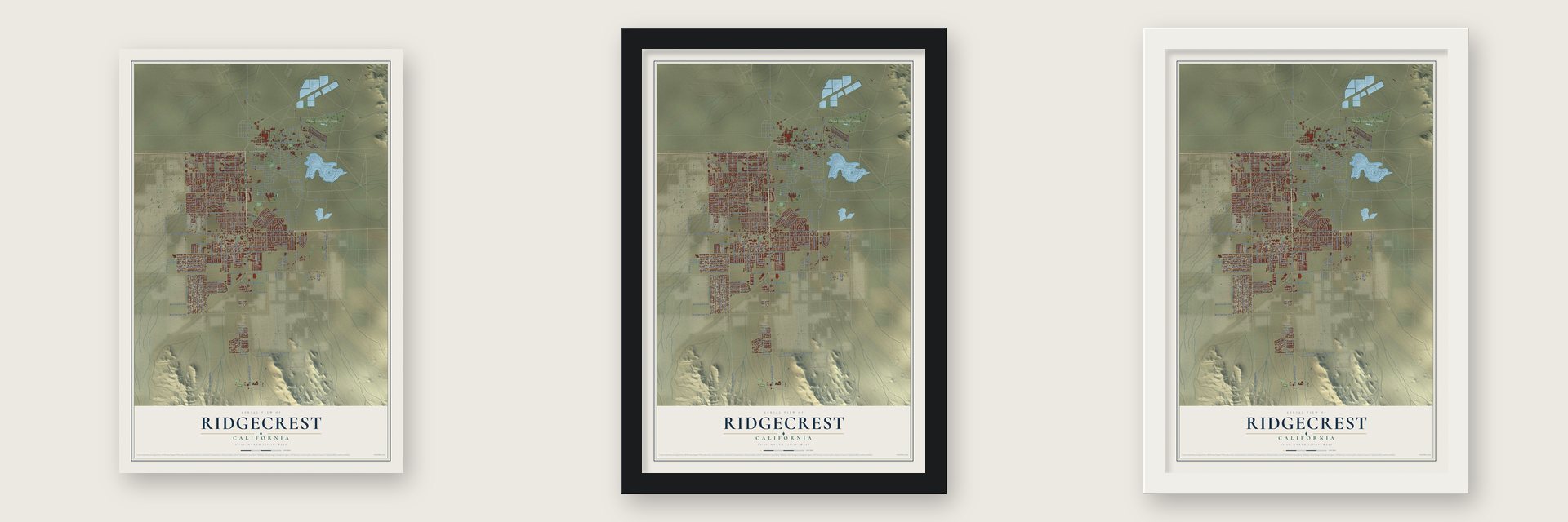
Unframed archival matte, a black wood frame or a white wood frame.
Up close
Geography Worth Displaying
This map was created using accurate cartographic data and authoritative geographic sources, including the U.S. Geological Survey and the Census Bureau. The map brings together terrain, waterways, roads, and building detail. The majority of the streets are labeled, houses are accurately depicted, and the topography is derived from government sources. Combining local data with carefully composed color and shading leads to this beautifully detailed Ridgecrest artwork for your wall.
Rather than simply showing street outlines, we’ve included as many of the street names as we could reasonably fit on the map while keeping their names legible. Zoom in on the high resolution preview to see exactly what’s on the map. We truly set out to create a statement piece for anyone who loves Ridgecrest. So whether it’s for you, or a gift for someone you love, we hope this map of Ridgecrest brings back fond memories.
Read the story behind this map of Ridgecrest, California from 2026.

About Ridgecrest, California
Ridgecrest is a city of 27,959 people in Kern County, set in the Indian Wells Valley next to Naval Air Weapons Station China Lake. Paiute, Shoshone and Kawaiisu people lived in the valley long before settlers came. Settlers stayed for good only after the Los Angeles Aqueduct and the Southern Pacific Railroad reached the valley. The town started in 1912 as a farm community called Crumville, after the dairymen James and Robert Crum.
The town opened its first post office in 1941, and that same year residents voted to give it the name Ridgecrest. It was still small in 1943, with 115 homes and 196 people. That November the Naval Ordnance Test Station opened next door. The base gave the valley steady work, the town grew around it, and Ridgecrest became a city in 1963.
- Over 20,000 petroglyphsShoshone artists carved bighorn sheep, deer and antelope, their favorite subjects, into the rock of the Coso Range. More than 20,000 of these carvings survive in the Coso Rock Art District on the China Lake base. Big and Little Petroglyph Canyons became a National Historic Landmark in 1964 and part of a larger landmark district in 2001. Ridgecrest's Maturango Museum leads tours to Little Petroglyph Canyon, and the town has held a yearly Petroglyph Festival since 2014.
- How China Lake got its nameChinese railroad workers lived for a short time near the lake in the 1880s, and China Lake is named for them. Today the Navy tests airborne weapons on the station beside the city. In 2018 the station accounted for just under 8,000 jobs, most of the work in Ridgecrest.
- A 7.1 quake in 2019On July 4, 2019, a magnitude 6.4 earthquake struck southwest of Searles Valley, followed by more than 1,400 aftershocks. The next evening, at 8:19 P.M., a magnitude 7.1 quake centered about 10 miles northeast of Ridgecrest hit even harder. It was the strongest the area had felt in decades. Earthquake damage later forced Richmond Elementary's students to move to Vieweg Elementary.
- A rock star and an OlympianMark Hoppus, bassist and co-lead singer of Blink-182, is from Ridgecrest. So is Lacy Barnes-Mileham, a 1983 Burroughs High graduate who won national discus titles and competed at the 1996 Atlanta Olympics.
Find your street
Names on the Ridgecrest map
Every name below is printed on this map. Look for your street, your school, the park where you played, or the pond down the road.
Places and landmarks3
- Ridgecrest City Hall
- China Lake
- China Lake Golf Course
Streets and roads220
- North China Lake Boulevard
- East Ridgecrest Boulevard
- West Inyokern Road
- Inyokern Road
- Ridgecrest Boulevard
- West Upjohn Avenue
- West Ridgecrest Boulevard
- East Upjohn Avenue
- Richmond Road
- Javis Avenue
- Gateway Boulevard
- San Bernardino Boulevard
- Sandquist Road
- Downs Street
- South China Lake Boulevard
- East Bowman Road
- Pilot Plant Road
- West Springer Avenue
- Saratoga Avenue
- Peg Street
- Drummond Avenue
- Norma Street
- South Norma Street
- North Helena Street
- College Heights Boulevard
- North Sierra View Street
- West Mariposa Avenue
- North Knox Road
- North Lauritsen Road
- Nimitz Avenue
Show all 220 streets
- North Mahan Street
- North Downs Street
- North Norma Street
- South Mahan Street
- West Las Flores Avenue
- Bowman Road
- East Church Avenue
- North Inyo Street
- North Richmond Road
- Las Flores Avenue
- French Avenue
- East California Avenue
- West Graaf Avenue
- West Ward Avenue
- Dolphin Avenue
- North Pole Line Road
- Blandy Avenue
- West Church Avenue
- West Treat Avenue
- South Knox Road
- West Reeves Avenue
- West Franklin Avenue
- Argus Avenue
- West Felspar Avenue
- Alene Avenue
- Hussey Road
- West Langley Avenue
- West Bataan Avenue
- Mayo Street
- Cottonwood Drive
- South Sunset Street
- Forrestal Street
- Bowen Avenue
- Independence Street
- Sims Street
- South Farragut Street
- South McCall Street
- Porter Street
- South Yorktown Street
- Burroughs Avenue
- South Ranger Street
- South Downs Street
- Sunland Street
- West Radar Avenue
- West Benson Avenue
- West Howell Avenue
- Brady Street
- Sydnor Avenue
- Groves Street
- East Bataan Avenue
- King Avenue
- Ticonderoga Avenue
- East Wilson Avenue
- West Coronado Avenue
- Atkins Avenue
- West Wilson Avenue
- Kearsarge Avenue
- Fowler Street
- Rowe Street
- Halsey Avenue
- North Sunland Street
- Lexington Avenue
- North Kern Street
- East Coso Avenue
- McIntire Street
- Stroop Avenue
- West Coral Avenue
- North Mono Street
- Entwistle Street
- Kinnett Avenue
- East Dolphin Avenue
- Guam Street
- North Brady Street
- South Gordon Street
- West Tamarisk Avenue
- West Cielo Avenue
- Oasis Drive
- South Valley Street
- Kendall Avenue
- Sherri Street
- Robalo Street
- Carolyn Street
- Kimball Road
- Dewey Street
- West Vicki Avenue
- Blue Ridge Road
- Rodman Street
- Ranger Street
- 16th Street
- Mamie Avenue
- Tyler Street
- Mary Street
- Larkspur Street
- Trisha Court
- Lumill Street
- Allen Street
- Garth Street
- Vista Street
- Richmond Street
- East Javis Avenue
- County Line Road
- West Javis Avenue
- South Primrose Street
- Weiman Avenue
- White Oak Drive
- North Heritage Drive
- North Gold Canyon Street
- Hornet Street
- West Rader Avenue
- West Coso Avenue
- Dibb Road
- South Silver Ridge Street
- West Wasp Avenue
- Balsam Street
- Toro Street
- Essex Circle
- Wayne Street
- Sierra View Street
- South Alvord Street
- Scott Street
- South Locust Street
- Chelsea Street
- College Heights
- Chambers Street
- Dragon Peak Street
- Abigail Vst
- Forest Knoll Street
- Santa Fe Street
- 14th Street
- Salt River Drive
- Amanda Street
- Harpoon Street
- North El Prado Street
- Mesquite Avenue
- Card Street
- Hayward Avenue
- Sonja Avenue
- Rio Bravo Street
- East Street
- Cll de Casa
- South Del Rosa Drive
- South Warner Street
- South Nevada Street
- West Saint George Avenue
- South Sunland Street
- Perdew Avenue
- West Perch Avenue
- West Haloid Avenue
- South Sierra View Street
- North Alvord Street
- Gordon Street
- Rademacher Hill
- Hubbard Circle
- Smith Road
- Lee Avenue
- Bennett Avenue
- Bard Street
- West Ginger Avenue
- Denise Street
- Triangle Drive
- North Arroyo Street
- Primrose Street
- Pinon Court
- Lacey Street
- White Oak Lane
- North Sanders Street
- California Avenue
- West Iowa Avenue
- West Boston Avenue
- West Willow Avenue
- West Wildrose Avenue
- North Gateway Boulevard
- West Vulcan Avenue
- West Moyer Avenue
- Palm Drive
- South Allen Street
- Leyte Road
- East Las Flores Avenue
- North Erwin Street
- Sunset Place
- Rainshadow Court
- Panamint Avenue
- Sylvia Avenue
- Randolph Street
- Petris Avenue
- Mary Ann Avenue
- Traci Lane
- Felspar Avenue
- Kathy Avenue
- Quail Way
Names are listed as they appear on the printed map. Zoom into the product photos to find them.
The art of mapping a place
How This Map Was Made
Real places. Remarkable detail. Discover the layers that turn geographic data into a map of home.

The view from above
Aerial imagery reveals the character of the land: woodland, open fields, and the patterns of a place.

The shape of the land
Elevation data brings hills, valleys, and subtle changes in the landscape into view.

The details of home
Roads, waterways, and building footprints come together to make the map feel unmistakably local.

Geography becomes art
Considered color, shading, and typography bring the layers together in a map made for your wall.


Process illustrated with Mendon, Massachusetts. Aerial imagery: USDA NAIP. Terrain: USGS 3D Elevation Program. Map details and finished artwork: KNOWOL.
The Details
About This Print
Choose an archival matte print, or a black or white Ayous wood frame. The archival matte print is unframed.
Select your size and finish above to see the matching product image and price.
Materials & Craftsmanship
A contemporary map with the character of a classic atlas, printed on archival matte paper. Optional frames are made from Ayous wood.
Your printed map does not include the watermark shown in the full-map preview.
Shipping & Delivery
Free shipping within the United States. Every print is made to order in the USA.
Buying a gift? Add a note in your cart and we'll include it. We never put prices in the package.
Prints ship within 2 to 3 business days. Allow 7 to 10 days total from ordering for delivery. Timing may vary during holidays or periods of high order volume.
Read our shipping policy.
Returns and damaged prints
Each print is made to order. Change-of-mind refunds are not available after production.
If your print arrives damaged, misprinted or incorrect, contact support@knowol.com within 30 days of receiving it. Include your order number, photos and a description of the issue.
Read our full refund and replacement policy. For questions about your order, email support@knowol.com.
Find your town
Looking for another city?
Find a map of home in our California collection, or any town in the country.
Nearby
Maps of towns near Ridgecrest
Know someone from one of these towns? Their map makes a great gift.
 Ridgecrest Heights
, California
From $39.99See the map
 China Lake Acres
, California
From $39.99See the map
 Inyokern
, California
From $39.99See the map
More maps nearby: Johannesburg, Searles Valley, Randsburg, Pearsonville and Trona.