
Search for another town





Free U.S. delivery 7 to 10 days after you order
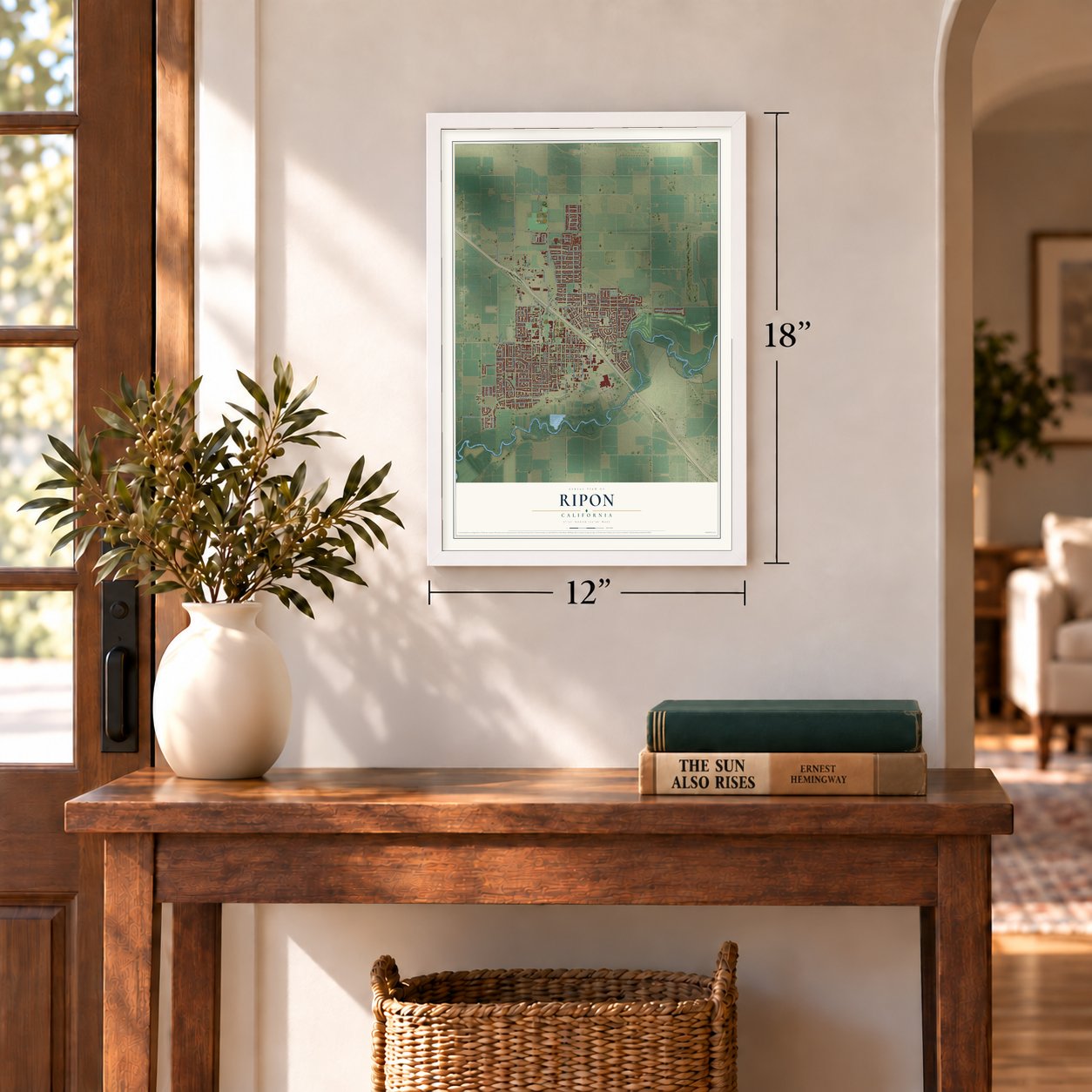
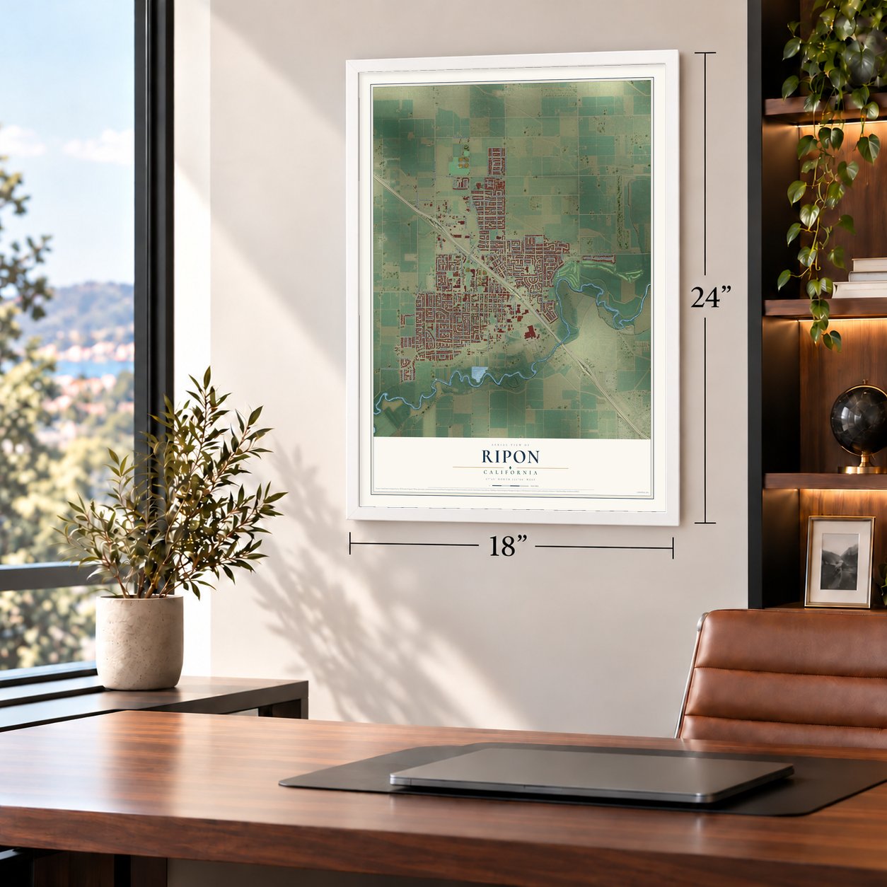
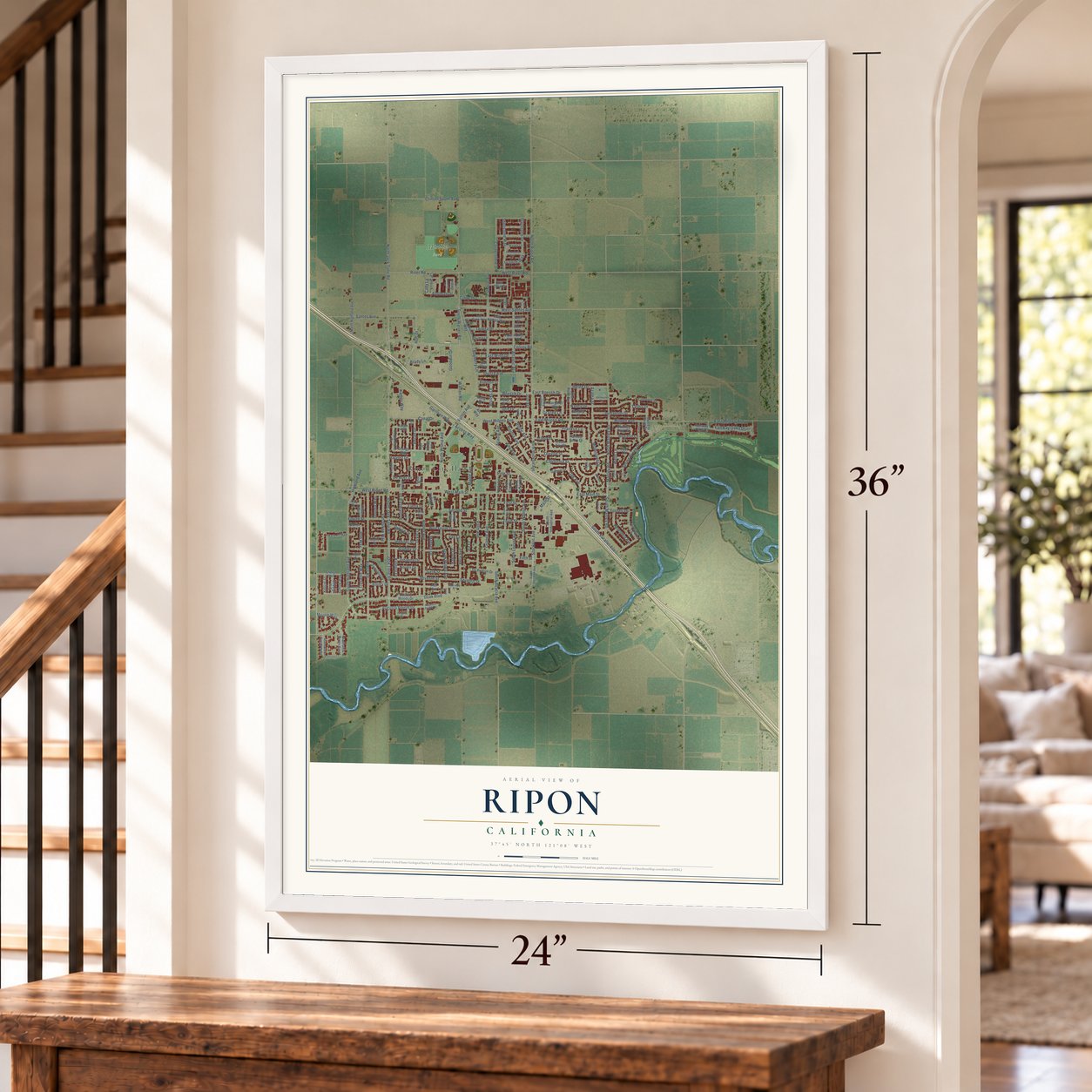
Ripon, California Map Art
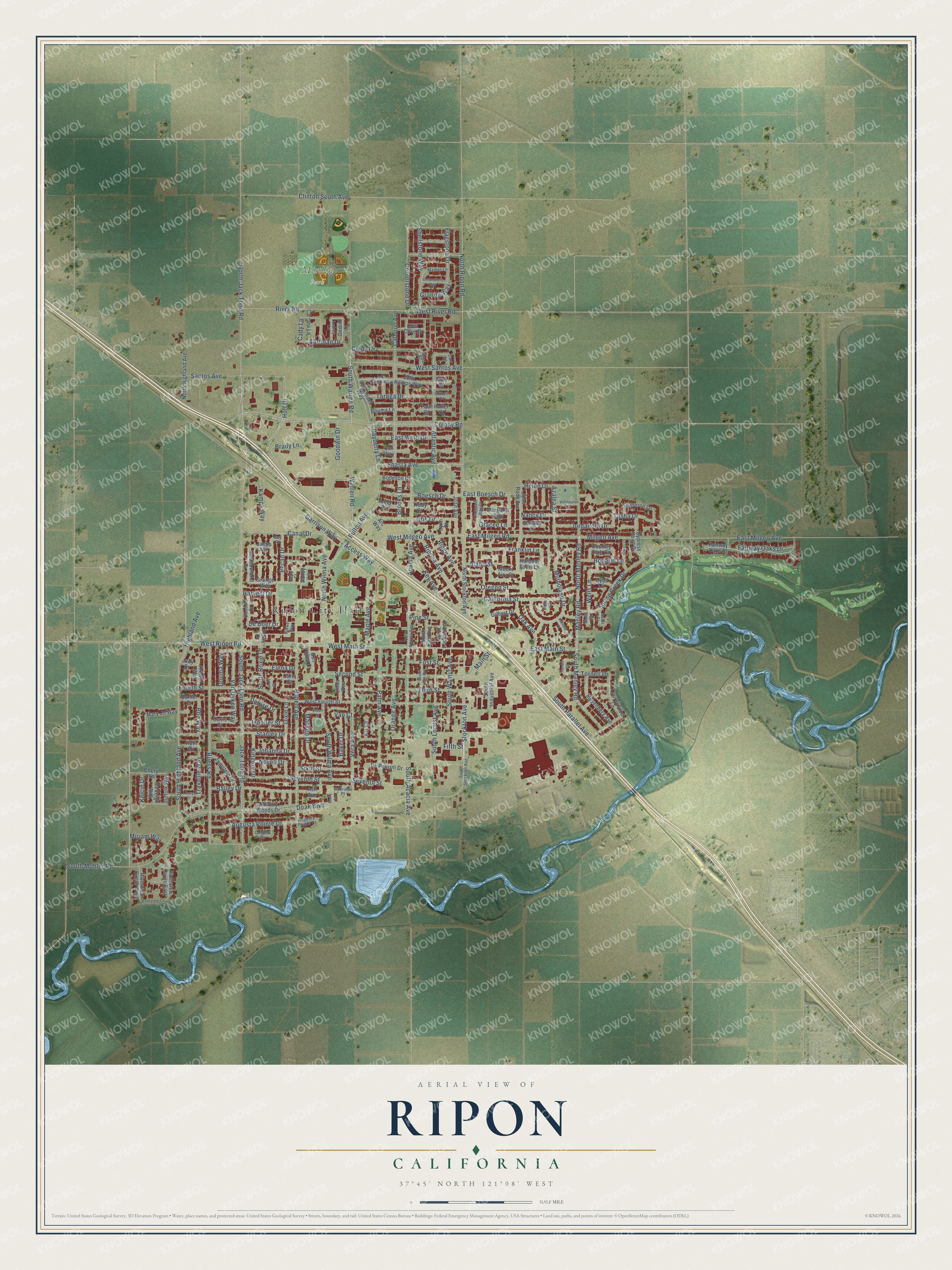
Building by building, with labeled streets and shaded relief.
12" x 18" Archival Matte Print
A Map of Home. A Work of Art.
Explore Ripon, California from a whole new perspective. Created using aerial imagery and detailed geographic data, this map captures Ripon building by building, with labeled streets, familiar landmarks, and shaded topographical relief that highlights the natural contours of the landscape.
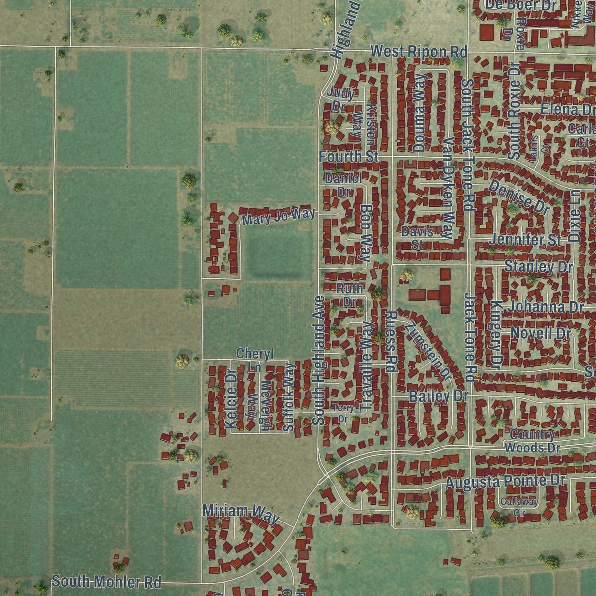
Combining modern data with the timeless character of a vintage atlas, this map is just as interesting up close as it is beautiful on the wall. Whether you grew up in Ripon, spent memorable years there, or call it home today, this unique map is a great way to celebrate a place that means something to you. Zoom in on the preview to look for your street, and then order a print to put your memories on the wall.
Three ways to hang it
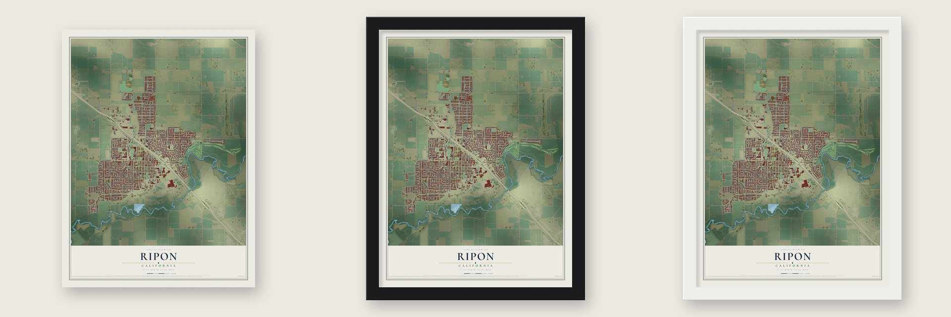
Unframed archival matte, a black wood frame or a white wood frame.
Up close
Geography Worth Displaying
This map was created using accurate cartographic data and authoritative geographic sources, including the U.S. Geological Survey and the Census Bureau. The map brings together terrain, waterways, roads, and building detail. The majority of the streets are labeled, houses are accurately depicted, and the topography is derived from government sources. Combining local data with carefully composed color and shading leads to this beautifully detailed Ripon artwork for your wall.
Rather than simply showing street outlines, we’ve included as many of the street names as we could reasonably fit on the map while keeping their names legible. Zoom in on the high resolution preview to see exactly what’s on the map. We truly set out to create a statement piece for anyone who loves Ripon. So whether it’s for you, or a gift for someone you love, we hope this map of Ripon brings back fond memories.
Read the story behind this map of Ripon, California from 2026.

Find your street
Names on the Ripon map
Every name below is printed on this map. Look for your street, your school, the park where you played, or the pond down the road.
Places and landmarks2
- Ripon City Hall
- Mistlin Park
Streets and roads206
- South Highland Avenue
- South Jack Tone Road
- Canal Drive
- Pecan Drive
- West Ripon Road
- De Boer Drive
- Second Street
- South Manley Road
- Fairway Oaks Drive
- North Manley Road
- Otis Drive
- West Milgeo Avenue
- Aartman Drive
- Cady Lane
- North Wilma Avenue
- Wells Lane
- East Main Street
- Van Dyken Way
- North Jack Tone Road
- Main Street
- West Main Street
- Tornga Drive
- Tornell Drive
- Doak Boulevard
- Brady Lane
- Madsen Drive
- Baker Drive
- Franklin Lane
- Fulton Avenue
- West Santos Avenue
Show all 206 streets
- Cornerstone Drive
- Access Way
- Bob Way
- Colony Road
- Fourth Street
- Manley Road
- Ruess Road
- North Ripon Road
- South Mohler Road
- Stockton Avenue
- Jack Tone Road
- Robert Avenue
- Milgeo Avenue
- South Acacia Avenue
- Vera Avenue
- Calhoun Avenue
- East Milgeo Avenue
- Santos Avenue
- South Wilma Avenue
- Palm Avenue
- Mulholand Drive
- Hoff Drive
- Warren Road
- South Warren Road
- South Parallel Avenue
- South Locust Avenue
- West River Road
- Seventh Street
- Atlantic Avenue
- Acacia Avenue
- California Street
- River Road
- Goodwin Drive
- Nancy Drive
- Bailey Drive
- Spring Creek Drive
- Augusta Pointe Drive
- Shasta Avenue
- Boesch Drive
- Orange Avenue
- East Milgeo Road
- Maple Avenue
- Ripona Avenue
- South Walnut Avenue
- Third Street
- Stanley Drive
- Kamps Way
- Azalea Street
- Oak Avenue
- Highland Avenue
- Cindy Drive
- First Street
- Garrison Way
- Key Avenue
- Pine Street
- East Wind Drive
- East Boesch Drive
- Clinton South Avenue
- Oregon Street
- Helen Drive
- Kelcie Drive
- Sixth Street
- Flagstone Drive
- Ridge Avenue
- Jordanolo Drive
- Dixie Lane
- Fifth Street
- Travaille Way
- Denise Drive
- Shellstone Way
- Bogarin Lane
- South Roxie Drive
- Jennifer Street
- Kingery Drive
- Johanna Drive
- Gracee Lane
- Miriam Way
- Brooks Lane
- Tasha Drive
- Douma Way
- Elena Drive
- Granite Way
- Harvest Drive
- Bayberry Lane
- Novell Drive
- Idaho Street
- Fir Court
- Van Court
- Dedini Lane
- Jacob Avenue
- Meadowland Drive
- Joan Avenue
- Laurelwood Lane
- Bouma Lane
- Sandy Lane
- North Stockton Avenue
- Suffolk Way
- West Fourth Street
- Meyenberg Avenue
- South Industrial Avenue
- John Roos Avenue
- Grange Way
- Arc Way
- Country Woods Drive
- North Highland Avenue
- Van Andel Way
- Riverview Circle East
- Cypress Point Drive
- Country Club Circle
- Zumstein Drive
- Gilbert Drive
- De Pedrini Drive
- John Kamps Way
- Cheryl Lane
- Riverview Circle West
- Anna Drive
- Mary Jo Way
- Carrara Lane
- Cameron Lane
- Margaret Way
- North Locust Avenue
- McVeigh Way
- North Elm Avenue
- Fairway Oaks Court
- Sea Cove Drive
- Bodeson Court
- Kristen Way
- Ash Avenue
- Linda Avenue
- Sun Valley Court
- Opal Lane
- Ruth Drive
- Sultana Court
- Mount Airy Court
- Harbour Town Lane
- Davis Street
- Daniel Drive
- Roxie Drive
- Lan Way
- Judy Drive
- Trudy Court
- Smit Court
- Haller Court
- Carla Court
- Paul Court
- Lynn Court
- Nikkel Way
- South Stockton Avenue
- North Acacia Avenue
- John Kamp Way
- Marble Lane
- Blossom Drive
- Pleasant Bay Drive
- Audrey Lane
- Gabrielle Place
- Augusta Pointe Court
- Viggo Place
- Aster Court
- Clifton Court
- Sepp Court
- Carl Lane
- Wells Court
- Guy Place
- Rose Court
- Tornell Circle
- Greenstone Way
- South Elm Avenue
- Callaway Circle
- Hawes Lane
- Terry Drive
- Riverview Circle
- Vermeulen Drive
- Primula Court
- Lannis Court
- Emily Lane
- Stuart Street
Names are listed as they appear on the printed map. Zoom into the product photos to find them.
About Ripon, California
Ripon is a city of 16,013 people in San Joaquin County. The site went by several names before this one: Murphy's Ferry, then Stanislaus City, then Stanislaus Station. In 1876 the town took the name of Ripon, Wisconsin, which had borrowed its own name from a city in North Yorkshire, England.
Farming has long driven the local economy, and Ripon is known for growing a large share of almonds. A big wave of growth began in 1998, when land north of Highway 99 was set aside for housing and wide stretches of farmland were marked for building. The intersection at Jack Tone Road got a full rebuild in 2003, and Love's and Flying J truck stops opened beside it that same year. Restaurants and a shopping center followed over the next few years.
“The first school was held in an old shack which had been used as a residence. The partitions were torn out and wooden desks and seats put in.”
- New schools in 1965 and 1985Ripona Elementary opened in 1965 and Weston Elementary in 1985. Both have been named California Distinguished Schools, as have Colony Oak Elementary and Ripon Elementary.
- A Grammy-winning gospel artistRipon counts Walter Hawkins, the Grammy Award-winning gospel artist, among its notable people. The list also includes fencing champion Gay Jacobsen D'Asaro, biologist Edward L. Kessel and actress Kim Johnston Ulrich.
- Commuter trains planned for 2027Ripon is slated for a station on the Altamont Corridor Express, the commuter rail line, with service planned to begin in 2027.
Keep exploring California
Ripon is one of 1,990 California towns we've mapped. Every dot on the map is a print of its own.
The search covers every state, California first.
Near Ripon
Order 2 or more town maps and save 10%. Shown in the size and finish you picked above, so they hang as a set.
- Salida 12" x 18" / Archival Matte Print $39.99
- Manteca 12" x 18" / Archival Matte Print $39.99
- Del Rio 12" x 18" / Archival Matte Print $39.99


More maps nearby: Van Allen, Escalon, Collegeville, Modesto and West Modesto.
The art of mapping a place
How This Map Was Made
Real places. Remarkable detail. Discover the layers that turn geographic data into a map of home.

The view from above
Aerial imagery reveals the character of the land: woodland, open fields, and the patterns of a place.

The shape of the land
Elevation data brings hills, valleys, and subtle changes in the landscape into view.

The details of home
Roads, waterways, and building footprints come together to make the map feel unmistakably local.

Geography becomes art
Considered color, shading, and typography bring the layers together in a map made for your wall.


Process illustrated with Mendon, Massachusetts. Aerial imagery: USDA NAIP. Terrain: USGS 3D Elevation Program. Map details and finished artwork: KNOWOL.
The Details
About This Print
Choose an archival matte print, or a black or white Ayous wood frame. The archival matte print is unframed.
Select your size and finish above to see the matching product image and price.
Materials & Craftsmanship
A contemporary map with the character of a classic atlas, printed on archival matte paper. Optional frames are made from Ayous wood.
Your printed map does not include the watermark shown in the full-map preview.
Shipping & Delivery
Free shipping within the United States. Every print is made to order in the USA.
Buying a gift? Add a note in your cart and we'll include it. We never put prices in the package.
Prints ship within 2 to 3 business days. Allow 7 to 10 days total from ordering for delivery. Timing may vary during holidays or periods of high order volume.
Read our shipping policy.
Returns and damaged prints
Each print is made to order. Change-of-mind refunds are not available after production.
If your print arrives damaged, misprinted or incorrect, contact support@knowol.com within 30 days of receiving it. Include your order number, photos and a description of the issue.
Read our full refund and replacement policy. For questions about your order, email support@knowol.com.