Search for another town





Free U.S. delivery 7 to 10 days after you order
Riverside, Ohio Map Art
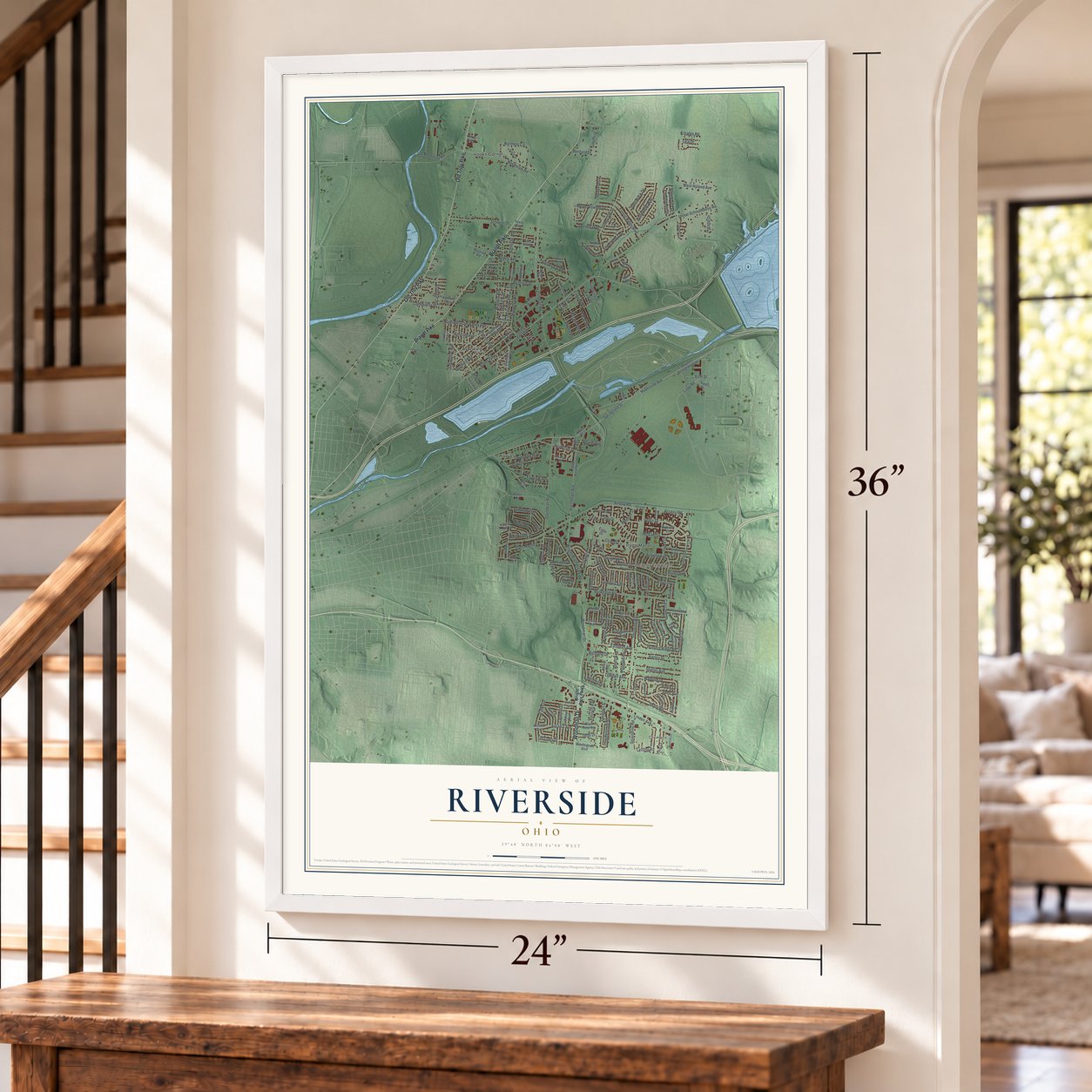
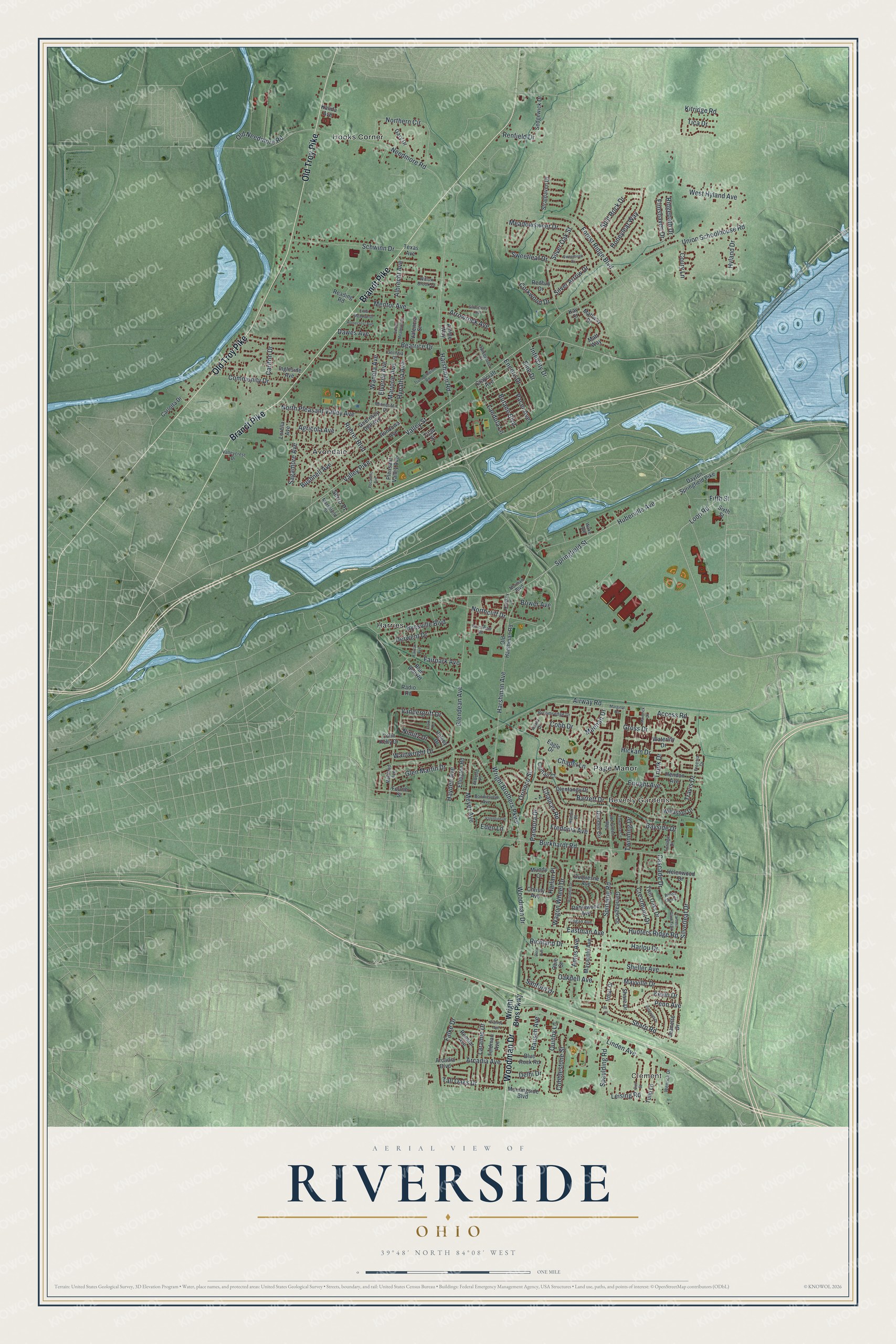
A new map of Riverside, Ohio, made in 2026 and printed to order on thick archival matte paper.
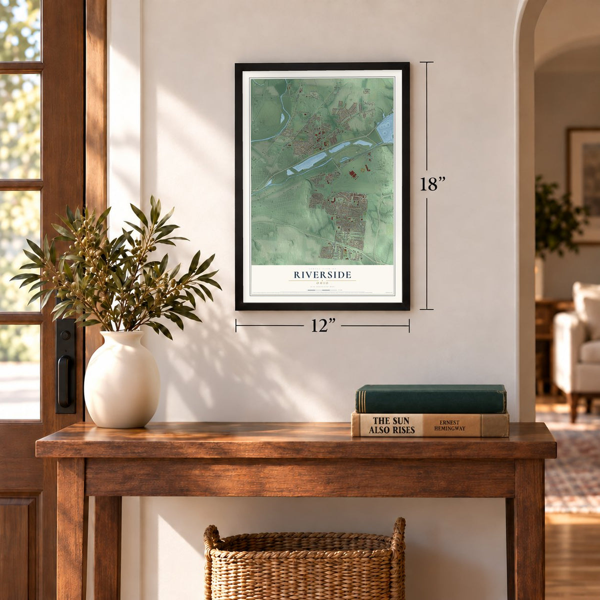
12" x 18" Archival Matte Print
A Map of Home. A Work of Art.
If you grew up in Page Manor, Beverly Gardens or Avondale, or you grew up near Wright Field, this map puts all of Riverside in one frame. It's an aerial view of Riverside in Montgomery County, Ohio, made from modern data and given a vintage look. Zoom in on the preview and look for your block.
Three ways to hang it
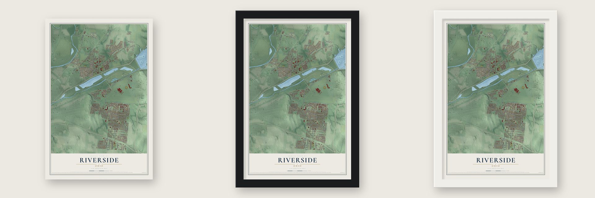
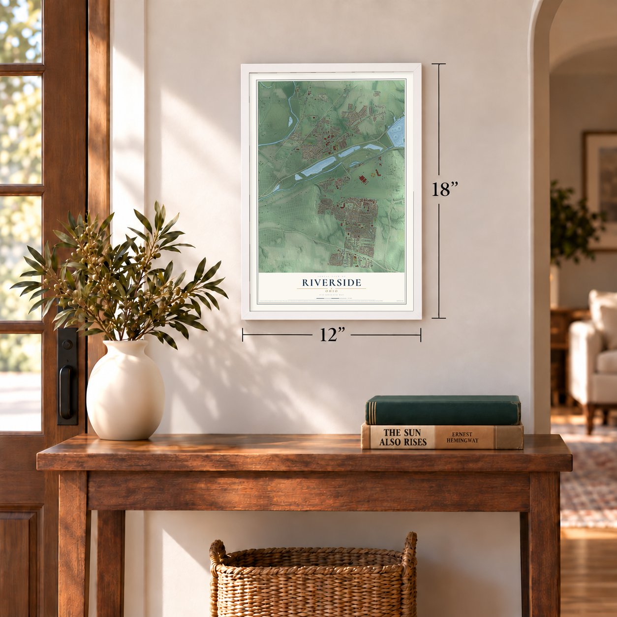
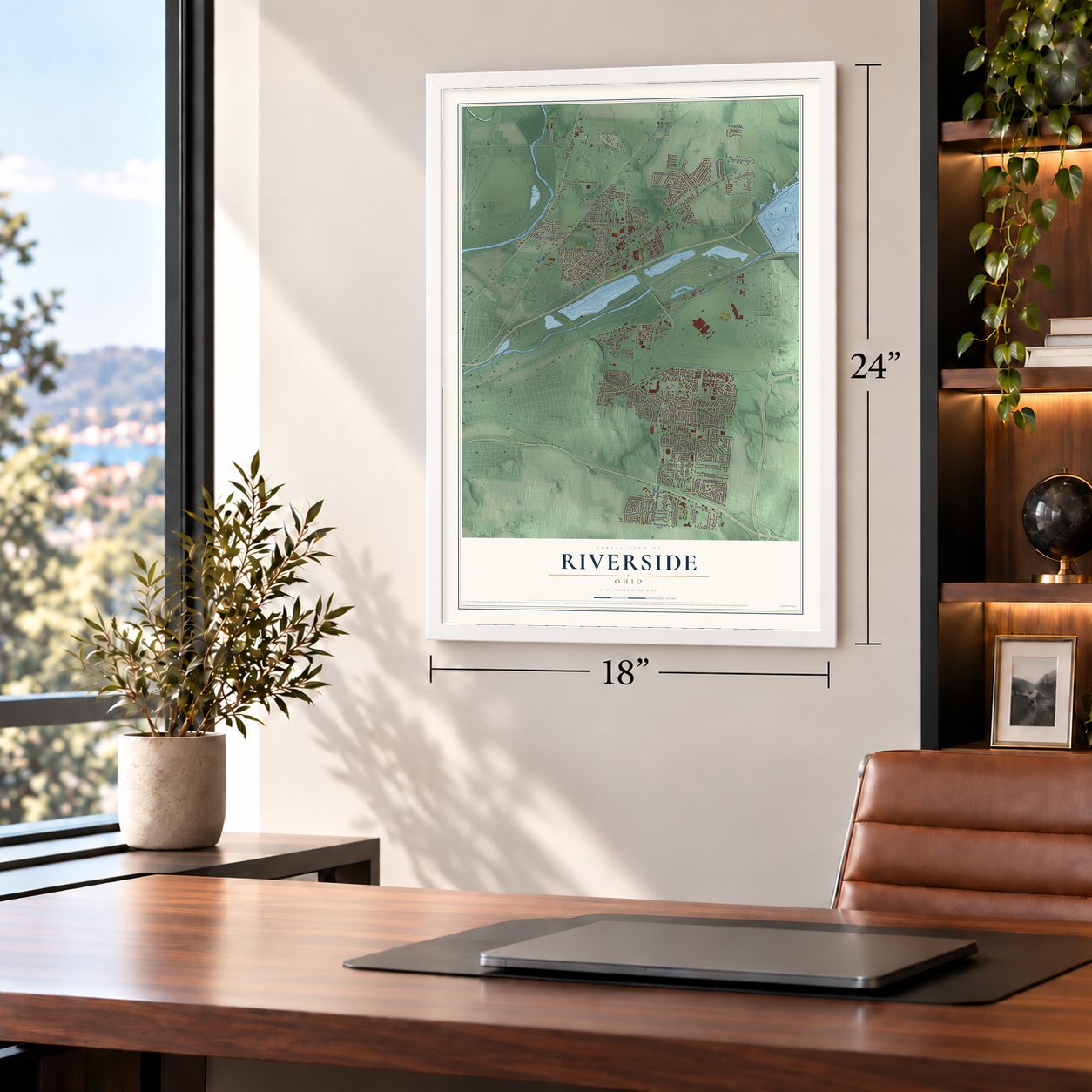
Unframed archival matte, a black wood frame or a white wood frame.
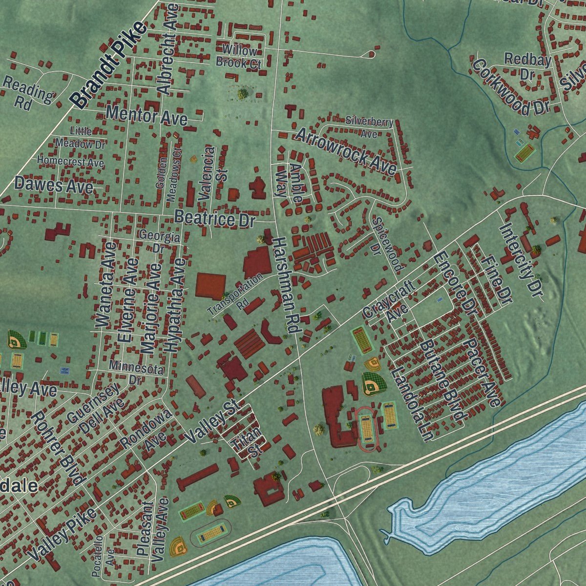
Up close
Real geography. Art worth displaying.
This map was created using accurate cartographic data and authoritative geographic sources, including the U.S. Geological Survey and the Census Bureau. The map brings together terrain, waterways, roads, and building detail. The majority of the streets are labeled, houses are accurately depicted, and the topography is derived from government sources. Combining local data with carefully composed color and shading leads to this beautifully detailed Riverside artwork for your wall.
Rather than simply showing street outlines, we’ve included as many of the street names as we could reasonably fit on the map while keeping their names legible. Zoom in on the high resolution preview to see exactly what’s on the map. We truly set out to create a statement piece for anyone who loves Riverside. So whether it’s for you, or a gift for someone you love, we hope this map of Riverside brings back fond memories.
Read the story behind this map of Riverside, Ohio from 2026.

About Riverside, Ohio
Riverside is a city in Montgomery County and part of the Dayton metropolitan area. Its present geography reflects a 1994 merger with Mad River Township, leaving six disconnected sections among neighboring jurisdictions. The city's history reaches from the early Kemp family homestead to Wright Field, a center of aeronautical research and development.
- 2020 PopulationThe 2020 census recorded 24,474 residents in Riverside.
- Six Separate SectionsRiverside's 1994 merger with Mad River Township resulted in six disconnected sections of the city.
- Wright FieldDedicated on October 12, 1927, Wright Field was named for Dayton aviation pioneers Wilbur and Orville Wright.
- Kemp HomesteadLewis and Elizabeth Kemp arrived around 1806 with eight children and soon built the stone portion of their home.
- Public SchoolsMad River Local School District serves Riverside with four elementary schools, two middle schools, and Stebbins High School.
Find your street
Names on the Riverside map
Every name below is printed on this map. Look for your street, your school, the park where you played, or the pond down the road.
Places and landmarks6
- Clement
- Beverly Gardens
- Avondale
- Harries
- Hooks Corner
- Page Manor
Streets and roads213
- Old Troy Pike
- Brandt Pike
- Woodman Drive
- Valley Pike
- Springfield Street
- Huberville Avenue
- Loop Road
- Harshman Avenue
- Harshman Road
- Landola Lane
- Pacer Avenue
- Airway Road
- Spinning Road
- Linden Avenue
- Union Schoolhouse Road
- Burkhardt Road
- Bayside Drive
- Needmore Road
- Beatrice Drive
- Sheller Avenue
- Waneta Avenue
- Penn Avenue
- Silver Oak Street
- Glendean Avenue
- North Pleasant Valley Avenue
- Meadowsweet Drive
- Barrett Drive
- Rohrer Boulevard
- Community Drive
- Valley Street
Show all 213 streets
- Northern Circle
- Wright Brothers Parkway
- Bushnell Avenue
- Travis Drive
- Schwinn Drive
- Forest Ridge Boulevard
- Cobb Drive
- Hickam Drive
- Gross Drive
- Northcliff Drive
- Nimitz Drive
- Honeyleaf Way
- Meyer Avenue
- Hypathia Avenue
- Sharp Road
- Hyland Drive
- Crestmont Drive
- Sweetleaf Drive
- Eastman Avenue
- Cascade Drive
- Richland Drive
- Wagon Wheel Drive
- Old Needmore Road
- Wainwright Drive
- Arcadia Avenue
- Byesville Boulevard
- Vandergrift Drive
- Oakdell Avenue
- Fairpark Avenue
- Falke Drive
- Ames Avenue
- Silverleaf Drive
- Hunters Ridge Road
- Laramie Drive
- Kitridge Road
- Elmshaven Drive
- Tall Oaks Drive
- Chapel Lane
- Marjorie Avenue
- Elverne Avenue
- Enright Avenue
- West Hyland Avenue
- Glen Martin Drive
- Butane Boulevard
- Trunk Drive
- Chaucer Road
- Mayville Drive
- Access Road
- Spaulding Road
- Arrowrock Avenue
- Harlou Drive
- Encore Drive
- Derwent Drive
- Sanford Drive
- Sagamore Avenue
- Cobblestone Street
- Albrecht Avenue
- Leising Road
- Mentor Avenue
- Hayden Avenue
- Agricola Avenue
- Split Rock Drive
- Silver Arrow Drive
- Rausch Avenue
- Delhi Drive
- Orinoco Street
- Renfield Drive
- Quinby Lane
- Carlton Drive
- Corkwood Drive
- Intercity Drive
- Kevin Drive
- Ridgepath Drive
- Meehan Drive
- Fredonia Avenue
- Pandora Drive
- Coury Lane
- Dawes Avenue
- Fifth Street
- Bower Avenue
- Twinning Drive
- Tica Drive
- Harlan Place
- Fine Drive
- Serro Place
- Eden Lane
- Wright Bros Parkway
- Dayton Springfield Pike
- Craycraft Avenue
- Duquesne Avenue
- Titan Street
- Old Harshman Road
- Rondowa Avenue
- Guernsey Dell Avenue
- Jeanette Drive
- Arcadia Boulevard
- Mayapple Avenue
- Colin Kelly Drive
- Ingleside Avenue
- Obie Street
- Blue Bell Road
- Halsey Drive
- Robinwood Avenue
- Willaston Drive
- Twin Oaks Drive
- Blue Rock Road
- Ellington Road
- Hendon Avenue
- Olentangy Drive
- Sedgewick Drive
- Pleasant Valley Avenue
- Tulip Lane
- Gary Drive
- Dundee Circle
- Gleneagle Drive
- Strathaven Drive
- Reading Road
- Helenwood Drive
- Valencia Street
- Carlotta Drive
- Renslar Avenue
- Amble Way
- Morningside Boulevard
- Lorella Avenue
- Fourth Street
- Matt Way
- Redbay Drive
- Feldman Avenue
- Caittail Court
- Waterlily Drive
- Christy Avenue
- Share Drive
- Mattway Drive
- Irmal Drive
- Kalida Avenue
- Sixth Street
- Mundy Court
- Kay Court
- Radio Road
- Texas Avenue
- Eagle Drive
- Broomsedge Drive
- Georgia Drive
- Spicewood Drive
- Bonnieview Avenue
- Minnesota Drive
- Mertland Avenue
- Joe Green Way
- Torlage Drive
- Wenrick Drive
- Freesia Drive
- Logan Avenue
- Hawkey Lane
- Valleycrest Drive
- Marshfield Street
- Renoir Place
- Willow Brook Court
- Atwood Place
- Norman Boulevard
- Azara Drive
- Wake Avenue
- Marginal Road
- Franlou Avenue
- Fairfax Avenue
- Worchester Road
- Golf Street
- Sweetbirch Drive
- Transportation Road
- Silverberry Avenue
- Woodhill Drive
- Valentine Drive
- Towanda Circle
- Ringwalt Drive
- Dora Avenue
- Golden Meadows Court
- Homecrest Avenue
- Lantern Glow Trail
- Little Meadow Drive
- Maverick Drive
- Pocatello Avenue
- Clark Drive
- Willow Glen Court
- Ila Court
Names are listed as they appear on the printed map. Zoom into the product photos to find them.
The art of mapping a place
How This Map Was Made
Real places. Remarkable detail. Discover the layers that turn geographic data into a map of home.

The view from above
Aerial imagery reveals the character of the land: woodland, open fields, and the patterns of a place.

The shape of the land
Elevation data brings hills, valleys, and subtle changes in the landscape into view.

The details of home
Roads, waterways, and building footprints come together to make the map feel unmistakably local.

Geography becomes art
Considered color, shading, and typography bring the layers together in a map made for your wall.


Process illustrated with Mendon, Massachusetts. Aerial imagery: USDA NAIP. Terrain: USGS 3D Elevation Program. Map details and finished artwork: KNOWOL.
The Details
About This Print
Choose an archival matte print, or a black or white Ayous wood frame. The archival matte print is unframed.
Select your size and finish above to see the matching product image and price.
Materials & Craftsmanship
A contemporary map with the character of a classic atlas, printed on archival matte paper. Optional frames are made from Ayous wood.
Your printed map does not include the watermark shown in the full-map preview.
Shipping & Delivery
Free shipping within the United States. Every print is made to order in the USA.
Buying a gift? Add a note in your cart and we'll include it. We never put prices in the package.
Prints ship within 2 to 3 business days. Allow 7 to 10 days total from ordering for delivery. Timing may vary during holidays or periods of high order volume.
Read our shipping policy.
Returns and damaged prints
Each print is made to order. Change-of-mind refunds are not available after production.
If your print arrives damaged, misprinted or incorrect, contact support@knowol.com within 30 days of receiving it. Include your order number, photos and a description of the issue.
Read our full refund and replacement policy. For questions about your order, email support@knowol.com.
Find your town
Looking for another city?
Find a map of home in our Ohio collection.
Nearby
Maps of towns near Riverside
Know someone from one of these towns? Their map makes a great gift.