
Search for another town





Free U.S. delivery 7 to 10 days after you order
Rockford, Illinois Map Art
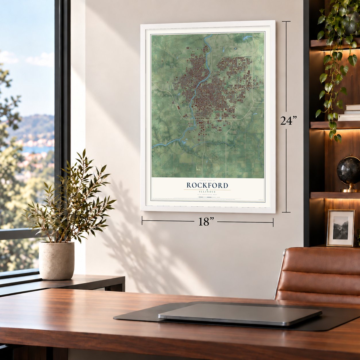
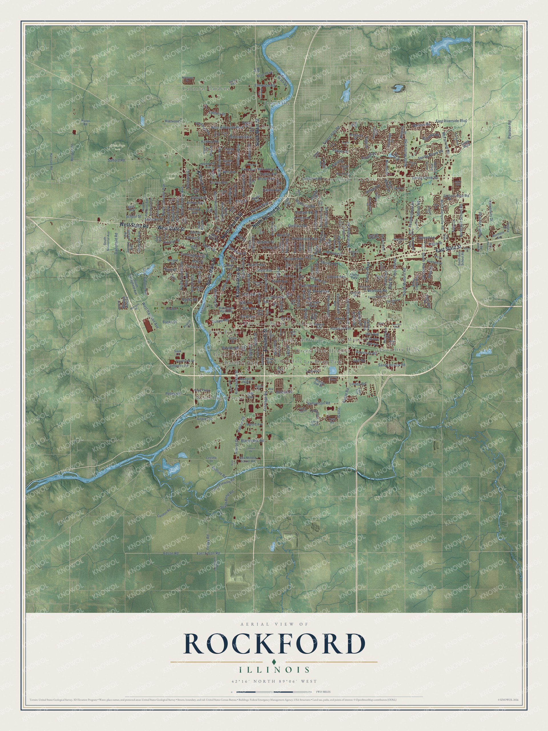
A new map of Rockford, Illinois, made in 2026 and printed to order on thick archival matte paper.
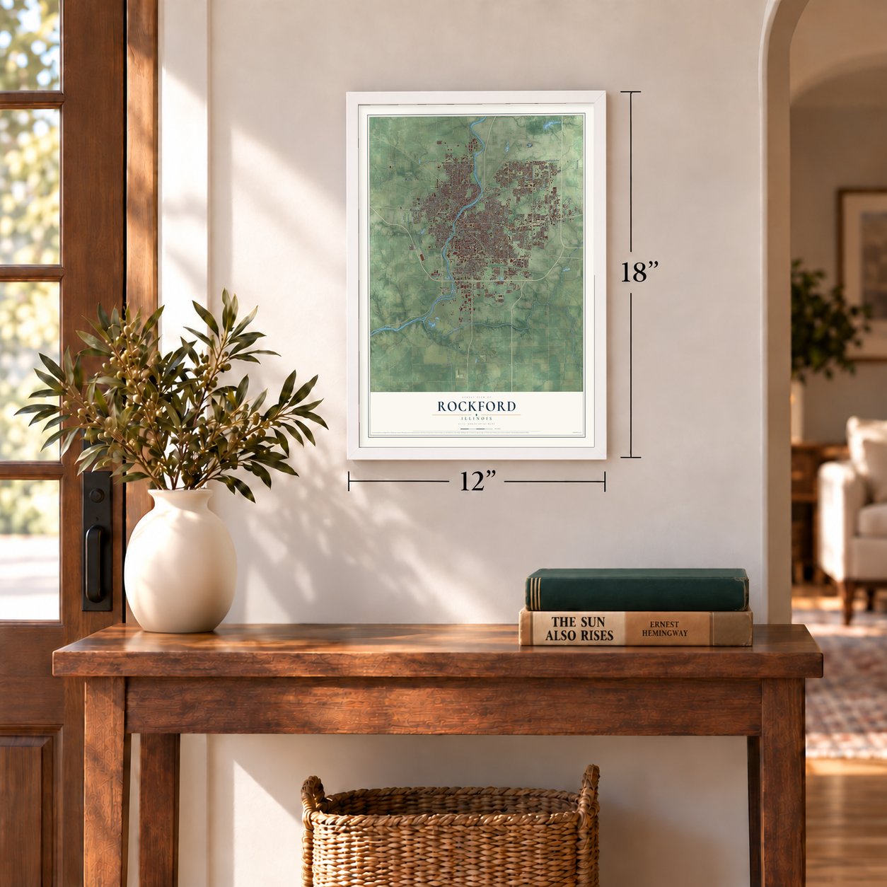
12" x 18" Archival Matte Print
A Map of Home. A Work of Art.
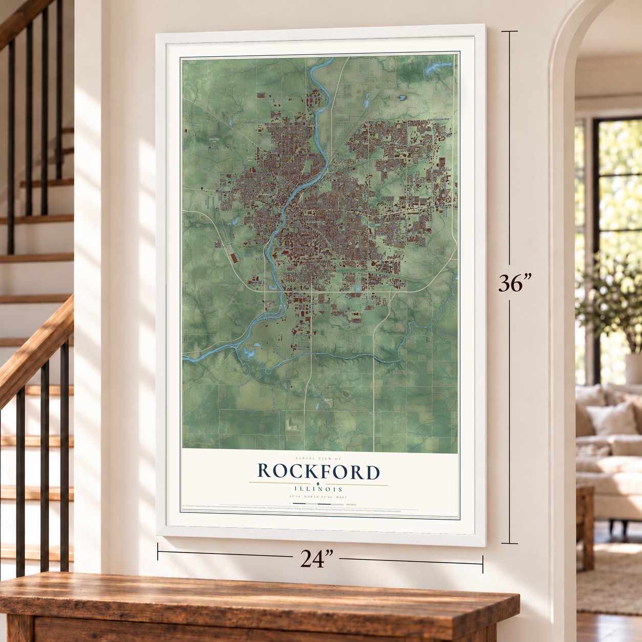
Explore Rockford, Illinois from a whole new perspective. Created using aerial imagery and detailed geographic data, this map captures Rockford building by building, with labeled streets, familiar landmarks, and shaded topographical relief that highlights the natural contours of the landscape.
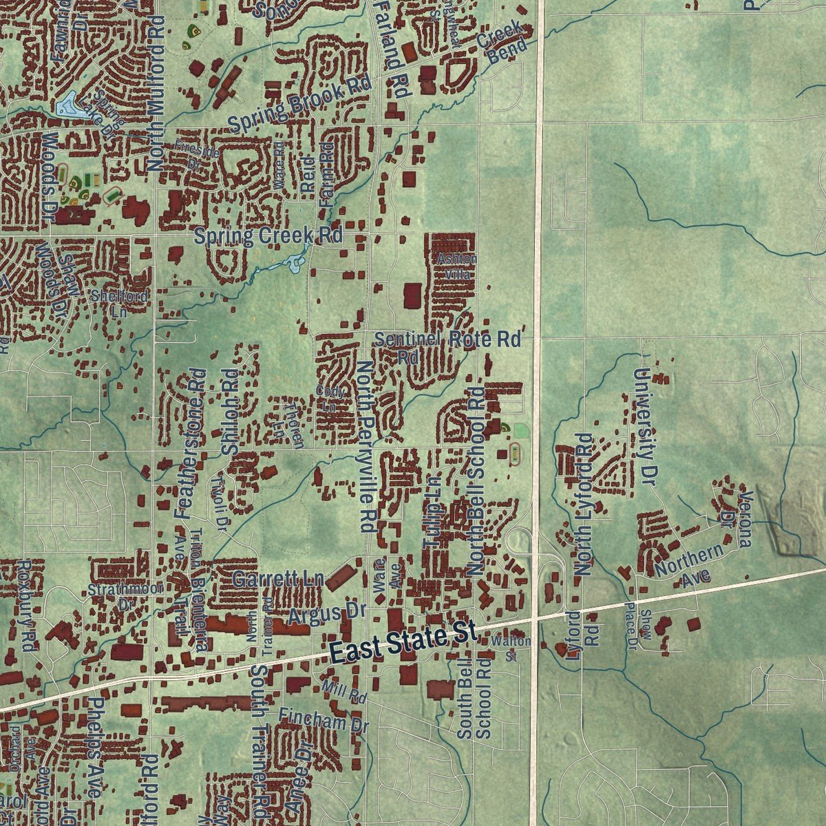
Combining modern data with the timeless character of a vintage atlas, this map is just as interesting up close as it is beautiful on the wall. Whether you grew up in Rockford, spent memorable years there, or call it home today, this unique map is a great way to celebrate a place that means something to you. Zoom in on the preview to look for your street, and then order a print to put your memories on the wall.
Three ways to hang it
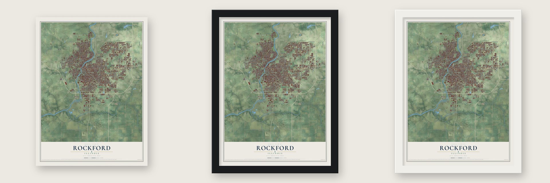
Unframed archival matte, a black wood frame or a white wood frame.
Up close
Geography Worth Displaying
This map was created using accurate cartographic data and authoritative geographic sources, including the U.S. Geological Survey and the Census Bureau. The map brings together terrain, waterways, roads, and building detail. The majority of the streets are labeled, houses are accurately depicted, and the topography is derived from government sources. Combining local data with carefully composed color and shading leads to this beautifully detailed Rockford artwork for your wall.
Rather than simply showing street outlines, we’ve included as many of the street names as we could reasonably fit on the map while keeping their names legible. Zoom in on the high resolution preview to see exactly what’s on the map. We truly set out to create a statement piece for anyone who loves Rockford. So whether it’s for you, or a gift for someone you love, we hope this map of Rockford brings back fond memories.
Read the story behind this map of Rockford, Illinois from 2026.
About Rockford, Illinois
Rockford is a city of 148,655 people and the county seat of Winnebago County, on the banks of the Rock River. Its story began in 1834, when Germanicus Kent and Thatcher Blake, with Lewis Lemon, a man Blake held as a slave, started Kentville on the west bank, while Daniel Shaw Haight settled the east bank. Kent called the colony Midway because it sat about halfway between Chicago and Galena, and he wrote to old neighbors in Alabama asking them to join him.
Native people already called the spot Rock ford. Near the site of the later dam, a solid rock bottom kept the water shallow enough in most seasons to cross on ponies. When Winnebago County was formed in 1836, Midway became its seat. In 1837 the village took the name Rockford and opened its first post office, with Haight as postmaster. Rockford was chartered as a city on January 3, 1852, the same year the Galena and Chicago Union Railroad linked it to Chicago.
“The first mail bag received at Rockford was unaccompanied by a key, and consequently could not be opened, and was sent back.”
- Manny beat McCormickInventor John Henry Manny came to Rockford in 1853 to build horse-drawn reapers for farmers and ship them out by rail. After he had made nearly 6,000 machines, the Chicago maker Cyrus McCormick took him to court. Manny won the case and won again on appeal.
- Second only to Grand RapidsSwedish furniture cooperatives, led by John Erlander's Rockford Union Furniture Company, turned Rockford into a manufacturing center. The city rose to second in the nation in furniture making, behind Grand Rapids, and Erlander's home is now a museum that tells that story.
- Jane Addams, 1881Rockford Female Seminary was founded here in 1847. Jane Addams graduated from it in 1881, and as its courses broadened it was renamed Rockford College in 1892. It admitted men for the first time in 1955 and is now Rockford University.
- The Coronado in 1927The Coronado Theatre opened in 1927, built in the atmospheric style and a match for the movie palaces of Chicago. It joined the National Register in 1979, and after it showed its last film in 1984 it hosted only stage shows.
- The Forest CityThe New York Tribune first called Rockford the Forest City in 1853, for its shady neighborhoods. In September 1949, Life magazine held up postwar Rockford as about as close to an ordinary American city as any place could get. In the late 1950s Dutch elm disease killed over 50,000 of the city's trees.
Find your street
Names on the Rockford map
Every name below is printed on this map. Look for your street, your school, the park where you played, or the pond down the road.
Places and landmarks19
- Anna Page Park
- Searls Park
- Colonial Gardens
- Coventry Hills
- Factory Addition
- Grant Park
- Green View Heights
- Greendale
- Harrison Avenue Gardens
- Jonesville
- Lindberg Park
- Pine Manor
Show all 19 places
- Ravinia Park
- River Forest
- Ruby
- Samuelson Corners
- Winnebago Court
- Alpine Park
- Blackhawk Park
Streets and roads356
- East State Street
- South Main Street
- North Main Street
- West State Street
- West State Road
- North Second Street
- North Church Street
- Kishwaukee Street
- Eleventh Street
- Kilburn Avenue
- Harrison Avenue
- Spring Creek Road
- Auburn Street
- Airport Drive
- Harlem Boulevard
- Linden Road
- Highcrest Road
- Seminary Street
- Winthrop Lane
- Woods Drive
- 29th Street
- Tenth Street
- Andrews Street
- Weaver Road
- North Mulford Road
- South Alpine Road
- North Perryville Road
- North Alpine Road
- Sandy Hollow Road
- Charles Street
Show all 356 streets
- Guilford Road
- North Rockton Avenue
- East Riverside Boulevard
- Spring Brook Road
- 20th Street
- Ninth Street
- Broadway
- North Bell School Road
- North Central Avenue
- Eighth Street
- Elmwood Road
- South Mulford Road
- Pepper Drive
- Huffman Boulevard
- 15th Avenue
- Rural Street
- Crosby Street
- Samuelson Road
- School Street
- 18th Avenue
- Newburg Road
- Falcon Drive
- Falcon Road
- North Court Street
- Seventh Street
- 16th Avenue
- West Riverside Boulevard
- Frontage Road
- Beltline Road
- South Central Avenue
- Elm Street
- Ridge Avenue
- Halsted Road
- Safford Road
- McFarland Road
- Latham Street
- East Edson Road
- Edson Road
- Twelfth Avenue
- Green Street
- Greenwood Avenue
- Jackson Street
- South Fifth Street
- 18th Street
- 22nd Street
- South Bend Road
- Tenth Avenue
- 16th Street
- Preston Street
- South Trainer Road
- Forest Hills Road
- Loomis Street
- 15th Street
- Easton Parkway
- Fulton Avenue
- Custer Avenue
- Brooke Road
- 35th Street
- Arthur Avenue
- Second Avenue
- 20th Avenue
- Rote Road
- West Harrison Avenue
- North Johnston Avenue
- Sixth Avenue
- Garrett Lane
- Brown Avenue
- University Drive
- Rose Avenue
- Ogilby Road
- North Horsman Street
- North Lyford Road
- Colorado Avenue
- Daisyfield Road
- Pelley Road
- 22nd Avenue
- American Road
- 25th Street
- Shiloh Road
- Belmont Boulevard
- Argus Drive
- Clifton Avenue
- West Street
- Blackhawk Road
- Fourth Avenue
- Embury Drive
- Featherstone Road
- Phelps Avenue
- Cunningham Street
- Jonquil Place
- Sage Drive
- Kent Street
- Larson Avenue
- Concord Avenue
- Paris Avenue
- Sewell Street
- Chelsea Avenue
- Christina Street
- Morsay Drive
- Simpson Road
- Royal Avenue
- 26th Street
- Cedar Street
- Tulip Lane
- Rockwell Street
- Wood Road
- Pelham Road
- Hulin Street
- Eaton Drive
- Sonoma Road
- Skokie Drive
- Alpine Road
- Crofton Drive
- Shirley Road
- Ford Avenue
- King Street
- Camlin Avenue
- Anee Drive
- Bell Avenue
- Paulson Road
- Friday Road
- Post Drive
- Quaker Road
- 27th Avenue
- 26th Avenue
- Price Street
- Banks Street
- Colt Road
- Hill Street
- Bienterra Trail
- Fairview Boulevard
- North Longwood Street
- 28th Avenue
- Forest View Road
- 39th Avenue
- North Winnebago Street
- South Memorial Avenue
- Northern Avenue
- South Springfield Avenue
- Arnold Avenue
- 17th Avenue
- South Pierpont Avenue
- Fairview Avenue
- Morgan Street
- 17th Street
- 23rd Street
- 19th Street
- East Gate Parkway
- Reid Farm Road
- Landstrom Road
- Glenwood Avenue
- James Avenue
- Ohio Parkway
- 24th Street
- Shaw Woods Drive
- Pierce Avenue
- Lapey Street
- Bradley Road
- Eastmoreland Avenue
- Meridian Road
- 21st Avenue
- Alliance Avenue
- Seward Avenue
- Sandhutton Avenue
- Camp Elmwood Road
- North Pierpont Avenue
- Sentinel Road
- North Sunset Avenue
- Packard Parkway
- Roxbury Road
- Fremont Street
- North Avon Street
- New Milford School Road
- Scarlet Oak Drive
- Westwood Lane
- Willoubhby Avenue
- Bluffside Drive
- Blackhawk Park Avenue
- Research Parkway
- Tay Street
- Warren Avenue
- South Bell School Road
- Fincham Drive
- Sauber Avenue
- Braur Parkway
- La Salle Avenue
- Skylark Drive
- Innsbruck Drive
- Southrock Drive
- Holmes Street
- Hunter Avenue
- Meadow View Lane
- Milford Avenue
- Fawnridge Drive
- Stony Creek Way
- Harrison Road
- Onyx Parkway
- Condon Road
- Lookout Drive
- Highridge Road
- McLain Avenue
- Elva Lane
- College Avenue
- Verona Drive
- Alida Street
- Porter Road
- Browns Beach Road
- Dakota Lane
- Trenton Avenue
- Modesto Drive
- Lund Avenue
- Prairie Road
- Grove Street
- Cessna Drive
- Vassar Road
- Carol Court
- Tesa Road
- Myott Avenue
- Lee Street
- Iris Avenue
- Route 99
- Jacoby Place
- Sauk Lane
- Score Street
- Turner Street
- Lyran Avenue
- Creek Bend
- Lyford Road
- Mila Avenue
- Day Avenue
- Hiatt Drive
- Strathmoor Drive
- 23rd Avenue
- Brendenwood Road
- Yonge Street
- Eighth Avenue
- Forest View Avenue
- Alton Avenue
- North Day Avenue
- North Prospect Street
- 14th Street
- 19th Avenue
- Eleventh Avenue
- Saner Avenue
- North Chicago Avenue
- Edgemont Street
- Hemlock Lane
- Horton Street
- Boeing Drive
- Roncevalles Avenue
- Cannon Street
- Hermitage Trail
- Coolidge Place
- Oak Grove Lane
- Marsh Avenue
- Mill Road
- North Junction Road
- Welty Avenue
- Arline Avenue
- 27th Street
- Searles Avenue
- North Avenue
- Regents Park Road
- Clinton Street
- Park Avenue
- Shaw Street
- Dorset Drive
- Dorchester Drive
- Spring Lake Drive
- Madron Road
- Indiana Avenue
- Eddy Avenue
- Crescent Drive
- Kristi Lane
- Northline Drive
- Triton Avenue
- Ashby Trail
- Shelford Lane
- Tivoli Drive
- Thoren Lane
- Heidi Lane
- Ware Avenue
- Capital Drive
- Kay Avenue
- Olden Oak Drive
- Show Place Drive
- Willow Lane
- North Trainer Road
- Twelfth Street
- Shepherd Trail
- Montague Road
- 13th Street
- Bildahl Street
- Oakley Avenue
- Walton Street
- North Willard Avenue
- Orchard Avenue
- Springwheat Street
- North Oak Knolls Avenue
- Williamsburg Road
- Ashton Villa
- Foster Avenue
- Sovereign Boulevard
- Toft Street
- Grand Cape Road
- Columbia Parkway
- Shelly Drive
- Beale Court
- Senate Drive
- Steven's Ridge
- Kings Highway
- Sterling Drive
- Uram Lane
- Fireside Drive
- Ware Road
- Dierks Drive
- Biltmore Chase
- Leonard Road
- Ross Lane
- Ed Vera Drive
- Nadine Avenue
- Garden Lane
- Regina Lane
- Cody Lane
- Crane Drive
- Davis Street
Names are listed as they appear on the printed map. Zoom into the product photos to find them.
The art of mapping a place
How This Map Was Made
Real places. Remarkable detail. Discover the layers that turn geographic data into a map of home.

The view from above
Aerial imagery reveals the character of the land: woodland, open fields, and the patterns of a place.

The shape of the land
Elevation data brings hills, valleys, and subtle changes in the landscape into view.

The details of home
Roads, waterways, and building footprints come together to make the map feel unmistakably local.

Geography becomes art
Considered color, shading, and typography bring the layers together in a map made for your wall.


Process illustrated with Mendon, Massachusetts. Aerial imagery: USDA NAIP. Terrain: USGS 3D Elevation Program. Map details and finished artwork: KNOWOL.
The Details
About This Print
Choose an archival matte print, or a black or white Ayous wood frame. The archival matte print is unframed.
Select your size and finish above to see the matching product image and price.
Materials & Craftsmanship
A contemporary map with the character of a classic atlas, printed on archival matte paper. Optional frames are made from Ayous wood.
Your printed map does not include the watermark shown in the full-map preview.
Shipping & Delivery
Free shipping within the United States. Every print is made to order in the USA.
Buying a gift? Add a note in your cart and we'll include it. We never put prices in the package.
Prints ship within 2 to 3 business days. Allow 7 to 10 days total from ordering for delivery. Timing may vary during holidays or periods of high order volume.
Read our shipping policy.
Returns and damaged prints
Each print is made to order. Change-of-mind refunds are not available after production.
If your print arrives damaged, misprinted or incorrect, contact support@knowol.com within 30 days of receiving it. Include your order number, photos and a description of the issue.
Read our full refund and replacement policy. For questions about your order, email support@knowol.com.
Find your town
Looking for another city?
Find a map of home in our Illinois collection, or any town in the country.
Nearby
Maps of towns near Rockford
Know someone from one of these towns? Their map makes a great gift.
 Cherry Valley
, Illinois
From $39.99See the map
 New Milford
, Illinois
From $39.99See the map
 Loves Park
, Illinois
From $39.99See the map
More maps nearby: Machesney Park, Winnebago, Belvidere, Argyle and Davis Junction.