
Search for another town





Free U.S. delivery 7 to 10 days after you order
Rockport, Massachusetts Map Art
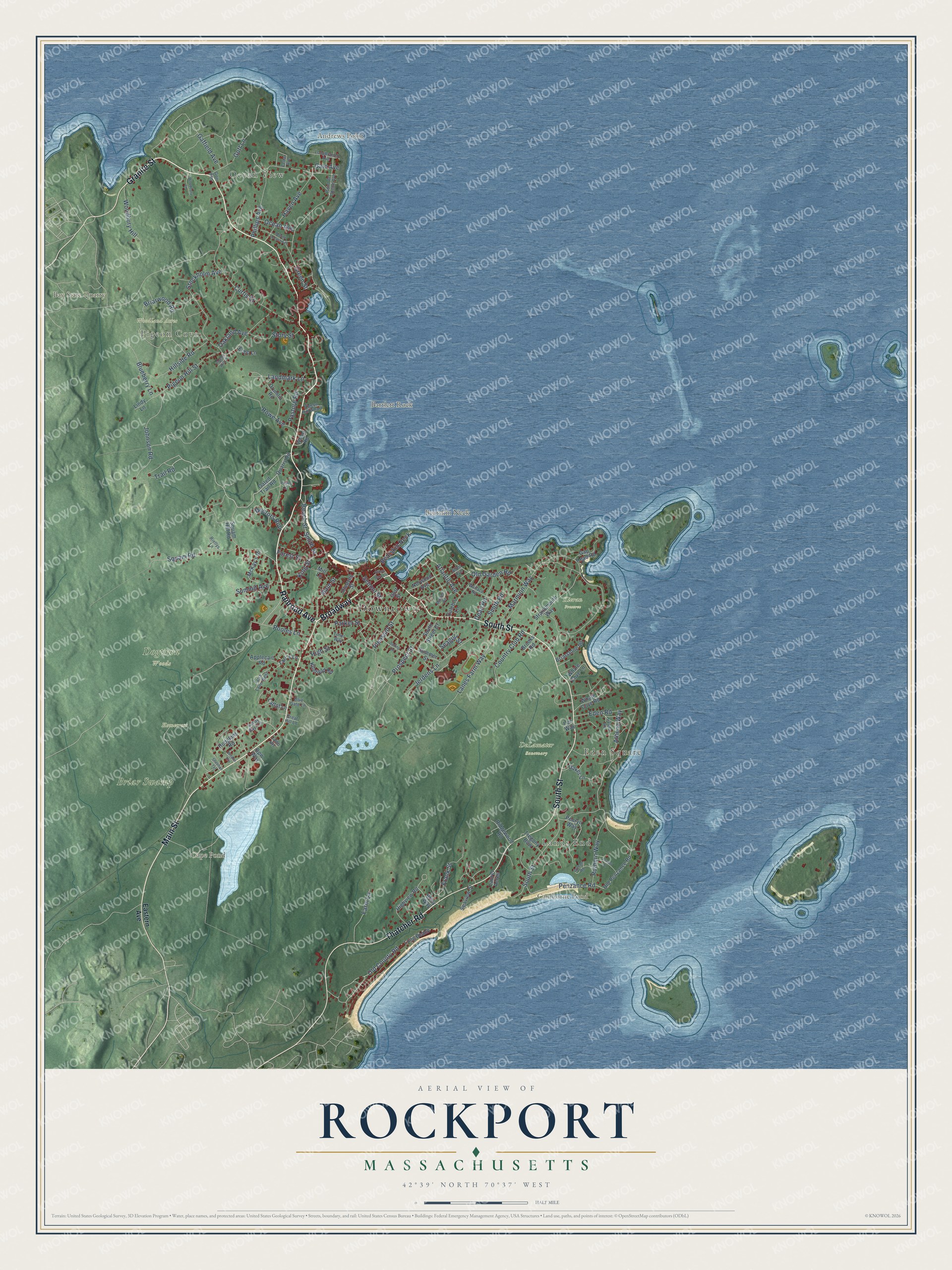
Building by building, with labeled streets and shaded relief.
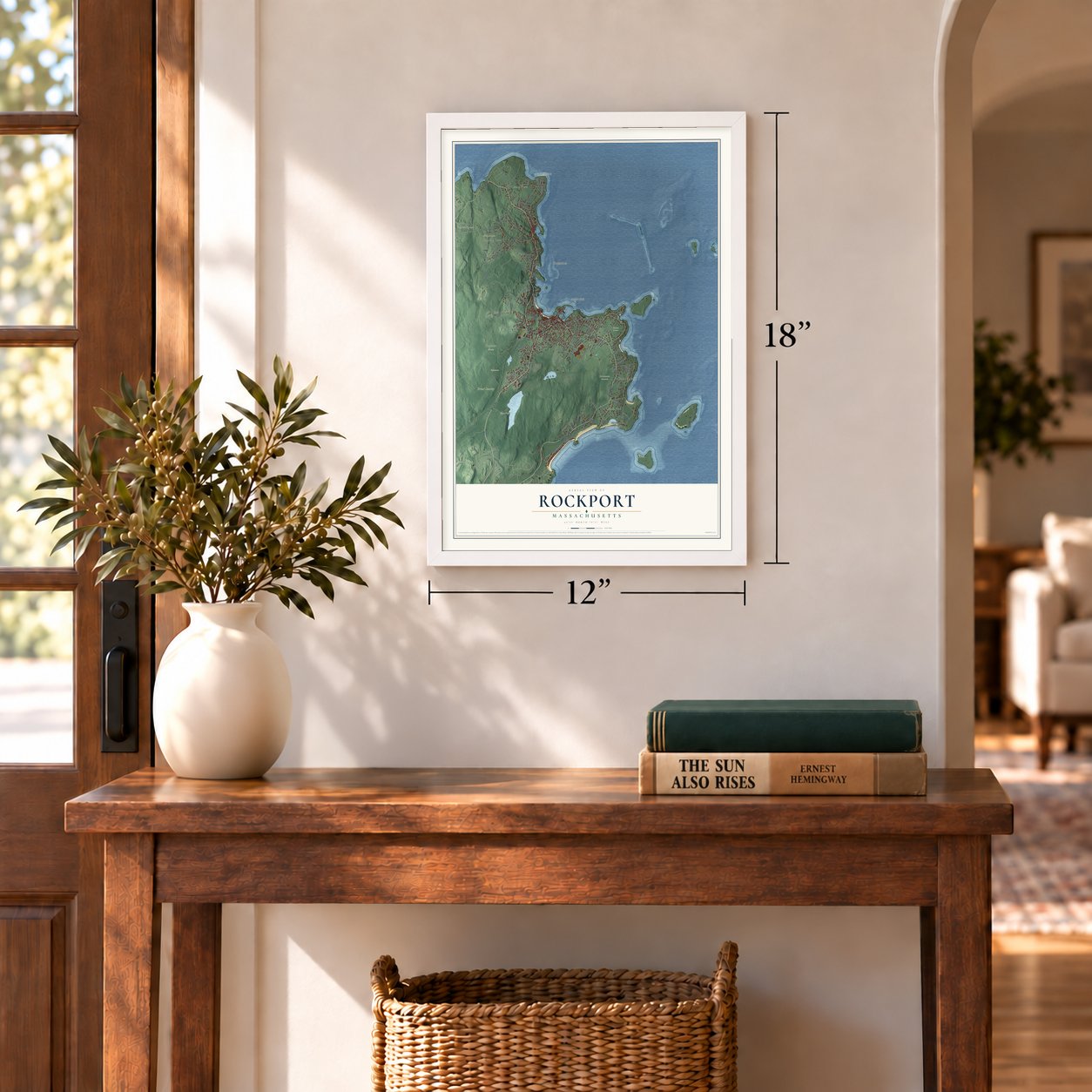
12" x 18" Archival Matte Print
A Map of Home. A Work of Art.
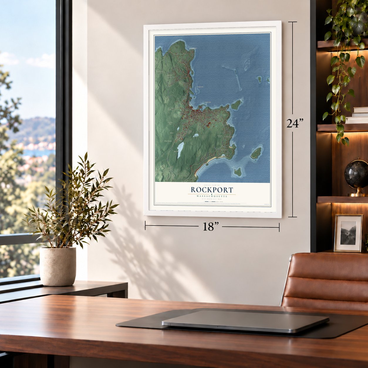
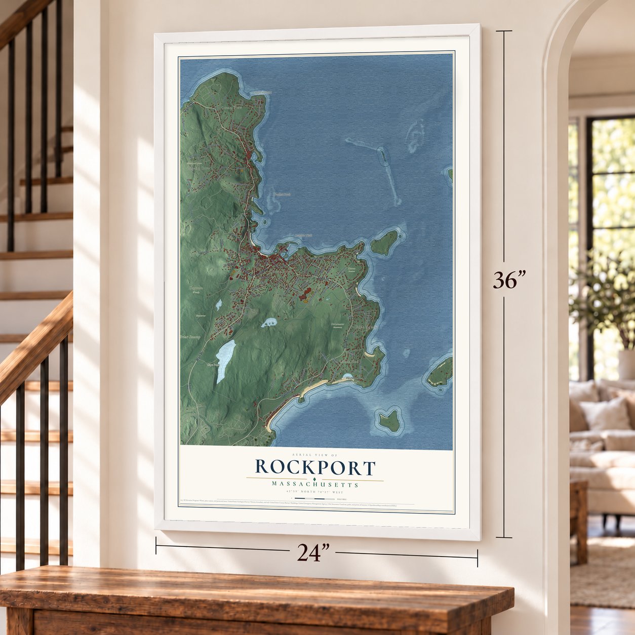
Explore Rockport, Massachusetts from a whole new perspective. Created using aerial imagery and detailed geographic data, this map captures Rockport building by building, with labeled streets, familiar landmarks, and shaded topographical relief that highlights the natural contours of the landscape.
Combining modern data with the timeless character of a vintage atlas, this map is just as interesting up close as it is beautiful on the wall. Whether you grew up in Rockport, spent memorable years there, or call it home today, this unique map is a great way to celebrate a place that means something to you. Zoom in on the preview to look for your street, and then order a print to put your memories on the wall.
Three ways to hang it
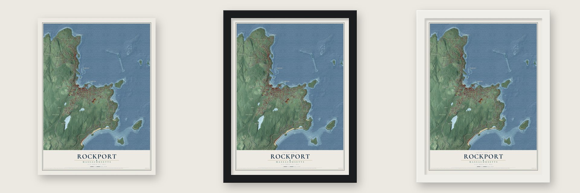
Unframed archival matte, a black wood frame or a white wood frame.
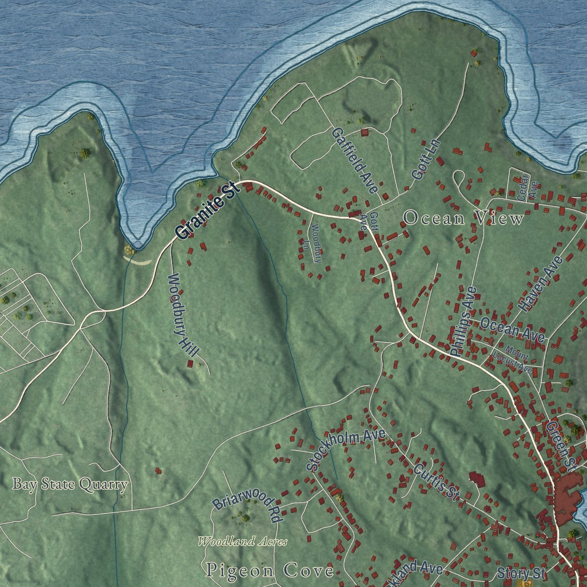
Up close
Geography Worth Displaying
This map was created using accurate cartographic data and authoritative geographic sources, including the U.S. Geological Survey (USGS) and FEMA. The map brings together terrain, waterways, roads, and building detail. The majority of the streets are labeled, houses are accurately depicted, and the topography is derived from government sources. Combining local data with carefully composed color and shading leads to this beautifully detailed Rockport artwork for your wall.
Rather than simply showing street outlines, we’ve included as many of the street names as we could reasonably fit on the map while keeping their names legible. Zoom in on the high resolution preview to see exactly what’s on the map. We truly set out to create a statement piece for anyone who loves Rockport. So whether it’s for you, or a gift for someone you love, we hope this map of Rockport brings back fond memories.
Explore the full map of Rockport, Massachusetts and read about the local places it shows.

Find your street
Names on the Rockport map
Every name below is printed on this map. Look for your street, your school, the park where you played, or the pond down the road.
Places and landmarks17
- Downtown
- Ocean View
- Pigeon Cove
- Lands End
- Eden Square
- Andrews Point
- Bartlett Rock
- Bay State Quarry
- Bearskin Neck
- Camborne Pond
- Cape Pond
- Briar Swamp
Show all 17 places
- DeLamater Sanctuary
- Dogtown Woods
- Homecrest
- Woodland Acres
- Kieran Preserve
Streets and roads121
- Granite Street
- Broadway
- Railroad Avenue
- Main Street
- South Street
- Thatcher Road
- Trail Road
- Parker Street
- Old County Road
- Marmion Way
- Phillips Avenue
- Penzance Road
- Rowe Avenue
- Pleasant Street
- Eden Road
- Curtis Street
- Squam Road
- Briarwood Road
- Pigeon Hill Street
- High Street
- Lanes Farm Way
- Stockholm Avenue
- Johnson Road
- Atlantic Avenue
- Jerdens Lane
- Prospect Street
- Beach Street
- Country Club Road
- Old Garden Road
- Haven Avenue
Show all 121 streets
- Hillside Road
- Blueberry Lane
- Ruthern Way
- Frank Street
- Summit Avenue
- Story Street
- Gott Lane
- School Street
- Farm Lane
- King Street
- Smith Road
- Gaffield Avenue
- Landmark Lane
- Woodbury Hill
- Dean Road
- Doctors Run
- Pasture Road
- Pooles Lane
- Athena Way
- Ocean Avenue
- Oakland Avenue
- Gale Avenue
- Forest Street
- Seagull Street
- Smith Street
- Green Street
- Eastern Avenue
- Gated Trail Road
- Tarr's Lane
- Old Penzance Road
- Long Beach
- Highview Road
- Quarry Road
- Squam Hill Road
- Straitsmouth Way
- Hodgkins Road
- Summer Street
- Penryn Way
- Ridgewood Road
- Norwood Avenue
- Whale Cove Road
- Caleb's Lane
- Drumlin Road
- Oakes Lane
- Gap Head Road
- McKay's Drive
- Kitefield Road
- Whale Cove Lane
- Briarstone Road
- Cleaves Street
- Applecart Road
- Tregony Bow
- Lee Way
- Wharf Road
- South Street Court
- Seaview Street
- Gott Street
- Lattof Lane
- Briny Way
- Lindy Lane
- Echo Lane
- Mill Lane
- Brooks Road
- Laurel Acres
- Dpw Way
- Sandy Bay Terrace
- Wallace Road
- Irvana Road
- Point de Chene Avenue
- Tarrs Lane West
- Gott Avenue
- Longbranch Avenue
- Great Hill Lane
- Timer Way
- Pigeon Hill Wharf
- Blue Gate Lane
- Allen Avenue
- Riellys Lane
- Cedar Avenue
- Lamb Heights
- Mount Locust Avenue
- Witham Road
- Lozant Place
- Spring Lane
- Stone Barn Lane
- Woodbury Lane
- Marbee Road
- Wildon Heights
- Sheehan Terrace
- Pigeon Hill Court
- Prides Lane
Names are listed as they appear on the printed map. Zoom into the product photos to find them.
About Rockport, Massachusetts
Rockport is a town of 6,992 people in Essex County, on the eastern tip of Cape Ann, with Gloucester as its only neighbor and the Atlantic on every other side. Agawam villages stood on Cape Ann before Europeans came. By 1680 Richard Tarr, a stone cutter of granite, had made his home here as the Sandy Bay Colony's first settler.
Sandy Bay's pine went into ships, and a dock built on the harbor in 1743 served both the timber trade and the fishing boats. Quarrying began around 1800, and by the 1830s ships carried Rockport granite to cities up and down the East Coast. The village of estates, summer homes and fishermen had little in common with fast-growing Gloucester, so its residents broke away and incorporated Rockport as a town in 1840.
- A cannonball in the steepleIn the War of 1812, HMS Nymphe, a British frigate blockading New England, sent two barges into Sandy Bay on September 8, 1814. One took the fort at Long Cove. When townspeople saw the other round Bearskin Neck, they rang the Congregational Church bell, and the Sea Fencibles traded musket fire with its crew, but no one was hurt. A cannonball aimed at the bell stuck in the steeple until the church removed it; a replica sits there now.
- The women's raid of 1856In 1856 Hannah Jumper led about 200 women through town, destroying whatever alcohol they found, in what people still call Rockport's revolt against rum. Liquor was banned afterward, and except for a stretch in the 1930s Rockport stayed dry. Restaurants could serve drinks starting in 2005, and stores had to wait until 2019, when one market got a license to sell beer and wine.
- The quarry strike of 1899Finns first came to Pigeon Cove in the early 1890s as strikebreakers but became the Rockport Granite Company's most determined union men, striking from March to June 1899. The company brought in Italian laborers from Boston. On April 20 about 200 Finns with clubs and stones drove them into a boiler house, and many went home. The more than 2,000 strikers won a nine-hour day, time-and-a-half for overtime and a promise of fair treatment.
- Motif Number 1Artists worldwide have painted and photographed Motif Number 1, a red fishing shack built on Bradley Wharf in 1884. In 1933 the town's American Legion post built a 27-foot model, designed by Aldro Hibbard and Anthony Thieme, and took it to Chicago, where on October 3 it won first place among 200 floats. Over 4,000 people welcomed it home at Great Hill. The Blizzard of 1978 wrecked the shack, and an exact copy replaced it that year.
Keep exploring Massachusetts
Rockport is one of 466 Massachusetts towns we've mapped. Every dot on the map is a print of its own.
The search covers every state, Massachusetts first.
Near Rockport
Order 2 or more town maps and save 10%. Shown in the size and finish you picked above, so they hang as a set.
- Gloucester 12" x 18" / Archival Matte Print $39.99
- Essex 12" x 18" / Archival Matte Print $39.99
- Manchester-by-the-Sea 12" x 18" / Archival Matte Print $39.99


More maps nearby: Ipswich, Hamilton, Beverly, Wenham and Rowley.
The art of mapping a place
How This Map Was Made
Real places. Remarkable detail. Discover the layers that turn geographic data into a map of home.

The view from above
Aerial imagery reveals the character of the land: woodland, open fields, and the patterns of a place.

The shape of the land
Elevation data brings hills, valleys, and subtle changes in the landscape into view.

The details of home
Roads, waterways, and building footprints come together to make the map feel unmistakably local.

Geography becomes art
Considered color, shading, and typography bring the layers together in a map made for your wall.


Process illustrated with Mendon, Massachusetts. Aerial imagery: USDA NAIP. Terrain: USGS 3D Elevation Program. Map details and finished artwork: KNOWOL.
The Details
About This Print
Choose an archival matte print, or a black or white Ayous wood frame. The archival matte print is unframed.
Select your size and finish above to see the matching product image and price.
Materials & Craftsmanship
A contemporary map with the character of a classic atlas, printed on archival matte paper. Optional frames are made from Ayous wood.
Your printed map does not include the watermark shown in the full-map preview.
Shipping & Delivery
Free shipping within the United States. Every print is made to order in the USA.
Buying a gift? Add a note in your cart and we'll include it. We never put prices in the package.
Prints ship within 2 to 3 business days. Allow 7 to 10 days total from ordering for delivery. Timing may vary during holidays or periods of high order volume.
Read our shipping policy.
Returns and damaged prints
Each print is made to order. Change-of-mind refunds are not available after production.
If your print arrives damaged, misprinted or incorrect, contact support@knowol.com within 30 days of receiving it. Include your order number, photos and a description of the issue.
Read our full refund and replacement policy. For questions about your order, email support@knowol.com.