
Search for another town





Free U.S. delivery 7 to 10 days after you order
Rome, Georgia Map Art
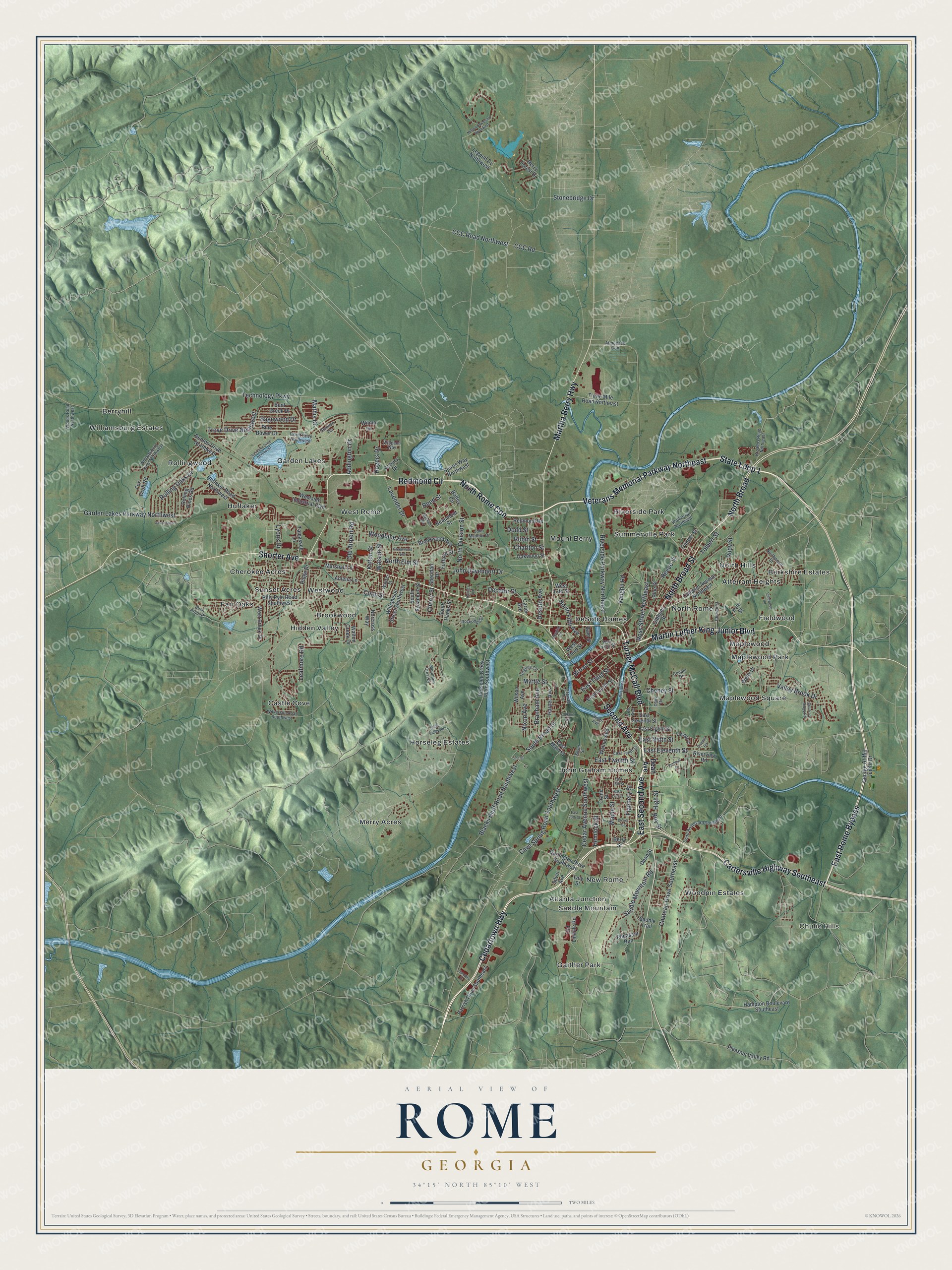
A new map of Rome, Georgia, made in 2026 and printed to order on thick archival matte paper.
12" x 18" Archival Matte Print
A Map of Home. A Work of Art.
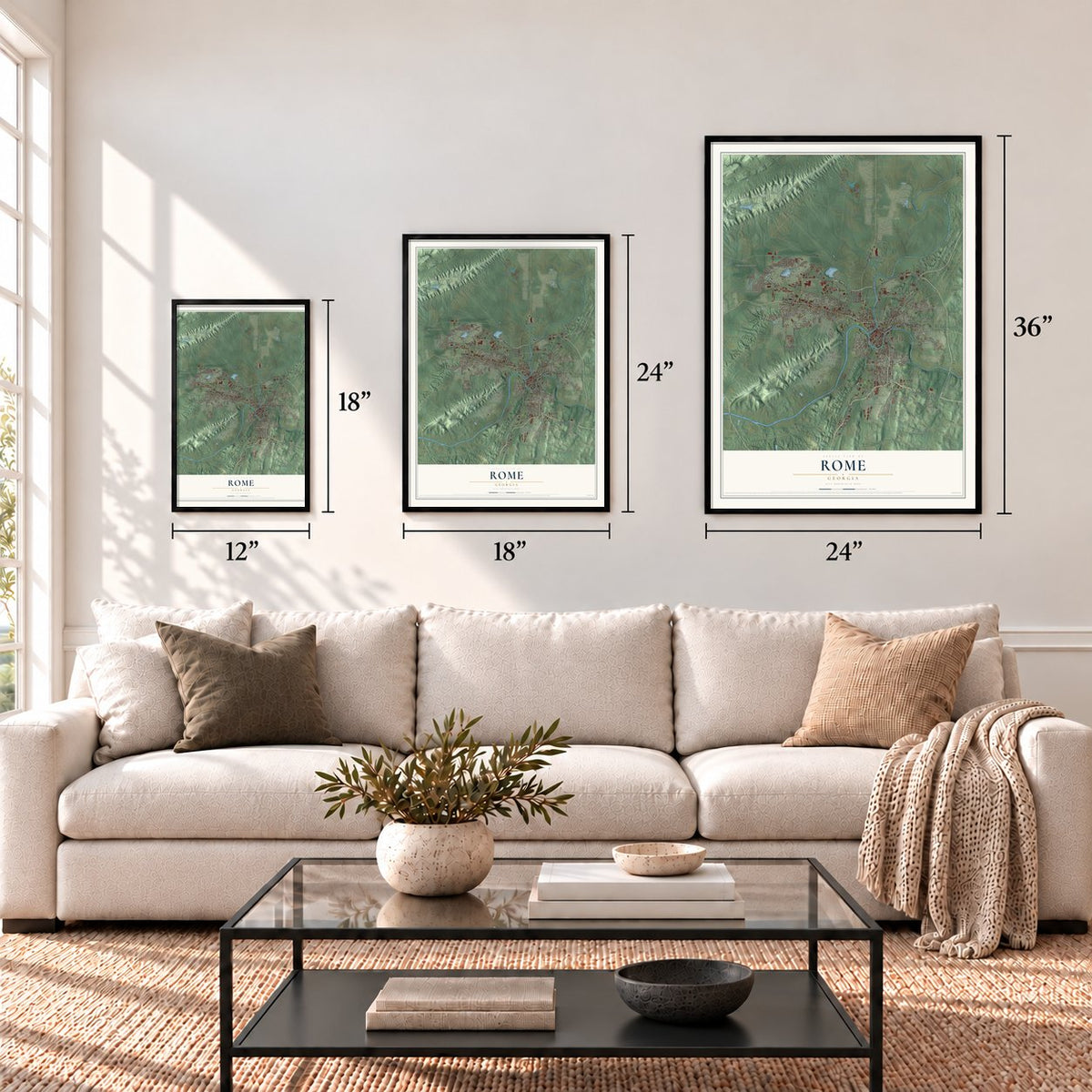
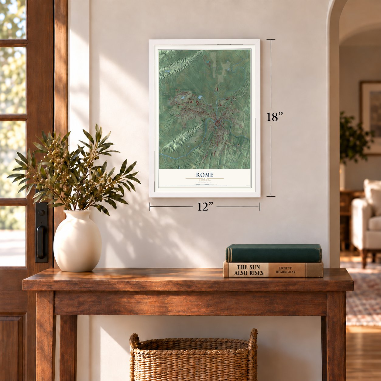
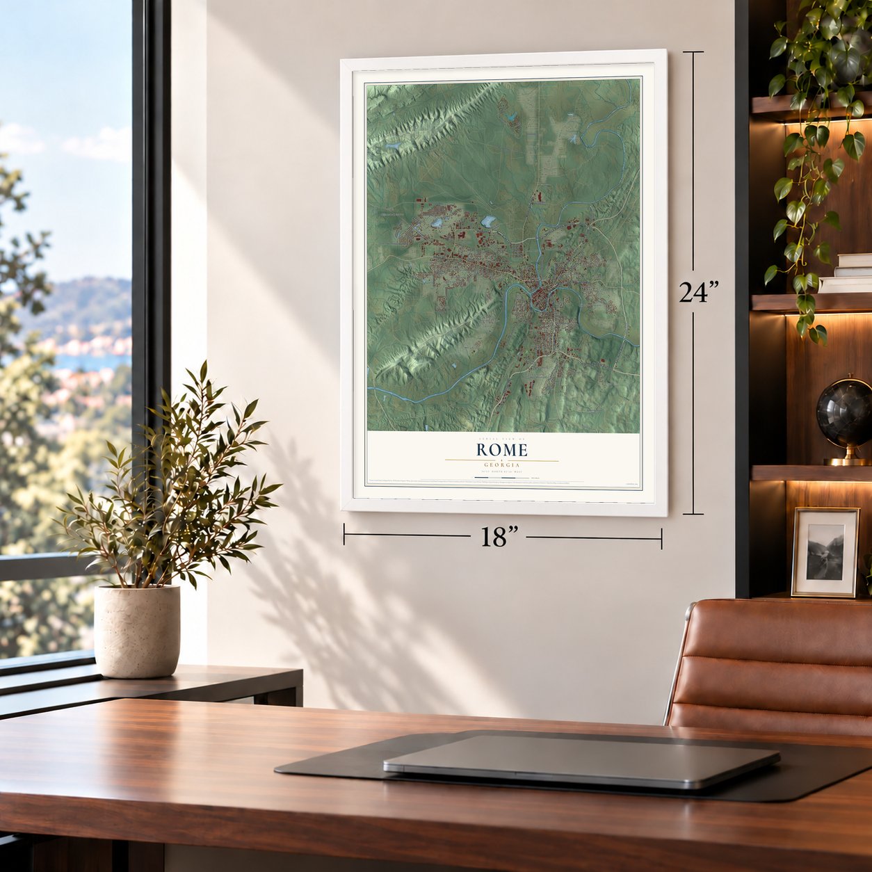
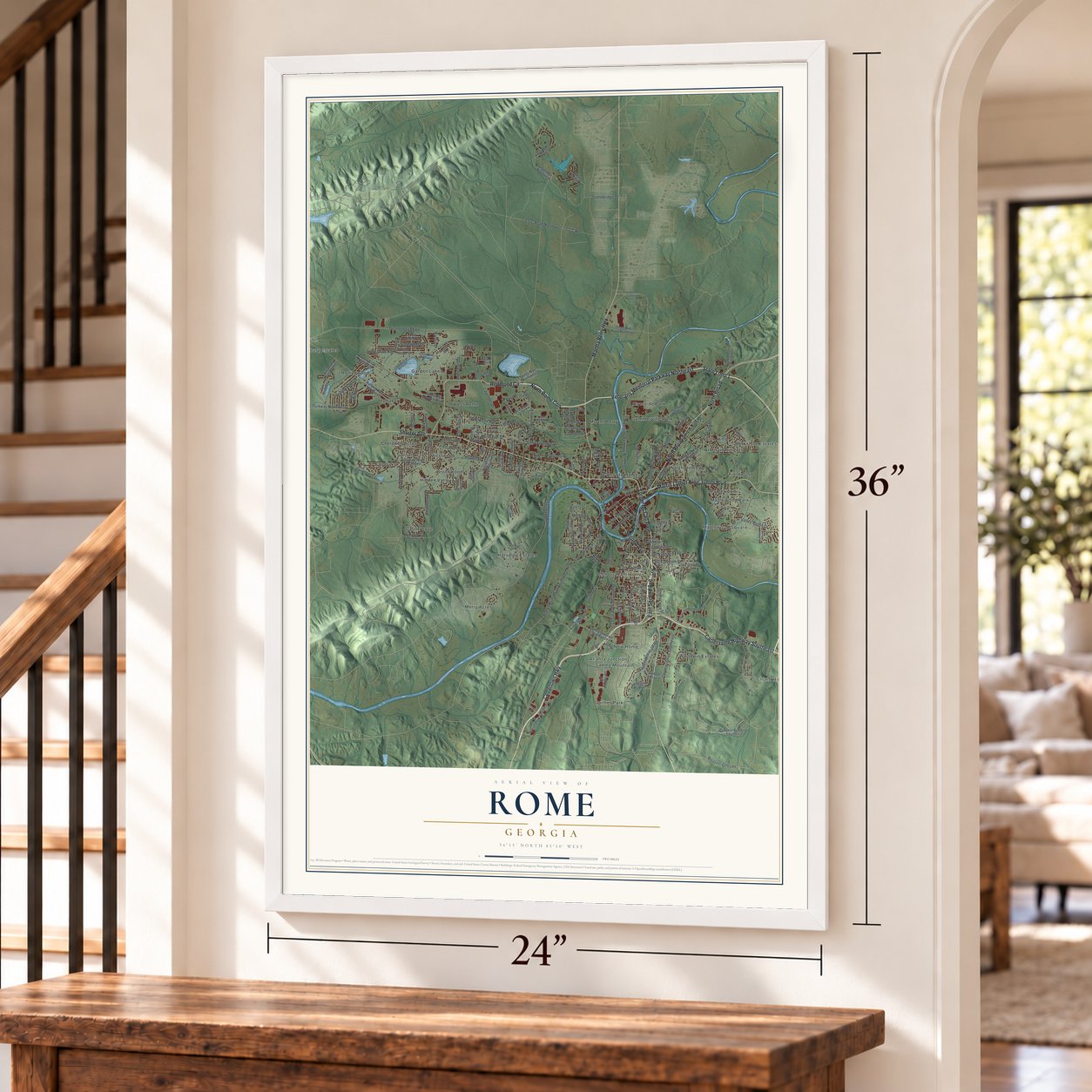
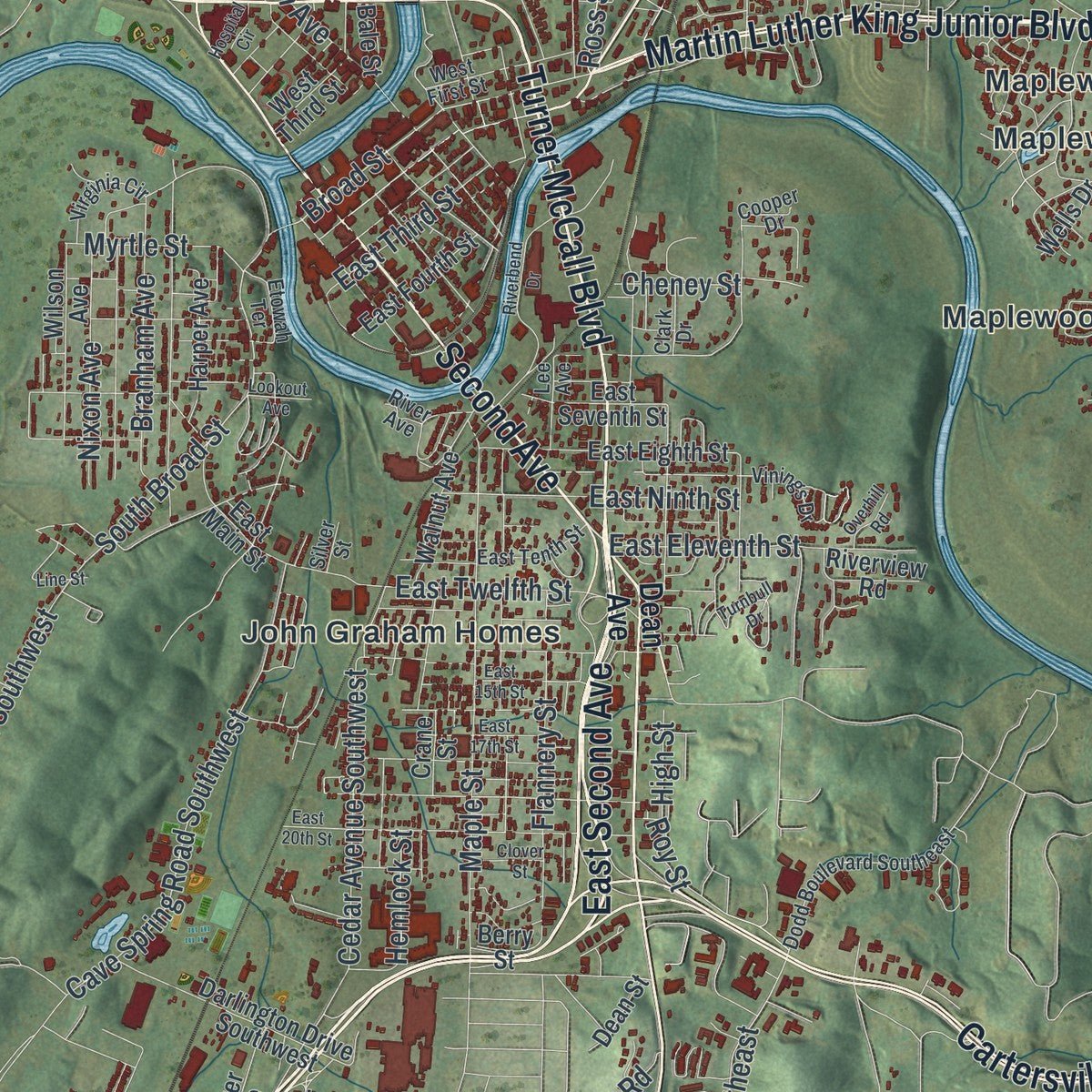
Explore Rome, Georgia from a whole new perspective. Created using aerial imagery and detailed geographic data, this map captures Rome building by building, with labeled streets, familiar landmarks, and shaded topographical relief that highlights the natural contours of the landscape.
Combining modern data with the timeless character of a vintage atlas, this map is just as interesting up close as it is beautiful on the wall. Whether you grew up in Rome, spent memorable years there, or call it home today, this unique map is a great way to celebrate a place that means something to you. Zoom in on the preview to look for your street, and then order a print to put your memories on the wall.
Three ways to hang it
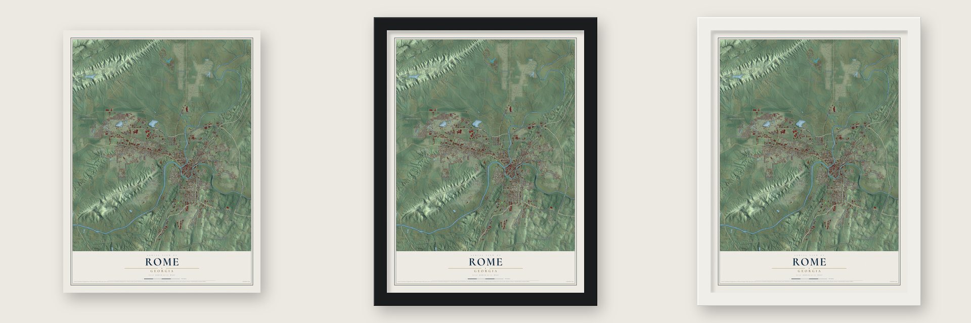
Unframed archival matte, a black wood frame or a white wood frame.
Up close
Geography Worth Displaying
This map was created using accurate cartographic data and authoritative geographic sources, including the U.S. Geological Survey (USGS) and FEMA. The map brings together terrain, waterways, roads, and building detail. The majority of the streets are labeled, houses are accurately depicted, and the topography is derived from government sources. Combining local data with carefully composed color and shading leads to this beautifully detailed Rome artwork for your wall.
Rather than simply showing street outlines, we’ve included as many of the street names as we could reasonably fit on the map while keeping their names legible. Zoom in on the high resolution preview to see exactly what’s on the map. We truly set out to create a statement piece for anyone who loves Rome. So whether it’s for you, or a gift for someone you love, we hope this map of Rome brings back fond memories.
Explore the full map of Rome, Georgia and read about the local places it shows.
About Rome, Georgia
Rome is the county seat and largest city of Floyd County, with 37,713 people at the 2020 census. It grew where the Etowah and Oostanaula rivers meet to form the Coosa, on land held first by the Creek and later by the Cherokee. Cherokee leaders Major Ridge and John Ross both lived and farmed cotton here until the Cherokee were forced west on the Trail of Tears in 1838, and Ridge's home survives as the Chieftains Museum.
Five founders, most of them veterans of the War of 1812, started the town in 1834. They drew names at Alhambra, and Col. Daniel R. Mitchell's choice won because the place sat on seven hills between rivers, like the Rome in Italy. The legislature chartered the city in 1835, and the county seat moved here from Livingston. The first steamboat came up the Coosa in 1836 to carry cotton toward New Orleans, an 18-mile rail spur reached Kingston in 1849, and by 1860 Rome had 4,010 people.
- Forrest saves the town, 1863In April 1863 Union Colonel Abel Streight led a raid on mules from near Cedar Bluff, Alabama, aiming for Rome. Confederate General Nathan Bedford Forrest fooled him into giving up a few miles from the city. Shaken, the city council spent $3,000 on three forts, named Attaway, Norton and Stovall for local men killed in the war, and they were ready by October 1863.
- Sherman's army in 1864Rome's iron works had made cannons for the Confederacy, so the town was a prize. Union General Jefferson C. Davis captured it in May 1864, and his troops held it for months while Sherman himself stayed briefly. On November 11, 1864, as they marched off to the sea, they destroyed the forts, the iron works and the rail line to Kingston.
- A water tank turned clock towerIn 1871 the city built a water tank on Neely Hill, above downtown. It was later made into the Rome Clock Tower, which can be seen from much of the city and appears on the city's crest, so locals call the spot Clock Tower Hill.
- A steamboat on Broad StreetThe flood of 1886 put so much water in the streets that a steamboat made its way along Broad Street. Five years later, in 1891, the state legislature acted on advice from the Army Corps of Engineers and amended Rome's charter, creating a commission responsible for building levees along the rivers.
- A wolf statue from Italy, 1929In the late 1920s an American company and an Italian company built a rayon plant here together. Italy honored the project and the city in 1929, when Benito Mussolini sent Rome a copy of the famous wolf statue, with the twins Romulus and Remus nursing, the emblem of the first Rome's founding legend.
Find your street
Names on the Rome map
Every name below is printed on this map. Look for your street, your school, the park where you played, or the pond down the road.
Places and landmarks34
- Chulio Hills
- Atlanta Junction
- Atteiram Heights
- Berkshire Estates
- Berryhill
- Brookwood
- Castle Cove
- Cherokee Acres
- DeSoto Homes
- Fair Oaks
- Fieldwood
- Gaither Park
Show all 34 places
- Garden Lakes
- Hidden Valley
- Horseleg Estates
- Huffaker
- John Graham Homes
- Maplewood
- Maplewood Park
- Maplewood Square
- Merry Acres
- Mount Berry
- New Rome
- North Hills
- North Rome
- Riverside Park
- Rollingwood
- Saddle Mountain
- Summerville Park
- Sunset Acres
- West Rome
- Westwood
- Williamsburg Estates
- Woodpin Estates
Streets and roads183
- Shorter Avenue
- Turner McCall Boulevard
- East Second Avenue
- Second Avenue
- North Rome Con
- Martin Luther King Junior Boulevard
- Veterans Memorial Parkway Northeast
- North Broad Street
- State Loop 1
- Cedartown Highway
- Cartersville Highway Southeast
- Redmond Circle
- East Rome Bypass
- Martha Berry Highway
- North Broad
- Chateau Drive Southeast
- Broad Street
- South Broad Street
- Technology Parkway
- Garden Lakes Parkway Northwest
- Riverside Parkway Northeast
- Cave Spring Road Southwest
- Stonebridge Drive
- John Davenport Drive
- Maple Street
- Saddle Mountain Road
- Charlton Street
- Cedar Avenue Southwest
- Branham Avenue
- East Twelfth Street
Show all 183 streets
- Lavender Drive
- Blacks Bluff Road Southwest
- East Eleventh Street
- CCC Road Northwest
- North Division Street
- Ross Street Northeast
- Woodbine Avenue
- Vaughn Road
- North Fifth Avenue
- Rolling Oaks Drive
- East Ninth Street
- Valley Brook Drive
- East Third Street
- Flannery Street
- North Elm Street
- Mathis Drive
- Addington Drive
- Trove Drive Northwest
- Decatur Street
- Leafmore Road
- Nixon Avenue
- Roy Street
- Tolbert Street
- Watson Street
- Reece Street
- Sagewood Drive
- Rudy Street
- Myrtle Street
- Old Airport Road
- Hemlock Street
- CCC Road
- Lyons Drive
- Desoto Avenue
- Rogers Drive
- Robin Street
- Conn Street
- Reed Street
- Cheney Street
- Cherry Street
- Kirton Street
- High Street
- Dodd Street
- Dean Avenue
- Spires Way Northwest
- Calhoun Avenue Northeast
- Horseleg Creek Road Southwest
- Huffaker Road Northwest
- Redmond Road
- Hampton Boulevard Southeast
- Billy Pyle Road Southwest
- Old Lindale Road
- Parrish Drive Southeast
- Brookwood Avenue
- Darlington Drive Southwest
- East Eighth Street
- Williamson Street Southwest
- Gibbons Street
- George Griffin Junior Drive
- Three Mile Road Northeast
- Saddle Trail
- Berry Forest Drive
- Crane Street
- Benton Drive Northwest
- Legend Cv Northwest
- Wilson Avenue
- Pleasant Valley Road
- Pine Bower Drive
- East Main Street
- Tamassee Lane
- Bent Creek Drive
- Fox Croft Road
- East Fourth Street
- Pheasant Run
- West Brook Drive
- Westside Industrial Boulevard
- Oakwood Street
- Walnut Avenue
- East Seventh Street
- Harper Avenue
- Rolling Pines Road
- South Hanks Street
- Fortune Street
- Walton Creek Drive
- South Sycamore Street
- Beaumont Street
- Amelia Lane
- Battey Circle
- Pine Street
- Riverview Road
- Wilma Drive
- Marshall Lane
- Sheridan Drive
- Couper Street
- Silver Avenue
- Norcross Way
- West Third Street
- Bale Street
- West 13th Street
- Ridge Drive
- Carter Avenue
- Asbury Drive
- Wells Drive
- Dean Street
- Berry Street
- Kyle Street
- Ivey Street
- Dodd Boulevard Southeast
- Vinings Drive
- Elliott Drive Northwest
- Armuchee Con
- West First Street
- Wolf Drive Northeast
- East Tenth Street
- Church Street
- Wilkerson Road Southwest
- Cooper Drive
- John Maddox Drive
- Northwood Drive
- Williamsburg Drive Northwest
- Broadus Road Northeast
- Woods Road Northwest
- Mountain Crest Drive
- Rockridge Drive
- Virginia Circle
- River Avenue
- Glenrise Terrace
- Lee Avenue
- Widgeon Way
- Etowah Terrace
- Wallace Street
- Clark Drive
- Bush Arbor Place
- Silver Street
- Nelson Boulevard Northwest
- East 20th Street
- Shoreline Drive Northwest
- Pine Valley Road
- Riverbend Drive
- Turnbull Drive
- Fieldwood Road
- East 17th Street
- East 15th Street
- Marable Way
- South Ivy Ridge Road
- Sanders Drive
- Savannah Place
- Greenwood Avenue
- Clover Street
- Overhill Road
- Hospital Circle
- Lookout Avenue
- Holmes Avenue
- Line Street
Names are listed as they appear on the printed map. Zoom into the product photos to find them.
The art of mapping a place
How This Map Was Made
Real places. Remarkable detail. Discover the layers that turn geographic data into a map of home.

The view from above
Aerial imagery reveals the character of the land: woodland, open fields, and the patterns of a place.

The shape of the land
Elevation data brings hills, valleys, and subtle changes in the landscape into view.

The details of home
Roads, waterways, and building footprints come together to make the map feel unmistakably local.

Geography becomes art
Considered color, shading, and typography bring the layers together in a map made for your wall.


Process illustrated with Mendon, Massachusetts. Aerial imagery: USDA NAIP. Terrain: USGS 3D Elevation Program. Map details and finished artwork: KNOWOL.
The Details
About This Print
Choose an archival matte print, or a black or white Ayous wood frame. The archival matte print is unframed.
Select your size and finish above to see the matching product image and price.
Materials & Craftsmanship
A contemporary map with the character of a classic atlas, printed on archival matte paper. Optional frames are made from Ayous wood.
Your printed map does not include the watermark shown in the full-map preview.
Shipping & Delivery
Free shipping within the United States. Every print is made to order in the USA.
Buying a gift? Add a note in your cart and we'll include it. We never put prices in the package.
Prints ship within 2 to 3 business days. Allow 7 to 10 days total from ordering for delivery. Timing may vary during holidays or periods of high order volume.
Read our shipping policy.
Returns and damaged prints
Each print is made to order. Change-of-mind refunds are not available after production.
If your print arrives damaged, misprinted or incorrect, contact support@knowol.com within 30 days of receiving it. Include your order number, photos and a description of the issue.
Read our full refund and replacement policy. For questions about your order, email support@knowol.com.
Find your town
Looking for another city?
Find a map of home in our Georgia collection, or any town in the country.
Nearby
Maps of towns near Rome
Know someone from one of these towns? Their map makes a great gift.
 Berry College
, Georgia
From $39.99See the map
 Garden Lakes
, Georgia
From $39.99See the map
 Lindale
, Georgia
From $39.99See the map
More maps nearby: Shannon, Coosa, Plainville, Cave Spring and Kingston.