


Search for another town



Free U.S. delivery 7 to 10 days after you order
Roswell, New Mexico Map Art
Building by building, with labeled streets and shaded relief.
12" x 18" Archival Matte Print
A Map of Home. A Work of Art.
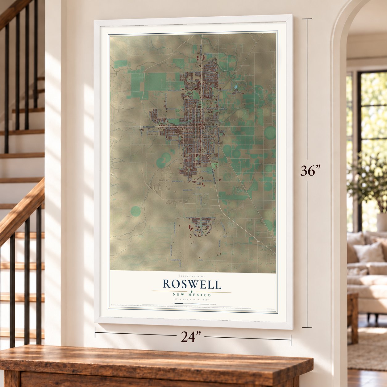
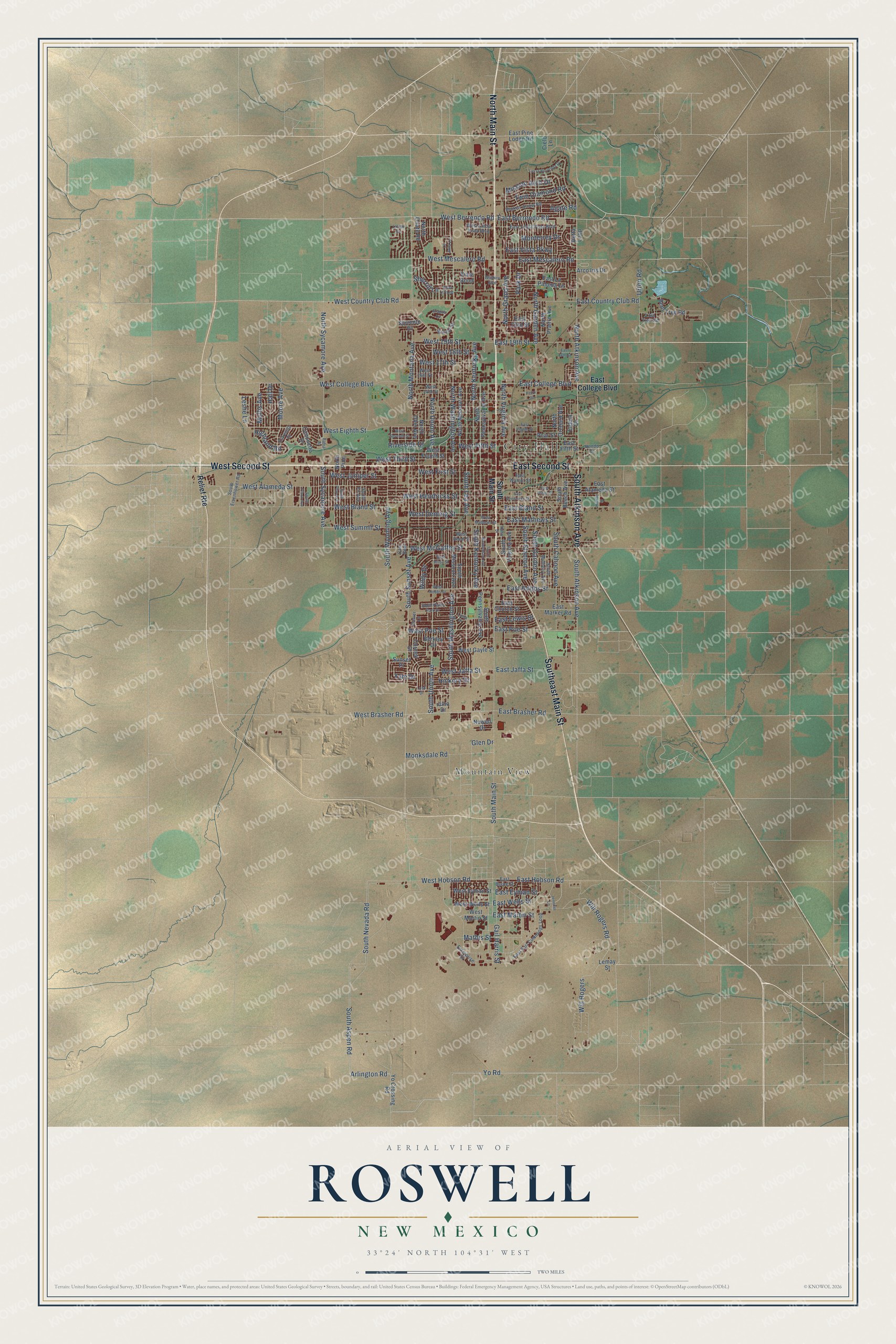
Explore Roswell, New Mexico from a whole new perspective. Created using aerial imagery and detailed geographic data, this map captures Roswell building by building, with labeled streets, familiar landmarks, and shaded topographical relief that highlights the natural contours of the landscape.
Combining modern data with the timeless character of a vintage atlas, this map is just as interesting up close as it is beautiful on the wall. Whether you grew up in Roswell, spent memorable years there, or call it home today, this unique map is a great way to celebrate a place that means something to you. Zoom in on the preview to look for your street, and then order a print to put your memories on the wall.
Three ways to hang it
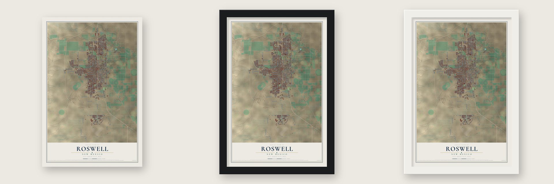
Unframed archival matte, a black wood frame or a white wood frame.
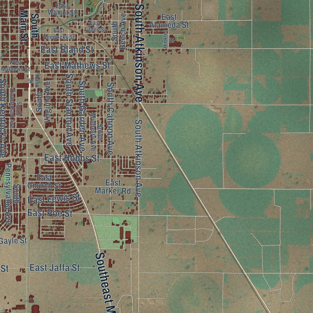
Up close
Geography Worth Displaying
This map was created using accurate cartographic data and authoritative geographic sources, including the U.S. Geological Survey and the Census Bureau. The map brings together terrain, waterways, roads, and building detail. The majority of the streets are labeled, houses are accurately depicted, and the topography is derived from government sources. Combining local data with carefully composed color and shading leads to this beautifully detailed Roswell artwork for your wall.
Rather than simply showing street outlines, we’ve included as many of the street names as we could reasonably fit on the map while keeping their names legible. Zoom in on the high resolution preview to see exactly what’s on the map. We truly set out to create a statement piece for anyone who loves Roswell. So whether it’s for you, or a gift for someone you love, we hope this map of Roswell brings back fond memories.
Read the story behind this map of Roswell, New Mexico from 2026.

Find your street
Names on the Roswell map
Every name below is printed on this map. Look for your street, your school, the park where you played, or the pond down the road.
Places and landmarks2
- City Hall
- Mountain View
Streets and roads174
- West Second Street
- North Main Street
- Southeast Main Street
- East Second Street
- South Atkinson Avenue
- East Mescalero Road
- West Berrendo Road
- East Berrendo Road
- South Aspen Road
- West Country Club Road
- South Nevada Road
- Arlington Road
- East Brasher Road
- North Atkinson Avenue
- Riverside Drive
- West Hobson Road
- North Garden Avenue
- West Bland Street
- East Hobson Road
- East Poe Street
- West Fifth Street
- East Mathews Street
- South Sycamore Avenue
- Yo Road
- South Main Street
- West Alameda Street
- West College Boulevard
- North Washington Avenue
- South Sunset Avenue
- West Eighth Street
Show all 174 streets
- South Union Avenue
- South Washington Avenue
- West Brasher Road
- South Lea Avenue
- North Montana Avenue
- West Hendricks Street
- North Kentucky Avenue
- North Union Avenue
- North Sycamore Avenue
- East College Boulevard
- Will Rogers Road
- South Wyoming Avenue
- West Third Street
- North Grand Avenue
- East Country Club Road
- South Stanton Avenue
- West First Street
- Will Rogers
- South Garden Avenue
- West Summit Street
- Mission Arch Drive
- West McGaffey Street
- East Bland Street
- South Kentucky Avenue
- West Jaffa Street
- Highland Road
- West Deming Street
- West Mescalero Road
- South Cahoon Avenue
- East 19th Street
- West Juniper Street
- West 19th Street
- Moore Avenue
- North Virginia Avenue
- West Poe Street
- East Hobbs Street
- Gail Harris Street
- Twin Diamond Road
- Sherrill Lane
- Mathis Street
- Urton Road
- Hall Drive
- West 17th Street
- East Vista Parkway
- East Jaffa Street
- Park Drive
- Monksdale Road
- East Wells Street
- East Eyman Street
- Mullis Avenue
- Monterrey Drive
- East Martin Street
- West 18th Street
- East Lewis Street
- Hickory Drive
- Wildy Drive
- Agate Road
- Leslie Lane
- Yale Drive
- Glen Drive
- Relief Route
- Yo Crossing Road
- South Missouri Avenue
- South Pennsylvania Avenue
- West Fourth Street
- North Missouri Avenue
- North Pennsylvania Avenue
- South Virginia Avenue
- East Alameda Street
- North Ohio Avenue
- North Orchard Avenue
- West Gayle Street
- East Fifth Street
- Bent Tree Road
- West Wells Street
- South Beech Avenue
- East 23rd Street
- East La Paloma Lane
- East Pine Lodge Road
- East Marker Road
- Arco Iris Drive
- West Eyman Street
- North Onate Road
- Canoncito Drive
- Pear Street
- Berkley Drive
- North Prairie Avenue
- Cornell Drive
- East Church Street
- West Martin Street
- Sorrento Drive
- Sunset Place
- Eldora Drive
- Newell Drive
- Lemay Street
- North Pine
- Cielo Lane
- Detta Loop
- Viale Bond
- Juno Drive
- East Linda Vista Boulevard
- East Earl Cummings Loop
- South Mulberry Avenue
- West Linda Vista Boulevard
- East Walnut Street
- West 16th Street
- Broken Arrow Road
- Enterprise Street
- West 14th Street
- East Byrne Street
- West Reed Street
- Brazos Street
- South Eisenhower Road
- Clover Lane
- South Fir Avenue
- Estrellita Drive
- Lost Trail Road
- Hondo Drive
- Cam Real
- Hahn Street
- Tierra Berrenda Drive
- South Richardson Avenue
- East Hendricks Street
- West Seventh Street
- West Hobbs Street
- West Mathews Street
- West Wildy Street
- East Tilden Street
- West 27th Street
- South Plains Park Drive
- Wilshire Boulevard
- South Pine Avenue
- Hinkle Street
- East Eighth Street
- Lusk Drive
- Granite Circle
- Petro Drive
- Bahia Drive
- La Jolla Lane
- East 18th Street
- South Pinon Avenue
- Jennifer Lane
- Latigo Circle
- Linda Drive
Names are listed as they appear on the printed map. Zoom into the product photos to find them.
About Roswell, New Mexico
Roswell is a city of 48,422 people and the county seat of Chaves County, in the high plains of southeastern New Mexico. In 1865 pioneers from Missouri tried to start a settlement called Missouri Plaza about 15 miles to the southwest, but they had to give it up for lack of water. Then in 1869 Van C. Smith, an Omaha businessman, and his partner Aaron Wilburn put up two adobe buildings. They served as a general store, a post office and rooms for paying guests. Smith claimed the land in 1871, became the first postmaster, and named the place for his father, Roswell Smith, a lawyer in Lafayette, Indiana.
In 1877 the family of Captain Joseph Calloway Lea bought out Smith's claim, and in time the Leas owned most of the town and the land around it. The real growth began in 1890. That year merchant Nathan Jaffa had a well drilled behind his house on Richardson Avenue, and it tapped a major aquifer. New Mexico Military Institute was founded in 1891, and the Pecos Valley Railroad reached town in 1892.
- An iron cross in the riverbankDuring World War II, German prisoners from a camp in nearby Orchard Park paved the banks of the North Spring River. Some set stones in the shape of an iron cross on the north bank, and concrete later hid it. A cleanup crew found it again in the 1980s. On November 11, 1996, the park beside it became POW/MIA Park, and it now holds a piece of the Berlin Wall from the German Air Force.
- Goddard's rocketsIn the 1930s Robert H. Goddard did much of his early rocket work in Roswell. The Roswell Museum rebuilt his engine workshop as an exhibit, and Goddard High School carries his name.
- 72 home runs in 1954Joe Bauman hit 72 home runs for the 1954 Roswell Rockets, a minor-league record, and today's Roswell Invaders play at Joe Bauman Ballpark. Willie Stargell, later a Baseball Hall of Fame inductee, played for the 1959 Roswell Pirates.
- From air base to UFO townThe 1947 UFO report took the town's name, though the alleged crash site lay some 75 miles north, closer to Corona, and the Roswell Army Air Field handled the debris. The city was a military town from 1941 until Walker Air Force Base closed in 1967. It then drew retirees with its climate, and a yearly UFO festival has run since 1995.
Keep exploring New Mexico
Roswell is one of 544 New Mexico towns we've mapped. Every dot on the map is a print of its own.
The search covers every state, New Mexico first.
Near Roswell
Order 2 or more town maps and save 10%. Shown in the size and finish you picked above, so they hang as a set.
- Mountain View 12" x 18" / Archival Matte Print $39.99
- East Grand Plains 12" x 18" / Archival Matte Print $39.99
- Midway 12" x 18" / Archival Matte Print $39.99


More maps nearby: Dexter, Hagerman, Lake Arthur, Morningside and Artesia.
The art of mapping a place
How This Map Was Made
Real places. Remarkable detail. Discover the layers that turn geographic data into a map of home.

The view from above
Aerial imagery reveals the character of the land: woodland, open fields, and the patterns of a place.

The shape of the land
Elevation data brings hills, valleys, and subtle changes in the landscape into view.

The details of home
Roads, waterways, and building footprints come together to make the map feel unmistakably local.

Geography becomes art
Considered color, shading, and typography bring the layers together in a map made for your wall.


Process illustrated with Mendon, Massachusetts. Aerial imagery: USDA NAIP. Terrain: USGS 3D Elevation Program. Map details and finished artwork: KNOWOL.
The Details
About This Print
Choose an archival matte print, or a black or white Ayous wood frame. The archival matte print is unframed.
Select your size and finish above to see the matching product image and price.
Materials & Craftsmanship
A contemporary map with the character of a classic atlas, printed on archival matte paper. Optional frames are made from Ayous wood.
Your printed map does not include the watermark shown in the full-map preview.
Shipping & Delivery
Free shipping within the United States. Every print is made to order in the USA.
Buying a gift? Add a note in your cart and we'll include it. We never put prices in the package.
Prints ship within 2 to 3 business days. Allow 7 to 10 days total from ordering for delivery. Timing may vary during holidays or periods of high order volume.
Read our shipping policy.
Returns and damaged prints
Each print is made to order. Change-of-mind refunds are not available after production.
If your print arrives damaged, misprinted or incorrect, contact support@knowol.com within 30 days of receiving it. Include your order number, photos and a description of the issue.
Read our full refund and replacement policy. For questions about your order, email support@knowol.com.