
Search for another town


Free U.S. delivery 7 to 10 days after you order
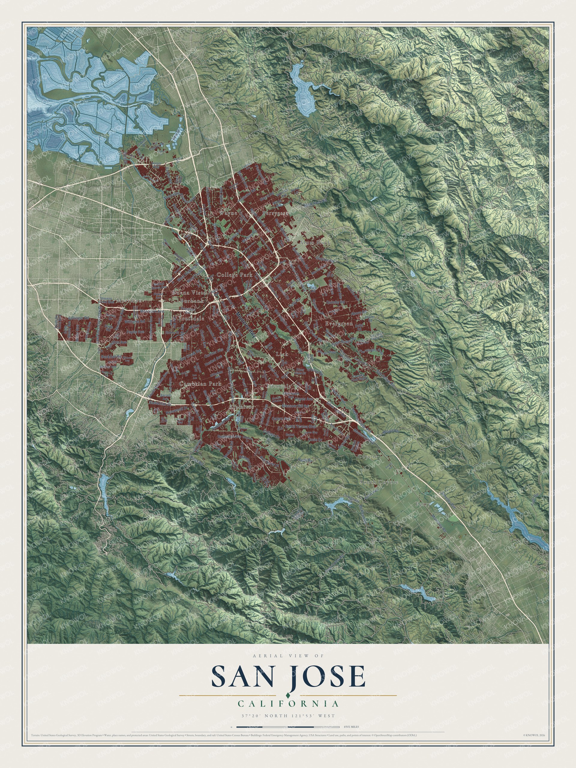
San Jose, California Map Art
Building by building, with labeled streets and shaded relief.
12" x 18" Archival Matte Print
A Map of Home. A Work of Art.
Explore San Jose, California from a whole new perspective. Created using aerial imagery and detailed geographic data, this map captures San Jose building by building, with labeled streets, familiar landmarks, and shaded topographical relief that highlights the natural contours of the landscape.
Combining modern data with the timeless character of a vintage atlas, this map is just as interesting up close as it is beautiful on the wall. Whether you grew up in San Jose, spent memorable years there, or call it home today, this unique map is a great way to celebrate a place that means something to you. Zoom in on the preview to look for your street, and then order a print to put your memories on the wall.
Three ways to hang it
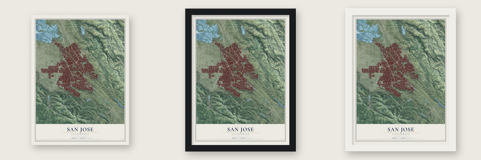
Unframed archival matte, a black wood frame or a white wood frame.
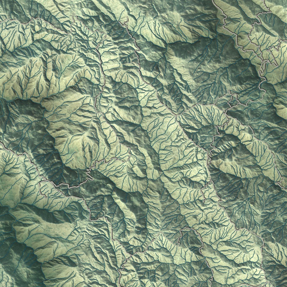
Up close
Geography Worth Displaying
This map was created using accurate cartographic data and authoritative geographic sources, including the U.S. Geological Survey and the Census Bureau. The map brings together terrain, waterways, roads, and building detail. The majority of the streets are labeled, houses are accurately depicted, and the topography is derived from government sources. Combining local data with carefully composed color and shading leads to this beautifully detailed San Jose artwork for your wall.
Rather than simply showing street outlines, we’ve included as many of the street names as we could reasonably fit on the map while keeping their names legible. Zoom in on the high resolution preview to see exactly what’s on the map. We truly set out to create a statement piece for anyone who loves San Jose. So whether it’s for you, or a gift for someone you love, we hope this map of San Jose brings back fond memories.
Read the story behind this map of San Jose, California from 2026.

Find your street
Names on the San Jose map
Every name below is printed on this map. Look for your street, your school, the park where you played, or the pond down the road.
Places and landmarks16
- Alamitos
- Alum Rock
- Berryessa
- Buena Vista
- Burbank
- Cambrian Park
- College Park
- Coyote
- Edenvale
- Evergreen
- Fruitdale
- Lick
Show all 16 places
- Meridian
- Perry
- South Coyote
- Wayne
Streets and roads242
- Monterey Highway
- North First Street
- Lawrence Expressway
- South Bascom Avenue
- Saratoga Avenue
- Vine Street
- Miller Avenue
- West Hedding Street
- Monterey Road
- Harry Road
- New Street
- Bernal Road
- Almaden Expressway
- Capitol Expressway
- Camden Avenue
- Santa Teresa Boulevard
- Blossom Hill Road
- Meridian Avenue
- Almaden Road
- Tully Road
- Yerba Buena Road
- Curtner Avenue
- Sierra Road
- Zanker Road
- Leigh Avenue
- Story Road
- North Capitol Avenue
- Cherry Avenue
- Senter Road
- San Felipe Road
Show all 242 streets
- McLaughlin Avenue
- Moorpark Avenue
- Snell Avenue
- Quimby Road
- South White Road
- Berryessa Road
- Montague Expressway
- Mabury Road
- Aborn Road
- Hellyer Avenue
- McKean Road
- Coyote Road
- McKee Road
- Oakland Road
- Lincoln Avenue
- Ruby Avenue
- South Tenth Street
- Williams Road
- Murillo Avenue
- Coleman Road
- Hostetter Road
- Bird Avenue
- Dry Creek Road
- North Fourth Street
- Lundy Avenue
- Casa Loma Road
- Redmond Avenue
- Silver Creek Road
- Junction Avenue
- Piedmont Road
- Calero Avenue
- Metcalf Road
- Curie Drive
- Hamilton Avenue
- North Tenth Street
- Bollinger Road
- Tuers Road
- Morrill Avenue
- Payne Avenue
- North White Road
- Pearl Avenue
- McAbee Road
- Husted Avenue
- Basking Ridge Avenue
- Narvaez Avenue
- Bucknall Road
- Bret Harte Drive
- Lucretia Avenue
- Frost Road
- North 17th Street
- Cahalan Avenue
- Flint Avenue
- South Second Street
- Rosswood Drive
- Clayton Road
- Hicks Road
- West Taylor Street
- Scheller Avenue
- Silver Leaf Road
- Colleen Drive
- Alum Rock Road
- Orlando Drive
- Samaritan Drive
- Hampton Drive
- Hayes Avenue
- Gold Street
- Disk Drive
- Stevens Creek Boulevard
- Park Avenue
- Forest Avenue
- Delmas Avenue
- South De Anza Boulevard
- Hillsdale Avenue
- South King Road
- Chynoweth Avenue
- Old Oakland Road
- Bailey Avenue
- Willow Street
- Cottle Road
- Airport Boulevard
- Coleman Avenue
- Union Avenue
- County Highway G8
- Country Club Parkway
- Lean Avenue
- Park Road
- Nieman Boulevard
- Winchester Boulevard
- Ocala Avenue
- Hassler Parkway
- Winfield Boulevard
- Jarvis Avenue
- Fowler Road
- Los Esteros Road
- Doyle Road
- Ross Avenue
- Suncrest Avenue
- Holger Way
- Parkmoor Avenue
- New Jersey Avenue
- The Villages Parkway
- Stokes Street
- Harwood Road
- O'Toole Avenue
- Johnson Avenue
- Scottsdale Drive
- Via del Oro
- Snow Drive
- South Blaney Avenue
- South 22nd Street
- Walnut Grove Avenue
- Marten Avenue
- Bering Drive
- Terilyn Avenue
- Endicott Boulevard
- Avenue Espana
- Lewis Road
- Delta Road
- Allen Avenue
- Cinnabar Hills Road
- Del Mar Avenue
- McCoy Avenue
- River View Drive
- Borina Drive
- Grand Bl
- Ezie Street
- Bose Lane
- Alvin Avenue
- Stone Avenue
- Dove Hill Road
- Noble Avenue
- Roeder Road
- Dow Drive
- Aragon Way
- Cisco Way
- Hurst Avenue
- Rudy Drive
- Pala Avenue
- Barrett Avenue
- Hill Lane
- Cerro Verde
- Taft Drive
- Galen Drive
- Perie Lane
- Gila Drive
- Silver Creek Valley Road
- Guadalupe Mines Road
- Cropley Avenue
- Chesbro Avenue
- Flickinger Avenue
- Martin Avenue
- Landess Avenue
- Phelan Avenue
- West Trimble Road
- Vistapark Drive
- Skyway Drive
- Los Pinos Way
- Farnsworth Drive
- Dent Avenue
- Rincon Avenue
- Potrero Drive
- Davis Street
- Avenue Arboles
- Wallace Drive
- Old Yerba Buena Road
- D'Amico Drive
- Bonita Avenue
- North 26th Street
- Spring Hill Way
- Chopin Avenue
- Alex Drive
- Lick Avenue
- Metro Drive
- Ranch Drive
- Altino Boulevard
- Anne Way
- Ute Drive
- Newhall Street
- Taylor Street
- North Jackson Avenue
- Glenview Drive
- San Tomas Expressway
- Cottle Avenue
- Leyland Park Drive
- Stockton Avenue
- Trinidad Drive
- South Daniel Way
- Quito Road
- West Tasman Drive
- Westmont Avenue
- Las Plumas Avenue
- Sundown Lane
- Rogers Avenue
- Brigadoon Way
- Park Estates Way
- Joseph Lane
- Zanker Lane
- Vallejo Drive
- Heaton Moor Drive
- Ilikai Avenue
- Copco Lane
- Ellen Avenue
- Barron Park Drive
- Mazzone Drive
- Bambi Lane
- Bassett Street
- Purple Hills Drive
- Emado Avenue
- Taffy Drive
- Adair Way
- Rice Drive
- Don Avenue
Names are listed as they appear on the printed map. Zoom into the product photos to find them.
About San Jose, California
San Jose is a city of 1,013,240 people and the seat of Santa Clara County, at the south end of San Francisco Bay. The Tamien, an Ohlone people, lived in the Santa Clara Valley for thousands of years before the Spanish came. Juan Bautista de Anza chose a spot on the east bank of the Guadalupe River for a farming town, and on November 29, 1777, José Joaquín Moraga founded the Pueblo de San José de Guadalupe there.
The river flooded the pueblo so often that in 1791 the settlers moved it about a mile south, around a plaza that is now Plaza de César Chávez. The town grew from about 700 people in 1835 to 900 by 1845, mostly through American newcomers. In 1846 Captain Thomas Fallon rode in from Santa Cruz with nineteen volunteers and took the pueblo during the Bear Flag Revolt. San Jose was incorporated on March 27, 1850, and it became the first state capital when California joined the Union that September.
“Within a year after the opening of the first overland route from Mexico to Alta California, Governor Felipe de Neve authorized establishment of California's first civil settlement.”
- Fifteen ranchosTo draw settlers to thinly peopled California, Mexico handed out thirty-eight rancho land grants in the Santa Clara Valley between 1833 and 1845, and 15 of them lie inside today's San Jose. Two went to men who served as the pueblo's alcalde: Antonio Suñol received Rancho Los Coches, and José María Alviso received Rancho Milpitas.
- The accent on San JoséNineteenth-century newspapers wrote San José, but on December 11, 1943, the U.S. Board on Geographic Names settled on San Jose, following local usage. Residents later pushed to bring the accent back to honor the city's Mexican roots. The city council voted for San José on August 20, 1974, then reversed itself a week later over the cost of new typewriters, documents and signs. On April 3, 1979, it adopted the accented spelling for its seal, stationery and departments.
- Capital of Silicon ValleyAfter World War II San Jose boomed, and in the 1950s and 1960s it grew fast and annexed many neighboring communities. As the technology industry took off around it, the old farm town became a big city, and in 1988 Mayor Tom McEnery made "Capital of Silicon Valley" its motto. The 1990 census showed that San Jose had grown larger than San Francisco.
Keep exploring California
San Jose is one of 1,990 California towns we've mapped. Every dot on the map is a print of its own.
The search covers every state, California first.
Near San Jose
Order 2 or more town maps and save 10%. Shown in the size and finish you picked above, so they hang as a set.
- Communications Hill 12" x 18" / Archival Matte Print $39.99
- Little Portugal 12" x 18" / Archival Matte Print $39.99
- Willow Glen 12" x 18" / Archival Matte Print $39.99

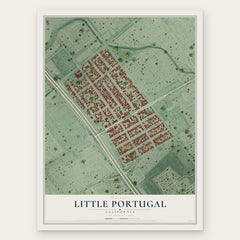

More maps nearby: Alum Rock, Downtown San Jose, Almaden Valley, Buena Vista and East Foothills.
The art of mapping a place
How This Map Was Made
Real places. Remarkable detail. Discover the layers that turn geographic data into a map of home.

The view from above
Aerial imagery reveals the character of the land: woodland, open fields, and the patterns of a place.

The shape of the land
Elevation data brings hills, valleys, and subtle changes in the landscape into view.

The details of home
Roads, waterways, and building footprints come together to make the map feel unmistakably local.

Geography becomes art
Considered color, shading, and typography bring the layers together in a map made for your wall.


Process illustrated with Mendon, Massachusetts. Aerial imagery: USDA NAIP. Terrain: USGS 3D Elevation Program. Map details and finished artwork: KNOWOL.
The Details
About This Print
Choose an archival matte print, or a black or white Ayous wood frame. The archival matte print is unframed.
Select your size and finish above to see the matching product image and price.
Materials & Craftsmanship
A contemporary map with the character of a classic atlas, printed on archival matte paper. Optional frames are made from Ayous wood.
Your printed map does not include the watermark shown in the full-map preview.
Shipping & Delivery
Free shipping within the United States. Every print is made to order in the USA.
Buying a gift? Add a note in your cart and we'll include it. We never put prices in the package.
Prints ship within 2 to 3 business days. Allow 7 to 10 days total from ordering for delivery. Timing may vary during holidays or periods of high order volume.
Read our shipping policy.
Returns and damaged prints
Each print is made to order. Change-of-mind refunds are not available after production.
If your print arrives damaged, misprinted or incorrect, contact support@knowol.com within 30 days of receiving it. Include your order number, photos and a description of the issue.
Read our full refund and replacement policy. For questions about your order, email support@knowol.com.