


Search for another town





Free U.S. delivery 7 to 10 days after you order
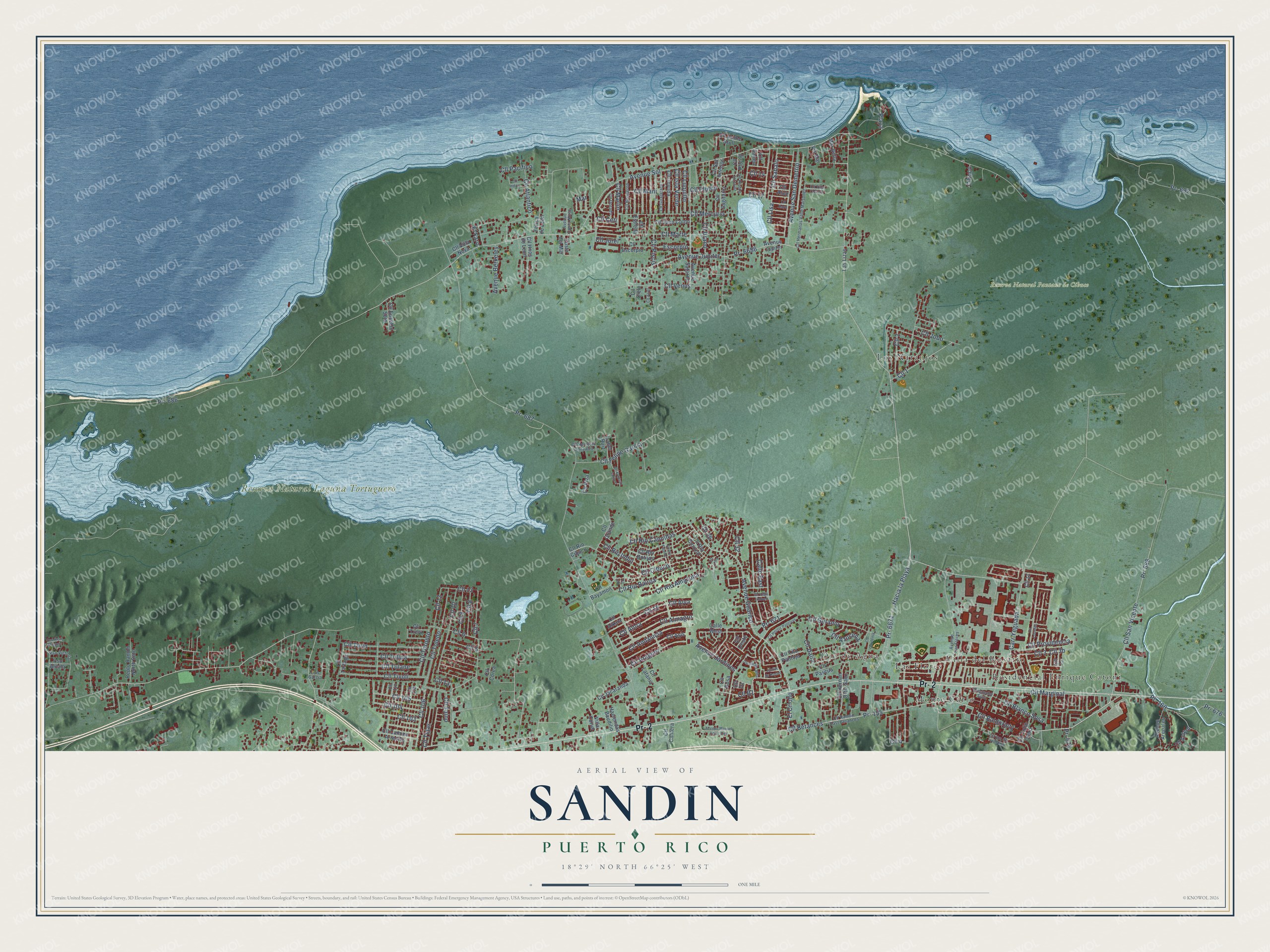
Sandin, Puerto Rico Map Art
Building by building, with labeled streets and shaded relief.
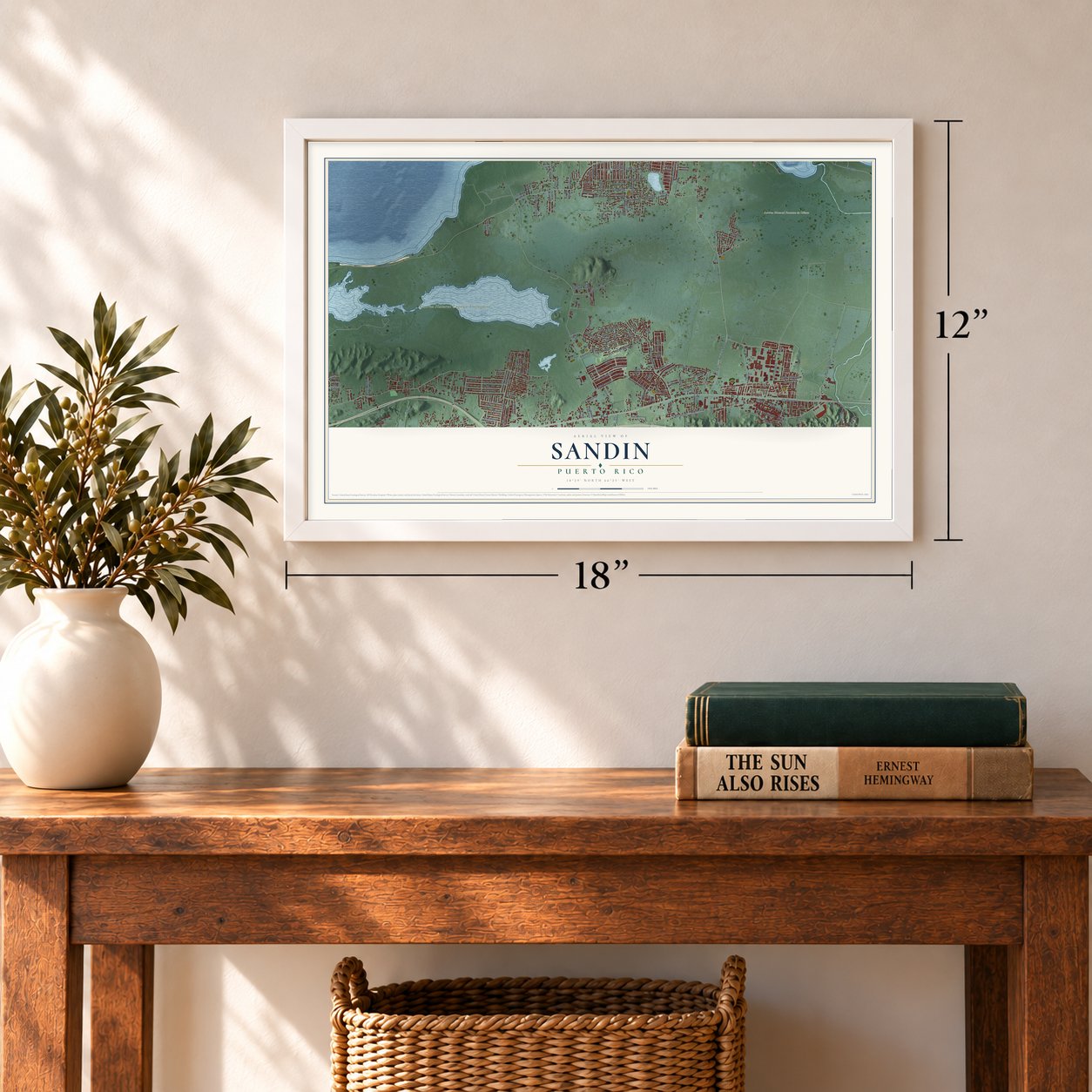
12" x 18" Archival Matte Print
A Map of Home. A Work of Art.
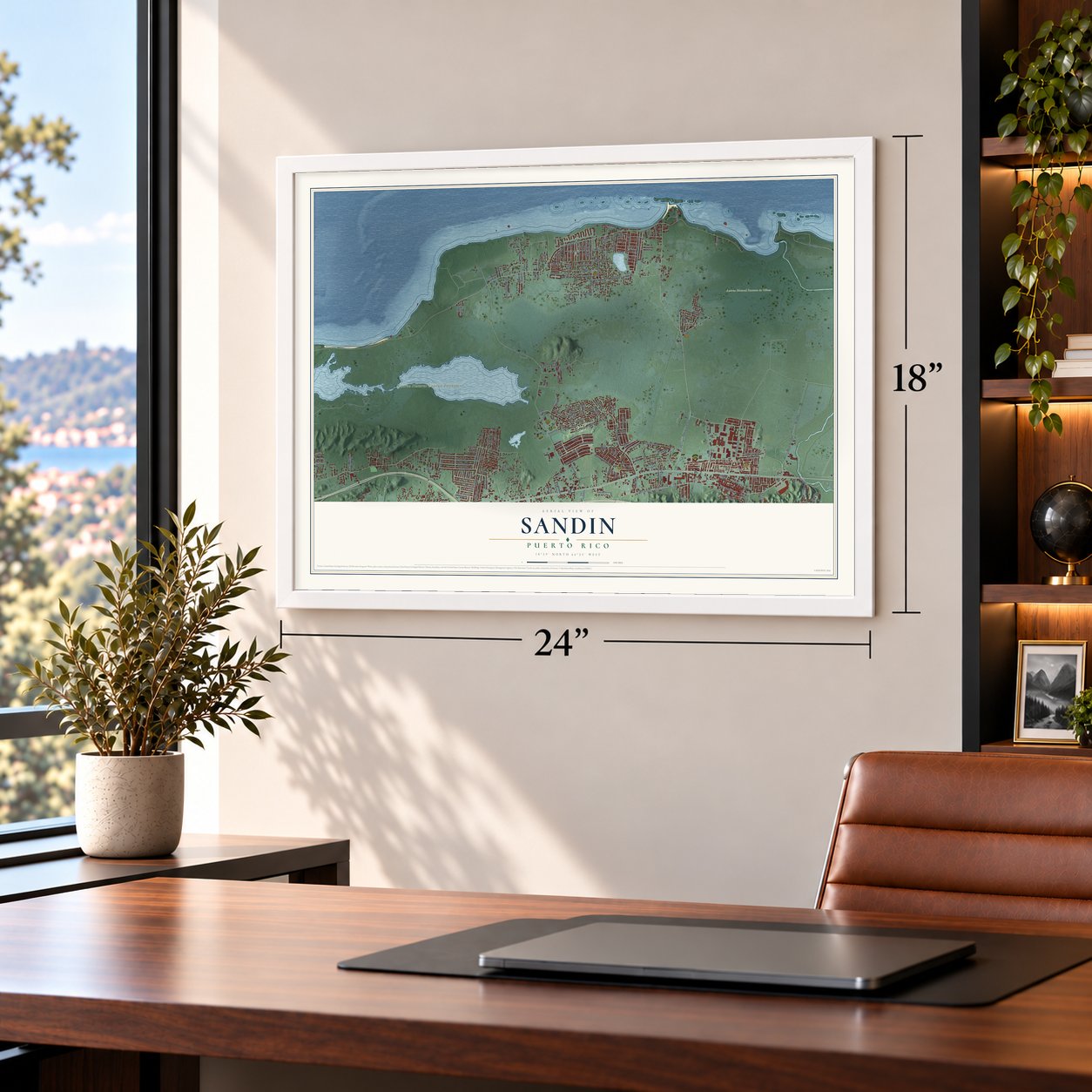
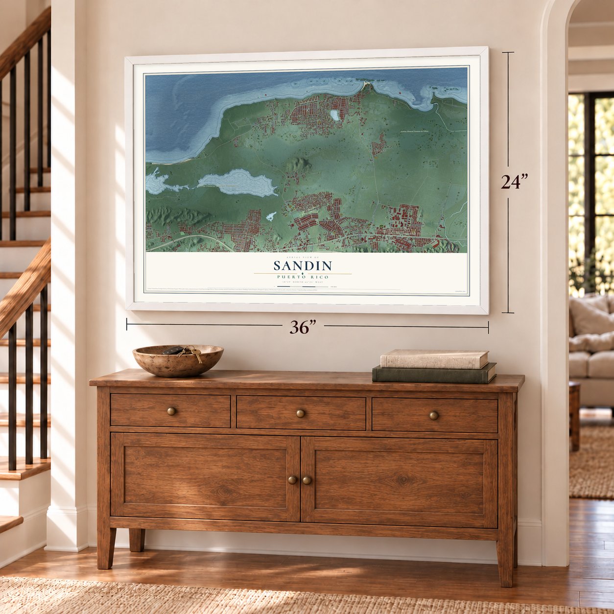
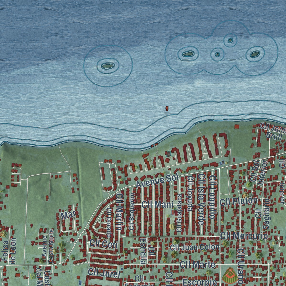
Explore Sandin, Puerto Rico from a whole new perspective. Created using aerial imagery and detailed geographic data, this map captures Sandin building by building, with labeled streets, familiar landmarks, and shaded topographical relief that highlights the natural contours of the landscape.
Combining modern data with the timeless character of a vintage atlas, this map is just as interesting up close as it is beautiful on the wall. Whether you grew up in Sandin, spent memorable years there, or call it home today, this unique map is a great way to celebrate a place that means something to you. Zoom in on the preview to look for your street, and then order a print to put your memories on the wall.
Three ways to hang it
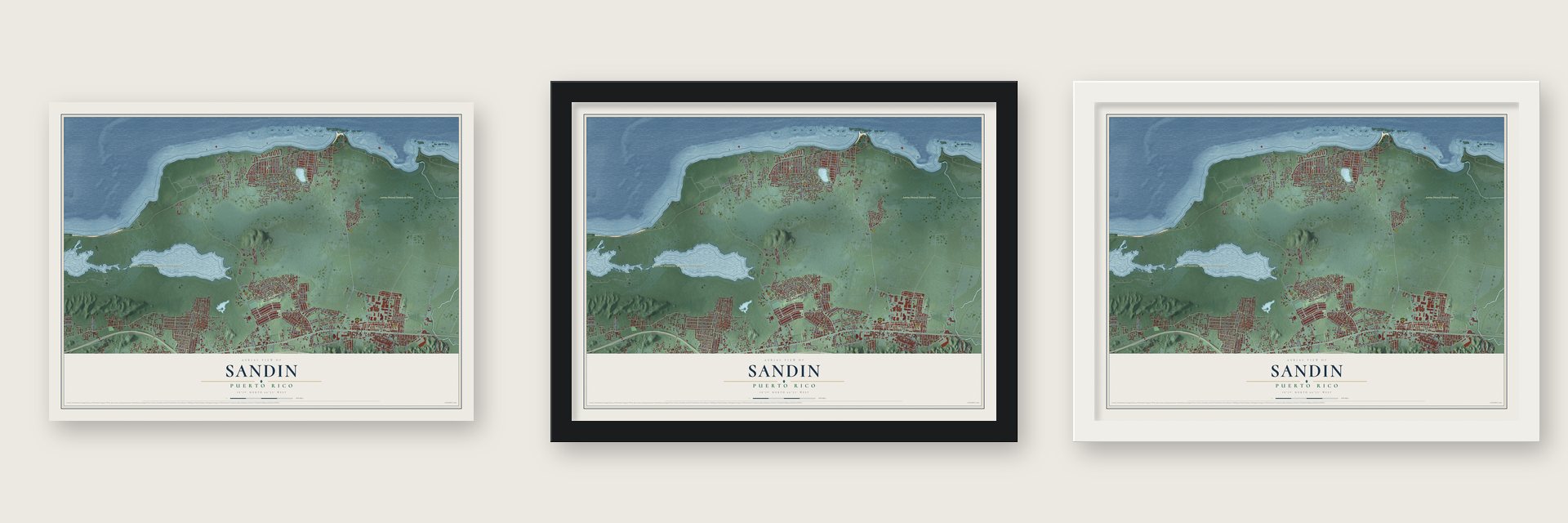
Unframed archival matte, a black wood frame or a white wood frame.
Up close
Geography Worth Displaying
This map was created using accurate cartographic data and authoritative geographic sources, including the U.S. Geological Survey and the Census Bureau. The map brings together terrain, waterways, roads, and building detail. The majority of the streets are labeled, houses are accurately depicted, and the topography is derived from government sources. Combining local data with carefully composed color and shading leads to this beautifully detailed Sandin artwork for your wall.
Rather than simply showing street outlines, we’ve included as many of the street names as we could reasonably fit on the map while keeping their names legible. Zoom in on the high resolution preview to see exactly what’s on the map. We truly set out to create a statement piece for anyone who loves Sandin. So whether it’s for you, or a gift for someone you love, we hope this map of Sandin brings back fond memories.
Read the story behind this map: Detailed Map of Sandin, Puerto Rico.
Find your street
Names on the Sandin map
Every name below is printed on this map. Look for your street, your school, the park where you played, or the pond down the road.
Places and landmarks8
- Reserva Natural Laguna Tortuguero
- Reserva Natural Pantano de Cibuco
- Ojo de Agua
- Los Naranjos
- Villa del Rosario
- Monte Carlo
- Residencial Enrique Catoni
- Las Flores
Streets and roads176
- Pr- 2
- Pr- 155
- Cll Betances
- Avenue Guarico
- El Criollo
- Calle East
- Cll B1
- Cll Felipe García
- Cll Marginal
- Cll Rio Caonillas
- Cll 6
- Carr Yeguada
- Cll 8
- Pr- 686
- Avenue Sol
- Avenue San Demetrio
- Cll Lisa
- Cll Sabalo
- Cll Marlin
- Cll Mercurio
- Pr- 687
- Avenue Jardines
- Pr- 671
- Cll Rio Bairoa
- Cll 1
- Cll Cibuco
- Cll 2
- Cll Rio Indio
- Cll Plutón
- Cll 3
Show all 176 streets
- Cll 9
- Pr- 692
- Pr- 6671
- Pr- 688
- Pr- 6686
- Cll 4
- Avenue Júpiter
- Cll Venus
- Cll San Vicente
- Cll 5
- Cll 13
- Cll 10
- Cll Marte
- Cll 7
- Hacia la Playa
- Cll Baldorioty
- Cll Urano
- Cll Tulipa
- Cll 12
- Cll Tivoli
- Cll Andalucia
- Cll Blanco Sosa
- Cll Turin
- Pr- 160
- Cll Almagro
- Cll Tulane
- Cll 104
- Cll Alva
- Cll Providencia
- Cll Atlantico
- Cll Alora
- Cll Rio Amazona
- Cll Geranio
- Cll Araguez
- Cll Toledo
- Cll Maní
- Pr- 676
- Cll Tejas
- Cll 14
- Cll Azucena
- Cll Piscis
- Cll 105
- Avenue Berkeley
- Cll Jobo
- Cll Toronto
- Cll 32
- Cll 106
- Cll Luquillo
- Cll 15
- Cll Isla Verde
- Escorpio
- Cll Dalia
- Cll Pacifico
- Cll Jurel
- Cll Taino
- Cll 26
- Cll 103
- Playa
- Cll 17
- Cibuco
- Cll Ceti
- Pr- 674
- El Faro
- Mar
- Cll Trevi
- Avenue Jupiter
- Cll D1
- Cll Pluton
- Cll Bayamon
- Cll Rio Cibuco
- Pso Alcala
- Vis Mar
- Cll Rio Corozal
- Avenue Saturno
- Cll Camino Arrecife
- Cll Rio Botijas
- Cll Hernan Ortiz Saez
- Cll 11
- Cll Juan Colón
- Calle West
- Cll Asis
- Cll Tulio Otero
- Cll Estrella
- Cll Eusebio Soto
- Repto Ramon North Soto
- Cll Joyuda
- Cll Grande
- Avenue Arenales
- Cll Antero
- Cll Jacaranda
- Cll Pascua
- Haciendas Baudilio
- Cll Sol Interior
- Costa del Mar
- Las Lizas
- Cll Escorpio
- Cll Tartago
- Cll Jaime Brull
- Felisa de Leon
- Cll Sagitario
- Villa Curiel
- Cll Tito Pantoja
- Mar Bella
- Isabel Ruiz
- Cll Villa Nova
- Cll Hnos de Leon
- Cll Latania
- Cll Cantera
- Cll Corea
- Cll Atun
- Cll Cielo
- Cll Piza
- Cll Balaju
- Cll Oeste
- Cll Rosa
- Cll Aikaia
- Cll Plutón Interior
- Cll Ramon East Betances
- Cll Hermanas Valle Maisonet
- Cll Boqueron
- Cll Em de Hostos
- Cll Guajataca
- Pso Victoria
- Cll Dorado
- Avenue Costa Norte
- Cll Nemesio Gonzalez
- Avenue Las Flores
- Ensanche Silva
- Luis Garcia
- Cll 108
- Cll 110
- Jardin de Rosas
- Cll Vega Jiminez
- Avenue Manuel Velez Itier
- Cll Ernesto Santos
- Cll Rio Fajardo
- Cll Hector Pantojas
- Pso Real Montejo
- Jardin del Alba
- Cll Indico
- Cll Gardenia
- Cll Lourdes
- Cll Raya
- Cll Villa Costera
- Cll Aries
- Cll Cora
Names are listed as they appear on the printed map. Zoom into the product photos to find them.
Keep exploring Puerto Rico
Sandin is one of 295 Puerto Rico towns we've mapped. Every dot on the map is a print of its own.
The search covers every state, Puerto Rico first.
Near Sandin
Order 2 or more town maps and save 10%. Shown in the size and finish you picked above, so they hang as a set.
- Vega Baja 12" x 18" / Archival Matte Print $39.99
- Coto Norte 12" x 18" / Archival Matte Print $39.99
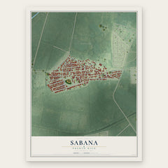
- Sabana 12" x 18" / Archival Matte Print $39.99

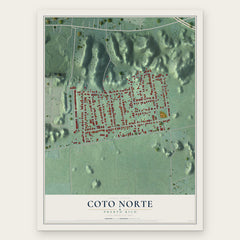
More maps nearby: Monserrate, Breñas, Tierras Nuevas Poniente, Vega Alta and Manatí.
The art of mapping a place
How This Map Was Made
Real places. Remarkable detail. Discover the layers that turn geographic data into a map of home.

The view from above
Aerial imagery reveals the character of the land: woodland, open fields, and the patterns of a place.

The shape of the land
Elevation data brings hills, valleys, and subtle changes in the landscape into view.

The details of home
Roads, waterways, and building footprints come together to make the map feel unmistakably local.

Geography becomes art
Considered color, shading, and typography bring the layers together in a map made for your wall.


Process illustrated with Mendon, Massachusetts. Aerial imagery: USDA NAIP. Terrain: USGS 3D Elevation Program. Map details and finished artwork: KNOWOL.
The Details
About This Print
Choose an archival matte print, or a black or white Ayous wood frame. The archival matte print is unframed.
Select your size and finish above to see the matching product image and price.
Materials & Craftsmanship
A contemporary map with the character of a classic atlas, printed on archival matte paper. Optional frames are made from Ayous wood.
Your printed map does not include the watermark shown in the full-map preview.
Shipping & Delivery
Free shipping within the United States. Every print is made to order in the USA.
Buying a gift? Add a note in your cart and we'll include it. We never put prices in the package.
Prints ship within 2 to 3 business days. Allow 7 to 10 days total from ordering for delivery. Timing may vary during holidays or periods of high order volume.
Read our shipping policy.
Returns and damaged prints
Each print is made to order. Change-of-mind refunds are not available after production.
If your print arrives damaged, misprinted or incorrect, contact support@knowol.com within 30 days of receiving it. Include your order number, photos and a description of the issue.
Read our full refund and replacement policy. For questions about your order, email support@knowol.com.