
Search for another town





Free U.S. delivery 7 to 10 days after you order
Savannah, Tennessee Map Art
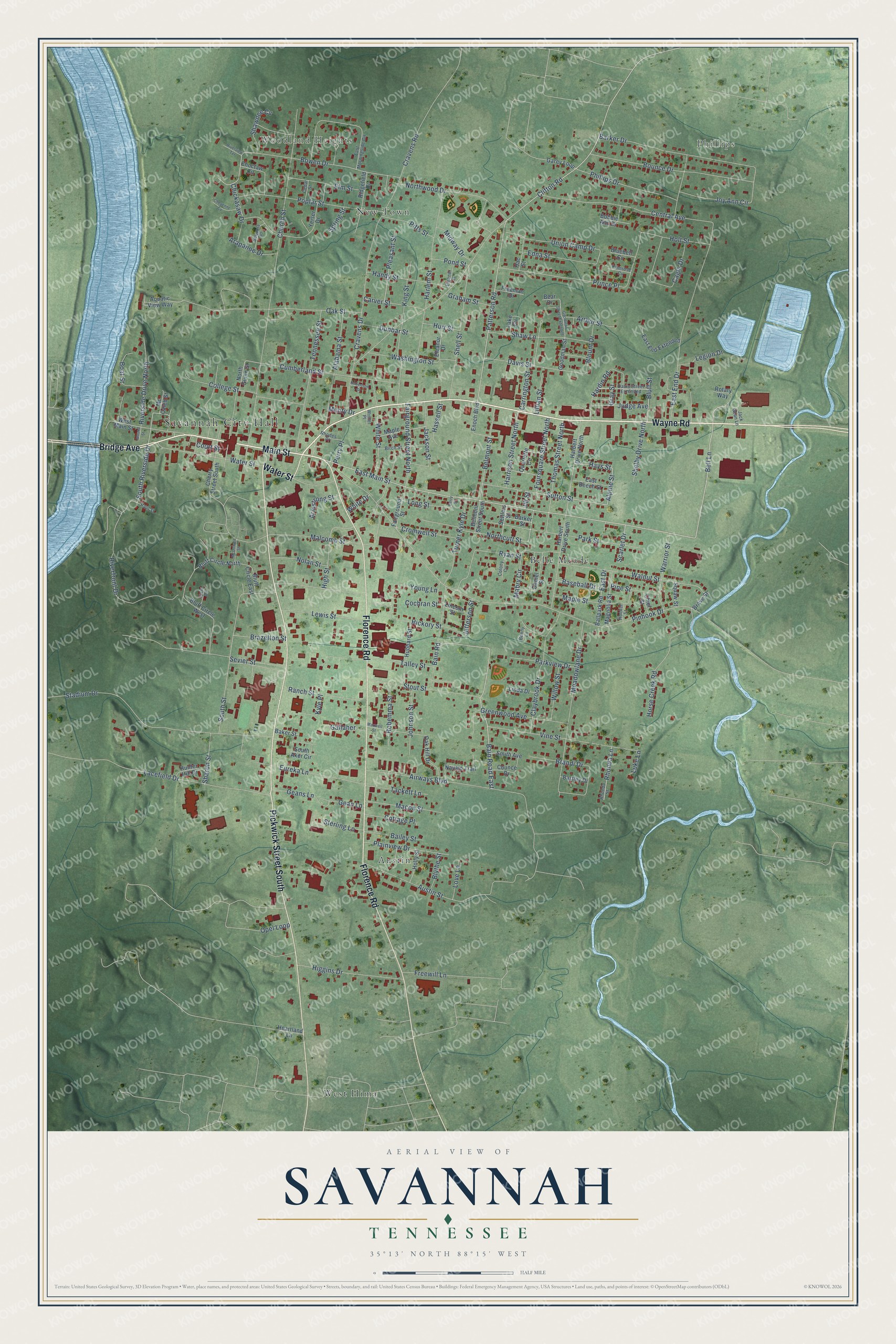
A new map of Savannah, Tennessee, made in 2026 and printed to order on thick archival matte paper.
12" x 18" Archival Matte Print
A Map of Home. A Work of Art.
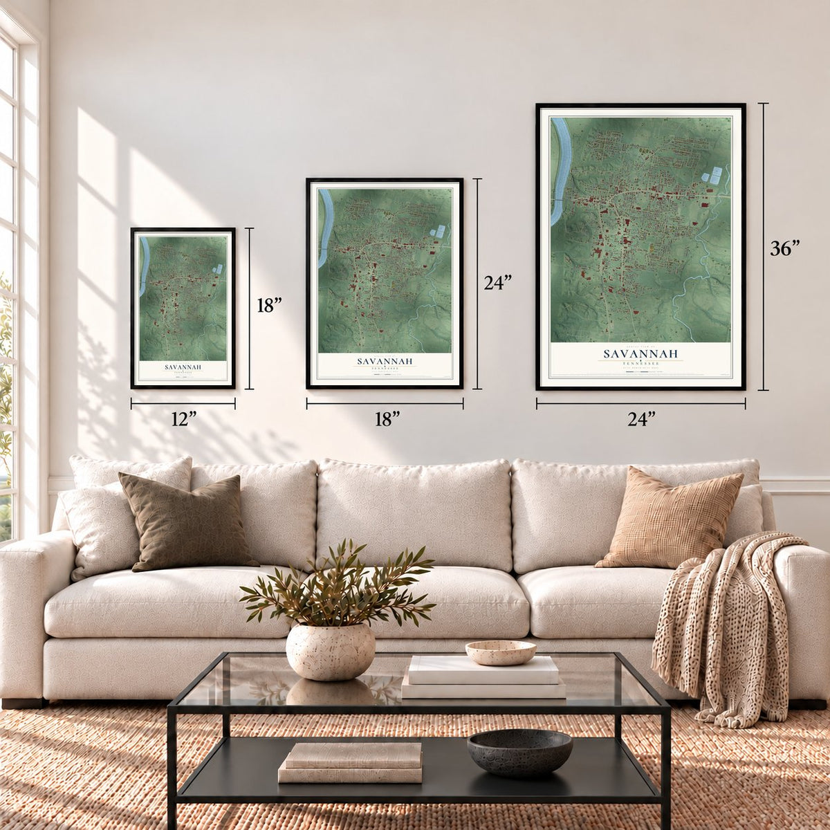
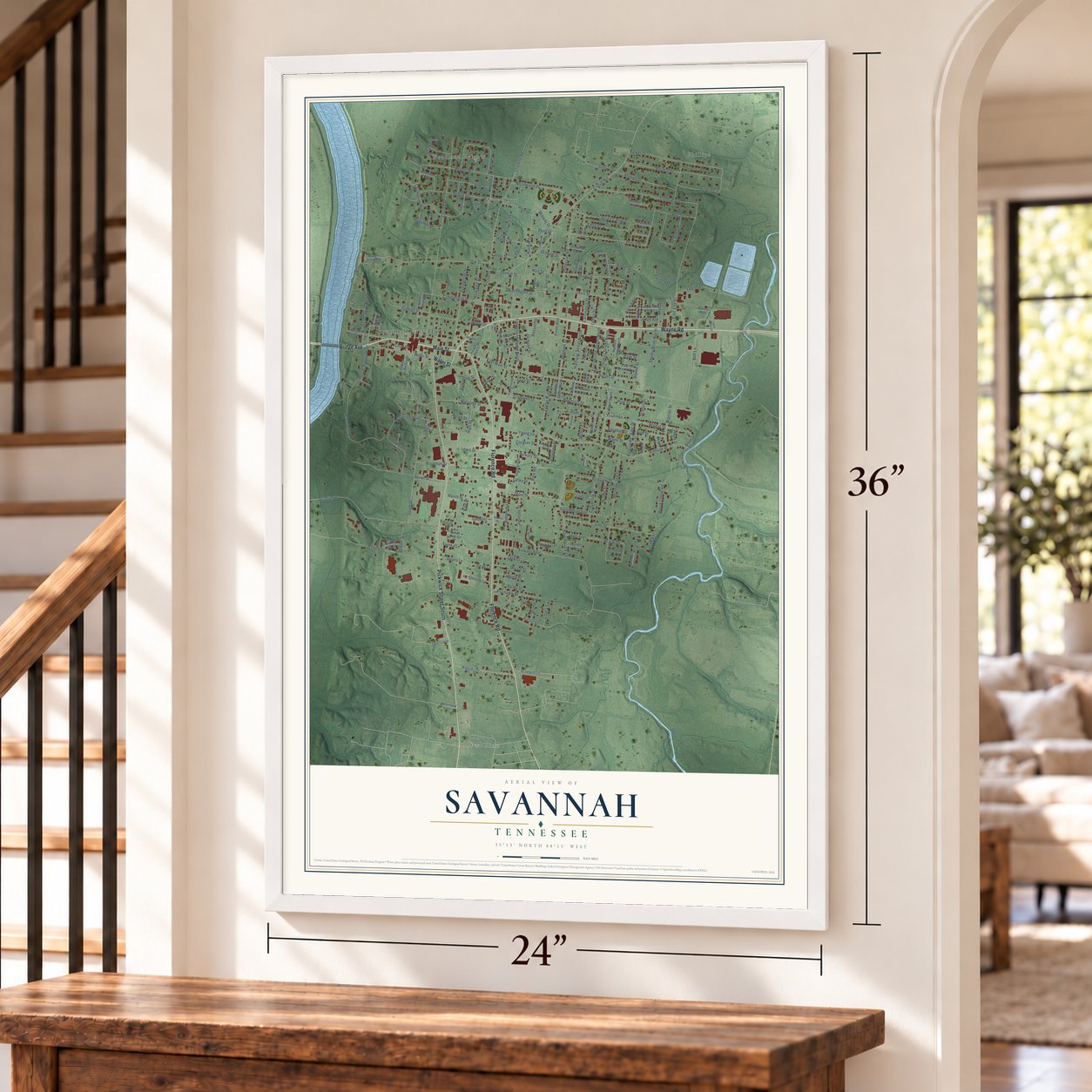
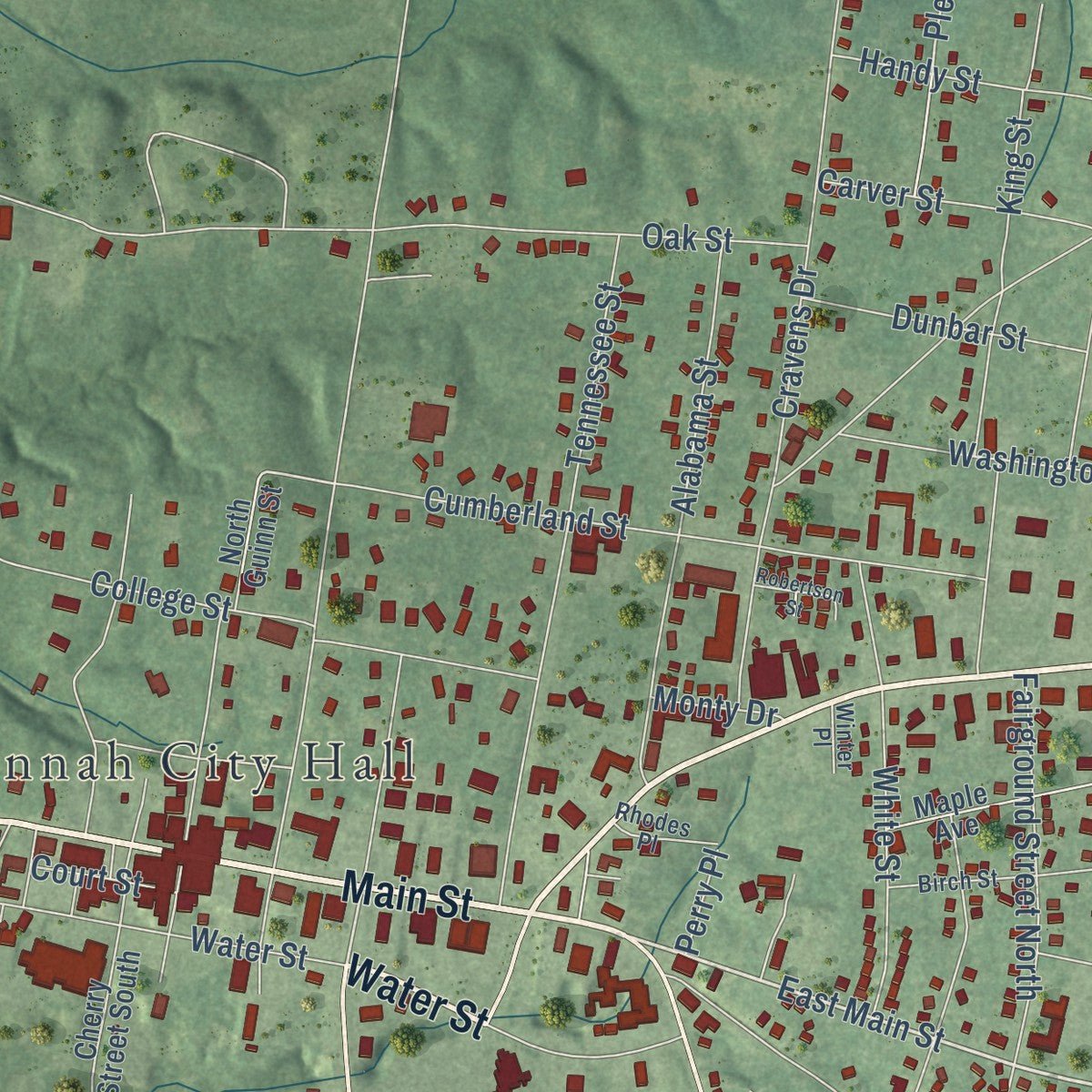
Explore Savannah, Tennessee from a whole new perspective. Created using aerial imagery and detailed geographic data, this map captures Savannah building by building, with labeled streets, familiar landmarks, and shaded topographical relief that highlights the natural contours of the landscape.
Combining modern data with the timeless character of a vintage atlas, this map is just as interesting up close as it is beautiful on the wall. Whether you grew up in Savannah, spent memorable years there, or call it home today, this unique map is a great way to celebrate a place that means something to you. Zoom in on the preview to look for your street, and then order a print to put your memories on the wall.
Three ways to hang it
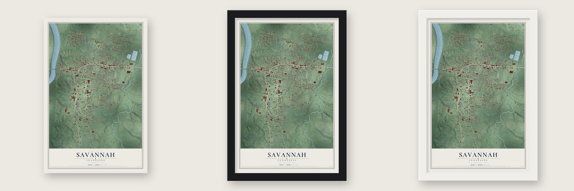
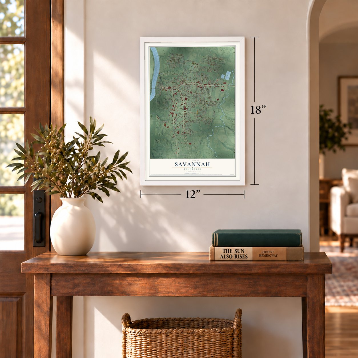
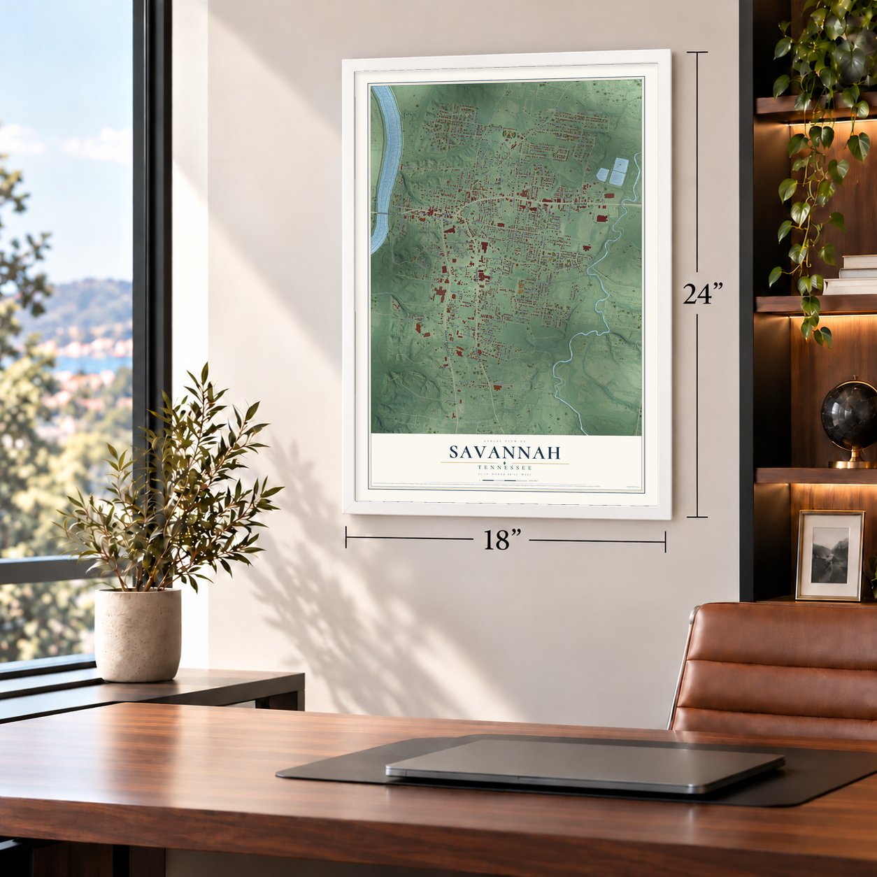
Unframed archival matte, a black wood frame or a white wood frame.
Up close
Geography Worth Displaying
This map was created using accurate cartographic data and authoritative geographic sources, including the U.S. Geological Survey and the Census Bureau. The map brings together terrain, waterways, roads, and building detail. The majority of the streets are labeled, houses are accurately depicted, and the topography is derived from government sources. Combining local data with carefully composed color and shading leads to this beautifully detailed Savannah artwork for your wall.
Rather than simply showing street outlines, we’ve included as many of the street names as we could reasonably fit on the map while keeping their names legible. Zoom in on the high resolution preview to see exactly what’s on the map. We truly set out to create a statement piece for anyone who loves Savannah. So whether it’s for you, or a gift for someone you love, we hope this map of Savannah brings back fond memories.
Read the story behind this map of Savannah, Tennessee from 2026.
About Savannah, Tennessee
Savannah is a city of 7,213 people and the county seat of Hardin County, on a bluff along the east side of the Tennessee River. Part of the town is built inside an old wall and trench, among a line of fourteen mounds that follow the river. In 1821 James Rudd put up a house on the riverbank near today's landing and started a ferry, and the settlement became known as Rudd's Ferry.
Hardin County first held court at Hardinsville, but after seven years that town proved to be too far east. Rudd's Ferry was picked as the new county seat in 1829, and the court moved there in 1830. The ground was then a thicket of gum saplings, so the first homes were pole cabins cut from that wood, and the courthouse itself was made of round gum logs. The town was named for Savannah, Georgia, where Rudd's wife, Elizabeth, grew up, and the state legislature incorporated it in 1850.
- Grant's headquarters in 1862The Battle of Shiloh was fought in 1862 on ground about 10 miles southwest of town. During the battle, Union General Ulysses S. Grant took over the Cherry Mansion, near the city square, and ran his command from it. The house joined the National Register in 1977.
- The county's first bridge, 1930The town began as a ferry crossing, and for a long time boats were the way over the Tennessee. That changed in 1930, when the Milo Lambert Bridge opened at Savannah as the first span over the river anywhere in Hardin County.
- A museum of the riverThe Tennessee River Museum fills Savannah's historic post office building. Its exhibits show how the river shaped the history and folkways of the town and the county around it.
- NAIA title game, 1996 to 2007For twelve seasons, from 1996 to 2007, Savannah was the host city for the NAIA national championship game in college football.
Find your street
Names on the Savannah map
Every name below is printed on this map. Look for your street, your school, the park where you played, or the pond down the road.
Places and landmarks7
- Savannah City Hall
- Phillips
- Woodland Heights
- Austin
- Belle Meade
- New Town
- West Hima
Streets and roads221
- Bridge Avenue
- Main Street
- Water Street
- Florence Road
- Wayne Road
- Pickwick Street South
- East Main Street
- Bell Lane
- Hays Street
- Alpine Street
- Sutton Street
- Bain Road East
- South Riverside Drive
- Thomas Street North
- Pleasant Street
- Pinhook Drive
- Church Street
- Clifton Road
- Cravens Drive
- Bowen Drive
- Hickory Street
- Stout Street
- East End Drive
- Lacefield Drive
- Prince Place
- Airways Boulevard
- South Street
- Patterson Road
- Oak Street
- Meadowlane Drive
Show all 221 streets
- Riverfront Drive
- Central Avenue
- Harlem Street
- Park Street
- Bounce Drive
- Cumberland Street
- Barker Drive
- Vine Street
- Walnut Street
- Stadium Drive
- Poplar Street
- Austin Street
- Tennessee Street
- King Street
- Malcomb Street
- Shell Street
- Alabama Street
- Claybrook Drive
- Talley Street
- College Street
- Horse Creek Road
- Northwood Drive
- Greenwood Avenue
- Cagle Drive
- Brandi Drive
- Sevier Street
- Eureka Lane
- Higgins Drive
- Joy Ann Circle
- Phillips Drive
- Bain Road
- Shaw Lane
- Davis Street
- Northcutt Street
- Union Camp Drive
- Carrington Street
- White Street
- Cravens Road
- Pine Street
- Belmont Street
- Freewill Lane
- Ryan Street
- Mabry Circle
- Turner Kyle Drive
- Washington Street
- Riverside Drive North
- Plainview Drive
- Lewis Street
- Handy Street
- Ranch Street
- Jackson Street
- Fairground Street North
- High Street
- Macon Street
- Warrior Street
- Edna Street
- Harrison Street North
- Elm Street
- Foursquare Street North
- Young Lane
- Holt Street
- Maple Street
- Hardin Road
- Johnson Street
- Parkview Drive
- Geans Lane
- Sterling Lane
- East Drive
- Tackett Lane
- Opel Loop
- Robemma Street
- Dunbar Street
- Cromwell Street
- Carver Street
- Chickasaw Drive
- Shelby Drive North
- Boat Street
- Bailey Street
- Nolan Street
- Pitts Street
- Judge Avenue
- Willow Street
- Cottage Place
- Shawnee Cv
- Arthur Street
- Rhonda Lane
- Brazelton Street
- Arapahoe Drive
- Midway Drive
- Long Street
- Graham Street
- Blount Drive
- Legion Drive
- Lillian Street
- Perry Place
- Baseball Drive
- Hassell Street
- Gean Lane
- Armstrong Street
- Bluff Street
- Gallaher
- Love Lane
- Blythe Street
- Scarlet Drive
- Cochran Street
- Pond Street
- Hurt Street
- Jefferson Street
- Kyle Place
- Court Street
- Luke Lane
- Spring Street
- Gray Street
- Sharon Street
- Monty Drive
- White Drive
- Jill Street
- Aquatic View Way
- Harbert Drive North
- Bluff Circle North
- Cherry Street South
- Yeiser Drive
- Bluff Circle West
- Harbert Drive South
- West Main Street
- North Guinn Street
- Quartette Circle
- Hubbard Street
- Ridgefield Drive
- Navajo Trail
- Daniel Street
- Ballpark Road
- Magnolia Street
- East End Extended
- Oak Hill Drive
- Maple Avenue
- Enoch Boulevard
- Choctaw Circle
- Lake Circle
- Fairground Street
- Counce Drive
- East Beech Street
- Bluff Circle East
- Hunter Hill Drive
- Rotary Way
- Holly Street
- Hac Street
- Eleanor Drive
- Smith Avenue
- Goodman Street
- Belmont Street South
- Settlers Street
- Garey Loop
- Linda Drive
- Bobbie Ann Drive
- Freeman Drive
- Bartley Drive
- Barker Street
- Heartland Lane
- South Aker Circle
- Lincoln Street
- Bluebell Cv
- Baker Street
- Mc Caleb Street
- Chief Street
- Brave Street
- Bear Drive
- Davis Street Extended
- Rhonda Street
- Birch Street
- East Morningside Circle
- Eleanor Street
- Hooker Street
- Sequoia Place
- Colony Cv
- Rhodes Place
- Primrose Cv
- Jack Gean Lane
- Irwin Drive
- Cedar Street
- Paul Street
- Winter Place
- Benny Lane
- Goodman Street Extended
- Maxwell Street
- McDowell Street
- Cheyenne Cv
- Robertson Street
- Riverview Terrace
- Mound Street
- Perry Street
Names are listed as they appear on the printed map. Zoom into the product photos to find them.
The art of mapping a place
How This Map Was Made
Real places. Remarkable detail. Discover the layers that turn geographic data into a map of home.

The view from above
Aerial imagery reveals the character of the land: woodland, open fields, and the patterns of a place.

The shape of the land
Elevation data brings hills, valleys, and subtle changes in the landscape into view.

The details of home
Roads, waterways, and building footprints come together to make the map feel unmistakably local.

Geography becomes art
Considered color, shading, and typography bring the layers together in a map made for your wall.


Process illustrated with Mendon, Massachusetts. Aerial imagery: USDA NAIP. Terrain: USGS 3D Elevation Program. Map details and finished artwork: KNOWOL.
The Details
About This Print
Choose an archival matte print, or a black or white Ayous wood frame. The archival matte print is unframed.
Select your size and finish above to see the matching product image and price.
Materials & Craftsmanship
A contemporary map with the character of a classic atlas, printed on archival matte paper. Optional frames are made from Ayous wood.
Your printed map does not include the watermark shown in the full-map preview.
Shipping & Delivery
Free shipping within the United States. Every print is made to order in the USA.
Buying a gift? Add a note in your cart and we'll include it. We never put prices in the package.
Prints ship within 2 to 3 business days. Allow 7 to 10 days total from ordering for delivery. Timing may vary during holidays or periods of high order volume.
Read our shipping policy.
Returns and damaged prints
Each print is made to order. Change-of-mind refunds are not available after production.
If your print arrives damaged, misprinted or incorrect, contact support@knowol.com within 30 days of receiving it. Include your order number, photos and a description of the issue.
Read our full refund and replacement policy. For questions about your order, email support@knowol.com.
Find your town
Looking for another city?
Find a map of home in our Tennessee collection, or any town in the country.
Nearby
Maps of towns near Savannah
Know someone from one of these towns? Their map makes a great gift.
 Olivet
, Tennessee
From $39.99See the map
 Crump
Crump, Tennessee
From $39.99See the map
 Nixon
Nixon, Tennessee
From $39.99See the map
More maps nearby: Adamsville, Morris Chapel, Shiloh, Childers Hill and Saltillo.