
Search for another town





Free U.S. delivery 7 to 10 days after you order
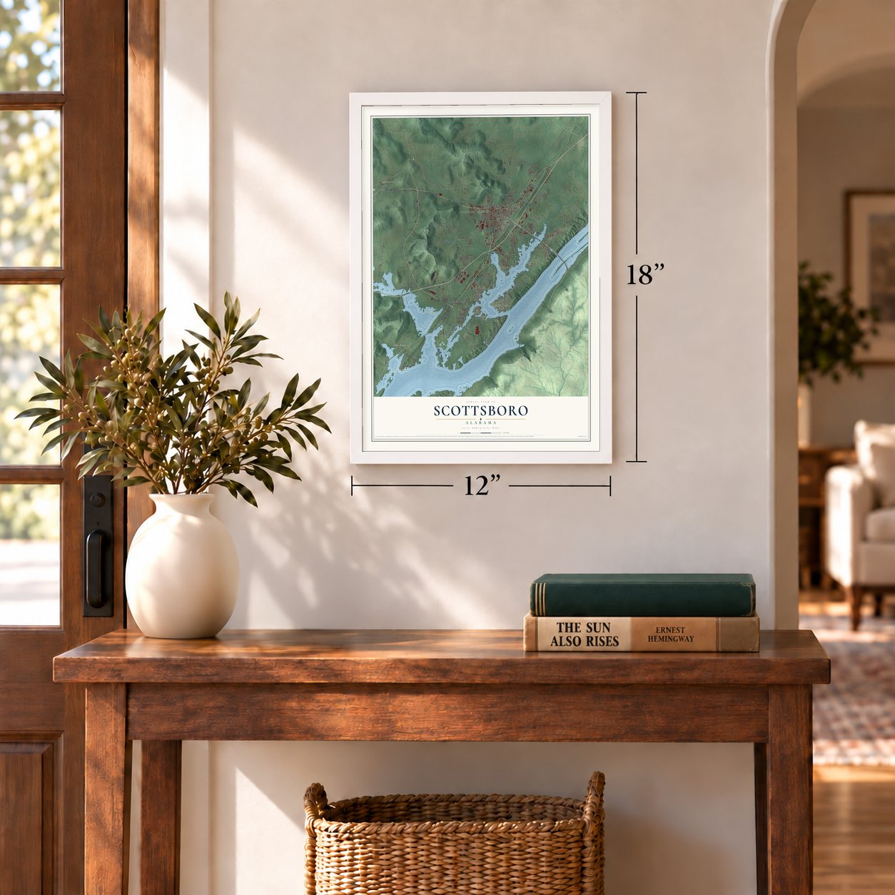
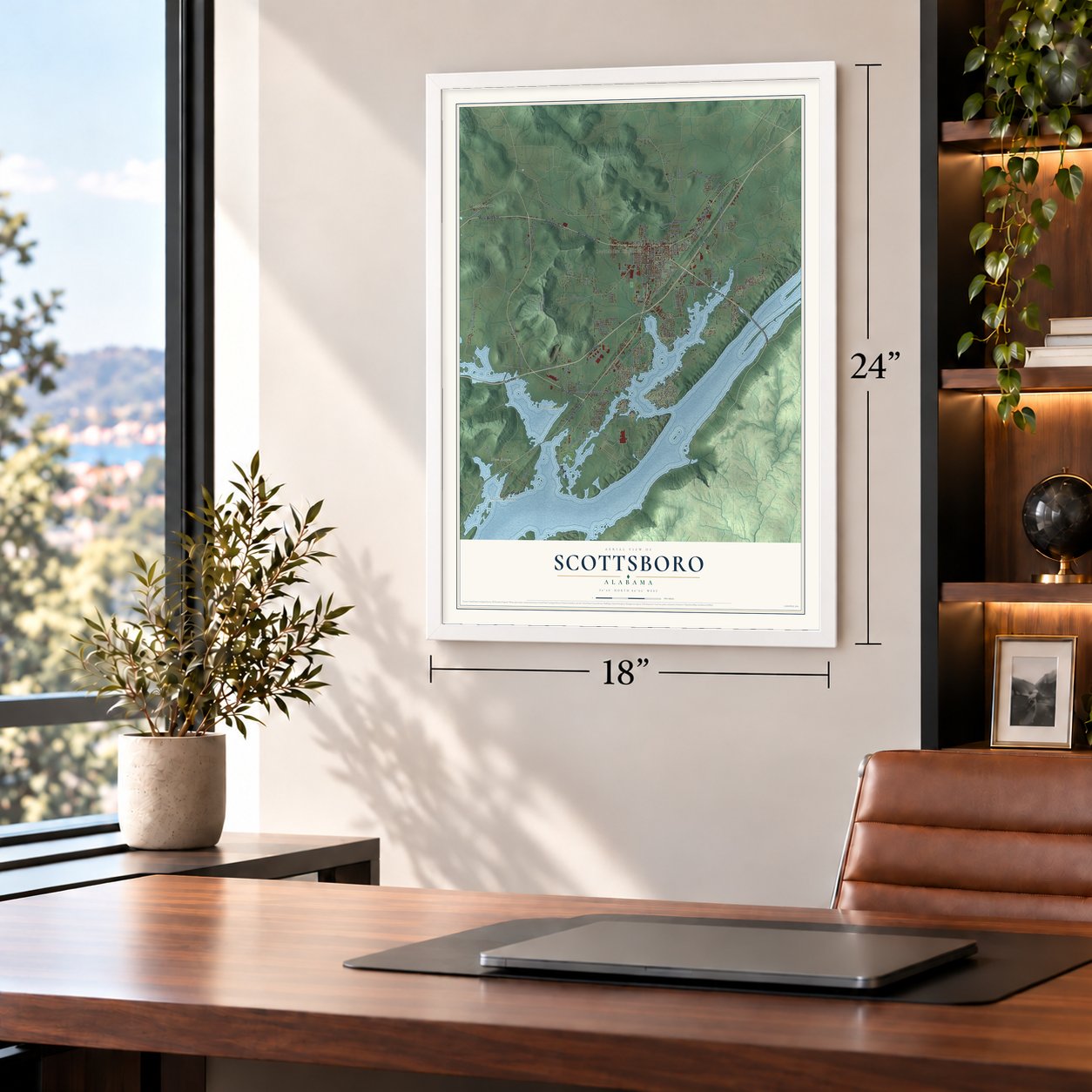
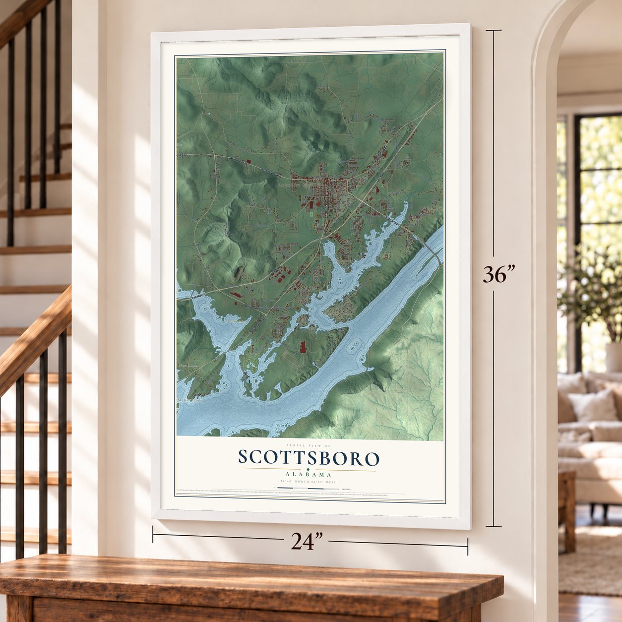
Scottsboro, Alabama Map Art
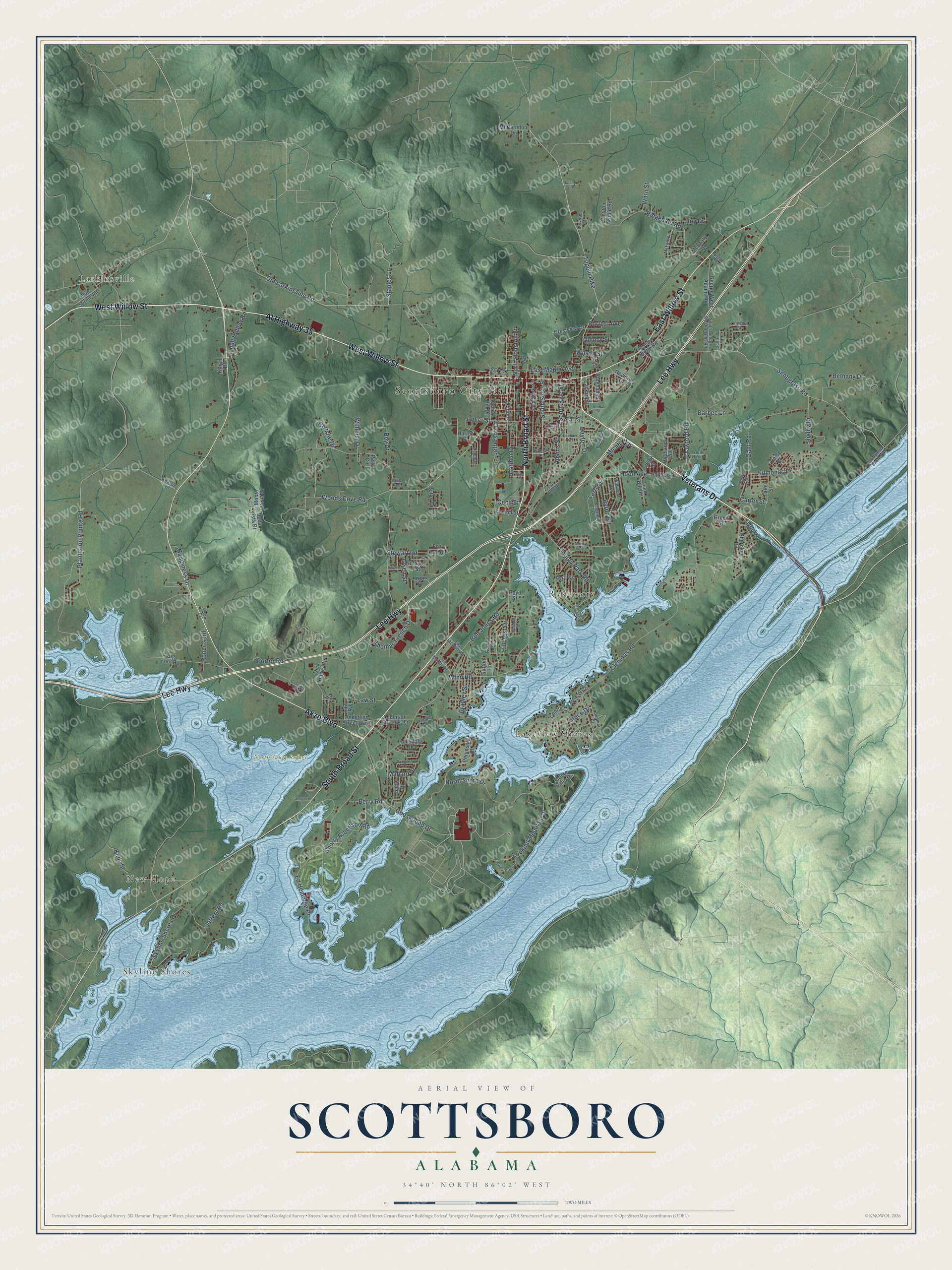
A new map of Scottsboro, Alabama, made in 2026 and printed to order on thick archival matte paper.
12" x 18" Archival Matte Print
A Map of Home. A Work of Art.
Explore Scottsboro, Alabama from a whole new perspective. Created using aerial imagery and detailed geographic data, this map captures Scottsboro building by building, with labeled streets, familiar landmarks, and shaded topographical relief that highlights the natural contours of the landscape.
Combining modern data with the timeless character of a vintage atlas, this map is just as interesting up close as it is beautiful on the wall. Whether you grew up in Scottsboro, spent memorable years there, or call it home today, this unique map is a great way to celebrate a place that means something to you. Zoom in on the preview to look for your street, and then order a print to put your memories on the wall.
Three ways to hang it
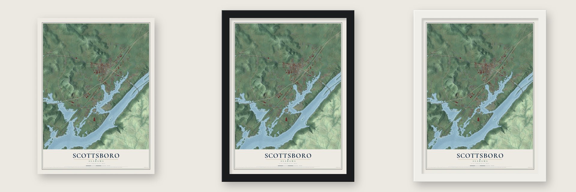
Unframed archival matte, a black wood frame or a white wood frame.
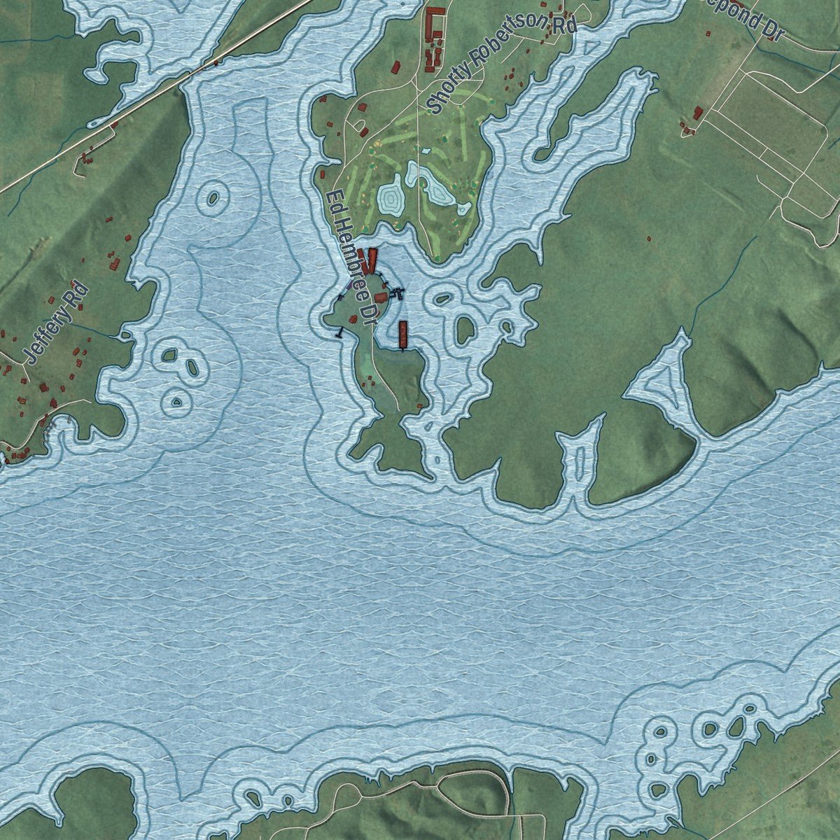
Up close
Geography Worth Displaying
This map was created using accurate cartographic data and authoritative geographic sources, including the U.S. Geological Survey and the Census Bureau. The map brings together terrain, waterways, roads, and building detail. The majority of the streets are labeled, houses are accurately depicted, and the topography is derived from government sources. Combining local data with carefully composed color and shading leads to this beautifully detailed Scottsboro artwork for your wall.
Rather than simply showing street outlines, we’ve included as many of the street names as we could reasonably fit on the map while keeping their names legible. Zoom in on the high resolution preview to see exactly what’s on the map. We truly set out to create a statement piece for anyone who loves Scottsboro. So whether it’s for you, or a gift for someone you love, we hope this map of Scottsboro brings back fond memories.
Read the story behind this map of Scottsboro, Alabama from 2026.
About Scottsboro, Alabama
Scottsboro is a city of 15,578 people and the seat of Jackson County, on Lake Guntersville along the Tennessee River in Alabama's mountainous northeast corner. Robert T. Scott, a North Carolina native, came here from Bellefonte in the late 1840s and built a grist mill and a shingle factory. He talked the Memphis and Charleston line into laying its tracks across his land, and in 1856 a station opened there. The village went from Scottsville to Scott's Mill and settled on Scottsboro in 1858.
Scott spent years trying to pull the county seat away from Bellefonte, which had refused the railroad to protect its river trade, but he died in 1863 without winning. In 1868 his widow struck a deal with the county: she handed over a site for a courthouse and jail, provided that Scottsboro become the seat. On Friday, November 13, 1868, the county's records left Bellefonte for Scottsboro, and the legislature incorporated the town on January 20, 1870. Bellefonte, with no railroad, faded quickly.
“The Scottsboro Cemetery, where only six people have been interred, is a lovely spot, and, if improved and adorned with flowers, would be a most beautiful burial ground.”
- A Union camp, 1863 to 1864Union Maj.-Gen. John A. Logan set up the headquarters of his Fifteenth Army Corps at Scottsboro near the end of December 1863. Col. Reuben Williams kept about 3000 soldiers from Illinois, Ohio and Indiana regiments in camp by the depot, guarding the railroad and the telegraph line. That spring Williams threw a dance in the town's first school and church, on what is now Maple Avenue. The Scottsboro Memphis and Charleston Railroad Depot joined the National Register in 1998.
- Lindbergh's stunts in 1927On October 5, 1927, Col. Charles Lindbergh flew into Scottsboro and put The Spirit of St. Louis through stunts over the town before heading on to Chattanooga.
- The Scottsboro Boys, 1931In March 1931, two white women falsely accused nine young Black men of rape. The case was tried in Scottsboro, where all-white juries, rushing through the trials while a mob gathered, condemned eight of them to death.
- Two Supreme Court rulingsThe U.S. Supreme Court twice overturned the Scottsboro convictions, ruling that defendants deserve effective counsel and that juries can't shut out Black citizens. Gov. George Wallace pardoned the last living defendant in 1976, and the Scottsboro Boys Museum and Cultural Center opened here in February 2010.
- A bridge to Sand MountainA ferry carried people and cars to Sand Mountain from 1908. The Kansas City Bridge Company worked from 1928 to 1931 on the B. B. Comer Bridge, a steel span 2,143 feet long. It opened to traffic in July 1930 and nearly tripled the town's population. A second bridge came in the 1980s, and the old one was torn down in 2016.
Find your street
Names on the Scottsboro map
Every name below is printed on this map. Look for your street, your school, the park where you played, or the pond down the road.
Places and landmarks7
- Scottsboro City Hall
- Larkinsville
- Skyline Shores
- New Hope
- North Sauty Refuge
- Lakeview Shores
- Roseberry
Streets and roads156
- West Willow Street
- North Broad Street
- Veterans Drive
- East Willow Street
- South Broad Street
- Lee Highway
- Akzo Boulevard
- Al Highway 35
- Woods Cove Road
- Tupelo Pike
- Dover Street
- Jeffery Road
- South Scott Street
- Adams Street
- Old Larkinsville Road
- Porter Road
- Bob Jones Road
- Clemons Road
- Snodgrass Road
- Ed Hembree Drive
- County Park Road
- Ridgedale Road
- Gant Road
- Winn Road
- Skyline Shores Drive
- Goosepond Drive
- Stewart Road
- Byron Road
- Crawford Road
- Lookout Mountain Drive
Show all 156 streets
- Plantation Pointe Road
- North Shore Drive
- Bethany Drive
- Edmonds Drive
- Thomas French Drive
- Jefferson Drive
- Long Hollow Road
- Law Street
- Shorty Robertson Road
- Hood Avenue
- Garden Drive
- Larry Drive
- East Maple Avenue
- South Kyle Street
- Bradley Street
- Kelly Street
- Wilhelm Drive
- North Houston Street
- Happiness Drive
- Boy Drive
- Bruce Drive
- Roberts Road
- Staples Lane
- Dock Street
- Barbee Lane
- Berry Road
- Joy Drive
- Larkin Street
- Hillcrest Drive
- Pell Street
- Micah Way
- Christie Drive
- Shelby Drive
- Mallard Drive
- Dayton Drive
- Forrest Avenue
- Quincy Street
- Carter Street
- Warn Street
- Wilson Street
- Cecil Street
- Gwen Street
- Cedar Hill Drive
- McClendon Drive
- Monte Sano Drive
- Peninsula Drive
- Crestview Drive
- Dick Hayes Road
- Moody Ridge Road
- George West Adams Road
- South Street
- Anderson Street West
- Phillips Drive
- Cherokee Road
- Scenic Drive
- Newport Drive
- Bella Vista Drive
- Lasone Drive
- Anderson Street East
- Petty Circle
- Lisa Lane
- Gant Hill Road
- Bingham Street
- Highland Avenue
- Hillsdale Drive
- Law Road
- Clayton Arnold Road
- Floyd Circle
- Gentle Circle
- Blue Spring Road
- Legion Street
- Snow Drive
- Talley Street
- Wayne Street
- Butler Drive
- McCrary Drive
- Lora Street
- Earl Street
- Monte Vista Drive
- 200th Street
- Green Street
- Fox Run Road
- Harley Street
- Big Foot Road
- Knight Drive
- Sutton Lane
- Rome Street
- Boyd Street
- East Stewart Road
- South Market Street
- McFoilton Lane
- Wildwood Avenue
- Sumner Drive
- South George West Adams Road
- Redstone Drive
- Owens Drive
- Kingwood Drive
- Ashmore Lane
- Ida Moody Road
- Oak Street
- Hembree Street
- Driftwood Shores Drive
- Belle Hart Drive
- Mosiac Street
- Scotland Drive
- Camille Street
- Keasling Drive
- Linwood Street
- Linville Street
- Rogers Road
- Bibb Avenue
- Lee Street
- East Ridge Road
- Brown Street
- Widgeon Drive
- Goodyear Boulevard
- West Mary Hunter Avenue
- Briarwood Road
- Meadow Island Road
- Morning Glory Drive
- Benham Avenue
- Masonic Drive
- Edwin Street
- Shrader Drive
- Country Lane
- Pine Street
Names are listed as they appear on the printed map. Zoom into the product photos to find them.
The art of mapping a place
How This Map Was Made
Real places. Remarkable detail. Discover the layers that turn geographic data into a map of home.

The view from above
Aerial imagery reveals the character of the land: woodland, open fields, and the patterns of a place.

The shape of the land
Elevation data brings hills, valleys, and subtle changes in the landscape into view.

The details of home
Roads, waterways, and building footprints come together to make the map feel unmistakably local.

Geography becomes art
Considered color, shading, and typography bring the layers together in a map made for your wall.


Process illustrated with Mendon, Massachusetts. Aerial imagery: USDA NAIP. Terrain: USGS 3D Elevation Program. Map details and finished artwork: KNOWOL.
The Details
About This Print
Choose an archival matte print, or a black or white Ayous wood frame. The archival matte print is unframed.
Select your size and finish above to see the matching product image and price.
Materials & Craftsmanship
A contemporary map with the character of a classic atlas, printed on archival matte paper. Optional frames are made from Ayous wood.
Your printed map does not include the watermark shown in the full-map preview.
Shipping & Delivery
Free shipping within the United States. Every print is made to order in the USA.
Buying a gift? Add a note in your cart and we'll include it. We never put prices in the package.
Prints ship within 2 to 3 business days. Allow 7 to 10 days total from ordering for delivery. Timing may vary during holidays or periods of high order volume.
Read our shipping policy.
Returns and damaged prints
Each print is made to order. Change-of-mind refunds are not available after production.
If your print arrives damaged, misprinted or incorrect, contact support@knowol.com within 30 days of receiving it. Include your order number, photos and a description of the issue.
Read our full refund and replacement policy. For questions about your order, email support@knowol.com.
Find your town
Looking for another city?
Find a map of home in our Alabama collection, or any town in the country.
Nearby
Maps of towns near Scottsboro
Know someone from one of these towns? Their map makes a great gift.
 Section
, Alabama
From $39.99See the map
 Hollywood
, Alabama
From $39.99See the map
 Langston
, Alabama
From $39.99See the map
More maps nearby: Dutton, Pleasant Groves, Skyline, Powell and Pisgah.