
Search for another town





Free U.S. delivery 7 to 10 days after you order
Seymour, Tennessee Map Art
Building by building, with labeled streets and shaded relief.
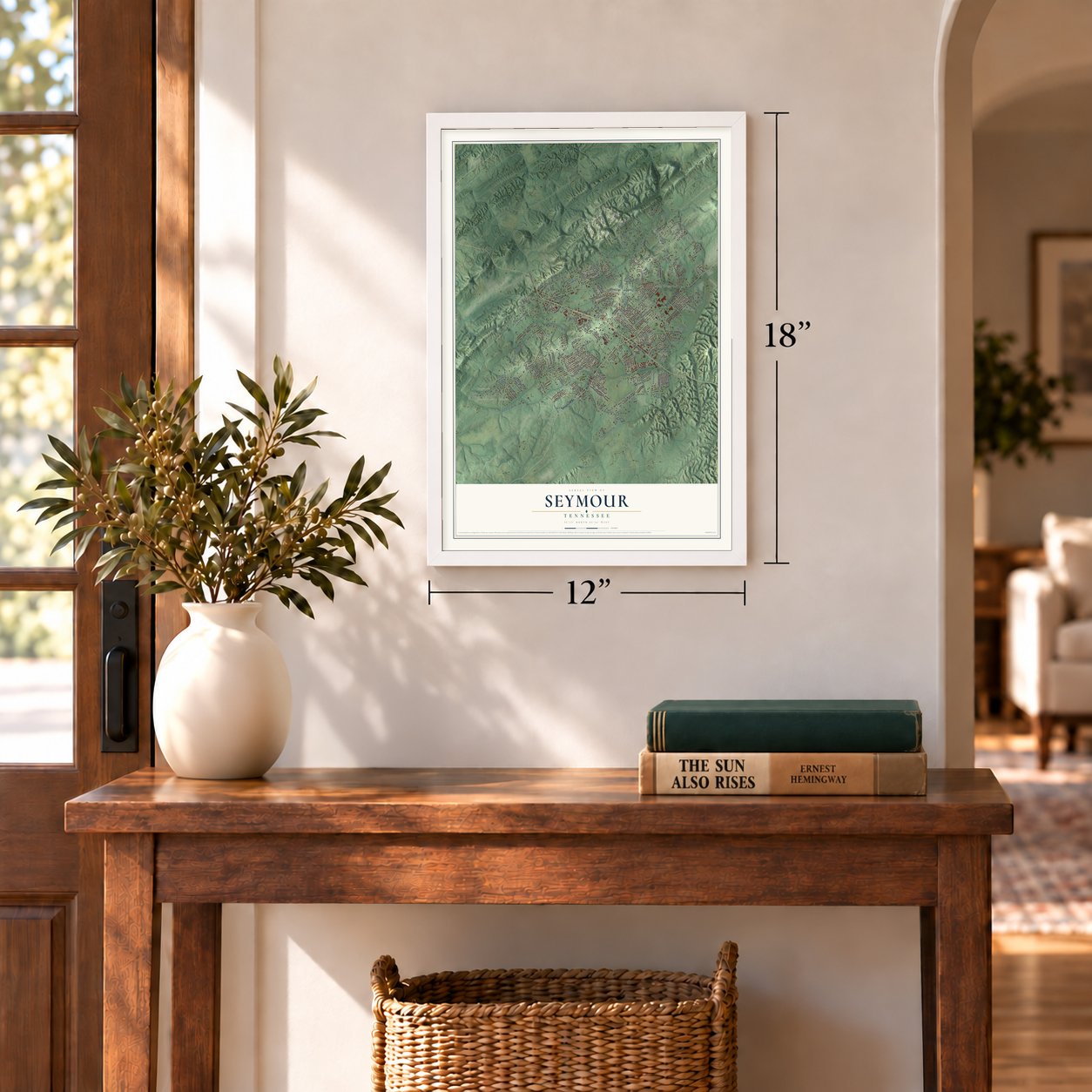
12" x 18" Archival Matte Print
A Map of Home. A Work of Art.
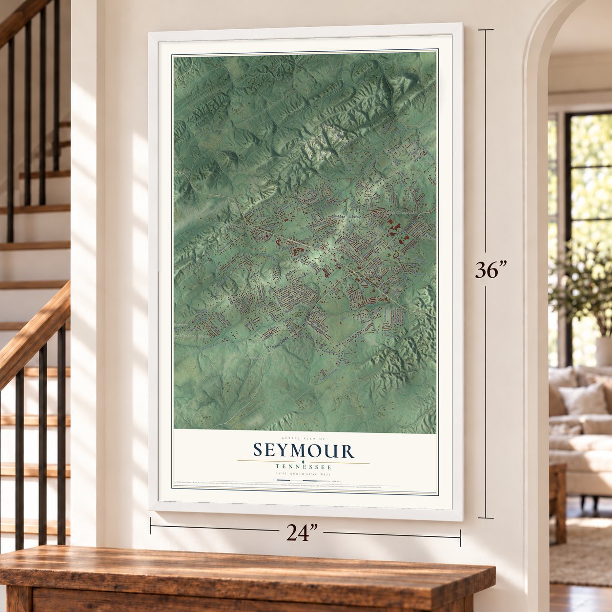
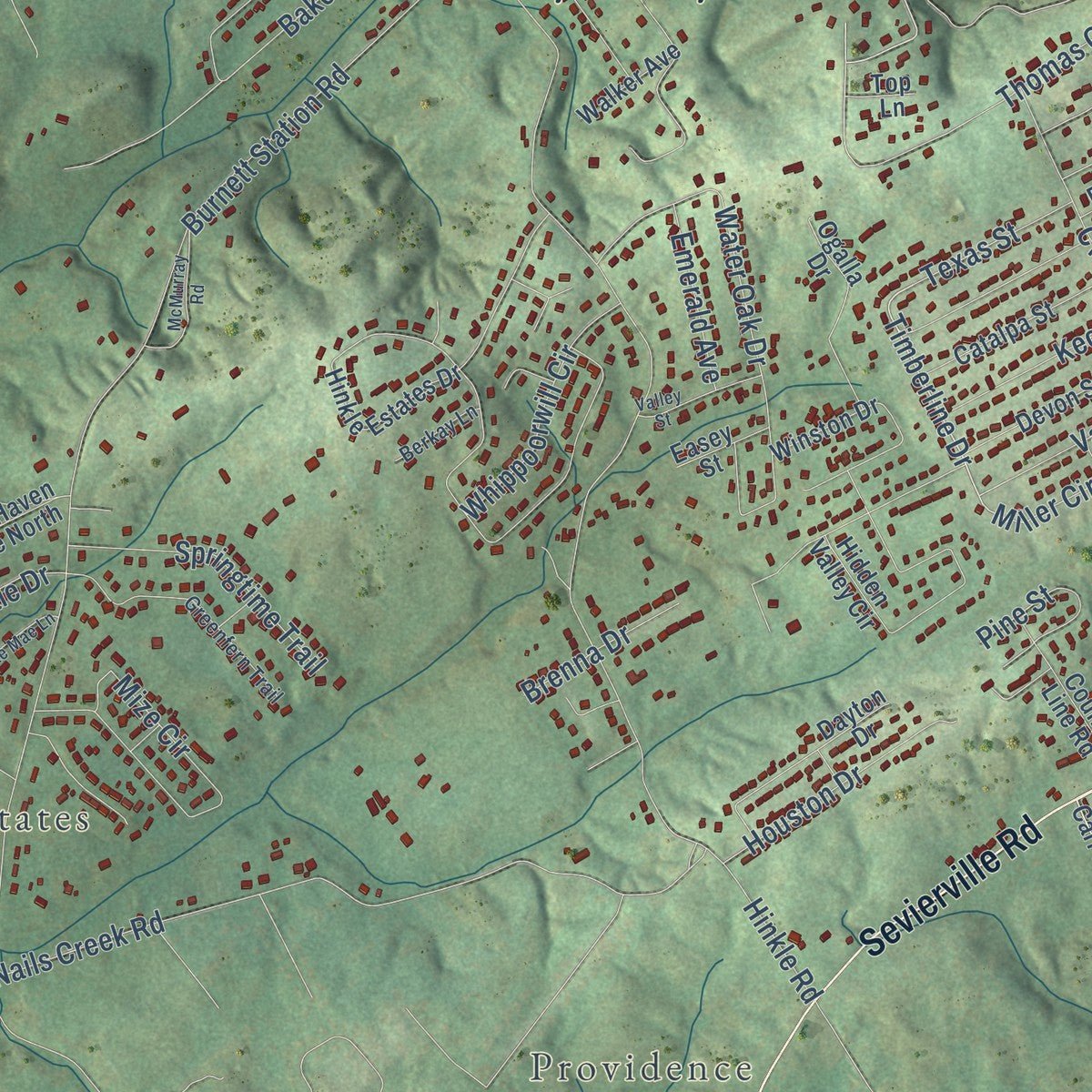
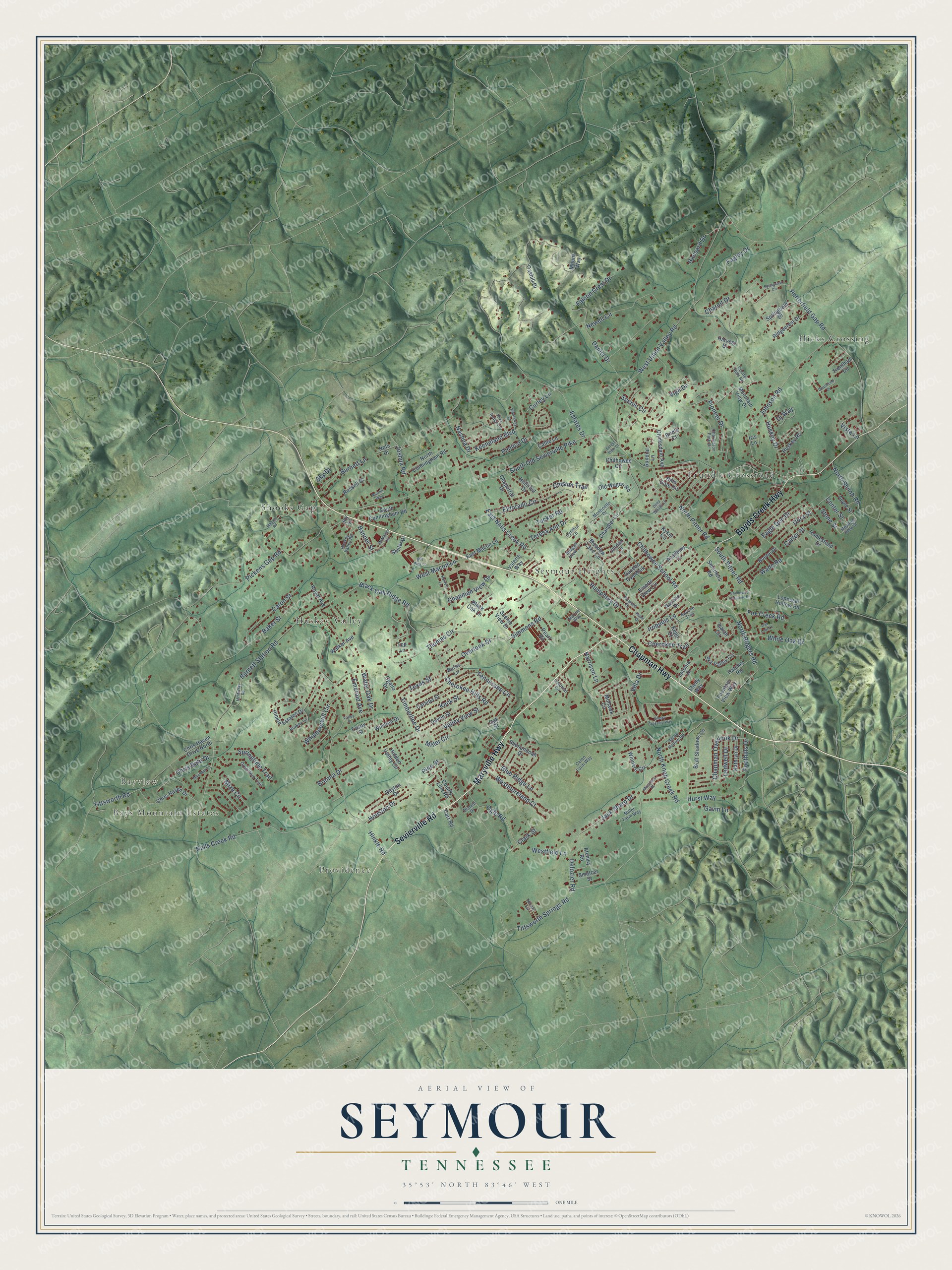
Explore Seymour, Tennessee from a whole new perspective. Created using aerial imagery and detailed geographic data, this map captures Seymour building by building, with labeled streets, familiar landmarks, and shaded topographical relief that highlights the natural contours of the landscape.
Combining modern data with the timeless character of a vintage atlas, this map is just as interesting up close as it is beautiful on the wall. Whether you grew up in Seymour, spent memorable years there, or call it home today, this unique map is a great way to celebrate a place that means something to you. Zoom in on the preview to look for your street, and then order a print to put your memories on the wall.
Three ways to hang it
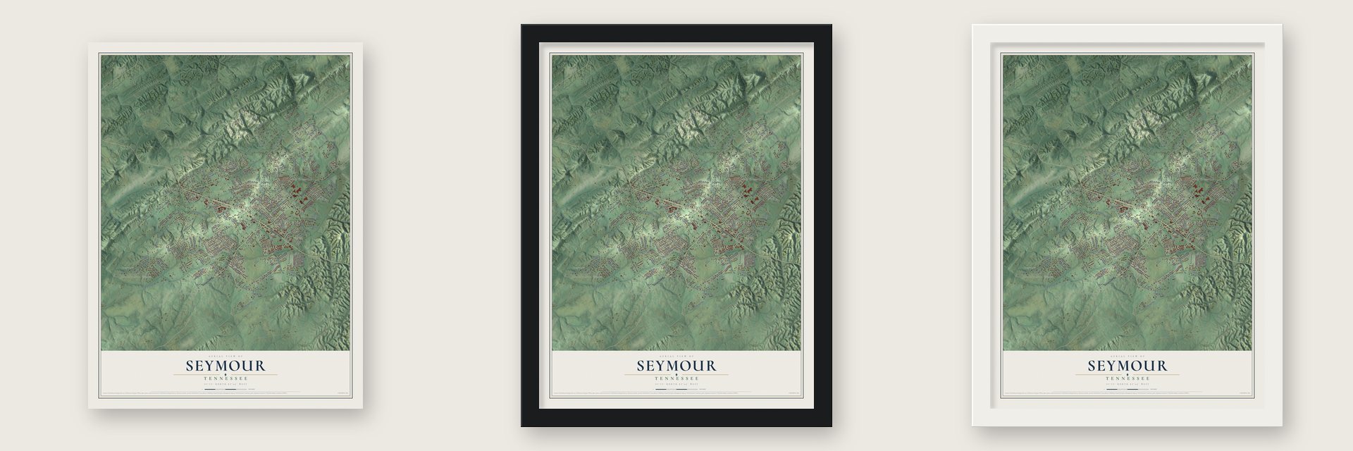
Unframed archival matte, a black wood frame or a white wood frame.
Up close
Geography Worth Displaying
This map was created using accurate cartographic data and authoritative geographic sources, including the U.S. Geological Survey and the Census Bureau. The map brings together terrain, waterways, roads, and building detail. The majority of the streets are labeled, houses are accurately depicted, and the topography is derived from government sources. Combining local data with carefully composed color and shading leads to this beautifully detailed Seymour artwork for your wall.
Rather than simply showing street outlines, we’ve included as many of the street names as we could reasonably fit on the map while keeping their names legible. Zoom in on the high resolution preview to see exactly what’s on the map. We truly set out to create a statement piece for anyone who loves Seymour. So whether it’s for you, or a gift for someone you love, we hope this map of Seymour brings back fond memories.
Read the story behind this map of Seymour, Tennessee from 2026.

Find your street
Names on the Seymour map
Every name below is printed on this map. Look for your street, your school, the park where you played, or the pond down the road.
Places and landmarks8
- Bayview
- Bays Mountain Estates
- Providence
- Hicks Crossing
- Huskey Valley
- Seymour Heights
- Shooks Gap
- Trundle Crossroad
Streets and roads205
- Chapman Highway
- Maryville Highway
- Boyds Creek Highway
- Sevierville Road
- Timberline Drive
- Texas Street
- North Rogers Road
- Thomas Circle
- Keeneland Boulevard
- East Nails Creek Road
- Tittsworth Springs Road
- Humphrey Drive
- Miller Circle
- Valley View Street
- South Old Sevierville Pike
- Burnett Station Road
- Estates Drive
- Porterfield Gap Road
- North Knob Creek Road
- Hinkle Road
- West Union Valley Road
- Black Oak Ridge Road
- Pickens Gap Road
- Johnson Road
- Nails Creek Road
- Newell Circle
- Eldorado Circle
- Chilhowee School Road
- Cherokee Trail
- Wade Road
Show all 205 streets
- Water Oak Drive
- Whippoorwill Circle
- Cherokee Hills Road
- Daniel Drive
- Mize Circle
- North Pitner Road
- Pioneer Drive
- Tennessee Circle
- Chapman Overlook Drive
- Curley Lane
- Jack Sharp Drive
- Falcon Crest Drive
- Baker Street
- Fagley Drive
- Caton Street
- West Macon Lane
- Scenic Circle
- Ogle Road
- Westmoreland Court
- Eagle Den Drive
- Blue Ridge Lane
- Simmons Road
- Chisum Trail
- Springtime Trail
- Pimlico Drive
- Huskey Drive
- Tucker Road
- Keck Street
- Houston Drive
- Villa Drive
- Foothills Drive
- Burnett Lane
- Chapman View Drive
- White Oak Drive
- Teresa Ann Drive
- Tittsworth Road
- Overlook Drive
- Chariot Drive
- North Shiloh Road
- South Pitner Road
- Dj Way
- Pine Street
- Hansard Drive
- Iroquois Lane
- Dora Street
- Brenna Drive
- Ledwell Drive
- Carter Street
- Fox Creek Road
- Westfield Lane
- Emerald Avenue
- Hurst Way
- Harrison Lane
- Chris Dale Drive
- Vista Lane
- Joshua Road
- Center Street
- Delozier Road
- Nashua Drive
- Stone Street
- Clark Street
- Gavin Lane
- Banner Street
- Sky Drive
- Vigil Drive
- Carr Road
- Gazebo Overlook
- Atchley Road
- North Cunningham Road
- Hinkle Estates Drive
- Mohawk Circle
- Mountain View Drive
- Chris Haven Drive North
- Sky Valley Circle
- Hidden Valley Circle
- Hills Gate Circle
- Emerts View Circle
- Winners Circle
- Chris Haven Drive
- Old Wagon Road
- Devon Street
- Walker Avenue
- Harvest Drive
- Kyker Circle
- Shenandoah Drive
- Winston Drive
- Isaiah Circle
- Trentham Circle
- Academy Drive
- Catalpa Street
- South Cunningham Road
- Dayton Drive
- Chilhowee Circle
- Boone Drive
- Ogalla Drive
- Sundial Lane
- Clydesdale Avenue
- Russell Drive
- East Macon Lane
- Navaho Drive
- Bluff Shadows Lane
- Chandler Lane
- Loposser Hollow Road
- Smothers Road
- Black Oak Lane
- Ridgecrest Drive
- County Line Road
- Shelly Way
- Springfield Drive
- Homestead Drive
- Meadow Lake Circle
- Apple Street
- Chaparral Drive
- Scenic View Drive
- Hillcrest Drive
- Kathryn Drive
- Oakhill Drive
- Huskey Road
- Hatcher Road
- Valerie Way
- Fountain View Way
- Smelcer Street
- Jordan Lane
- Royal Avenue
- Callie Lane
- Burns Lane
- Latonia Drive
- Pearl Road
- Shular Drive
- Easey Street
- Nola Drive
- Bridle Court
- Keno Court
- Top Lane
- Mount Way
- Oak Street
- Joy Street
- Iris Lane
- Howard Drive
- Greenfern Trail
- Caton Farm Way
- Charleston Park Drive
- Colonial Circle
- Miller Farm Way
- Monticello Drive
- Huskey Valley Road
- Cynthia Lane
- Harris Hollow Road
- Riva Ridge Lane
- Reagan View Lane
- Apache Trail
- Nicole Lane
- Berkay Lane
- Meadow View Street
- Conner Hills Road
- Marine Way
- Donald Drive
- Smoky Crossing Way
- Rader Drive
- Springview Circle
- Maples Road
- Chilhowee Academy Road
- Bus Park Lane
- Deep Woods Lane
- McMurray Road
- McMahan Road
- Valley Street
- Missylane Road
- Dearmond Drive
- Hunters Lane
- Whirlaway Lane
- Mae Mae Lane
- Oak Leaf Lane
- Murrell Way
- Forest View Court
Names are listed as they appear on the printed map. Zoom into the product photos to find them.
About Seymour, Tennessee
Seymour is a community of 14,705 people in Sevier and Blount counties, with Knoxville to the northwest. The pioneer Samuel Newell set up a frontier station here in 1783. In March 1785, when this land was part of the State of Franklin, the first court of Sevier County met at Newell's Station on Boyds Creek.
For most of the nineteenth century the place went by Trundles Crossroads, for the spot where the road out of Sevierville split, with one branch going north to Knoxville and the other going west to Maryville. The Knoxville, Sevierville and Eastern Railway was finished on December 18, 1909, and its stop here was named Seymour for Charles Seymour, the line's chief engineer. Soon after, the Trundles Crossroads post office took the new name as well.
- The old Trundles forkThe fork in the road that gave Trundles Crossroads its name is now the corner where Boyds Creek Highway meets Old Sevierville Pike.
- Unincorporated by choiceResidents have met more than once to talk about becoming a town or city. Supporters hoped new revenue would pay for a community center and sidewalks, while most neighbors feared higher taxes and a bigger government. When the question went to a vote, the voters overwhelmingly chose to keep Seymour unincorporated.
- Between two ridgesSeymour sits in a rolling valley at the meeting point of the Great Smoky Mountain foothills and the long ridges of the Appalachian Ridge-and-Valley country. To the south stands Bluff Mountain, where the Chilhowee Mountain ridge comes to an end, and to the north runs the Bays Mountain ridge.
Keep exploring Tennessee
Seymour is one of 640 Tennessee towns we've mapped. Every dot on the map is a print of its own.
The search covers every state, Tennessee first.
Near Seymour
Order 2 or more town maps and save 10%. Shown in the size and finish you picked above, so they hang as a set.
- New Hopewell 12" x 18" / Archival Matte Print $39.99
- Prospect 12" x 18" / Archival Matte Print $39.99
- Bonny Kate 12" x 18" / Archival Matte Print $39.99


More maps nearby: Boyds Creek, Colonial Village, Wildwood, Carter and Holston Hills.
The art of mapping a place
How This Map Was Made
Real places. Remarkable detail. Discover the layers that turn geographic data into a map of home.

The view from above
Aerial imagery reveals the character of the land: woodland, open fields, and the patterns of a place.

The shape of the land
Elevation data brings hills, valleys, and subtle changes in the landscape into view.

The details of home
Roads, waterways, and building footprints come together to make the map feel unmistakably local.

Geography becomes art
Considered color, shading, and typography bring the layers together in a map made for your wall.


Process illustrated with Mendon, Massachusetts. Aerial imagery: USDA NAIP. Terrain: USGS 3D Elevation Program. Map details and finished artwork: KNOWOL.
The Details
About This Print
Choose an archival matte print, or a black or white Ayous wood frame. The archival matte print is unframed.
Select your size and finish above to see the matching product image and price.
Materials & Craftsmanship
A contemporary map with the character of a classic atlas, printed on archival matte paper. Optional frames are made from Ayous wood.
Your printed map does not include the watermark shown in the full-map preview.
Shipping & Delivery
Free shipping within the United States. Every print is made to order in the USA.
Buying a gift? Add a note in your cart and we'll include it. We never put prices in the package.
Prints ship within 2 to 3 business days. Allow 7 to 10 days total from ordering for delivery. Timing may vary during holidays or periods of high order volume.
Read our shipping policy.
Returns and damaged prints
Each print is made to order. Change-of-mind refunds are not available after production.
If your print arrives damaged, misprinted or incorrect, contact support@knowol.com within 30 days of receiving it. Include your order number, photos and a description of the issue.
Read our full refund and replacement policy. For questions about your order, email support@knowol.com.