
Search for another town




Free U.S. delivery 7 to 10 days after you order
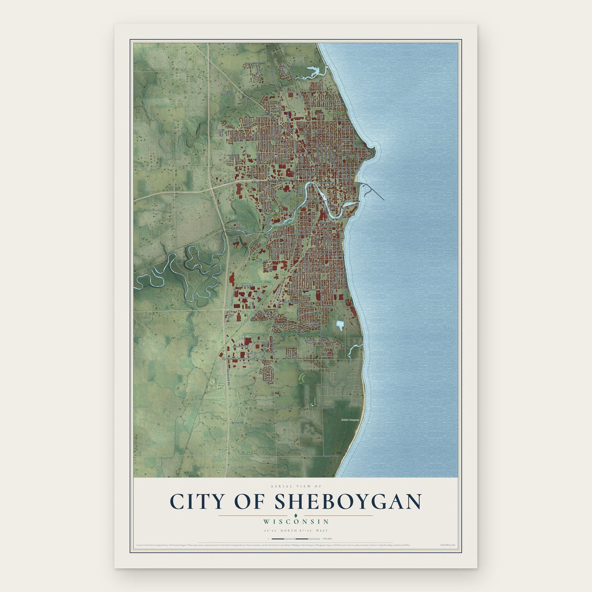
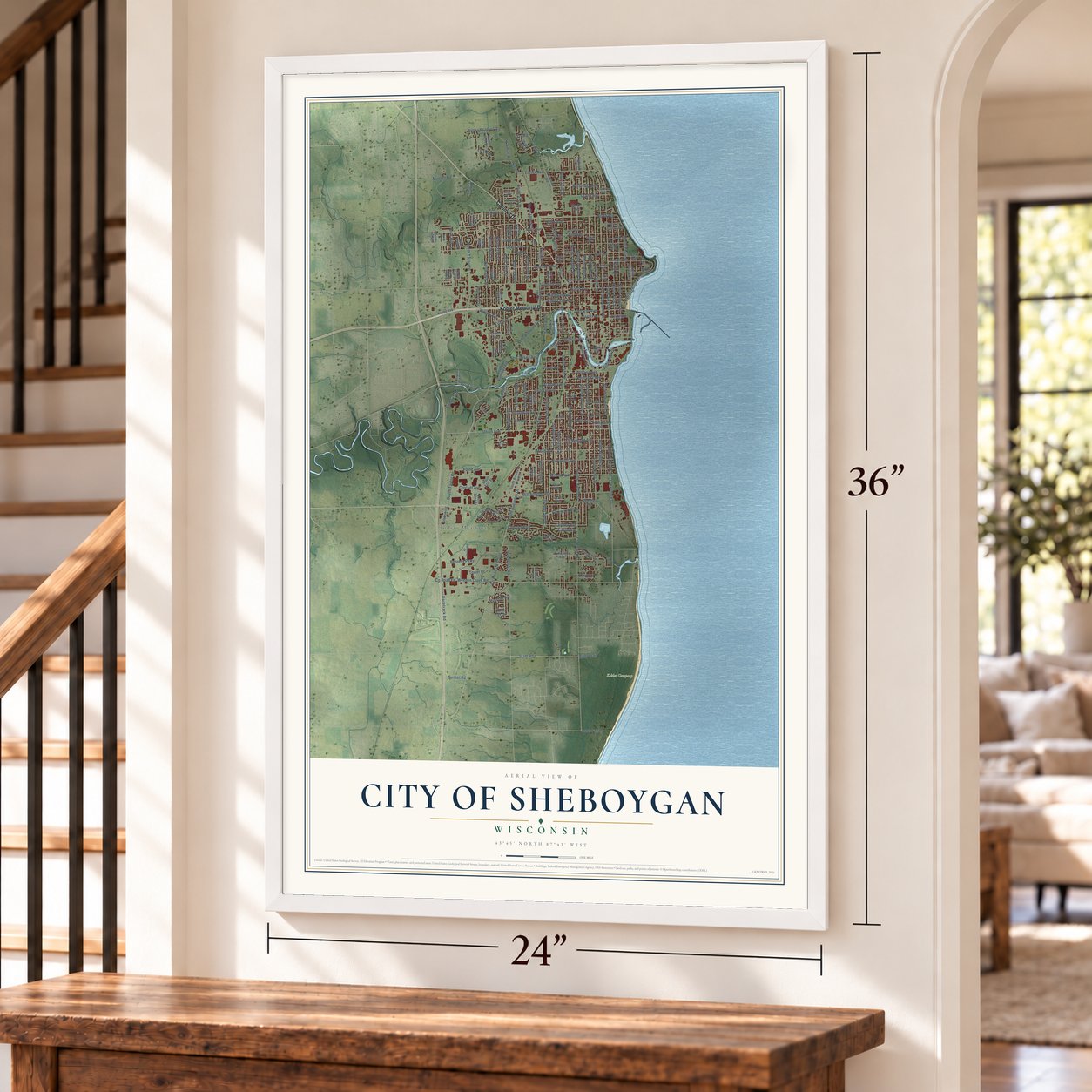
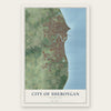
City of Sheboygan, Wisconsin Map Art
Building by building, with labeled streets and shaded relief.
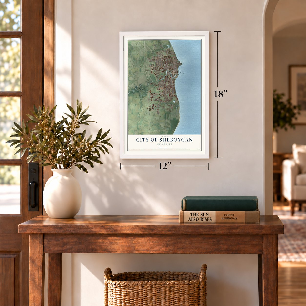
12" x 18" Archival Matte Print
A Map of Home. A Work of Art.
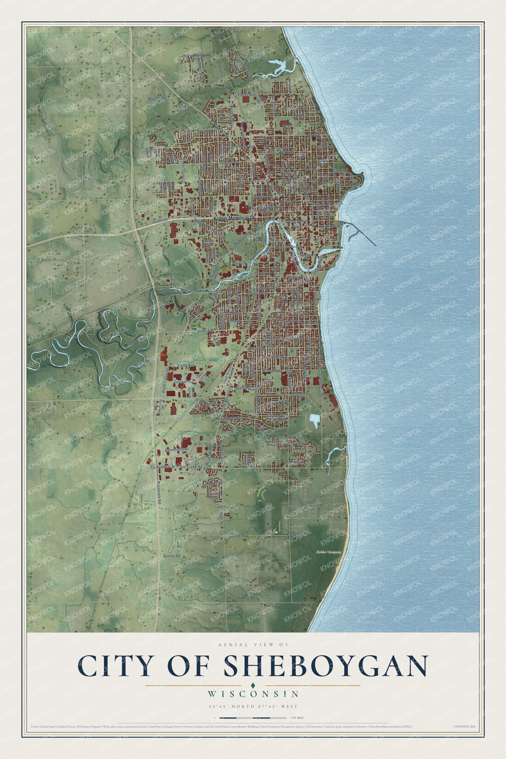
Explore Sheboygan, Wisconsin from a whole new perspective. Created using aerial imagery and detailed geographic data, this map captures Sheboygan building by building, with labeled streets, familiar landmarks, and shaded topographical relief that highlights the natural contours of the landscape.
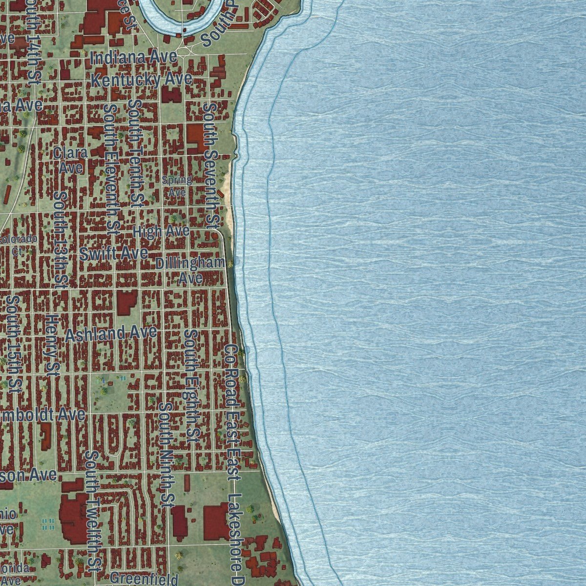
Combining modern data with the timeless character of a vintage atlas, this map is just as interesting up close as it is beautiful on the wall. Whether you grew up in Sheboygan, spent memorable years there, or call it home today, this unique map is a great way to celebrate a place that means something to you. Zoom in on the preview to look for your street, and then order a print to put your memories on the wall.
Three ways to hang it
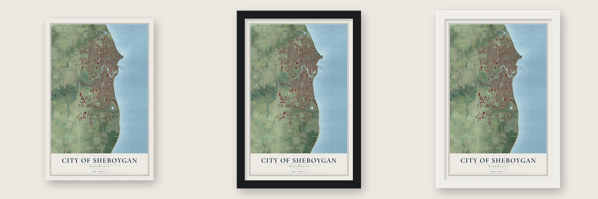
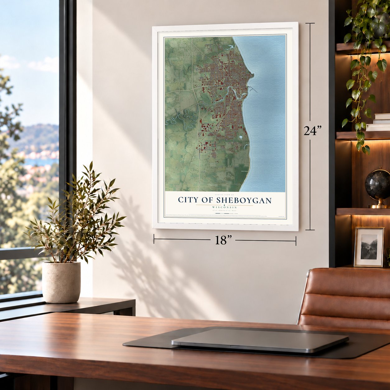
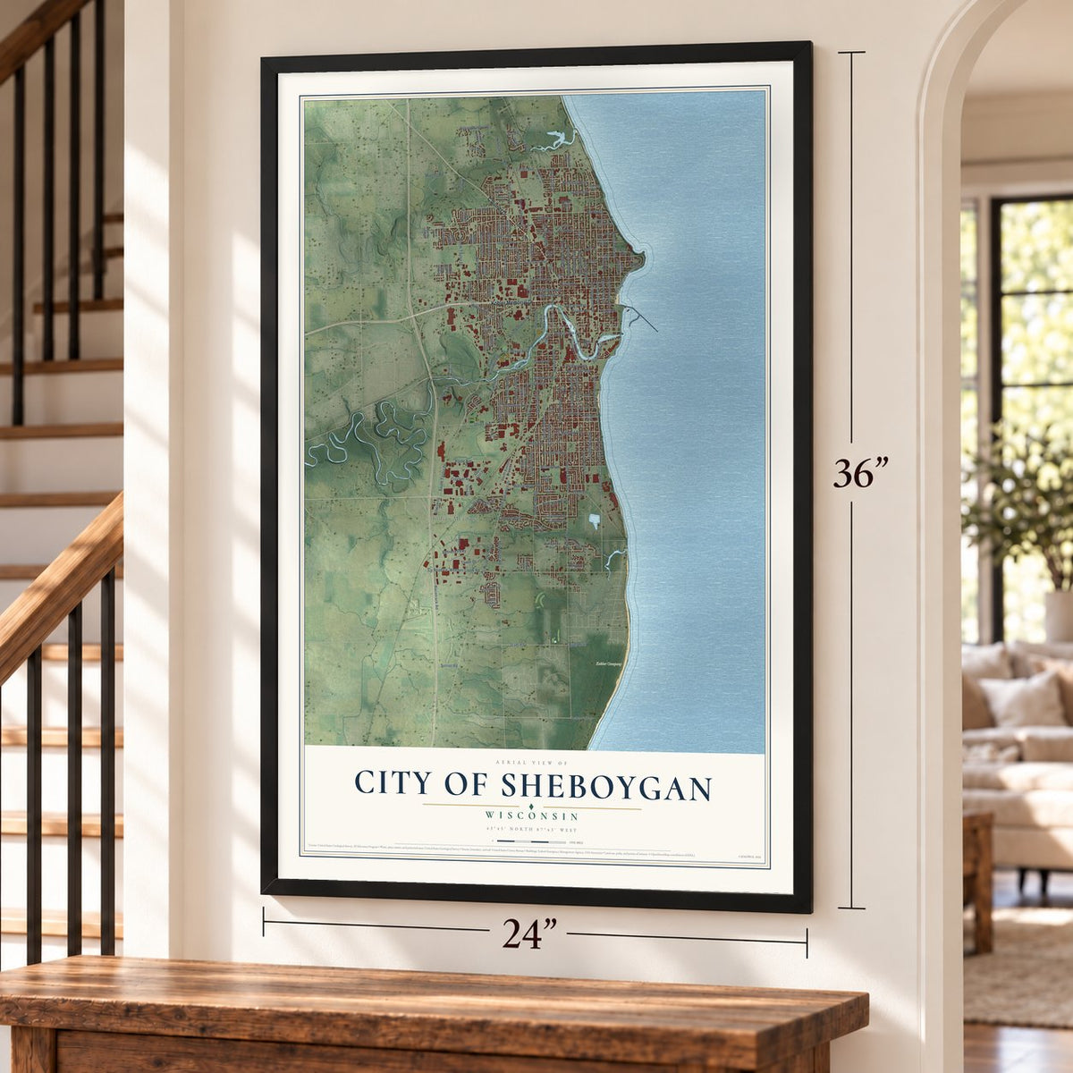
Unframed archival matte, a black wood frame or a white wood frame.
Up close
Geography Worth Displaying
This map was created using accurate cartographic data and authoritative geographic sources, including the U.S. Geological Survey and the Census Bureau. The map brings together terrain, waterways, roads, and building detail. The majority of the streets are labeled, houses are accurately depicted, and the topography is derived from government sources. Combining local data with carefully composed color and shading leads to this beautifully detailed Sheboygan artwork for your wall.
Rather than simply showing street outlines, we’ve included as many of the street names as we could reasonably fit on the map while keeping their names legible. Zoom in on the high resolution preview to see exactly what’s on the map. We truly set out to create a statement piece for anyone who loves Sheboygan. So whether it’s for you, or a gift for someone you love, we hope this map of Sheboygan brings back fond memories.
Read the story behind this map of the City of Sheboygan, Wisconsin from 2026.
Find your street
Names on the Sheboygan map
Every name below is printed on this map. Look for your street, your school, the park where you played, or the pond down the road.
Places and landmarks3
- Sheboygan City Hall
- Indian Meadows
- Kohler Company
Streets and roads199
- Kohler Memorial Drive
- Calumet Drive
- South Taylor Drive
- Georgia Avenue
- South Ninth Street
- Union Avenue
- County Road East East
- Stahl Road
- Racetrack Road
- Campus Drive
- South Business Drive
- County Road Ee
- Lakeshore Drive
- North 15th Street
- North 13th Street
- Weeden Creek Road
- North Tenth Street
- South 14th Street
- North Eighth Street
- County Road Ls
- South Eighth Street
- Superior Avenue
- North Third Street
- North Avenue
- North Sixth Street
- South 13th Street
- North Hiawatha Circle
- South Twelfth Street
- County Road Kk
- Indiana Avenue
Show all 199 streets
- Geele Avenue
- South 17th Street
- South 15th Street
- Erie Avenue
- Washington Avenue
- South Tenth Street
- County Road Ok South
- South Eleventh Street
- North Seventh Street
- North 25th Street
- North 29th Street
- North Ninth Street
- South 18th Street
- North Eleventh Street
- North 27th Street
- North 28th Street
- North Twelfth Street
- North Fifth Street
- Saemann Avenue
- South 16th Street
- Michigan Avenue
- Main Avenue
- North Taylor Drive
- North Fourth Street
- Broadway Avenue
- South 22nd Street
- Moenning Road
- Wilson Avenue
- Broughton Drive
- South Seventh Street
- New Jersey Avenue
- Huron Avenue
- South 19th Street
- North 23rd Street
- Carmen Avenue
- Saint Clair Avenue
- North 21st Street
- North 19th Street
- Eisner Avenue
- Mead Avenue
- Pershing Avenue
- Ashland Avenue
- Humboldt Avenue
- Ontario Avenue
- Bell Avenue
- Camelot Boulevard
- South 24th Street
- Wilgus Avenue
- Alabama Avenue
- Kentucky Avenue
- North 20th Street
- Grand Avenue
- Behrens Parkway
- South Pier Drive
- South 26th Street
- Henry Street
- Najacht Road
- Swift Avenue
- Elm Avenue
- Paine Avenue
- Tower Drive
- Cooper Avenue
- Parkwood Boulevard
- Crocker Avenue
- Jay Road
- Sunset Road
- Castle Avenue
- Lisa Avenue
- Mueller Road
- River Trail
- South Commerce Street
- South Wildwood Avenue
- Lakeshore Road
- Virginia Avenue
- North Wildwood Avenue
- North 18th Street
- Illinois Avenue
- North 26th Street
- Lower Falls Road
- Pennsylvania Avenue
- Lincoln Avenue
- North 36th Street
- North 17th Street
- South 21st Street
- South 20th Street
- Bluff Avenue
- Center Avenue
- North 14th Street
- North 22nd Street
- Niagara Avenue
- North 24th Street
- North 31st Street
- North 30th Street
- North 27th Place
- Martin Avenue
- Clara Avenue
- Greenfield Avenue
- North 16th Street
- South Business Drive II
- Sommer Drive
- Greenwing Drive
- Riverdale Avenue
- Mill Road
- Dillingham Avenue
- Rolling Meadows Drive
- Logan Avenue
- Kiwanis Park Road
- Park Avenue
- High Avenue
- North 40th Street
- North 37th Street
- Sunnyside Avenue
- North 35th Street
- North Second Street
- Vollrath Boulevard
- Fairway Drive
- Pine Bluff Drive
- North Field Drive
- North 34th Street
- Beach Park Lane
- White Fox Drive
- School Avenue
- South 31st Street
- Ohio Avenue
- Ashwood Drive
- Washington Court
- Koehn Avenue
- Wiemann Avenue
- South 32nd Street
- Parkview Terrace
- Clifton Avenue
- Knoll Crest Drive
- Idlewild Lane
- Highcliff Court
- South River Street
- Grant Avenue
- North 31st Place
- Marie Court
- End Court
- North Point Drive
- Florida Avenue
- Columbus Avenue
- Sauk Trail Road
- Gateway Drive
- Cleveland Avenue
- Euclid Avenue
- Bollman Drive
- Pine Grove Avenue
- South 27th Street
- Barrett Street
- Evergreen Park Road
- Ashby Court
- South 36th Street
- Zimbal Avenue
- Lenz Court
- Plath Court
- Mayflower Avenue
- North 38th Street
- South Hiawatha Circle
- Los Angeles Avenue
- Kohls Court
- North Evans Street
- Clement Avenue
- Spring Avenue
- Lily Court
- Silver Leaf Lane
- Colorado Court
- John Court
- Trim Court
Names are listed as they appear on the printed map. Zoom into the product photos to find them.
About the City of Sheboygan, Wisconsin
Sheboygan is a city of 49,929 people and the county seat of Sheboygan County, where the Sheboygan River empties into Lake Michigan. The Menominee ceded the ground here to the U.S. government in the 1831 Treaty of Washington, and by 1836 investors had platted much of the town, laying out more than one thousand lots. The financial crash of 1837 stalled the young settlement, and by early 1840 its blacksmith shop stood abandoned.
The first newcomers came mostly from New York, Michigan and New England, and they cut timber to ship east across the Great Lakes. After the revolutions of 1848 in Europe, middle-class Germans arrived in large numbers. Dutch Protestants also settled here between 1840 and 1890, as did Irish families escaping the Great Famine. Sheboygan was incorporated in 1846, and the Legislature made it a city on March 19, 1853; voters held the first election under the new charter on April 5, 1853.
“This is a promising place. There are a great many best class of Germans settling around it.”
- First Socialists in office, 1898In the spring of 1898 Sheboygan voters elected August L. Mohr and Fred C. Haack to the city council, the first Social Democrats in public office anywhere in the United States. Haack first won in 1897 as a Populist, then switched when the Social Democrats organized in town. After sixteen years on the council he moved to Milwaukee and won a seat there as a Socialist. In 1932 the Socialist Party convention honored him as America's first Socialist officeholder.
- The Lottie Cooper wreckA gale in April 1894 sank the schooner Lottie Cooper just off Sheboygan. Workers building the Harbor Centre Marina later found its wreck buried in the harbor, and the hull now sits on free display in Deland Park on the lakefront, the only exhibit of its kind on the Great Lakes. The waters offshore became part of the Wisconsin Shipwreck Coast National Marine Sanctuary in 2021.
- Malibu of the MidwestLake Michigan's waves earned Sheboygan its nickname as the "Malibu of the Midwest." From 1988 to 2012 the city hosted the Dairyland Surf Classic, the biggest lake surfing contest in the world, and its surf scene appeared in the 2003 documentary Step into Liquid.
- A Hmong memorial by the lakeLate in the 20th century, Hmong families who had fled Laos as refugees made new homes in Sheboygan, which now holds one of the larger Hmong communities in the country. The Sheboygan Hmong Memorial in Deland Park, on the Lake Michigan shore, honors the Hmong who fought for the United States in the Secret War of 1961 to 1975.
Keep exploring Wisconsin
City of Sheboygan is one of 2,021 Wisconsin towns we've mapped. Every dot on the map is a print of its own.
The search covers every state, Wisconsin first.
Near City of Sheboygan
Order 2 or more town maps and save 10%. Shown in the size and finish you picked above, so they hang as a set.
- Kohler 12" x 18" / Archival Matte Print $39.99
- Town of Sheboygan 12" x 18" / Archival Matte Print $39.99
- Erdman 12" x 18" / Archival Matte Print $39.99


More maps nearby: City of Sheboygan Falls, Wilson, Town of Sheboygan Falls, Mosel and Howards Grove.
The art of mapping a place
How This Map Was Made
Real places. Remarkable detail. Discover the layers that turn geographic data into a map of home.

The view from above
Aerial imagery reveals the character of the land: woodland, open fields, and the patterns of a place.

The shape of the land
Elevation data brings hills, valleys, and subtle changes in the landscape into view.

The details of home
Roads, waterways, and building footprints come together to make the map feel unmistakably local.

Geography becomes art
Considered color, shading, and typography bring the layers together in a map made for your wall.


Process illustrated with Mendon, Massachusetts. Aerial imagery: USDA NAIP. Terrain: USGS 3D Elevation Program. Map details and finished artwork: KNOWOL.
The Details
About This Print
Choose an archival matte print, or a black or white Ayous wood frame. The archival matte print is unframed.
Select your size and finish above to see the matching product image and price.
Materials & Craftsmanship
A contemporary map with the character of a classic atlas, printed on archival matte paper. Optional frames are made from Ayous wood.
Your printed map does not include the watermark shown in the full-map preview.
Shipping & Delivery
Free shipping within the United States. Every print is made to order in the USA.
Buying a gift? Add a note in your cart and we'll include it. We never put prices in the package.
Prints ship within 2 to 3 business days. Allow 7 to 10 days total from ordering for delivery. Timing may vary during holidays or periods of high order volume.
Read our shipping policy.
Returns and damaged prints
Each print is made to order. Change-of-mind refunds are not available after production.
If your print arrives damaged, misprinted or incorrect, contact support@knowol.com within 30 days of receiving it. Include your order number, photos and a description of the issue.
Read our full refund and replacement policy. For questions about your order, email support@knowol.com.