
Search for another town





Free U.S. delivery 7 to 10 days after you order
Somerville, Massachusetts Map Art
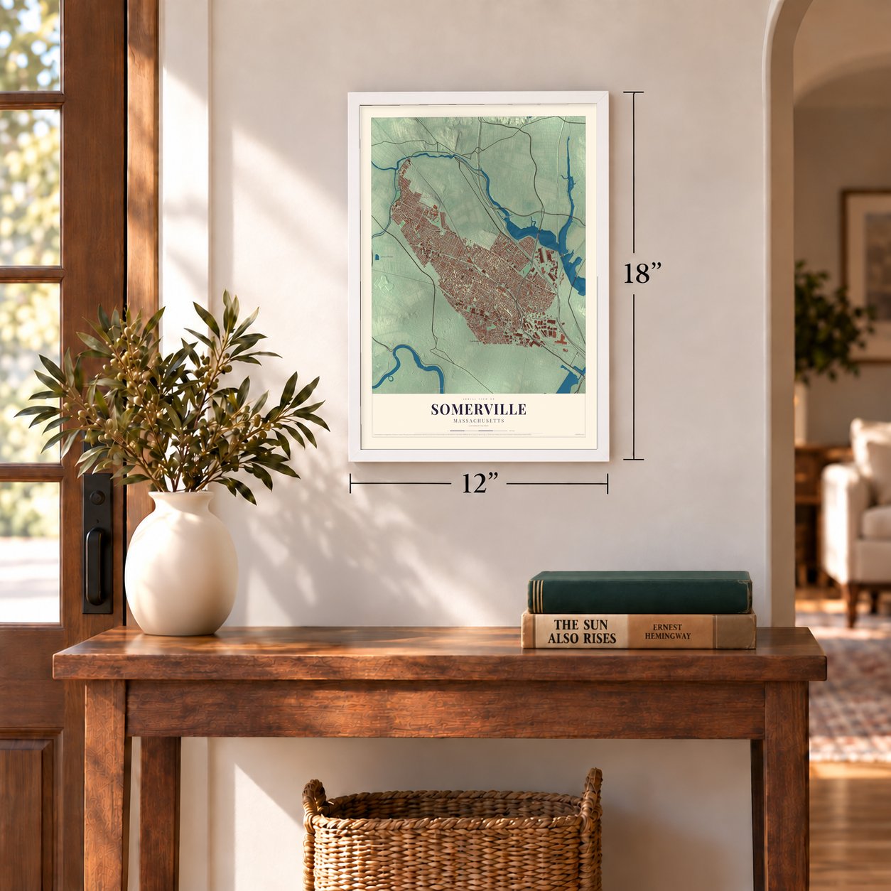
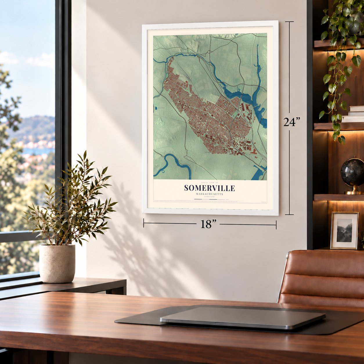
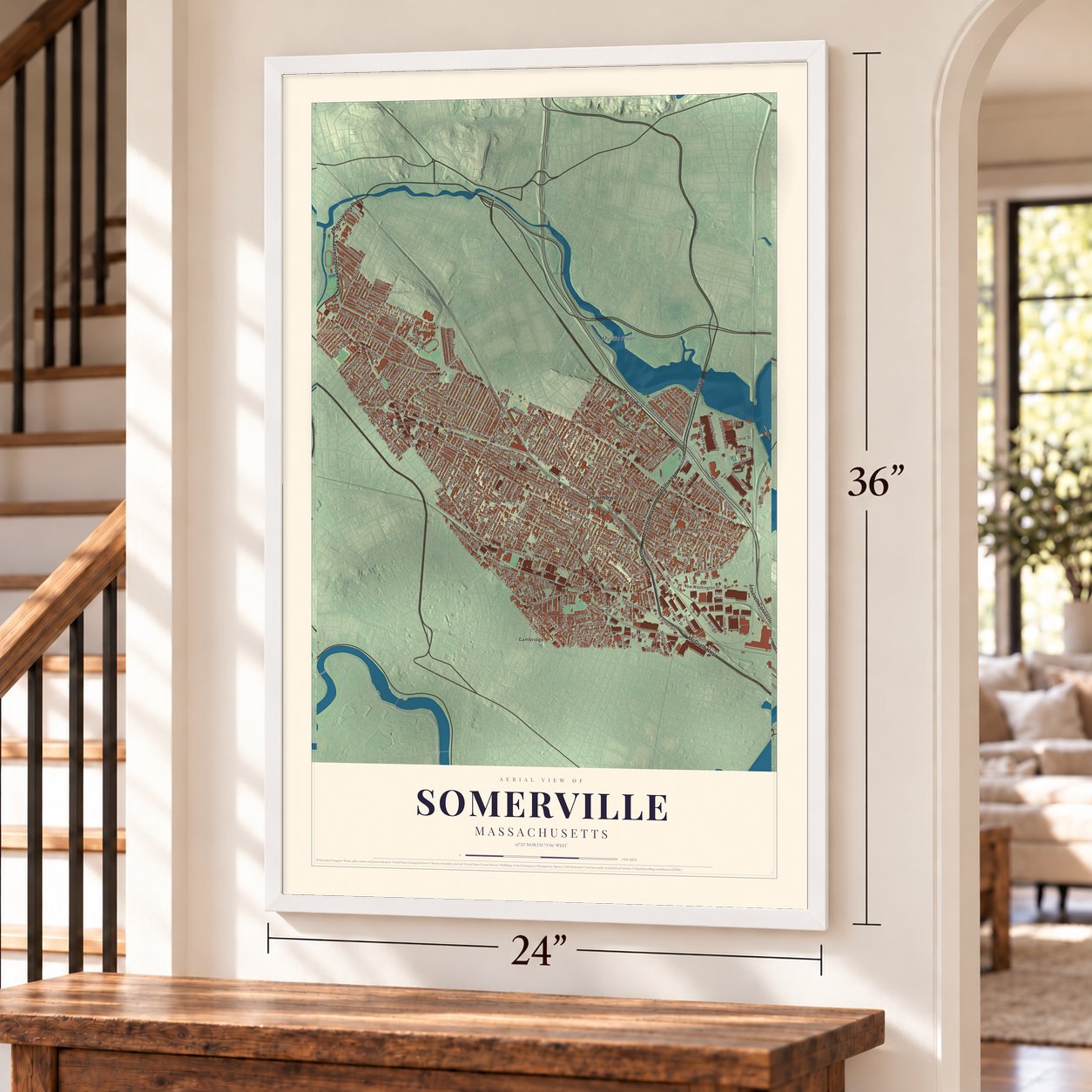
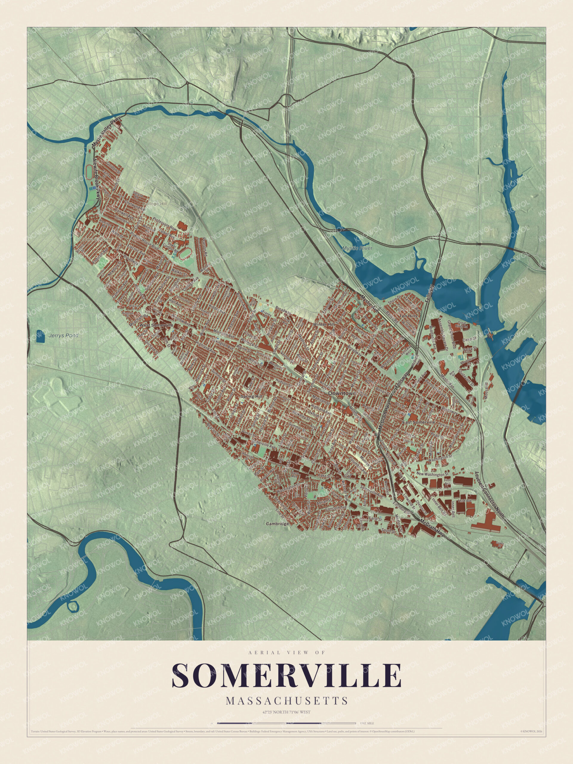
A new map of Somerville, Massachusetts, made in 2026 and printed to order on thick archival matte paper.
12" x 18" Archival Matte Print
A Map of Home. A Work of Art.
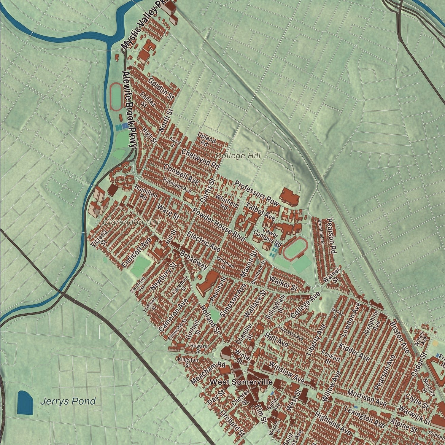
Explore Somerville, Massachusetts from a whole new perspective. Created using aerial imagery and detailed geographic data, this map captures Somerville building by building, with labeled streets, familiar landmarks, and shaded topographical relief that highlights the natural contours of the landscape.
Combining modern data with the timeless character of a vintage atlas, this map is just as interesting up close as it is beautiful on the wall. Whether you grew up in Somerville, spent memorable years there, or call it home today, this unique map is a great way to celebrate a place that means something to you. Zoom in on the preview to look for your street, and then order a print to put your memories on the wall.
Three ways to hang it
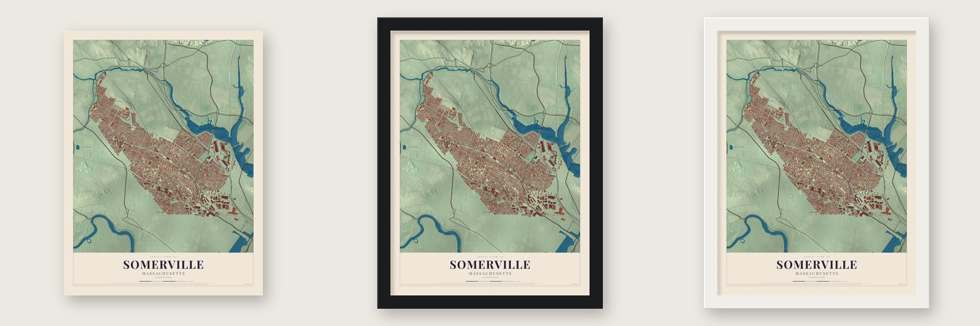
Unframed archival matte, a black wood frame or a white wood frame.
Up close
Geography Worth Displaying
This map was created using accurate cartographic data and authoritative geographic sources, including the U.S. Geological Survey (USGS) and FEMA. The map brings together terrain, waterways, roads, and building detail. The majority of the streets are labeled, houses are accurately depicted, and the topography is derived from government sources. Combining local data with carefully composed color and shading leads to this beautifully detailed Somerville artwork for your wall.
Rather than simply showing street outlines, we’ve included as many of the street names as we could reasonably fit on the map while keeping their names legible. Zoom in on the high resolution preview to see exactly what’s on the map. We truly set out to create a statement piece for anyone who loves Somerville. So whether it’s for you, or a gift for someone you love, we hope this map of Somerville brings back fond memories.
Explore the full map of Somerville, Massachusetts and read about the local places it shows.

About Somerville, Massachusetts
Somerville is a city of 81,045 people on the Mystic River. In 1630 a trader named John Woolrich came over from the Charlestown peninsula and built his home near what is now Dane Street. The next year Governor John Winthrop received a grant of 600 acres here and named it Ten Hills Farm for its ten small knolls, and in 1639 the woman sachem of the Mystic people deeded the land to the English.
For about two centuries this was the part of Charlestown that lay beyond the Neck. An 1880 county history found no more than about 250 people here when the Revolution came, living in just over thirty houses, and most of them were farmers who produced milk. Winter, Prospect and Spring hills were cedar-dotted pasture. Somerville broke away from Charlestown as a town on March 3, 1842. It became a city in 1872, and George O. Brastow was the man who served as its first mayor.
“Somerville, one of Boston's bed-chambers, is built on seven hills, three miles from the capitol.”
- The Powder Alarm of 1774John Mallet built a stone windmill here in 1703 or 1704, and in 1747 the colony bought it to store gunpowder. On September 1, 1774, General Gage's soldiers hauled away 250 half barrels of powder, and the seizure became known as the Powder Alarm. In 1890 the descendants of Nathan Tufts handed the Old Powder House, along with the farm around it, over to the city, and Powder House Park joined the National Register in 1975.
- The front line of the siegeAfter Bunker Hill, Somerville's hills held the American line around Boston. Putnam's scarlet flag, bearing the words An Appeal to Heaven, went up over Prospect Hill on July 18, 1775. After dark on August 26, roughly two thousand men led by General Sullivan dug in on Ploughed Hill while British guns shelled them from Bunker Hill and from boats on the Mystic. As 1776 began, on January 1, the United Colonies flag rose over Prospect Hill.
- The first soldiers' monumentSomerville had about nine thousand people when the Civil War began. It supplied forty officers and 1,085 men, 147 above its quota, and ninety-eight of them died. During the summer of 1863, the town's Light Infantry company used money left over from its 1861 send-off fund to raise a marble shaft topped by an eagle. An 1890 county history called it the first in Massachusetts, and it still stands in the Milk Row Cemetery.
- A home telephone in 1877Charles Williams Jr. made telegraph instruments in a Boston shop where Thomas Watson and Alexander Graham Bell were developing the telephone. In 1877 a line joined that shop to his house on Arlington Street, giving the world its first permanent home telephone service. The Charles Williams Jr. House joined the National Register in 1989.
- Davis Square's theatre, 1914Joseph Hobbs put up the Hobbs Building in Davis Square in 1914, with a theatre built for stage shows, vaudeville, opera and movies. The Somerville Theatre still shows films and hosts concerts.
Find your street
Names on the Somerville map
Every name below is printed on this map. Look for your street, your school, the park where you played, or the pond down the road.
Places and landmarks11
- Downtown
- Clarendon Hill
- College Hill
- Jerrys Pond
- Mystic River
- Cambridge
- East Somerville
- Spring Hill
- Ten Hills
- West Somerville
- Winter Hill
Streets and roads250
- Fellsway
- Mystic Avenue
- Alewife Brook Parkway
- McGrath Highway
- Mystic Valley Parkway
- Leverett Connector North
- Powder House Boulevard
- Shore Drive
- Bailey Road
- College Avenue
- Curtis Street
- Somerville Avenue
- Holland Street
- Middlesex Avenue
- Elm Street
- Boston Avenue
- Wheatland Street
- Medford Street
- Boston Street
- Wyatt Street
- Broadway
- Highland Avenue
- Summer Street
- Washington Street
- Beacon Street
- Central Street
- Pearl Street
- Lowell Street
- School Street
- Cedar Street
Show all 250 streets
- Walnut Street
- Assembly Square Drive
- Willow Avenue
- Inner Belt Road
- Morrison Avenue
- Hudson Street
- Albion Street
- Jaques Street
- Sycamore Street
- Cross Street
- North Street
- Kidder Avenue
- Grand Union Boulevard
- Glen Street
- Concord Avenue
- Franklin Street
- Prospect Street
- Porter Street
- Professors Row
- Webster Avenue
- Ten Hills Road
- Heath Street
- Hancock Street
- Linwood Street
- Temple Street
- Inner Belt
- Thurston Street
- Sturtevant Street
- Pearson Road
- Line Street
- Mount Vernon Street
- Fitchburg Street
- New Washington Street
- Bow Street
- Flint Street
- Marshall Street
- Munroe Street
- Grant Street
- Orchard Street
- Liberty Avenue
- Bonair Street
- Pennsylvania Avenue
- Foley Street
- Moreland Street
- Oxford Street
- Columbus Avenue
- Talbot Avenue
- Myrtle Street
- Vinal Avenue
- Linden Avenue
- Vernon Street
- Electric Avenue
- Dane Street
- Wallace Street
- Alpine Street
- Lexington Avenue
- Berkeley Street
- Fremont Street
- Gordon Street
- Conwell Avenue
- South Street
- Pearson Avenue
- Newbury Street
- Craigie Street
- Benton Road
- Putnam Street
- Lowden Avenue
- Park Street
- Spring Street
- Oak Street
- Otis Street
- Winslow Avenue
- Joy Street
- Prescott Street
- Hinckley Street
- Cameron Avenue
- Trull Street
- Simpson Avenue
- Meacham Road
- Church Street
- Garfield Avenue
- Laurel Street
- Day Street
- Adams Street
- Warwick Street
- Hall Avenue
- Dimick Street
- Tennyson Street
- Rush Street
- Endicott Avenue
- Madison Street
- Chetwynd Road
- Canal Street
- Earle Street
- Lake Street
- Moosal Place
- Ware Street
- Alston Street
- Cutter Street
- Mason Street
- Walker Street
- Harvard Street
- Perry Street
- Clyde Street
- Banks Street
- Bond Street
- Adrian Street
- Tower Street
- Ames Street
- West Street
- Memorial Road
- Great River Road
- Josephine Avenue
- Governor Winthrop Road
- Dartmouth Street
- Gilman Street
- Puritan Road
- Fellsway West
- Avon Street
- Perkins Street
- Lower Campus Road
- Chandler Street
- Revolution Drive
- Properzi Way
- Sargent Avenue
- Derby Street
- Victoria Street
- Main Street
- Tufts Street
- Fairfax Street
- Chestnut Street
- Richdale Avenue
- Chester Street
- Edgar Avenue
- Hanson Street
- Columbia Street
- Pitman Street
- Paulina Street
- Mansfield Street
- Springfield Street
- Gorham Street
- Stone Avenue
- Ivaloo Street
- Third Avenue
- High Street
- Whitfield Road
- Foskett Street
- Woodbine Street
- Harrison Street
- Saint James Avenue
- Upland Road
- Franey Road
- Hamlet Street
- Sewall Street
- Allen Street
- Billingham Street
- Tremont Street
- Dane Avenue
- Austin Street
- Hamilton Road
- Clark Street
- Chester Avenue
- Warner Street
- Fisk Avenue
- Bolton Street
- Miller Street
- Winter Street
- Loring Street
- Autumn Street
- Hill Street
- First Avenue
- Belmont Street
- Cherry Street
- Partridge Avenue
- Raymond Avenue
- New Road
- Oliver Street
- Elmwood Street
- Murdock Street
- Everett Avenue
- Sydney Street
- Radcliffe Road
- Whitman Street
- Princeton Street
- Kingston Street
- Gibbens Street
- Prospect Hill Avenue
- Nashua Street
- Burnham Street
- Claremon Street
- Wesley Street
- Cutter Avenue
- Dell Street
- Rose Street
- Oakland Avenue
- Howard Street
- Tyler Street
- Conwell Street
- Dawes Street
- Wilson Avenue
- White Street
- Conners Drive
- Glenwood Road
- Newton Street
- Pinckney Street
- Bromfield Road
- Clarendon Avenue
- Preston Road
- Francesca Avenue
- Mallet Street
- Holyoke Road
- Pleasant Avenue
- Butler Drive
- Melvin Street
- Aldersey Street
- Lincoln Avenue
- Bailey Street
- Yorktown Street
- Windom Street
- North Union Street
Names are listed as they appear on the printed map. Zoom into the product photos to find them.
The art of mapping a place
How This Map Was Made
Real places. Remarkable detail. Discover the layers that turn geographic data into a map of home.

The view from above
Aerial imagery reveals the character of the land: woodland, open fields, and the patterns of a place.

The shape of the land
Elevation data brings hills, valleys, and subtle changes in the landscape into view.

The details of home
Roads, waterways, and building footprints come together to make the map feel unmistakably local.

Geography becomes art
Considered color, shading, and typography bring the layers together in a map made for your wall.


Process illustrated with Mendon, Massachusetts. Aerial imagery: USDA NAIP. Terrain: USGS 3D Elevation Program. Map details and finished artwork: KNOWOL.
The Details
About This Print
Choose an archival matte print, or a black or white Ayous wood frame. The archival matte print is unframed.
Select your size and finish above to see the matching product image and price.
Materials & Craftsmanship
A contemporary map with the character of a classic atlas, printed on archival matte paper. Optional frames are made from Ayous wood.
Your printed map does not include the watermark shown in the full-map preview.
Shipping & Delivery
Free shipping within the United States. Every print is made to order in the USA.
Buying a gift? Add a note in your cart and we'll include it. We never put prices in the package.
Prints ship within 2 to 3 business days. Allow 7 to 10 days total from ordering for delivery. Timing may vary during holidays or periods of high order volume.
Read our shipping policy.
Returns and damaged prints
Each print is made to order. Change-of-mind refunds are not available after production.
If your print arrives damaged, misprinted or incorrect, contact support@knowol.com within 30 days of receiving it. Include your order number, photos and a description of the issue.
Read our full refund and replacement policy. For questions about your order, email support@knowol.com.
Find your town
Looking for another city?
Find a map of home in our Massachusetts collection, or any town in the country.
Nearby
Maps of towns near Somerville
Know someone from one of these towns? Their map makes a great gift.
 Cambridge
, Massachusetts
From $39.99See the map
 Medford
, Massachusetts
From $39.99See the map
 Everett
, Massachusetts
From $39.99See the map
More maps nearby: Malden, Chelsea, Arlington, Belmont and Watertown.