
Search for another town




Free U.S. delivery 7 to 10 days after you order
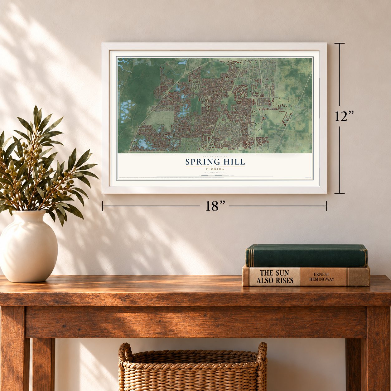
Spring Hill, Florida Map Art
A new map of Spring Hill, Florida, made in 2026 and printed to order on thick archival matte paper.
12" x 18" Archival Matte Print
A Map of Home. A Work of Art.
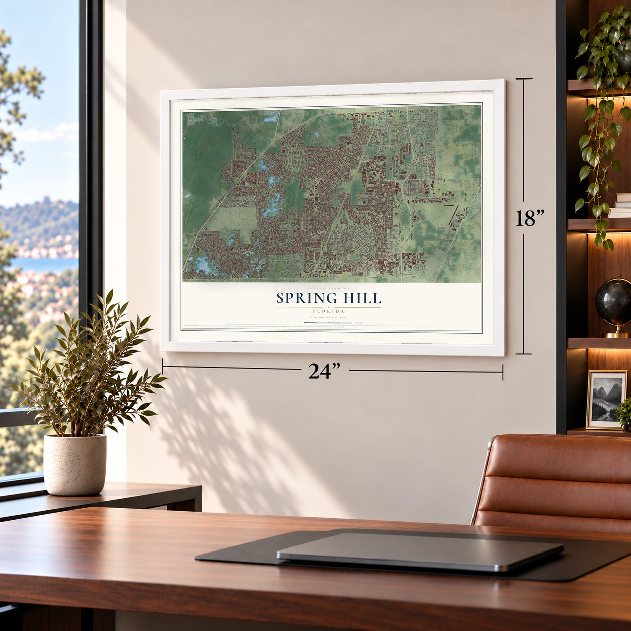
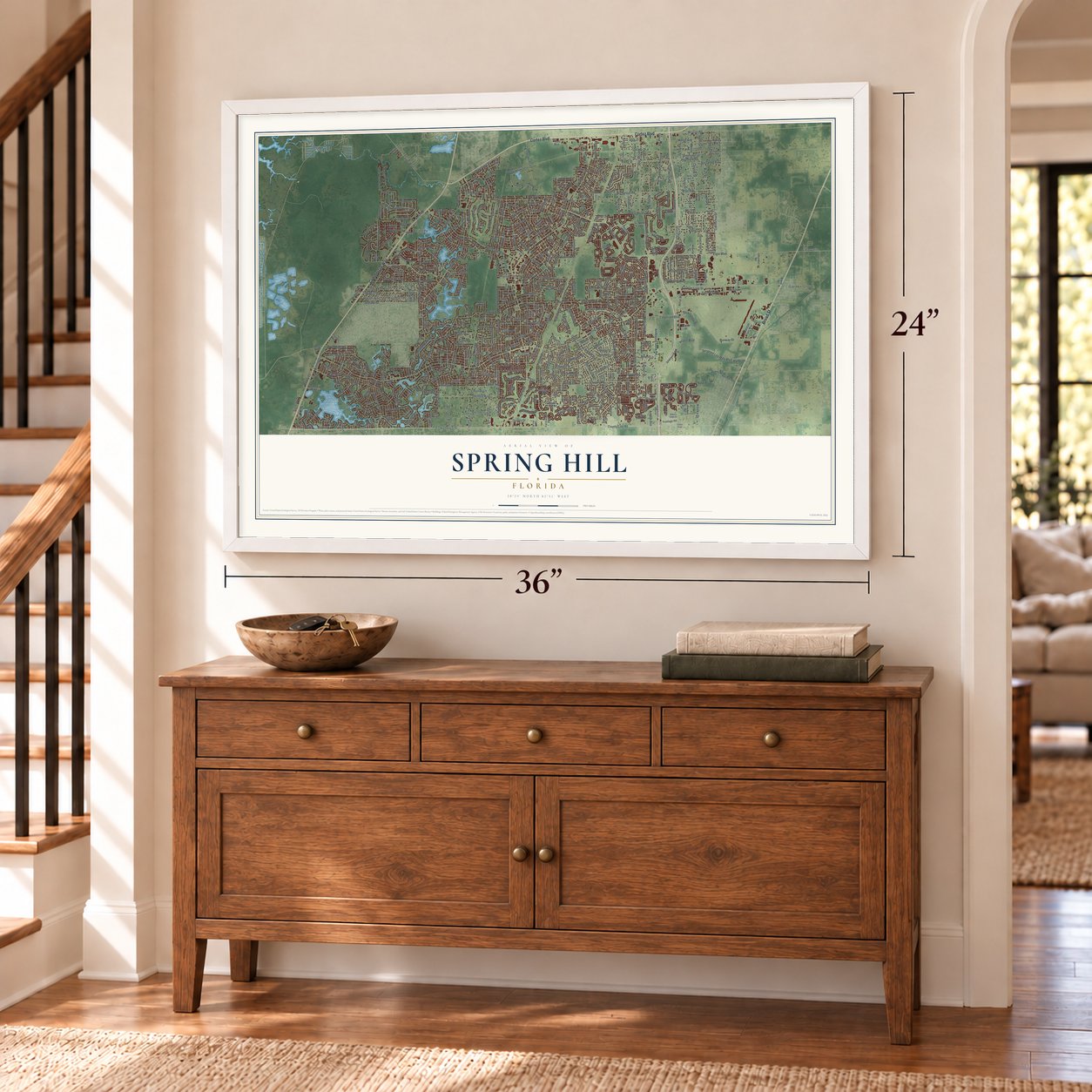
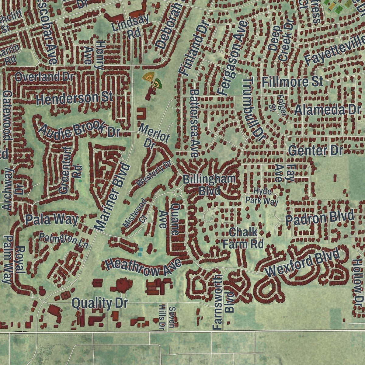
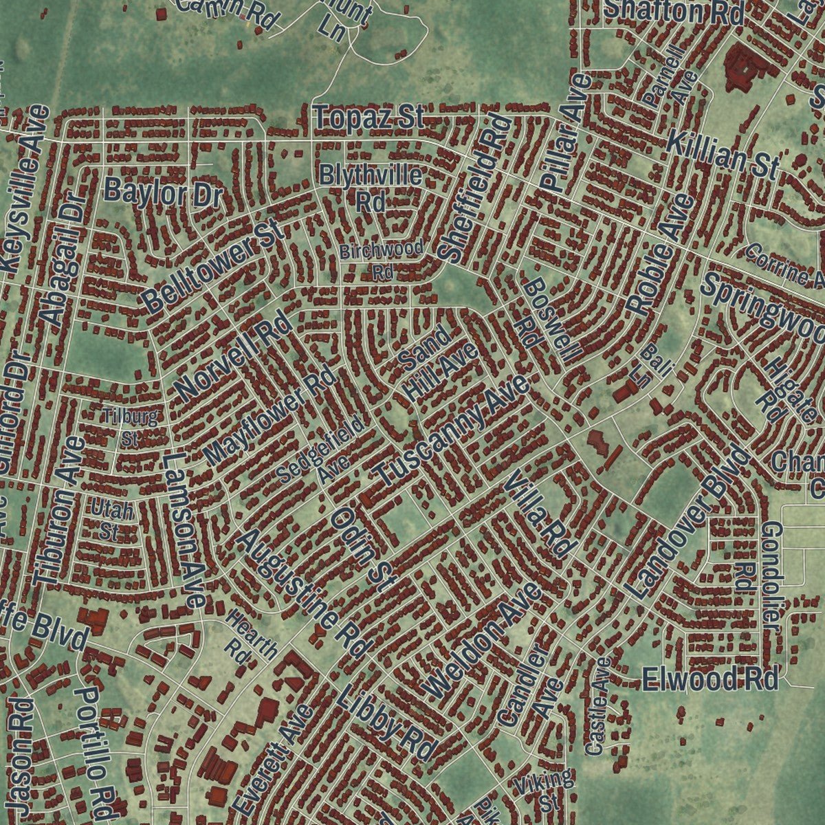
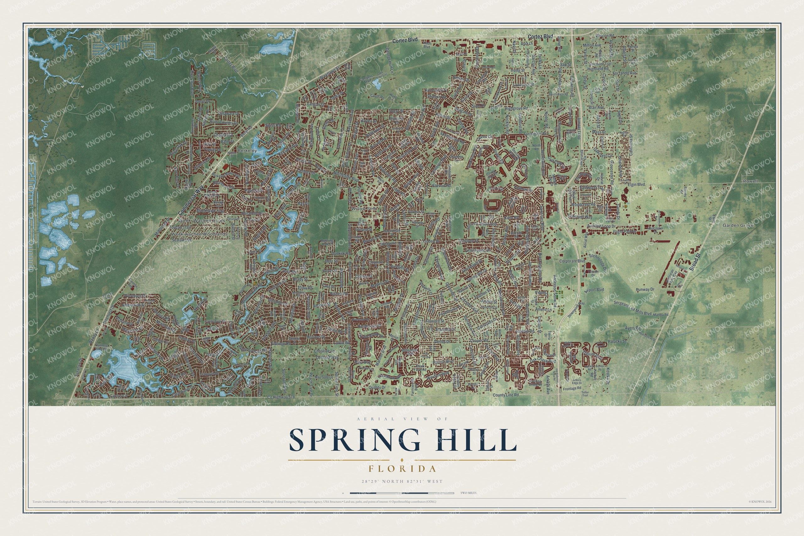
Explore Spring Hill, Florida from a whole new perspective. Created using aerial imagery and detailed geographic data, this map captures Spring Hill building by building, with labeled streets, familiar landmarks, and shaded topographical relief that highlights the natural contours of the landscape.
Combining modern data with the timeless character of a vintage atlas, this map is just as interesting up close as it is beautiful on the wall. Whether you grew up in Spring Hill, spent memorable years there, or call it home today, this unique map is a great way to celebrate a place that means something to you. Zoom in on the preview to look for your street, and then order a print to put your memories on the wall.
Three ways to hang it
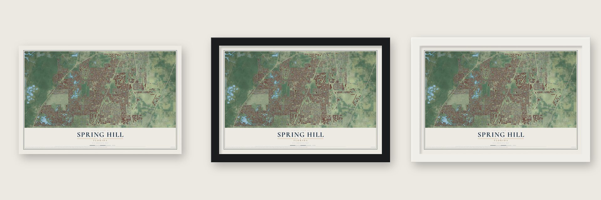
Unframed archival matte, a black wood frame or a white wood frame.
Up close
Geography Worth Displaying
This map was created using accurate cartographic data and authoritative geographic sources, including the U.S. Geological Survey (USGS) and FEMA. The map brings together terrain, waterways, roads, and building detail. The majority of the streets are labeled, houses are accurately depicted, and the topography is derived from government sources. Combining local data with carefully composed color and shading leads to this beautifully detailed Spring Hill artwork for your wall.
Rather than simply showing street outlines, we’ve included as many of the street names as we could reasonably fit on the map while keeping their names legible. Zoom in on the high resolution preview to see exactly what’s on the map. We truly set out to create a statement piece for anyone who loves Spring Hill. So whether it’s for you, or a gift for someone you love, we hope this map of Spring Hill brings back fond memories.
Explore the full map of Spring Hill, Florida and read about the local places it shows.

About Spring Hill, Florida
Spring Hill is an unincorporated community of 113,568 people in Hernando County, about 40 miles north of Tampa. A place called Spring Hill was already on county maps by 1856, along the road now named Fort Dade Avenue, a little north of Wiscon. The modern community began in 1967, when the Deltona Corporation and the Mackle Brothers laid it out as a planned development.
The developers called the project Spring Lake while they planned it, but another local place already used that name, so they settled on Spring Hill. They followed the same plans they had drawn for their community of Deltona and sold lots through advertising across the whole country. Buyers kept coming, and the census count grew from 98,621 in 2010 to 113,568 in 2020, though Spring Hill has never incorporated as a city.
- A waterfall at the entranceThe Spring Hill waterfall still marks the main entrance to the original 1967 development, where Spring Hill Drive meets U.S. Route 19, which locals know as Commercial Way.
- Closer to Tampa since 2001The Suncoast Parkway, a toll road numbered SR 589, was finished in 2001. It runs through Spring Hill and connects it to Pasco and Hillsborough counties, so the drive to Tampa got much easier.
- A schoolhouse turned bookstoreThe Spring Hill Branch Library replaced the old Little Red Schoolhouse Branch Library. The Friends of the Library turned the historic building into a bookstore, and its sales help pay for the county's libraries.
- A 100,000-square-foot campusPasco-Hernando State College built its Spring Hill Campus with 100,000 square feet of space. Of the five campuses the college now runs, only three opened before this one, and a single campus came after it.
Find your street
Names on the Spring Hill map
Every name below is printed on this map. Look for your street, your school, the park where you played, or the pond down the road.
Places and landmarks6
- Berkeley
- Garden Grove
- Powell
- Weeki Wachee Acres
- Weekiwachee Woodlands
- Willow Sink
Streets and roads547
- Cortez Boulevard
- Commercial Way
- Broad Street
- County Line Road
- River Run Boulevard
- Eastwood Trail
- Spring Hill Drive
- Elgin Boulevard
- Mariner Boulevard
- Linden Drive
- Landover Boulevard
- Powell Road
- Deltona Boulevard
- Coronado Drive
- Pinehurst Drive
- Barclay Avenue
- California Street
- Horizon Drive
- Waterfall Drive
- Lema Drive
- Anderson Snow Road
- County Highway 578
- Northcliffe Boulevard
- Elwood Road
- Freeport Drive
- Ayers Road
- Cooper Road
- Holiday Drive
- Wexford Boulevard
- Trillium Boulevard
Show all 547 streets
- Augustine Road
- Norvell Road
- Godfrey Avenue
- Eldridge Road
- Sealawn Drive
- Dothan Avenue
- Lawrence Street
- Jumper Loop
- Highgrove Road
- Toucan Trail
- Gifford Drive
- Sheffield Road
- Dunkirk Road
- Corporate Boulevard
- Saint Ives Boulevard
- Larkin Road
- Drew Street
- Drayton Drive
- Keysville Avenue
- Oakcrest Circle
- Bay Drive
- Orchard Way
- Bishop Road
- Whitewood Avenue
- Lamson Avenue
- Sergeant Lea Mills Boulevard
- Glenridge Drive
- Drysdale Street
- Montano Avenue
- Delaware Drive
- Clearwater Drive
- River Country Drive
- Nodoc Road
- Philatelic Drive
- Roble Avenue
- Tranquil Drive
- Treehaven Drive
- Little Farms Drive
- Bayridge Court
- Cobblestone Drive
- Ambassador Avenue
- Copeland Way
- Finland Drive
- Aviation Loop Drive
- Oak Chase Boulevard
- Secretariat Run
- Bayside Court
- Flight Path Drive
- Aladdin Road
- Alameda Drive
- Meredith Drive
- Curry Drive
- Abagail Drive
- Harrow Road
- Amherst Avenue
- Rudi Loop
- Meadow Lark Road
- Wiscon Road
- Quality Drive
- Bedford Road
- Genter Drive
- Bolger Avenue
- Coronet Court
- Orlando Avenue
- Bret Ferguson Road
- Killian Street
- Century Drive
- Amero Lane
- Jomel Drive
- Irving Street
- Henderson Street
- Pagoda Drive
- Kirkland Avenue
- Highfield Road
- Gibralter Street
- Belltower Street
- Portillo Road
- Swiss Road
- Fillmore Street
- Bentley Avenue
- Gold Road
- Odin Street
- Anchor Avenue
- Christine Lane
- Topaz Street
- Abeline Road
- Newhope Road
- Covewood Drive
- Royal Oak Drive
- Fayetteville Drive
- Florian Way
- Runway Drive
- Golf Club Lane
- Rhanbuoy Road
- Shafton Road
- Hawthorne Road
- Alderwood Street
- George Hurt Lane
- Springwood Road
- Golddust Road
- Elida Road
- Kirkwood Avenue
- Maderia Street
- Piedmont Drive
- Cressida Circle
- Tuscanny Avenue
- Corydon Avenue
- Trumbull Drive
- India Drive
- Altoona Avenue
- Deborah Drive
- Danforth Road
- Villa Road
- Jena Road
- Suncoast Boulevard
- Tarrytown Drive
- Gates Circle
- Ardenwood Drive
- Chaucer Drive
- Plumosa Street
- Blair Avenue
- Langan Street
- Vicksburg Road
- Cactus Circle
- Lydia Court
- Durango Circle
- Coble Road
- Boatwrite Road
- Peach Tree Drive
- Spring Time Street
- Omaha Circle
- Aldoro Avenue
- Libby Road
- Technology Drive
- Woodcrest Road
- Alberta Street
- Cartwrite Road
- Arizona Street
- Florentine Court
- Ashland Drive
- Brentlawn Street
- Waters Way
- Hallcrest Avenue
- Nocklyn Road
- Oak Lake Drive
- Baffin Circle
- Pullman Drive
- Patricia Place
- Kane Road
- Ring Road
- Gallup Road
- Monarch Street
- Milton Avenue
- Apple Orchard Road
- Gretna Drive
- Angler Street
- Lola Drive
- Belmont Road
- Forzando Avenue
- Wendy Court
- Grove Road
- Casson Street
- Kurt Street
- Palacky Street
- Hanley Drive
- Carlton Street
- Audie Brook Drive
- Chase Street
- Cara Street
- Pillar Avenue
- Riddle Drive
- Feather Street
- Talbot Circle
- Escobar Avenue
- Tiburon Avenue
- Salters Street
- Toledo Road
- Oriana Drive
- Airport Boulevard
- Suzanne Drive
- Greynolds Avenue
- Jason Road
- Blackhawk Trail
- Skylark Drive
- Gloucester Road
- Barranca Avenue
- Evenglow Avenue
- Deer Street
- Waycross Drive
- Tanner Road
- Alhambra Court
- Heathrow Avenue
- Kass Circle
- Haulover Avenue
- Aloe Drive
- Lucky Lane
- Groveland Street
- Kostka Drive
- Alice Street
- Siam Drive
- Padron Boulevard
- Middlesex Drive
- Sago Drive
- Redgate Street
- Seagate Street
- Fergason Avenue
- Brady Street
- Amidon Street
- Glade Road
- Weldon Avenue
- Pala Way
- Jamaica Road
- Ballard Street
- Arkays Avenue
- Flyway Drive
- Lauren Drive
- Candy Drive
- Baylor Drive
- Clarion Street
- Slater Road
- Vance Street
- Beryl Road
- Plaza Avenue
- Moss Street
- Dora Street
- Ireland Street
- Navy Drive
- Balm Street
- Sap Street
- Forest Oaks Boulevard
- Frontage Road
- Sterling Hill Boulevard
- Landmark Drive
- Championship Cup Lane
- Everett Avenue
- Dow Lane
- Overland Drive
- Blythville Road
- Laredo Avenue
- Don Loop
- Shoshone Trail
- Aerial Way
- Gondolier Road
- Deep Creek Drive
- Claymore Street
- Crescent Road
- Airmont Drive
- Mayflower Road
- Sea Holly Drive
- San Antonio Road
- Banyan Road
- Trenton Avenue
- Jacaranda Circle
- Rachel Boulevard
- Downwind Way
- Captain Drive
- Argyll Drive
- Mosquero Road
- Candler Avenue
- Sandra Drive
- Martha Road
- Chamber Court
- Berkeley Manor Boulevard
- Suwannee Road
- Moongate Road
- Hoover Street
- Ainsworth Avenue
- Surrey Bend
- Tryon Circle
- Running Oak Court
- Nugent Circle
- Battersea Avenue
- Higate Road
- Black Oak Trail
- Rim Drive
- Canterbury Street
- Fentress Court
- Cumberland Lane
- Gatewood Avenue
- Barrow Street
- Skyline Court
- Mullins Road
- Korbus Road
- Pond Circle
- Auburndale Street
- Lori Drive
- Schalekamp Drive
- Tyler Avenue
- Rusk Circle
- Archway Drive
- Tampa Street
- Mallard Lake Drive
- Royal Palm Way
- Ayrshire Drive
- Grayton Drive
- May Gold Lane
- Edgehill Avenue
- Gainsboro Avenue
- Everard Drive
- Sand Ridge Boulevard
- Preston Hollow Drive
- Tierra Drive
- Palomar Street
- Burbank Drive
- American Flyer Way
- Mentmore Avenue
- Ivydale Road
- Essex Lane
- Katherwood Street
- Geneva Street
- Lindsay Road
- Bone Lane
- Boswell Road
- Colma Street
- Lodge Circle
- River Birch Drive
- Kimball Court
- Layton Avenue
- Coast Drive
- Rio Circle
- Morven Drive
- Indian River Street
- Challice Drive
- Hilary Street
- Cecil Court
- Holston Avenue
- Quane Avenue
- Diane Street
- Firwood Avenue
- Homer Drive
- Henry Avenue
- Lafoy Road
- Conway Street
- Marquette Street
- Covington Avenue
- Greenturf Road
- Roland Street
- Restmere Lane
- Farnsworth Boulevard
- Alba Drive
- Stoneville Court
- Breezy Way
- Hunters Lake Road
- Melville Avenue
- Billingham Boulevard
- Sunburst Court
- Kadri Boulevard
- Bluestone Avenue
- Smiley Street
- Helicopter Drive
- Cori Loop
- Valiant Avenue
- Sand Hill Avenue
- Farley Avenue
- Hayes Street
- Camm Road
- Pilgrim Road
- Campers Trail
- Hunting Creek Place
- Gillian Drive
- Hunt Lane
- Fay Avenue
- Chalk Farm Road
- Telcom Drive
- Sylvia Avenue
- North Road
- Raines Road
- Fountain Court
- Amy Circle
- Zamia Drive
- Bock Lane
- Jollett Street
- Habitat Drive
- Abby Avenue
- Day Street
- Persian Avenue
- Giles Avenue
- Merlot Drive
- Anton Avenue
- Covey Run Place
- Oak Street
- Navajo Trail
- Sutton Place
- Ciro Avenue
- Watt Avenue
- Maple Drive
- Alcan Avenue
- July Avenue
- Third Street
- Legend Hills Lane
- Wake Robin Drive
- Autumn Amber Drive
- River Road
- Braemere Drive
- Cedar Crst Lp
- Heathcliff Street
- Arbuckle Road
- Switch Back Road
- Leafy Way Avenue
- Catalina Street
- Castle Avenue
- Carrin Road
- Hazelcrest Street
- Lyon Road
- Banner Road
- Boyce Street
- Sedgefield Avenue
- Cessna Drive
- Trollman Street
- Dandelion Court
- Tascosa Avenue
- Autumn Road
- Azora Road
- Hviezdoslav Street
- Smithfield Avenue
- Sigmund Street
- Corrine Avenue
- Palmgren Lane
- Osowaw Boulevard
- Founder Road
- Belvedere Street
- Eric Street
- Hearth Road
- Blaine Road
- Dan River Drive
- Bonita Avenue
- Krista Drive
- Parnell Avenue
- Frost Road
- Bonkirk Avenue
- Hartford Heights Street
- Sterling Run
- Baton Avenue
- Unity Street
- Shorecrest Court
- Elston Street
- Arbors Edge Drive
- Sardinia Avenue
- Deer Path Drive
- Aberyls Street
- Bayshore Drive
- Dottie Court
- Firefly Street
- Virts Avenue
- Hankla Road
- Traverse Lane
- Minerva Place
- Kimberly Avenue
- Lacy Street
- Gulfport Lane
- Alster Avenue
- William Street
- Pike Avenue
- Riviera Court
- Cilly Avenue
- Allegro Avenue
- Tellor Trail
- Naples Street
- Viking Street
- Rhine Avenue
- Elkin Avenue
- Utah Street
- Alex Avenue
- Bali Lane
- Weatherstone Drive
- Eagle Scout Trail
- Wooden Drive
- Newmark Street
- Breakwater Boulevard
- Loretto Street
- Jessica Drive
- Birchwood Road
- Stone House Drive
- Annapolis Road
- Folger Street
- Buckhurst Drive
- Bruni Drive
- Delbarton Street
- Tilburg Street
- Beverly Court
- Swordfish Lane
- Parkhill Avenue
- Miracle Drive
- Mountain Way Avenue
- Air Commerce Boulevard
- Firethorn Point
- Juliet Court
- Seybold Drive
- Westerly Drive
- Railpark Drive
- Sunflower Drive
- Hyde Park Way
- Patio Court
- Jordan Street
- Old Anderson Snow Road
- Breckland Court
- Hamlet Circle
- Antilles Lane
- Circuit Way
- Gator Trail
- Mistwood Court
- Lake Hill Court
- Schaffer Street
- Polo Lane
- Fantasy Way
- Boynton Road
- Nardello Avenue
- Agate Avenue
- Appian Avenue
- Kirkshire Lane
- Galiano Court
- Josef Avenue
- Seven Hills Drive
- Coral Reef Court
- Topline Way
- Zagnut Lane
- Hugo Avenue
Names are listed as they appear on the printed map. Zoom into the product photos to find them.
The art of mapping a place
How This Map Was Made
Real places. Remarkable detail. Discover the layers that turn geographic data into a map of home.

The view from above
Aerial imagery reveals the character of the land: woodland, open fields, and the patterns of a place.

The shape of the land
Elevation data brings hills, valleys, and subtle changes in the landscape into view.

The details of home
Roads, waterways, and building footprints come together to make the map feel unmistakably local.

Geography becomes art
Considered color, shading, and typography bring the layers together in a map made for your wall.


Process illustrated with Mendon, Massachusetts. Aerial imagery: USDA NAIP. Terrain: USGS 3D Elevation Program. Map details and finished artwork: KNOWOL.
The Details
About This Print
Choose an archival matte print, or a black or white Ayous wood frame. The archival matte print is unframed.
Select your size and finish above to see the matching product image and price.
Materials & Craftsmanship
A contemporary map with the character of a classic atlas, printed on archival matte paper. Optional frames are made from Ayous wood.
Your printed map does not include the watermark shown in the full-map preview.
Shipping & Delivery
Free shipping within the United States. Every print is made to order in the USA.
Buying a gift? Add a note in your cart and we'll include it. We never put prices in the package.
Prints ship within 2 to 3 business days. Allow 7 to 10 days total from ordering for delivery. Timing may vary during holidays or periods of high order volume.
Read our shipping policy.
Returns and damaged prints
Each print is made to order. Change-of-mind refunds are not available after production.
If your print arrives damaged, misprinted or incorrect, contact support@knowol.com within 30 days of receiving it. Include your order number, photos and a description of the issue.
Read our full refund and replacement policy. For questions about your order, email support@knowol.com.
Find your town
Looking for another city?
Find a map of home in our Florida collection, or any town in the country.
Nearby
Maps of towns near Spring Hill
Know someone from one of these towns? Their map makes a great gift.
 Timber Pines
, Florida
From $39.99See the map
 High Point
, Florida
From $39.99See the map
 Masaryktown
, Florida
From $39.99See the map
More maps nearby: Brookridge, Shady Hills, North Weeki Wachee, Wiscon and Garden Grove.