
Search for another town


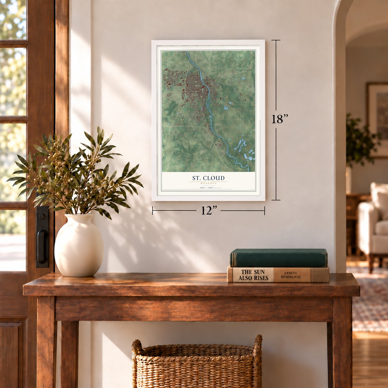

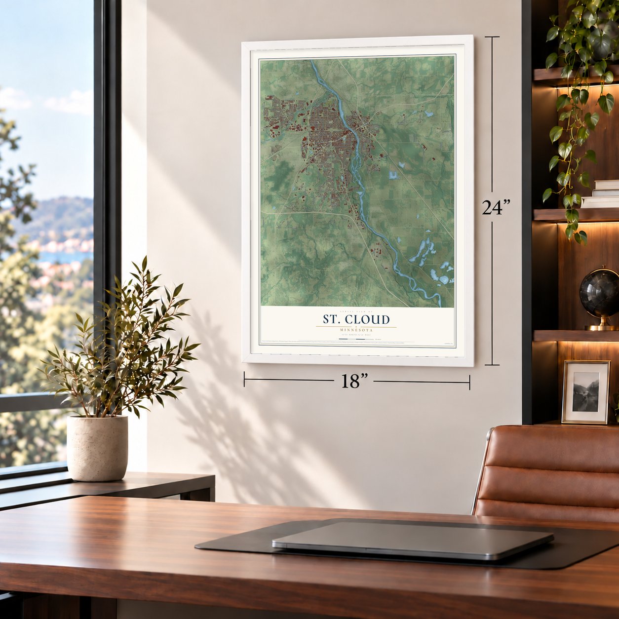

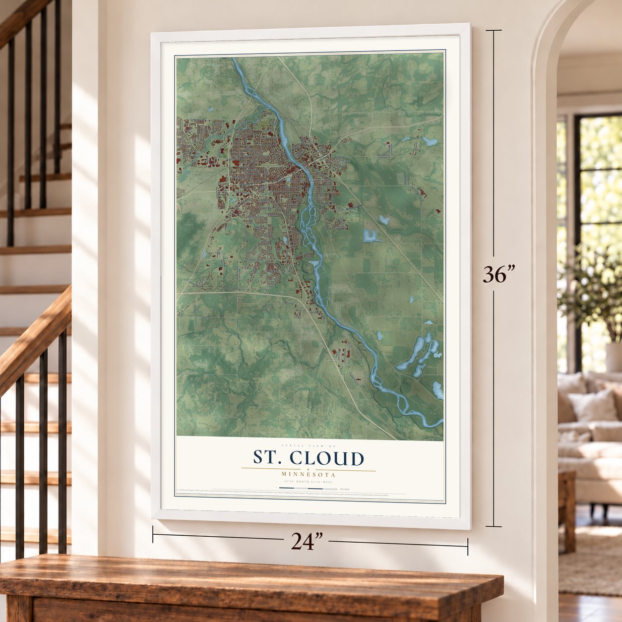

Free U.S. delivery 7 to 10 days after you order
St. Cloud, Minnesota Map Art
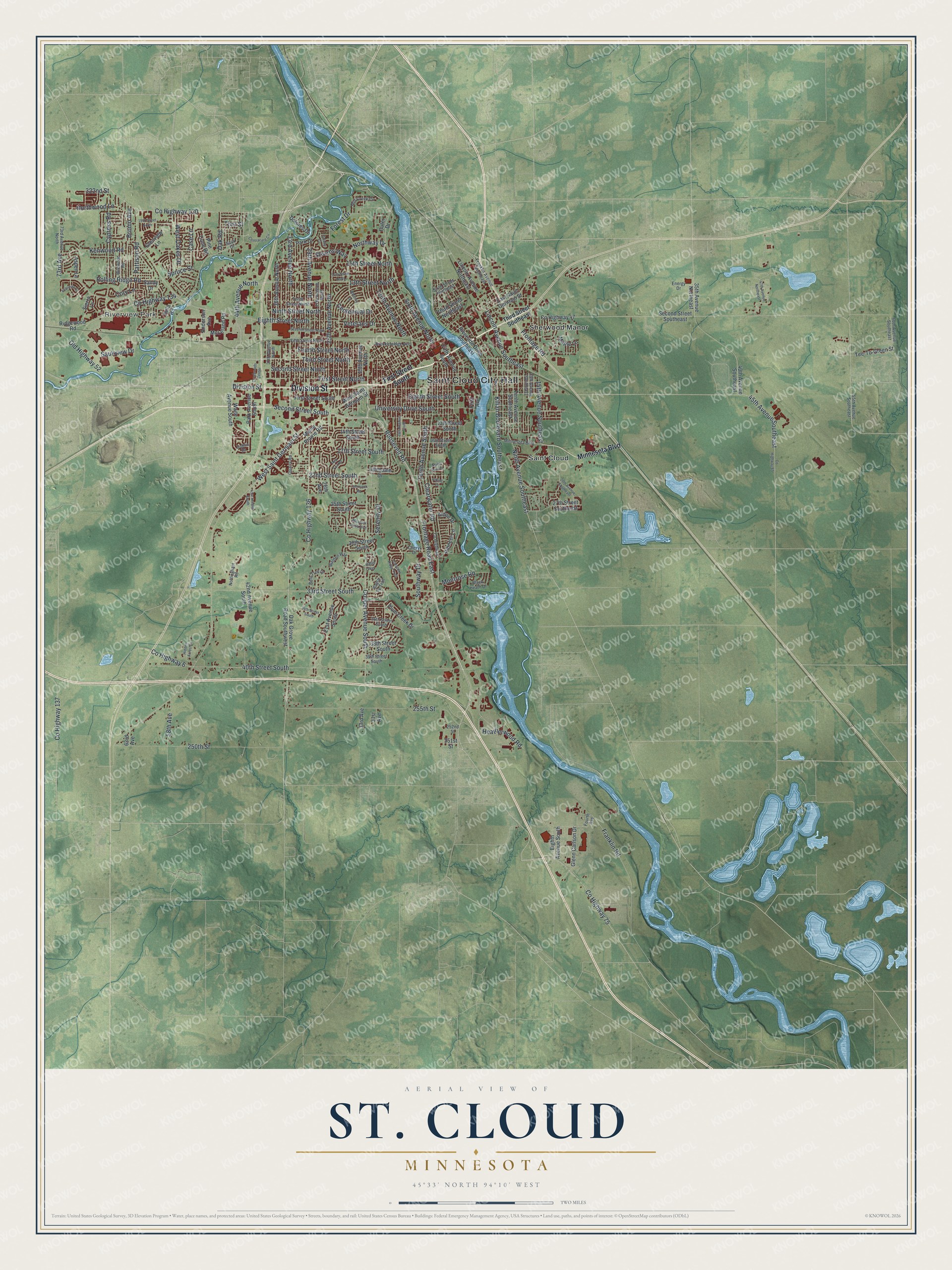
A new map of St. Cloud, Minnesota, made in 2026 and printed to order on thick archival matte paper.
12" x 18" Archival Matte Print
A Map of Home. A Work of Art.
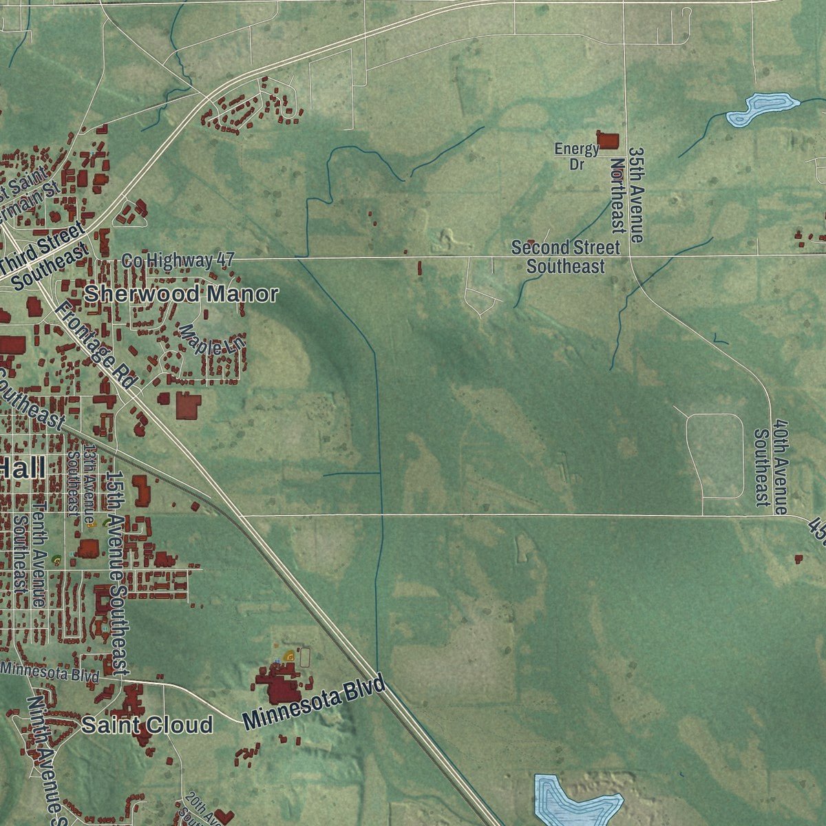
Explore St. Cloud, Minnesota from a whole new perspective. Created using aerial imagery and detailed geographic data, this map captures St. Cloud building by building, with labeled streets, familiar landmarks, and shaded topographical relief that highlights the natural contours of the landscape.
Combining modern data with the timeless character of a vintage atlas, this map is just as interesting up close as it is beautiful on the wall. Whether you grew up in St. Cloud, spent memorable years there, or call it home today, this unique map is a great way to celebrate a place that means something to you. Zoom in on the preview to look for your street, and then order a print to put your memories on the wall.
Three ways to hang it
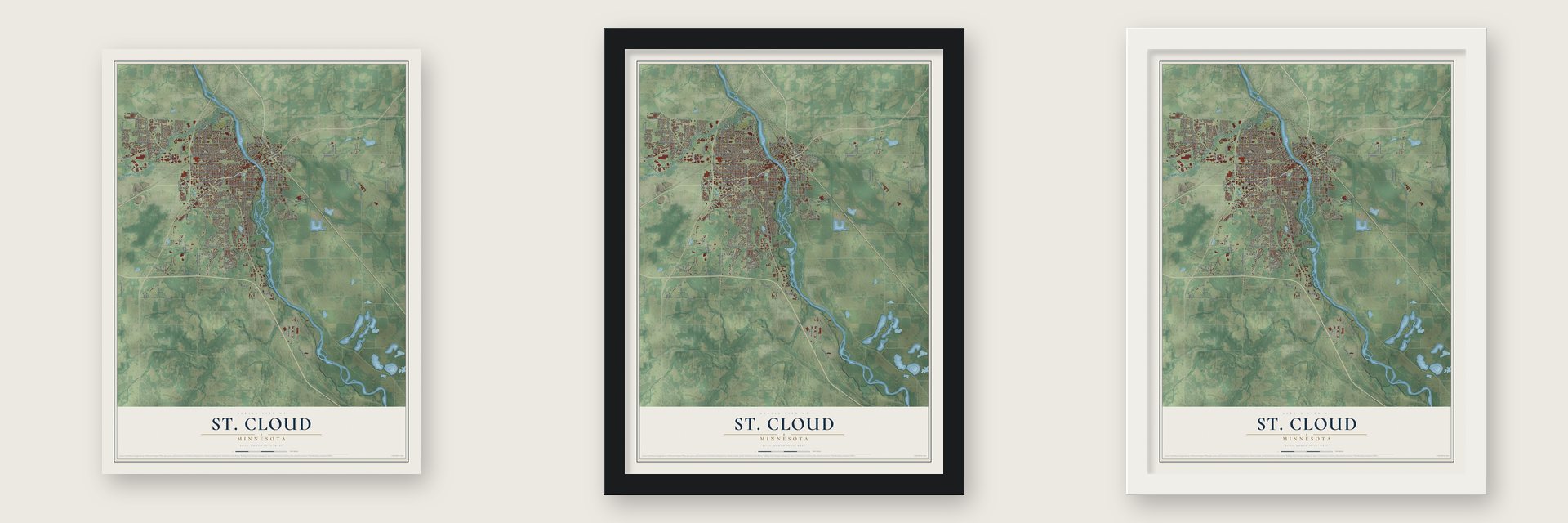
Unframed archival matte, a black wood frame or a white wood frame.
Up close
Geography Worth Displaying
This map was created using accurate cartographic data and authoritative geographic sources, including the U.S. Geological Survey and the Census Bureau. The map brings together terrain, waterways, roads, and building detail. The majority of the streets are labeled, houses are accurately depicted, and the topography is derived from government sources. Combining local data with carefully composed color and shading leads to this beautifully detailed St. Cloud artwork for your wall.
Rather than simply showing street outlines, we’ve included as many of the street names as we could reasonably fit on the map while keeping their names legible. Zoom in on the high resolution preview to see exactly what’s on the map. We truly set out to create a statement piece for anyone who loves St. Cloud. So whether it’s for you, or a gift for someone you love, we hope this map of St. Cloud brings back fond memories.
Read the story behind this map of St. Cloud, Minnesota from 2026.

About St. Cloud, Minnesota
St. Cloud is a city of 68,881 people and the county seat of Stearns County, built on both banks of the Mississippi River. Settlers began three separate villages here in 1853, called Upper Town, Middle Town and Lower Town, and deep ravines divided them; traces of those ravines can still be seen. Father Francis Xavier Pierz drew German Catholic families to Middle Town, while Lower Town filled with Protestants from New England and upstate New York who opposed slavery.
John L. Wilson, a homesteader from Columbia, Maine, who admired Napoleon, chose the name. He took it from Saint-Cloud, the Paris suburb where the emperor kept his favorite palace. The villages became one city in 1856. Métis traders also came through with long trains of Red River carts on their way between Pembina and Saint Paul, and they camped west of town before crossing the Mississippi.
“In the fall of 1856, the first school in Stearns county was opened at St. Cloud, in an unpretentious frame building, by Father Cornelius Wittman. The school was numerously attended, but to found a college was the aim of the Benedictines.”
- A press in the riverGeneral Sylvanus Lowry, a Kentucky trader, laid out Upper Town and brought enslaved people with him into a free territory. Jane Grey Swisshelm, an abolitionist editor from Pittsburgh, attacked him in print again and again. Then a "Committee of Vigilance" that Lowry organized broke into her office and threw her press into the Mississippi. Lowry started a rival paper, The Union. When the Civil War began, nearly all the Southerners left town, and Lowry died here in 1865.
- The Granite CityQuarries have worked the local granite since the 1880s, and the stone gave St. Cloud its nickname. The bedrock is thought to be 1.7 billion years old. It lay buried until miles of rock above it wore away.
- Pan-Cars in 1917Samuel Pandolfo founded the Pan Motor Company here in 1917 and promised his Pan-Cars would turn St. Cloud into the new Detroit. The company failed while the country's resources went to World War I. Pandolfo was later convicted and sent to prison for trying to defraud investors. The Pan Motor Company Office and Sheet Metal Works joined the National Register in 1984.
- A governor from 1864Stephen Miller, a Pennsylvania German businessman, lawyer and abolitionist, is the only St. Cloud resident ever to serve as governor of Minnesota. He took office in 1864 for a two-year term. After the war, local veterans in the Grand Army of the Republic raised money for a statue of Abraham Lincoln, and it still stands near the St. Germain Street bridge.
Find your street
Names on the St. Cloud map
Every name below is printed on this map. Look for your street, your school, the park where you played, or the pond down the road.
Places and landmarks4
- Saint Cloud City Hall
- Riverview Park
- Saint Cloud
- Sherwood Manor
Streets and roads173
- Division Street
- Roosevelt Road
- Cooper Avenue South
- Third Street North
- First Street North
- 33rd Avenue North
- Second Street South
- County Highway 120
- Cypress Road
- County Highway 134
- 44th Avenue North
- Cory Lane
- Frontage Road
- Tenth Avenue South
- 15th Avenue Southeast
- Second Street North
- 13th Street North
- Frontage Road East
- 25th Avenue North
- 33rd Street South
- County Highway 136
- 40th Street South
- Clearwater Road
- Eighth Street North
- County Highway 75
- 255th Street
- 250th Street
- Kilian Boulevard Southeast
- West Saint Germain Street
- Ninth Avenue Southeast
Show all 173 streets
- Sixth Avenue North
- Veterans Drive
- 22nd Street South
- 29th Avenue North
- Fourth Street North
- University Drive South
- Franklin Road
- Lincoln Avenue Southeast
- 15th Street North
- Ninth Street North
- Eighth Street South
- Tenth Avenue North
- Saukview Drive
- 45th Avenue Southeast
- Rolling Ridge Road
- 17th Street South
- West Oakes Drive
- County Highway 137
- Northway Drive
- Old Highway 52
- Kenwood Road
- Heatherwood Road
- Northwood Lane
- Forest Drive
- Southway Drive
- 73rd Avenue
- Montrose Road
- 58th Avenue
- Centennial Drive
- 322nd Street
- County Highway 6
- Case Lane
- Stearns Way
- Oak Road
- Serenity Drive
- Pattison Road
- Bromo Avenue
- Spruce Street
- Thru Street
- Minnesota Boulevard
- First Street South
- Third Street Northeast
- Waite Avenue South
- First Avenue
- Ridgewood Road
- 21st Avenue South
- Pioneer Lane
- Anderson Avenue
- Second Street Southeast
- County Highway 47
- Eighth Avenue South
- East Saint Germain Street
- Oak Grove Road Southwest
- 38th Street South
- 14th Street South
- 13th Street South
- Riverside Drive Southeast
- Glenview Lane
- Fifth Avenue South
- 36th Avenue North
- Plum Creek Drive
- Park Drive
- Tenth Avenue Southeast
- 42nd Avenue South
- 19th Avenue North
- Tee-To-Green Street
- Lincoln Avenue Northeast
- 27th Street Southeast
- 30th Street South
- Park Avenue South
- Pine Cone Road
- Glenn Carlson Drive
- 40th Avenue Southeast
- 25th Street South
- Maine Prairie Road
- 35th Avenue Northeast
- McLeland Road
- Maple Lane
- Aspen Lane
- Dolores Drive
- Aldon Drive
- Allendale Drive
- 33rd Avenue
- Rilla Road
- Outer Drive
- Sandy Drive
- 251st Street
- 26th Avenue
- Sierra Lane
- 31st Avenue
- 63rd Avenue
- Third Street Southeast
- Breckenridge Avenue
- 55th Avenue Southeast
- Fourth Avenue
- Tenth Street North
- Fifth Street North
- 27th Avenue North
- Walden Way
- 13th Avenue Southeast
- 37th Avenue North
- 16th Street South
- County Highway 7
- Bent Tree Drive
- 73rd Avenue North
- Franklin Avenue Northeast
- Sixth Street Northeast
- 39th Street South
- 36th Street South
- Santa Fe Trail
- Wildwood Road
- Mill Creek Circle
- 60th Avenue Southeast
- Nottingham Road
- Black Heath Drive
- Sauk Drive
- Quarry Road
- Energy Drive
- Cheryl Drive
- 252nd Street
- Dublin Drive
- Seventh Street North
- 15th Avenue South
- 14th Street North
- County Highway 65
- Centracare Circle
- 20th Avenue Southeast
- 47th Avenue Northeast
- Crossroads Center
- Hidden Acres Circle
- 19th Street North
- Crescent Ridge Trail
- 41st Avenue South
- Meadow Rose Boulevard
- 34th Street South
- Red Fox Road
- Haller Way
- Whitney Drive
- Colony Circle
- Temminck Road
- Yosemite Street
- Viking Drive
- North Park Place
Names are listed as they appear on the printed map. Zoom into the product photos to find them.
The art of mapping a place
How This Map Was Made
Real places. Remarkable detail. Discover the layers that turn geographic data into a map of home.

The view from above
Aerial imagery reveals the character of the land: woodland, open fields, and the patterns of a place.

The shape of the land
Elevation data brings hills, valleys, and subtle changes in the landscape into view.

The details of home
Roads, waterways, and building footprints come together to make the map feel unmistakably local.

Geography becomes art
Considered color, shading, and typography bring the layers together in a map made for your wall.


Process illustrated with Mendon, Massachusetts. Aerial imagery: USDA NAIP. Terrain: USGS 3D Elevation Program. Map details and finished artwork: KNOWOL.
The Details
About This Print
Choose an archival matte print, or a black or white Ayous wood frame. The archival matte print is unframed.
Select your size and finish above to see the matching product image and price.
Materials & Craftsmanship
A contemporary map with the character of a classic atlas, printed on archival matte paper. Optional frames are made from Ayous wood.
Your printed map does not include the watermark shown in the full-map preview.
Shipping & Delivery
Free shipping within the United States. Every print is made to order in the USA.
Buying a gift? Add a note in your cart and we'll include it. We never put prices in the package.
Prints ship within 2 to 3 business days. Allow 7 to 10 days total from ordering for delivery. Timing may vary during holidays or periods of high order volume.
Read our shipping policy.
Returns and damaged prints
Each print is made to order. Change-of-mind refunds are not available after production.
If your print arrives damaged, misprinted or incorrect, contact support@knowol.com within 30 days of receiving it. Include your order number, photos and a description of the issue.
Read our full refund and replacement policy. For questions about your order, email support@knowol.com.
Find your town
Looking for another city?
Find a map of home in our Minnesota collection, or any town in the country.
Nearby
Maps of towns near St. Cloud
Know someone from one of these towns? Their map makes a great gift.
 Waite Park
, Minnesota
From $39.99See the map
 Sauk Rapids
, Minnesota
From $39.99See the map
 St. Augusta
, Minnesota
From $39.99See the map
More maps nearby: Sartell, St. Joseph, Rockville, Clear Lake and Clearwater.