
Search for another town





Free U.S. delivery 7 to 10 days after you order
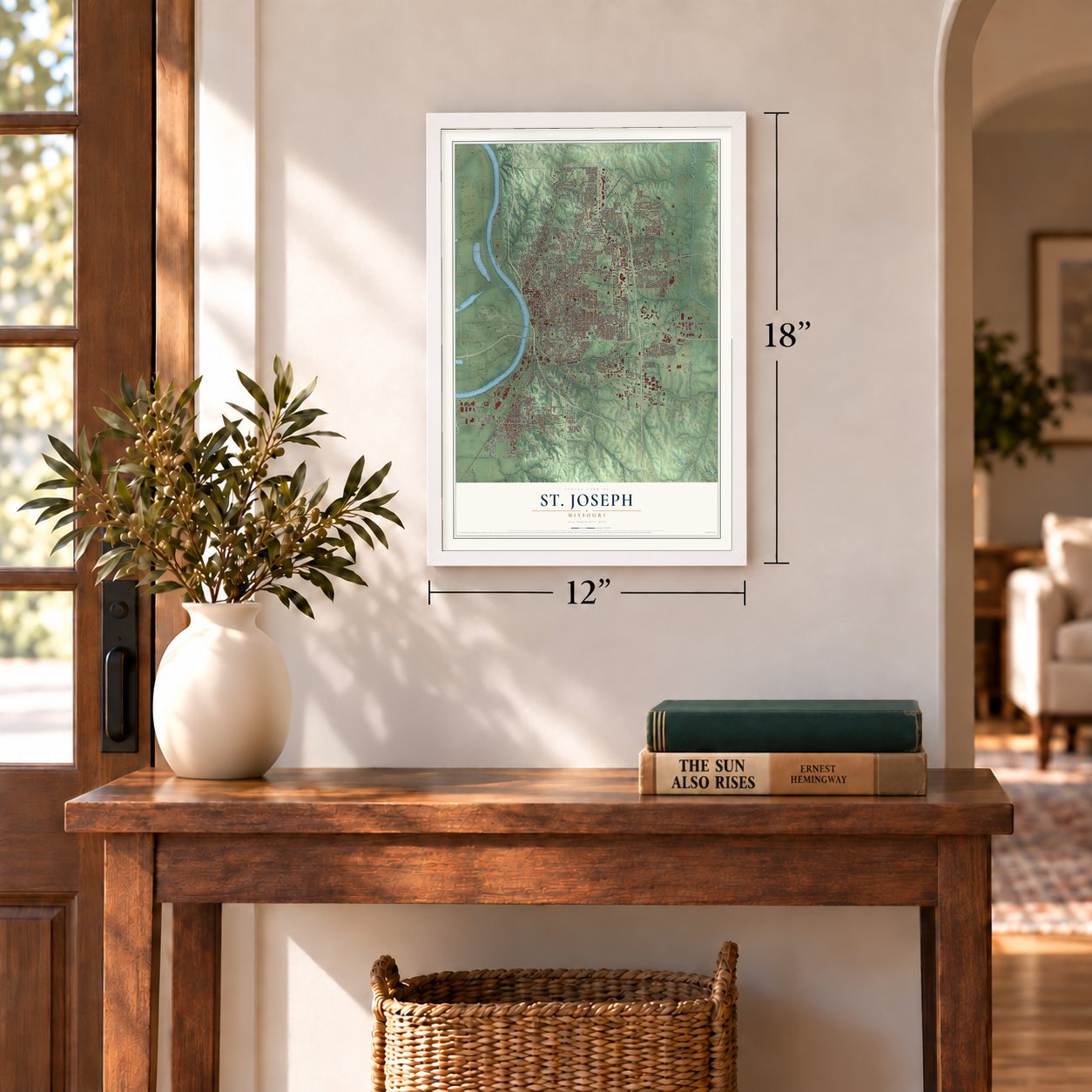
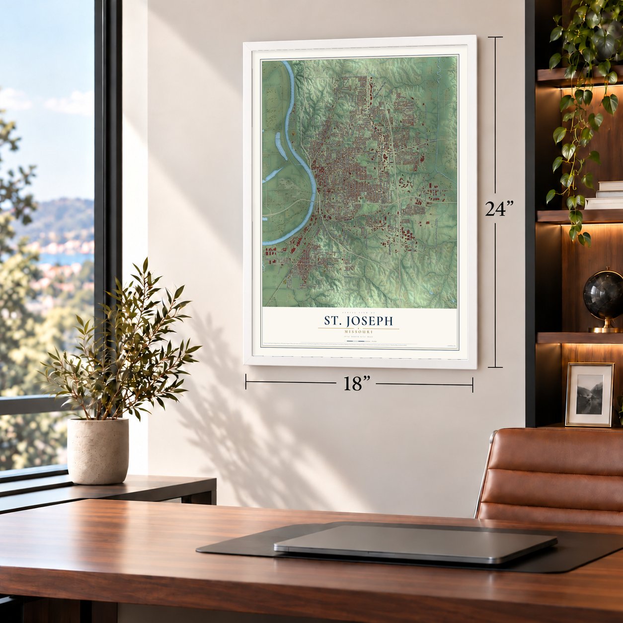
St. Joseph, Missouri Map Art
A new map of St. Joseph, Missouri, made in 2026 and printed to order on thick archival matte paper.
12" x 18" Archival Matte Print
A Map of Home. A Work of Art.
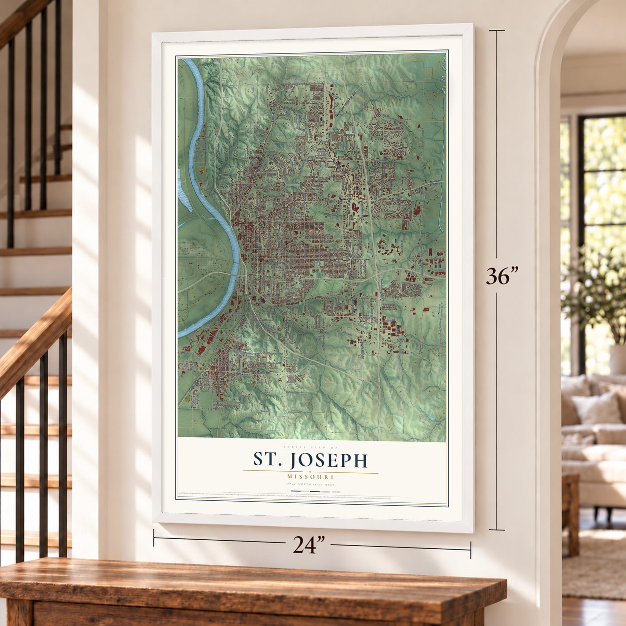
Explore St. Joseph, Missouri from a whole new perspective. Created using aerial imagery and detailed geographic data, this map captures St. Joseph building by building, with labeled streets, familiar landmarks, and shaded topographical relief that highlights the natural contours of the landscape.
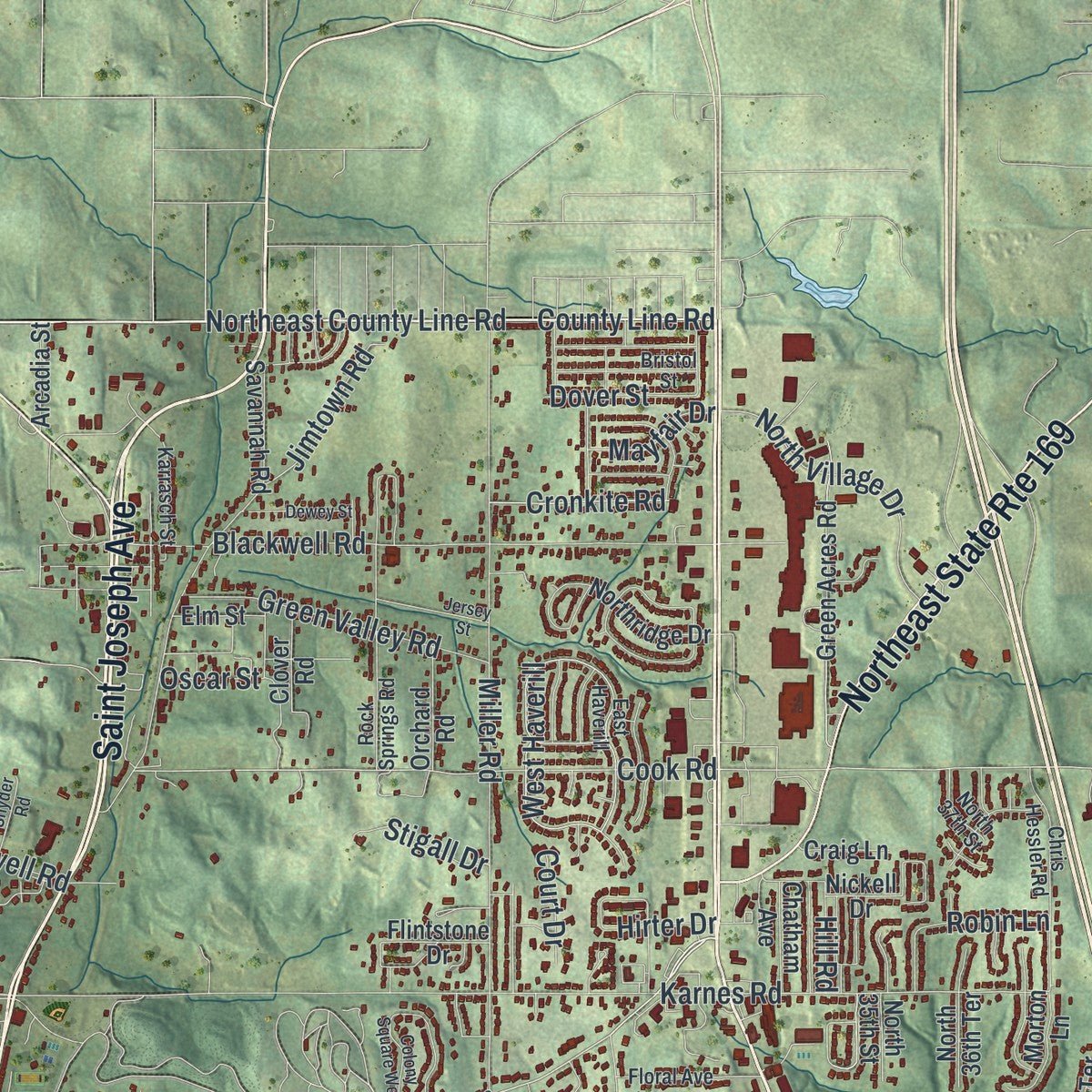
Combining modern data with the timeless character of a vintage atlas, this map is just as interesting up close as it is beautiful on the wall. Whether you grew up in St. Joseph, spent memorable years there, or call it home today, this unique map is a great way to celebrate a place that means something to you. Zoom in on the preview to look for your street, and then order a print to put your memories on the wall.

Three ways to hang it
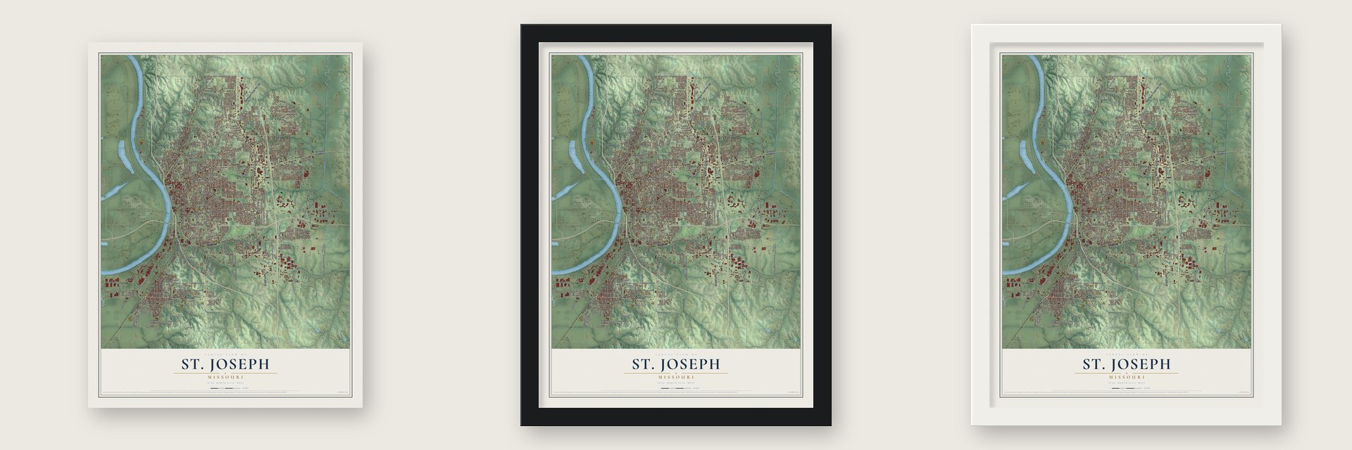
Unframed archival matte, a black wood frame or a white wood frame.
Up close
Geography Worth Displaying
This map was created using accurate cartographic data and authoritative geographic sources, including the U.S. Geological Survey and the Census Bureau. The map brings together terrain, waterways, roads, and building detail. The majority of the streets are labeled, houses are accurately depicted, and the topography is derived from government sources. Combining local data with carefully composed color and shading leads to this beautifully detailed St. Joseph artwork for your wall.
Rather than simply showing street outlines, we’ve included as many of the street names as we could reasonably fit on the map while keeping their names legible. Zoom in on the high resolution preview to see exactly what’s on the map. We truly set out to create a statement piece for anyone who loves St. Joseph. So whether it’s for you, or a gift for someone you love, we hope this map of St. Joseph brings back fond memories.
Read the story behind this map of St. Joseph, Missouri from 2026.

About St. Joseph, Missouri
St. Joseph is a city and the county seat of Buchanan County, situated on the Missouri River in northwestern Missouri. Incorporated in 1843, it developed as a frontier supply point and later served as an endpoint of the Pony Express. The 2020 census recorded 72,473 residents.
- Pony Express EndpointFrom April 3, 1860, through late October 1861, St. Joseph was one of the Pony Express's two endpoints.
- Downtown Street NamesJoseph Robidoux's eight children gave their names to the principal east-west streets downtown.
- Early Electric StreetcarsSt. Joseph became the nation's second city to install electric streetcars, with regular service beginning July 4, 1888.
Find your street
Names on the St. Joseph map
Every name below is printed on this map. Look for your street, your school, the park where you played, or the pond down the road.
Places and landmarks7
- Saint Joseph City Hall
- Kirschner
- Saxton
- Corby Grove
- Hyde Park
- Krug Park
- Saint Joseph
Streets and roads406
- North Belt Highway
- Saint Joseph Avenue
- South Tenth Street
- North US Highway 169
- Frederick Avenue
- South Belt Highway
- South US Highway 169
- South Ninth Street
- Pear Street
- Garfield Avenue
- South 22nd Street
- Northeast State Route 169
- Memorial Highway
- Lake Avenue
- Mason Road
- South 40th Street
- King Hill Avenue
- South Sixth Street
- South 37th Street
- South Fourth Street
- Waterworks Road
- County Line Road
- North Fourth Street
- Northeast County Line Road
- Lovers Lane
- Ashland Avenue
- North Tenth Street
- County Route 6
- Amazonia Road
- Whitaker Road
Show all 406 streets
- Route Oo
- North Riverside Road
- South 48th Terrace
- Jules Street
- South Riverside Road
- Felix Street
- Corinth Drive
- West Highland Avenue
- South Eighth Street
- South Second Street
- Cook Road
- Sylvanie Street
- North 22nd Street
- Northeast Riverside Road
- South 33rd Street
- South 50th Street
- Oscar Street
- Boyd Street
- Southwest Parkway
- Mitchell Avenue
- Faraon Street
- Easton Road
- Messanie Street
- Pickett Road
- Gene Field Road
- South Eleventh Street
- South 14th Street
- South 16th Street
- Karnes Road
- Penn Street
- Seneca Street
- North Woodbine Road
- Sacramento Street
- Duncan Street
- North Second Street
- Monterey Street
- Olive Street
- Mansfield Road
- Lafayette Street
- State Highway Ac
- Francis Street
- Charles Street
- South 24th Street
- Pacific Street
- Edmond Street
- Southwest Lower Lake Road
- North Leonard Road
- Huntoon Road
- South 18th Street
- South 28th Street
- Angelique Street
- Northwest Parkway
- South 29th Street
- South 36th Street
- Miller Road
- South 19th Street
- North 36th Street
- South Leonard Road
- South 13th Street
- Blackwell Road
- Patee Street
- Locust Street
- North Seventh Street
- Jackson Street
- Douglas Street
- Dewey Avenue
- South 15th Street
- Riverside Terrace Southeast
- Ajax Road
- Southeast Ajax Road
- North Third Street
- North Twelfth Street
- Beck Road
- Alabama Street
- Main Street
- Northeast Parkway
- Downs Drive
- North 18th Street
- Corporate Drive
- Packers Avenue
- North Sixth Street
- North Eleventh Street
- Renick Street
- North 13th Street
- Sherman Street
- North 20th Street
- Pryor Avenue
- Diagonal Road
- Commercial Street
- South 21st Street
- County Route 45
- South 26th Street
- Parker Road
- Oak Street
- Atchison Street
- East Walter Lane
- South 27th Street
- Stonecrest Terrace
- Bishop Road
- Hickory Street
- South 35th Street
- Scott Street
- North 25th Street
- Safari Drive
- Carnegie Street
- Green Valley Road
- South 39th Street
- Clay Street
- Mulberry Street
- South 34th Street
- Grant Street
- North Noyes Boulevard
- Pleasant Avenue
- North 24th Street
- Buckingham Street
- Elizabeth Street
- Oakland Avenue
- Cedar Street
- Sixth Avenue
- South 42nd Street
- Harmon Street
- South 38th Street
- Prospect Avenue
- Union Street
- South 40th Terrace
- Ingersoll Road
- Outer Road
- Greystone Drive
- Pettis Road
- North Village Drive
- Village Drive
- King Hill Drive
- Green Street
- North Lakewood Drive
- Eastwood Drive
- West Haverill
- Beechwood Boulevard
- Gordon Avenue
- Meadow Ridge Drive
- Randolph Street
- Crystal Drive
- Empire Lane
- Heartland Road
- Marie Street
- Maxwell Road
- Chellew Road
- Tucker Street
- Court Street
- Gooding Avenue
- South 41st Street
- Lion Road
- Blake Street
- Phillip Street
- Ollmeda Street
- Industrial Road
- Newport Road
- Miller Avenue
- Eureka Street
- Miami Street
- Agency Road
- Tamara Drive
- Virginia Street
- Moss Street
- Jimtown Road
- Shawnee Road
- Hamburg Avenue
- Cronkite Road
- Valley Lane
- Dale Avenue
- Esther Street
- Warehouse Road
- Smith Street
- Fourth Avenue
- Vine Street
- Cougar Road
- Summit Avenue
- Valley Street
- Stigall Drive
- Lookout Street
- Dover Street
- Mayfair Drive
- Mack Street
- Iris Avenue
- Bryce Road
- Folsom Street
- Bragg Avenue
- Wilmer Lane
- Court Drive
- Robin Lane
- Erie Street
- Hill Road
- Hillcrest
- Hirter Drive
- East Hyde Park Avenue
- Northeast State Route 6
- South 49th Street
- Bush Road
- Maple Leaf Parkway
- Corby Parkway
- West Lake Boulevard
- Hill Drive
- South 17th Street
- Southeast Riverside Terrace
- South Eleventh Street Road
- South 20th Street
- South Twelfth Street
- South Third Street
- East Highland Avenue
- South 30th Street
- Stockyards Expressway
- North Ninth Street
- Savannah Road
- South 32nd Street
- South Noyes Boulevard
- Belle Street
- North Fifth Street
- Highly Street
- North 31st Street
- South Woodbine Road
- Grand Avenue
- South 31st Street
- West Joseph Street
- North 32nd Street
- North 30th Street
- Green Acres Road
- Holman Street
- East Cliff Street
- North 27th Street
- Northridge Drive
- Riverview Drive
- Jones Street
- West Broadway Street
- Aegean Terrace
- Sherman Avenue
- North Third Saint Road
- McArthur Drive
- Illinois Avenue
- Highland Meadows
- Kensington Drive
- University Avenue
- Excello Drive
- Southeast Galvin Road
- County Route 5
- Garden Street
- Florence Road
- Berkshire Drive
- Powell Street
- Elwood Street
- East Lake Boulevard
- Pat Drive
- Greenbriar Terrace
- Tyrone Street
- Riverside Road
- North 35th Street
- Coach Light Place
- River Road
- Brookside Drive
- Henry Street
- North 39th Terrace
- Cudmore Avenue
- South 33rd Terrace
- North Pass
- Arcadia Street
- South 58th Street
- North 36th Terrace
- Bluff View Drive
- Arizona Avenue
- Buchanan Avenue
- Morton Lane
- Sun Valley Road
- Williams Street
- Orchard Road
- Cypress Avenue
- Long View Drive
- Beltview Drive
- Flintstone Drive
- East Ayrlawn Drive
- Hunter Drive
- Sycamore Court
- Chatham Avenue
- Robin Hood Drive
- Pine Street
- Hillside Lane
- Clover Road
- Mark Twain Drive
- Joyce Lane
- Ridge Drive
- Deer Park Drive
- Lucille Avenue
- Primrose Lane
- State Route Ff
- Craig Lane
- Elm Street
- Hall Street
- Rush Road
- Carol Drive
- 16th Street
- Ingalls Street
- Off Route Ac
- Nickell Drive
- Linda Lane
- Ryans Way
- Allen Street
- Birch Street
- Dix Drive
- North 26th Street
- Crescent Drive
- East Joseph Street
- North 29th Street
- South Fifth Street
- North 19th Street
- Rock Springs Road
- Sycamore Street
- South 23rd Street
- Mockingbird Lane
- Fifth Avenue
- Isadore Street
- Chris Hessler Road
- Savannah Avenue
- East Haverill
- Weisenborn Road
- Marion Street
- Wilshire Drive North
- North Fifth Terrace
- Floral Avenue
- Jamesport Street
- Bristol Street
- West Market Street
- West Walter Lane
- North 37th Street
- Karrasch Street
- South 59th Street
- Osage Street
- Fieldcrest Lane
- South 36th Saint Place
- Lakeview Avenue
- Manchester Road
- North 49th Terrace
- Midyett Road
- Clayton Street
- North 42nd Street
- Anna Road
- Glenn Drive
- Ring Can Drive
- Marlin Lane
- Hilda Lane
- Pine Ridge
- Stonecrest Drive
- Wayne Drive
- South Seventh Street
- South 25th Street
- Washington Street
- South Lakewood Drive
- Colhoun Street
- Mobile Lane
- Wilshire Drive South
- Heartland Avenue
- Seymour Street
- Melody Lane
- Morris Street
- Dogwood Street
- Rock Island Street
- Jersey Street
- Colony Square West
- Dewey Street
- Warsaw Avenue
- Court Terrace
- Crestview Lane
- Sunset Drive
- First Street
- Bel Nor Drive
- Snyder Road
- Martha Street
- Cardiff Drive
- Bucher Drive
- Dunn Drive
Names are listed as they appear on the printed map. Zoom into the product photos to find them.
The art of mapping a place
How This Map Was Made
Real places. Remarkable detail. Discover the layers that turn geographic data into a map of home.

The view from above
Aerial imagery reveals the character of the land: woodland, open fields, and the patterns of a place.

The shape of the land
Elevation data brings hills, valleys, and subtle changes in the landscape into view.

The details of home
Roads, waterways, and building footprints come together to make the map feel unmistakably local.

Geography becomes art
Considered color, shading, and typography bring the layers together in a map made for your wall.


Process illustrated with Mendon, Massachusetts. Aerial imagery: USDA NAIP. Terrain: USGS 3D Elevation Program. Map details and finished artwork: KNOWOL.
The Details
About This Print
Choose an archival matte print, or a black or white Ayous wood frame. The archival matte print is unframed.
Select your size and finish above to see the matching product image and price.
Materials & Craftsmanship
A contemporary map with the character of a classic atlas, printed on archival matte paper. Optional frames are made from Ayous wood.
Your printed map does not include the watermark shown in the full-map preview.
Shipping & Delivery
Free shipping within the United States. Every print is made to order in the USA.
Buying a gift? Add a note in your cart and we'll include it. We never put prices in the package.
Prints ship within 2 to 3 business days. Allow 7 to 10 days total from ordering for delivery. Timing may vary during holidays or periods of high order volume.
Read our shipping policy.
Returns and damaged prints
Each print is made to order. Change-of-mind refunds are not available after production.
If your print arrives damaged, misprinted or incorrect, contact support@knowol.com within 30 days of receiving it. Include your order number, photos and a description of the issue.
Read our full refund and replacement policy. For questions about your order, email support@knowol.com.
Find your town
Looking for another city?
Find a map of home in our Missouri collection, or any town in the country.
Nearby
Maps of towns near St. Joseph
Know someone from one of these towns? Their map makes a great gift.
 Country Club
, Missouri
From $39.99See the map
 Agency
, Missouri
From $39.99See the map
 Amazonia
, Missouri
From $39.99See the map
More maps nearby: Easton, Cosby, Faucett, Savannah and De Kalb.