
Search for another town





Free U.S. delivery 7 to 10 days after you order
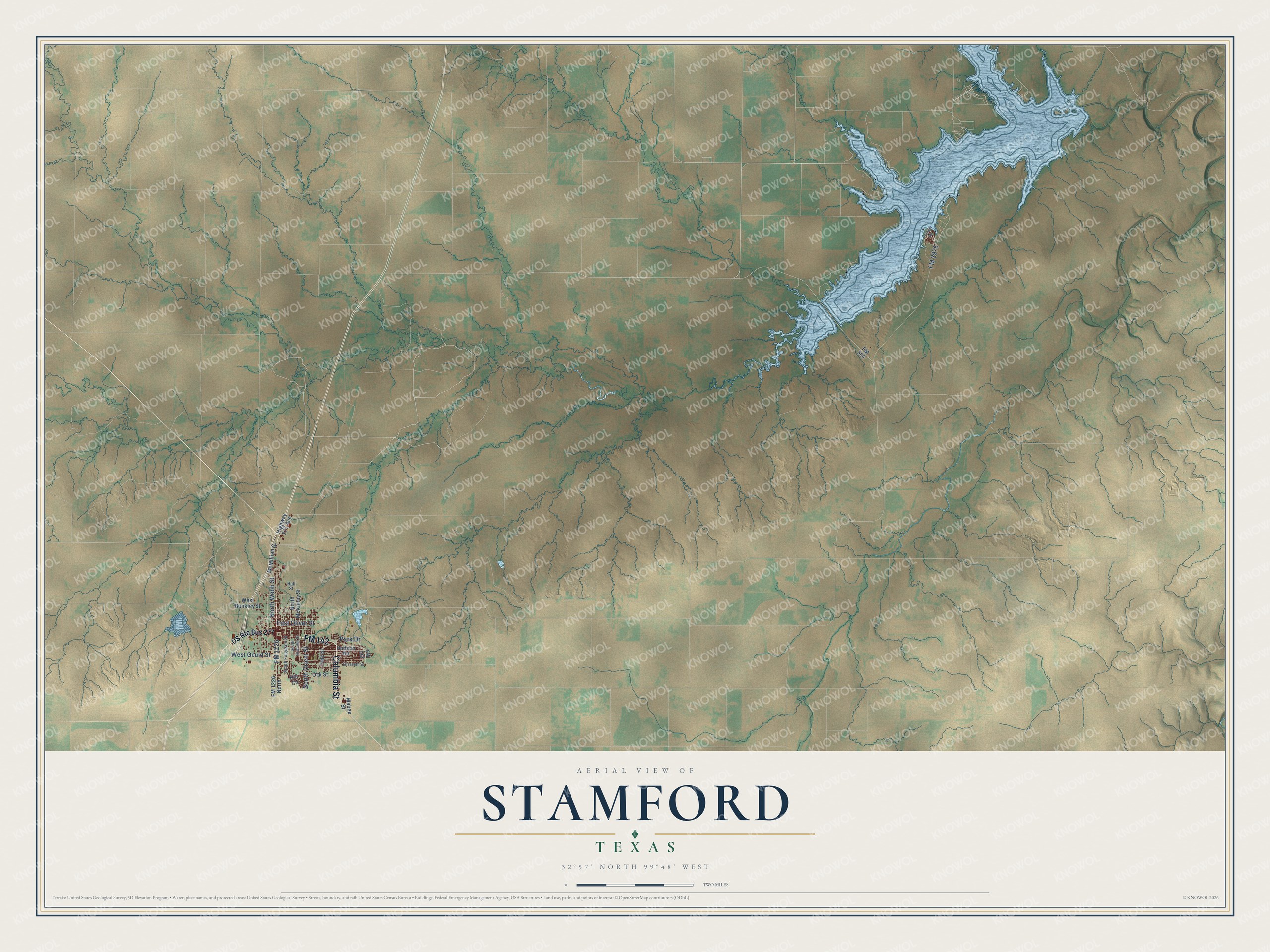
Stamford, Texas Map Art
Building by building, with labeled streets and shaded relief.
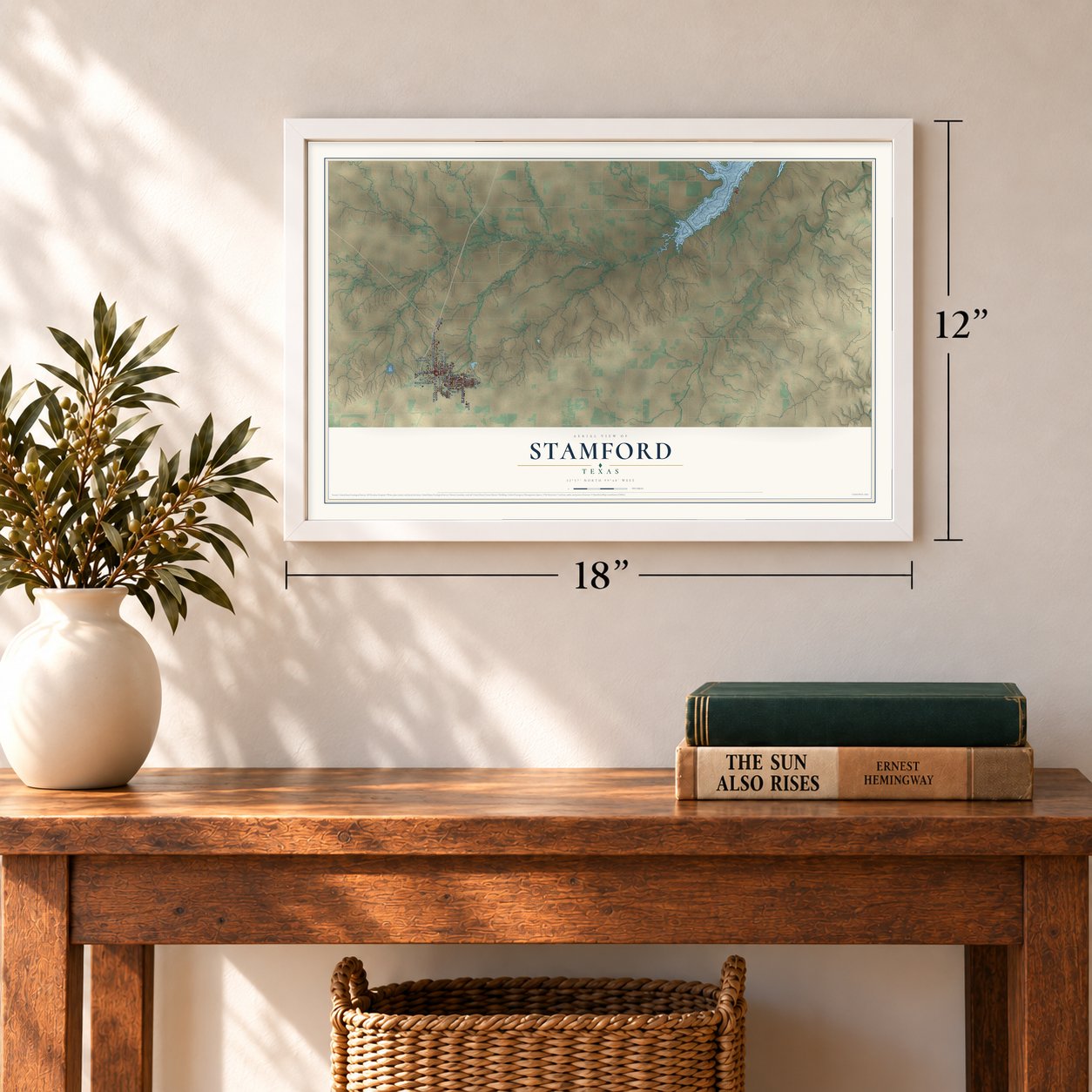
12" x 18" Archival Matte Print
A Map of Home. A Work of Art.
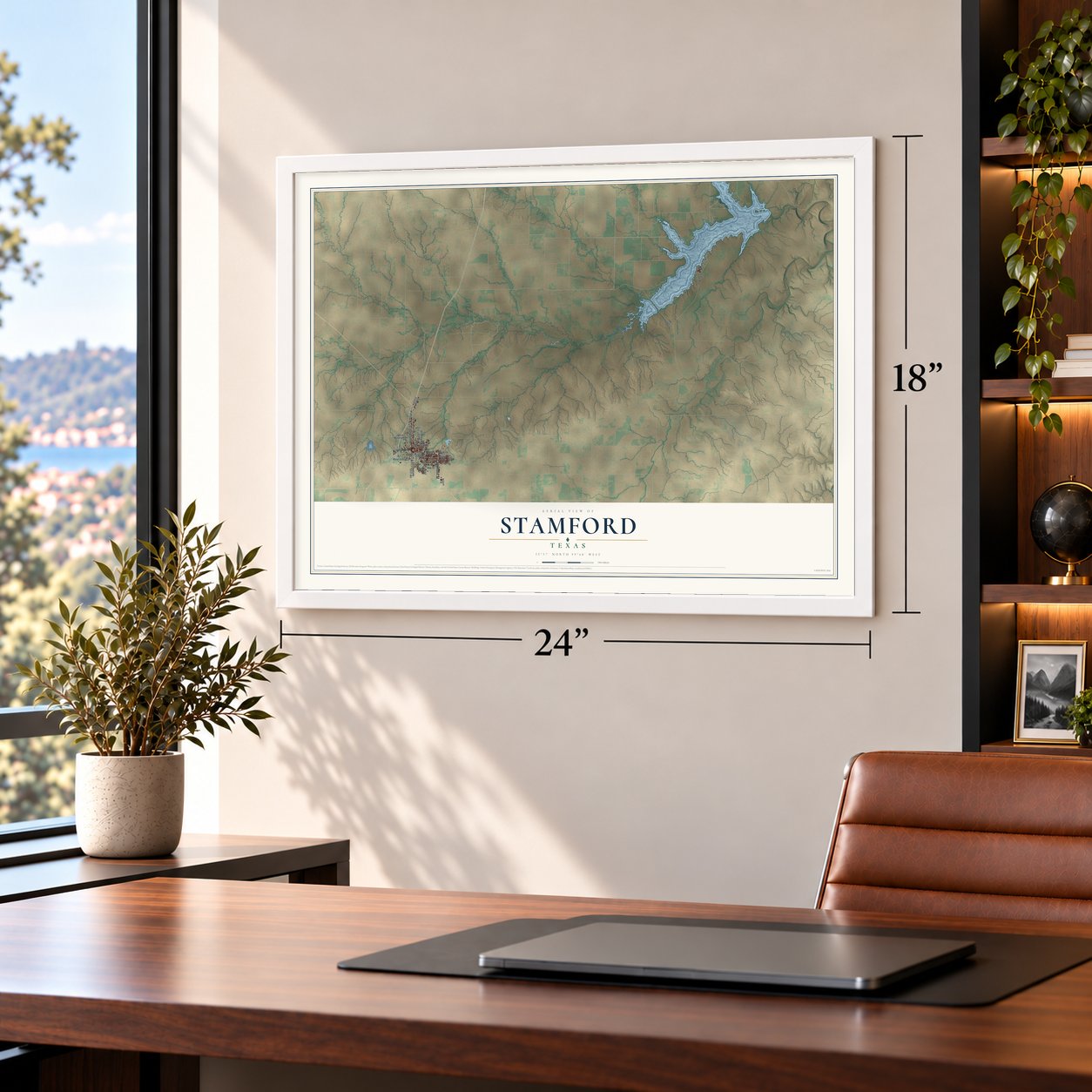
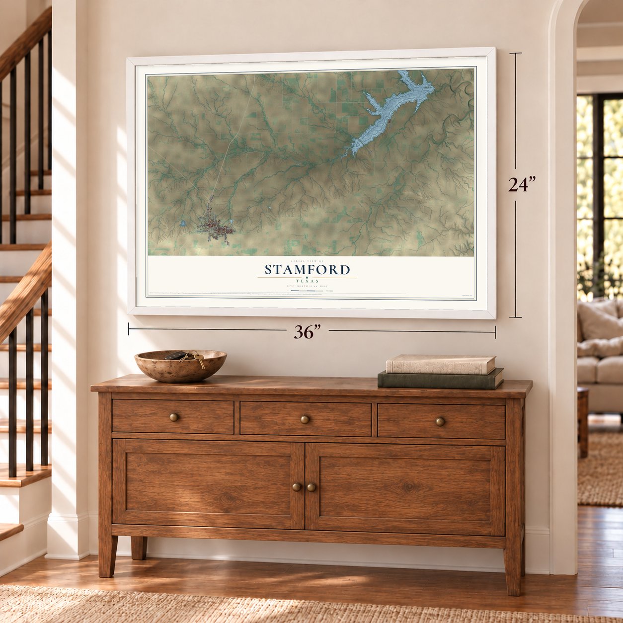
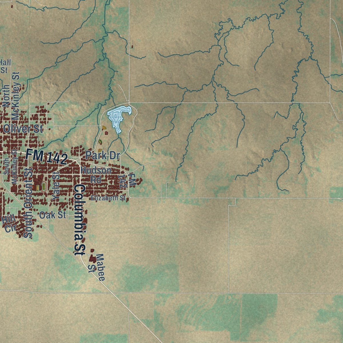
Explore Stamford, Texas from a whole new perspective. Created using aerial imagery and detailed geographic data, this map captures Stamford building by building, with labeled streets, familiar landmarks, and shaded topographical relief that highlights the natural contours of the landscape.
Combining modern data with the timeless character of a vintage atlas, this map is just as interesting up close as it is beautiful on the wall. Whether you grew up in Stamford, spent memorable years there, or call it home today, this unique map is a great way to celebrate a place that means something to you. Zoom in on the preview to look for your street, and then order a print to put your memories on the wall.
Three ways to hang it
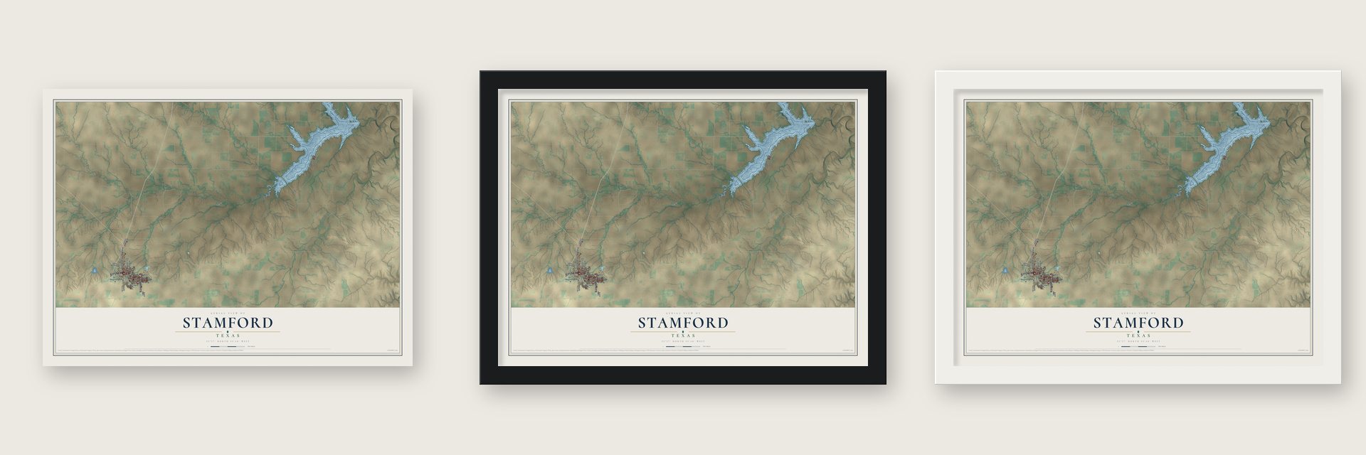
Unframed archival matte, a black wood frame or a white wood frame.
Up close
Geography Worth Displaying
This map was created using accurate cartographic data and authoritative geographic sources, including the U.S. Geological Survey and the Census Bureau. The map brings together terrain, waterways, roads, and building detail. The majority of the streets are labeled, houses are accurately depicted, and the topography is derived from government sources. Combining local data with carefully composed color and shading leads to this beautifully detailed Stamford artwork for your wall.
Rather than simply showing street outlines, we’ve included as many of the street names as we could reasonably fit on the map while keeping their names legible. Zoom in on the high resolution preview to see exactly what’s on the map. We truly set out to create a statement piece for anyone who loves Stamford. So whether it’s for you, or a gift for someone you love, we hope this map of Stamford brings back fond memories.
Read the story behind this map of Stamford, Texas from 2026.

Find your street
Names on the Stamford map
Every name below is printed on this map. Look for your street, your school, the park where you played, or the pond down the road.
Streets and roads26
- FM 142
- Columbia Street
- Park Drive
- FM 1226
- East Oliver Street
- North Webb Street
- South Orient Street
- FM 2976
- West Gould Street
- US Route Bus 277
- FM 600
- West Bunkley Street
- Hill Circle
- McMillian Street
- North McKinley Street
- Yale Street
- Oak Street
- Hudson Road
- FM 1226 North
- Mabee Street
- Highway 277 Acc
- South Ferguson Street
- Hall Street
- Elizabeth Street
- Crappie Drive
- South McKinley Street
Names are listed as they appear on the printed map. Zoom into the product photos to find them.
About Stamford, Texas
Stamford is a city of 2,907 people straddling the line between Jones and Haskell counties, on the Rolling Plains of West Texas. Its land belonged to the SMS Ranches of Swante Magnus Swenson, the first Swedish immigrant to Texas, whose holdings in West Texas approached 500,000 acres by 1860. In 1899 his sons, Eric Pierson and Swen Albin Swenson, talked Henry McHarg, president of the Texas Central Railroad, into running his line across their land.
A railroad boxcar served as the first post office in December 1899. In 1900 the Texas Central finished its 38-mile line from Albany, the brothers gave a townsite of 640 acres, and McHarg named the town for his hometown of Stamford, Connecticut. The railroad and the Swensons worked together to sell lots and draw business, and many cotton farmers bought land from the brothers. Growth was quick, and by 1910 Stamford had 3,902 people. The main street still carries the Swenson name.
“For virtually all of the town's first half century, George G. Flournoy kept order as police chief. A small, crippled, cigar-chewing man, Flournoy began each day's work with target shooting at a stump outside city hall.”
- Texas Cowboy Reunion since 1930The Swensons led the founding of the Texas Cowboy Reunion, first held on June 28, 1930, to honor cowboys and lift spirits during the Depression. More than 12,000 people watched three days of roping and riding and the first show of wild-cow milking. Will Rogers appeared in 1935, less than two months before his death. A record 70,000 visitors came in 1937, and in 1940 the reunion hosted the American Quarter Horse Association's very first show.
- The Father of StamfordR. L. Penick earned the title by starting a bank and steering the young town's growth. Voters made him mayor in 1903, 1917 and 1919, and he served as the first president of the Texas Cowboy Reunion Association. In those years a flour mill led local industry, from 1906 until fire destroyed it in 1946.
- Stamford College, 1907 to 1920The Methodists opened Stamford Collegiate Institution in 1907, and two years later sixteen teachers had 346 students. Then a drought in 1910, World War I and a 1918 fire cut into enrollment and money. The college closed in 1920, when the Methodists started McMurry College in Abilene instead.
- Elvis twice in 1955On Friday, April 15, 1955, Elvis Presley performed on stage in the auditorium of Stamford High School, then played Roundup Hall, out on the reunion grounds, later that night. He came back to Roundup Hall just over two months later, on Friday, June 17, 1955.
Keep exploring Texas
Stamford is one of 2,049 Texas towns we've mapped. Every dot on the map is a print of its own.
The search covers every state, Texas first.
Near Stamford
Order 2 or more town maps and save 10%. Shown in the size and finish you picked above, so they hang as a set.
- Paint Creek 12" x 18" / Archival Matte Print $39.99
- Haskell 12" x 18" / Archival Matte Print $39.99
- Avoca 12" x 18" / Archival Matte Print $39.99
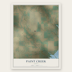
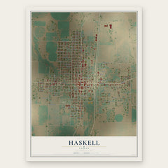
More maps nearby: Lueders, Rule, Weinert, Rochester and Throckmorton.
The art of mapping a place
How This Map Was Made
Real places. Remarkable detail. Discover the layers that turn geographic data into a map of home.

The view from above
Aerial imagery reveals the character of the land: woodland, open fields, and the patterns of a place.

The shape of the land
Elevation data brings hills, valleys, and subtle changes in the landscape into view.

The details of home
Roads, waterways, and building footprints come together to make the map feel unmistakably local.

Geography becomes art
Considered color, shading, and typography bring the layers together in a map made for your wall.


Process illustrated with Mendon, Massachusetts. Aerial imagery: USDA NAIP. Terrain: USGS 3D Elevation Program. Map details and finished artwork: KNOWOL.
The Details
About This Print
Choose an archival matte print, or a black or white Ayous wood frame. The archival matte print is unframed.
Select your size and finish above to see the matching product image and price.
Materials & Craftsmanship
A contemporary map with the character of a classic atlas, printed on archival matte paper. Optional frames are made from Ayous wood.
Your printed map does not include the watermark shown in the full-map preview.
Shipping & Delivery
Free shipping within the United States. Every print is made to order in the USA.
Buying a gift? Add a note in your cart and we'll include it. We never put prices in the package.
Prints ship within 2 to 3 business days. Allow 7 to 10 days total from ordering for delivery. Timing may vary during holidays or periods of high order volume.
Read our shipping policy.
Returns and damaged prints
Each print is made to order. Change-of-mind refunds are not available after production.
If your print arrives damaged, misprinted or incorrect, contact support@knowol.com within 30 days of receiving it. Include your order number, photos and a description of the issue.
Read our full refund and replacement policy. For questions about your order, email support@knowol.com.