
Search for another town


Free U.S. delivery 7 to 10 days after you order
Statesville, North Carolina Map Art
Building by building, with labeled streets and shaded relief.
12" x 18" Archival Matte Print
A Map of Home. A Work of Art.
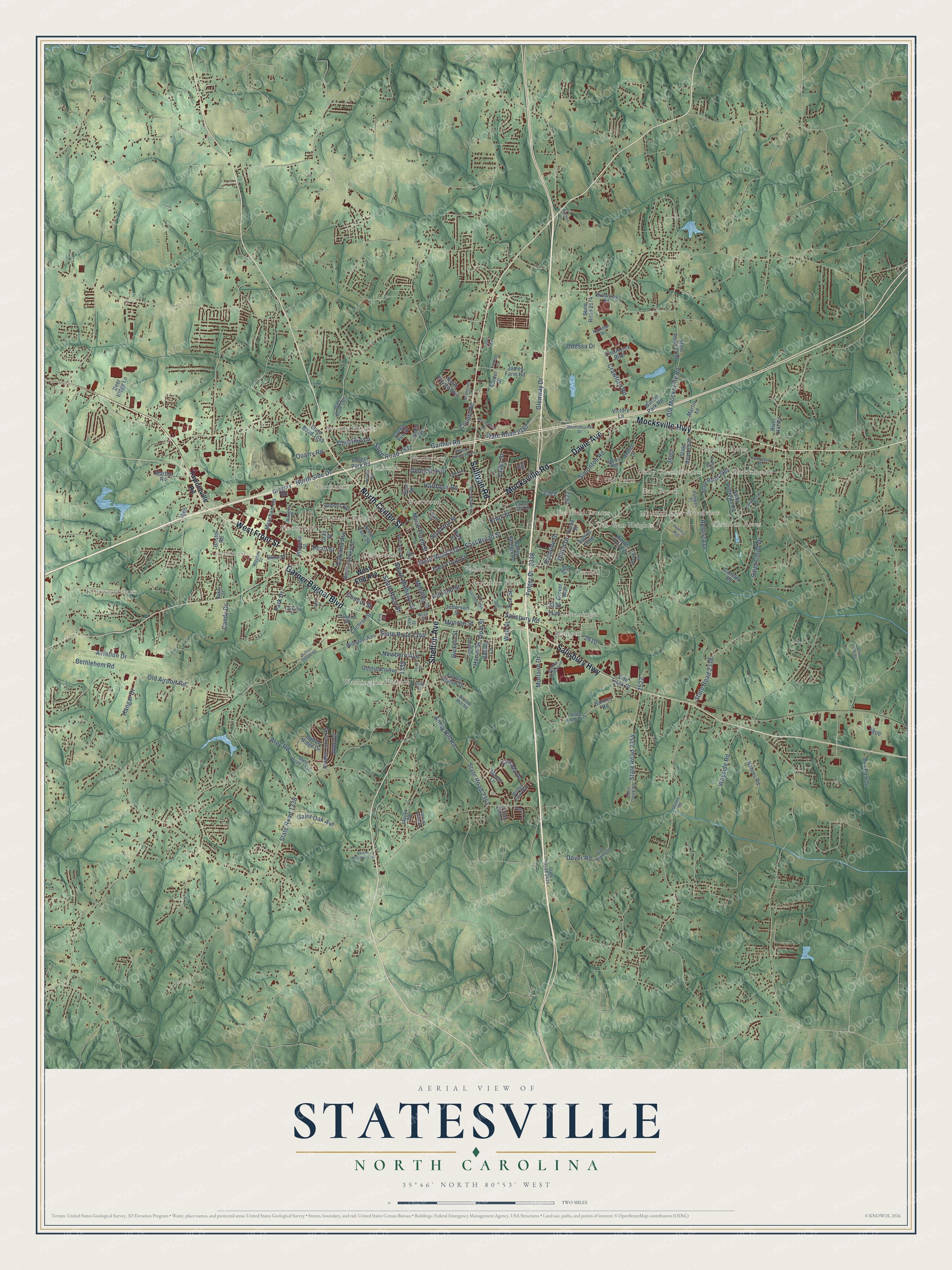
Explore Statesville, North Carolina from a whole new perspective. Created using aerial imagery and detailed geographic data, this map captures Statesville building by building, with labeled streets, familiar landmarks, and shaded topographical relief that highlights the natural contours of the landscape.
Combining modern data with the timeless character of a vintage atlas, this map is just as interesting up close as it is beautiful on the wall. Whether you grew up in Statesville, spent memorable years there, or call it home today, this unique map is a great way to celebrate a place that means something to you. Zoom in on the preview to look for your street, and then order a print to put your memories on the wall.
Three ways to hang it

Unframed archival matte, a black wood frame or a white wood frame.
Up close
Geography Worth Displaying
This map was created using accurate cartographic data and authoritative geographic sources, including the U.S. Geological Survey and the Census Bureau. The map brings together terrain, waterways, roads, and building detail. The majority of the streets are labeled, houses are accurately depicted, and the topography is derived from government sources. Combining local data with carefully composed color and shading leads to this beautifully detailed Statesville artwork for your wall.
Rather than simply showing street outlines, we’ve included as many of the street names as we could reasonably fit on the map while keeping their names legible. Zoom in on the high resolution preview to see exactly what’s on the map. We truly set out to create a statement piece for anyone who loves Statesville. So whether it’s for you, or a gift for someone you love, we hope this map of Statesville brings back fond memories.
Read the story behind this map of Statesville, North Carolina from 2026.

Find your street
Names on the Statesville map
Every name below is printed on this map. Look for your street, your school, the park where you played, or the pond down the road.
Places and landmarks27
- Valley Stream
- Kentwood Park
- Brookmeade
- Washington Heights
- Dal-Wan Heights
- Bloomfield
- Beverly Heights
- Ourdell
- Nelly Green Estates
- Starmount
- Belmont
- Cloverdale
Show all 27 places
- Westwood
- Northview
- Shannon Acres
- Mitchell Aire
- Oakland Heights
- Lakeside
- Eastfield Estates
- Cloaninger
- Old Farm
- Broadview
- Greencrest
- Ian Joy Acres
- Camelot Acres
- Berkshire Hills
- East Brook
Streets and roads177
- West Front Street
- Davie Avenue
- Mocksville Road
- Mocksville Highway
- North Center Street
- Shelton Avenue
- Sullivan Road
- Garner Bagnal Boulevard
- Salisbury Highway
- Opal Street
- East Broad Street
- State Road 2321
- Amity Hill Road
- State Road 2342
- Salisbury Road
- North Side Drive
- Aviation Drive
- Simonton Road
- Glenway Drive
- Crawford Road
- State Road 2187
- Hartness Road
- State Road 1931
- State Road 1344
- Augusta Drive
- Oakland Avenue
- Dover Road
- Valley Street
- Eastside Drive
- Old Mocksville Road
Show all 177 streets
- Stockton Street
- Meeting Street
- Saint Cloud Drive
- State Road 1338
- Monroe Street
- East Front Street
- Wall Street
- State Road 2318
- Folger Drive
- State Road 2354
- Old Airport Road
- Connor Street
- Arey Road
- Rickert Street
- Gaither Road
- Bethlehem Road
- Park Drive
- Georgia Avenue
- Knox Street
- South Mulberry Street
- Odessa Drive
- Gaint Oak Avenue
- Wayside Road
- Hangar Drive
- Canada Drive
- Chestnut Lane
- Newbern Avenue
- Garfield Street
- North Tradd Street
- Pearl Street
- South Race Street
- Jobe Drive
- Quarry Road
- Morland Drive
- County Road
- Candy Drive
- Harris Street
- Fox Street
- Dillon Drive
- West End Avenue
- Taylorsville Road
- Safriet Loop
- Bost Street
- State Road 2320
- Saint Andrews Road
- State Road 2174
- Gregory Road
- North Race Street
- Winston Avenue
- Bristol Road
- Bus Park Drive
- State Road 2158
- James Farm Road
- State Road 2464
- Barkley Road
- Radio Road
- Commerce Boulevard
- Batten Ridge Drive
- Andes Drive
- Wilson Park Road
- Meacham Road
- Hidden Lakes Road
- Cochran Street
- Phoenix Street
- South Toria Drive
- Summit Avenue
- North Pointe Boulevard
- Goldsboro Avenue
- North Lackey Street
- Absher Park Road
- Nabors Road
- Deer Ridge Lane
- Marble Road
- Valley Stream Road
- Park Street
- Forest Hollow Drive
- Side Track Drive
- River Hill Road
- Rolling Lane
- Gray Street
- Martin Lane
- State Road 1645
- Cline Street
- Jefferson Street
- Glover Avenue
- Camden Road
- Parcel Drive
- Margo Lane
- Victory Lane
- Crown Vue Court
- Horne Street
- Brookdale Drive
- Third Creek Road
- State Road 2475
- State Road 1337
- Fifth Street
- State Road 1907
- Forest Park Drive
- Wooten Street
- Scott Road
- International Drive
- Whites Mill Road
- Wedge View Way
- Brookview Road
- Lerain Court
- James Way
- Columbia Street
- Trillium Drive
- State Road 2434
- Pampas Place
- Waverly Place
- Randa Drive
- Shiloh Road
- National Drive
- Faye Street
- Cotton Field Drive
- Lorcan Lane
- Skyuka Road
- Baker Street
- Wise Street
- Boyd Street
- Buffalo Shoals Road
- State Road 2351
- Old Salisbury Road
- Carolina Avenue North
- North Kelly Street
- Holland Drive
- Barkley Road North
- Oakdale Drive
- Crossroads Drive
- Innes Circle
- Westchester Road
- Serene Meadow Trail
- Henkel Road
- Lakeview Drive
- Cambridge Place
- Hazelnut Way
- Planters Drive
- Dorset Street
- Logan Street
- Northcross Lane
- Harvest Pointe Drive
- Auction Lane
- Third Street
- John Long Road
- Light Street
- Pine Street
Names are listed as they appear on the printed map. Zoom into the product photos to find them.
About Statesville, North Carolina
Statesville is a city of 28,419 people and the seat of Iredell County, in the western Piedmont. Starting in 1753, Scots-Irish Presbyterians and German Lutherans came down from Pennsylvania to farm the rich ground, where water and game were easy to find. They called their settlement Fourth Creek Congregation, after the stream north of today's downtown. It was the fourth creek west of Salisbury. The Presbyterians met in a log cabin on the spot where First Presbyterian Church stands now.
In 1788 the legislature split Rowan County and named the new county for James Iredell, a justice on the first U.S. Supreme Court. A year later, in 1789, lawmakers chose Fourth Creek as the county seat, and the settlement took the name Statesville. The 1800 census spelled it "States Ville" and counted 95 people there, 68 free whites and 27 enslaved.
- Fort Dobbs from 1755In 1755 Governor Arthur Dobbs ordered a fort built about 3 miles north of the Fourth Creek settlement. North Carolina soldiers built and manned Fort Dobbs, which guarded the colony's western edge in the French and Indian War and the Anglo-Cherokee War. It housed troops, sheltered settlers, stored supplies and hosted talks with Native Americans.
- Tobacco, whiskey and herbsLocal leaders began laying railroad track as early as 1833 to tie the Piedmont to the rest of the country. By 1858 the town was growing fast. Soon it led North Carolina in tobacco and tobacco products and in making and blending whiskey, and it became a major market for roots and herbs.
- The Bostian Bridge wreckOn August 27, 1891, a passenger train jumped the rails on the Bostian Bridge, a 300-foot span, and seven cars fell from it. About 30 people were killed.
- A women's college from 1852Mitchell Community College opened in 1852 as a Presbyterian college for women and is now a public community college. Its Main Building joined the National Register in 1973. During the 2008 to 2009 school year, NASA accepted it into the University Student Launch Initiative competition, and no community college in the country had been let in before.
- The Statesville OwlsFrom 1939 until 1969 the city had minor league baseball, mostly as the Statesville Owls. The teams played at Senior High Stadium, the field at Statesville Senior High School, and won league titles in 1940, 1948 and 1962.
Keep exploring North Carolina
Statesville is one of 952 North Carolina towns we've mapped. Every dot on the map is a print of its own.
The search covers every state, North Carolina first.
Near Statesville
Order 2 or more town maps and save 10%. Shown in the size and finish you picked above, so they hang as a set.
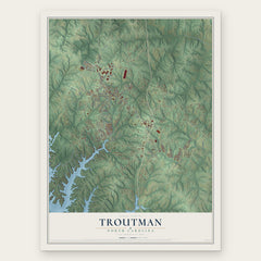
- Troutman 12" x 18" / Archival Matte Print $39.99
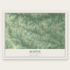
- Scotts 12" x 18" / Archival Matte Print $39.99
- Sharon 12" x 18" / Archival Matte Print $39.99

More maps nearby: Cleveland, Stony Point, Central, Catawba and Harmony.
The art of mapping a place
How This Map Was Made
Real places. Remarkable detail. Discover the layers that turn geographic data into a map of home.

The view from above
Aerial imagery reveals the character of the land: woodland, open fields, and the patterns of a place.

The shape of the land
Elevation data brings hills, valleys, and subtle changes in the landscape into view.

The details of home
Roads, waterways, and building footprints come together to make the map feel unmistakably local.

Geography becomes art
Considered color, shading, and typography bring the layers together in a map made for your wall.


Process illustrated with Mendon, Massachusetts. Aerial imagery: USDA NAIP. Terrain: USGS 3D Elevation Program. Map details and finished artwork: KNOWOL.
The Details
About This Print
Choose an archival matte print, or a black or white Ayous wood frame. The archival matte print is unframed.
Select your size and finish above to see the matching product image and price.
Materials & Craftsmanship
A contemporary map with the character of a classic atlas, printed on archival matte paper. Optional frames are made from Ayous wood.
Your printed map does not include the watermark shown in the full-map preview.
Shipping & Delivery
Free shipping within the United States. Every print is made to order in the USA.
Buying a gift? Add a note in your cart and we'll include it. We never put prices in the package.
Prints ship within 2 to 3 business days. Allow 7 to 10 days total from ordering for delivery. Timing may vary during holidays or periods of high order volume.
Read our shipping policy.
Returns and damaged prints
Each print is made to order. Change-of-mind refunds are not available after production.
If your print arrives damaged, misprinted or incorrect, contact support@knowol.com within 30 days of receiving it. Include your order number, photos and a description of the issue.
Read our full refund and replacement policy. For questions about your order, email support@knowol.com.