
Search for another town





Free U.S. delivery 7 to 10 days after you order
Strasburg, Virginia Map Art
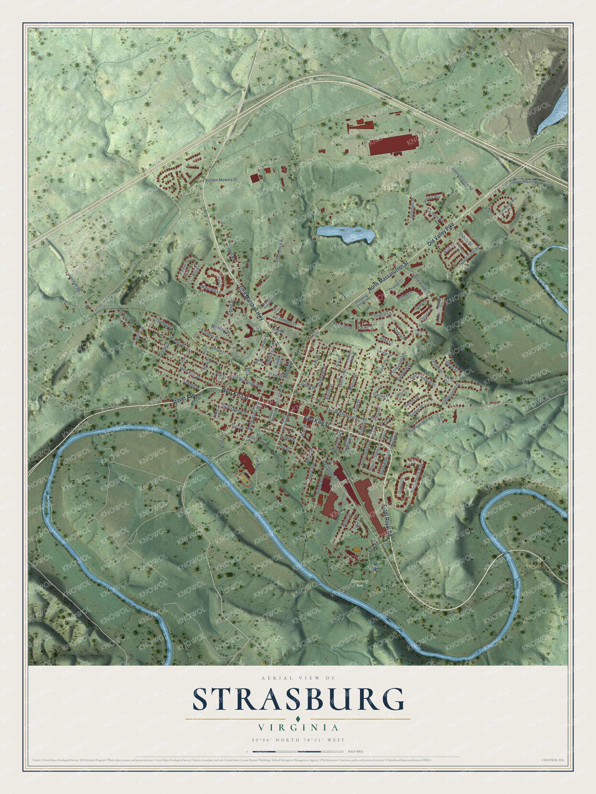
A new map of Strasburg, Virginia, made in 2026 and printed to order on thick archival matte paper.
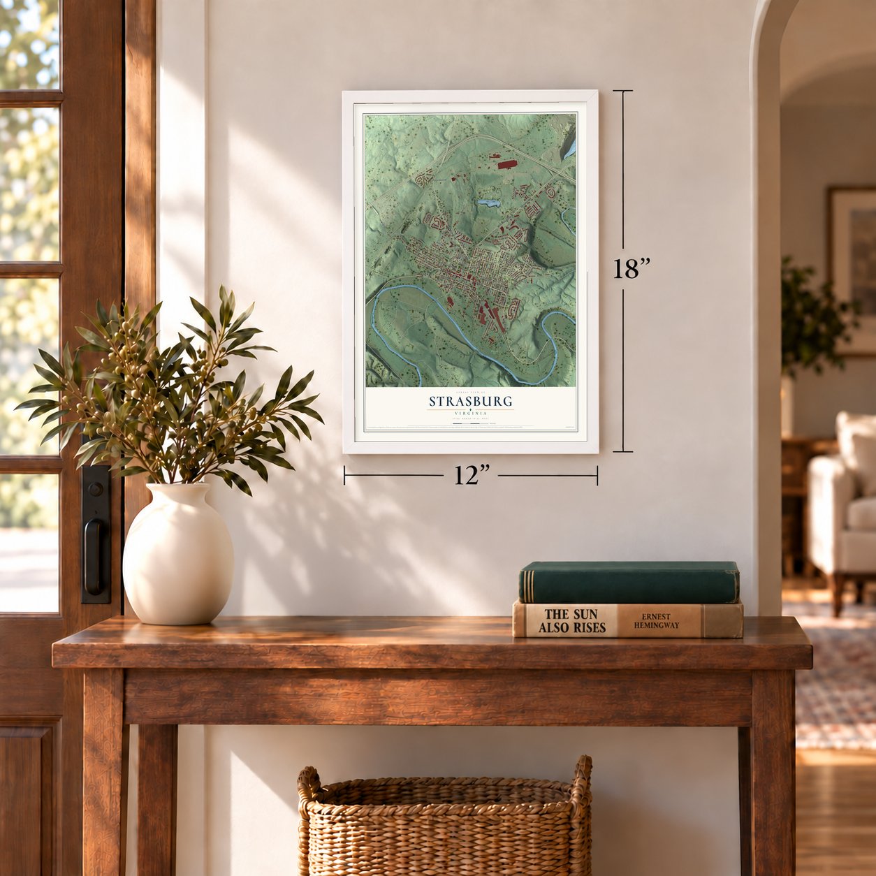
12" x 18" Archival Matte Print
A Map of Home. A Work of Art.
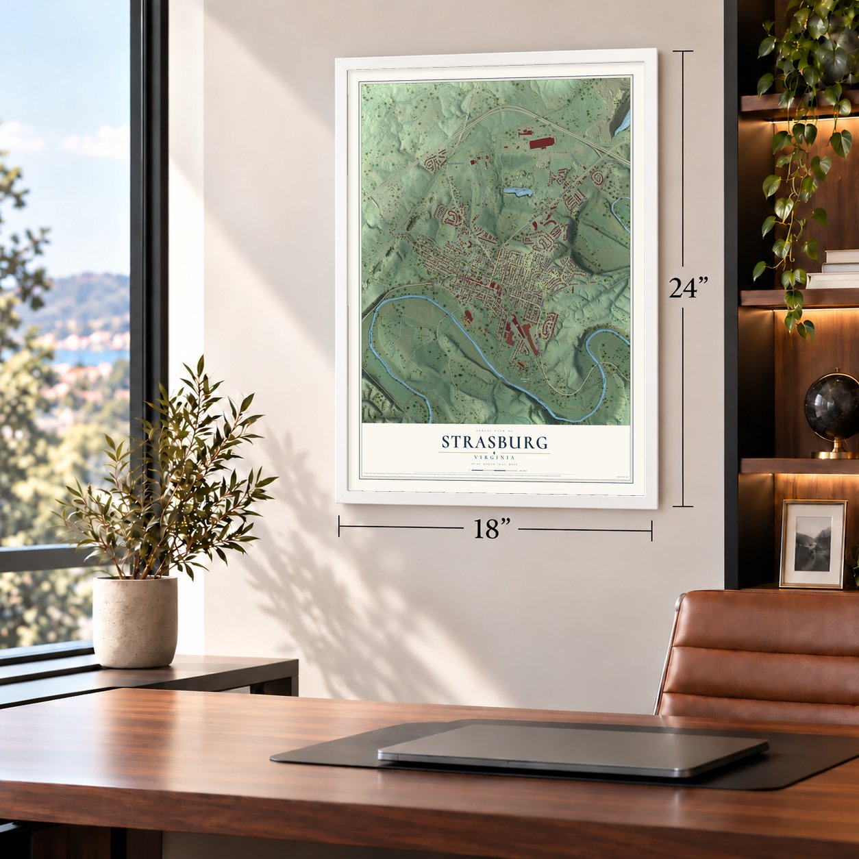
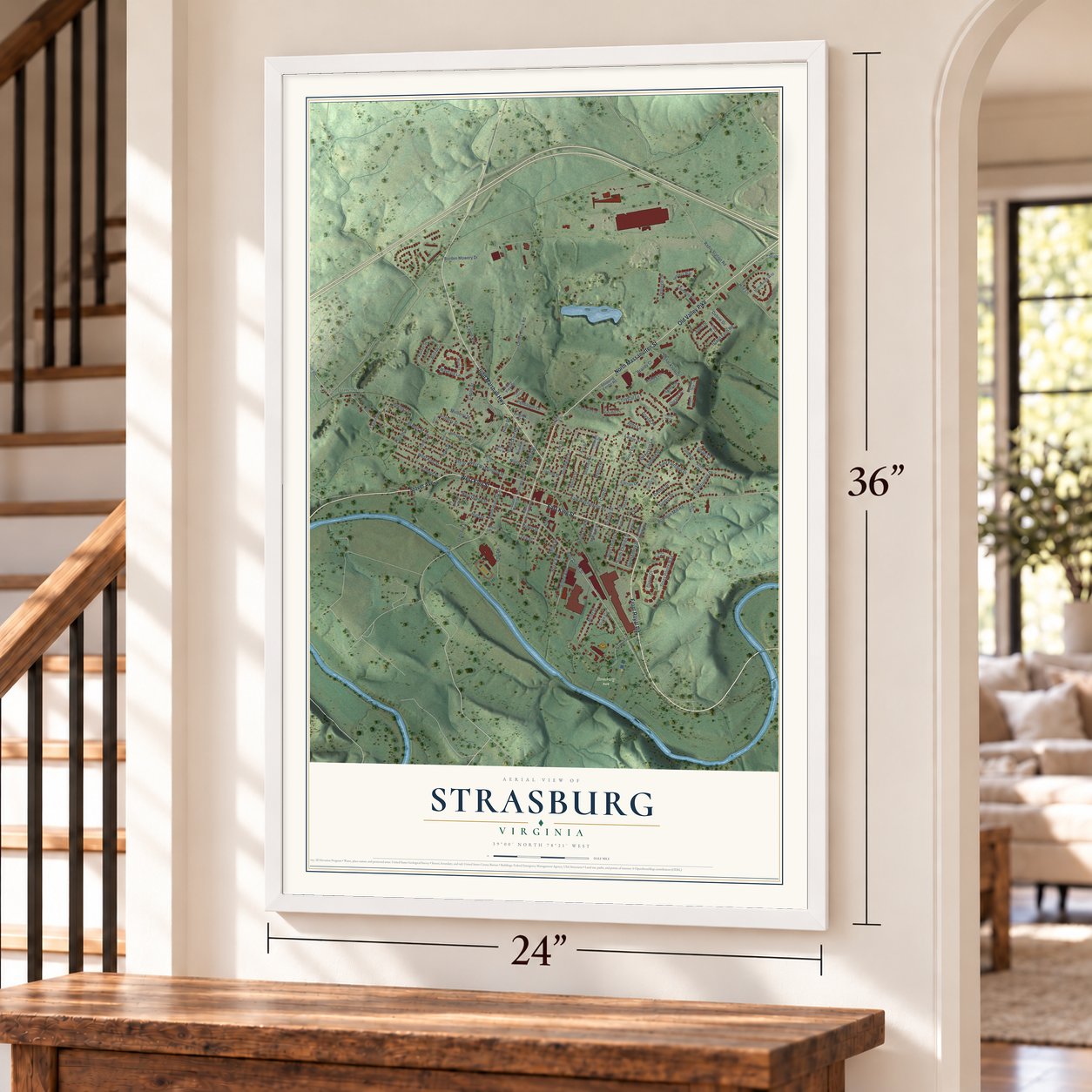
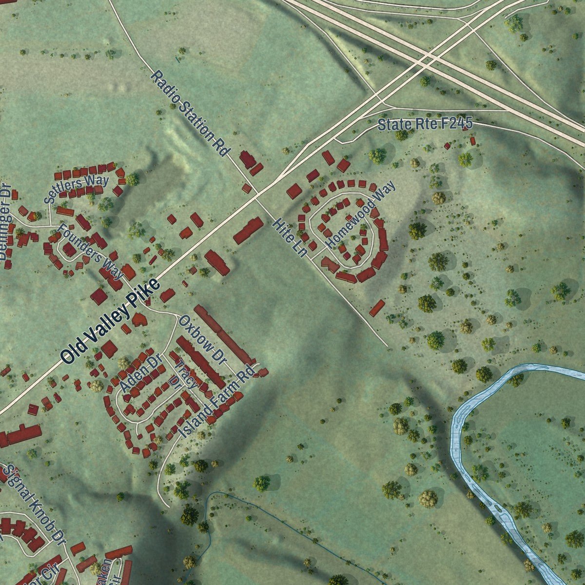
Explore Strasburg, Virginia from a whole new perspective. Created using aerial imagery and detailed geographic data, this map captures Strasburg building by building, with labeled streets, familiar landmarks, and shaded topographical relief that highlights the natural contours of the landscape.
Combining modern data with the timeless character of a vintage atlas, this map is just as interesting up close as it is beautiful on the wall. Whether you grew up in Strasburg, spent memorable years there, or call it home today, this unique map is a great way to celebrate a place that means something to you. Zoom in on the preview to look for your street, and then order a print to put your memories on the wall.
Three ways to hang it
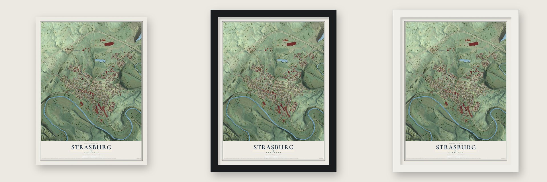
Unframed archival matte, a black wood frame or a white wood frame.
Up close
Geography Worth Displaying
This map was created using accurate cartographic data and authoritative geographic sources, including the U.S. Geological Survey and the Census Bureau. The map brings together terrain, waterways, roads, and building detail. The majority of the streets are labeled, houses are accurately depicted, and the topography is derived from government sources. Combining local data with carefully composed color and shading leads to this beautifully detailed Strasburg artwork for your wall.
Rather than simply showing street outlines, we’ve included as many of the street names as we could reasonably fit on the map while keeping their names legible. Zoom in on the high resolution preview to see exactly what’s on the map. We truly set out to create a statement piece for anyone who loves Strasburg. So whether it’s for you, or a gift for someone you love, we hope this map of Strasburg brings back fond memories.
Read the story behind this map of Strasburg, Virginia from 2026.

About Strasburg, Virginia
Strasburg is a town of 7,083 people in Shenandoah County, at the northern end of the Shenandoah Valley, and it is the largest town in the county. On August 21, 1734, Lieutenant Governor William Gooch granted 2,030 acres here to the speculator Henry Willis. Gooch hoped settlers in the Valley would shield the rest of the colony from Native American tribes. Willis sold all of the land to Jacob Funk in the summer of 1735, and Funk resold part of it to his brother John.
German-speaking families from Pennsylvania came to farm the fertile bottomland along the Shenandoah River, and they built family farms rather than plantations. Peter Stover, born in Germany in 1715, bought 483 acres from Jacob Funk on May 2, 1749, and divided it into lots for other settlers. In November 1761 Stover applied for a town charter, and the village officially became Strasburg, named for Strasbourg in Alsace. Some people called it Staufferstadt, German for Stoverstown.
“The Queen Street School, one of the first schools in Shenandoah County for African Americans, had opened in Strasburg by 1875.”
- Known as Pot TownStrasburg's potters turned out both everyday and fancy earthenware and stoneware, which earned the town the nickname Pot Town. The Strasburg Stone and Earthenware Manufacturing Company once worked out of the building that now holds the Strasburg Museum. The building later served as a Southern Railway depot until the early 1960s, opened as a museum in 1970, and is on the National Register.
- Stover's gift for schoolsPeter Stover, the town's founder, gave generously through most of his life. He died on August 13, 1799, at 84, and in his will he set aside land and $10,000 so the community could open schools. A monument in Riverview Cemetery honors him, though no one knows where his grave is.
- Apple Orchard, 1938Sarah Jane Blakeslee won a commission from the United States Treasury Section of Fine Arts and in 1938 finished a New Deal mural called Apple Orchard for Strasburg's post office. The painting is still inside the historic building.
- Caverns at Hupp's HillCrystal Caverns at Hupp's Hill drew visitors from 1922 to 2010. The Stonewall Jackson Museum there later closed, and the Cedar Creek Battlefield Foundation rebuilt it, renaming it the Hupp's Hill Cedar Creek Museum when it reopened on May 7, 2011.
Find your street
Names on the Strasburg map
Every name below is printed on this map. Look for your street, your school, the park where you played, or the pond down the road.
Places and landmarks2
- Strasburg Park
- Strasburg Junction
Streets and roads125
- East King Street
- Front Royal Road
- West King Street
- Stover Avenue
- Old Valley Pike
- North Massanutten Street
- John Marshall Highway
- South Holliday Street
- East Washington Street
- East Queen Street
- South Funk Street
- Capon Road
- North Street
- Sunset Street
- East Fairchild Drive
- Colley Block Road
- Ash Street
- Junction Road
- Capon Street
- Bowman Mill Road
- Branch Street
- Virginia Street
- Crystal Lane
- Radio Station Road
- Borden Mowery Drive
- Stonewall Street
- Hailey Lane
- Stony Pointe Way
- Crim Drive
- Signal Knob Drive
Show all 125 streets
- High Street
- Kanter Street
- Walton Street
- West Queen Street
- Lee Street
- Brown Street
- Zea Street
- Aden Drive
- Aileen Avenue
- Hite Lane
- Jenkins Lane
- Orchard Street
- Island Farm Road
- Ram Drive
- Christiansen Drive
- Borum Street
- Miller Drive
- Stickley Street
- Park Road
- Royal Avenue
- Tyler Circle
- Alsberry Street
- Brandy Court
- Pendleton Lane
- West Washington Street
- Oxbow Drive
- Logan Circle
- Banks Fort Road
- Maynard Lane
- Daniel Court
- Devine Drive
- South Charles Street
- Seldon Drive
- Dickerson Lane
- Varghese Drive
- Hupp Street
- South Eberly Street
- Laurie Drive
- Abby Lane
- Carrier Drive
- Dellinger Drive
- Brill Drive
- Rose Lane
- Hope Street
- Lincoln Street
- Taylor Street
- Crystal Place
- Mulberry Street
- Mineral Street
- Duke Circle
- Keller Lane
- Stuart Court
- North Water Street
- South Loudoun Street
- Fulton Drive
- South Fort Street
- Founders Way
- Rocky View Drive
- Burgess Street
- Franklin Street
- Cardinal Street
- Virginia Circle
- Homewood Way
- Sharpe Street
- Shopping Center Road
- Ruth Court
- Hupps Hill Court
- Deaken Circle
- Settlers Way
- Forest Glen Drive
- Newman Street
- Pleasant View Drive
- Acton Place
- South Marshall Street
- Ellen Drive
- Tracy Drive
- North Eberly Street
- Locust Drive
- South Water Street
- Artz Street
- Afton Place
- North Fort Street
- South Massanutten Street
- North Place Lane
- Pouts Hill Road
- Frontier Fort Lane
- Courtney Circle
- Beacon Street
- Angel Street
- North Loudoun Street
- North Charles Street
- West Fairchild Drive
- Anna Mae Court
- Cool Spring Road
- Crystal Hill Court
Names are listed as they appear on the printed map. Zoom into the product photos to find them.
The art of mapping a place
How This Map Was Made
Real places. Remarkable detail. Discover the layers that turn geographic data into a map of home.

The view from above
Aerial imagery reveals the character of the land: woodland, open fields, and the patterns of a place.

The shape of the land
Elevation data brings hills, valleys, and subtle changes in the landscape into view.

The details of home
Roads, waterways, and building footprints come together to make the map feel unmistakably local.

Geography becomes art
Considered color, shading, and typography bring the layers together in a map made for your wall.


Process illustrated with Mendon, Massachusetts. Aerial imagery: USDA NAIP. Terrain: USGS 3D Elevation Program. Map details and finished artwork: KNOWOL.
The Details
About This Print
Choose an archival matte print, or a black or white Ayous wood frame. The archival matte print is unframed.
Select your size and finish above to see the matching product image and price.
Materials & Craftsmanship
A contemporary map with the character of a classic atlas, printed on archival matte paper. Optional frames are made from Ayous wood.
Your printed map does not include the watermark shown in the full-map preview.
Shipping & Delivery
Free shipping within the United States. Every print is made to order in the USA.
Buying a gift? Add a note in your cart and we'll include it. We never put prices in the package.
Prints ship within 2 to 3 business days. Allow 7 to 10 days total from ordering for delivery. Timing may vary during holidays or periods of high order volume.
Read our shipping policy.
Returns and damaged prints
Each print is made to order. Change-of-mind refunds are not available after production.
If your print arrives damaged, misprinted or incorrect, contact support@knowol.com within 30 days of receiving it. Include your order number, photos and a description of the issue.
Read our full refund and replacement policy. For questions about your order, email support@knowol.com.
Find your town
Looking for another city?
Find a map of home in our Virginia collection, or any town in the country.
Nearby
Maps of towns near Strasburg
Know someone from one of these towns? Their map makes a great gift.
 Clary
Clary, Virginia
From $39.99See the map
 Fishers Hill
, Virginia
From $39.99See the map
 Locust Grove
, Virginia
From $39.99See the map
More maps nearby: Lebanon Church, Middletown, Mount Olive, Toms Brook and Maurertown.