
Search for another town





Free U.S. delivery 7 to 10 days after you order
Stroud, Pennsylvania Map Art
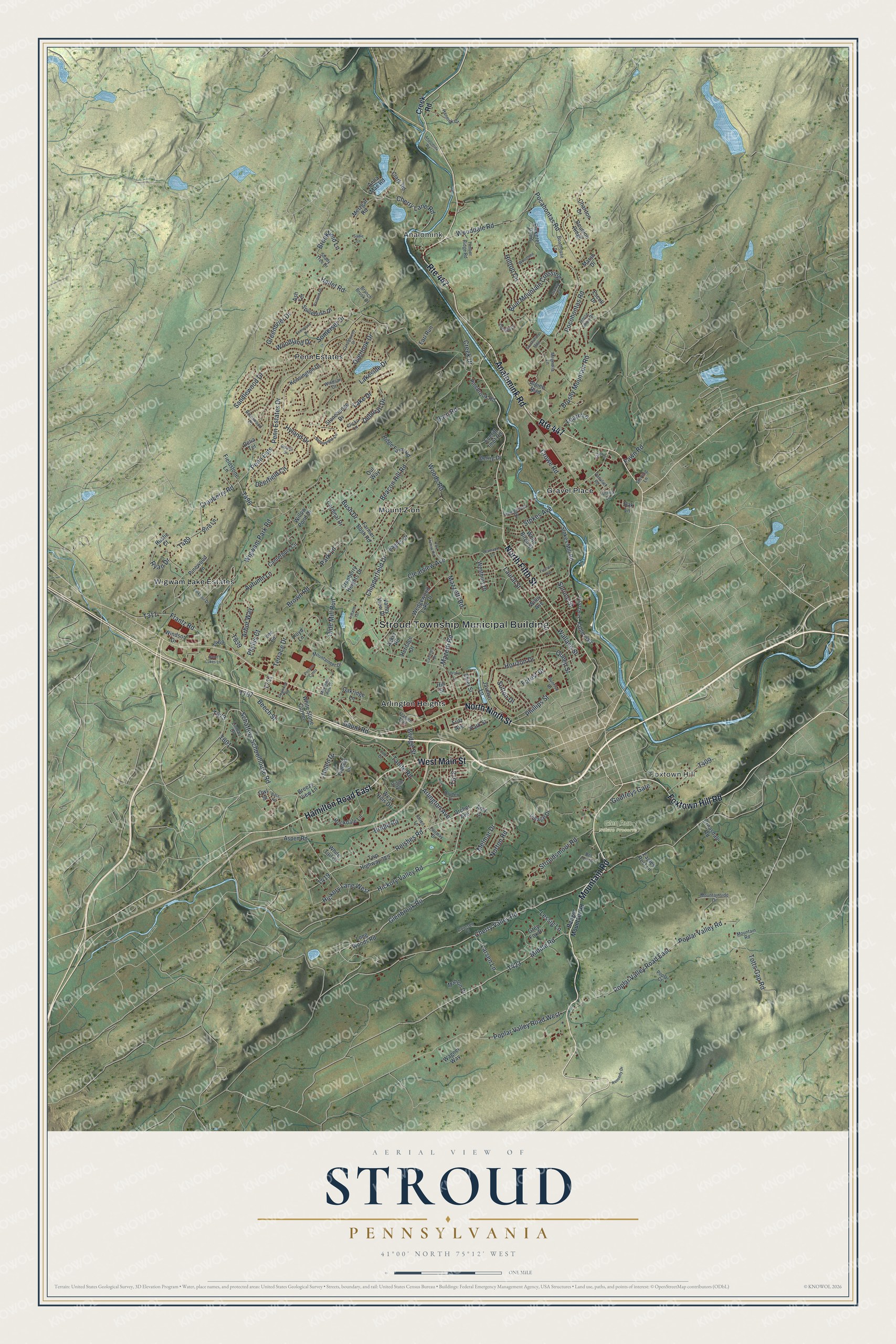
A new map of Stroud, Pennsylvania, made in 2026 and printed to order on thick archival matte paper.
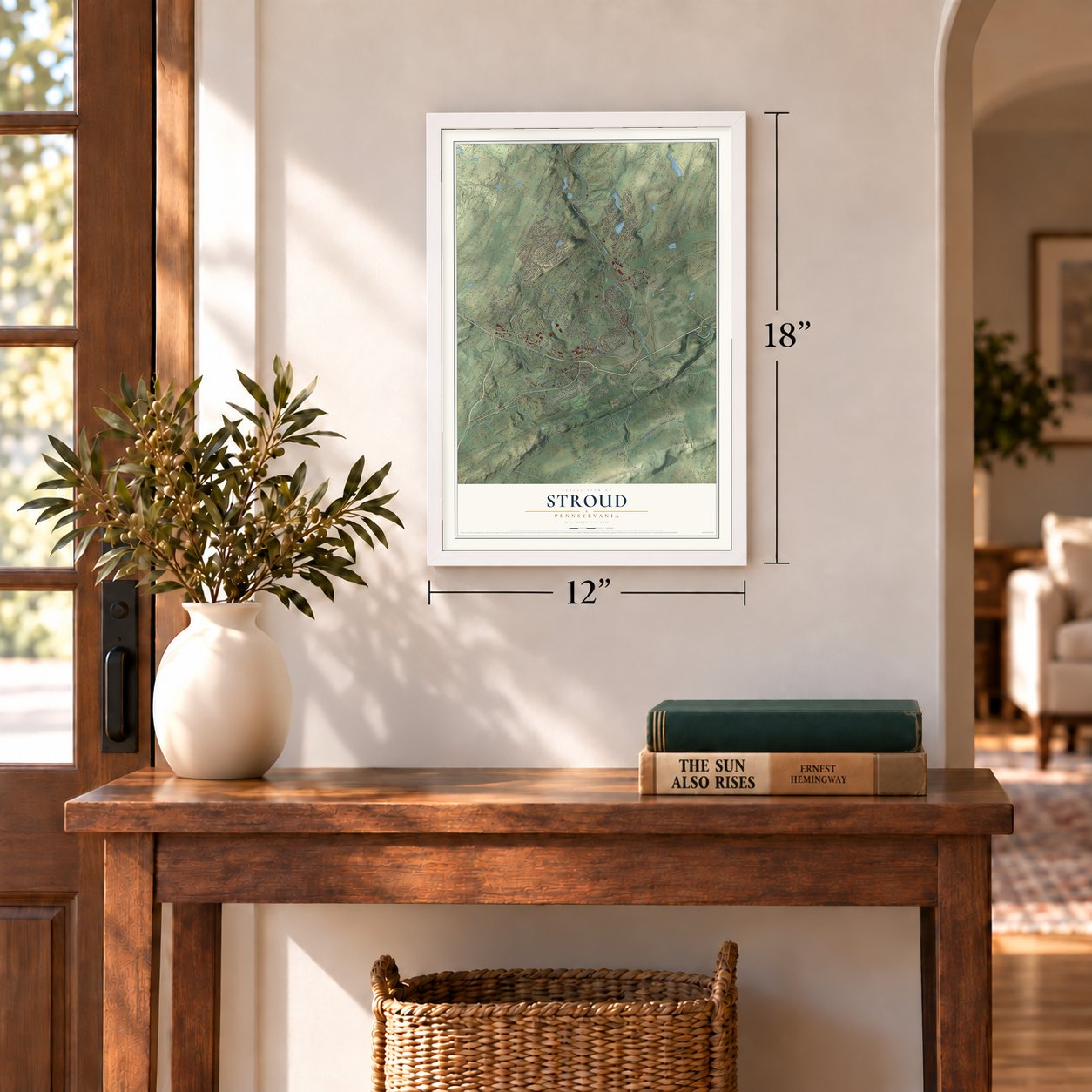
12" x 18" Archival Matte Print
A Map of Home. A Work of Art.
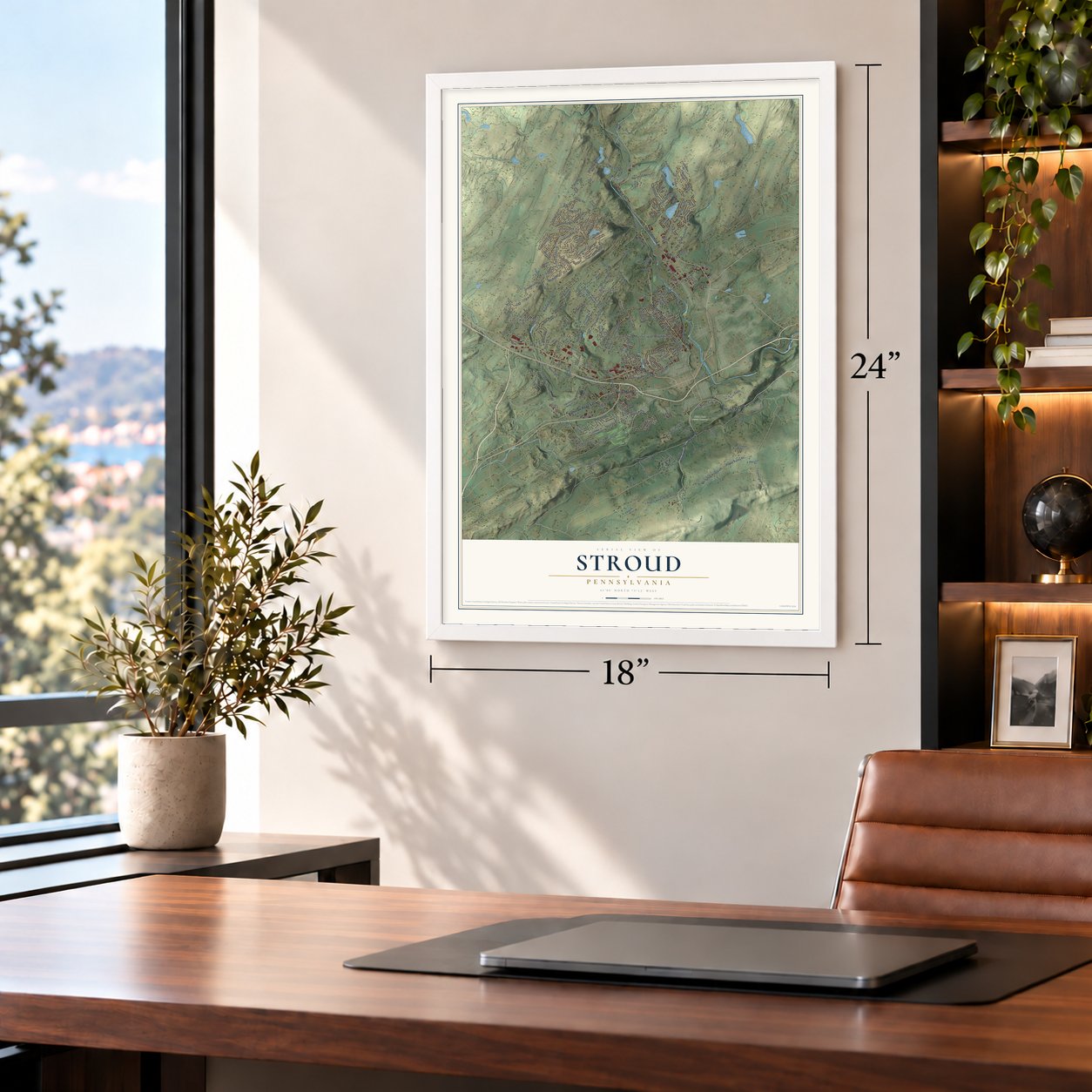
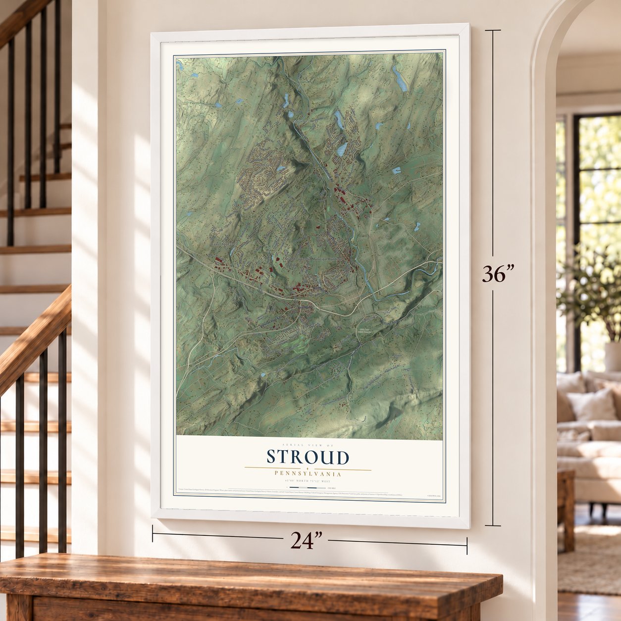
This beautifully detailed map of Stroud, Pennsylvania was created in 2026 using aerial imagery combined with modern topographical, census, street and landmark data. It's a modern aerial view of Stroud in Monroe County, Pennsylvania, that combines modern data with a vintage aesthetic. Zoom in on the preview and look for your block.
Three ways to hang it
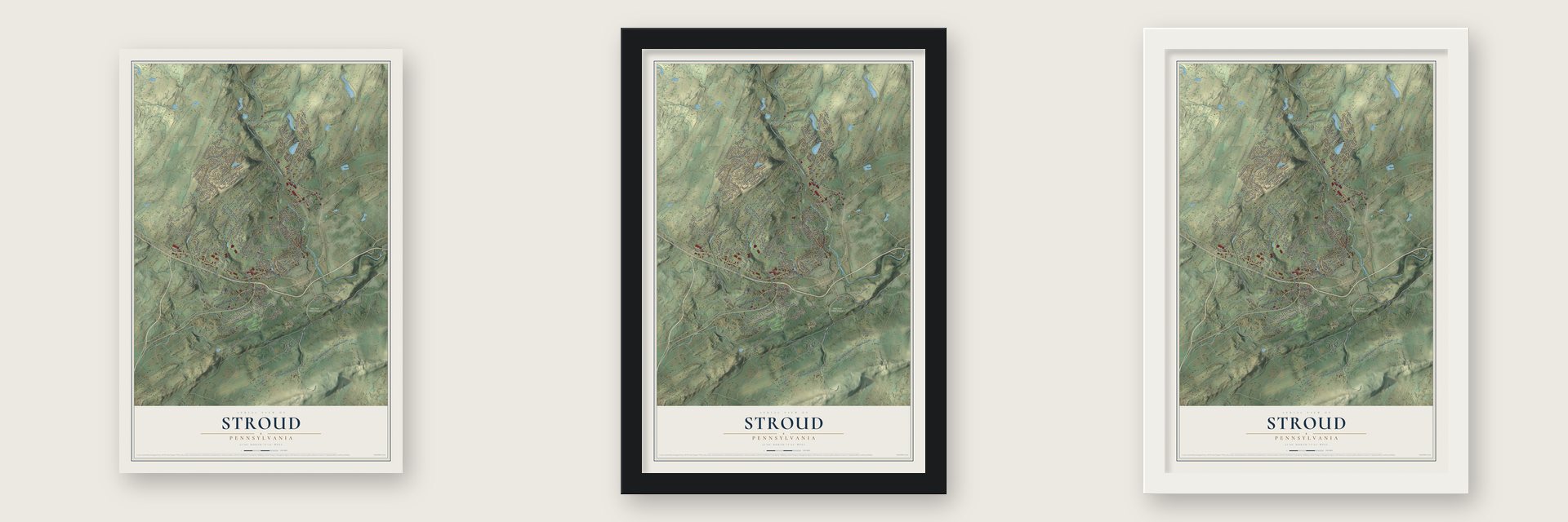
Unframed archival matte, a black wood frame or a white wood frame.
Up close
Real geography. Art worth displaying.
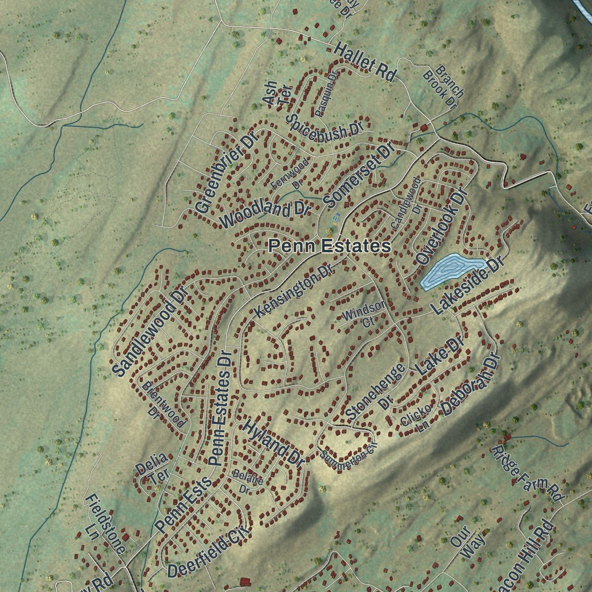
This map was created using accurate cartographic data and authoritative geographic sources, including the U.S. Geological Survey and the Census Bureau. The map brings together terrain, waterways, roads, and building detail. The majority of the streets are labeled, houses are accurately depicted, and the topography is derived from government sources. Combining local data with carefully composed color and shading leads to this beautifully detailed Stroud artwork for your wall.
Rather than simply showing street outlines, we’ve included as many of the street names as we could reasonably fit on the map while keeping their names legible. Zoom in on the high resolution preview to see exactly what’s on the map. We truly set out to create a statement piece for anyone who loves Stroud. So whether it’s for you, or a gift for someone you love, we hope this map of Stroud brings back fond memories.
Read the story behind this map of Stroud, Pennsylvania from 2026.

About Stroud, Pennsylvania
Stroud is a township in Monroe County, with a local identity shaped by the people and places recorded in its source history. The 2020 count recorded 19,834 residents, placing a clear present-day measure beside the community's longer story.
“The first night of their flight a halt was made at Cherry Valley, twelve miles distant, and the following morning a weary march of four hun- dred miles was begun, the mother often being so exhausted that it was necessary to urge her on with a weapon at the back.”
- 2020 populationThe recorded population was 19,834 residents.
- Monroe County communityStroud is identified as a township in Monroe County.
Find your street
Names on the Stroud map
Every name below is printed on this map. Look for your street, your school, the park where you played, or the pond down the road.
Places and landmarks9
- Stroud Township Municipal Building
- Analomink
- Foxtown Hill
- Glen Run Nature Preserve
- Arlington Heights
- Gravel Place
- Mount Zion
- Penn Estates
- Wigwam Lake Estates
Streets and roads206
- Mountain Road
- Foxtown Hill Road
- Route 447
- Hamilton Road East
- North Fifth Street
- Analomink Road
- North Ninth Street
- West Main Street
- Glenbrook Road
- Hickory Valley Road
- Schaffers Schoolhouse Road
- Reishes Road
- Mazzetti Road
- Arlington Avenue
- Pocohontas Road
- Mazetti Road
- Wigwam Park Road
- Cherry Lane Road
- Totts Gap Road
- Frantz Road
- Pocahontas Road
- Cherry Valley Road
- Chipperfield Drive
- Cranberry Road
- Hallet Road
- Penn Estates Drive
- Penn Ests
- Middle Road
- Poplar Valley Road
- Somerset Drive
Show all 206 streets
- Clearview Avenue
- Wooddale Road
- Beacon Hill Road
- Poplar Valley Road West
- Poplar Valley Road East
- Bridle Road
- Brushy Mountain Road
- Wallace Street
- Stokes Avenue
- Lakeside Drive
- Blue Mountain Crossing
- Hilltop Circle
- Greenbrier Drive
- Beech Street
- Tanite Road
- Hyland Drive
- Stroudsmoor Road
- Overlook Drive
- Olde Mill Run
- Sandlewood Drive
- Park Lane
- Arbor Way
- Phillips Street
- Norton Road
- Crowe Road
- Terrace Drive
- Horizon Drive
- Autumn Lane
- Helen Drive
- Woodland Drive
- Deerfield Circle
- Learn Lane
- Deborah Drive
- Laural Street
- Woods Road
- Brown Road
- Hickory Lane West
- Forest Drive
- Bush Drive
- Brookfield Lane
- Melmar Drive
- Godfreys Gate
- Creek Drive
- Lake Drive
- Lessig Lane
- Larsen Lane
- Sutton Drive
- Phyllis Court
- Queen Street
- Ryan Drive
- Bridge Street
- Spruce Street
- Barn Road
- Gaunt Road
- Fawn Road
- Creek Road
- Twp Highway 389
- Drcher Avenue
- Long Woods Road
- West Hills Drive
- Kensington Drive
- Stokes Mill Road
- Metzgar Road
- Reunion Ridge
- Wedgewood Lake Drive
- Stonehenge Drive
- Escoll Drive
- Alpine Boulevard
- Rockdale Lane
- White Tail Court
- Ehler Street
- Pinebrook Road
- Javelyn Lane
- Windsor Drive
- Fieldstone Lane
- Farmer Bush Road
- Spicebush Drive
- Pickerel Point
- Cardinal Drive
- Clark Road
- Canterbury Circle
- Lee Lane
- Eagles Rest Lane
- Chariton Drive
- Valley View Drive
- Cranberry Heights Drive
- White Stone Corner
- Ridge Farm Road
- Eagles Court
- Westbury Drive
- Fable Flats
- Grey Fox Drive
- Acker Road
- Willow Pond Drive
- Oakridge Lane
- Park Street
- Pinewood Lane
- Breezy View Lane
- Lloyd Lane
- Croasdale Road
- Francis Lane
- Mahlon Drive
- Aspen Road
- White Birch Street
- Ash Terrace
- Village Drive
- Earl Run
- Derrig Drive
- Anna Mae Road
- Heritage Drive
- Wagner Way
- Everitt Imbt Road
- Delia Terrace
- Our Way
- Wiley Avenue
- Rustic Court
- Marsh Drive
- Fritz Avenue
- Amy Court
- Bird Lane
- Oak Lane
- Hill Street
- Owl Street
- Bangor Mountain Road
- Mountaineer Drive
- Magnolia Lane
- Brentwood Drive
- Branch Brook Drive
- Coursen Court
- Boathouse Lane
- Mountainside Drive
- Horse Shoe Drive
- Serfass Lane
- Dryden Drive
- Ridge Road
- Clicko Lane
- Youngwood Drive
- Linmar Drive
- Hannick Court
- Bel Tor Drive
- Sunrise Drive
- Poplar Court
- Flagler Trail
- Shady Tree Drive
- Timber Ridge Road
- Windsor Court
- Althea Lane
- Fairway Drive
- Vanvliet Road
- Orien Lane
- Sterling Lane
- Daffodil Drive
- Pocono Cmns
- Mountain View Drive
- Pasquin Drive
- Summerton Circle
- Saint Lukes Lane
- Candlewood Drive
- Belaire Drive
- Larkspur Drive
- Fernwood Drive
- Dogwood Road
- Fremont Avenue
- Fox Hollow Road
- Woodbine Lane
- Kennedy Drive
- Southshore Mdw
- Ramapo Lane
- Osprey Court
- Camelot Drive
- Katie Lane
- Trilland Terrace
- Jodi Drive
- Sadie Lane
- Drake Lane
- Bass Road
Names are listed as they appear on the printed map. Zoom into the product photos to find them.
The art of mapping a place
How This Map Was Made
Real places. Remarkable detail. Discover the layers that turn geographic data into a map of home.

The view from above
Aerial imagery reveals the character of the land: woodland, open fields, and the patterns of a place.

The shape of the land
Elevation data brings hills, valleys, and subtle changes in the landscape into view.

The details of home
Roads, waterways, and building footprints come together to make the map feel unmistakably local.

Geography becomes art
Considered color, shading, and typography bring the layers together in a map made for your wall.


Process illustrated with Mendon, Massachusetts. Aerial imagery: USDA NAIP. Terrain: USGS 3D Elevation Program. Map details and finished artwork: KNOWOL.
The Details
About This Print
Choose an archival matte print, or a black or white Ayous wood frame. The archival matte print is unframed.
Select your size and finish above to see the matching product image and price.
Materials & Craftsmanship
A contemporary map with the character of a classic atlas, printed on archival matte paper. Optional frames are made from Ayous wood.
Your printed map does not include the watermark shown in the full-map preview.
Shipping & Delivery
Free shipping within the United States. Every print is made to order in the USA.
Buying a gift? Add a note in your cart and we'll include it. We never put prices in the package.
Prints ship within 2 to 3 business days. Allow 7 to 10 days total from ordering for delivery. Timing may vary during holidays or periods of high order volume.
Read our shipping policy.
Returns and damaged prints
Each print is made to order. Change-of-mind refunds are not available after production.
If your print arrives damaged, misprinted or incorrect, contact support@knowol.com within 30 days of receiving it. Include your order number, photos and a description of the issue.
Read our full refund and replacement policy. For questions about your order, email support@knowol.com.
Find your town
Looking for another city?
Find a map of home in our Pennsylvania collection.
Nearby
Maps of towns near Stroud
Know someone from one of these towns? Their map makes a great gift.
 Arlington Heights
, Pennsylvania
From $39.99See the map
 Stroudsburg
, Pennsylvania
From $39.99See the map
 East Stroudsburg
, Pennsylvania
From $39.99See the map
More maps nearby: Penn Estates, Smithfield, Delaware Water Gap, Hamilton and Pocono.