
Search for another town





Free U.S. delivery 7 to 10 days after you order
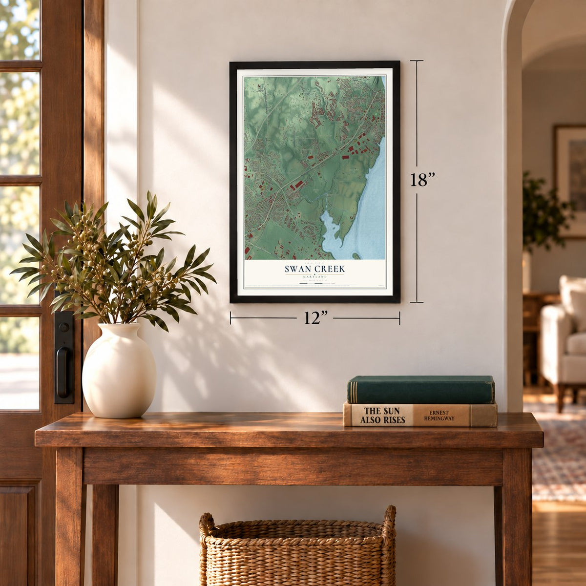
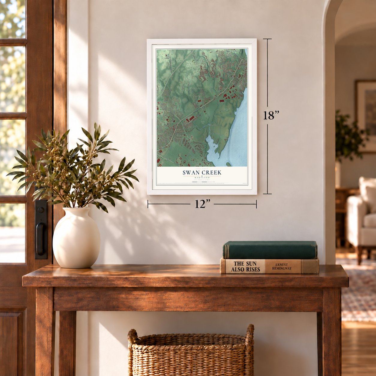
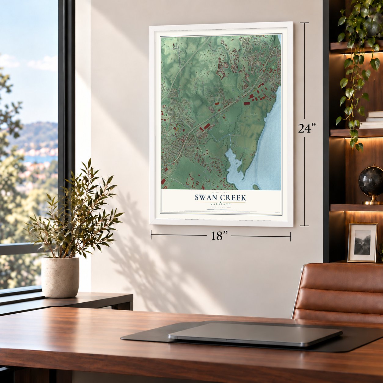
Swan Creek, Maryland Map Art
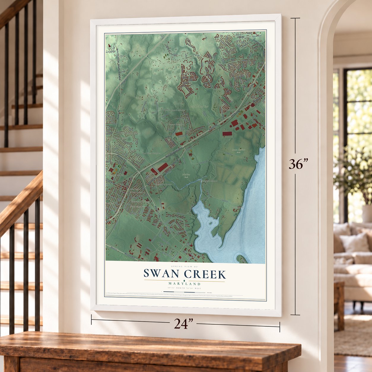
Building by building, with labeled streets and shaded relief.
12" x 18" Archival Matte Print
A Map of Home. A Work of Art.
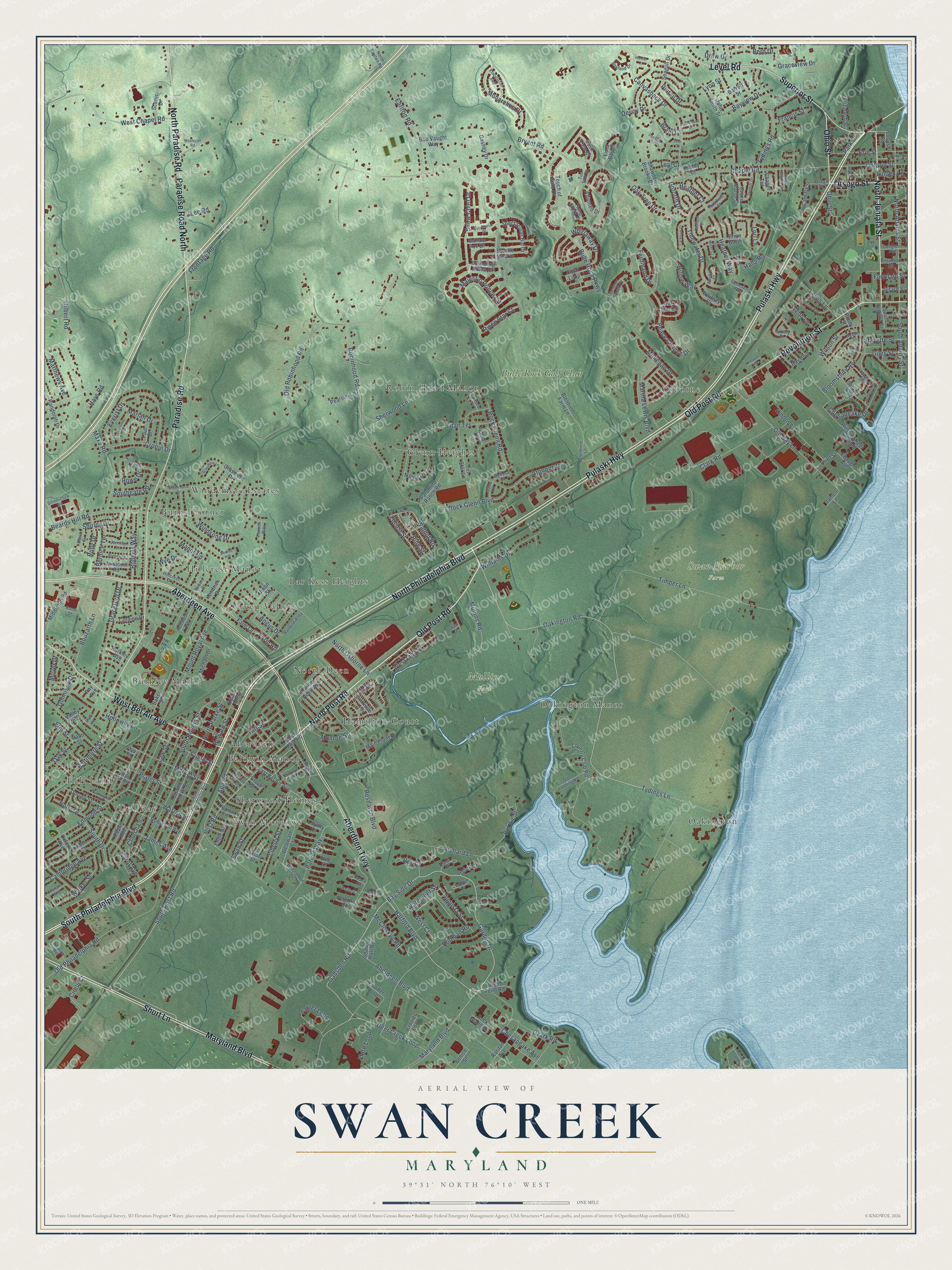
Explore Swan Creek, Maryland from a whole new perspective. Created using aerial imagery and detailed geographic data, this map captures Swan Creek building by building, with labeled streets, familiar landmarks, and shaded topographical relief that highlights the natural contours of the landscape.
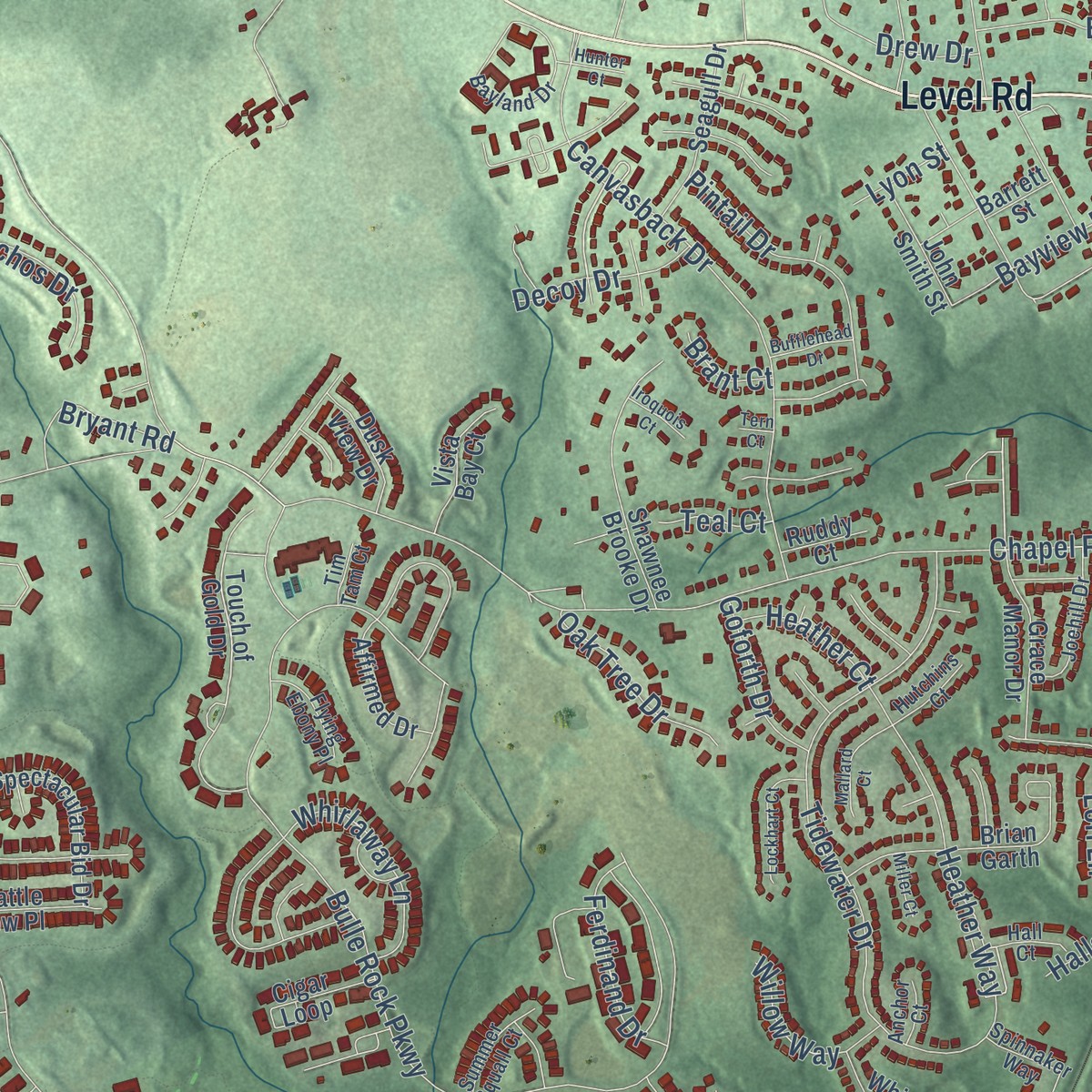
Combining modern data with the timeless character of a vintage atlas, this map is just as interesting up close as it is beautiful on the wall. Whether you grew up in Swan Creek, spent memorable years there, or call it home today, this unique map is a great way to celebrate a place that means something to you. Zoom in on the preview to look for your street, and then order a print to put your memories on the wall.
Three ways to hang it
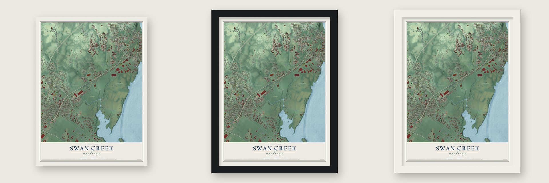
Unframed archival matte, a black wood frame or a white wood frame.
Up close
Geography Worth Displaying
This map was created using accurate cartographic data and authoritative geographic sources, including the U.S. Geological Survey and the Census Bureau. The map brings together terrain, waterways, roads, and building detail. The majority of the streets are labeled, houses are accurately depicted, and the topography is derived from government sources. Combining local data with carefully composed color and shading leads to this beautifully detailed Swan Creek artwork for your wall.
Rather than simply showing street outlines, we’ve included as many of the street names as we could reasonably fit on the map while keeping their names legible. Zoom in on the high resolution preview to see exactly what’s on the map. We truly set out to create a statement piece for anyone who loves Swan Creek. So whether it’s for you, or a gift for someone you love, we hope this map of Swan Creek brings back fond memories.
Read the story behind this map: Detailed Map of Swan Creek, Maryland.

Find your street
Names on the Swan Creek map
Every name below is printed on this map. Look for your street, your school, the park where you played, or the pond down the road.
Places and landmarks22
- Mullins Park
- Swan Harbor Farm
- Windemere Estates
- Robin Hood Manor
- Osborne
- Hill Land
- Oakington
- Green Valley
- Swan Meadows
- Hamilton Court
- Oakington Manor
- Glenn Heights
Show all 22 places
- Burkley Manor
- Hillcrest Manor
- Dol Ray
- Burns Corner
- Sherwood Homes
- Baldwin Manor
- North Deen
- Aberdeen
- Bar Kess Heights
- Bulle Rock Golf Club
Streets and roads320
- North Philadelphia Boulevard
- South Philadelphia Boulevard
- Old Post Road
- North Post Road
- North Juniata Street
- Maryland Boulevard
- Superior Street
- Aberdeen Trwy
- Pulaski Highway
- Paradise Road
- Aberdeen Avenue
- Short Lane
- North Paradise Road
- Paradise Road North
- Level Road
- West Bel Air Avenue
- Revolution Street
- Otsego Street
- Ohio Street
- Oakington Road
- Tydings Lane
- Harford Boulevard
- Bay Side Drive
- Gadsden Road
- Flare Loop
- Post Road
- South Post Road
- Deer Creek Loop
- Farm Road
- Beards Hill Road
Show all 320 streets
- West Inca Street
- Aberdeen Boulevard
- Chapel Road
- Robinhood Road
- Bulle Rock Parkway
- Old Robinhood Road
- West Chapel Road
- Garden Drive
- South Rogers Street
- Patriot Way
- Timber Lane
- Edmund Street
- Chesapeake Avenue
- Mount Royal Avenue
- Maxa Road
- Old Philadelphia Road
- Plater Street
- Lewis Lane
- Richard Lane
- Ontario Street
- Canvasback Drive
- Custis Street
- Sherwood Lane
- Tidewater Drive
- Old Bay Lane
- Chesapeake Drive
- Market Street
- Gilbert Road
- Rodman Road
- Warren Street
- Titan Terrace
- Everist Drive
- Law Street
- Walker Street
- South Adams Street
- Baltimore Street
- Church Lane
- Earlton Road
- Graceford Drive
- Wilson Street
- North Adams Street
- Argonne Drive
- Mohegan Drive
- Tydings Road
- Pine Street
- Roberts Way
- Bloomsbury Avenue
- Taft Street
- Mullins Road
- Windsong Drive
- Ozark Road
- Rock Glenn Boulevard
- Majestic Prince Circle
- Heather Way
- Target Loop
- James Avenue
- Swan Street
- Frontage Road
- Clark Road
- Snow Chief Drive
- Monarchos Drive
- Research Boulevard
- Peace Chance Drive
- Hinton Street
- Erie Street
- Liberty Street
- Bayview Drive
- Williams Drive
- Cronin Drive
- Pintail Drive
- Rock Glenn Road
- Oak Street
- Augusta Street
- Martha Lewis Boulevard
- Bern Drive
- Walnut Road
- Holloway Lane
- Fountain Street
- Manor Road
- Linden Lane
- Whirlaway Lane
- Bel Air Street
- Cambridge Avenue
- Bouzarth Lane
- Matthews Avenue
- Ferdinand Drive
- North Osborne Lane
- Locust Street
- Oak Tree Drive
- North Parke Street
- South Drive
- Carol Avenue
- Moyer Drive
- Giles Street
- Shirley Drive
- Monroe Street
- Graceview Drive
- Lafayette Street
- Risen Star Court
- Gunnison Drive
- Watervliet Street
- Bernice Terrace
- Apg Road
- Nova Drive
- Decoy Drive
- Marian Drive
- Willow Way
- Southgate Road
- Ruby Drive
- Bryant Road
- Goforth Drive
- Drew Drive
- Angus Drive
- McCloskey Road
- Webb Lane
- Holly Drive
- Heather Court
- Francis Street
- Park Drive
- Bay Court
- Hays Road
- West Court
- Wye Drive
- Howard Street
- Lee Road
- Lori Lane
- Elm Street
- Teal Court
- Rowe Drive
- Cirelli Court
- Brant Court
- Lyon Street
- Halls Road
- South Juniata Street
- Farm Lane
- East Bel Air Avenue
- Touch of Gold Drive
- Blenhiem Farm Lane
- Country Club Road
- South Parke Street
- Powder Loop
- Rock Island Road
- Seneca Avenue
- Crozier Loop
- Grasmere Drive
- Wilson Street Extended
- Robinson Avenue
- Center Deen Avenue
- Shawnee Brooke Drive
- Randolph Drive
- Middleton Road
- Raritan Avenue
- Michael Drive
- Lewis Drive
- Tel Star Lane
- Chapel Terrace
- Bay Boulevard
- Baker Street
- Union Street
- Brian Garth
- Oxford Avenue
- Kendrick Drive
- Delaware Court
- Shandy Hall Road
- Dark Star Circle
- Spectacular Bid Drive
- Poplar Alley
- Grace Manor Drive
- Ebaugh Avenue
- Bounding Home Court
- Seagull Drive
- Dorsey Street
- Andrews Road
- Cigar Loop
- Palomino Ranch Road
- Main Plant Drive
- Affirmed Drive
- Bob Vaught Way
- Colaine Drive
- Vista Bay Court
- Barrett Street
- Victory Street
- Elizabeth Street
- Dusk View Drive
- Pearson Lane
- High Point Road
- Gallant Fox Drive
- John Smith Street
- Seattle Slew Place
- Scenic Drive
- Whitney Court
- Beech Alley
- Benice Street
- Gashey Drive
- Bourbon Street
- Burkley Avenue
- Camilla Street
- Girard Street
- Engle Avenue
- Third Street
- Paul Drive
- Valley Road
- Agena Drive
- Dock Court
- Locust Road
- Ruddy Court
- James Lane
- Veteran Court
- Loyalty Court
- Flag Court
- Ray Avenue
- Pusey Street
- Grove Street
- Palm Street
- Hall Court
- Hillcrest Drive
- Weber Street
- Battery Drive
- Bayland Drive
- Webb Street
- Deaver Street
- Blenhiem Lane
- Rigdon Road
- Joehill Drive
- Old Landing Road
- Wyn Mar Avenue
- Doris Circle
- Railbird Alley
- Spinnaker Way
- Norman Avenue
- Jennifer Lane
- Red Robin Alley
- Canal Court
- Peace Court
- Congress Avenue
- Summer Squall Court
- Marylander Drive
- North Earlton Road
- Newton Road
- Flying Ebony Place
- Harlan Avenue
- Saturn Drive
- Shinnicock Road
- Riddle Drive
- Hutchins Court
- Melissa Court
- Rand Street
- Pride Court
- Bevard Court
- Jason Lane
- Penrith Way
- Anchor Court
- Tim Tam Court
- Van Street
- Ford Street
- Northgate Road
- Windemere Drive
- Walnut Street
- Washington Street
- Courtney Drive
- Anderson Avenue
- Elocutionist Awy
- Secretariat Drive
- Brenda Lane
- Lockhart Court
- Nautical Court
- Hoppers Lane
- Legion Drive
- Dolphin Court
- Grasmere Lane
- Mallard Court
- South Court
- Pledge Court
- Wesleyan Road
- Brannon Road
- Hebditch Lane
- Spesutie Island Road
- Lewis Street
- Mitchell Avenue
- Quarry Road
- Chapel Heights Drive
- Bufflehead Drive
- Keewee Road
- Iroquois Court
- Beards Hill
- Miller Court
- Hunter Court
- Oneil Court
- Rock Road
- Tern Court
Names are listed as they appear on the printed map. Zoom into the product photos to find them.
About Swan Creek, Maryland
Swan Creek was once a very busy landing. Settlers from Kent came across the bay to land there, then headed up the country. Tobacco was brought to the landing down a rolling road past Hall's Cross Roads, now Aberdeen. A large Presbyterian settlement grew up at Swan Creek.
Michael Gilbert and four or five young men from the Swan Creek neighborhood bought a boat and locked it to a tree. On Sabbath mornings they walked four or five miles to the boat. They crossed the river near what is now Port Deposit and walked five more miles to West Nottingham Church. They returned home in the evening.
Keep exploring Maryland
Swan Creek is one of 881 Maryland towns we've mapped. Every dot on the map is a print of its own.
The search covers every state, Maryland first.
Near Swan Creek
Order 2 or more town maps and save 10%. Shown in the size and finish you picked above, so they hang as a set.
- Aberdeen 12" x 18" / Archival Matte Print $39.99
- Havre de Grace 12" x 18" / Archival Matte Print $39.99
- Aberdeen Proving Ground 12" x 18" / Archival Matte Print $39.99


More maps nearby: Perryville, Perryman, Churchville, Port Deposit and Abingdon.
The art of mapping a place
How This Map Was Made
Real places. Remarkable detail. Discover the layers that turn geographic data into a map of home.

The view from above
Aerial imagery reveals the character of the land: woodland, open fields, and the patterns of a place.

The shape of the land
Elevation data brings hills, valleys, and subtle changes in the landscape into view.

The details of home
Roads, waterways, and building footprints come together to make the map feel unmistakably local.

Geography becomes art
Considered color, shading, and typography bring the layers together in a map made for your wall.


Process illustrated with Mendon, Massachusetts. Aerial imagery: USDA NAIP. Terrain: USGS 3D Elevation Program. Map details and finished artwork: KNOWOL.
The Details
About This Print
Choose an archival matte print, or a black or white Ayous wood frame. The archival matte print is unframed.
Select your size and finish above to see the matching product image and price.
Materials & Craftsmanship
A contemporary map with the character of a classic atlas, printed on archival matte paper. Optional frames are made from Ayous wood.
Your printed map does not include the watermark shown in the full-map preview.
Shipping & Delivery
Free shipping within the United States. Every print is made to order in the USA.
Buying a gift? Add a note in your cart and we'll include it. We never put prices in the package.
Prints ship within 2 to 3 business days. Allow 7 to 10 days total from ordering for delivery. Timing may vary during holidays or periods of high order volume.
Read our shipping policy.
Returns and damaged prints
Each print is made to order. Change-of-mind refunds are not available after production.
If your print arrives damaged, misprinted or incorrect, contact support@knowol.com within 30 days of receiving it. Include your order number, photos and a description of the issue.
Read our full refund and replacement policy. For questions about your order, email support@knowol.com.