
Search for another town




Free U.S. delivery 7 to 10 days after you order
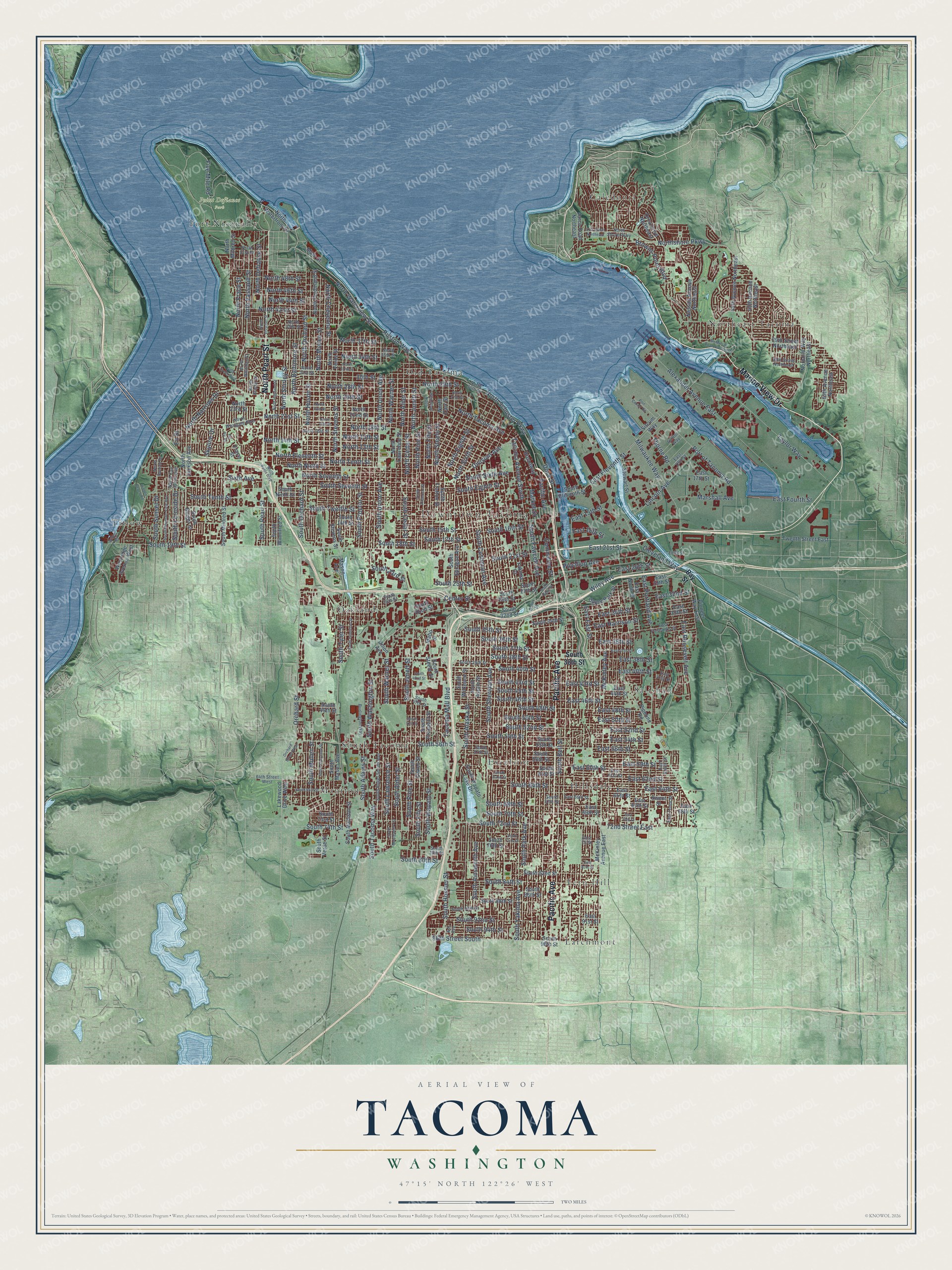
Tacoma, Washington Map Art
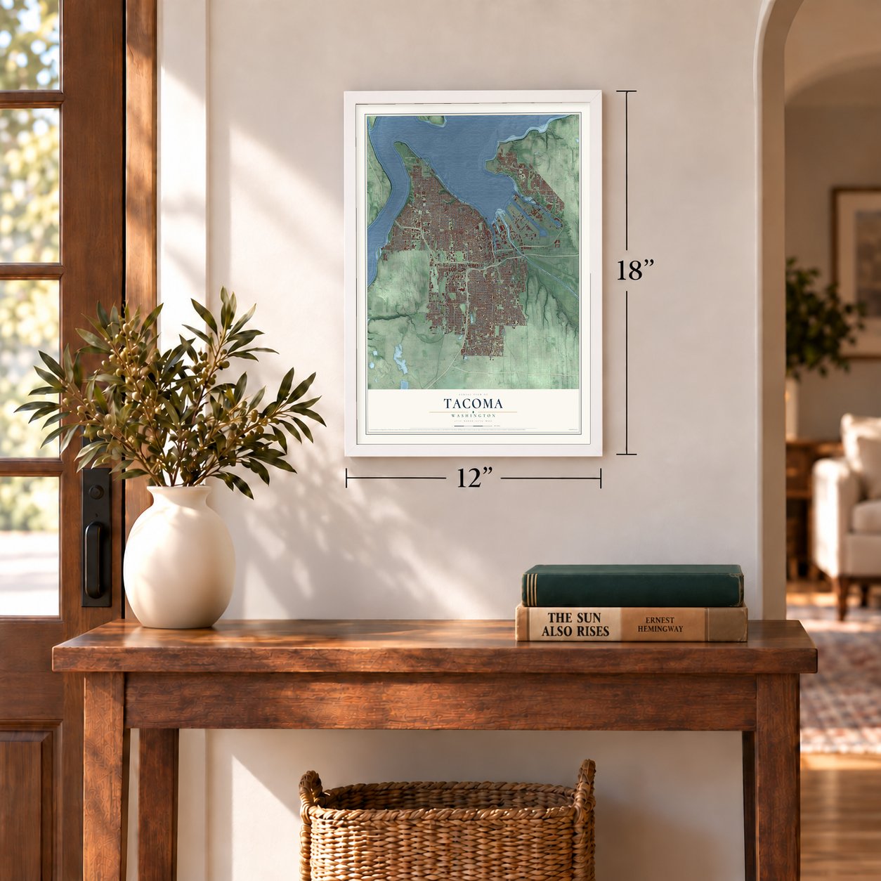
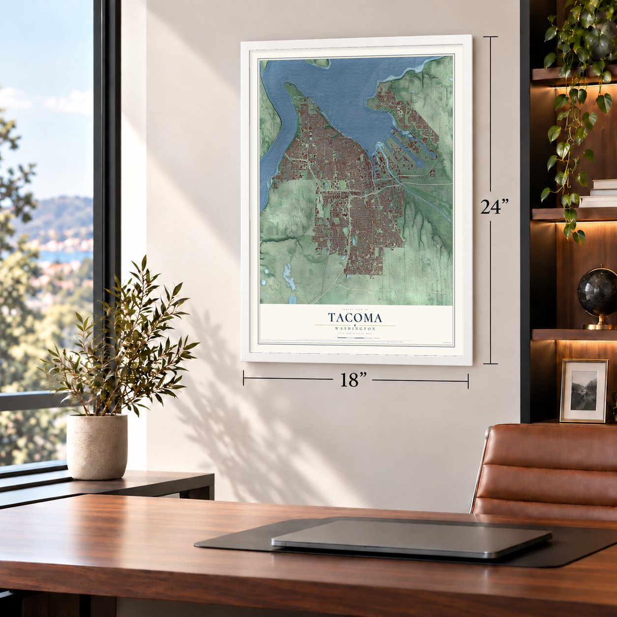
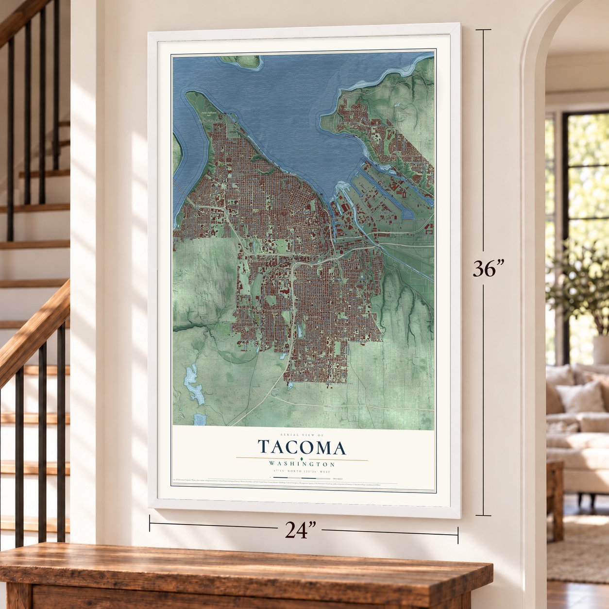
A new map of Tacoma, Washington, made in 2026 and printed to order on thick archival matte paper.
12" x 18" Archival Matte Print
A Map of Home. A Work of Art.
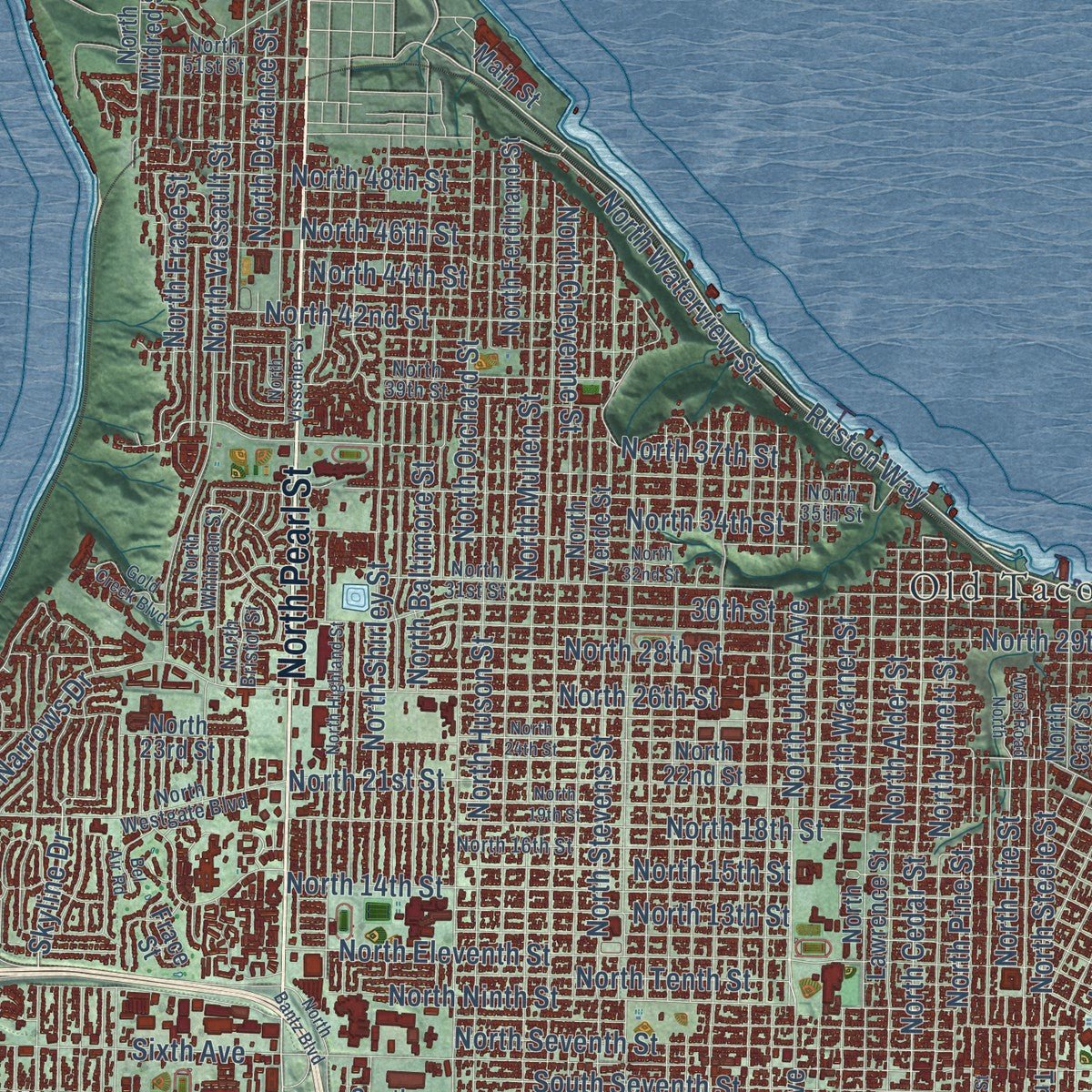
Explore Tacoma, Washington from a whole new perspective. Created using aerial imagery and detailed geographic data, this map captures Tacoma building by building, with labeled streets, familiar landmarks, and shaded topographical relief that highlights the natural contours of the landscape.
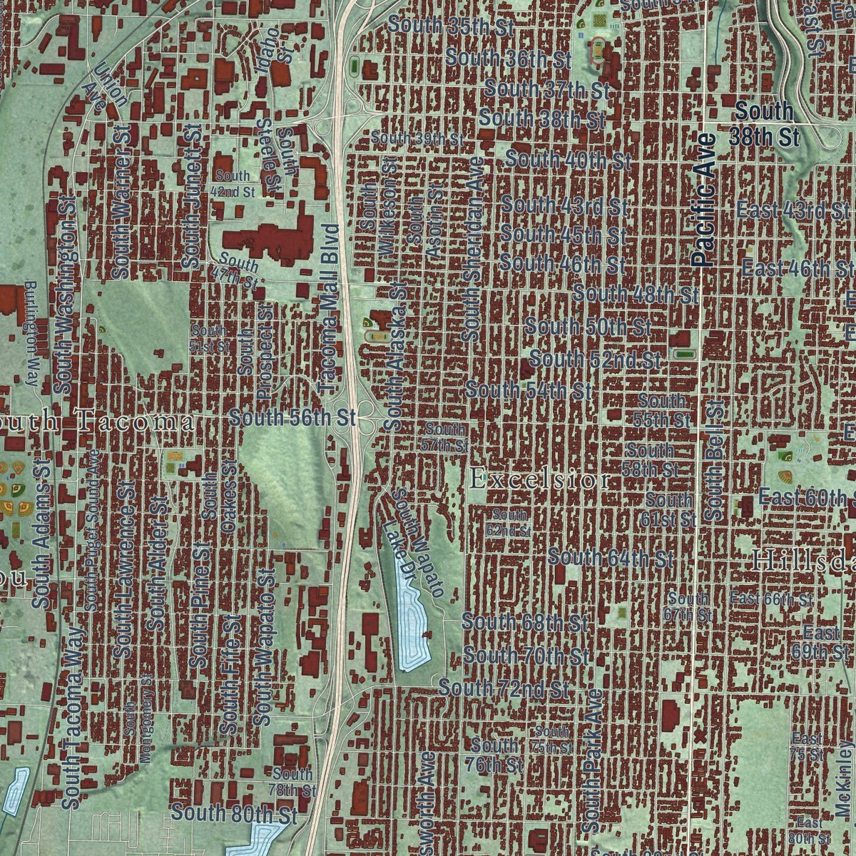
Combining modern data with the timeless character of a vintage atlas, this map is just as interesting up close as it is beautiful on the wall. Whether you grew up in Tacoma, spent memorable years there, or call it home today, this unique map is a great way to celebrate a place that means something to you. Zoom in on the preview to look for your street, and then order a print to put your memories on the wall.
Three ways to hang it
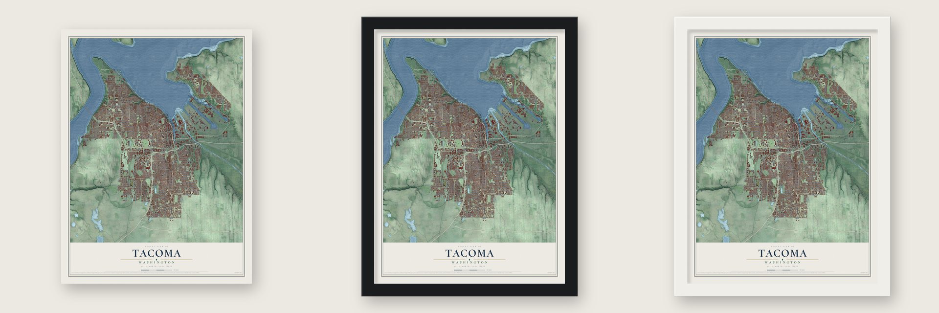
Unframed archival matte, a black wood frame or a white wood frame.
Up close
Geography Worth Displaying
This map was created using accurate cartographic data and authoritative geographic sources, including the U.S. Geological Survey and the Census Bureau. The map brings together terrain, waterways, roads, and building detail. The majority of the streets are labeled, houses are accurately depicted, and the topography is derived from government sources. Combining local data with carefully composed color and shading leads to this beautifully detailed Tacoma artwork for your wall.
Rather than simply showing street outlines, we’ve included as many of the street names as we could reasonably fit on the map while keeping their names legible. Zoom in on the high resolution preview to see exactly what’s on the map. We truly set out to create a statement piece for anyone who loves Tacoma. So whether it’s for you, or a gift for someone you love, we hope this map of Tacoma brings back fond memories.
Read the story behind this map of Tacoma, Washington from 2026.

About Tacoma, Washington
Tacoma is a city of 219,346 people and the county seat of Pierce County, set on bluffs above Commencement Bay. The Puyallup Tribe lived on the river delta here for thousands of years and called the area Squa-szucks. In 1852 a Swede named Nicholas Delin built a sawmill at the head of the bay, but its settlers fled during the Indian War of 1855-56 and never came back.
Job Carr, a Union Army veteran, came in 1864, and in 1868 he sold most of his land to the developer Morton McCarver. McCarver laid out Tacoma City and worked hard to win the Northern Pacific Railroad. In 1873 the railroad chose the bay for the western end of its line, but it built its depot two miles south and called that spot New Tacoma. The two towns stayed apart until the legislature joined them in January 1884. Between 1880 and 1890 the population jumped from 1,098 to 36,006.
“Seattle! Seattle! Death Rattle, Death Rattle; Tacoma! Tacoma! Aroma, Aroma”
- Named for the mountainPhillip Ritz, a Northern Pacific subcontractor, suggested the name, taken from a Native word for the snowy volcano that George Vancouver had called Rainier. Job Carr's son Anthony filed a "Tacoma" plat first, so McCarver added "City" to his. Tacoma's leaders then fought for decades to give the mountain the city's name. A bill passed the U.S. Senate in 1924, but it died in the House.
- The City of DestinyGeorge Francis Train, who lived in Tacoma for a few years, came up with the nickname "City of Destiny." In 1890 he set off on a trip around the world that began and ended in Tacoma, all to promote the city. A plaque downtown marks where he started and finished.
- Camp Lewis in 1917World War I filled the tideflats with shipyards, and Tacoma voters bought 70,000 acres on the Nisqually plain for the Army, which built Camp Lewis there. The camp later grew into Fort Lewis. In November 1918 the voters also created the Port of Tacoma.
- Powered by an aircraft carrierDuring a bitterly cold winter in 1929 and 1930, power dams shut down and Tacoma ran short of electricity for 30 days. The engines of the aircraft carrier USS Lexington kept the city supplied with power.
- Union Station, 1912The Northern Pacific joined the Union Pacific to build Union Station in 1912. Downtown declined in the decades after, and in 1991 the station became a federal courthouse, one of the first steps in the downtown's revival. It is on the National Register as Union Passenger Station.
Find your street
Names on the Tacoma map
Every name below is printed on this map. Look for your street, your school, the park where you played, or the pond down the road.
Places and landmarks15
- Downtown Tacoma
- Point Defiance Park
- Caledonia
- Excelsior
- Fern Hill
- Fort Nisqually
- Hillsdale
- Larchmont
- Manitou
- Northeast Tacoma
- Oakland
- Old Tacoma
Show all 15 places
- Salishan
- South Tacoma
- Titlow
Streets and roads306
- Marine View Drive
- North Pearl Street
- Pacific Avenue
- Tacoma Avenue South
- South 56th Street
- Ruston Way
- Browns Point Boulevard
- North 18th Street
- Dock Street
- Northshore Parkway
- North Schuster Parkway
- South Pearl Street
- North 34th Street
- East 15th Street
- Skyline Drive
- South Tacoma Way
- Five Mile Road
- South Cedar Street
- North Cedar Street
- South 72nd Street
- South 37th Street
- East Roosevelt Avenue
- North Defiance Street
- North Junett Street
- South 19th Street
- South Sheridan Avenue
- South Yakima Avenue
- South Fawcett Avenue
- East Portland Avenue
- South Cushman Avenue
Show all 306 streets
- Sixth Avenue
- South Alaska Street
- South Tyler Street
- South Pine Street
- North Tenth Street
- South Twelfth Street
- South Park Avenue
- North Ninth Street
- South Ainsworth Avenue
- North Eleventh Street
- East East Street
- South Lawrence Street
- South Eighth Street
- Center Street
- South Fife Street
- South 15th Street
- South 74th Street
- Alexander Avenue East
- South Mullen Street
- North Orchard Street
- South Tenth Street
- South Hosmer Street
- South Adams Street
- Orchard Street
- South 17th Street
- South Union Avenue
- Tacoma Mall Boulevard
- North 26th Street
- South Warner Street
- South Seventh Street
- South Junett Street
- North Eighth Street
- McKinley Avenue
- South Alder Street
- 30th Street
- South 48th Street
- South 64th Street
- South 38th Street
- North Cheyenne Street
- South Washington Street
- North Huson Street
- North Mullen Street
- North Stevens Street
- Port of Tacoma Road
- East Eleventh Street
- South Bell Street
- South 35th Street
- South 54th Street
- North Union Avenue
- North Seventh Street
- Taylor Way
- South 52nd Street
- North 21st Street
- North Vassault Street
- North 13th Street
- South 43rd Street
- South 45th Street
- South 68th Street
- North 29th Street
- North 28th Street
- South 36th Street
- Lincoln Avenue
- South 50th Street
- South 16th Street
- South 40th Street
- North 14th Street
- South 23rd Street
- South 70th Street
- North 15th Street
- North Shirley Street
- South 18th Street
- South 80th Street
- 72nd Street East
- East 64th Street
- North 37th Street
- Milwaukee Way
- South 25th Street
- North Baltimore Street
- East 34th Street
- North Narrows Drive
- South 46th Street
- North Alder Street
- South Proctor Street
- East 62nd Street
- South 92nd Street
- South 84th Street
- 96th Street South
- East 56th Street
- East 60th Street
- North Frace Street
- North Warner Street
- South 21st Street
- South Wapato Street
- North 42nd Street
- Commerce Street
- North 46th Street
- East 40th Street
- East Harrison Street
- East 26th Street
- East 43rd Street
- East 48th Street
- North Waterview Street
- East 46th Street
- East 38th Street
- East 32nd Street
- Puyallup Avenue
- East 52nd Street
- North 48th Street
- North Pine Street
- North Sixth Street
- North Tacoma Avenue
- South 94th Street
- Market Street
- South Sixth Avenue
- Division Avenue
- North Steele Street
- East 59th Street
- South Orchard Street
- East 54th Street
- East 50th Street
- East 36th Street
- North Fife Street
- East 18th Street
- Marshall Avenue
- Cleveland Way
- East Fourth Street
- South Fernside Drive
- South Sunset Drive
- Thorne Road
- East 21st Street
- Wiley Avenue
- North 44th Street
- Fir Street
- Bay Street
- North Waterfront Drive
- Broadway
- South 27th Street
- Lakewood Drive West
- Norpoint Way Northeast
- South Eleventh Street
- South Oakes Street
- South Ninth Street
- South Mason Avenue
- South Prospect Street
- South 58th Street
- South Asotin Street
- South Wilkeson Street
- South Madison Street
- South 14th Street
- North Ferdinand Street
- North Verde Street
- South 76th Street
- South Sprague Avenue
- South Stevens Street
- East North Street
- South Verde Street
- East 68th Street
- South Trafton Street
- North Lawrence Street
- McKinley Avenue East
- East 65th Street
- North 22nd Street
- South 34th Street
- South Steele Street
- East 35th Street
- South 49th Street
- South 28th Street
- Nassau Avenue Northeast
- East 44th Street
- North Mildred Street
- South 88th Street
- South 61st Street
- 49th Avenue Northeast
- North 23rd Street
- North Jackson Avenue
- South 82nd Street
- South Mildred Street
- 45th Avenue Northeast
- South 86th Street
- Pipeline Road
- Stewart Street
- South 55th Street
- East 17th Street
- East 67th Street
- East 29th Street
- South 73rd Street
- South Winnifred Street
- Twelfth Street East
- 29th Street Northeast
- Orca Drive Northeast
- South Wapato Lake Drive
- Sitcum Way
- Pioneer Way East
- South Geiger Street
- Westridge Avenue West
- Mason Avenue
- North Carr Street
- South 32nd Street
- East 69th Street
- 65th Avenue Northeast
- Upper Park Street
- East 91st Street
- Varco Road Northeast
- South Hood Street
- Yakima Court
- Sweet Street
- Frace Street
- Union Avenue
- Main Street
- South 96th Street
- Idaho Street
- North Shore Parkway
- Delin Street
- East 66th Street
- North 30th Street
- South Puget Sound Avenue
- North 31st Street
- North 35th Street
- North Bristol Street
- South 78th Street
- South 47th Street
- North 16th Street
- North Whitman Street
- East 61st Street
- South 39th Street
- North 39th Street
- South 90th Street
- East Fairbanks Street
- South 30th Street
- South 57th Street
- East 19th Street
- South 67th Street
- 25th Street Northeast
- East South Street
- Eells Street
- Burlington Way
- East 41st Street
- North 51st Street
- 64th Street West
- North Sunset Drive
- North Westgate Boulevard
- East Tonia Street
- Ashton Way
- North Karl Johan Avenue
- East 75 Street
- Ash Avenue
- South Delin Street
- 51st Street Northeast
- Orchard Street West
- North 27th Street
- South 66th Street
- North 24th Street
- North Highland Street
- South 62nd Street
- North 19th Street
- North Visscher Street
- South Cheyenne Street
- South Montgomery Street
- East 37th Street
- South 51st Street
- North 32nd Street
- South 42nd Street
- McMurray Road Northeast
- East 70th Street
- South Mountain View Avenue
- South Anderson Street
- South Gunnison Street
- Port Center Road
- South 75th Street
- Hidden Beach Road
- Gold Creek Boulevard
- West Road North
- North Bantz Boulevard
- Wilton Road
- Bel Air Road
- East 80th Street
Names are listed as they appear on the printed map. Zoom into the product photos to find them.
The art of mapping a place
How This Map Was Made
Real places. Remarkable detail. Discover the layers that turn geographic data into a map of home.

The view from above
Aerial imagery reveals the character of the land: woodland, open fields, and the patterns of a place.

The shape of the land
Elevation data brings hills, valleys, and subtle changes in the landscape into view.

The details of home
Roads, waterways, and building footprints come together to make the map feel unmistakably local.

Geography becomes art
Considered color, shading, and typography bring the layers together in a map made for your wall.


Process illustrated with Mendon, Massachusetts. Aerial imagery: USDA NAIP. Terrain: USGS 3D Elevation Program. Map details and finished artwork: KNOWOL.
The Details
About This Print
Choose an archival matte print, or a black or white Ayous wood frame. The archival matte print is unframed.
Select your size and finish above to see the matching product image and price.
Materials & Craftsmanship
A contemporary map with the character of a classic atlas, printed on archival matte paper. Optional frames are made from Ayous wood.
Your printed map does not include the watermark shown in the full-map preview.
Shipping & Delivery
Free shipping within the United States. Every print is made to order in the USA.
Buying a gift? Add a note in your cart and we'll include it. We never put prices in the package.
Prints ship within 2 to 3 business days. Allow 7 to 10 days total from ordering for delivery. Timing may vary during holidays or periods of high order volume.
Read our shipping policy.
Returns and damaged prints
Each print is made to order. Change-of-mind refunds are not available after production.
If your print arrives damaged, misprinted or incorrect, contact support@knowol.com within 30 days of receiving it. Include your order number, photos and a description of the issue.
Read our full refund and replacement policy. For questions about your order, email support@knowol.com.
Find your town
Looking for another city?
Find a map of home in our Washington collection, or any town in the country.
Nearby
Maps of towns near Tacoma
Know someone from one of these towns? Their map makes a great gift.
 Fircrest
, Washington
From $39.99See the map
 Browns Point
, Washington
From $39.99See the map
 Ruston
, Washington
From $39.99See the map
More maps nearby: Dash Point, University Place, Fife, Fife Heights and Waller.