
Search for another town





Free U.S. delivery 7 to 10 days after you order
Tampa, Florida Map Art
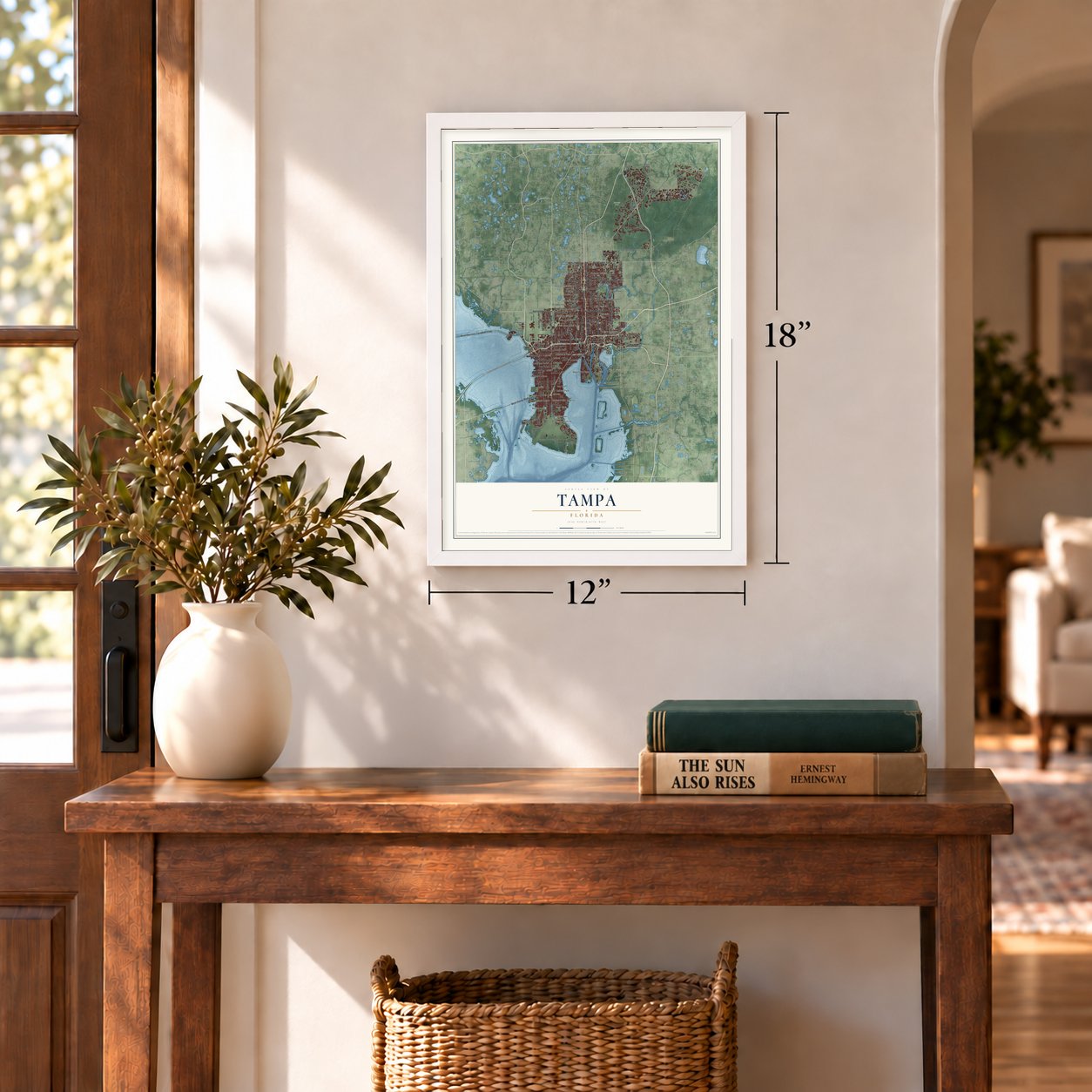
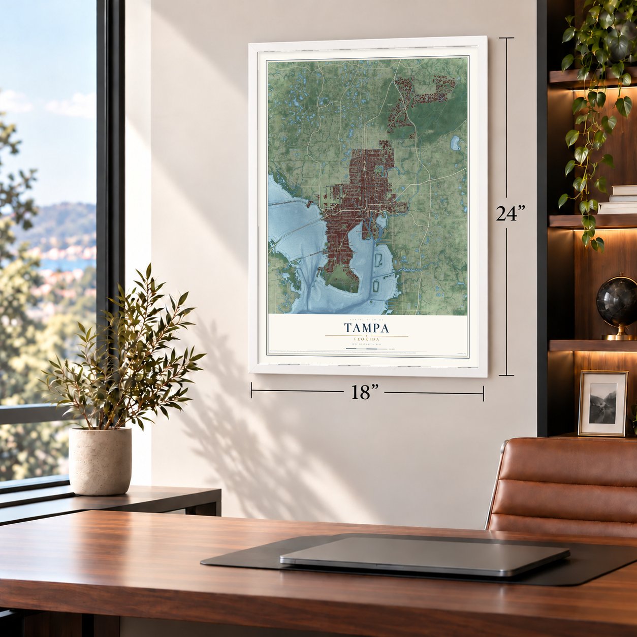
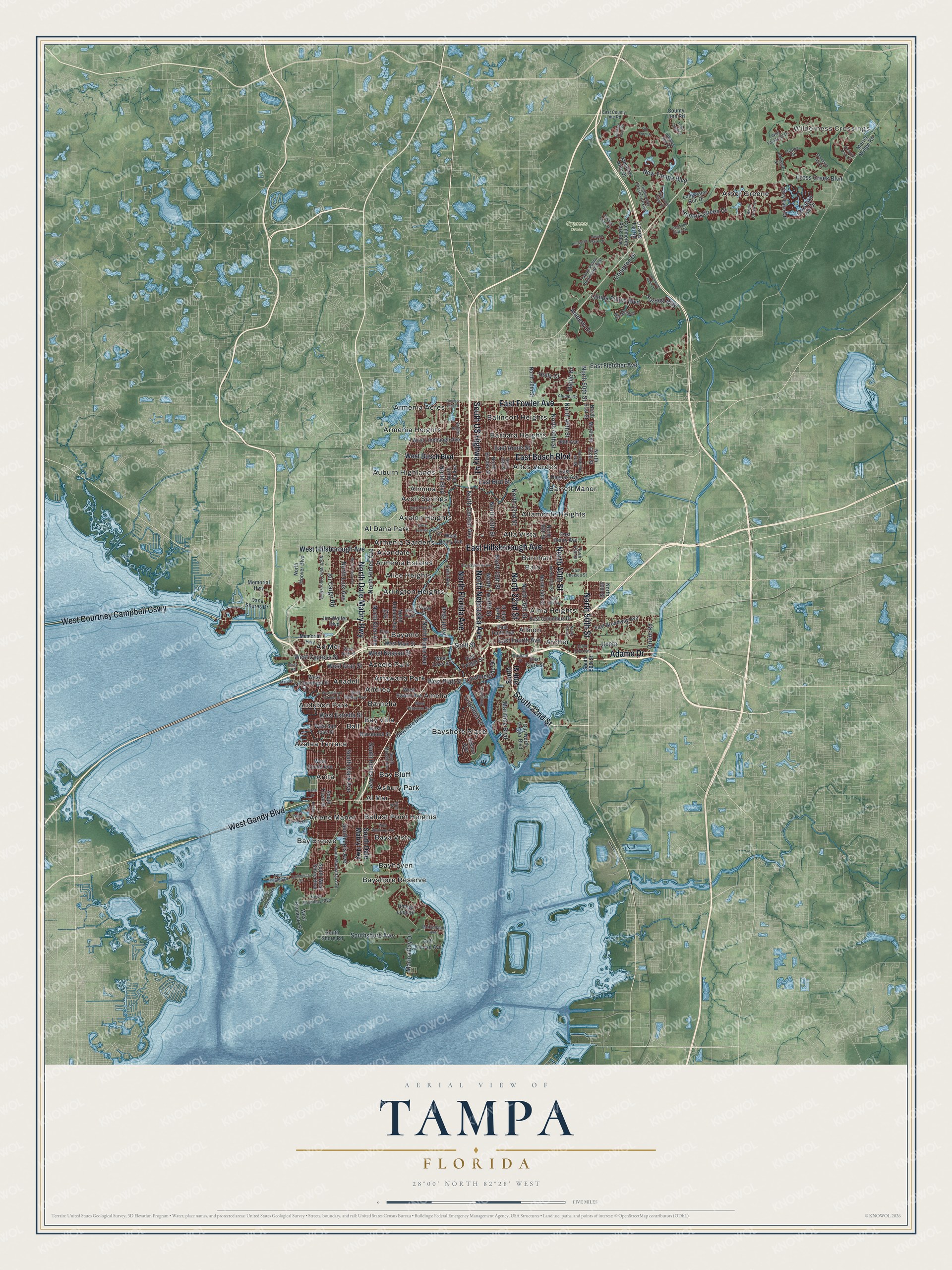
A new map of Tampa, Florida, made in 2026 and printed to order on thick archival matte paper.
12" x 18" Archival Matte Print
A Map of Home. A Work of Art.
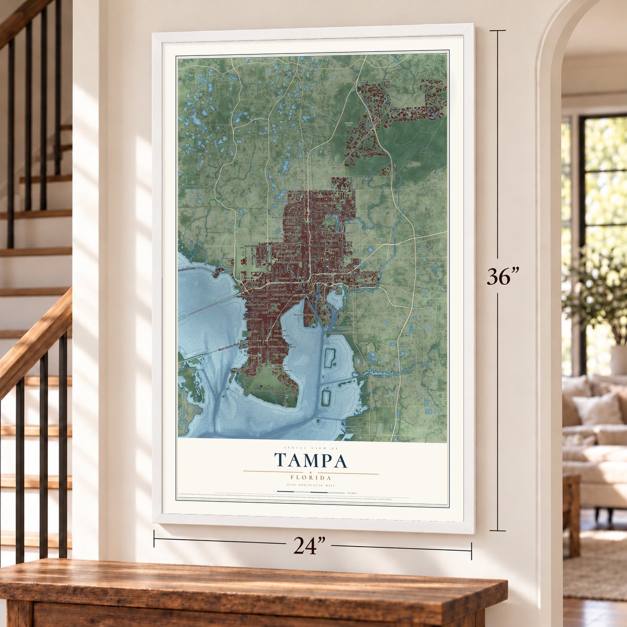
Explore Tampa, Florida from a whole new perspective. Created using aerial imagery and detailed geographic data, this map captures Tampa building by building, with labeled streets, familiar landmarks, and shaded topographical relief that highlights the natural contours of the landscape.
Combining modern data with the timeless character of a vintage atlas, this map is just as interesting up close as it is beautiful on the wall. Whether you grew up in Tampa, spent memorable years there, or call it home today, this unique map is a great way to celebrate a place that means something to you. Zoom in on the preview to look for your street, and then order a print to put your memories on the wall.
Three ways to hang it
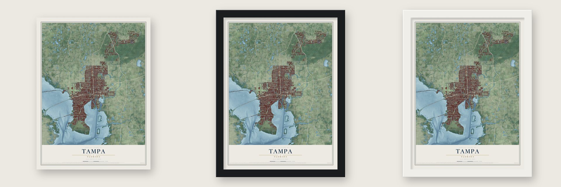
Unframed archival matte, a black wood frame or a white wood frame.
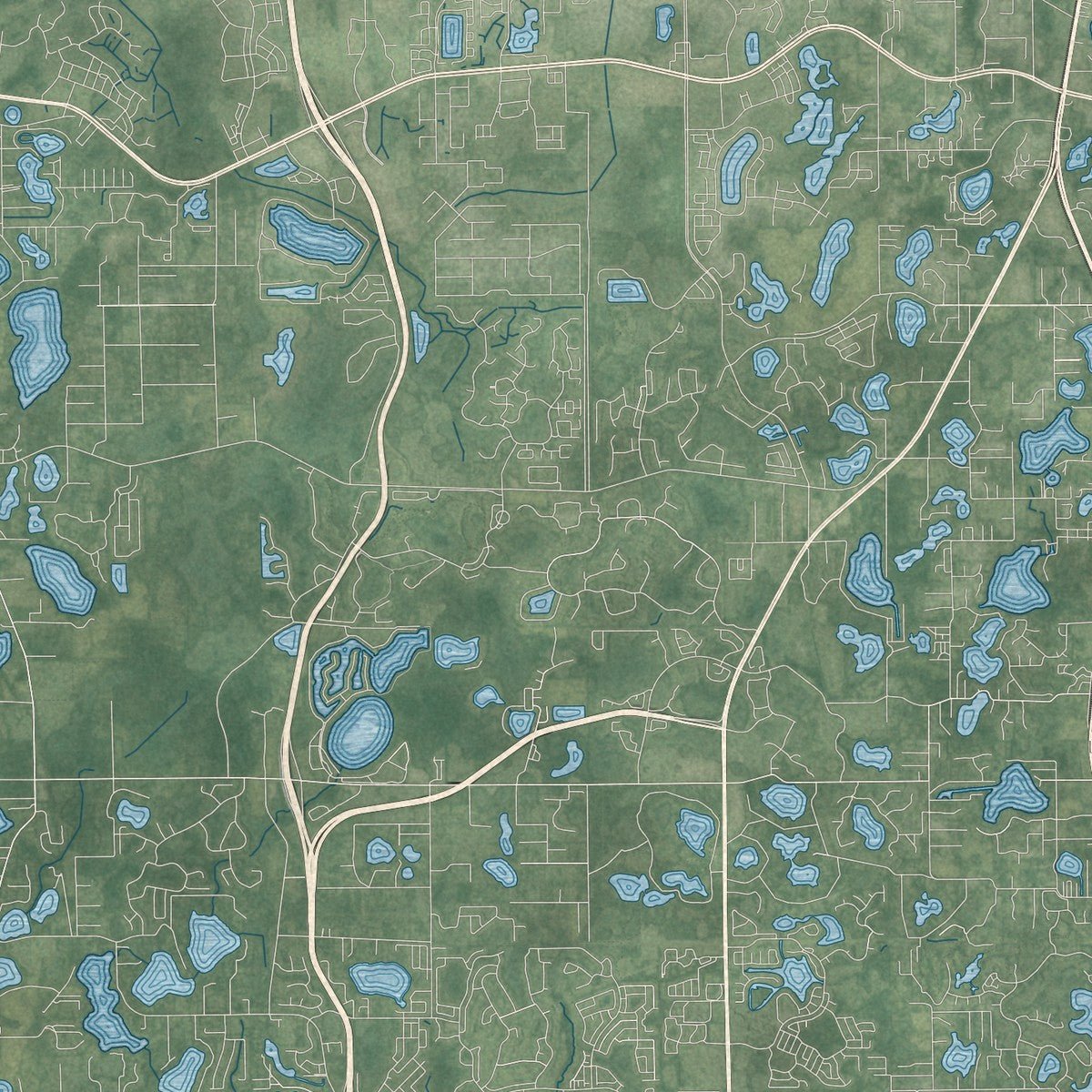
Up close
Geography Worth Displaying
This map was created using accurate cartographic data and authoritative geographic sources, including the U.S. Geological Survey (USGS) and FEMA. The map brings together terrain, waterways, roads, and building detail. The majority of the streets are labeled, houses are accurately depicted, and the topography is derived from government sources. Combining local data with carefully composed color and shading leads to this beautifully detailed Tampa artwork for your wall.
Rather than simply showing street outlines, we’ve included as many of the street names as we could reasonably fit on the map while keeping their names legible. Zoom in on the high resolution preview to see exactly what’s on the map. We truly set out to create a statement piece for anyone who loves Tampa. So whether it’s for you, or a gift for someone you love, we hope this map of Tampa brings back fond memories.
Explore the full map of Tampa, Florida and read about the local places it shows.
About Tampa, Florida
Tampa is the county seat of Hillsborough County, on the north shore of Tampa Bay, and the 2020 census counted 403,364 people there. The United States bought Florida from Spain in 1821, and in January 1824 the Army built Fort Brooke where the Hillsborough River meets the bay. Settlers gathered around the post, and on January 18, 1849, they incorporated it as the Village of Tampa, which people called Tampa Town until the name was cut to Tampa in 1855.
After the Civil War, Tampa was a poor fishing village, and repeated outbreaks of yellow fever drove more people away, so about 800 lived there in 1870 and about 700 in 1880. Everything changed in 1883. That year phosphate was found in the Bone Valley to the southeast, and late in the year Henry B. Plant's South Florida Railroad reached the town and its port. Cigar factories filled two newly built communities, Ybor City and West Tampa. Tampa was reincorporated as a city in 1887, and by 1900 it was one of Florida's biggest cities.
- Tanpa, a Calusa townHernando de Escalante Fontaneda was held by the Calusa for 17 years, and his memoirs hold the earliest record of the name, spelled Tanpa, as one of their important towns. Spanish maps marked the bay as B. Tampa as early as 1576. The name was first printed on a map in 1601, in Antonio de Herrera y Tordesillas's book, published in Madrid. No one knows what the word meant.
- Fishing camps on the bayBefore Florida came under American rule, the few people living here were Cuban and Native American fishermen who set up seasonal camps called ranchos along the shore. The biggest one stood at the mouth of Spanishtown Creek, in what is now the Hyde Park neighborhood along Bayshore Boulevard.
- Cannons in the riverOn June 30, 1862, the Union gunboat USS Sagamore traded fire with Confederate Fort Brooke for a few hours, then left with little harm done. In October 1863 Union troops landed under another bombardment and burned two blockade runners hidden up the Hillsborough. In May 1864 they came back, took the fort with little resistance, wrecked it, dumped its cannons in the river and left two days later. Two cannons now sit on the University of Tampa campus.
- The first TampeñosStarting in the late 1800s, people from Cuba, Italy and Spain came to build Ybor City and West Tampa and to work there. Around 1900 these newcomers had come to be called Tampeños, or Tampeñas for women. Their descendants still use the name at times, and it can also stretch to mean anyone from Tampa.
Find your street
Names on the Tampa map
Every name below is printed on this map. Look for your street, your school, the park where you played, or the pond down the road.
Places and landmarks49
- Wilderness Crossings
- Cypress Creek
- Ad Mer
- Al Dana Park
- Al Mar
- Albion
- Alice Heights
- Alma Heights
- Almima
- Alta Vista
- Altamonte Heights
- Altos Verdes
Show all 49 places
- Amelia
- Anadell
- Andrea
- Anita
- Arbor Greene
- Archer
- Arlene Manor
- Arlington Heights
- Armenia Acres
- Armenia Estates
- Armenia Gardens
- Armenia Heights
- Arrawana Park
- Asbury Park
- Auburn Highlands
- Audubon Park
- Avalon Heights
- Avon Springs
- Avondale
- Azalea Terrace
- Azeele Park
- Balincort Heights
- Ball
- Ballast Point Heights
- Balo
- Barbara Heights
- Barnelia
- Barnhart
- Barrett Manor
- Bay Bluff
- Bay Breeze
- Bay Villa
- Baya Vista
- Bayamo
- Bayhaven
- Bayshore Place
- Bayshore Reserve
Streets and roads171
- South US Highway 41
- North Florida Avenue
- North Nebraska Avenue
- North Dale Mabry Highway
- West Courtney Campbell Causeway
- Adamo Drive
- West Gandy Boulevard
- East Busch Boulevard
- East Fowler Avenue
- East Hillsborough Avenue
- South 22nd Street
- North 22nd Street
- North 50th Street
- North 40th Street
- North Rome Avenue
- North 15th Street
- North Central Avenue
- North Twelfth Street
- South Himes Avenue
- South Lois Avenue
- North 26th Street
- North 13th Street
- West Cypress Street
- South Clark Avenue
- North 46th Street
- North Himes Avenue
- East Fletcher Avenue
- North Boulevard
- West Gray Street
- Cross Creek Boulevard
Show all 171 streets
- Southshore Avenue
- West Nassau Street
- North Lois Avenue
- West Platt Street
- Tampa Palms Boulevard
- Amberly Drive
- New Tampa Boulevard
- North Glen Avenue
- Marina Bay Drive
- Maritime Boulevard
- East Bird Street
- East Annie Street
- Hunters Green Drive
- Air Cargo Road
- East Fourth Avenue
- West Estrella Street
- Compton Drive
- Channelside Drive
- Columbia Drive
- Yardley Way
- Scott Street
- Orient Road
- Holly Court
- Maple Drive
- Uceta
- South Dale Mabry Highway
- West Hillsborough Avenue
- South 20th Street
- West Busch Boulevard
- Bayshore Boulevard
- North 30th Street
- South West Shore Boulevard
- North Ola Avenue
- North 34th Street
- West Cleveland Street
- East Columbus Drive
- North Habana Avenue
- West Swann Avenue
- East Tenth Avenue
- North 16th Street
- South Trask Street
- North 36th Street
- Cory Lake Drive
- East Henry Avenue
- West Cass Street
- West Euclid Avenue
- East Broadway Avenue
- West Main Street
- South Shore Road
- West Boundary Street
- Morris Bridge Road
- West Henry Avenue
- North 52nd Street
- Lynn Avenue
- Golf Course Avenue
- West San Jose Street
- West Barcelona Street
- Guy North Verger Boulevard
- 98th Avenue
- North Brooks Street
- Hanger Loop Drive
- Commerce Park Boulevard
- North 51st Street
- West Linebaugh Avenue
- Cory Lake Isle Drive
- County Line Road
- Severn Avenue
- Dana Shores Drive
- North Hoover Boulevard
- East Regnas Avenue
- East Twiggs Street
- Longwater Run Drive
- Lizards Tail Road
- North 56th Street
- East Clark Street
- Jim Walter Boulevard
- Meadow Pine Drive
- Memorial Highway
- Myrtle Street
- Ivy Street
- Coral Street
- South Macdill Avenue
- South Manhattan Avenue
- North 18th Street
- East Chelsea Street
- West Tyson Avenue
- North West Shore Boulevard
- North 37th Street
- West Arch Street
- North Boundary Boulevard
- West Watrous Avenue
- Tampa Palms Boulevard West
- North 47th Street
- Highwoods Preserve Parkway
- East County Line Road
- Maclaurin Drive
- Picnic Island Boulevard
- Alumni Drive
- North Hyaleah Road
- Wild Tamarind Drive
- Ashley Street
- Lucaya Drive
- Pine Street
- McClelland Avenue
- West McKay Avenue
- Port Tampa Drive
- Beneficial Drive
- Arbor Creek Drive
- West Ivy Street
- Durham Street
- Umbria Hill Drive
- Portside Street
- Devon Park Drive
- Zion Street
- Gray Road
- South 50th Street
- East Osborne Avenue
- East 26th Avenue
- North Grady Avenue
- North 43rd Street
- Plantation Bay Drive
- Pictorial Park Drive
- Commerce Street
- West Wyoming Avenue
- Emerald Chase Drive
- West Flora Street
- Heritage Point Drive
- West Jean Street
- Lockwood Ridge Drive
- Burniston Drive
- Trout Creek Drive
- Country Club Drive
- Colchester Palms Drive
- Mariner Street
- West Sylvan Ramble Street
- Acline Drive East
- Richmond Place Drive
- Bridge Street
- River Terrace
- Old Town Drive
- Canal Drive
Names are listed as they appear on the printed map. Zoom into the product photos to find them.
The art of mapping a place
How This Map Was Made
Real places. Remarkable detail. Discover the layers that turn geographic data into a map of home.

The view from above
Aerial imagery reveals the character of the land: woodland, open fields, and the patterns of a place.

The shape of the land
Elevation data brings hills, valleys, and subtle changes in the landscape into view.

The details of home
Roads, waterways, and building footprints come together to make the map feel unmistakably local.

Geography becomes art
Considered color, shading, and typography bring the layers together in a map made for your wall.


Process illustrated with Mendon, Massachusetts. Aerial imagery: USDA NAIP. Terrain: USGS 3D Elevation Program. Map details and finished artwork: KNOWOL.
The Details
About This Print
Choose an archival matte print, or a black or white Ayous wood frame. The archival matte print is unframed.
Select your size and finish above to see the matching product image and price.
Materials & Craftsmanship
A contemporary map with the character of a classic atlas, printed on archival matte paper. Optional frames are made from Ayous wood.
Your printed map does not include the watermark shown in the full-map preview.
Shipping & Delivery
Free shipping within the United States. Every print is made to order in the USA.
Buying a gift? Add a note in your cart and we'll include it. We never put prices in the package.
Prints ship within 2 to 3 business days. Allow 7 to 10 days total from ordering for delivery. Timing may vary during holidays or periods of high order volume.
Read our shipping policy.
Returns and damaged prints
Each print is made to order. Change-of-mind refunds are not available after production.
If your print arrives damaged, misprinted or incorrect, contact support@knowol.com within 30 days of receiving it. Include your order number, photos and a description of the issue.
Read our full refund and replacement policy. For questions about your order, email support@knowol.com.
Find your town
Looking for another city?
Find a map of home in our Florida collection, or any town in the country.
Nearby
Maps of towns near Tampa
Know someone from one of these towns? Their map makes a great gift.
 Riverside Heights
, Florida
From $39.99See the map
 Tampa Heights
, Florida
From $39.99See the map
 Wellswood
, Florida
From $39.99See the map
More maps nearby: South Seminole Heights, Southeast Seminole Heights, Hyde Park, Harbour Island and Drew Park.