
Search for another town

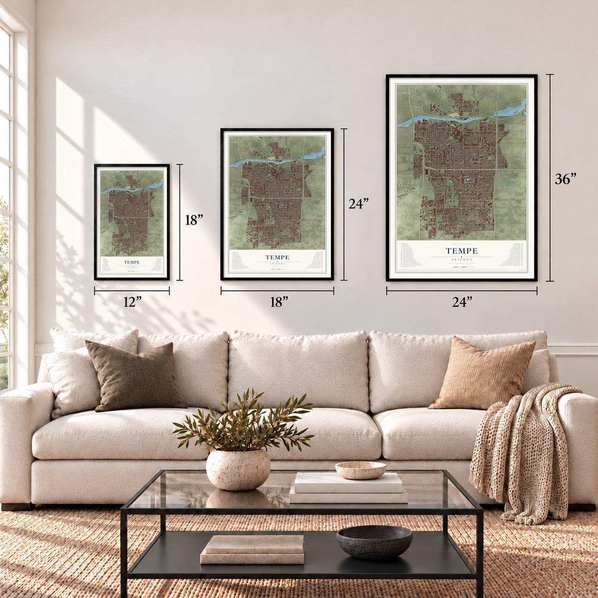

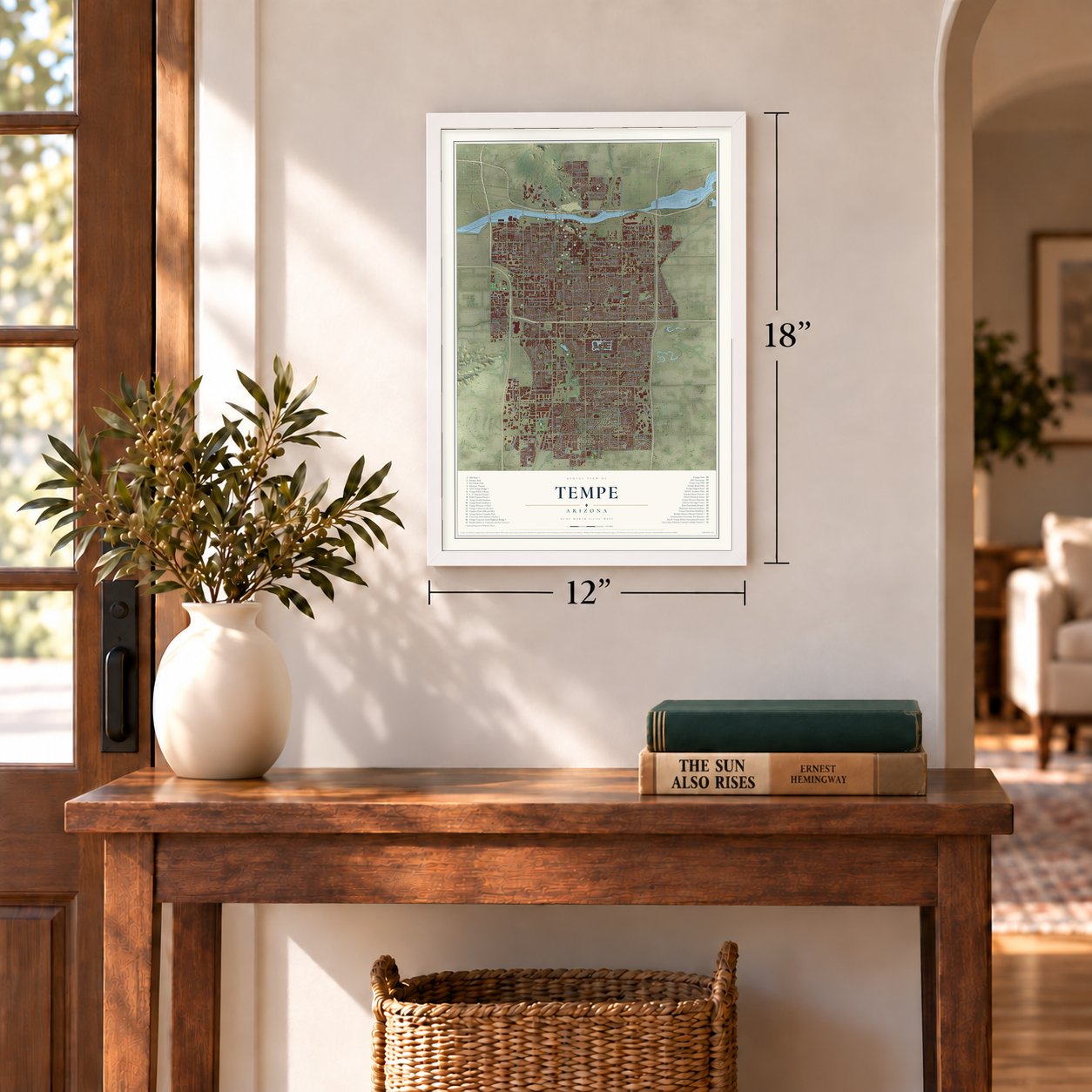
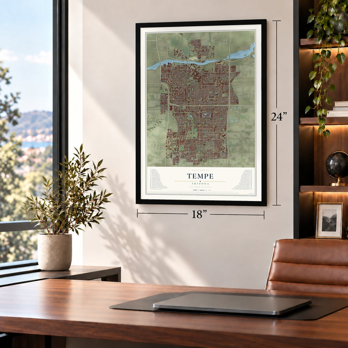
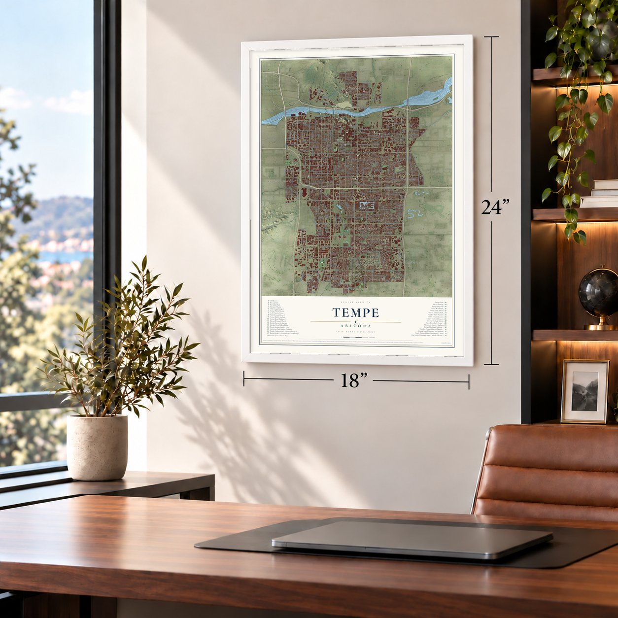


Free U.S. delivery 7 to 10 days after you order
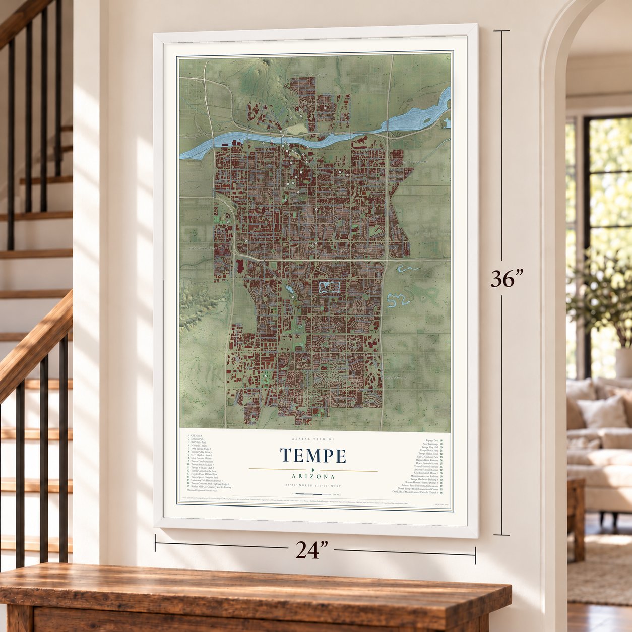
Tempe, Arizona Map Art
Building by building, with labeled streets and shaded relief.
12" x 18" Archival Matte Print
A Map of Home. A Work of Art.
Explore Tempe, Arizona from a whole new perspective. Created using aerial imagery and detailed geographic data, this map captures Tempe building by building, with labeled streets, familiar landmarks, and shaded topographical relief that highlights the natural contours of the landscape.
Combining modern data with the timeless character of a vintage atlas, this map is just as interesting up close as it is beautiful on the wall. Whether you grew up in Tempe, spent memorable years there, or call it home today, this unique map is a great way to celebrate a place that means something to you. Zoom in on the preview to look for your street, and then order a print to put your memories on the wall.

Three ways to hang it
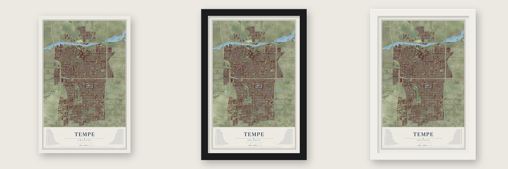
Unframed archival matte, a black wood frame or a white wood frame.
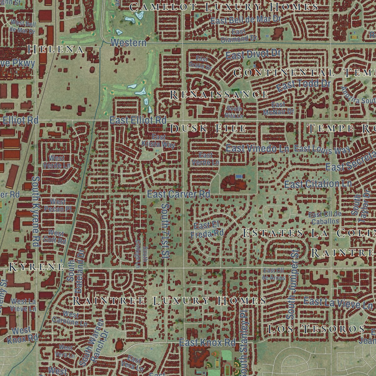
Up close
Geography Worth Displaying
This map was created using accurate cartographic data and authoritative geographic sources, including the U.S. Geological Survey (USGS) and FEMA. The map brings together terrain, waterways, roads, and building detail. The majority of the streets are labeled, houses are accurately depicted, and the topography is derived from government sources. Combining local data with carefully composed color and shading leads to this beautifully detailed Tempe artwork for your wall.
Rather than simply showing street outlines, we’ve included as many of the street names as we could reasonably fit on the map while keeping their names legible. Zoom in on the high resolution preview to see exactly what’s on the map. We truly set out to create a statement piece for anyone who loves Tempe. So whether it’s for you, or a gift for someone you love, we hope this map of Tempe brings back fond memories.
Explore the full map of Tempe, Arizona and read about the local places it shows.

Find your street
Names on the Tempe map
Every name below is printed on this map. Look for your street, your school, the park where you played, or the pond down the road.
Places and landmarks22
- Tempe Community Council
- Kyrene
- The Landings
- Wheel Inn Ranch
- Estates La Colina
- Contempo Tempe
- McClintock Manor
- Tempe Cascade
- Helena
- Los Tesoros
- Camelot Luxury Homes
- Marlborough Park
Show all 22 places
- Tempe Junction
- Peterson
- Normal Junction
- Tempe Royal Palms
- Renaissance
- Raintree Luxury Homes
- Raintree
- Continental Tempe
- Orangetree
- Dusk File
Streets and roads293
- South Mill Avenue
- South Los Feliz Drive
- East Warner Road
- East Elliot Road
- West Broadway Road
- West Southern Avenue
- West Elliot Road
- West Warner Road
- East Knox Road
- South College Avenue
- South Terrace Road
- East Southern Avenue
- East Broadway Road
- East Guadalupe Road
- East Fifth Street
- East Divot Drive
- South Price Road
- South Rural Road
- South McClintock Drive
- South Hardy Drive
- South Priest Drive
- Hardy Drive
- South Kyrene Road
- Western
- Highline Canal
- South Roosevelt Street
- South Ash Avenue
- South Country Club Way
- South River Drive
- South Beck Avenue
Show all 293 streets
- East Apache Boulevard
- East University Drive
- South Dorsey Lane
- South Lakeshore Drive
- East Rio Salado Parkway
- North Mill Avenue
- East Hermosa Drive
- East La Jolla Drive
- East Baseline Road
- South Juniper Street
- South Farmer Avenue
- West University Drive
- South 48th Street
- East Watson Drive
- East Concorda Drive
- West Baseline Road
- South Wilson Street
- North Price Road
- East Minton Drive
- South Stanley Place
- South 52nd Street
- East Laguna Drive
- West Alameda Drive
- South Evergreen Road
- East Fremont Drive
- East Curry Road
- West 14th Street
- East Geneva Drive
- East Carson Drive
- West First Street
- East La Vieve Lane
- East Lemon Street
- North Scottsdale Road
- West Fairmont Drive
- North Priest Drive
- Western Canal
- East Carver Road
- West Rio Salado Parkway
- East Vinedo Lane
- East McKellips Road
- East Secretariat Drive
- North 68th Street
- East Libra Drive
- East Ellis Drive
- East Oxford Drive
- East Orange Street
- East Don Carlos Avenue
- East Gemini Drive
- East Citation Lane
- East Bishop Drive
- West 16th Street
- West Tenth Place
- East Cornell Drive
- West Geneva Drive
- West Washington Street
- South Harl Avenue
- West 13th Street
- East Ranch Road
- East Carter Drive
- West Ninth Street
- East Weber Drive
- West Guadalupe Road
- South George Drive
- North Miller Road
- East Westchester Drive
- West Third Street
- East Southshore Drive
- North McClintock Drive
- West Grove Parkway
- East Todd Drive
- East Vaughn Street
- South 71st Street
- Auto Drive
- West Manhatton Drive
- West Vineyard Road
- West 17th Street
- West Santa Cruz Drive
- East Papago Drive
- East Fillmore Street
- East Broadway Lane
- South 55th Street
- East Tempe Drive
- East Spence Avenue
- East Golf Avenue
- East Victory Drive
- West 23rd Street
- South 60th Street
- East Third Street
- East Howe Avenue
- East Garfield Street
- North 56th Street
- East Laird Street
- California
- Quail Lane
- East Dunbar Drive
- South Myrtle Avenue
- South Margo Drive
- East Alameda Drive
- South McKemy Street
- East Manhatton Drive
- South La Rosa Drive
- South Maple Avenue
- East Broadmor Drive
- South McAllister Avenue
- East Del Rio Drive
- East Pebble Beach Drive
- South Elm Street
- East Balboa Drive
- East Caroline Lane
- East Malibu Drive
- South Taylor Drive
- East Riviera Drive
- South Palm Drive
- South Dateland Drive
- West Twelfth Street
- South Oak Street
- Ehrdardt Mhp
- South Arizona Mills Circle
- West Fifth Street
- West Tenth Street
- East Bell de Mar Drive
- East Eighth Street
- South Dromedary Drive
- East Louis Way
- West Knox Road
- East El Parque Drive
- South Cottonwood Drive
- East Julie Drive
- East Sesame Street
- South Bala Drive
- South River Parkway
- East Redfield Road
- East Sixth Street
- South Smith Road
- West Twelfth Place
- West Myrna Lane
- West Seventh Street
- South Fair Lane
- South El Camino Drive
- East Mc Kellips Street
- West Sixth Street
- West Cornell Drive
- West Courtney Lane
- East Jeanine Drive
- South Mitchell Drive
- West Fourth Street
- East Yale Drive
- East Cedar Street
- South Warner Ranch Drive
- East Tulane Drive
- East El Freda Road
- South Cutler Drive
- West 15th Street
- West 17th Place
- West Julie Drive
- South Potter Drive
- North Project Drive
- East Erie Drive
- West Carver Road
- South Wendler Drive
- West Project Drive
- Highline Canal South Branch
- East 14th Street
- East 15th Street
- Roosevelt Street
- West Stacey Lane
- East Alexander Boulevard
- South Perry Lane
- East Campo Allegre
- East Playa del Norte Drive
- West Medtronic Way
- West Lodge Drive
- South Lola Lane
- South Park Lane
- East Hayden Lane
- East McArthur Drive
- West Erie Drive
- West La Donna Drive
- East Hudson Drive
- South Sunrise Drive
- Manor Street
- West 21st Street
- East Aepli Drive
- Indian Wells
- East Hall Street
- North Bull Run
- West 22nd Street
- Keres Drive
- East Frost Drive
- East Cll Carmen
- West Kelly Lane
- South Test Drive
- East Encanto Drive
- South Kenwood Lane
- South Forest Avenue
- East Loma Vista Drive
- East Palmcroft Drive
- East McNair Drive
- East Loyola Drive
- East Cll de Caballos
- East Diamond Drive
- East La Donna Drive
- East Krista Way
- West Vaughn Street
- West La Vieve Lane
- East Orion Street
- West Fremont Drive
- South Hohokam Drive
- East Tenth Street
- West Caroline Lane
- East Apollo Avenue
- East Duke Drive
- Anozira South Parkway
- West Lisa Lane
- West Tulane Drive
- West Pecan Place
- East Vera Lane
- West Diamond Drive
- West Verde Lane
- South Diablo Way
- West Pinto Drive
- Frontage Road
- West Colt Road
- East Verde Lane
- Stacey Lane
- Palo Verde
- Hohokam Expressway
- South Butte Avenue
- South Rita Lane
- South Clark Drive
- South Siesta Lane
- South Grandview Avenue
- East Campus Drive
- East Drake Drive
- West Hermosa Drive
- East Greenway Drive
- East Cll de Arcos
- West La Jolla Drive
- East Harvard Drive
- West Bell de Mar Drive
- South Edward Drive
- West Vera Lane
- West Ranch Road
- North Loop Drive
- North La Rosa Drive
- West Greentree Drive
- West Laguna Drive
- West Yale Drive
- West Todd Drive
- East Sandpiper Drive
- East Lilac Drive
- East Radcliffe Drive
- West Ellis Drive
- North Stadem Drive
- West Operations Drive
- West Dunbar Drive
- West 24th Street
- Parkside Drive
- McClintock Drive
- South Hu Esta Drive
- South College Lane
- East Kelly Lane
- La Jolla Drive
Names are listed as they appear on the printed map. Zoom into the product photos to find them.
About Tempe, Arizona
Tempe is a city of 180,587 people in Maricopa County, on the Salt River, and Arizona State University has its main campus here. The Hohokam farmed this ground with canals and left their settlements in the 15th century. After the Army set up Fort McDowell upriver in 1865, soldiers and Hispanic workers hired to raise crops and feed for it camped beside the river. Their two camps became Hayden's Ferry, west of the butte, and San Pablo, east of it.
Charles T. Hayden's cable ferry became the main river crossing in the area, and on his land along the south bank he also ran a grist mill and a general store. His Hayden Flour Mill later gave Mill Avenue its name. Pioneer Darrell Duppa likened the valley by the butte to Greece's Vale of Tempe, below Mount Olympus, and the town took that name in 1879. The Maricopa and Phoenix Railroad bridged the river here in 1887, and Maricopa County's supervisors made Tempe an incorporated town in 1894.
- A teachers' school in 1885Charles Hayden pushed for a school to train teachers, and in 1885 the 13th Arizona Territorial Legislature picked Tempe for the Territorial Normal School. The school changed names as it grew: Arizona Normal School, then Arizona State Teachers College, then Arizona State College, and at last Arizona State University.
- Carl Hayden's birthplaceThe Hayden family built an adobe home here in the early 1870s, and their son Carl, later Arizona's longtime U.S. senator, came into the world there. After the family left in 1889, the house served boarders until 1924, then opened as a restaurant. In 1954 Leonard Monti bought it and ran it as Monti's La Casa Vieja, "the old house," until 2014.
- A MountainIn 1961 the city named its butte Hayden Butte, for Charles and Carl Hayden, though most people call it A Mountain for the gold A on its south face. Federal maps still list it as Tempe Butte, and its top rises to 1,495 feet. The O'odham call it ʼOidbaḍ Doʼag, which translates as "Dead Field Mountain."
- From creamery to breweryThe Borden Milk Co. Creamery and Ice Factory opened making ice and was later changed to bottle pasteurized milk as well. It carried the Borden name from 1927 until it shut down in 1953, then stood idle until the Four Peaks Brewery brought it back into use. Its nine red brick Mission Revival buildings joined the National Register in 1984, and in 1999 the city named a new park Creamery Park.
- A barrier broken in 1965For about 90 years after Tempe's founding in 1871, African Americans could work in town but had to make their homes somewhere else. That changed in 1965, when Warren and Carol Livingston became the first African American couple to own property in Tempe.
Keep exploring Arizona
Tempe is one of 528 Arizona towns we've mapped. Every dot on the map is a print of its own.
The search covers every state, Arizona first.
Near Tempe
Order 2 or more town maps and save 10%. Shown in the size and finish you picked above, so they hang as a set.
- Guadalupe 12" x 18" / Archival Matte Print $39.99
- Salt River 12" x 18" / Archival Matte Print $39.99
- Central City 12" x 18" / Archival Matte Print $39.99


More maps nearby: Ahwatukee Foothills, Chandler, Camelback East, Lehi and Encanto.
The art of mapping a place
How This Map Was Made
Real places. Remarkable detail. Discover the layers that turn geographic data into a map of home.

The view from above
Aerial imagery reveals the character of the land: woodland, open fields, and the patterns of a place.

The shape of the land
Elevation data brings hills, valleys, and subtle changes in the landscape into view.

The details of home
Roads, waterways, and building footprints come together to make the map feel unmistakably local.

Geography becomes art
Considered color, shading, and typography bring the layers together in a map made for your wall.


Process illustrated with Mendon, Massachusetts. Aerial imagery: USDA NAIP. Terrain: USGS 3D Elevation Program. Map details and finished artwork: KNOWOL.
The Details
About This Print
Choose an archival matte print, or a black or white Ayous wood frame. The archival matte print is unframed.
Select your size and finish above to see the matching product image and price.
Materials & Craftsmanship
A contemporary map with the character of a classic atlas, printed on archival matte paper. Optional frames are made from Ayous wood.
Your printed map does not include the watermark shown in the full-map preview.
Shipping & Delivery
Free shipping within the United States. Every print is made to order in the USA.
Buying a gift? Add a note in your cart and we'll include it. We never put prices in the package.
Prints ship within 2 to 3 business days. Allow 7 to 10 days total from ordering for delivery. Timing may vary during holidays or periods of high order volume.
Read our shipping policy.
Returns and damaged prints
Each print is made to order. Change-of-mind refunds are not available after production.
If your print arrives damaged, misprinted or incorrect, contact support@knowol.com within 30 days of receiving it. Include your order number, photos and a description of the issue.
Read our full refund and replacement policy. For questions about your order, email support@knowol.com.