
Tomblesons Thames River Map
Beautifully designed. Printed on archival paper for modern walls.
Archival print promise
- Free U.S. shipping: every order ships free and is backed by a 30 day replacement guarantee.
- Museum-quality paper: rich color, fine detail, and a premium feel.
- Packed for safe delivery: unframed prints ship in sturdy tubes; framed prints ship in padded boxes.
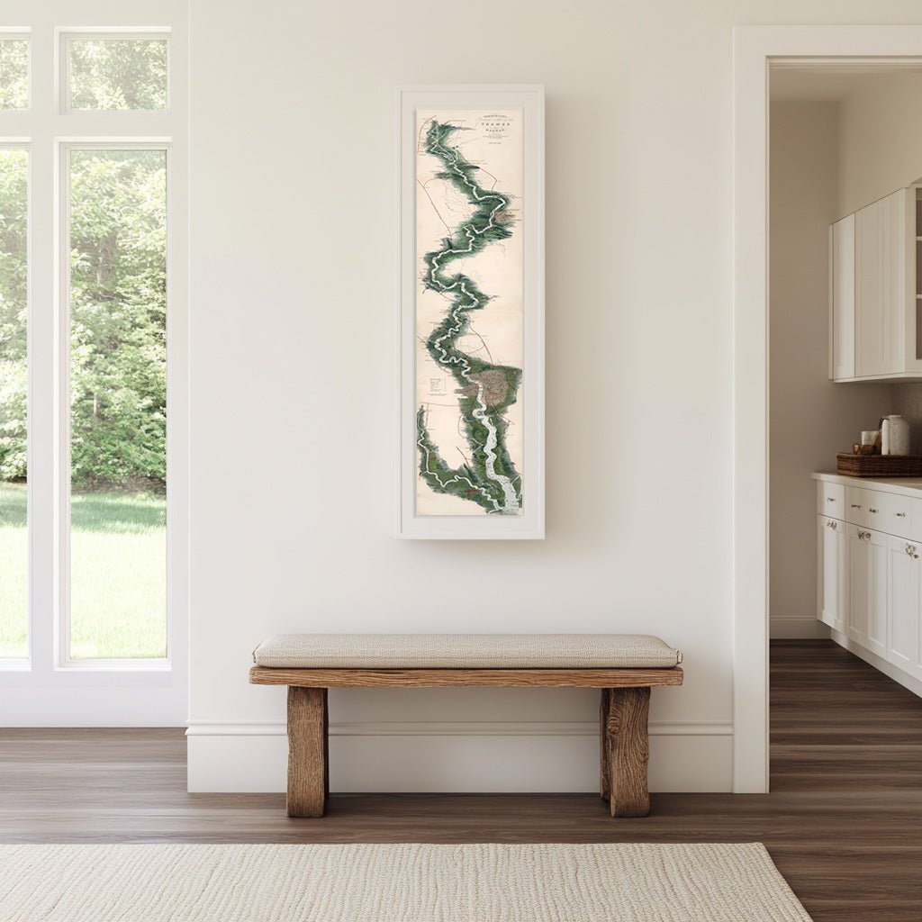
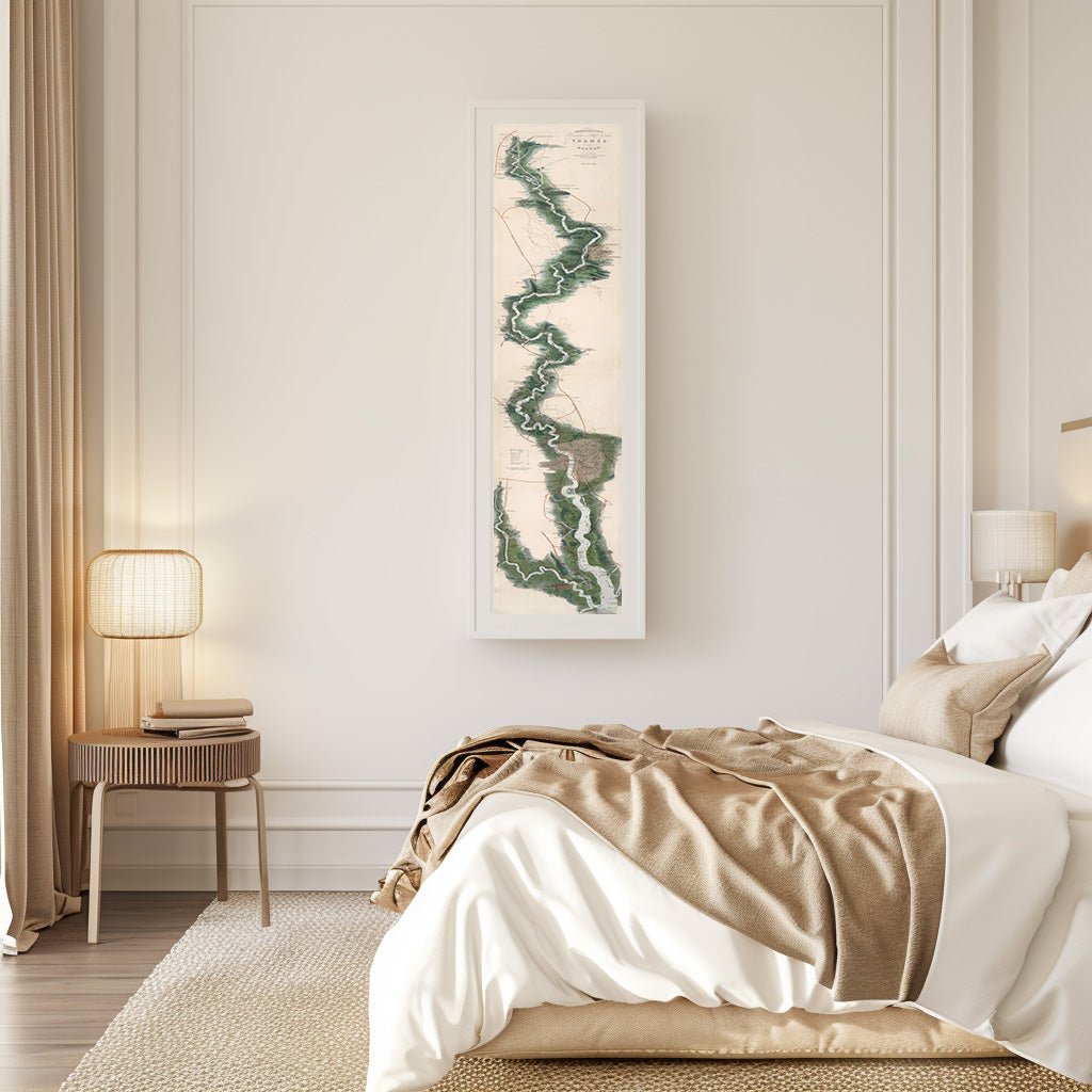
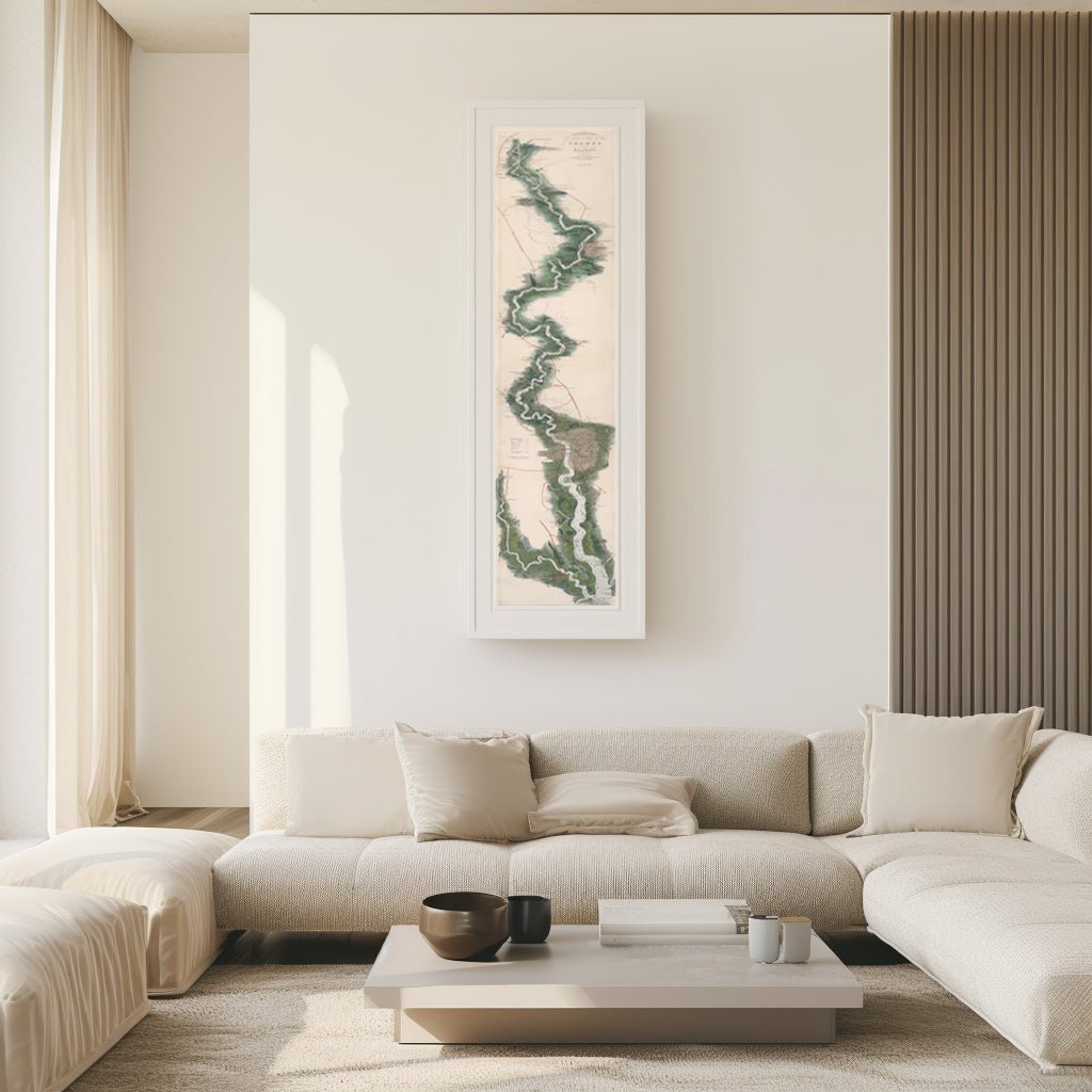
"Tombleson’s Thames River" map is a remarkable depiction of England’s most iconic river. Created in the early 19th century by William Tombleson, this map is a masterpiece of Victorian-era cartography, celebrated for its intricate detail and artistic charm. The map traces the Thames from its source in the Gloucestershire countryside to its final destination in the bustling port of London, showcasing not only the river's course but also its surrounding landscapes, historical landmarks, and bustling towns.
Tombleson’s work was part of a larger series that celebrated the picturesque rivers of Great Britain, aimed at capturing the imagination of both travelers and locals. The map serves as a historical record, offering a window into the early 19th-century view of the Thames, a river that has inspired poets, painters, and adventurers for centuries. Today, Tombleson’s Thames map remains a cherished artifact, revered by historians, collectors, and enthusiasts of vintage cartography, offering a timeless glimpse into the heart of England's waterways.
The Details
About This Print
🌲 Gallery-Quality Materials: Archival matte paper and optional solid, sustainably sourced Ayous wood frame.
✨ Shatterproof Protection: Crystal-clear Acrylite shield blocks glare and resists damage.
🛠️ Ready to Hang: Arrives at your door fully assembled and ready for the wall.
📦 Fast & Safe Shipping: Securely packaged to ensure flawless delivery.
Materials & Craftsmanship
The Unframed Print
Carefully restored from the original artwork and reproduced using gallery-quality, fade-resistant inks. Printed on heavyweight, museum-grade archival paper, this is the ideal choice if you prefer to use your own custom frame. KNOWOL reproductions are beautifully restored works of art.
The Framed Upgrade
Crafted from solid Ayous wood sourced from renewable forests, a sustainable, exotic timber that is lightweight and incredibly warp-resistant. Featuring a sleek 0.75″ profile in your choice of finish. Protected by premium Acrylite. Unlike cheap, heavy glass, our Acrylite is shatterproof, exceptionally clear, and lightweight, ensuring your vintage map is protected for decades to come. All framing components are ethically sourced from Japan and the US. Framed prints arrive fully assembled with hanging hardware included. No frame shop, no assembly, no second trips.
Shipping & Delivery
Free U.S. Shipping: All orders ship 100% free within the United States.
Unframed Prints: Carefully rolled and shipped in a heavy-duty, crush-resistant mailing tube.
Framed Prints: Shipped in custom-built protective packaging engineered specifically to keep the frame corners and Acrylite cover in flawless condition during transit.
Turnaround Time: Most orders ship within 3–5 business days and arrive at your door within 7–10 business days.
Returns & Quality Guarantee
Because every piece is custom-printed and framed to order exactly to your specifications, we are unable to accept returns or exchanges for a change of mind or sizing issues. However, we stand 100% behind our craftsmanship. If your art arrives damaged in transit or has a visible defect, email us a photo within 30 days and we will immediately expedite a flawless replacement. Quality guaranteed: the KNOWOL standard.