
Search for another town





Free U.S. delivery 7 to 10 days after you order
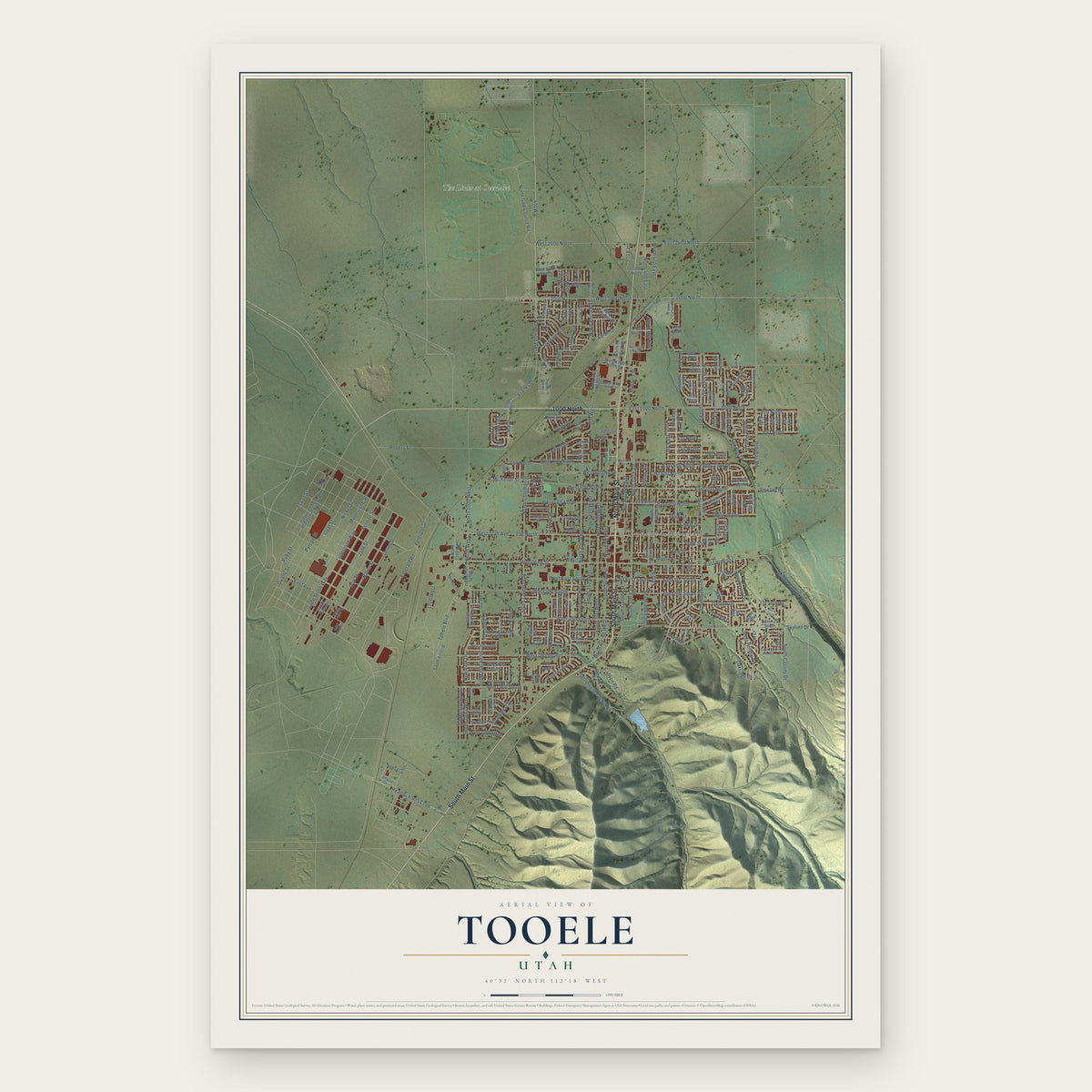
Tooele, Utah Map Art
Building by building, with labeled streets and shaded relief.
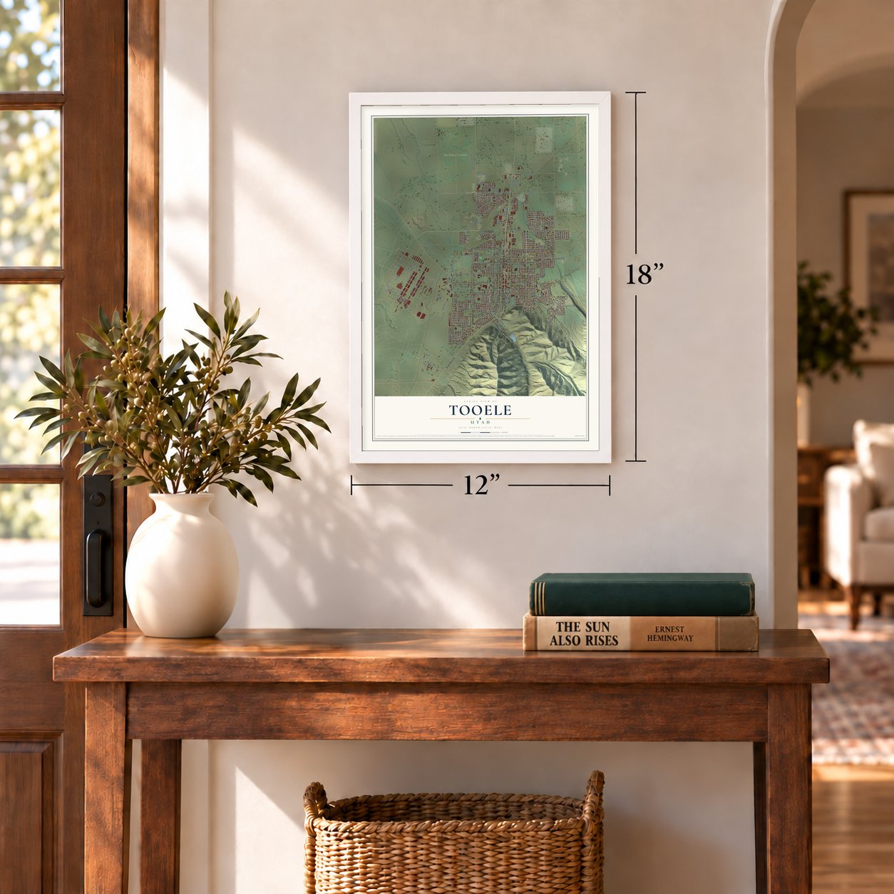
12" x 18" Archival Matte Print
A Map of Home. A Work of Art.
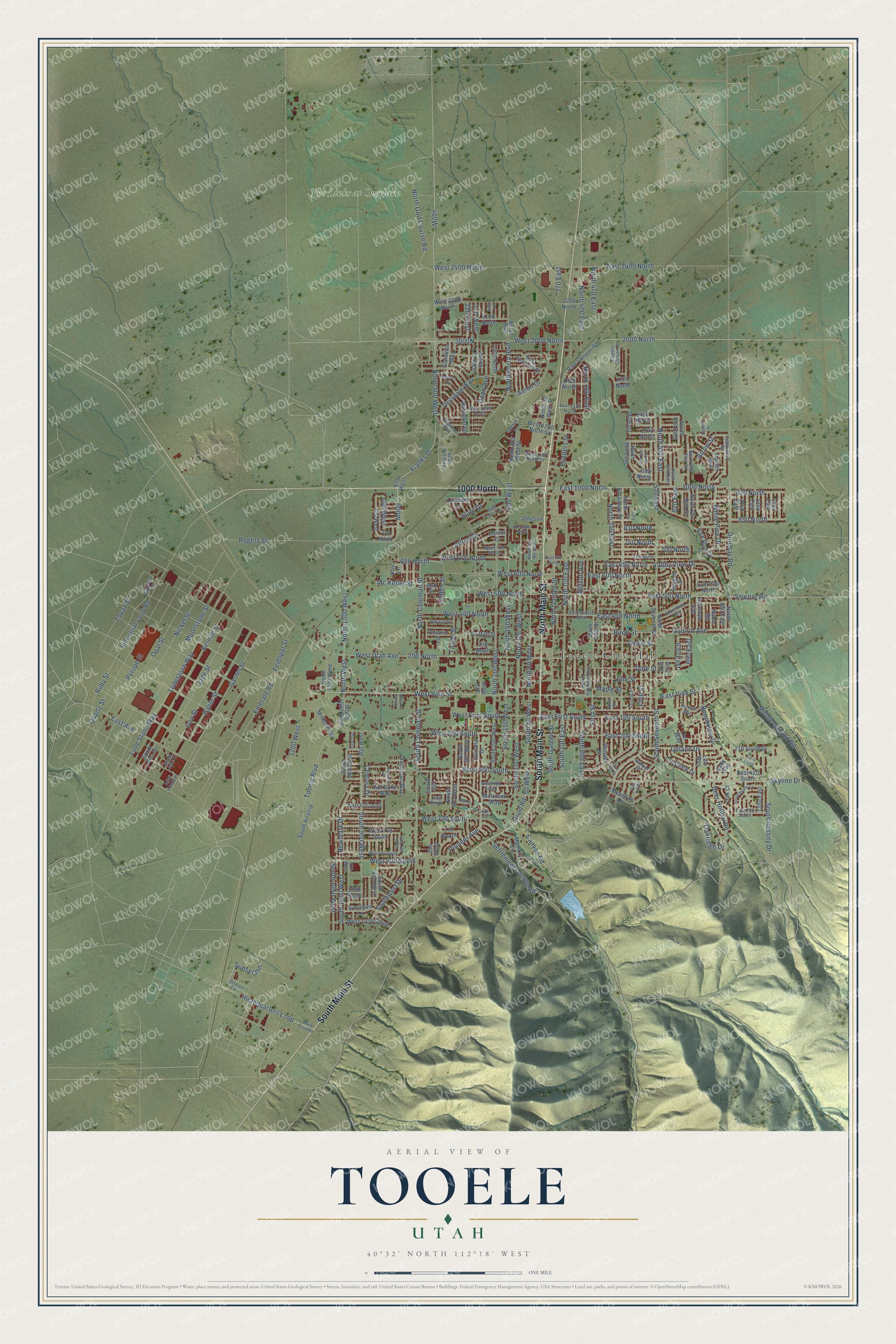
Explore Tooele, Utah from a whole new perspective. Created using aerial imagery and detailed geographic data, this map captures Tooele building by building, with labeled streets, familiar landmarks, and shaded topographical relief that highlights the natural contours of the landscape.
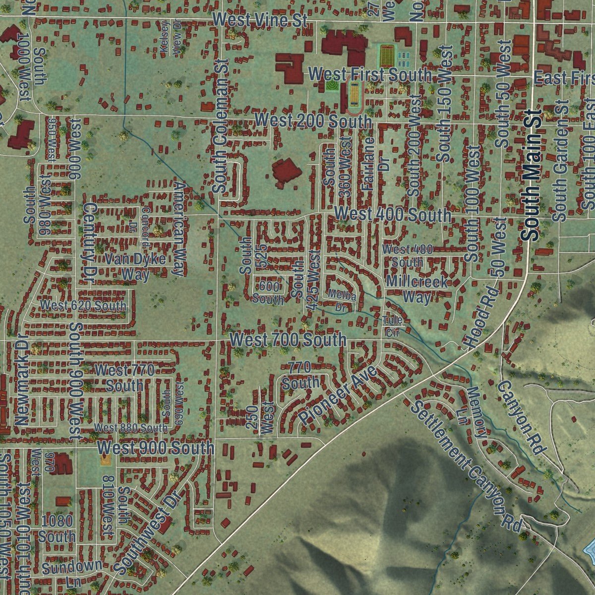
Combining modern data with the timeless character of a vintage atlas, this map is just as interesting up close as it is beautiful on the wall. Whether you grew up in Tooele, spent memorable years there, or call it home today, this unique map is a great way to celebrate a place that means something to you. Zoom in on the preview to look for your street, and then order a print to put your memories on the wall.
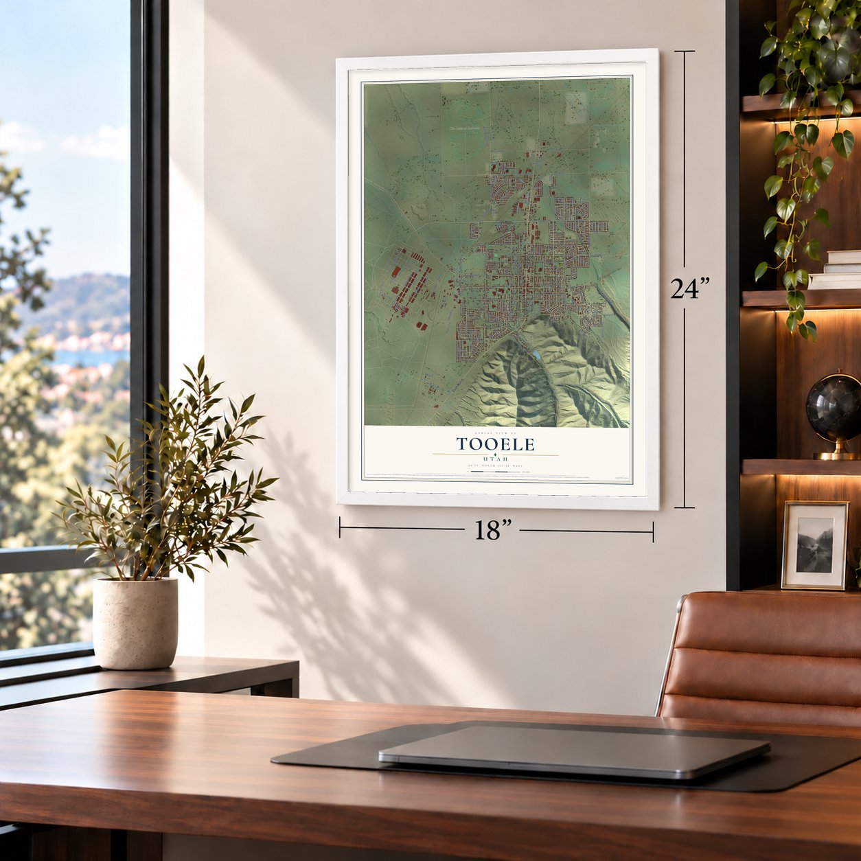
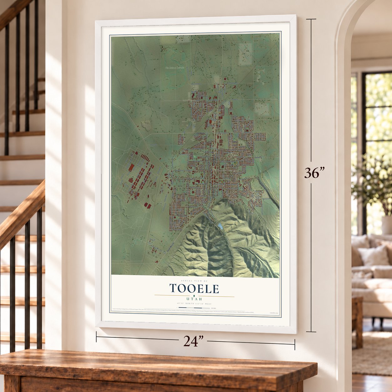
Three ways to hang it
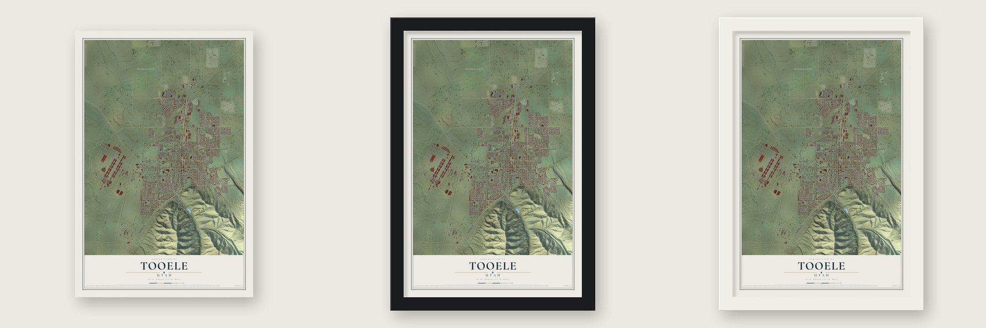
Unframed archival matte, a black wood frame or a white wood frame.
Up close
Geography Worth Displaying
This map was created using accurate cartographic data and authoritative geographic sources, including the U.S. Geological Survey and the Census Bureau. The map brings together terrain, waterways, roads, and building detail. The majority of the streets are labeled, houses are accurately depicted, and the topography is derived from government sources. Combining local data with carefully composed color and shading leads to this beautifully detailed Tooele artwork for your wall.
Rather than simply showing street outlines, we’ve included as many of the street names as we could reasonably fit on the map while keeping their names legible. Zoom in on the high resolution preview to see exactly what’s on the map. We truly set out to create a statement piece for anyone who loves Tooele. So whether it’s for you, or a gift for someone you love, we hope this map of Tooele brings back fond memories.

Find your street
Names on the Tooele map
Every name below is printed on this map. Look for your street, your school, the park where you played, or the pond down the road.
Places and landmarks2
- Tooele City Hall
- The Links at Overlake
Streets and roads264
- South Main Street
- North Main Street
- 1000 North
- East Vine Street
- Canyon Road
- Middle Canyon Road
- West Vine Street
- Tooele Boulevard
- 2000 North
- 810 North
- 680 West
- Franks Drive
- Ruby Street
- North 550 East
- East Avenue
- Industrial Loop Road
- North 400 West
- Pyrope Street
- West 600 North
- North 200 West
- 200 West
- East 500 North
- West 500 North
- 50 West
- East 650 North
- 650 North
- North 150 West
- North 50 West
- South 50 West
- Newmark Drive
Show all 264 streets
- 170 West
- 690 East
- South Cassity Drive
- North Berra Boulevard
- South 100 West
- South 150 West
- 850 North
- West Utah Avenue
- Droubay Road
- Skyline Drive
- West 2000 North
- Lodestone Way
- 200 North
- East 400 North
- Settlement Canyon Road
- South Coleman Street
- Nickel Street
- West 200 South
- Moonstone Street
- North 100 East
- Quartz Street
- Opal Street
- Upland Drive
- Rogers Street
- East 1000 North
- Lode Stone Way
- Garnet Street
- Jade Street
- North 100 West
- Emerald Road
- South 900 West
- East 2400 North
- Headquarters Loop
- Sunset Inn
- North 1000 West
- North Golf Course Road
- West 700 South
- Iron Street
- Kernite Street
- 520 East
- Valley View Drive
- North Garden Street
- North Coleman Street
- West 900 South
- Halite Street
- First Street
- West 400 North
- West 400 South
- Feldspar Street
- South 1050 West
- East 200 South
- East 100 South
- East First South
- Smelter Road
- North West
- North 400 East
- Pioneer Avenue
- West First South
- East 600 North
- North 180 East
- Topaz Street
- South Seventh Street
- South Garden Street
- Drysdale Way
- Deer Hollow Road
- West 670 North
- 970 North
- 700 North
- South 100 East
- Alfred Drive
- 1200 West
- West 2400 North
- Oquirrh Avenue
- Southwest Drive
- North 310 East
- South 1010 West
- Fifth Street
- Oakridge Drive
- Cedar Street
- Birch Street
- White Pine Drive
- Benchview Drive
- Date Street
- South 200 East
- Fox Run Drive
- North 470 East
- Elm Street
- Aaron Drive
- Mc Keller Street
- 740 North
- Tahoe Street
- Linden Street
- Arrow Street
- Flinders Street
- 270 East
- Dean Avenue
- Century Drive
- Nelson Avenue
- 620 East
- Slate Drive
- 220 West
- 630 East
- Hood Road
- Maple Street
- 1480 North
- North 650 East
- 720 West
- 1370 North
- North 200 West Street
- 1350 East
- 380 East
- 2200 North
- 1340 East
- 770 North
- West 2200 North
- North Fox Run Drive
- West 1280 North Street
- East Aparicio Drive
- 1090 North
- North Broadway Street
- North Seventh Street
- Pine Canyon Road
- 600 West
- South Airstrip
- North First Street
- South 200 West
- Memory Lane
- West 770 South
- Paulos Boulevard
- Second Street
- Durocher Lane
- North 170 West
- South 810 West
- Millcreek Way
- West 1220 South
- Sundown Lane
- 1970 North
- Crestview Drive
- South 980 West
- East 420 South
- North 1100 West
- South 1000 West
- South 425 West
- 900 West
- American Way
- Clemens Way
- South Kira Drive
- 270 South Street
- 250 West
- Fairlane Drive
- South 360 West
- North 30 West Street
- Van Dyke Way
- Antelope Avenue
- 2100 North
- Millburn Drive
- Daniel Drive
- North 380 East
- Oak Court
- North 880 East
- Seagull Drive
- Meadows Drive
- Ontario Street
- Noble Road
- 1430 East
- 1250 East
- 1700 North
- Griffith Street
- Johnson
- East 540 North
- Berra Boulevard
- Diamant Lane
- South 525
- 1080 South
- 230 North
- Lori Way
- 770 South
- Lisa Way
- Ash Street
- Sally Way
- 1720 North
- 270 West
- 570 East
- Kay Lane
- North 690 East Street
- North 50 West Street
- Clemente Way
- Officer Circle
- East Fourth North
- Sapphire Street
- 670 North
- Fourth Street
- Cedarwood Road
- Third Street
- 970 West
- North Pinehurst Avenue
- West 620 South
- Copper Canyon Drive
- Stansbury Avenue
- West 1180 North Street
- West 480 South
- Havasu Street
- North 600 East
- East 700 South
- Lacroix Lane
- West 700 North
- West 1530 North
- East 1530 North
- North 340 West
- 600 South
- Juniper Drive
- South Jake Court
- South Haylie Lane
- West 880 South
- Main Gate Road
- East 700 North
- Dawson Drive
- Buzianis Way
- West Quartz Road
- 400 East
- North 450 East
- Concord Drive
- Park Hill Drive
- Via la Costa
- South 690 West
- West 860 North
- 950 West
- Tule Circle
- South Brenda Place
- 90 West
- Conifer Street
- Kelsey View Drive
- Melba Drive
- Oak Hill Drive
Names are listed as they appear on the printed map. Zoom into the product photos to find them.
About Tooele, Utah
Tooele is a city of 35,742 people and the seat of Tooele County, on the western slope of the Oquirrh Mountains. The valley was home to the Tooele Valley Goshute, and the city's name comes from Tuuwɨɨta, a Goshute chief whose name is the Shoshoni word for black bear. Mormon pioneers first used the valley as winter range for their herds. In September 1849 three families made homes beside a small creek just south of today's city. More families followed, the city was organized by 1853, and by the end of the century about 1,200 people lived in this farming town.
Industry came in the next century. The Los Angeles and Salt Lake Railroad built through Tooele in 1904, and the International Smelting and Refining Company opened a smelter in Pine Canyon, east of town, in 1909. It refined copper from 1910 and lead and zinc from 1912, fed by the seven-mile Tooele Valley Railway, a 20,000 ft aerial tramway and, by 1941, a 22,000 ft tunnel. Copper work ended in 1946, zinc in 1968 and lead in 1972, and the smelter was torn down. The railway then served the Carr Fork mine and mill, which processed ore from 1979 to 1981, and made its last run on August 28, 1982.
- New Town for smelter workersMany of the smelter's 1,000 workers lived in New Town, built on the east side of Tooele. Families from Italy, Greece, the Balkans and Asia Minor settled there and built a community of their own, with its own school, its own church and many languages.
- A wartime depotWhen World War II began, the federal government took 25,000 acres in the southwest of the Tooele Valley for the Tooele Ordnance Depot. The military's arrival swelled school enrollment, so a junior high went up in 1943, built with federal defense funds, and a new Tooele high school followed in 1955.
- Army land turned to industryIn 1993 the Army scaled back the depot, by then called Tooele Army Depot, and about 1,700 acres with many buildings were annexed to the city. The Army also handed over 40 acres and a new large-vehicle maintenance building, which the city turned into the Utah Industrial Depot. A company bought it in 2013, and it is now Ninigret Depot.
- An arts festival since 1985The Tooele Arts Festival began in 1985 as a free, three-day open-air show of handmade art and live music. Late-spring cold snaps kept spoiling its end-of-May dates, so in 1998 sponsors moved it to the last weekend of June. A shortage of volunteers canceled the 2011 festival, the first year without one since it began, and it marked its 30th anniversary in June 2016.
Keep exploring Utah
Tooele is one of 363 Utah towns we've mapped. Every dot on the map is a print of its own.
The search covers every state, Utah first.
Near Tooele
Order 2 or more town maps and save 10%. Shown in the size and finish you picked above, so they hang as a set.
- Erda 12" x 18" / Archival Matte Print $39.99
- Stansbury Park 12" x 18" / Archival Matte Print $39.99
- Stockton 12" x 18" / Archival Matte Print $39.99


More maps nearby: Grantsville, Lake Point, Copperton, Ophir and Rush Valley.
The art of mapping a place
How This Map Was Made
Real places. Remarkable detail. Discover the layers that turn geographic data into a map of home.

The view from above
Aerial imagery reveals the character of the land: woodland, open fields, and the patterns of a place.

The shape of the land
Elevation data brings hills, valleys, and subtle changes in the landscape into view.

The details of home
Roads, waterways, and building footprints come together to make the map feel unmistakably local.

Geography becomes art
Considered color, shading, and typography bring the layers together in a map made for your wall.


Process illustrated with Mendon, Massachusetts. Aerial imagery: USDA NAIP. Terrain: USGS 3D Elevation Program. Map details and finished artwork: KNOWOL.
The Details
About This Print
Choose an archival matte print, or a black or white Ayous wood frame. The archival matte print is unframed.
Select your size and finish above to see the matching product image and price.
Materials & Craftsmanship
A contemporary map with the character of a classic atlas, printed on archival matte paper. Optional frames are made from Ayous wood.
Your printed map does not include the watermark shown in the full-map preview.
Shipping & Delivery
Free shipping within the United States. Every print is made to order in the USA.
Buying a gift? Add a note in your cart and we'll include it. We never put prices in the package.
Prints ship within 2 to 3 business days. Allow 7 to 10 days total from ordering for delivery. Timing may vary during holidays or periods of high order volume.
Read our shipping policy.
Returns and damaged prints
Each print is made to order. Change-of-mind refunds are not available after production.
If your print arrives damaged, misprinted or incorrect, contact support@knowol.com within 30 days of receiving it. Include your order number, photos and a description of the issue.
Read our full refund and replacement policy. For questions about your order, email support@knowol.com.