


Search for another town





Free U.S. delivery 7 to 10 days after you order
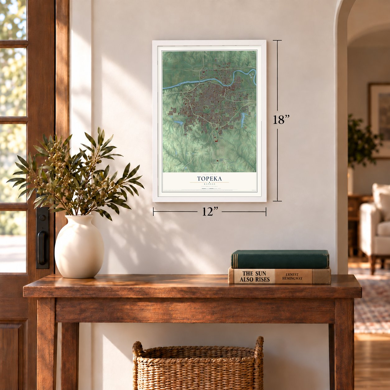
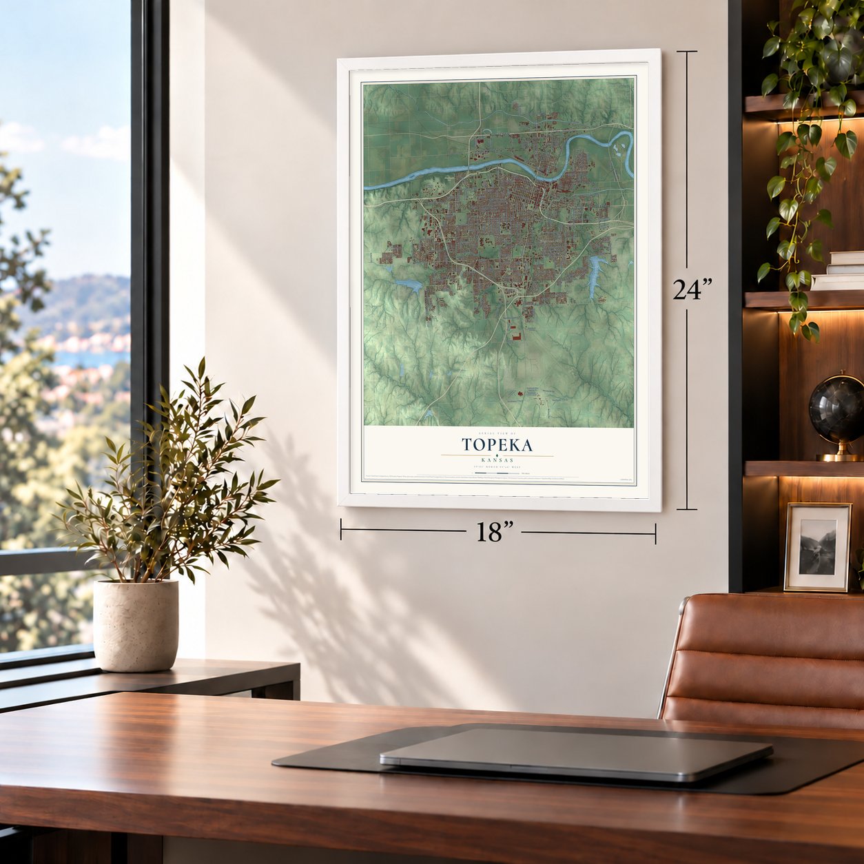
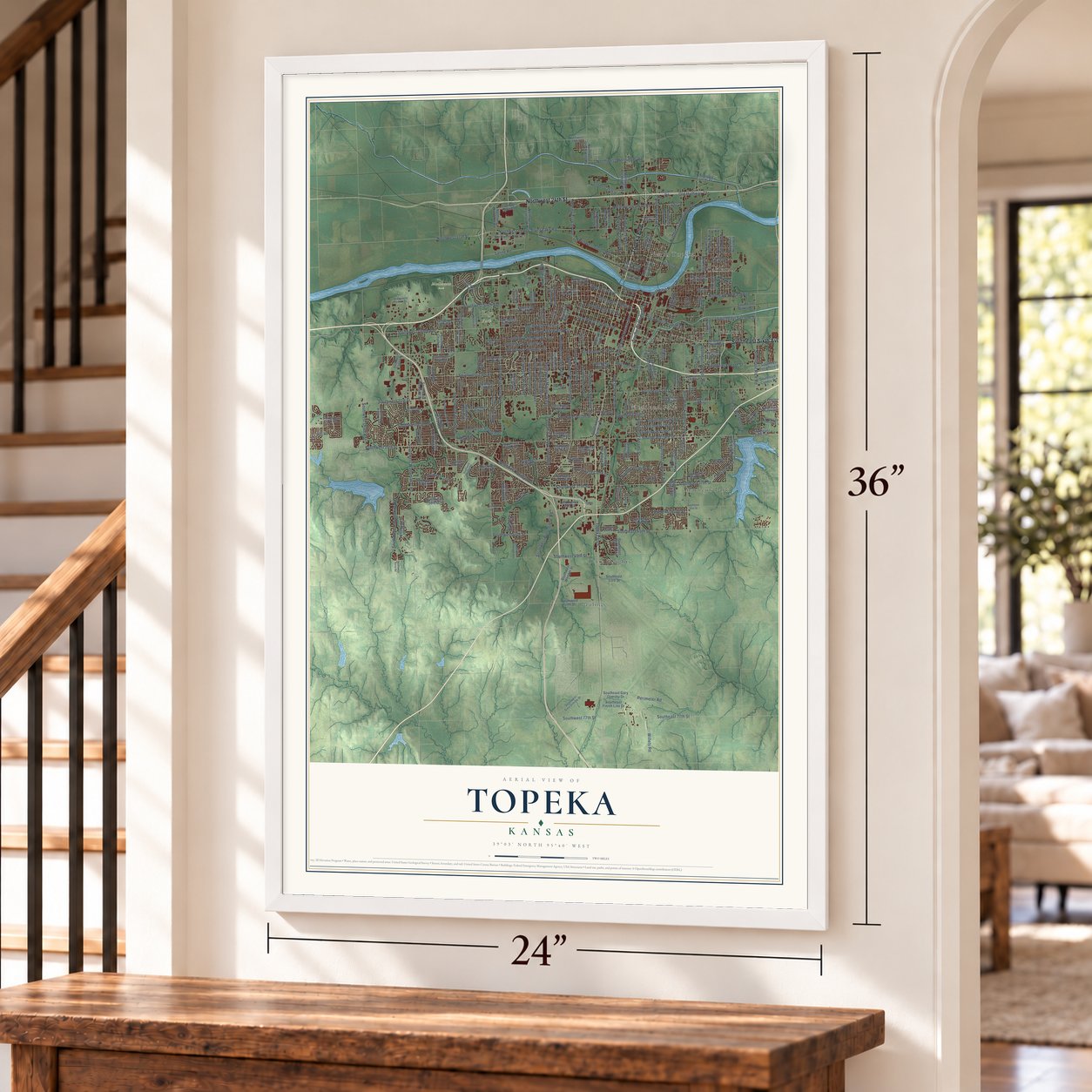
Topeka, Kansas Map Art
Building by building, with labeled streets and shaded relief.
12" x 18" Archival Matte Print
A Map of Home. A Work of Art.
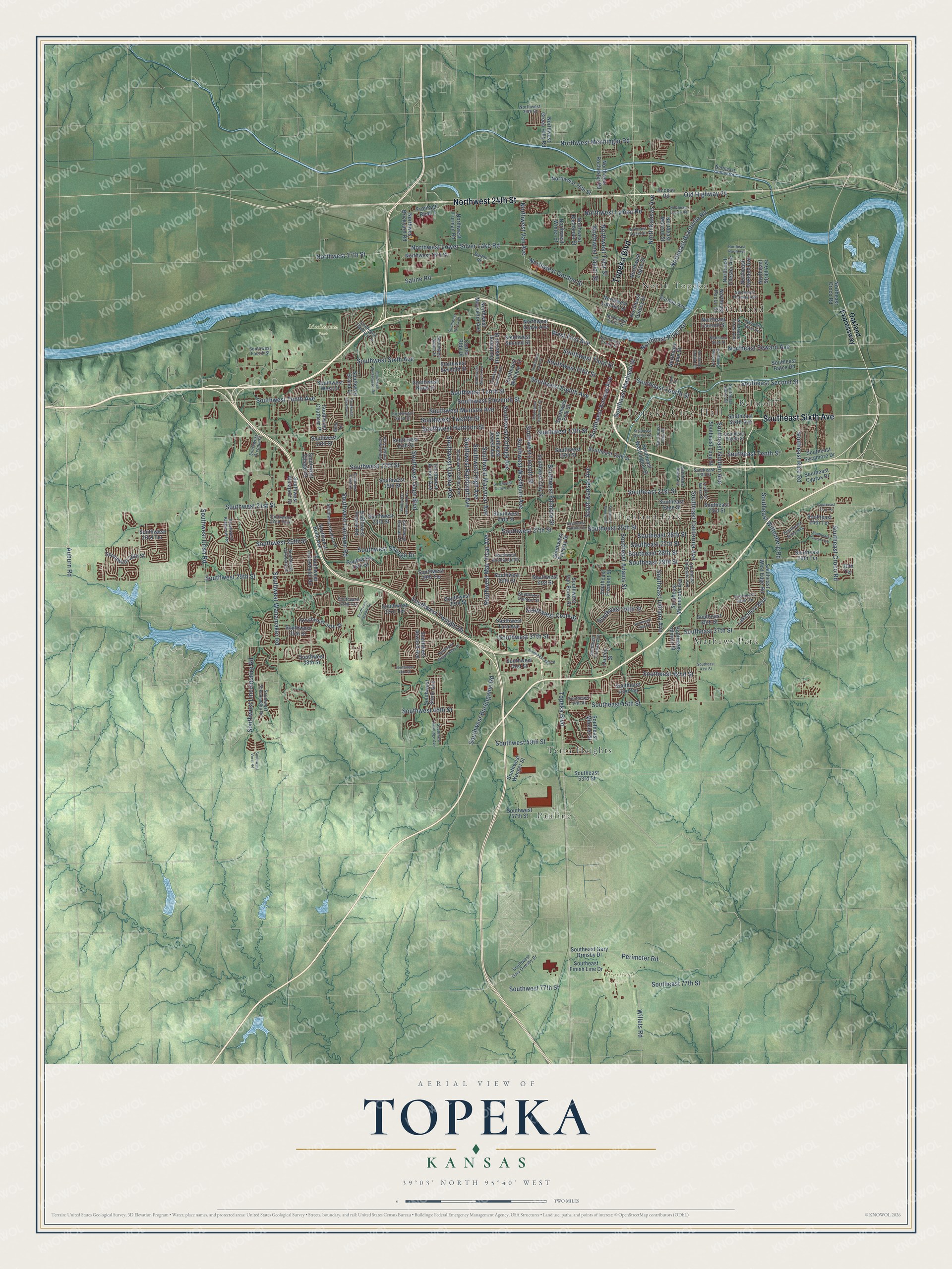
Explore Topeka, Kansas from a whole new perspective. Created using aerial imagery and detailed geographic data, this map captures Topeka building by building, with labeled streets, familiar landmarks, and shaded topographical relief that highlights the natural contours of the landscape.
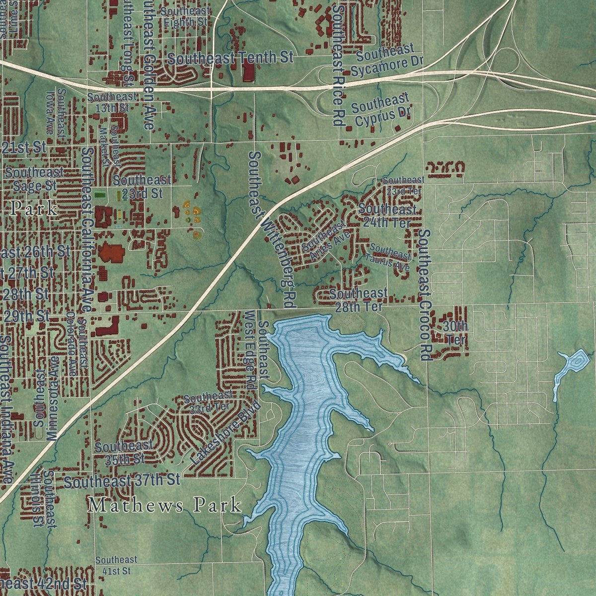
Combining modern data with the timeless character of a vintage atlas, this map is just as interesting up close as it is beautiful on the wall. Whether you grew up in Topeka, spent memorable years there, or call it home today, this unique map is a great way to celebrate a place that means something to you. Zoom in on the preview to look for your street, and then order a print to put your memories on the wall.
Three ways to hang it
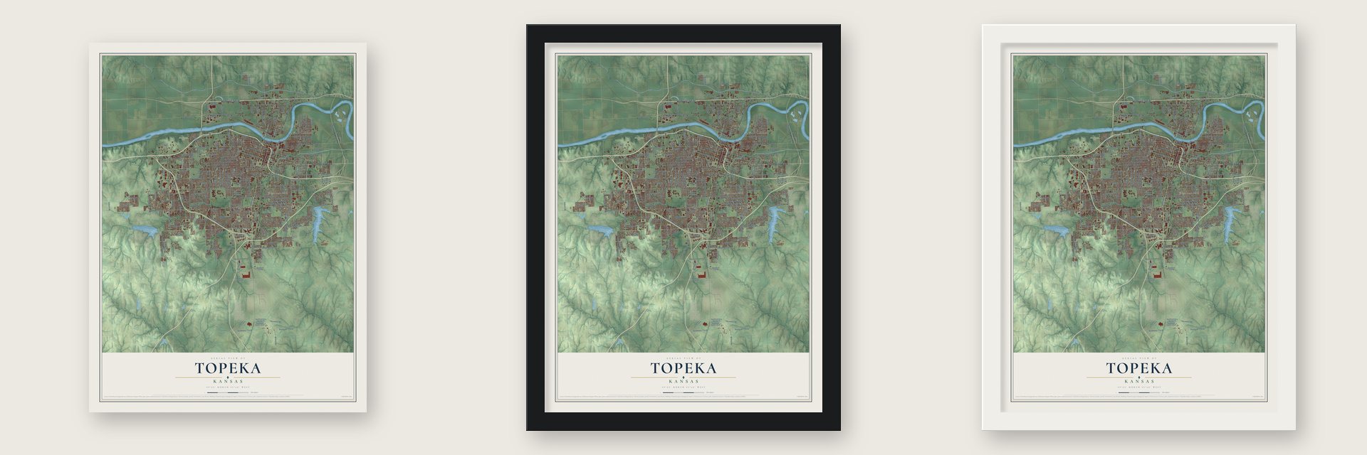
Unframed archival matte, a black wood frame or a white wood frame.
Up close
Geography Worth Displaying
This map was created using accurate cartographic data and authoritative geographic sources, including the U.S. Geological Survey and the Census Bureau. The map brings together terrain, waterways, roads, and building detail. The majority of the streets are labeled, houses are accurately depicted, and the topography is derived from government sources. Combining local data with carefully composed color and shading leads to this beautifully detailed Topeka artwork for your wall.
Rather than simply showing street outlines, we’ve included as many of the street names as we could reasonably fit on the map while keeping their names legible. Zoom in on the high resolution preview to see exactly what’s on the map. We truly set out to create a statement piece for anyone who loves Topeka. So whether it’s for you, or a gift for someone you love, we hope this map of Topeka brings back fond memories.

Find your street
Names on the Topeka map
Every name below is printed on this map. Look for your street, your school, the park where you played, or the pond down the road.
Places and landmarks12
- Topeka City Hall
- Gage Park
- Heartland Park
- MacLennan Park
- Belmont
- Highland Park
- Mathews Park
- North Topeka
- Oakland
- Pauline
- Terra Heights
- Southwest 22nd Park
Streets and roads240
- Southeast Sixth Avenue
- Topeka Boulevard
- Northwest 24th Street
- Southwest 17th Street
- Southeast 45th Street
- North Kansas Avenue
- Southwest Urish Road
- West First Avenue
- Perimeter Road
- Northeast River Road
- Southwest Kansas Avenue
- Northwest Taylor Street
- Southwest 29th Street
- Southwest Gage Boulevard
- Southwest 21st Street
- Southwest Sixth Avenue
- Southwest Tenth Avenue
- Southeast Adams Street
- Southwest Huntoon Street
- Southwest Tenth Street
- Southwest Wanamaker Road
- Southwest Fairlawn Road
- Southeast California Avenue
- Northwest Lower Silver Lake Road
- South Kansas Avenue
- Southwest Macvicar Avenue
- Southwest 37th Street
- Southwest Mac Vicar Avenue
- Southeast 29th Street
- Southwest 25th Street
Show all 240 streets
- Southeast 21st Street
- Southwest Randolph Avenue
- Southwest 27th Street
- Southwest Twelfth Street
- Southwest Burlingame Road
- Southeast Indiana Avenue
- Southwest Oakley Avenue
- Northwest 17th Street
- Southwest Eighth Avenue
- Southwest Fillmore Street
- Southeast Croco Road
- Southwest Eleventh Street
- Southwest College Avenue
- Southwest Lincoln Street
- Southwest Washburn Avenue
- Southeast Madison Street
- Southeast Second Street
- Northeast Seward Avenue
- Southwest High Avenue
- Southwest 13th Street
- Southeast 37th Street
- Southeast Golden Avenue
- Southeast 25th Street
- Southwest Munson Avenue
- Old Highway 24
- Northeast Grantville Road
- Southwest Third Street
- Southwest Shunga Drive
- Southwest 49th Street
- Southeast Fourth Street
- Northwest Lyman Road
- Southwest Lincolnshire Road
- Northwest Tyler Street
- Southeast 28th Street
- Northwest Gordon Street
- Southeast Rice Road
- Southwest Twilight Drive
- Southeast 77th Street
- Southeast Wittenberg Road
- Northwest Menninger Road
- Southeast Tenth Street
- Southeast 27th Street
- Southwest Fifth Street
- Southeast 26th Street
- Saline Road
- Southeast 34th Street
- Southwest 77th Street
- Southeast 42nd Street
- Southwest 45th Street
- Northwest Vail Avenue
- Willets Road
- Southwest Croix Street
- Auburn Road
- Oakland Expressway
- Southwest Arrowhead Road
- Northwest Macvictor Avenue
- Northeast Quincy Street
- Sardou Avenue
- Southwest Belle Avenue
- Southwest 19th Street
- Southwest Jewell Avenue
- Southwest 23rd Street
- Southwest 33rd Street
- Southwest 15th Street
- Southwest Seventh Street
- Southwest Clay Street
- Southwest 24th Street
- Southwest 28th Street
- Southwest Van Buren Street
- Southwest Mulvane Street
- Southwest 34th Street
- Southwest Westport Drive
- Southwest 16th Street
- Southeast Minnesota Avenue
- Southwest 30th Street
- Southwest Ninth Street
- Southwest 26th Street
- Southeast 23rd Street
- Southwest Second Street
- Southwest 29th Terrace
- Southwest Polk Street
- Frontage Road 1
- Southwest 31st Street
- Southwest 14th Street
- Southwest Prairie Road
- Northeast Strait Avenue
- Southwest Atwood Avenue
- Northeast Chester Avenue
- Southeast Fremont Street
- Northeast Monroe Street
- Northwest 25th Street
- Southwest 33rd Terrace
- Northeast Oakland Avenue
- Northeast Croco Road
- Lakeshore Boulevard
- Southwest Stone Avenue
- Southeast 43rd Terrace
- Southwest 38th Street
- Southwest 23rd Terrace
- Southeast Long Street
- Access Road
- Southwest 41st Street
- Southeast Gary Ormsby Drive
- Southwest 35th Street
- Northeast Laurent Street
- Southwest Arnold Avenue
- Southeast 35th Street
- Northwest Buchanan Street
- Southwest Wenger Street
- Southwest Tara Avenue
- Southeast Washington Street
- Southeast 15th Street
- Southwest West Drive
- Southeast Finish Line Drive
- Northwest Furman Road
- Southeast West Edge Road
- Southwest 57th Street
- Northwest Laurent Street
- Northwest Rochester Road
- Northeast Poplar Street
- Northwest 16th Street
- Southeast Mercier Street
- Northwest Grove Avenue
- Southeast 28th Terrace
- Southwest Grand Court
- Southwest Village Drive
- Southwest Roosevelt Street
- Northwest Brickyard Road
- Southwest Fairway Drive
- Southwest Chatham Place
- Northwest Logan Street
- Southeast Sycamore Drive
- Southeast 53rd Street
- Northeast Lake Street
- Southeast Cyprus Drive
- Southeast Sage Street
- Northwest Green Hills Road
- Southeast Bates Road
- Southeast 24th Terrace
- Northwest Winter Street
- Center Bldg Drive
- Southeast Illinois Street
- Quincy Street
- 30th Terrace
- Southeast 44th Street
- Southeast Colorado Avenue
- Southwest Collins Avenue
- Southwest Arvonia Place
- Southwest Fourth Street
- Southwest Chelsea Drive
- Southeast Eighth Street
- Northeast Forest Avenue
- Southeast Iowa Avenue
- Southwest Indian Trail
- Southeast 33rd Terrace
- Southeast 13th Street
- Southwest 32nd Terrace
- Southwest Kingsrow Road
- Southwest Ashworth Place
- Southwest Sena Drive
- Southwest Saline Street
- Southeast Truman Avenue
- Southeast Lime Street
- Southwest Danbury Lane
- Southwest Shenandoah Road
- Northeast Thomas Avenue
- Southwest Gary Ormsby Drive
- Northwest 35th Street
- Southeast Alkire Street
- Southwest Knollwood Drive
- Southeast Aries Avenue
- Button Road
- Northwest Curtis Street
- Southwest Duncan Drive
- Southwest Clontarf Street
- Northwest Crane Street
- Northeast Collier Road
- Belle Terrace
- Southwest Vorst Road
- Southwest Buchanan Street
- Southeast Monroe Street
- Southwest Cambridge Avenue
- Southwest Lane Street
- Southwest Wayne Avenue
- Southwest Seabrook Avenue
- Southwest Crest Drive
- Southwest Meadow Lane
- Northeast State Street
- Southeast 36th Street
- Southwest 39th Street
- Southeast Market Street
- Southwest Westchester Road
- Northeast Sumner Street
- Northeast Grattan Street
- Southwest Scenic Drive
- Southwest Kanza Drive
- Northeast Lyman Road
- Southwest Summit Avenue
- Southwest Wood Valley Drive
- Southeast 23rd Terrace
- Southeast Overton Street
- Northwest Studer Street
- Southwest 40th Street
- Southwest Durow Road
- Southeast Taurus Avenue
- Northeast Doran Avenue
- Southwest Hillside Drive
- Lime Street
- Southeast 41st Street
- Northeast North Avenue
Names are listed as they appear on the printed map. Zoom into the product photos to find them.
About Topeka, Kansas
Topeka, the Kansas capital and the seat of Shawnee County, is a city of 126,587 people on the Kansas River. Before there was a town, three half-Kansa sisters and their husbands, the French-Canadian Pappan brothers, ran a ferry here for Oregon Trail travelers. In October 1854 Cyrus K. Holliday and C. Robinson chose the site for the New England Emigrant society, and nine men founded the town that year.
The founders settled on the name Topeka in 1855. It is a Kansa-Osage word meaning a good place to dig potatoes, and a mixed-heritage Kansa man, Joseph James, called Jojim, is credited with suggesting it. Topeka sided with the free-state settlers. When proslavery forces surrounded it in 1856, residents raised a militia and built stone fortifications on Quincy Street. They held them until the siege was lifted that September, and in 1861 Kansas joined the Union as the 34th state, with Topeka as its capital.
“The first child born in the new town was named Topeka Zimmerman and received from his godfather, Dr. F. L. Crane, a lot 75 by 150 feet.”
- 37 years to build a capitolIn 1855 antislavery settlers met at Constitution Hall on Kansas Avenue to draft the first of the state's four constitutions, and the building later served as the statehouse. In 1862 Cyrus K. Holliday gave the state land for a capitol, and work began in 1866. State officers moved in by 1869, but finishing the east wing, the west wing and then the center, all in Kansas limestone, took about 37 years.
- Home of the Santa FeHolliday went on to serve as mayor and to found the Atchison, Topeka & Santa Fe Railroad. Its tracks started west from Topeka in 1869, and in 1878 the railroad put its general offices and machine shops in the city.
- Brown v. Board of EducationOliver Brown of Topeka was the named plaintiff in the Supreme Court case that ended "separate but equal" in public schools. Only the city's elementary schools were segregated then; Topeka High School had taught Black and white students together since it opened in 1871. Monroe Elementary, a segregated school in the case, became Brown v. Board of Education National Historic Site, which President George W. Bush opened on May 17, 2004.
- The tornado of 1966On June 8, 1966, an F5 tornado came in on the southwest side, crossed Burnett's Mound and tore through downtown and Washburn University. Repairs cost $100 million, among the costliest tornadoes in American history at the time. On WIBW-TV, Bill Kurtis told viewers to "take cover, for God's sake, take cover!" The city recovered, and the community and alumni helped Washburn rebuild.
Keep exploring Kansas
Topeka is one of 764 Kansas towns we've mapped. Every dot on the map is a print of its own.
The search covers every state, Kansas first.
Near Topeka
Order 2 or more town maps and save 10%. Shown in the size and finish you picked above, so they hang as a set.
- Pauline 12" x 18" / Archival Matte Print $39.99
- Tecumseh 12" x 18" / Archival Matte Print $39.99
- Grantville 12" x 18" / Archival Matte Print $39.99

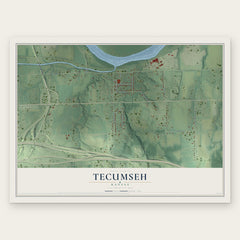

More maps nearby: Elmont, Silver Lake, Wakarusa, Auburn and Berryton.
The art of mapping a place
How This Map Was Made
Real places. Remarkable detail. Discover the layers that turn geographic data into a map of home.

The view from above
Aerial imagery reveals the character of the land: woodland, open fields, and the patterns of a place.

The shape of the land
Elevation data brings hills, valleys, and subtle changes in the landscape into view.

The details of home
Roads, waterways, and building footprints come together to make the map feel unmistakably local.

Geography becomes art
Considered color, shading, and typography bring the layers together in a map made for your wall.


Process illustrated with Mendon, Massachusetts. Aerial imagery: USDA NAIP. Terrain: USGS 3D Elevation Program. Map details and finished artwork: KNOWOL.
The Details
About This Print
Choose an archival matte print, or a black or white Ayous wood frame. The archival matte print is unframed.
Select your size and finish above to see the matching product image and price.
Materials & Craftsmanship
A contemporary map with the character of a classic atlas, printed on archival matte paper. Optional frames are made from Ayous wood.
Your printed map does not include the watermark shown in the full-map preview.
Shipping & Delivery
Free shipping within the United States. Every print is made to order in the USA.
Buying a gift? Add a note in your cart and we'll include it. We never put prices in the package.
Prints ship within 2 to 3 business days. Allow 7 to 10 days total from ordering for delivery. Timing may vary during holidays or periods of high order volume.
Read our shipping policy.
Returns and damaged prints
Each print is made to order. Change-of-mind refunds are not available after production.
If your print arrives damaged, misprinted or incorrect, contact support@knowol.com within 30 days of receiving it. Include your order number, photos and a description of the issue.
Read our full refund and replacement policy. For questions about your order, email support@knowol.com.