
Search for another town



Free U.S. delivery 7 to 10 days after you order
Tulare, California Map Art
Building by building, with labeled streets and shaded relief.
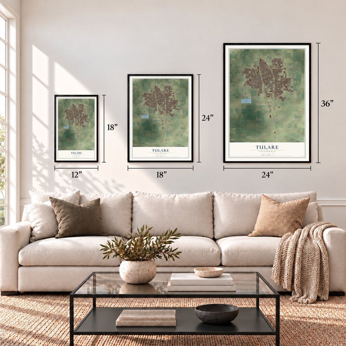
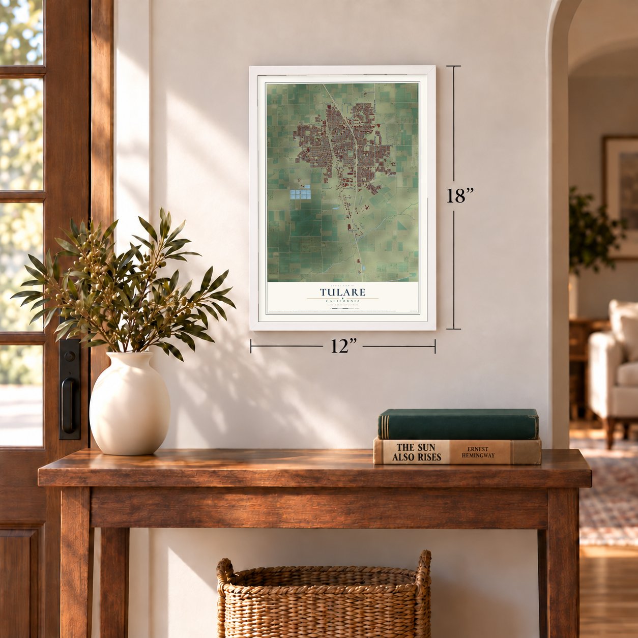
12" x 18" Archival Matte Print
A Map of Home. A Work of Art.
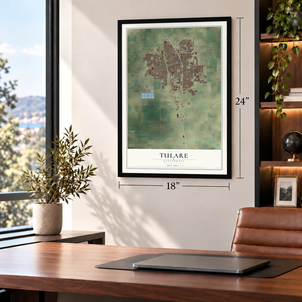
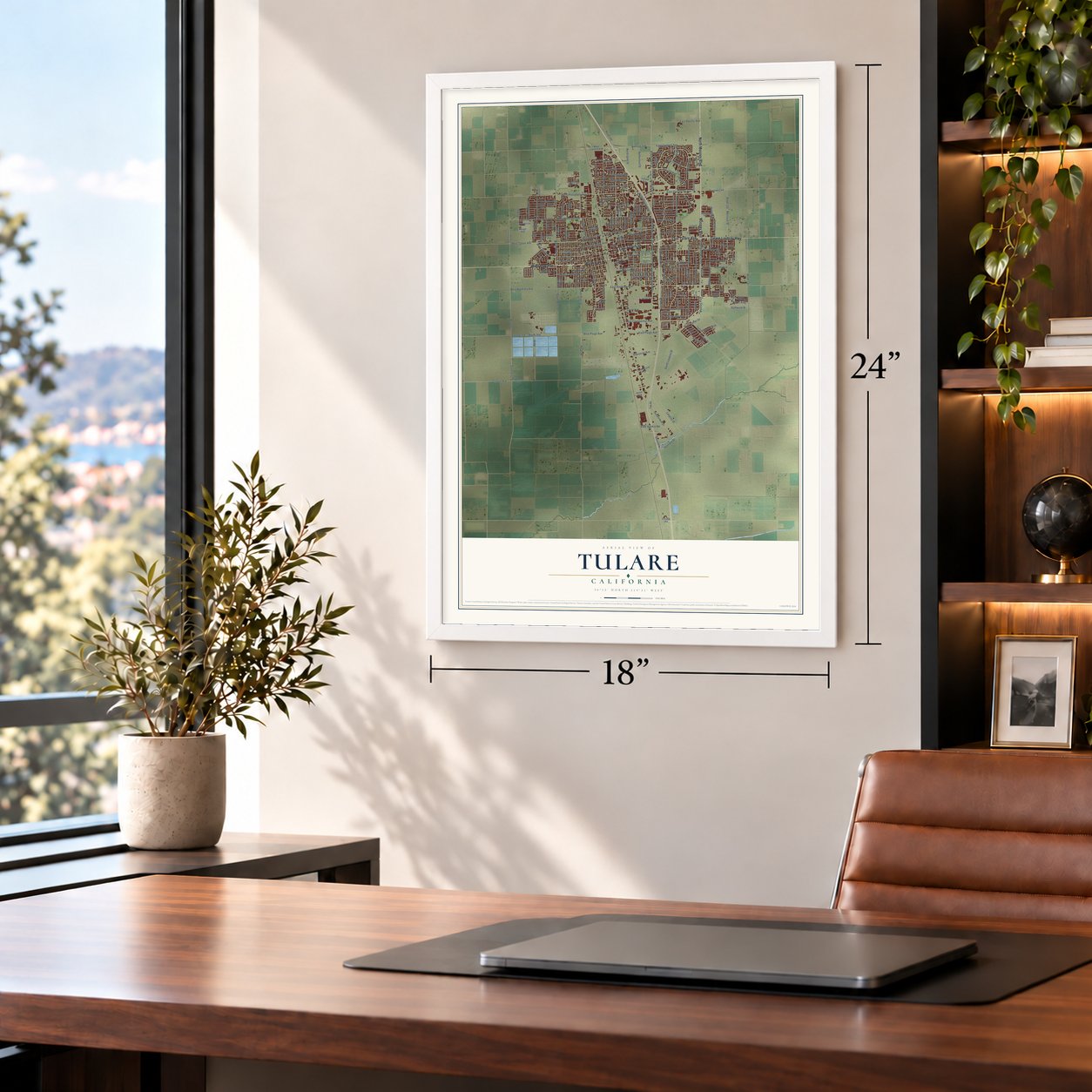
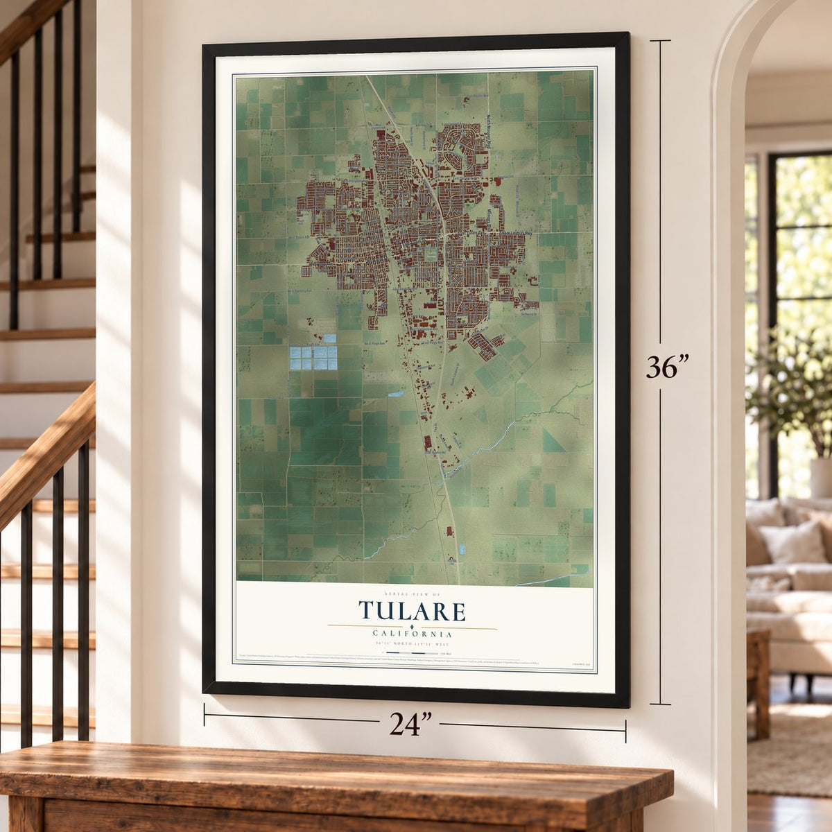
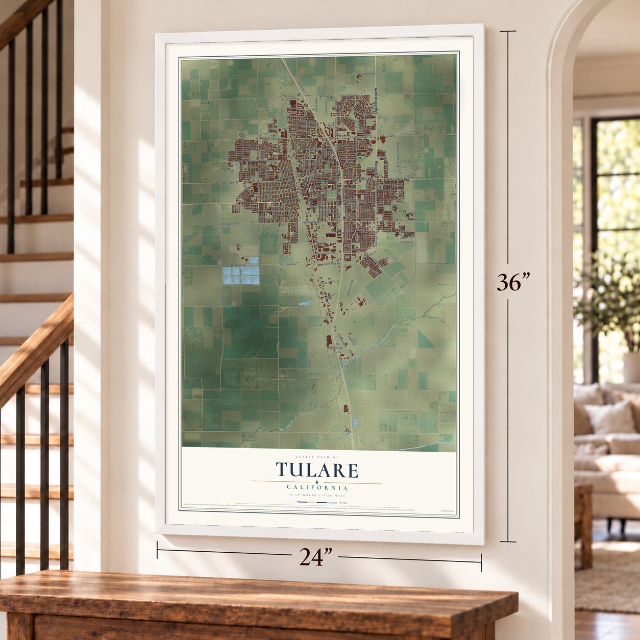
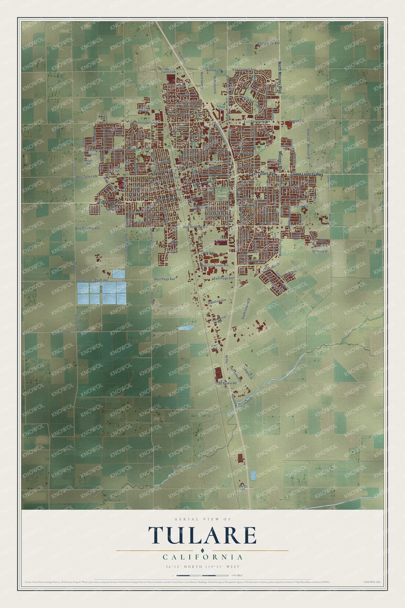
Explore Tulare, California from a whole new perspective. Created using aerial imagery and detailed geographic data, this map captures Tulare building by building, with labeled streets, familiar landmarks, and shaded topographical relief that highlights the natural contours of the landscape.
Combining modern data with the timeless character of a vintage atlas, this map is just as interesting up close as it is beautiful on the wall. Whether you grew up in Tulare, spent memorable years there, or call it home today, this unique map is a great way to celebrate a place that means something to you. Zoom in on the preview to look for your street, and then order a print to put your memories on the wall.
Three ways to hang it
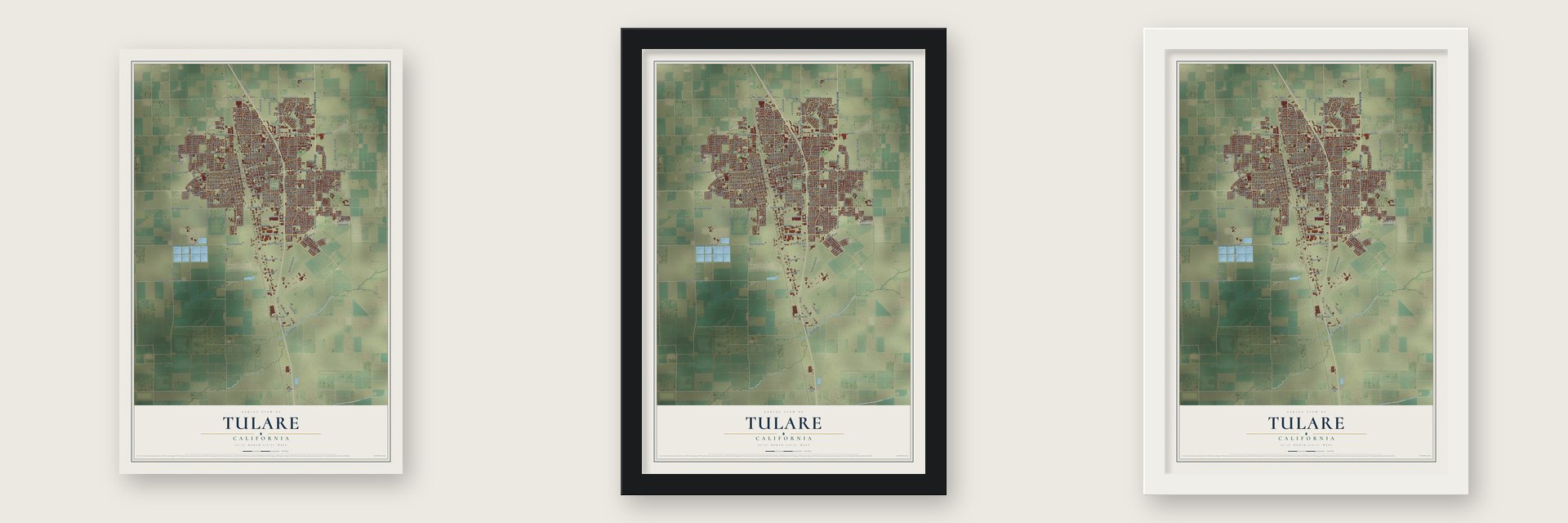
Unframed archival matte, a black wood frame or a white wood frame.
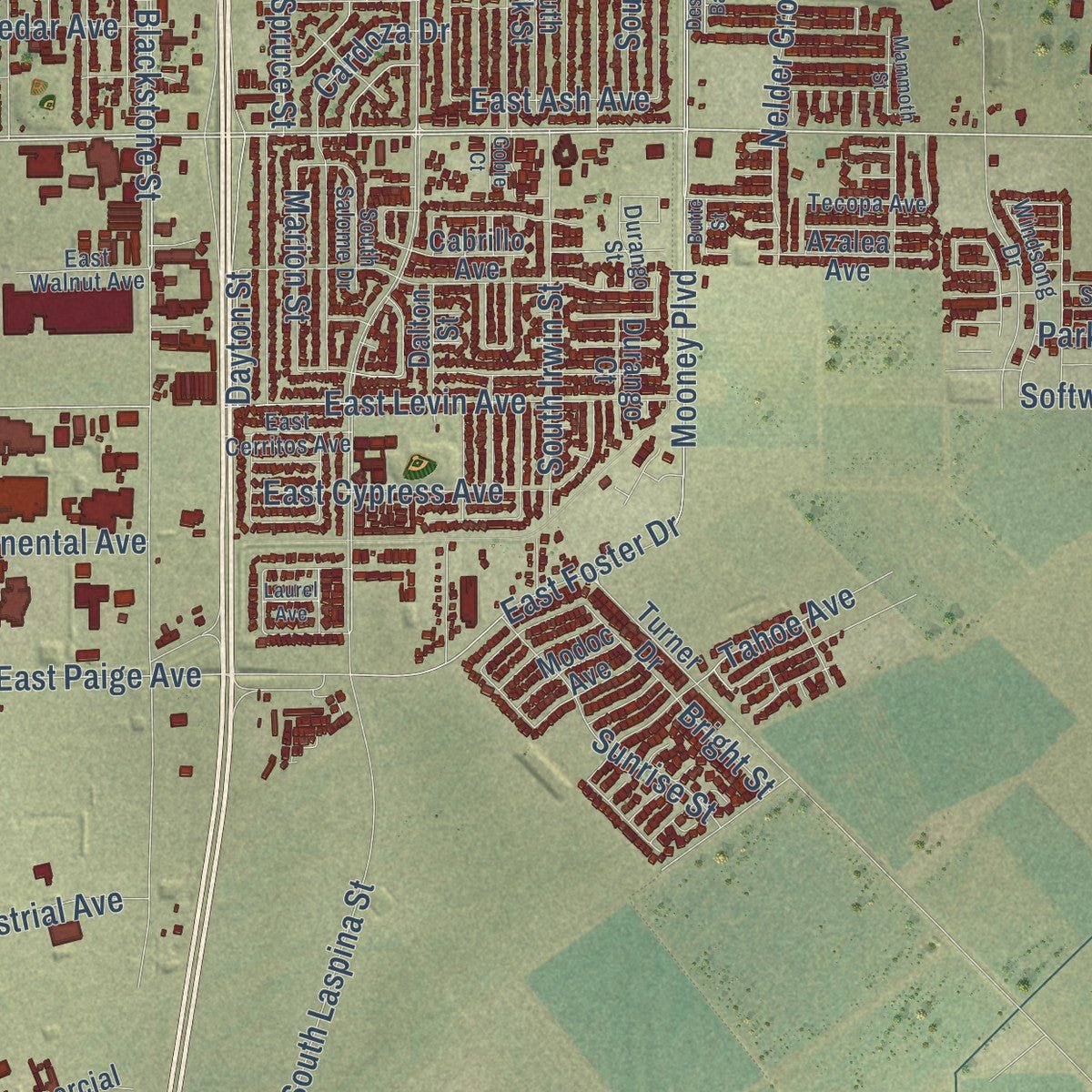
Up close
Geography Worth Displaying
This map was created using accurate cartographic data and authoritative geographic sources, including the U.S. Geological Survey and the Census Bureau. The map brings together terrain, waterways, roads, and building detail. The majority of the streets are labeled, houses are accurately depicted, and the topography is derived from government sources. Combining local data with carefully composed color and shading leads to this beautifully detailed Tulare artwork for your wall.
Rather than simply showing street outlines, we’ve included as many of the street names as we could reasonably fit on the map while keeping their names legible. Zoom in on the high resolution preview to see exactly what’s on the map. We truly set out to create a statement piece for anyone who loves Tulare. So whether it’s for you, or a gift for someone you love, we hope this map of Tulare brings back fond memories.
Read the story behind this map of Tulare, California from 2026.
Find your street
Names on the Tulare map
Every name below is printed on this map. Look for your street, your school, the park where you played, or the pond down the road.
Places and landmarks5
- Tulare City Hall
- Octol
- Elba
- Imhoff
- Tulare Cemetery
Streets and roads218
- East Tulare Avenue
- West Inyo Avenue
- West Inyo Street
- East Tulare Street
- North Mooney Boulevard
- Mooney Boulevard
- Tulare Lindsay Highway
- East Bardsley Avenue
- West Tulare Avenue
- West Tulare Drive
- North Blackstone Avenue
- West Bardsley Avenue
- Paige Avenue
- West Cross Avenue
- East Prosperity Avenue
- West Prosperity Avenue
- West Paige Avenue
- East Cross Avenue
- South Blackstone Street
- East Cartmill Avenue
- East Kern Avenue
- East Paige Avenue
- South Mooney Boulevard
- La Dawna Street
- Mooney Plvd
- West Kern Avenue
- Enterprise Street
- Road 96
- South Laspina Street
- Hillman Street
Show all 218 streets
- Softwind Street
- West Pleasant Avenue
- North Blackstone Street
- East Merritt Avenue
- Corvina Avenue
- North Laspina Street
- Nelson Street
- West Sonora Avenue
- South East Street
- North Place
- North East Street
- Morrison Street
- Pso del Lago
- North Gem Street
- North Cherry Street
- North Oaks Street
- Road 84
- South Pratt Street
- Avenue 248
- South West Street
- North West Street
- East Levin Avenue
- South Spruce Street
- Clinton Avenue
- Hosfield Drive
- Blackstone Street
- West San Joaquin Avenue
- Road 120
- Levin Avenue
- Avenue 216
- 88 Road
- Nelder Grove Street
- South Dayton Street
- Laspina Street
- Avenue 240
- East Ash Avenue
- South Latimer Street
- Tex Drive
- North Milner Street
- Road 100
- Bella Oaks Drive
- Retherford Street
- East Alpine Avenue
- South Irwin Street
- Tahoe Avenue
- Academy Avenue
- East Foster Drive
- Washington Avenue
- Sierra Avenue
- South Aronian Street
- Sunrise Street
- Martinho Avenue
- East Continental Avenue
- East Cypress Avenue
- Alpine Avenue
- East Rankin Road
- East Pacific Avenue
- Belmont Street
- East Gail Avenue
- Road 124
- Bright Street
- East Elm Avenue
- East Cedar Avenue
- Dayton Street
- Bell Port Avenue
- Solaria Street
- Avenue 236
- Industrial Avenue
- Firestone Drive
- East Finch Avenue
- Lincoln Street
- Auburn Street
- Parks Avenue
- Marion Street
- Vetter Drive
- Cardoza Drive
- Jackson Avenue
- Kern Avenue
- Alcott Street
- Manor Street
- Spruce Street
- West Cartmill Avenue
- Hough Avenue
- Cromley Road
- West Gail Avenue
- Spyglass Street
- Inverness Street
- Riesling Street
- Premo Street
- Martin Luther King Junior Avenue
- North Sacramento Street
- Hosfield Road
- West Maple Avenue
- East Academy Avenue
- East San Joaquin Avenue
- West Owens Avenue
- West Elm Avenue
- West King Avenue
- Ben Franklin Avenue
- West Alpine Avenue
- North North Street
- Avenue 208
- South Los Angeles Street
- Commercial Avenue
- Leonard Noel Drive
- De la Vina Street
- North Dickran Drive
- Turner Drive
- Montana de Oro Street
- Maricopa Street
- East Estate Drive
- Alpha Street
- Leland Avenue
- East Coelho Avenue
- East Inyo Avenue
- East Lyndale Drive
- West Shasta Avenue
- Hillcrest Avenue
- Cabrillo Avenue
- South Mark Street
- Dalton Street
- Hatch Avenue
- East Owens Avenue
- East Kohn Avenue
- Azalea Avenue
- Grove Drive
- East Lois Avenue
- East Birch Avenue
- Old Town Drive
- North North Place
- San Diego Street
- Palo Alto Street
- Avenue 184
- Olema Avenue
- Modoc Avenue
- White Street
- Durango Court
- Olson Avenue
- South Oakmore Street
- South Blackstone Avenue
- Windsong Drive
- East Walnut Avenue
- North Hillman Street
- North Lynora Street
- North Denair Street
- Diamante Drive
- West Pine Avenue
- Gemini Street
- North Enterprise Street
- East King Street
- Seminole Avenue
- Tecopa Avenue
- Center Street
- Eldridge Avenue
- Martin Street
- Eastgate Avenue
- Spring Sails Avenue
- East Cerritos Avenue
- South Salome Drive
- North Mahaleb Street
- West Lynn Avenue
- Hemingway Court
- Welch Drive
- Kennedy Avenue
- Durango Street
- Napa Street
- Olympia Avenue
- Randle Street
- Killette Road
- West Tulare Street
- East Sierra Avenue
- Aronian Street
- East Sonora Avenue
- Chevy Chase Street
- Descanso Bay Street
- Seaside Avenue
- Tuohy Street
- Buttonwood Avenue
- Ocean Street
- Magnolia Street
- Rosa Avenue
- Mammoth Street
- North Lamar Street
- Arciero Drive
- Lassen Court
- Goble Court
- Laurel Avenue
- Butte Street
Names are listed as they appear on the printed map. Zoom into the product photos to find them.
About Tulare, California
Tulare is a city of 68,875 people in Tulare County, in the middle of the San Joaquin Valley. Its name comes from Tulare Lake, once the biggest freshwater lake west of the Great Lakes, where Yokuts people fished from boats made of reeds for centuries. The Southern Pacific Railroad founded the town in 1872, and late that year the townsite was surveyed and its first lots were sold at public auction. Fire destroyed the town three times in its first fourteen years, and each time it was rebuilt. Tulare incorporated in 1888.
When the railroad moved on to Bakersfield in 1891, Tulare turned to farming. The town got only about 10 inches of rain a year, so residents formed the Tulare Irrigation District and sold $500,000 in bonds to dig canals bringing Sierra Nevada water to the fields. They paid the bonds off early, and in 1903 they marked the day by burning them.
- Tagus Ranch, 1912In 1912 Hulett C. Merritt founded Tagus Ranch, whose 7,000 acres made it the world's largest fruit ranch. Its fruit was known around the world and served in fine restaurants across America. At the end of World War II, part of the ranch held German prisoners of war.
- 10,000 pilots at Rankin FieldStunt pilot J.G. "Tex" Rankin won a War Department contract in 1940 to train Army Air Corps cadets. His Rankin Aeronautical Academy began operating at Tulare in February 1941, and over the course of the war Rankin Field gave 10,000 pilots their first flight training. Twelve of them became aces, and two earned the Medal of Honor.
- The fairgrounds camp of 1942In 1942 the Army took over the Tulare County Fairgrounds and turned it into the Tulare Assembly Center, a temporary camp for Japanese Americans. The first internee arrived on April 27, 1942, and at its peak the camp held 4,978 people, many of them American-born citizens. The last left on September 4, 1942, and most were moved to Arizona's Gila River War Relocation Center.
- World Ag Expo since 1968Every February since 1968, the International Agri-Center has hosted the World Ag Expo, the biggest yearly outdoor farm show in the country. Its three days bring in more than 100,000 visitors and upward of 1,200 exhibitors. The Tulare County Fair has been held here since 1915.
- Home of the decathlonTulare hosted the national decathlon championships in 1949, 1950, 1952 and 1962, along with the 1952 Olympic Trials for the decathlon.
Keep exploring California
Tulare is one of 1,914 California towns we've mapped. Every dot on the map is a print of its own.
The search covers every state, California first.
Near Tulare
Order 2 or more town maps and save 10%. Shown in the size and finish you picked above, so they hang as a set.
- Matheny 12" x 18" / Archival Matte Print $39.99
- East Tulare Villa 12" x 18" / Archival Matte Print $39.99
- Hypericum 12" x 18" / Archival Matte Print $39.99

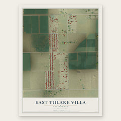

More maps nearby: Visalia, Linnell Camp, Tipton, Farmersville and Waukena.
The art of mapping a place
How This Map Was Made
Real places. Remarkable detail. Discover the layers that turn geographic data into a map of home.

The view from above
Aerial imagery reveals the character of the land: woodland, open fields, and the patterns of a place.

The shape of the land
Elevation data brings hills, valleys, and subtle changes in the landscape into view.

The details of home
Roads, waterways, and building footprints come together to make the map feel unmistakably local.

Geography becomes art
Considered color, shading, and typography bring the layers together in a map made for your wall.


Process illustrated with Mendon, Massachusetts. Aerial imagery: USDA NAIP. Terrain: USGS 3D Elevation Program. Map details and finished artwork: KNOWOL.
The Details
About This Print
Choose an archival matte print, or a black or white Ayous wood frame. The archival matte print is unframed.
Select your size and finish above to see the matching product image and price.
Materials & Craftsmanship
A contemporary map with the character of a classic atlas, printed on archival matte paper. Optional frames are made from Ayous wood.
Your printed map does not include the watermark shown in the full-map preview.
Shipping & Delivery
Free shipping within the United States. Every print is made to order in the USA.
Buying a gift? Add a note in your cart and we'll include it. We never put prices in the package.
Prints ship within 2 to 3 business days. Allow 7 to 10 days total from ordering for delivery. Timing may vary during holidays or periods of high order volume.
Read our shipping policy.
Returns and damaged prints
Each print is made to order. Change-of-mind refunds are not available after production.
If your print arrives damaged, misprinted or incorrect, contact support@knowol.com within 30 days of receiving it. Include your order number, photos and a description of the issue.
Read our full refund and replacement policy. For questions about your order, email support@knowol.com.