
Search for another town




Free U.S. delivery 7 to 10 days after you order
Ukiah, California Map Art
Building by building, with labeled streets and shaded relief.
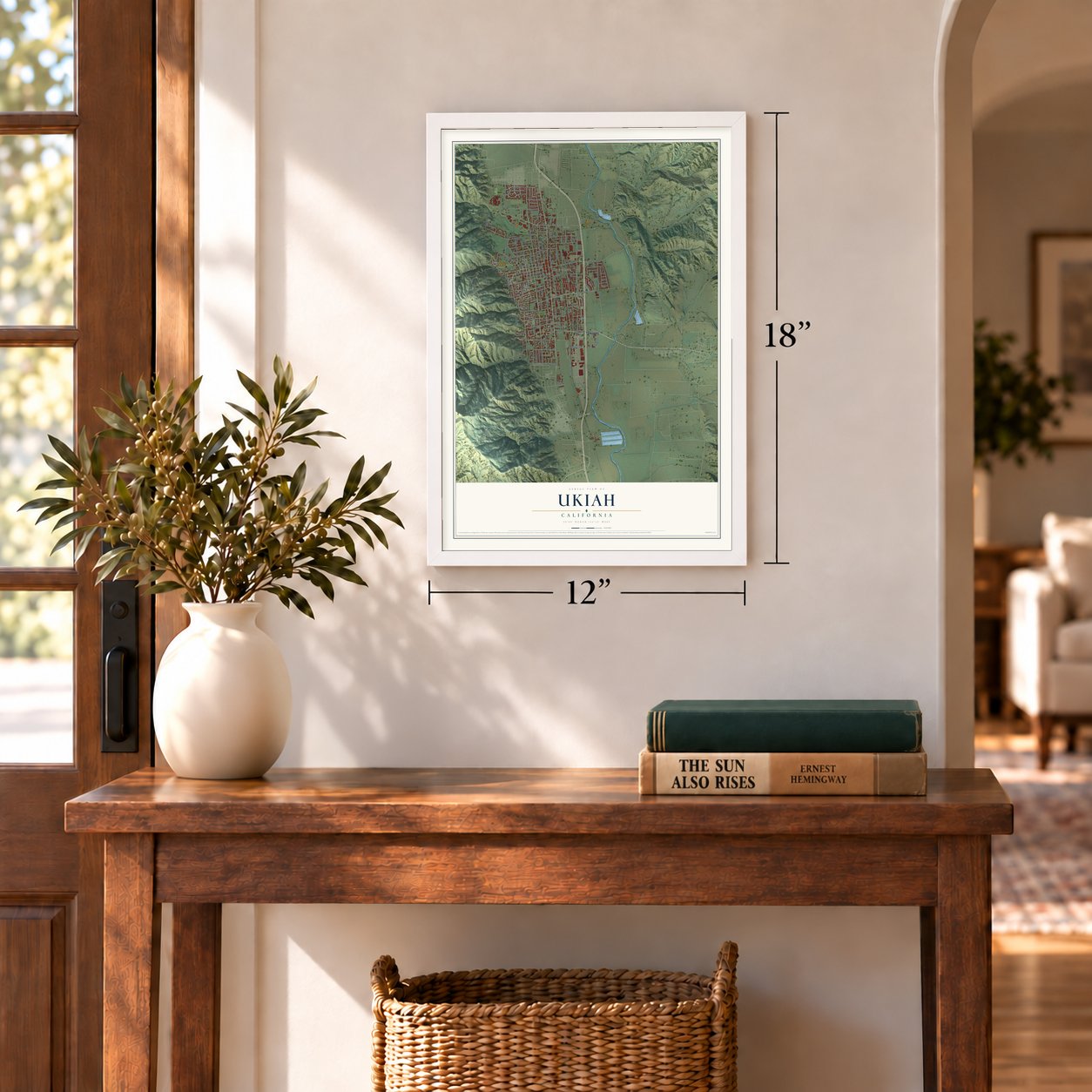
12" x 18" Archival Matte Print
A Map of Home. A Work of Art.
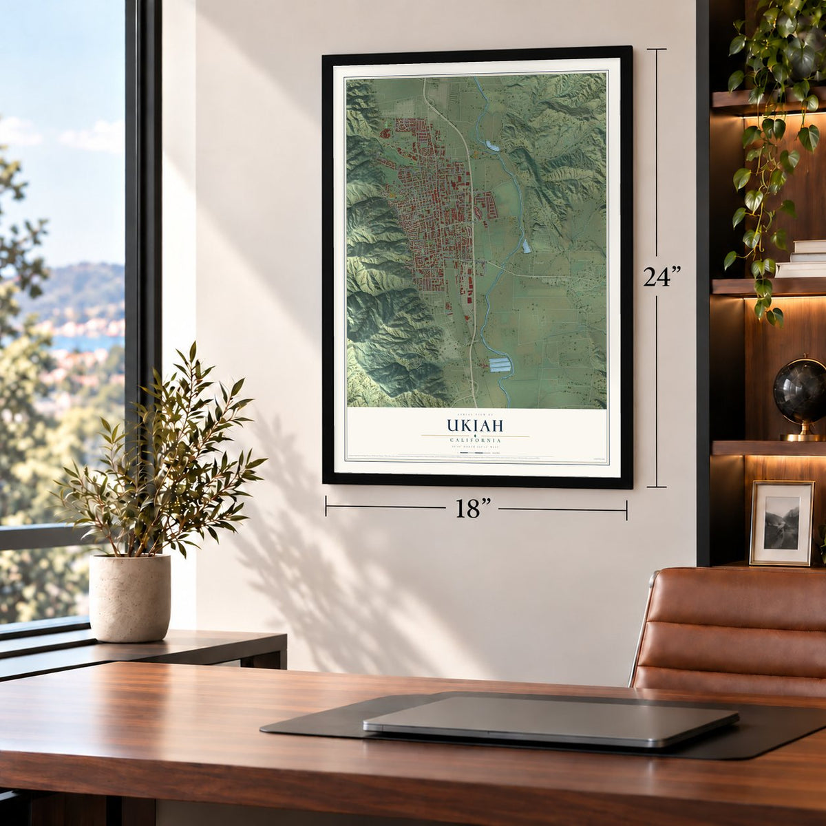
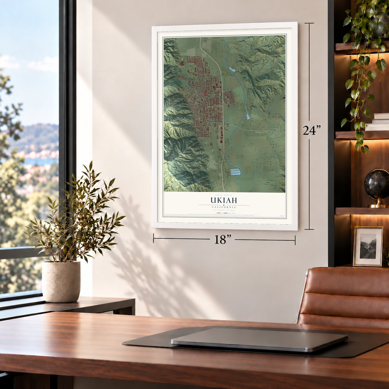
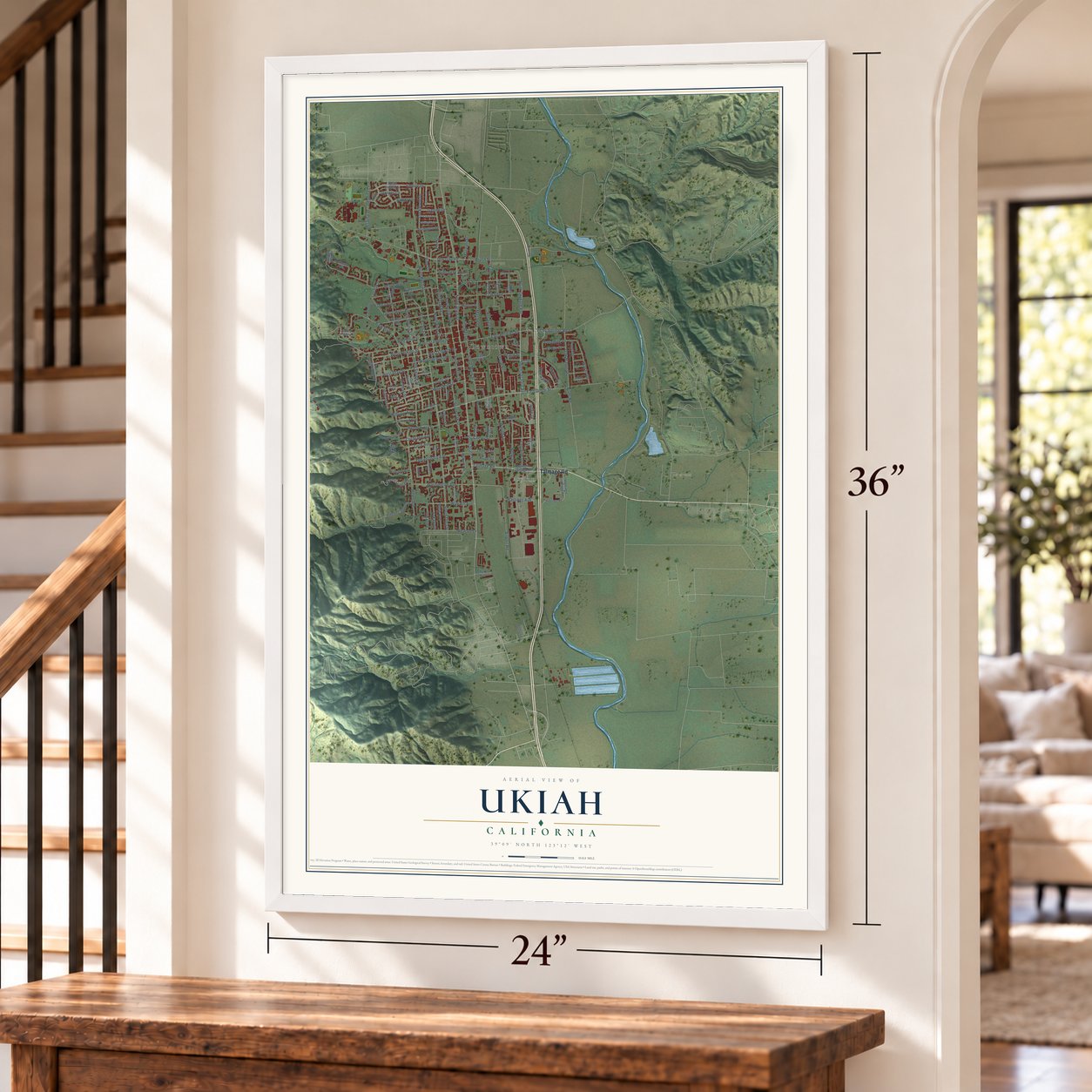
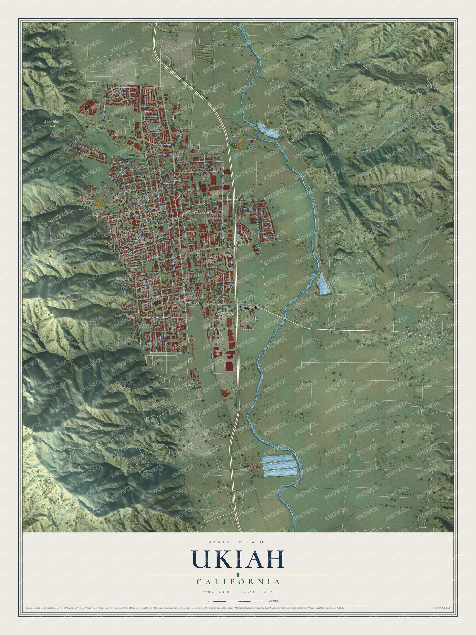
Explore Ukiah, California from a whole new perspective. Created using aerial imagery and detailed geographic data, this map captures Ukiah building by building, with labeled streets, familiar landmarks, and shaded topographical relief that highlights the natural contours of the landscape.
Combining modern data with the timeless character of a vintage atlas, this map is just as interesting up close as it is beautiful on the wall. Whether you grew up in Ukiah, spent memorable years there, or call it home today, this unique map is a great way to celebrate a place that means something to you. Zoom in on the preview to look for your street, and then order a print to put your memories on the wall.
Three ways to hang it
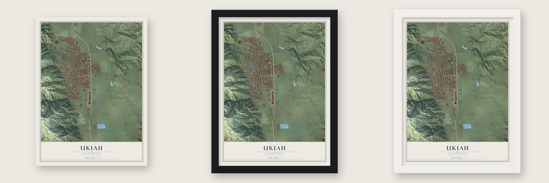
Unframed archival matte, a black wood frame or a white wood frame.
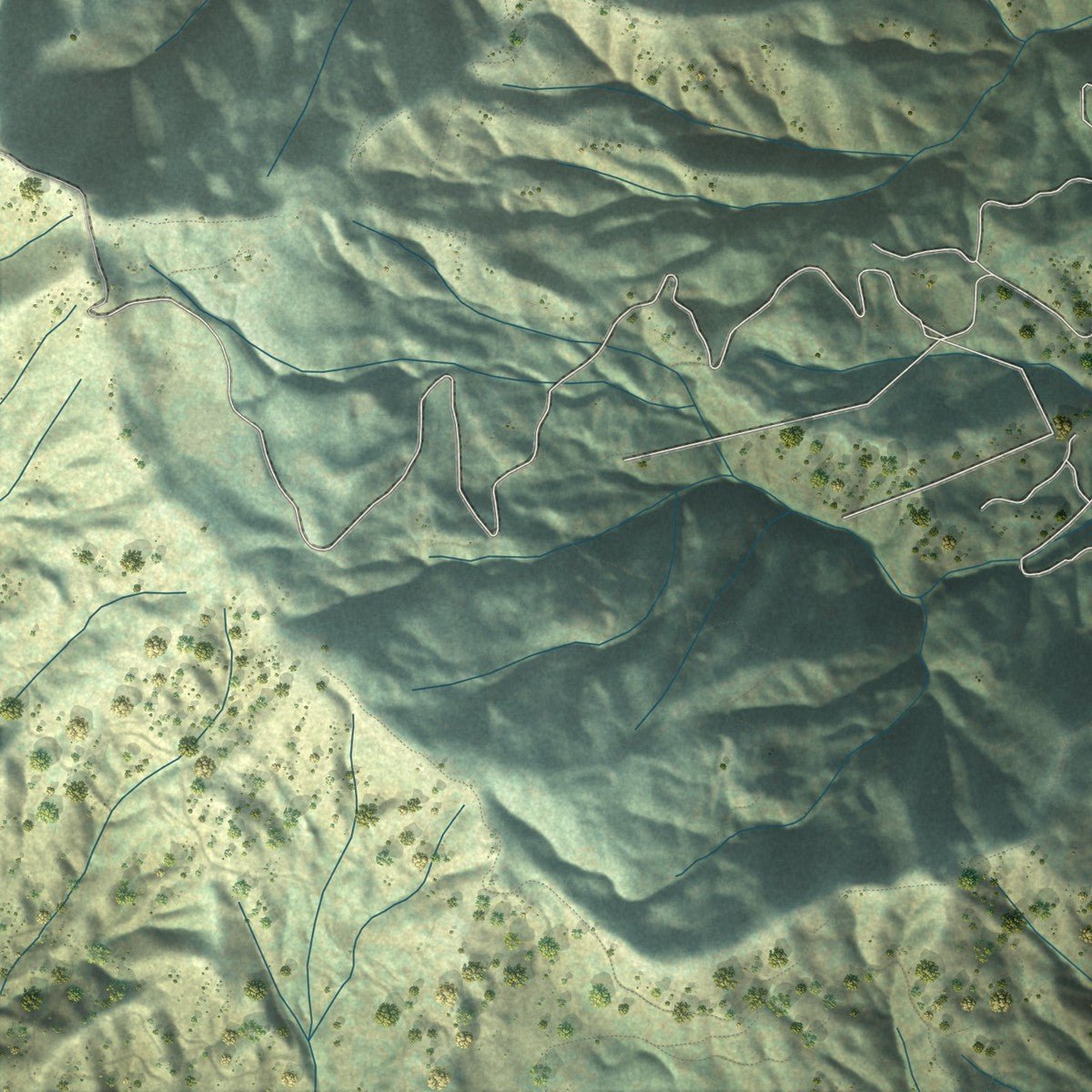
Up close
Geography Worth Displaying
This map was created using accurate cartographic data and authoritative geographic sources, including the U.S. Geological Survey and the Census Bureau. The map brings together terrain, waterways, roads, and building detail. The majority of the streets are labeled, houses are accurately depicted, and the topography is derived from government sources. Combining local data with carefully composed color and shading leads to this beautifully detailed Ukiah artwork for your wall.
Rather than simply showing street outlines, we’ve included as many of the street names as we could reasonably fit on the map while keeping their names legible. Zoom in on the high resolution preview to see exactly what’s on the map. We truly set out to create a statement piece for anyone who loves Ukiah. So whether it’s for you, or a gift for someone you love, we hope this map of Ukiah brings back fond memories.
Read the story behind this map of Ukiah, California from 2026.

Find your street
Names on the Ukiah map
Every name below is printed on this map. Look for your street, your school, the park where you played, or the pond down the road.
Places and landmarks3
- Downtown
- Asylum
- Low Gap Park
Streets and roads145
- Talmage Road
- South State Street
- West Perkins Street
- East Perkins Street
- North Orchard Avenue
- North State Street
- South Orchard Avenue
- South Dora Street
- South Main Street
- East Gobbi Street
- Washington Avenue
- Janix
- South Spring Street
- North Spring Street
- North Dora Street
- Low Gap Road
- North Bush Street
- West Standley Street
- Helen Avenue
- North Oak Street
- Airport Road
- Leslie Street
- Mendocino Drive
- West Church Street
- West Clay Street
- Oak Manor Drive
- South Oak Street
- North Pine Street
- Maple Avenue
- West Mill Street
Show all 145 streets
- Elm Street
- Empire Drive
- Waugh Lane
- Clara Avenue
- Luce Avenue
- Ford Street
- Park Boulevard
- Observatory Avenue
- Hastings Avenue
- Betty Street
- Beacon Lane
- Despina Drive
- Despina Lane
- Stanley Avenue
- Grove Avenue
- Pomo Drive
- North School Street
- Lorraine Street
- Capps Lane
- Mason Street
- Dora Avenue
- Wabash Avenue
- Vichy Springs Road
- Washo Drive
- Lockwood Drive
- Hospital Drive
- San Jacinta Drive
- North Main Street
- Yosemite Drive
- McPeak Street
- Mendocino Place
- Garrett Drive
- Cochrane Avenue
- Freeway Drive
- Mazzoni Street
- Laurel Avenue
- Manor Drive
- Cherry Street
- Gibson Street
- Rose Avenue
- Yokayo Drive
- Cindee Drive
- Brush Street
- Hillview Avenue
- Arlington Drive
- El Rio Street
- Donner Lane
- Orr Street
- Peach Street
- Court Street
- River Road
- Mill Court
- Rupe Street
- Pine Street
- South Highland Avenue
- Live Oak Drive
- South Empire Drive
- West Smith Street
- Walnut Avenue
- West Stephenson Street
- Cypress Avenue
- Hastings Frontage Road
- Jones Street
- Village Circle
- Banker Boulevard
- Hazel Avenue
- Mulberry Street
- South School Street
- Doolan Canyon Drive
- Marlene Street
- East Clay Street
- Fairway Avenue
- Redwood Avenue
- Highland Drive
- Thomas Street
- Valley View Drive
- Stella Drive
- Hillcrest Avenue
- Norton Street
- Munson Frontage Road
- Oak Park Avenue
- Cresta Drive
- Jefferson Lane
- Cooper Lane
- Porzio Lane
- Pomo Lane
- Apple Avenue
- Giorno Avenue
- Myron Street
- Sidnie Street
- Evans Street
- South Street
- Hastings Road
- Marwen Drive
- Alice Avenue
- Clubhouse Drive
- Burlington Drive
- Incline Drive
- Calvert Drive
- Holden Street
- Joseph Street
- Pomolita Drive
- Pomo Way
- Cherry Court
- Irvington Drive
- Nokomis Drive
- Carleton Drive
- Marshall Street
- Barbara Street
- Sidnie Court
- Plum Street
- Yaqui Drive
- Kings Court
- City Well Road
- South Avenue
Names are listed as they appear on the printed map. Zoom into the product photos to find them.
About Ukiah, California
Ukiah is a city of 16,607 people and the seat of Mendocino County, set in the Russian River valley. Its name comes from Yokáya, a Pomo village whose name means "deep valley" or "south valley," and the Pomo had lived here for thousands of years before settlers came. Under Mexican rule the valley lay within Rancho Yokaya, a land grant held by Cayetano Juárez.
In 1856 Samuel Lowry put up a log cabin near what is now the corner of East Perkins and North Main streets. In the spring of 1857 A.T. Perkins bought Lowry's claim, and the Perkins family became the first Anglo-American pioneer family in the township, with six more families arriving that same year. A post office opened in 1858, and by 1859 about 100 people lived here. That was enough for Ukiah to take over county business that Sonoma County had handled until then, and the town was incorporated in 1876.
- The railroad came in 1889For years, travelers reached Ukiah only by stagecoach or on horseback. In 1870 the train from San Francisco stopped at Petaluma, nearly 80 miles south, and the rest of the trip took two more days by horse. The line later reached Cloverdale, but the town stayed isolated until the San Francisco and North Pacific Railroad finished its track to Ukiah in 1889, connecting the county seat with railroads across the country.
- Hops from 1868L.F. Long of Largo planted Ukiah's first hops in 1868 as an experiment. The plant, used to flavor beer, liked the climate, and the fields spread until production peaked in 1885. Falling prices cut the crop in the late 1880s, yet in 1890 Mendocino County still ranked third in California for hops, with more than 900 acres planted. A restored hop kiln still stands at the north end of town, east of Highway 101.
- Pears for nearly 90 yearsAlex R. Thomas & Company grew Bartlett pears on hundreds of acres on the east side of the Ukiah Valley, and for nearly 90 years local people and migrant workers packed the fruit for buyers at home and abroad. On December 1, 2008, the company said bankruptcy would force it to close most operations at the end of the year. Vineyards have replaced some of the old orchards, and grapes are now the valley's main crop.
- Five on the National RegisterThe Palace Hotel joined the National Register in 1979, followed by the Sun House in 1981, the Held-Poage House in 1988, the Charles Hofman House in 1993 and the Ukiah Main Post Office in 2012.
- The Grace Hudson MuseumGrace Hudson was a commercial portrait photographer and a collector of Pomo artifacts. The Grace Hudson Museum in Ukiah carries her name and holds her collections.
Keep exploring California
Ukiah is one of 1,960 California towns we've mapped. Every dot on the map is a print of its own.
The search covers every state, California first.
Near Ukiah
Order 2 or more town maps and save 10%. Shown in the size and finish you picked above, so they hang as a set.
- Talmage 12" x 18" / Archival Matte Print $39.99
- Calpella 12" x 18" / Archival Matte Print $39.99
- Redwood Valley 12" x 18" / Archival Matte Print $39.99


More maps nearby: Potter Valley, Boonville, Hopland, Philo and Upper Lake.
The art of mapping a place
How This Map Was Made
Real places. Remarkable detail. Discover the layers that turn geographic data into a map of home.

The view from above
Aerial imagery reveals the character of the land: woodland, open fields, and the patterns of a place.

The shape of the land
Elevation data brings hills, valleys, and subtle changes in the landscape into view.

The details of home
Roads, waterways, and building footprints come together to make the map feel unmistakably local.

Geography becomes art
Considered color, shading, and typography bring the layers together in a map made for your wall.


Process illustrated with Mendon, Massachusetts. Aerial imagery: USDA NAIP. Terrain: USGS 3D Elevation Program. Map details and finished artwork: KNOWOL.
The Details
About This Print
Choose an archival matte print, or a black or white Ayous wood frame. The archival matte print is unframed.
Select your size and finish above to see the matching product image and price.
Materials & Craftsmanship
A contemporary map with the character of a classic atlas, printed on archival matte paper. Optional frames are made from Ayous wood.
Your printed map does not include the watermark shown in the full-map preview.
Shipping & Delivery
Free shipping within the United States. Every print is made to order in the USA.
Buying a gift? Add a note in your cart and we'll include it. We never put prices in the package.
Prints ship within 2 to 3 business days. Allow 7 to 10 days total from ordering for delivery. Timing may vary during holidays or periods of high order volume.
Read our shipping policy.
Returns and damaged prints
Each print is made to order. Change-of-mind refunds are not available after production.
If your print arrives damaged, misprinted or incorrect, contact support@knowol.com within 30 days of receiving it. Include your order number, photos and a description of the issue.
Read our full refund and replacement policy. For questions about your order, email support@knowol.com.