
Search for another town





Free U.S. delivery 7 to 10 days after you order
Union, South Carolina Map Art
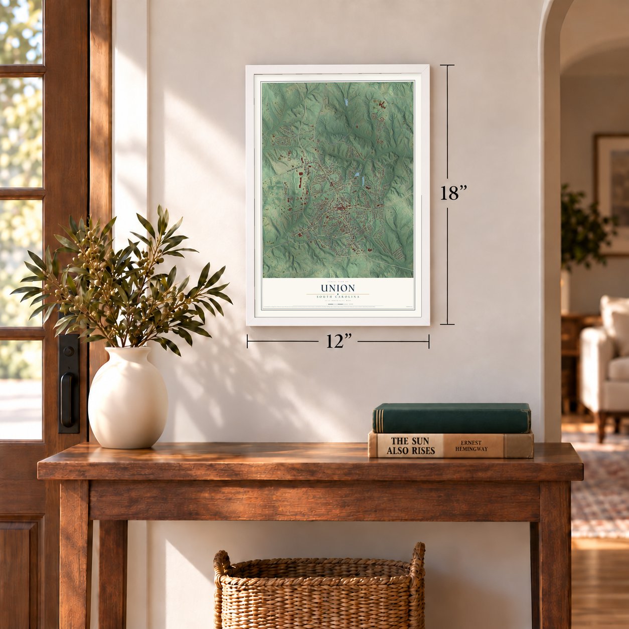
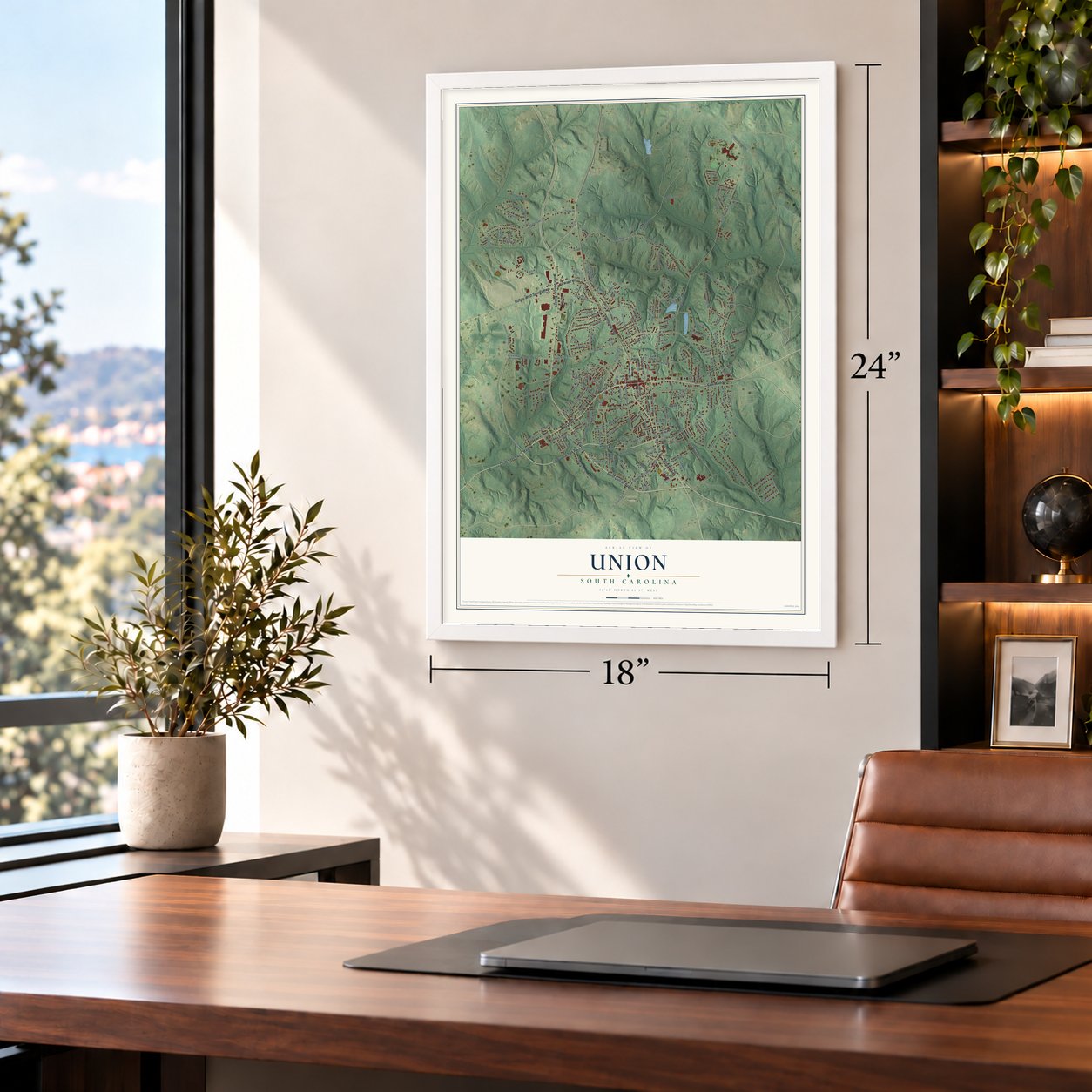
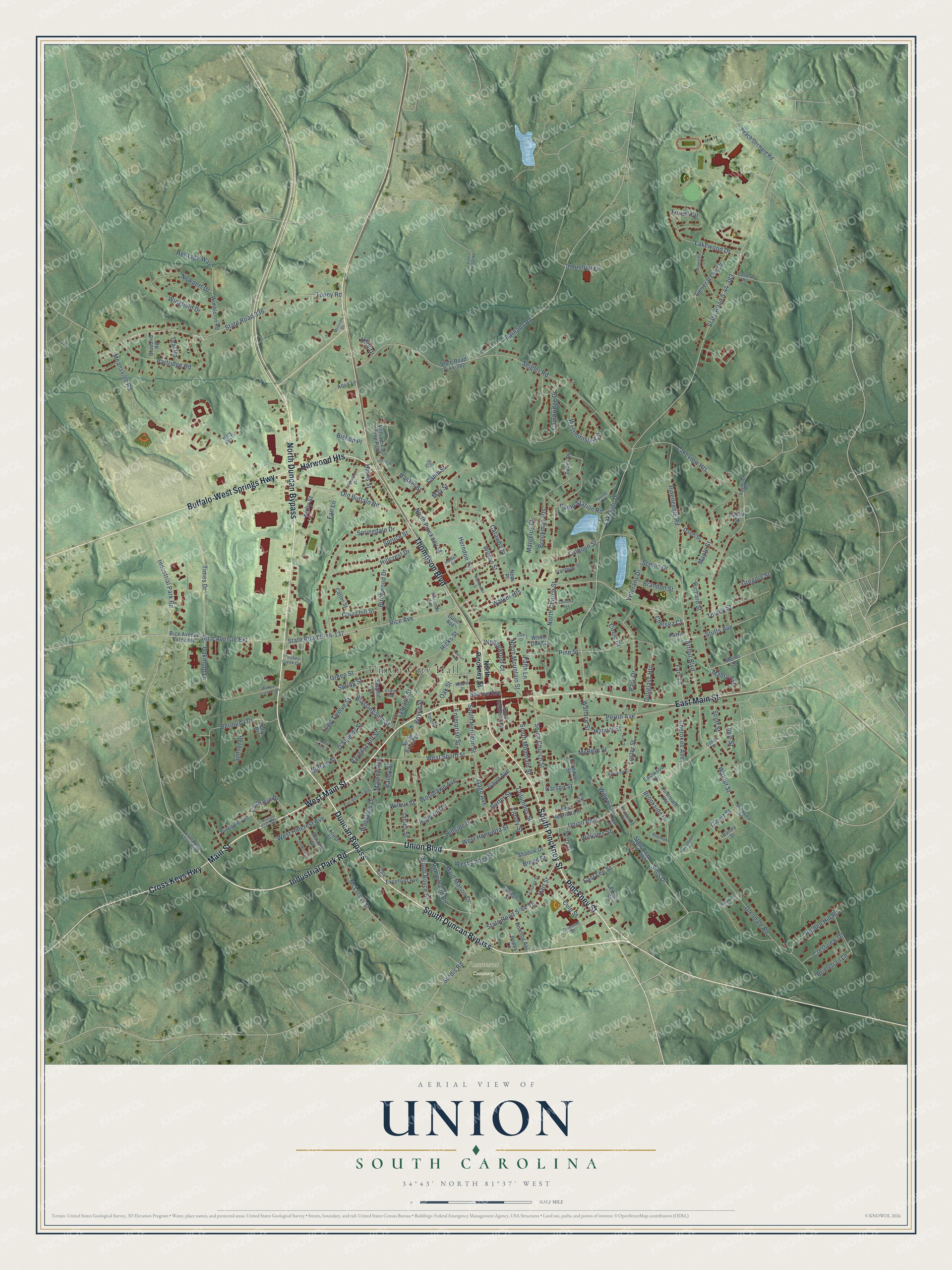
A new map of Union, South Carolina, made in 2026 and printed to order on thick archival matte paper.
12" x 18" Archival Matte Print
A Map of Home. A Work of Art.
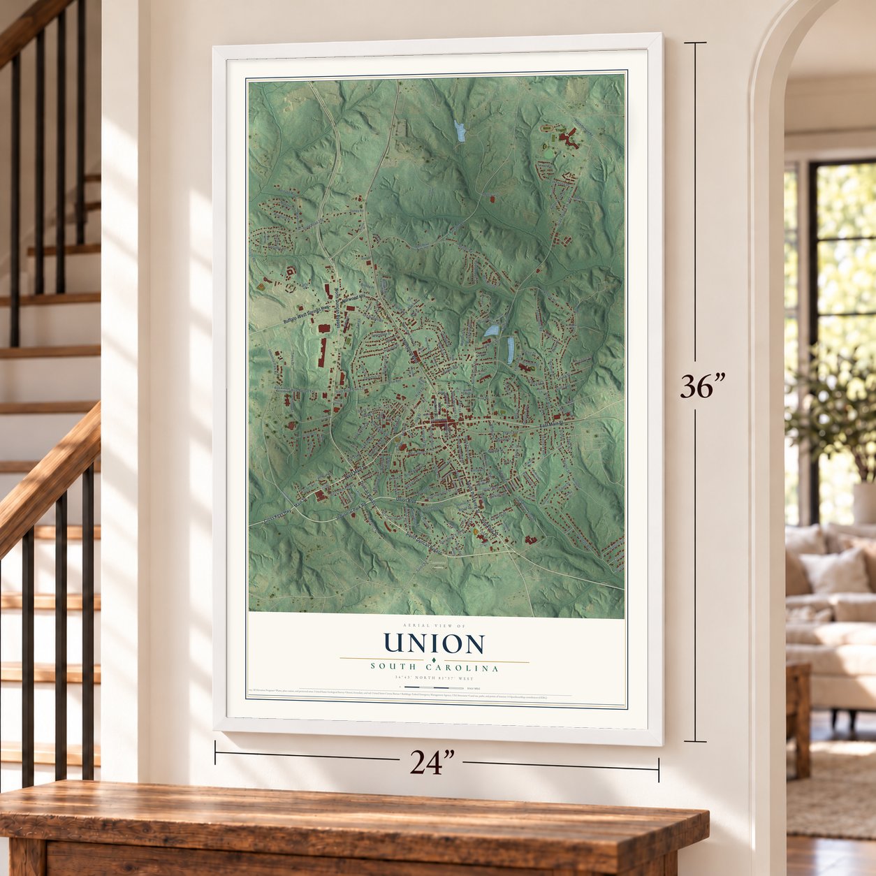
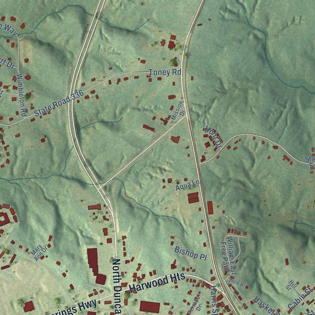
Explore Union, South Carolina from a whole new perspective. Created using aerial imagery and detailed geographic data, this map captures Union building by building, with labeled streets, familiar landmarks, and shaded topographical relief that highlights the natural contours of the landscape.
Combining modern data with the timeless character of a vintage atlas, this map is just as interesting up close as it is beautiful on the wall. Whether you grew up in Union, spent memorable years there, or call it home today, this unique map is a great way to celebrate a place that means something to you. Zoom in on the preview to look for your street, and then order a print to put your memories on the wall.
Three ways to hang it
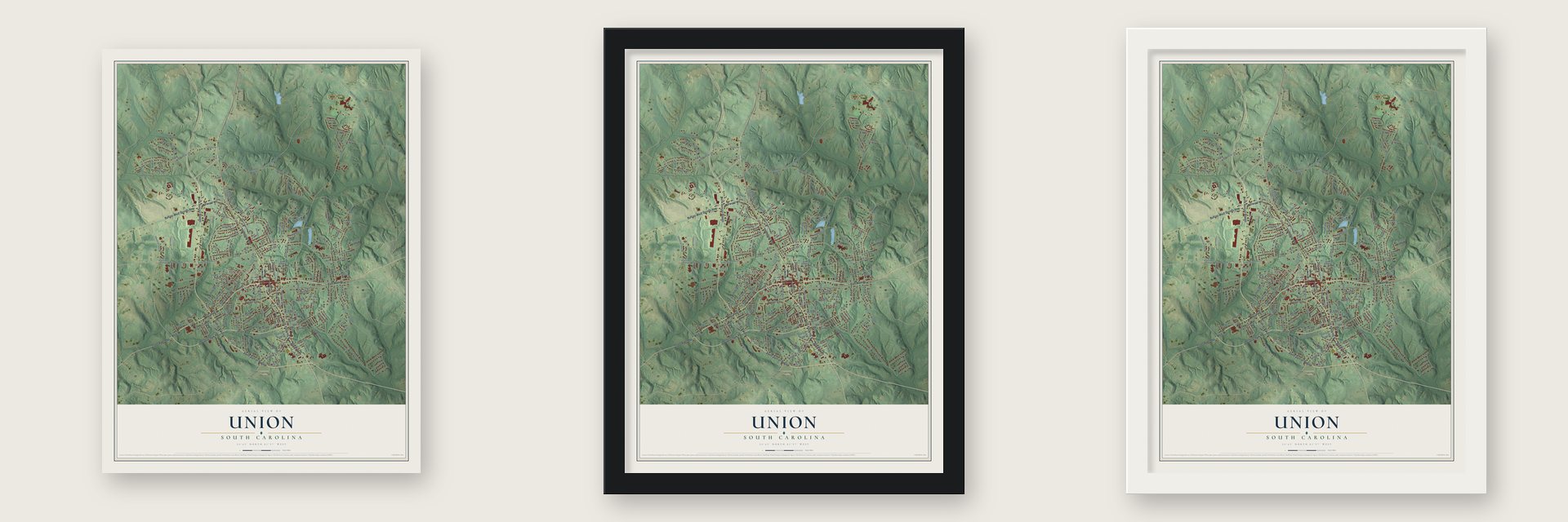
Unframed archival matte, a black wood frame or a white wood frame.
Up close
Geography Worth Displaying
This map was created using accurate cartographic data and authoritative geographic sources, including the U.S. Geological Survey and the Census Bureau. The map brings together terrain, waterways, roads, and building detail. The majority of the streets are labeled, houses are accurately depicted, and the topography is derived from government sources. Combining local data with carefully composed color and shading leads to this beautifully detailed Union artwork for your wall.
Rather than simply showing street outlines, we’ve included as many of the street names as we could reasonably fit on the map while keeping their names legible. Zoom in on the high resolution preview to see exactly what’s on the map. We truly set out to create a statement piece for anyone who loves Union. So whether it’s for you, or a gift for someone you love, we hope this map of Union brings back fond memories.
Read the story behind this map of Union, South Carolina from 2026.

About Union, South Carolina
Union is a city of 8,174 people and the county seat of Union County, South Carolina. The city and the county both take their name from the old Union Church, which stood a short way from the Monarch Mill. The town was known as Unionville at first, before the name was cut down to Union.
Settlers from Virginia, the first white families in the county, arrived in 1749, and the county's population grew fastest from 1762 until the Revolutionary War began. Those families lived in log cabins and raised tobacco, flax, corn and wheat. The town itself began to form only after the General Assembly created Union County in 1785.
- Spared by the Broad RiverUnion was among the earliest towns in this part of the state. When Sherman's army came near during the Civil War, high water on the Broad River forced the troops to change course, so the town came through the war untouched.
- A college campus since 1965The University of South Carolina opened USC Union, a satellite campus, in the city in 1965. The Southern Association of Colleges and Schools accredits it.
- Best Small Library of 2009The Union County Carnegie Library serves both the town and the students of USC Union. Library Journal named it the Best Small Library in America for 2009.
- One high school for the countyFor years Union County had three high schools: Union Comprehensive, Jonesville and Lockhart. A council ruling closed Jonesville and Lockhart and sent their students to Union High School, which took the new name Union County High School.
Find your street
Names on the Union map
Every name below is printed on this map. Look for your street, your school, the park where you played, or the pond down the road.
Places and landmarks2
- Union City Hall
- Rosemont Cemetery
Streets and roads223
- North Duncan Bypass
- Main Street
- West Main Street
- Duncan Bypass
- South Duncan Bypass
- South Pinckney Street
- Pinckney Street
- Thompson Boulevard
- East Main Street
- Buffalo-West Springs Highway
- Union Boulevard
- Industrial Park Road
- Harwood Heights
- Cross Keys Highway
- Arthur Boulevard
- North Pinckney Street
- South Church Street
- Rice Avenue
- Lakeside Drive
- West South Street
- Wallace Street
- Walnut Street
- Newport Drive
- State Road S-44-383
- State Road S-44-137
- Barnado Road
- Lakeview Heights
- North Church Street
- Meansville Road
- State Road 336
Show all 223 streets
- Toney Road
- Brookside Drive
- Perrin Avenue
- Glendale Road
- Seigler Road
- Pineneedle Road
- State Road S-44-16
- Old Buffalo Road
- Springdale Drive
- South Boyce Street
- Cambridge Drive
- Richard Street
- Sims Drive
- Highland Drive
- Pine Street
- Blassingame Street
- Partridge Road
- Hart Street
- Brockman Heights
- Rice Avenue Extension
- Wilson Street
- Foster Street
- Hicks Street
- Boyce Street
- Maple Street
- Park Drive
- Veterans Drive
- West Henrietta Street
- Bermuda Drive
- Green Street
- Hillcrest Drive
- McBeth Street
- Robin Hood Circle
- Lakewood Drive
- Westminister Circle
- Maid Marion Drive
- General Lee Drive
- Calhoun Street
- Catawba Street
- West Hillcrest Avenue
- Wingfield Drive
- South Mountain Street
- Ravenscroft Street
- Gage Avenue
- Westview Drive
- McLurest Street
- Scott Street
- Spruce Street
- Toluca Street
- Culp Street
- North Mountain Street
- Hillside Drive
- Collector Drive
- Hidden Hill Road
- Kirby Street
- May Street
- Woodlawn Avenue
- Wilbur Street
- Forest Circle
- Heritage Way
- Birchwood Drive
- East Lee Street
- Herndon Terrace
- Oakmont Lane
- Enterprise Street
- Faith Lane
- Walker Heights
- Pump Station Road
- Stutts Avenue
- Haskel Street
- O'Shields Street
- Cherokee Avenue
- Douglass Heights
- Sardis Road
- Columbus Street
- Cabin Street
- Porter Street
- Churchill Street
- Spring Street
- Scenic Drive
- Times Drive
- Hamlet Street
- South Herndon Street
- Crestview Drive
- Brandon Street
- Bridletrail Lane
- Gregory Street
- Long Twelve Street
- Oak Street
- Marcelus Street
- Lipsey Street
- West Cohen Street
- Gault Avenue
- Wedgewood Court
- Harris Street
- Lybrand Street
- Fant Lane
- Sharpe Avenue
- Circle Drive
- Sunset Drive
- Chelsea Court
- Lowe Street
- Mabry Avenue
- Malone Avenue
- Williams Street
- Industrial Drive
- Buffalo Street
- Carson Street
- James Street
- Broad Street
- Teal Road
- Bailey Street
- Fair Lane
- Gibert Street
- Bishop Place
- Willow Lane
- Hunt Drive
- Peach Orchard Road
- Banny Street
- State Road S-44-382
- State Road S-44-282
- North Boyce Street
- Bennett Street
- William East Free Path
- Davis Street
- Locust Street
- Shadow Drive
- Talley Drive
- East Henrietta Street
- Powell Street
- Bowling Avenue
- Pinedale Avenue
- Carter Street
- Excelsior Avenue
- Wimbleton Road
- Rice Avenue Extended
- Second Avenue
- South Gadberry Street
- College Street
- Munro Street
- Cornwell Street
- Culbreath Heights
- Eastwood Drive
- Bluebird Road
- Berry Street
- Poppy Lane
- White Oak Street
- Aqua Lane
- Dunn Avenue
- Poplar Street
- Holly Drive
- Parris Lane
- Neds Place
- State Road S-44-194
- Pinetree Lane
- Horseshoe Circle
- Havird Lane
- Toshes Creek Circle
- Standpipe Street
- Hill Street
- Jenkins Street
- Terrace Drive
- Raymond Road
- New Street
- Callihan Road
- Erwin Avenue
- Coleman Street
- Louise Street
- Merriman Avenue
- Harlan Street
- Brickyard Road
- Halden Drive
- Mission Drive
- Moore Street
- Mary Ann Drive
- Cohen Street
- Ingle Avenue
- Keenan Avenue
- North Evans Street
- Woodrow Street
- Medical Sciences Drive
- East Hillcrest Avenue
- McPherson Street
- Rosewood Terrace
- Carolina Avenue
- Murrah Apartment
- Beechtree Place
- Axel Street
- Briarwood Lane
- Lillie Drive
- Pine Knoll Road
- Rogers Circle
- Culp Court
Names are listed as they appear on the printed map. Zoom into the product photos to find them.
The art of mapping a place
How This Map Was Made
Real places. Remarkable detail. Discover the layers that turn geographic data into a map of home.

The view from above
Aerial imagery reveals the character of the land: woodland, open fields, and the patterns of a place.

The shape of the land
Elevation data brings hills, valleys, and subtle changes in the landscape into view.

The details of home
Roads, waterways, and building footprints come together to make the map feel unmistakably local.

Geography becomes art
Considered color, shading, and typography bring the layers together in a map made for your wall.


Process illustrated with Mendon, Massachusetts. Aerial imagery: USDA NAIP. Terrain: USGS 3D Elevation Program. Map details and finished artwork: KNOWOL.
The Details
About This Print
Choose an archival matte print, or a black or white Ayous wood frame. The archival matte print is unframed.
Select your size and finish above to see the matching product image and price.
Materials & Craftsmanship
A contemporary map with the character of a classic atlas, printed on archival matte paper. Optional frames are made from Ayous wood.
Your printed map does not include the watermark shown in the full-map preview.
Shipping & Delivery
Free shipping within the United States. Every print is made to order in the USA.
Buying a gift? Add a note in your cart and we'll include it. We never put prices in the package.
Prints ship within 2 to 3 business days. Allow 7 to 10 days total from ordering for delivery. Timing may vary during holidays or periods of high order volume.
Read our shipping policy.
Returns and damaged prints
Each print is made to order. Change-of-mind refunds are not available after production.
If your print arrives damaged, misprinted or incorrect, contact support@knowol.com within 30 days of receiving it. Include your order number, photos and a description of the issue.
Read our full refund and replacement policy. For questions about your order, email support@knowol.com.
Find your town
Looking for another city?
Find a map of home in our South Carolina collection, or any town in the country.
Nearby
Maps of towns near Union
Know someone from one of these towns? Their map makes a great gift.
 Monarch Mill
, South Carolina
From $39.99See the map
 Buffalo
, South Carolina
From $39.99See the map
 Jonesville
, South Carolina
From $39.99See the map
More maps nearby: Lockhart, Carlisle, Glenn Springs, Cross Anchor and Central Pacolet.