
Search for another town


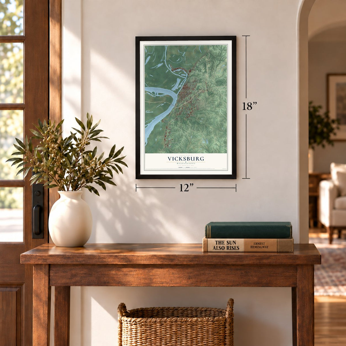
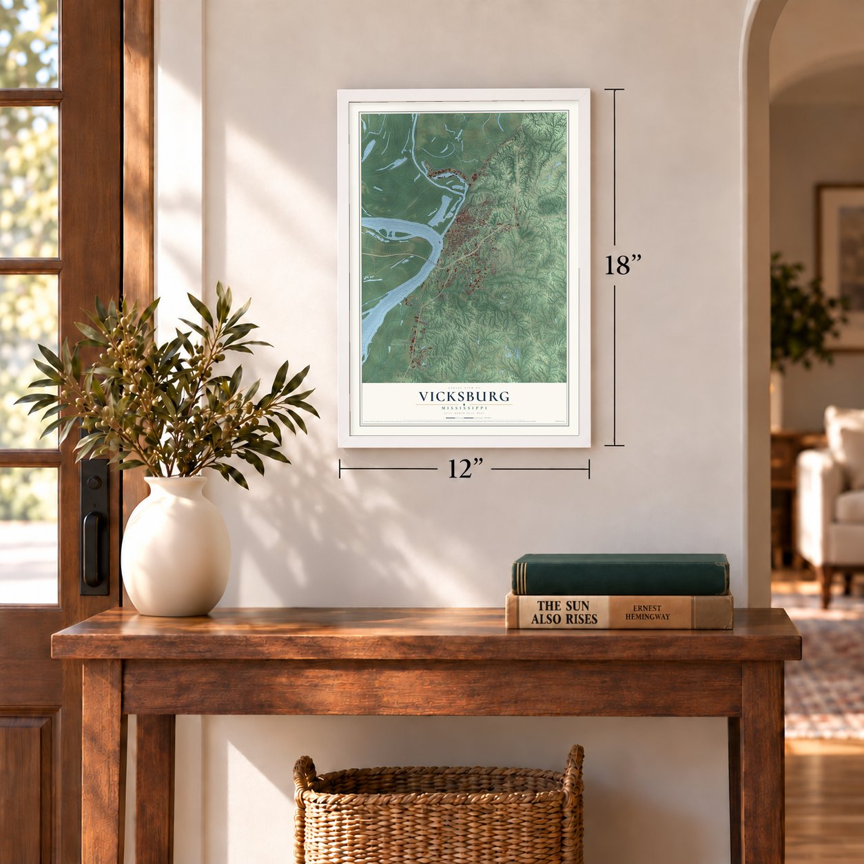
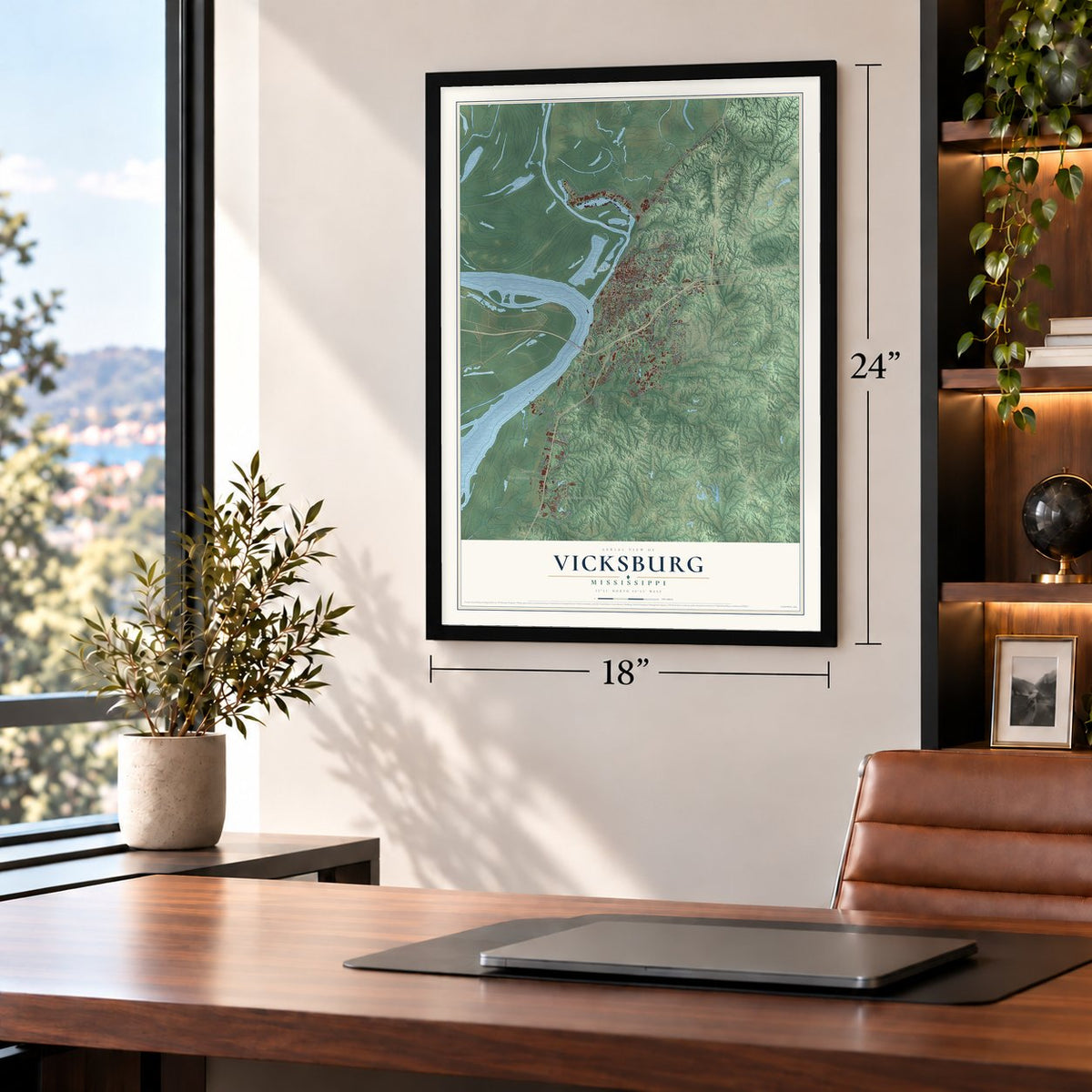
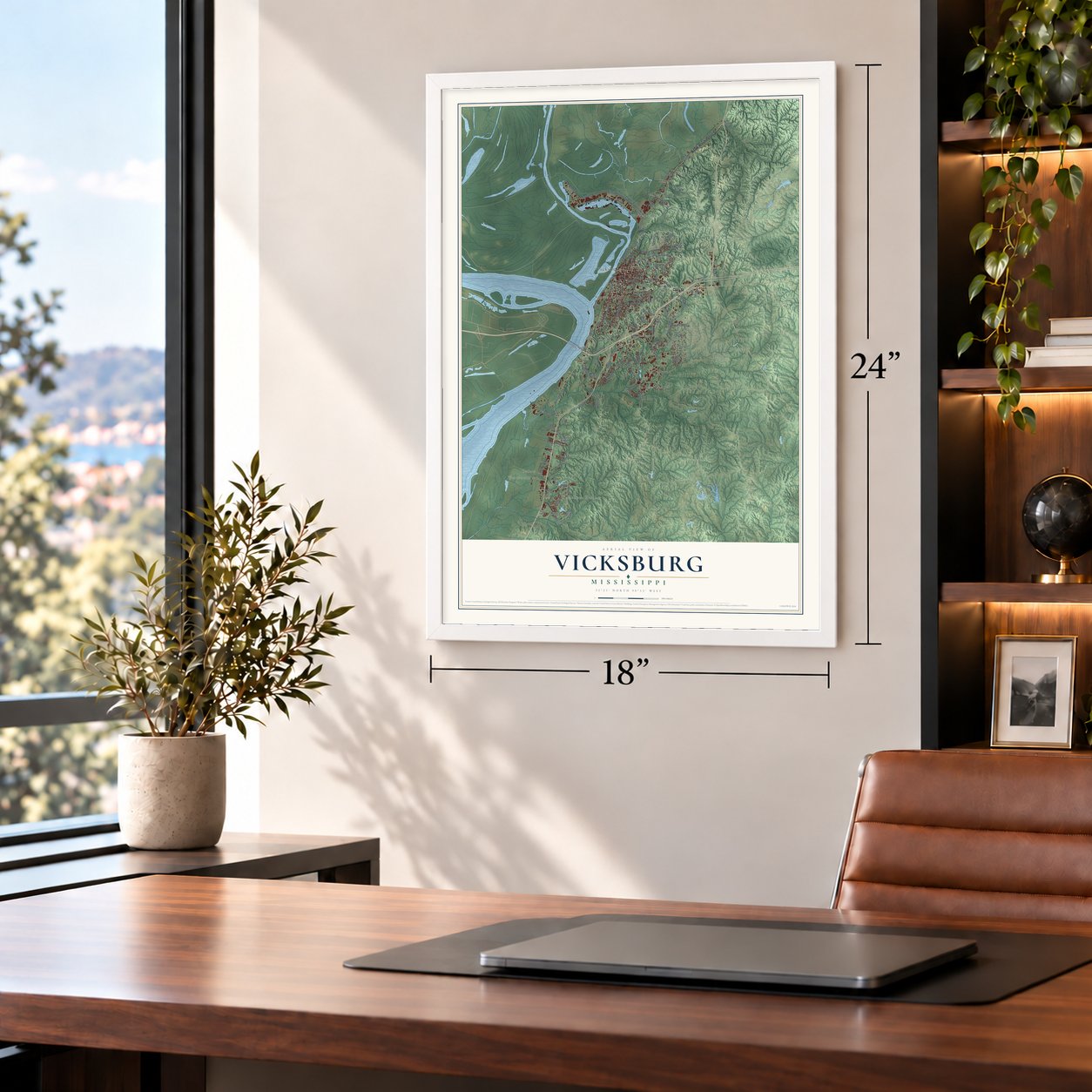

Free U.S. delivery 7 to 10 days after you order
Vicksburg, Mississippi Map Art
A new map of Vicksburg, Mississippi, made in 2026 and printed to order on thick archival matte paper.
12" x 18" Archival Matte Print
A Map of Home. A Work of Art.
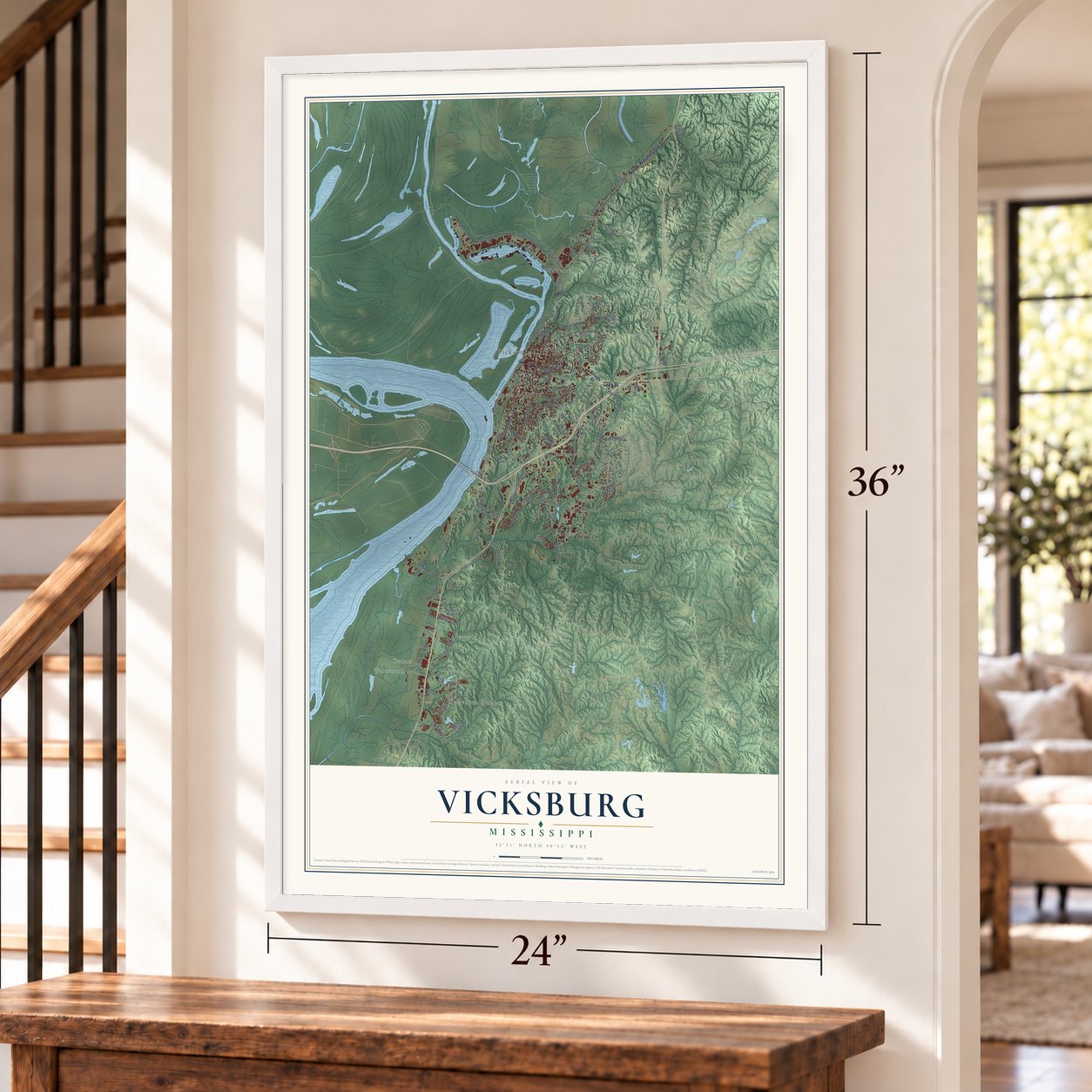
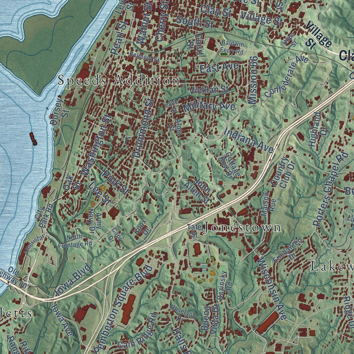
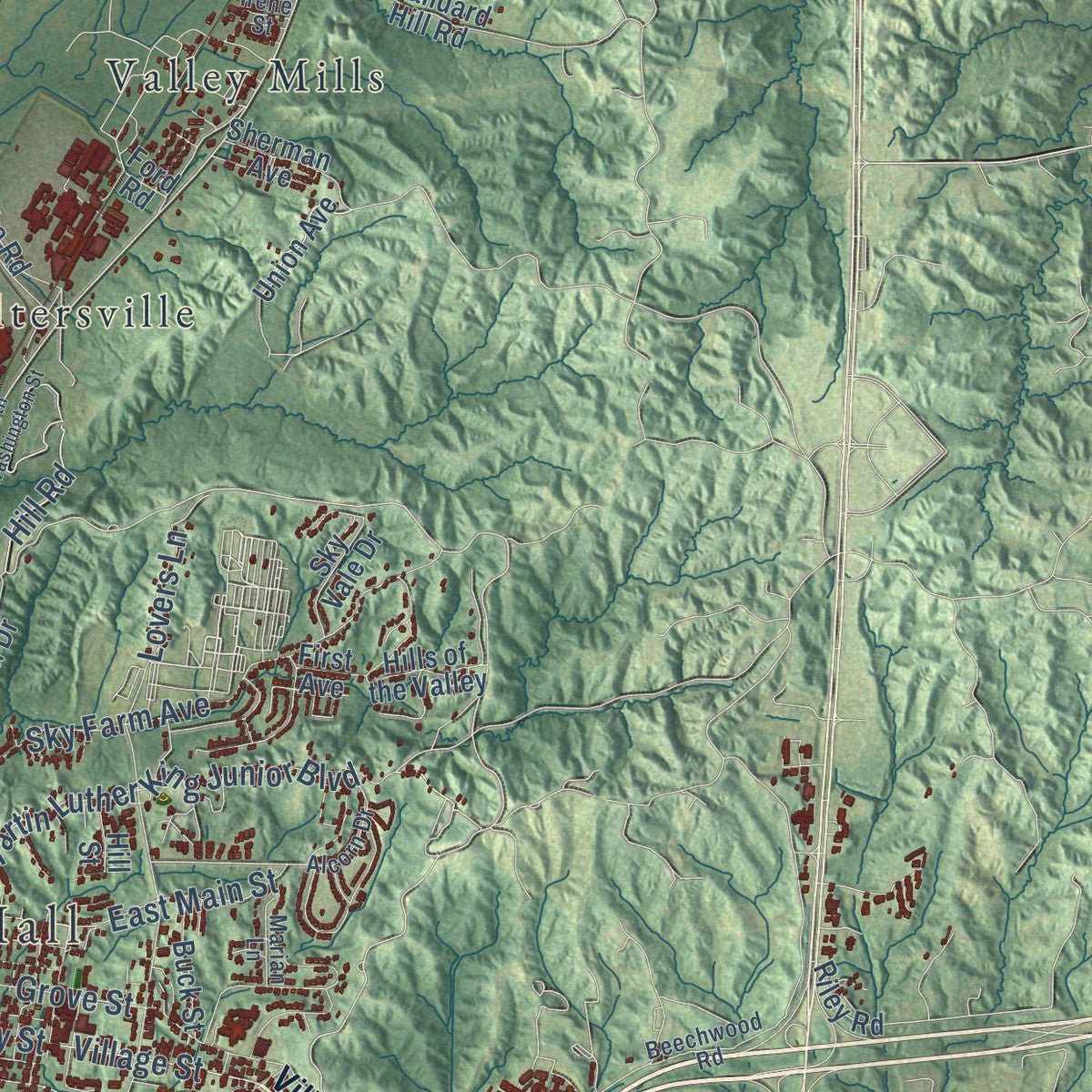
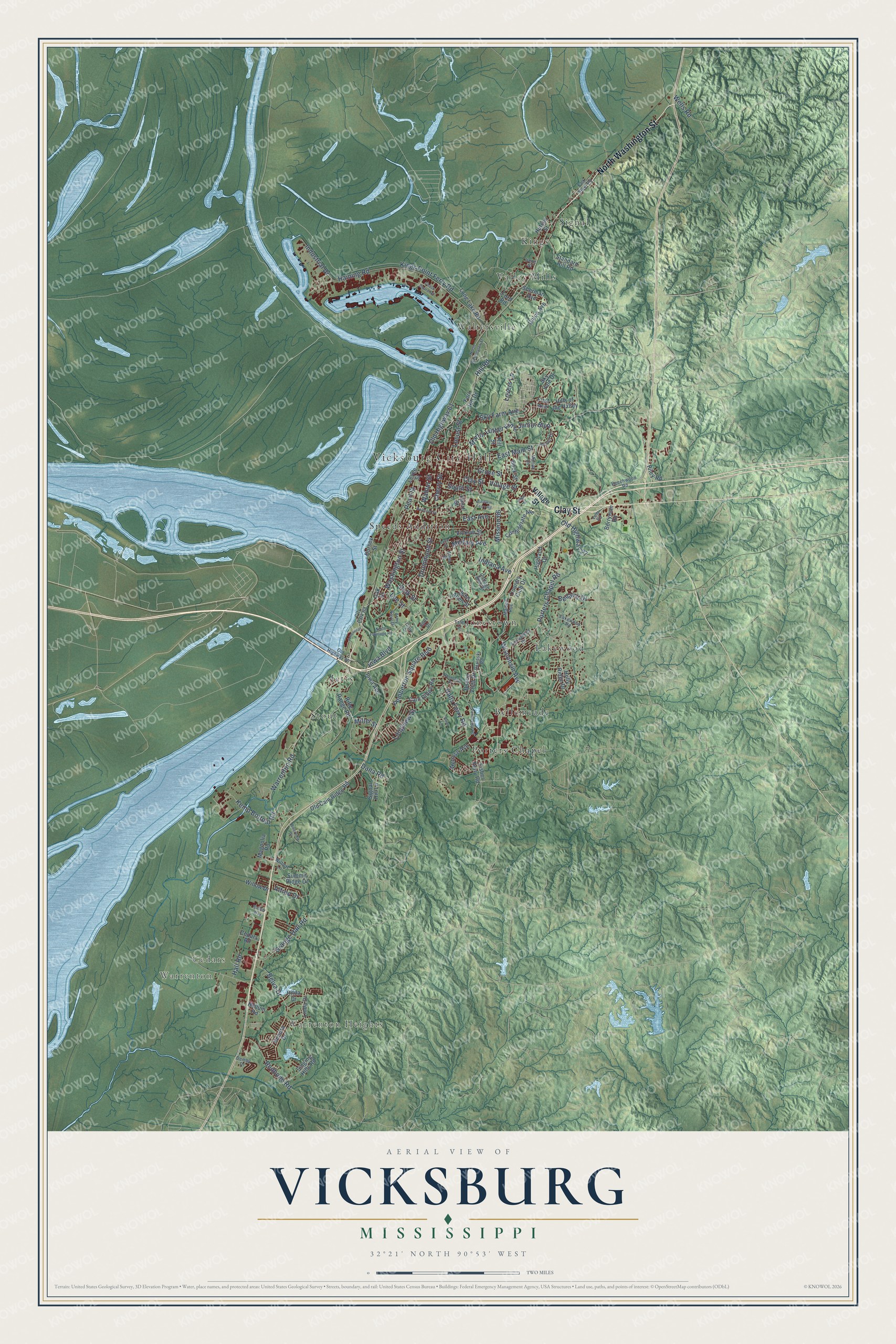
Explore Vicksburg, Mississippi from a whole new perspective. Created using aerial imagery and detailed geographic data, this map captures Vicksburg building by building, with labeled streets, familiar landmarks, and shaded topographical relief that highlights the natural contours of the landscape.
Combining modern data with the timeless character of a vintage atlas, this map is just as interesting up close as it is beautiful on the wall. Whether you grew up in Vicksburg, spent memorable years there, or call it home today, this unique map is a great way to celebrate a place that means something to you. Zoom in on the preview to look for your street, and then order a print to put your memories on the wall.
Three ways to hang it
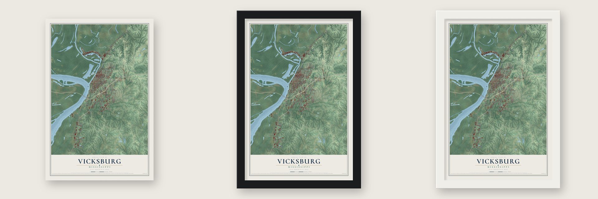
Unframed archival matte, a black wood frame or a white wood frame.
Up close
Geography Worth Displaying
This map was created using accurate cartographic data and authoritative geographic sources, including the U.S. Geological Survey and the Census Bureau. The map brings together terrain, waterways, roads, and building detail. The majority of the streets are labeled, houses are accurately depicted, and the topography is derived from government sources. Combining local data with carefully composed color and shading leads to this beautifully detailed Vicksburg artwork for your wall.
Rather than simply showing street outlines, we’ve included as many of the street names as we could reasonably fit on the map while keeping their names legible. Zoom in on the high resolution preview to see exactly what’s on the map. We truly set out to create a statement piece for anyone who loves Vicksburg. So whether it’s for you, or a gift for someone you love, we hope this map of Vicksburg brings back fond memories.
Read the story behind this map of Vicksburg, Mississippi from 2026.

About Vicksburg, Mississippi
Vicksburg is a city of 21,573 people and the seat of Warren County, set high on bluffs above the Mississippi River and facing Louisiana. The Natchez people lived here long before Europeans came. In 1790 the Spanish built a military post on the site and called it Fort Nogales, for its walnut trees, and when the Americans took over in 1798 they renamed it Walnut Hills. Newitt Vick, a Methodist minister, started a Protestant mission there, and the village took his name when it was incorporated in 1825.
Steamboats stopped here to load cotton from the surrounding counties, and Vicksburg soon became the second-largest community in Mississippi, behind only Natchez. That position made it vital in the Civil War. Union attacks failed in the summer of 1862, so Ulysses S. Grant planned a longer campaign, and after a 47-day siege Confederate General John C. Pemberton gave up the city. Union troops marched in on July 4, 1863, one day after Robert E. Lee's defeat at Gettysburg, and the two events are remembered as the war's turning point.
“Vicksburg is the key.”
- Coca-Cola's first bottlesOn March 12, 1894, Joseph A. Biedenharn, a Vicksburg candy maker, put Coca-Cola into bottles for the first time. His old soda bottles from the 1800s are now prized by collectors, and his candy store has been restored as the Biedenharn Coca-Cola Museum. The Biedenharn Candy Company Building joined the National Register in 1977.
- The river moved away in 1876Steamboat trade made Vicksburg rich, but in 1876 a flood cut through De Soto Point and moved the Mississippi's channel away from the city, leaving only an oxbow lake. Without a working port, business suffered. The U.S. Army Corps of Engineers turned the Yazoo River into the old channel, and when its Yazoo Diversion Canal was finished in 1903, Vicksburg was a river town again. The Corps still runs three large installations in the city.
- More than 1,300 monumentsAfter the siege, Vicksburg became a place to remember the soldiers. The federal government opened a national cemetery for Union dead here in 1865, and Soldiers' Rest grew into the largest Confederate burial ground in Mississippi. In 1899 Congress created the Vicksburg National Military Park, where more than 1,300 monuments mark moments in the campaign.
- A Jewish congregation since 1841About twenty of the 3,000 people in the town at its 1825 incorporation were Jewish immigrants from Bavaria, Prussia and Alsace-Lorraine. Mississippi's second Jewish congregation began here in 1841, and in 1862 fifty Jewish families organized the Hebrew Benevolent Congregation Anshe Chesed and won a state charter. The Anshe Chesed Cemetery followed in 1864, the second Jewish cemetery in the city.
Find your street
Names on the Vicksburg map
Every name below is printed on this map. Look for your street, your school, the park where you played, or the pond down the road.
Places and landmarks15
- Vicksburg City Hall
- Warrenton Heights
- Warrenton
- Cedars
- Bellemeade
- Jetts
- Jonestown
- Kings
- Lakewood
- Porters Chapel
- Signal
- Speeds Addition
Show all 15 places
- Stout
- Valley Mills
- Waltersville
Streets and roads117
- Clay Street
- North Washington Street
- Old Highway 61
- Washington Street
- Hill Road
- Lee Street
- Pearl Street
- Drummond Street
- Village Street
- Halls Ferry Road
- Porters Chapel Road
- Haining Road
- Warrenton Road
- Kings Point Ferry Road
- Wisconsin Avenue
- Mission 66
- Martin Luther King Junior Boulevard
- Cherry Street
- Sky Farm Avenue
- Grove Street
- Indiana Avenue
- Belva Drive
- Pemberton Square Boulevard
- Iowa Boulevard
- East Main Street
- Locust Street
- South Street
- Grange Hall Road
- Redbone Road
- Kemp Bottom Road
Show all 117 streets
- Walnut Street
- East Avenue
- Old Highway 27
- Bellaire Drive
- Hall Road
- Military Avenue
- Dana Road
- Industrial Drive
- Lovers Lane
- Longview Street
- Alfred Drive
- Polk Street
- Wells Road
- Miller Street
- Confederate Avenue
- Union Avenue
- Oak Street
- Levee Street
- Cain Ridge Road
- Long Lake Road
- Rifle Range Road
- Iowa Avenue
- Fort Hill Drive
- Old Cain Ridge Road
- Hutson Street
- Standard Hill Road
- Linda Drive
- Vicklan Street
- Kendra Drive
- Fisher Ferry Road
- Singing Hills Road
- Summit Ridge Drive
- Buena Vista Drive
- Dorsey Street
- Sherman Avenue
- John Allen Street
- Magnolia Road
- Ford Road
- Signal Hill Lane
- Melrose Avenue
- Holly Ridge Drive
- Sky Vale Drive
- Hullum Road
- Willow Drive
- Berryman Road
- Hills of the Valley
- Highland Drive
- Country Club Drive
- Riley Road
- Hilda Drive
- Buck Street
- Cedars Road
- Court Street
- Hill Street
- First Avenue
- Old Highway 80
- Bazinsky Road
- Alcorn Drive
- Lakewood Road
- Demby Drive
- Maison Rue
- Enchanted Drive
- Falk Steel Road
- Wilbert Lane
- Beechwood Road
- Army Navy Drive
- City Park Road
- Cottage Row Drive
- Knox Drive
- Tate Street
- Marian Lane
- Lum Road
- Alma Street
- Irene Street
- North Frontage Road
- Baldwin Ferry Road
- Tennessee Road
- Ameristar
- Roseland Drive
- Hope Street
- Riverview Drive
- Lane Street
- Belmont Street
- Coast Guard Road
- Rubber Way
- Capri Drive
- Briar Lane
Names are listed as they appear on the printed map. Zoom into the product photos to find them.
The art of mapping a place
How This Map Was Made
Real places. Remarkable detail. Discover the layers that turn geographic data into a map of home.

The view from above
Aerial imagery reveals the character of the land: woodland, open fields, and the patterns of a place.

The shape of the land
Elevation data brings hills, valleys, and subtle changes in the landscape into view.

The details of home
Roads, waterways, and building footprints come together to make the map feel unmistakably local.

Geography becomes art
Considered color, shading, and typography bring the layers together in a map made for your wall.


Process illustrated with Mendon, Massachusetts. Aerial imagery: USDA NAIP. Terrain: USGS 3D Elevation Program. Map details and finished artwork: KNOWOL.
The Details
About This Print
Choose an archival matte print, or a black or white Ayous wood frame. The archival matte print is unframed.
Select your size and finish above to see the matching product image and price.
Materials & Craftsmanship
A contemporary map with the character of a classic atlas, printed on archival matte paper. Optional frames are made from Ayous wood.
Your printed map does not include the watermark shown in the full-map preview.
Shipping & Delivery
Free shipping within the United States. Every print is made to order in the USA.
Buying a gift? Add a note in your cart and we'll include it. We never put prices in the package.
Prints ship within 2 to 3 business days. Allow 7 to 10 days total from ordering for delivery. Timing may vary during holidays or periods of high order volume.
Read our shipping policy.
Returns and damaged prints
Each print is made to order. Change-of-mind refunds are not available after production.
If your print arrives damaged, misprinted or incorrect, contact support@knowol.com within 30 days of receiving it. Include your order number, photos and a description of the issue.
Read our full refund and replacement policy. For questions about your order, email support@knowol.com.
Find your town
Looking for another city?
Find a map of home in our Mississippi collection, or any town in the country.
Nearby
Maps of towns near Vicksburg
Know someone from one of these towns? Their map makes a great gift.
 Beechwood
, Mississippi
From $39.99See the map
 Bovina
, Mississippi
From $39.99See the map
 Redwood
, Mississippi
From $39.99See the map
More maps nearby: Edwards, Eagle Bend, Utica, Learned and Valley Park.