
Search for another town





Free U.S. delivery 7 to 10 days after you order
Victoria, Texas Map Art
Building by building, with labeled streets and shaded relief.
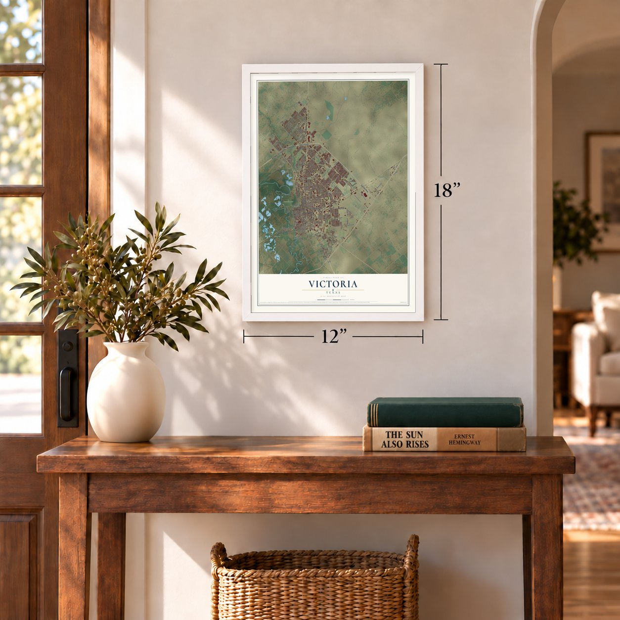
12" x 18" Archival Matte Print
A Map of Home. A Work of Art.
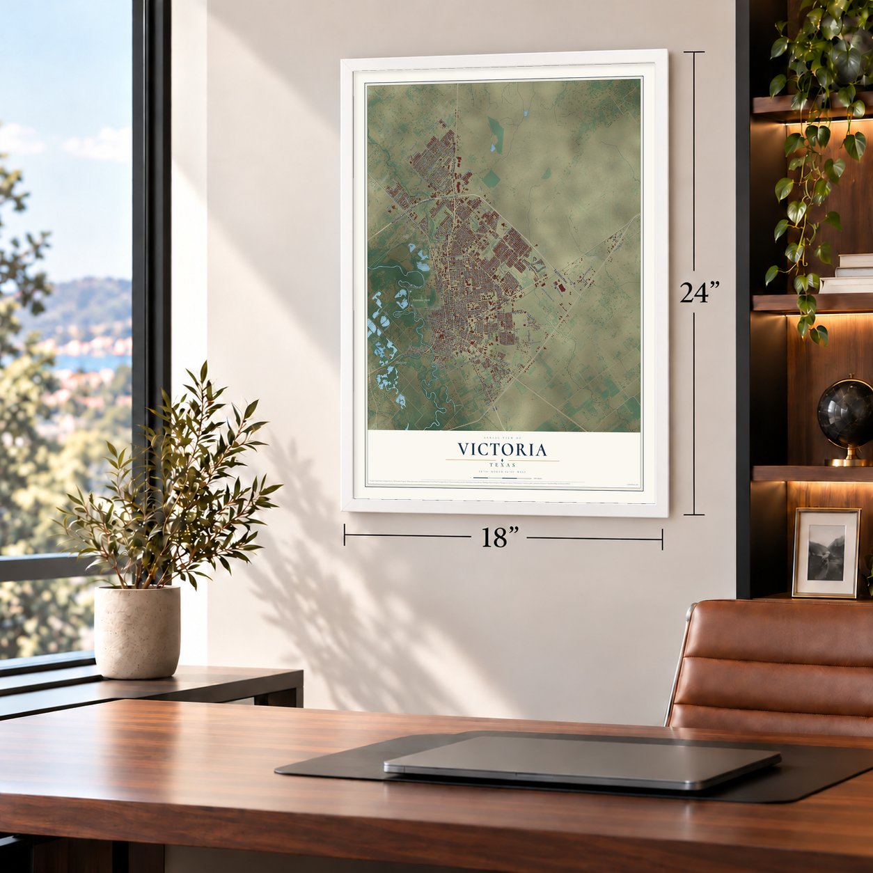
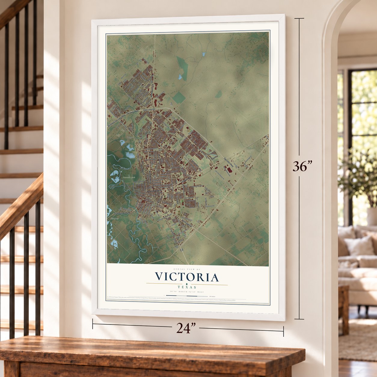
Explore Victoria, Texas from a whole new perspective. Created using aerial imagery and detailed geographic data, this map captures Victoria building by building, with labeled streets, familiar landmarks, and shaded topographical relief that highlights the natural contours of the landscape.
Combining modern data with the timeless character of a vintage atlas, this map is just as interesting up close as it is beautiful on the wall. Whether you grew up in Victoria, spent memorable years there, or call it home today, this unique map is a great way to celebrate a place that means something to you. Zoom in on the preview to look for your street, and then order a print to put your memories on the wall.
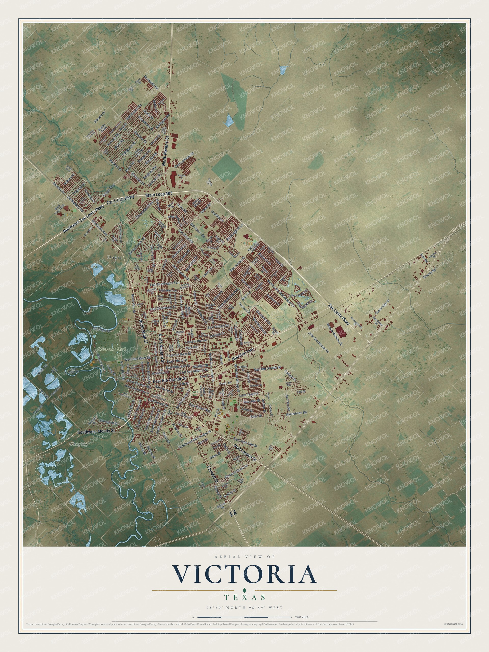
Three ways to hang it
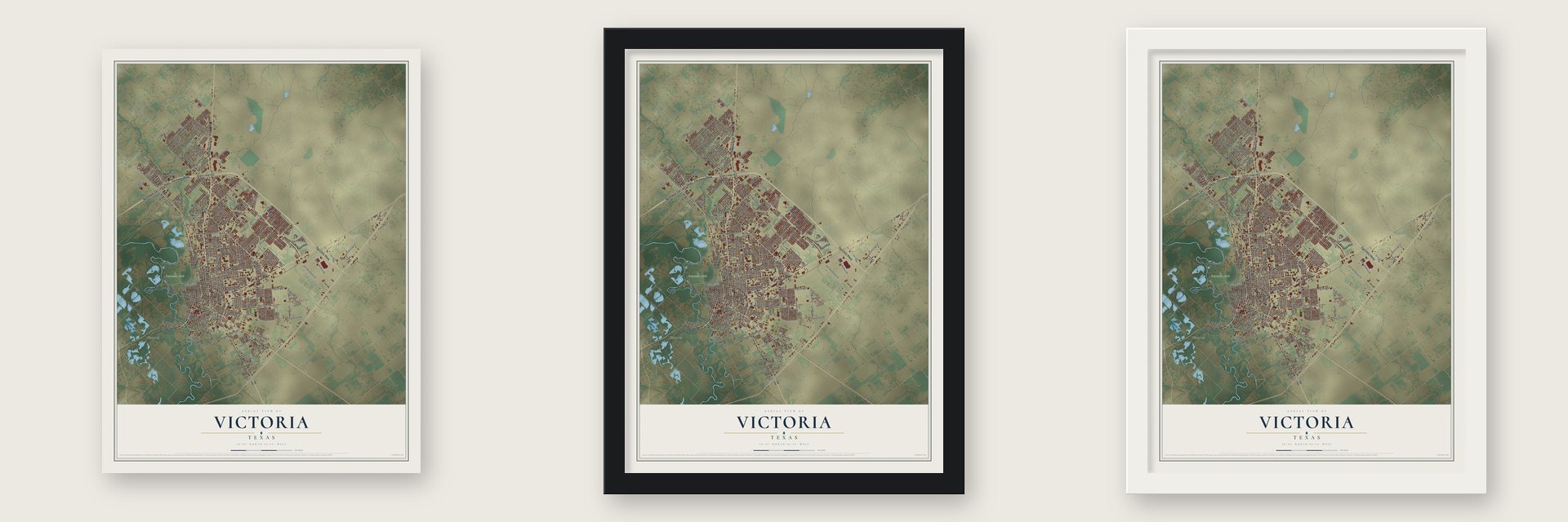
Unframed archival matte, a black wood frame or a white wood frame.
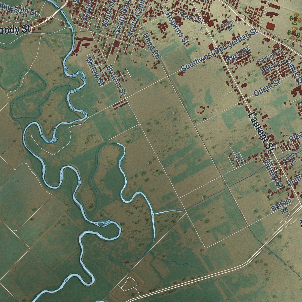
Up close
Geography Worth Displaying
This map was created using accurate cartographic data and authoritative geographic sources, including the U.S. Geological Survey and the Census Bureau. The map brings together terrain, waterways, roads, and building detail. The majority of the streets are labeled, houses are accurately depicted, and the topography is derived from government sources. Combining local data with carefully composed color and shading leads to this beautifully detailed Victoria artwork for your wall.
Rather than simply showing street outlines, we’ve included as many of the street names as we could reasonably fit on the map while keeping their names legible. Zoom in on the high resolution preview to see exactly what’s on the map. We truly set out to create a statement piece for anyone who loves Victoria. So whether it’s for you, or a gift for someone you love, we hope this map of Victoria brings back fond memories.
Read the story behind this map of Victoria, Texas from 2026.

Find your street
Names on the Victoria map
Every name below is printed on this map. Look for your street, your school, the park where you played, or the pond down the road.
Places and landmarks3
- Dupre
- Riverside Park
- Chipley
Streets and roads262
- Zac Lentz Parkway
- State Loop 463
- North Main Street
- North Navarro Street
- Port Lavaca Drive
- East Rio Grande Street
- Houston Highway
- Laurent Street
- Northwest Zac Lentz Parkway
- Southwest Moody Street
- East Airline Road
- Sam Houston Drive
- North Ben Jordan Street
- Ben Jordan Street
- Southwest Ben Jordan Street
- North Laurent Street
- Mc Cright Drive
- North George Street
- Old Cuero Highway
- Old Nursery Road
- South Navarro Street
- Willow Street
- West Stayton Avenue
- Lone Tree Road
- Rhinegold Street
- North Bluff Street
- Tropical Drive
- Kelly Drive
- North John Stockbauer Drive
- East Juan Linn Street
Show all 262 streets
- North Vine Street
- Glascow Street
- East North Street
- Delmar Drive
- North Ben Wilson Street
- East Red River Street
- Salem Road
- East Mockingbird Lane
- Ball Airport Road
- Pleasant Green Drive
- Mallette Street
- FM 1685
- East Mistletoe Avenue
- Edinburgh Street
- Anthony Road
- Hanselman Road
- East Colorado Street
- Country Club Drive
- John Stockbauer Drive
- East Crestwood Drive
- North De Leon Street
- Blyth Road
- Odem Street
- Briggs Boulevard
- Miori Lane
- Park Avenue
- Guy Grant Road
- East San Antonio Street
- Leary Lane
- Callis Street
- Lova Drive
- East Power Avenue
- Halsey Street
- Wayne Watkins Drive
- West Red River Street
- Taos Drive
- East Trinity Street
- Loma Vista Avenue
- Levi Street
- North Bridge Street
- Charleston Drive
- Simpson Road
- Westwood Drive
- Broadmoor Street
- Memorial Drive
- East Forrest Street
- Lilac Lane
- College Drive
- Mead Road
- Berwick Road
- East Larkspur Street
- Dudley Street
- Champions Row
- Northgate Road
- Bottom Street
- Northside Road
- South De Leon Street
- Santa Fe Drive
- South Cameron Street
- Dairy Road
- Monterrey Drive
- Bingham Road
- Spring Creek Road
- Profit Drive
- Plantation Drive
- Maplewood Drive
- South Main Street
- South Glass Street
- Pozzi Road
- Bianchi Drive
- Auburn Hl
- Rhodes Road
- Ash Street
- Mockingbird Lane
- Linda Drive
- Hopkins Street
- Berkman Drive
- King Arthur Street
- Fillmore Avenue
- Hand Road
- Smith Road
- Redwood Drive
- Swan Drive
- Cypress Street
- Will Heard Road
- Larkspur Street
- Country Lane
- Joplin Street
- Kingsway Street
- Cambridge Street
- Nursery Drive
- South Vine Street
- Bridle Lane
- Bobolink Street
- Navidad Street
- Byron Lane
- Tibiletti Drive
- Catalpa Street
- Young Drive
- County Road
- Putney Street
- Lenora Drive
- Holt Road
- Raab Street
- Kern Drive
- FM 404
- North Ben Jorden Street
- Lingo Lane
- North Nimitz Street
- North Cameron Street
- Circle Street
- Anaqua Avenue
- East Guadalupe Street
- Kerh Boulevard
- Berwick Street
- Azalea Street
- Kelly Crick Road
- Mac Arthur Street
- Oleander Drive
- West Commercial Street
- Arroyo Drive
- Colony Creek Drive
- North Moody Street
- Navajo Drive
- Shiloh Drive
- Smith Street
- West Tropical Drive
- Brushy Creek
- Tampa Drive
- Paco Drive
- River Road
- Creekridge Drive
- Woodway Drive
- Windy Way Drive
- Ivanhoe Drive
- Kingwood Drive
- Parsifal Street
- Tibiletti Road
- Sundance Drive
- Regency Avenue
- Jade Drive
- Windsor Street
- Gemini Court
- Lariat Lane
- North Azalea Street
- Cotswold Lane
- McLane Street
- Stadium Drive
- Harry Street
- Sparkman Road
- Fox Bend Drive
- Stolz Street
- Manor Drive
- Ridge Vw
- Stoner Road
- Owens Street
- Port Street
- Bottom Road
- Polk Avenue
- Coffey Street
- Hovar Drive
- Oliver Street
- Proctor Street
- Palm Drive
- Robin Lane
- Lala Street
- Love Street
- Elk Drive
- East Constitution Street
- North East Street
- East Commercial Street
- Burroughsville Road
- Perth Road
- Bon Aire Avenue
- Berkshire Lane
- Brocton Drive
- Glendale Street
- Pine Street
- Palmetto Avenue
- Timberlane Drive
- Antietam Drive
- Dahlia Lane
- Paco Road
- Cobble Stone Court
- Garrett Street
- Hyak Avenue
- Cardinal Street
- Hartman Road
- Victoria Station Drive
- Eden Roc Street
- Holly Street
- Arabian Drive
- Legend Drive
- Milton Street
- Beacon Lane
- Fannin Drive
- Ernst Street
- Otilia Road
- John Street
- Kay Drive
- Augusta Drive
- Eisenhower Street
- West Constitution Street
- Rosewood Drive
- West Nueces Street
- Dunbar Drive
- Avondale Street
- West Brazos Street
- Turtle Rock Drive
- Gettysburg Drive
- Pebble Brook
- Pecan Street
- Cimarron Drive
- Macon Creek
- Plainview Street
- Mulberry Street
- Hospital Drive
- Whispering Creek Drive
- Terravista Trail
- Bradley Road
- Larimore Street
- Burning Tree Street
- Terra Vista Ranch Road
- Armory Drive
- Carville Street
- Dean Cook Drive
- Alydar Drive
- Willard Street
- Marilyn Drive
- Center Street
- Robles Street
- Conti Lane
Names are listed as they appear on the printed map. Zoom into the product photos to find them.
About Victoria, Texas
Victoria is a city of 65,534 people and the seat of Victoria County, on the east side of the Guadalupe River. The Mexican empresario Martín De León founded it in 1824 as the center of his new colony, and he named it Guadalupe Victoria to honor the first president of independent Mexico. Ten years later, about 300 people lived in the town.
During the Texas Revolution the town sent men and supplies to the rebel side, but Mexican troops moved in after they beat James Fannin at the Battle of Coleto. Once Santa Anna lost at San Jacinto, Anglo settlers drove out the Mexican families and shortened the name to Victoria. Germans and other Europeans came in large numbers in the middle of the nineteenth century, and by the turn of the next century the city was growing quickly as the trade center for its region.
- De León's town squareWhen he laid out the town, De León reserved four public squares. One of them is now DeLeon Plaza, which holds monuments and memorials and a bandstand put up in 1890. Two years later, in 1892, the county finished its courthouse of Texas granite and Indiana limestone.
- St. Mary's ChurchSt. Mary's, downtown, was the first Catholic church in the Republic of Texas to be formally set up under church law, and only one Catholic church in Texas is older. Today Victoria is the seat of a Catholic bishop, who leads the Roman Catholic Diocese of Victoria in Texas from the city.
- Fossati's since 1882Fossati's Delicatessen opened downtown in 1882 and is still serving customers in Victoria.
- Riverside Park and its zooRiverside Park covers 562 acres along the Guadalupe. It is home to the Texas Zoo, which shows more than 200 species of animals and plants native to Texas in settings like their natural habitats, and to a paddling trail on the river.
- A white Christmas in 2004Snow falls in Victoria only about once every 11 years. On December 24 and 25, 2004, the city had its first white Christmas on record, when 12.5 inches of snow came down.
Keep exploring Texas
Victoria is one of 2,049 Texas towns we've mapped. Every dot on the map is a print of its own.
The search covers every state, Texas first.
Near Victoria
Order 2 or more town maps and save 10%. Shown in the size and finish you picked above, so they hang as a set.
- Quail Creek 12" x 18" / Archival Matte Print $39.99
- Nursery 12" x 18" / Archival Matte Print $39.99
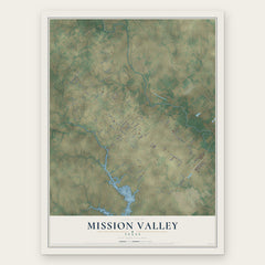
- Mission Valley 12" x 18" / Archival Matte Print $39.99
More maps nearby: Inez, Bloomington, Placedo, Meyersville and Vanderbilt.
The art of mapping a place
How This Map Was Made
Real places. Remarkable detail. Discover the layers that turn geographic data into a map of home.

The view from above
Aerial imagery reveals the character of the land: woodland, open fields, and the patterns of a place.

The shape of the land
Elevation data brings hills, valleys, and subtle changes in the landscape into view.

The details of home
Roads, waterways, and building footprints come together to make the map feel unmistakably local.

Geography becomes art
Considered color, shading, and typography bring the layers together in a map made for your wall.


Process illustrated with Mendon, Massachusetts. Aerial imagery: USDA NAIP. Terrain: USGS 3D Elevation Program. Map details and finished artwork: KNOWOL.
The Details
About This Print
Choose an archival matte print, or a black or white Ayous wood frame. The archival matte print is unframed.
Select your size and finish above to see the matching product image and price.
Materials & Craftsmanship
A contemporary map with the character of a classic atlas, printed on archival matte paper. Optional frames are made from Ayous wood.
Your printed map does not include the watermark shown in the full-map preview.
Shipping & Delivery
Free shipping within the United States. Every print is made to order in the USA.
Buying a gift? Add a note in your cart and we'll include it. We never put prices in the package.
Prints ship within 2 to 3 business days. Allow 7 to 10 days total from ordering for delivery. Timing may vary during holidays or periods of high order volume.
Read our shipping policy.
Returns and damaged prints
Each print is made to order. Change-of-mind refunds are not available after production.
If your print arrives damaged, misprinted or incorrect, contact support@knowol.com within 30 days of receiving it. Include your order number, photos and a description of the issue.
Read our full refund and replacement policy. For questions about your order, email support@knowol.com.