
Search for another town




Free U.S. delivery 7 to 10 days after you order
Vidalia, Georgia Map Art
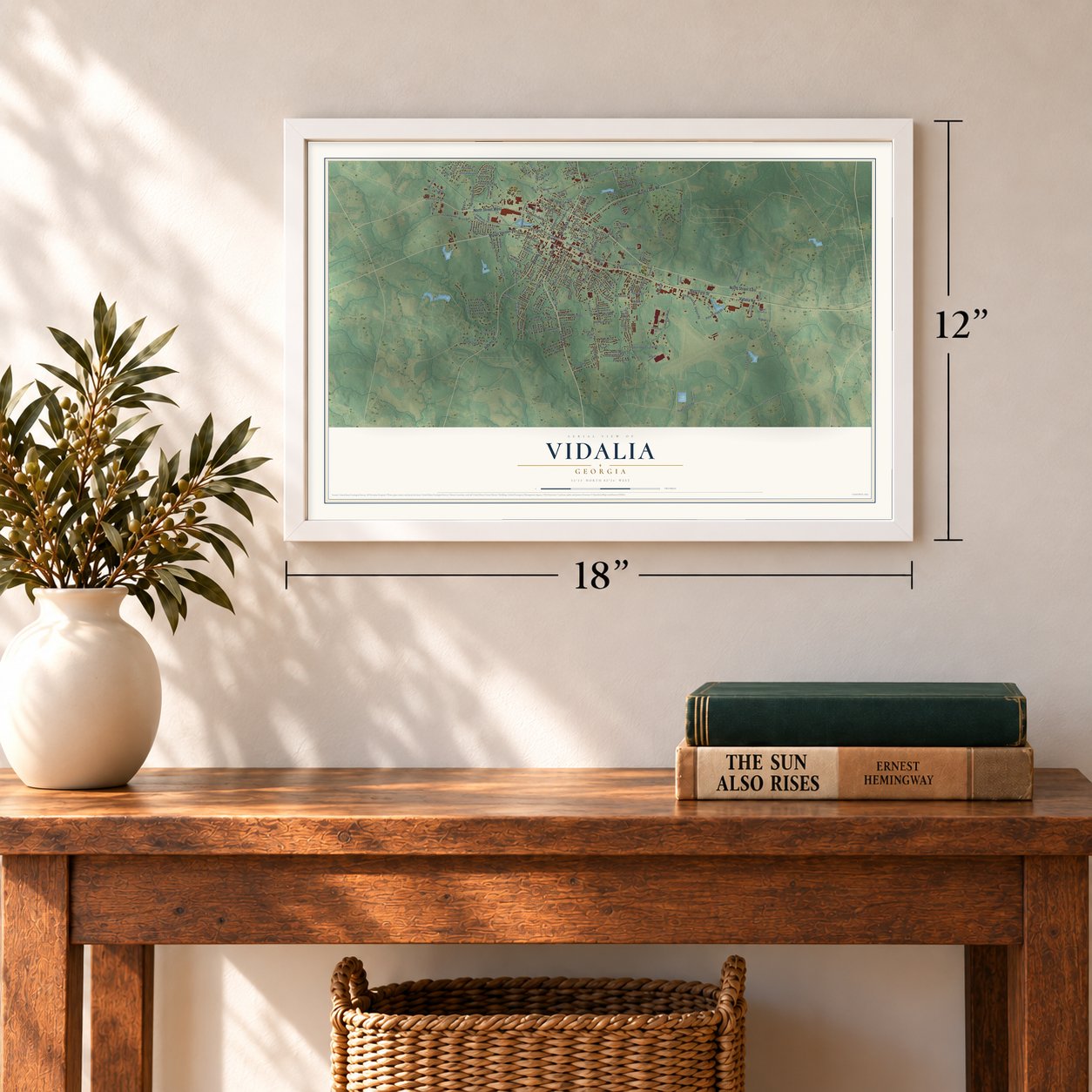
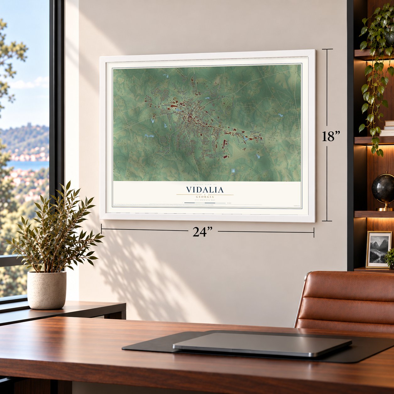
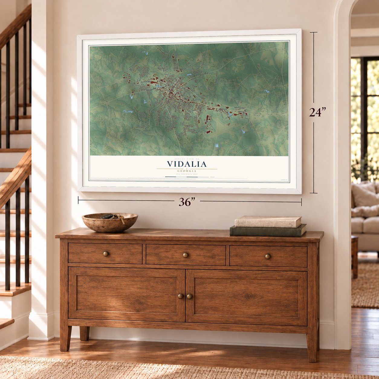
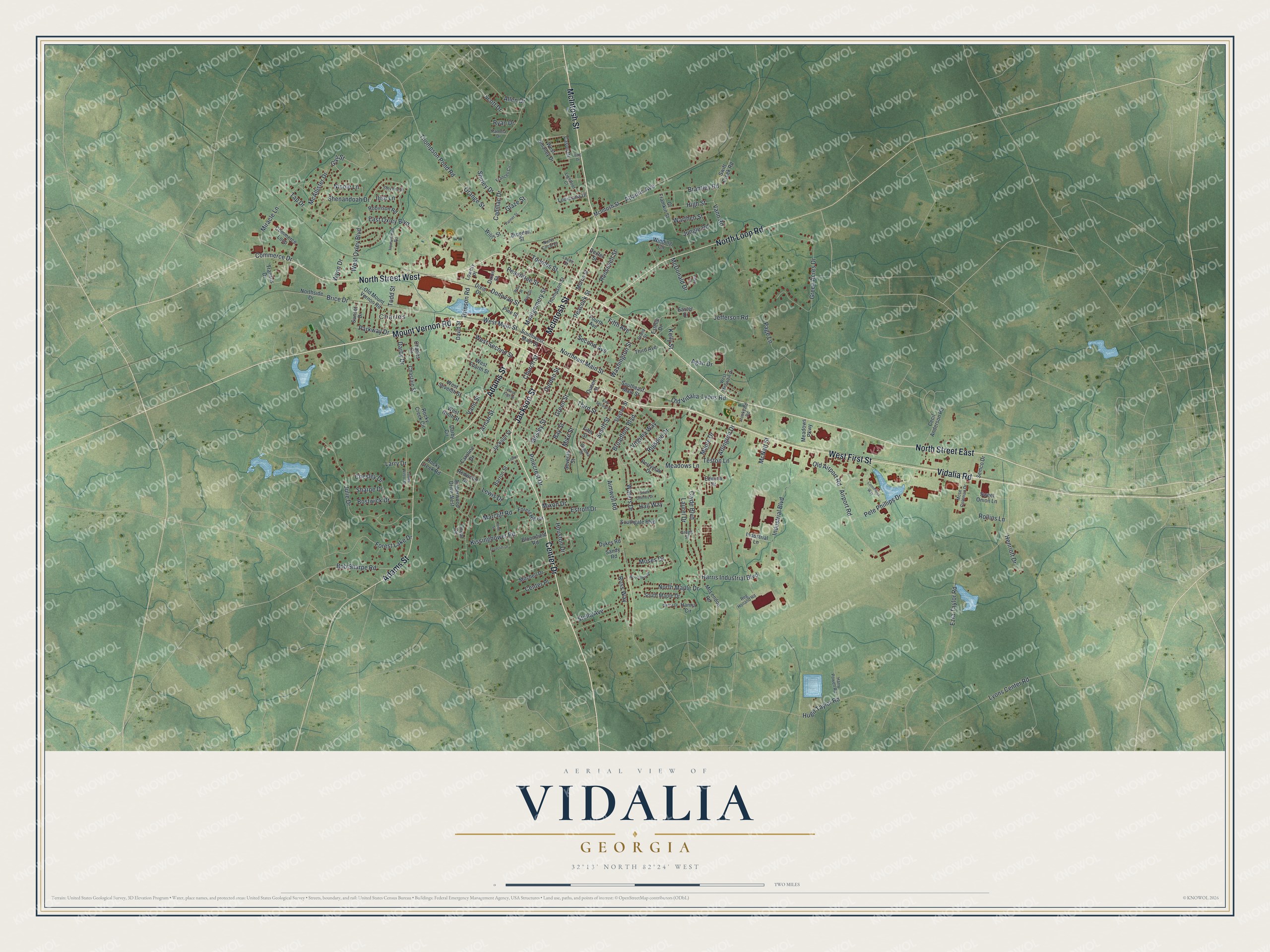
A new map of Vidalia, Georgia, made in 2026 and printed to order on thick archival matte paper.
12" x 18" Archival Matte Print
A Map of Home. A Work of Art.
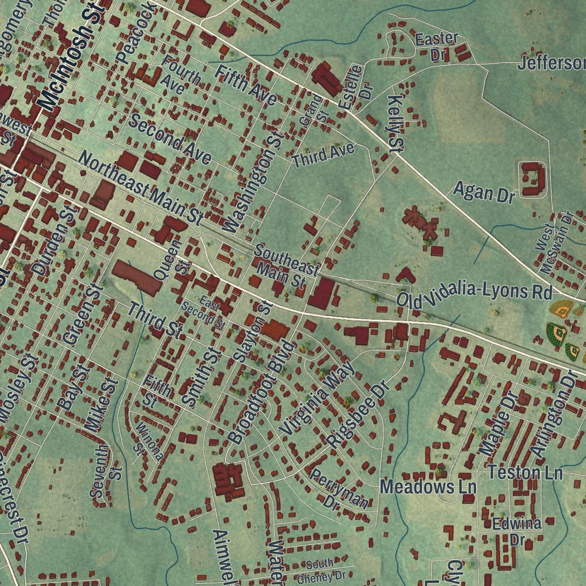
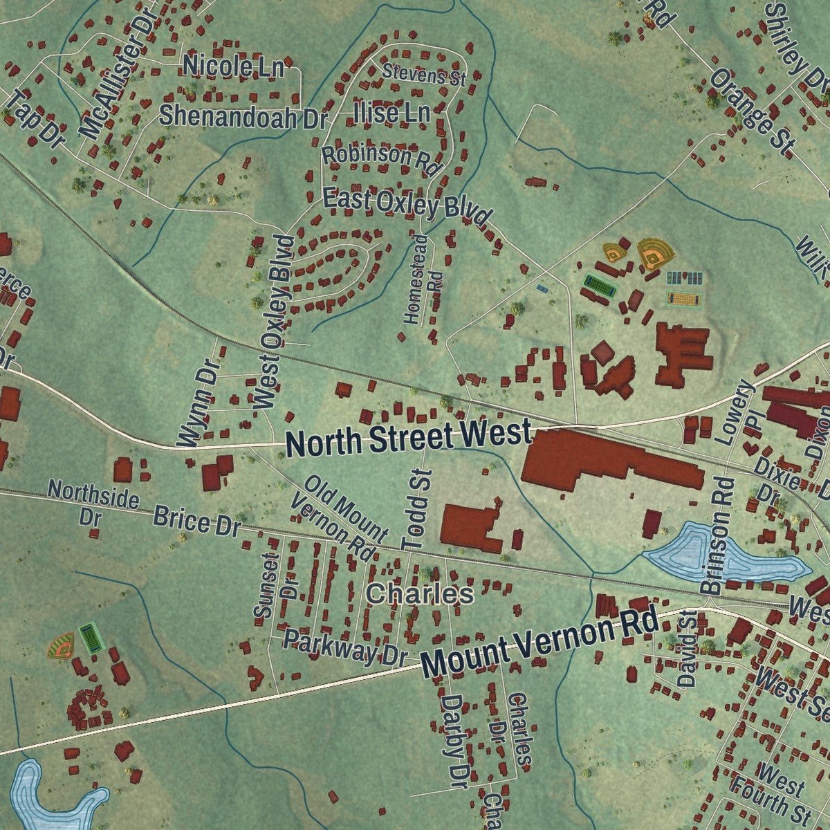
Explore Vidalia, Georgia from a whole new perspective. Created using aerial imagery and detailed geographic data, this map captures Vidalia building by building, with labeled streets, familiar landmarks, and shaded topographical relief that highlights the natural contours of the landscape.
Combining modern data with the timeless character of a vintage atlas, this map is just as interesting up close as it is beautiful on the wall. Whether you grew up in Vidalia, spent memorable years there, or call it home today, this unique map is a great way to celebrate a place that means something to you. Zoom in on the preview to look for your street, and then order a print to put your memories on the wall.
Three ways to hang it
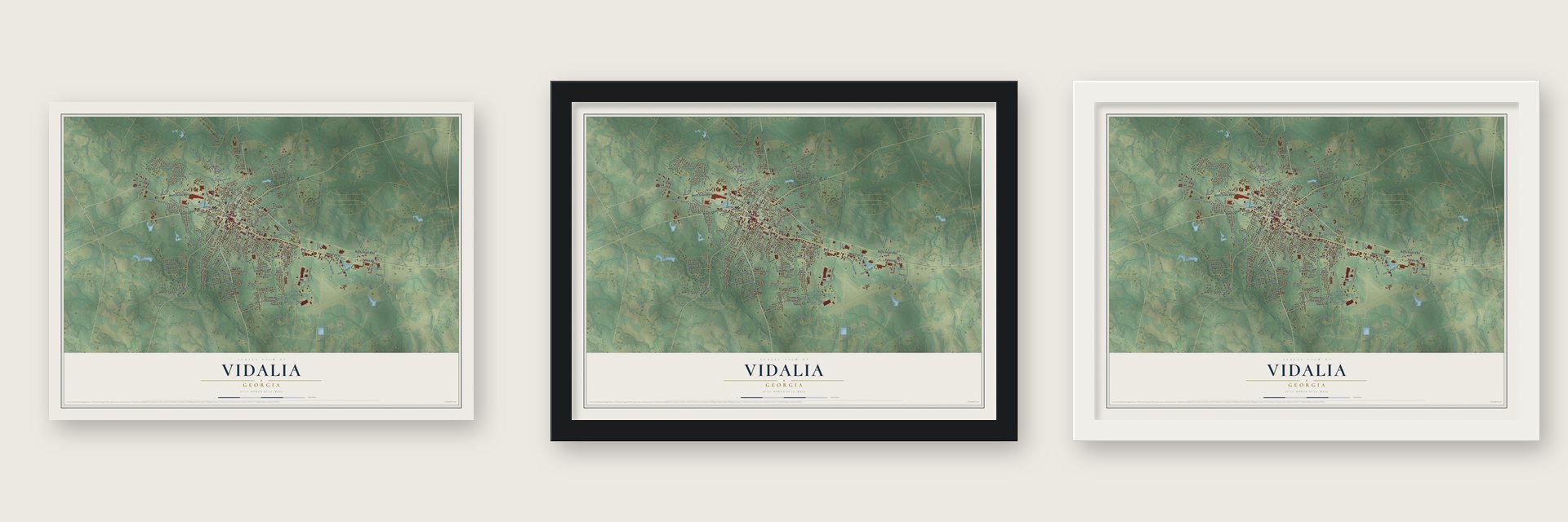
Unframed archival matte, a black wood frame or a white wood frame.
Up close
Geography Worth Displaying
This map was created using accurate cartographic data and authoritative geographic sources, including the U.S. Geological Survey (USGS) and FEMA. The map brings together terrain, waterways, roads, and building detail. The majority of the streets are labeled, houses are accurately depicted, and the topography is derived from government sources. Combining local data with carefully composed color and shading leads to this beautifully detailed Vidalia artwork for your wall.
Rather than simply showing street outlines, we’ve included as many of the street names as we could reasonably fit on the map while keeping their names legible. Zoom in on the high resolution preview to see exactly what’s on the map. We truly set out to create a statement piece for anyone who loves Vidalia. So whether it’s for you, or a gift for someone you love, we hope this map of Vidalia brings back fond memories.
Explore the full map of Vidalia, Georgia and read about the local places it shows.

About Vidalia, Georgia
Vidalia is a city of 10,785 people, mostly in Toombs County, with its western edge reaching a little way into Montgomery County. No city in Toombs County is bigger, yet the county seat is Lyons, six miles to the east. The settlement first went by Jenkins Station, after Warren T. Jenkins, who owned land here, and it was incorporated on January 1, 1890.
The town grew up around a rail yard where nearby farmers sent off their pecans and tobacco. Its present name most likely came from a daughter of Samuel Hawkins, who headed the Savannah, Americus and Montgomery Railroad. Hawkins had four daughters, and nobody knows which one chose the name or where she found it.
- Mose Coleman's sweet onionsOnions were not a major crop here until long after the town began. Around 1931 a farmer named Mose Coleman noticed that his onions tasted sweeter than other onions. Neighboring farmers began planting them too, and by the 1940s tourists were buying Vidalia onions to take home. In 1990 Georgia made the Vidalia onion its official state vegetable.
- A name protected by lawGrowers worked to guard the Vidalia name. The Vidalia Onion Trademark Act of 1986 gave state trademark protection to onions grown around Vidalia and Toombs County. In 1989 the USDA's Federal Marketing Order #955 let growers and handlers form the Vidalia Onion Committee and protected the name nationwide. Today an onion sold as a Vidalia has to come from one of thirteen Georgia counties or from set parts of seven more.
- Five days of onions each springEvery spring Vidalia holds the Vidalia Onion Festival, which runs for five days and draws visitors from far away. Year round, the Vidalia Onion Museum on Vidalia Sweet Onion Drive fills 1,300 square feet with exhibits on the onion's role in the local economy, culture and kitchen.
- A railroad junctionIn the 1950s Piggly Wiggly opened a distribution center in Vidalia, which brought many jobs and more freight for the railroads. The Georgia and Florida line crossed the Seaboard Air Line Railroad in the city then, so a seven-track yard and a large engine shop were built here. The big yard was taken out in the 1970s, and Dot Foods now uses most of the old Piggly Wiggly building.
- League champions in 1953From 1952 to 1956 the city had its own minor league team, the Vidalia Indians, a Class D farm club of the Cleveland Indians. Playing in the Georgia State League, the team won the league championship in 1953.
Find your street
Names on the Vidalia map
Every name below is printed on this map. Look for your street, your school, the park where you played, or the pond down the road.
Places and landmarks1
- Charles
Streets and roads202
- North Street East
- McIntosh Street
- North Street West
- Center Drive
- Mount Vernon Road
- Vidalia Road
- West First Street
- Jackson Street
- Adams Street
- North Loop Road
- Church Street
- Pinecrest Drive
- Mixon Drive
- Broadfoot Boulevard
- Rigsbee Drive
- East Oxley Boulevard
- Brice Drive
- Tap Drive
- West Main Street
- Fifth Avenue
- Third Street
- Northeast Main Street
- Brinson Road
- Arnan Street
- Mike Street
- Vann Road
- Gail Street
- Orange Street
- Aimwell Road
- Ezra Taylor Road
Show all 202 streets
- Thompson Pond Road
- Maple Drive
- Green Acres Drive
- Julie Drive
- Cadillac Drive
- McNatt Street
- Brantley Road
- Waters Drive
- Airport Road
- Harris Industrial Boulevard
- Atlantic Avenue
- Page Lane
- Jefferson Road
- Miracle Lane
- Second Avenue
- Meadows Lane
- Laurel Drive
- Montgomery Street
- Clyde Boulevard
- Peacock Street
- Forest Lake Drive
- Green Street
- Durden Street
- Old Vidalia-Lyons Road
- Donovan Street
- Pete Phillips Drive
- Peachtree Street
- Mosley Street
- Bob Sharpe Road
- Bay Street
- West Second Street
- Vann Street
- North Maple Drive
- Toombs Street
- Agan Drive
- Estroff Drive
- Industrial Boulevard
- Virginia Way
- Glaze Street
- Stella Avenue
- Smith Street
- Washington Street
- West Oxley Boulevard
- Shenandoah Drive
- Houston Drive
- Teston Lane
- Lyons Center Road
- Bostwick Drive
- Warthen Street
- Moses Drive
- Hugh Taylor Road
- Kissingbower Road
- Roosevelt Street
- Lewis Drive
- Hall Way
- Nicole Lane
- Ross Way
- Old Airport Road
- Chesley Drive
- High Street
- Jungle Road
- Darby Drive
- Commerce Drive
- McAllister Drive
- Scott Drive
- Todd Street
- Parkway Drive
- Center Place
- Henriott Drive
- Arlington Drive
- McDonald Drive
- Shirley Drive
- Marcliff Road
- Rollins Lane
- Sharpe Drive
- Allen Drive
- Wynn Drive
- Ilise Lane
- Ryan Drive
- Kelly Street
- Larry Drive
- David Street
- Fifth Street
- Northside Drive
- Southeast Main Street
- Thompson Street
- Rocky Creek Circle
- Morris Street
- Southwest Main Street
- Forest Hill Circle
- Perryman Drive
- West Seventh Street
- Pine Street
- Transus Drive
- South Maple Drive
- Swift Creek Road
- Winding Circle
- Fourth Avenue
- West Ninth Street
- Amberwood Drive West
- Commerce Loop
- West Fourth Street
- Slayton Street
- McLendon Road
- Cecil Anderson Road
- Hanna Circle
- Old Mount Vernon Road
- Sunset Drive
- Mitchell Drive
- Southgate Boulevard
- Bloomfield Road
- Rocky Creek Road
- Dixie Drive
- Sweet Onion Lane
- Barron Street
- Oneal Circle
- Charles Drive
- Louisiana Drive
- Seventh Street
- West Smalley Drive
- Robinson Road
- Meadows Parkway
- Cl Framkin Street
- Chastain Street
- Darby Circle
- Industrial Lane
- Semco Drive
- Brogden Street
- Third Avenue
- Willis Street
- Redwood Drive
- Dixon Street
- Cason Drive
- Dykes Road
- Edwina Drive
- Caroline Drive
- Queen Street
- Lowery Place
- Easter Drive
- Sandy Road
- Dexter Street
- Estelle Drive
- Stevens Street
- Winona Street
- Grand Street
- North Circle Drive
- Frances Circle
- Mose Coleman Drive
- Homestead Road
- Reg Holland Road
- West McSwain Drive
- Harry Powell Road
- Stockyard Road
- Lightfoot Court
- Pamela Drive
- Gregg Street
- Locke Street
- West Fifth Street
- East Second Street
- Ward Street
- South Cheney Drive
- Commerce Way
- West Street
- Palmer Street
- James Wilson Drive
- Irene Street
- Woodlawn Drive
- Ferncliff Drive
- Pearl Street
- Hanna Drive
- Lofton Lane
- King Drive
Names are listed as they appear on the printed map. Zoom into the product photos to find them.
The art of mapping a place
How This Map Was Made
Real places. Remarkable detail. Discover the layers that turn geographic data into a map of home.

The view from above
Aerial imagery reveals the character of the land: woodland, open fields, and the patterns of a place.

The shape of the land
Elevation data brings hills, valleys, and subtle changes in the landscape into view.

The details of home
Roads, waterways, and building footprints come together to make the map feel unmistakably local.

Geography becomes art
Considered color, shading, and typography bring the layers together in a map made for your wall.


Process illustrated with Mendon, Massachusetts. Aerial imagery: USDA NAIP. Terrain: USGS 3D Elevation Program. Map details and finished artwork: KNOWOL.
The Details
About This Print
Choose an archival matte print, or a black or white Ayous wood frame. The archival matte print is unframed.
Select your size and finish above to see the matching product image and price.
Materials & Craftsmanship
A contemporary map with the character of a classic atlas, printed on archival matte paper. Optional frames are made from Ayous wood.
Your printed map does not include the watermark shown in the full-map preview.
Shipping & Delivery
Free shipping within the United States. Every print is made to order in the USA.
Buying a gift? Add a note in your cart and we'll include it. We never put prices in the package.
Prints ship within 2 to 3 business days. Allow 7 to 10 days total from ordering for delivery. Timing may vary during holidays or periods of high order volume.
Read our shipping policy.
Returns and damaged prints
Each print is made to order. Change-of-mind refunds are not available after production.
If your print arrives damaged, misprinted or incorrect, contact support@knowol.com within 30 days of receiving it. Include your order number, photos and a description of the issue.
Read our full refund and replacement policy. For questions about your order, email support@knowol.com.
Find your town
Looking for another city?
Find a map of home in our Georgia collection, or any town in the country.
Nearby
Maps of towns near Vidalia
Know someone from one of these towns? Their map makes a great gift.
 Higgston
, Georgia
From $39.99See the map
 Lyons
Lyons, Georgia
From $39.99See the map
 Santa Claus
, Georgia
From $39.99See the map
More maps nearby: Alston, Ailey, Ohoopee, Oak Park and Mount Vernon.